April 27 , 2022 .
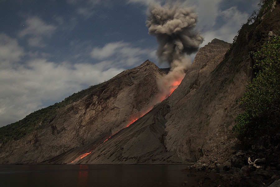
Indonesia , Batu Tara :
VOLCANO OBSERVATORY NOTICE FOR AVIATION – VONA
Issued : April 26 , 2022
Volcano : Batutara (264260)
Current Aviation Colour Code : YELLOW
Previous Aviation Colour Code : unassigned
Source : Batutara Volcano Observatory
Notice Number : 2022TAR01
Volcano Location : S 07 deg 47 min 31 sec E 123 deg 34 min 44 sec
Area : East Nusa Tenggara, Indonesia
Summit Elevation : 2394 FT (748 M)
Volcanic Activity Summary :
Eruption with volcanic ash cloud at 01h45 UTC (18h45 local). Eruption and ash emission is not continuing.
Volcanic Cloud Height :
Ash-cloud is not visible
Other Volcanic Cloud Information :
fog covered mountain
Remarks :
Thermal anomaly low
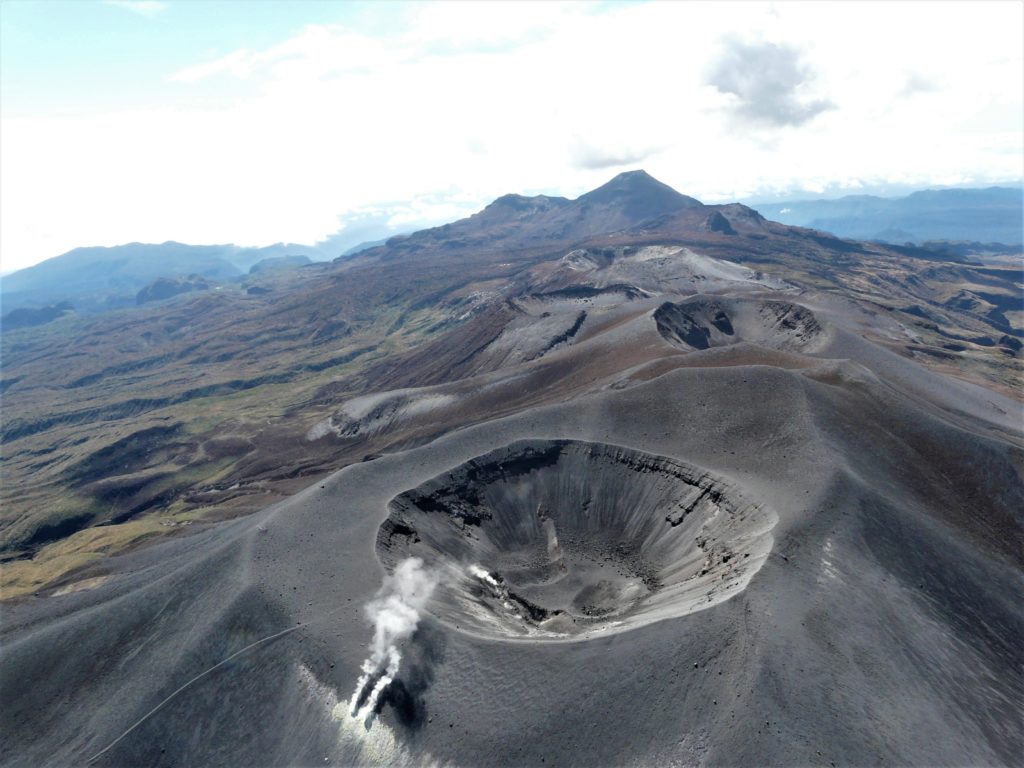
The small isolated island of Batu Tara in the Flores Sea about 50 km N of Lembata (fomerly Lomblen) Island contains a scarp on the eastern side similar to the Sciara del Fuoco of Italy’s Stromboli volcano. Vegetation covers the flanks to within 50 m of the summit. Batu Tara lies north of the main volcanic arc and is noted for its potassic leucite-bearing basanitic and tephritic rocks. The first historical eruption, during 1847-52, produced explosions and a lava flow.
Source : Magma Indonésie , GVP.
Photo : Photovolcanica ( http://www.photovolcanica.com/VolcanoInfo/Batu%20Tara/BatuTara.html )
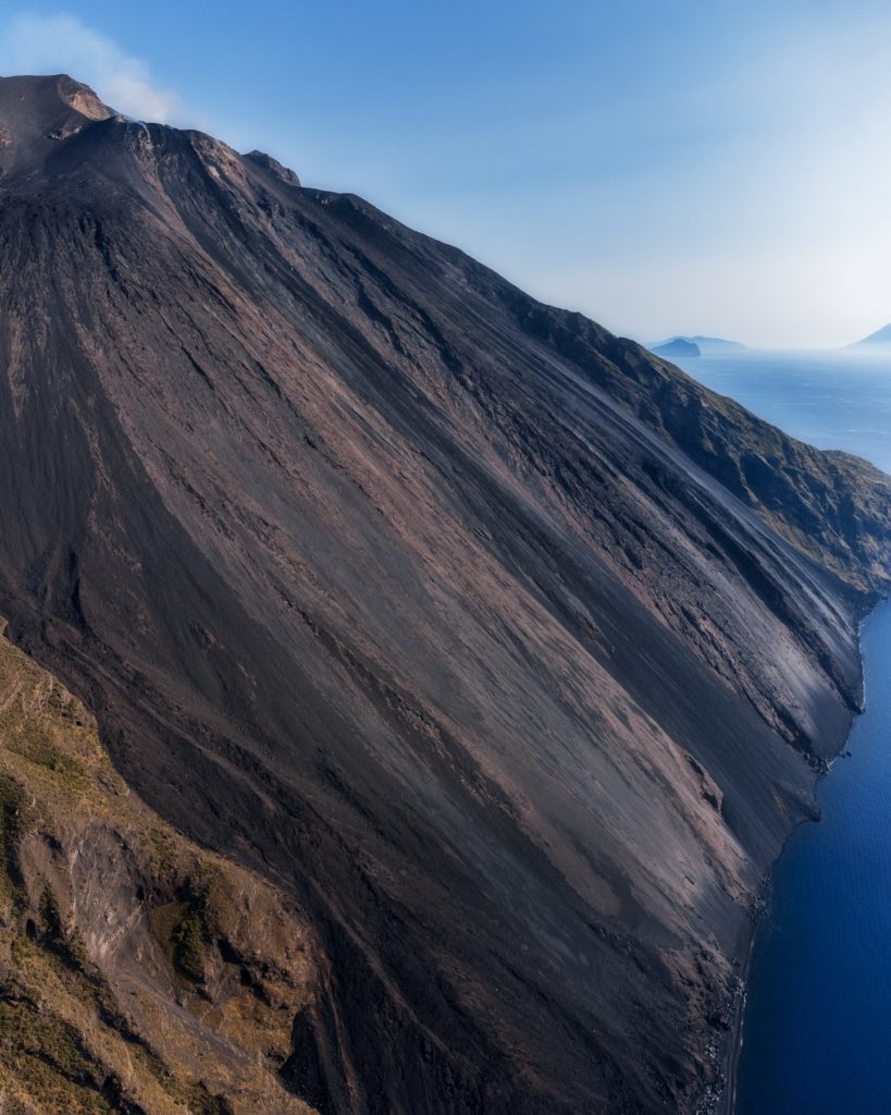
Italy , Stromboli :
WEEKLY BULLETIN, April 18, 2022 to April 24, 2022. (issue date April 26, 2022)
ACTIVITY STATUS SUMMARY
In the light of the surveillance data, it is highlighted:
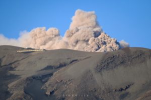
1) VOLCANOLOGICAL OBSERVATIONS: In this period a normal explosive activity of Strombolian type was observed. The total hourly frequency of explosions fluctuated between medium-low (7 events/h) and medium (13 events/h) values. The intensity of the explosions varied from low to medium in the areas of the North and Center-South craters.
2) SEISMOLOGY: The seismological parameters monitored do not show any significant variations.
3) SOIL DEFORMATIONS: The island’s soil deformation monitoring networks did not show any significant variation.
4) GEOCHEMISTRY: SO2 flux at a medium-low level
Due to technical issues, there are no updates on CO2 fluxes in the crater area.
C/S ratio in the plume slightly increasing on average values.
There are no updated values of the isotopic ratio of Helium dissolved in the Stromboli thermal aquifer compared to the previous bulletin (R/Ra 4.36 of 05/04/2022).
5) SATELLITE OBSERVATIONS: The thermal activity observed by satellite was at a low level.
VOLCANOLOGICAL OBSERVATIONS
During the observation period, the eruptive activity of Stromboli was characterized through the analysis of images recorded by the INGV-OE surveillance cameras (altitude 190m, Punta Corvi, altitude 400m and Pizzo). The explosive activity was mainly produced by 4 (four) eruptive vents located in the North crater area and 2 (two) eruptive vents located in the Center-South crater area. All the mouths are located inside the depression which occupies the terrace of the crater.
Due to unfavorable weather conditions, the visibility of the crater terrace on April 20, 2022 was insufficient for a correct description of the eruptive activity.
Sector N1 located in the area of the North crater produced explosions of medium-low intensity (less than 120m high) emitting coarse materials (lapilli and bombs). Sector N2, with three emission points, showed low intensity explosive activity (less than 80 m in height) emitting coarse materials. The average frequency of explosions varied from 5 to 8 events/h.
In the Center-South zone, sectors C and S1 did not show any significant explosive activity. Sector S2, with two emission points, had explosions of medium and low intensity (the products of the explosions often exceeded 80 m in height) emitting coarse materials. The frequency of the explosions varied between 2 and 6 events/h.
Source : INGV.
Photo : Giantaranto
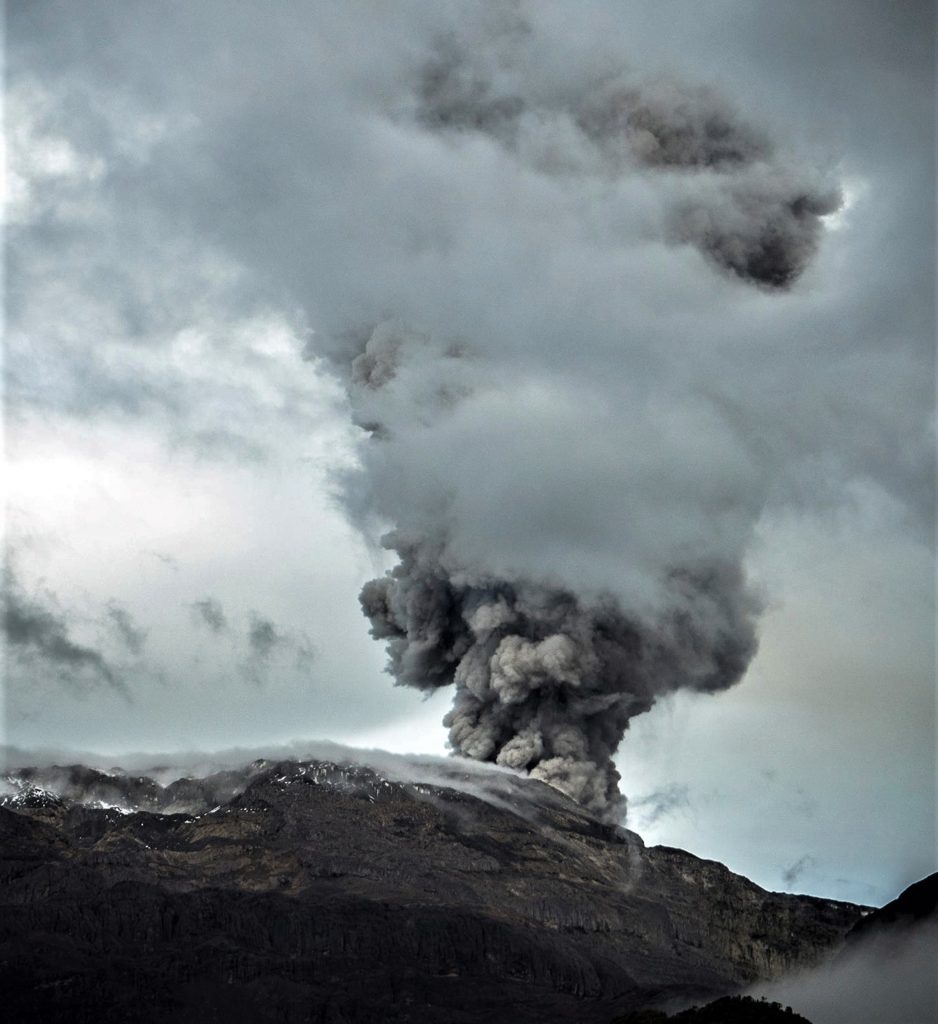
Colombia , Nevado del Ruiz :
Subject: Nevado del Ruiz volcano activity level bulletin.
The activity level continues at: Yellow activity level or (III): changes in the behavior of volcanic activity.
Regarding the monitoring of the activity of the Nevado del Ruiz volcano, the COLOMBIAN GEOLOGICAL SERVICE reports that:
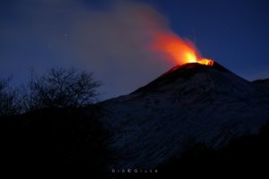
At the time of publication of this bulletin, ash falls have been reported in various sectors of the city of Manizales and the municipality of Villamaría, which is linked to gas and ash emissions from the Nevado de Ruiz volcano recorded in the night of yesterday and today April 26. These emissions were related to seismic signals of moderate energy level, associated with the movement of fluids inside the volcanic conduits.
Seismicity associated with rock fracturing increased in number of earthquakes and seismic energy released, compared to the previous week. This seismic activity was located mainly on the west and south-east flank of the volcano and to a lesser extent in the north-east and south-west sectors of the Arenas crater. The depth of the earthquakes varied between 0.5 and 6.2 km. The maximum magnitude recorded during the week was 2.0 ML (Local Magnitude), corresponding to the earthquake that occurred on April 25 at 4:48 p.m. (local time), located 2.2 km southeast of the Arenas crater, at a depth of 3.6 km. An increase in this seismicity is noted on April 19, located in the western sector 5.8 km from the crater. The maximum magnitude recorded during the increase was 1.4 ML (Local Magnitude) corresponding to an earthquake recorded at 04:20 the same day (local time), located at a depth of 5.2 km.
Seismicity related to fluid dynamics inside volcanic conduits decreased in number of earthquakes and increased in released seismic energy, compared to the previous week.
This seismic activity was characterized by the appearance of continuous volcanic tremors, TC, tremor pulses, TR, long period type earthquakes, LP, and very long period type earthquakes, VLP. In general, these signals exhibited low to moderate energy levels and variable spectral content. Most of these earthquakes were located in the Arenas crater. Some of them were associated with gas and ash emissions that have been confirmed by the cameras installed in the volcano area and by reports from officials of the Los Nevados National Natural Park and the Colombian Geological Service, in addition to visual appreciation in different places around the area of influence of the volcano. Similarly, changes in the relative temperature of the emitted material have been observed using the FLIR cameras (Thermal Cameras) of the SGC’s multi-parameter volcanic monitoring network. Among the signals associated with gas and ash emissions, those that occurred yesterday and this morning stand out, corresponding to several multiple fluid events.
Source : SGC
Photo : Álex Palacio
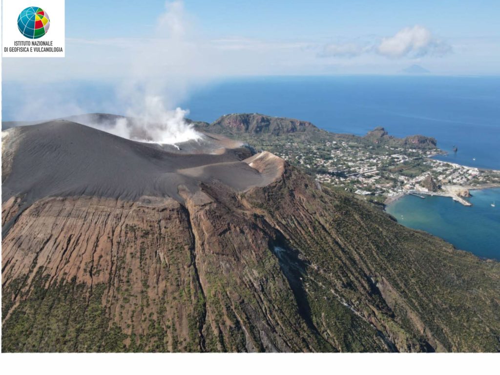
Italy , Vulcano :
WEEKLY BULLETIN, April 18, 2022 to April 24, 2022. (issue date April 26, 2022)
ACTIVITY STATUS SUMMARY
In the light of the surveillance data, it is highlighted:
1) Temperature of the crater fumaroles: The temperatures recorded on the rim of the crater show stable values at high levels.
2) CO2 flux in the crater area: The latest measurements show high values.
3) SO2 flux in the crater area: SO2 flux at a medium-high level
4) Geochemistry of fumarolic gases: No update is available: the last sampling of March 31 confirmed the downward trend in the concentration of magmatic gases in the fumaroles of Vulcano.
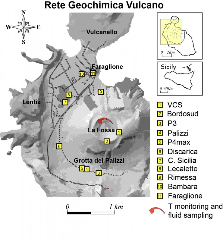
5) CO2 fluxes at the base of the La Fossa cone and in the Vulcano Porto area: The CO2 fluxes recorded in the C. Sicilia, P4max and Rimessa sites continue to show a slight downward trend, but remain on medium-high values; in the Faraglione site, there are values close to the background level.
6) Geochemistry of thermal aquifers: The temperature measured in the Camping Sicilia well is at high and stable values. The electrical conductivity shows low values.
The level values measured in the Bambara well show a small fluctuation. Conductivity values remain constant at medium-high levels.
7) Local seismicity: low occurrence rate of local events.
8) Regional seismicity: Low fracturing seismicity associated with earthquakes with Ml >= 1.0.
9) Deformations – GNSS: The network of permanent GNSS stations has not recorded any significant changes.
10) Deformations – Inclinometry: The inclinometric network has not recorded any significant changes.
11) Other observations: Gravimetry: No significant variation was recorded.
CRATER FUMEROLES TEMPERATURE:
Along the upper edge, the maximum emission temperature has very stable values (T1: 380-385°C), with a weekly average of 383°C (hourly data recorded between April 19 and 26). The fumarole field has equivalent emission temperatures over the entire summit fracture line to confirm a thermal anomaly still maintained by a constant flow of steam: fumarole F5 (sensor T3) showed emission temperatures (T MAX 391; min., 374; average T 376° C) perfectly superimposable on the temperatures of the T2 sensor placed in F5AT. Shortly after the last reset intervention, the signal in T3 started to show some measurements (from April 17th) which cannot be validated which however were not taken into account in the calculation of the average. The maximum temperature recorded at the level of the sensor placed on the internal slope was 113°C, but the site is disturbed by exogenous effects.
CO2 FLOW AT THE BASE OF LA FOSSA CONE AND IN THE VULCANO PORTO AREA
The CO2 fluxes at the base of the crater in the C. Sicilia site show average to high values, above the background level, although in sharp decline compared to the period November-December 2021; the P4max site shows medium to high values, a slight increase compared to last week, while continuing to show a slight downward trend; the Remessa site recorded medium-high values, stable compared to last week; in the Faraglione site, there are values close to the background level.
Source : INGV.
Photos : INGV.
Colombia , Puracé :
Weekly activity bulletin Volcan Puracé – Volcanic chain Los Coconucos:
From the analysis and evaluation of the information obtained through the monitoring network of the Puracé volcano – Los Coconucos volcanic chain, during the week of April 19 to 25, 2022, the COLOMBIAN GEOLOGICAL SERVICE – Volcanological and Seismological Observatory of Popayan reports that:
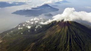
• Regarding the number and released energy of recorded seismic events, a stable behavior was observed, compared to the previous week. There is a predominance of earthquakes associated with fluid dynamics within volcanic conduits, in relation to rock fracturing processes (type VT). A total of 294 seismic events were recorded, of which 72 were associated with rock fracturing processes (type VT) and 221 with fluid dynamics in volcanic conduits; of these, 207 were cataloged as long period events (LP type) and 14 as low energy tremor pulses (TR type).
• The geodetic network of GNSS (Global Navigation Satellite System) stations monitoring soil deformation continues to record a process associated with centimetric inflation.
Regarding volcanic gas monitoring, sulfur dioxide (SO2) flux emissions recorded by telemetry and field stations show a decrease compared to the previous week, reporting flux values in the mobile instrument of 937 t/day and a flow in telemetry stations with a maximum emitted of 992 t/day. Other gas analysis instruments in the volcanic influence zone show no significant changes for the assessed period.
• In the monitoring of surface activity, images were obtained during the week thanks to the Mina, Lavas Rojas, Anambio and Cerro Sombrero web cameras, which showed degassing of the volcanic system, with a white column oriented preferentially to the northwest. On April 22, a visit was made to the proximal area of the Curiquinga and Piocollo craters, where it was possible to inspect the surface cracks previously reported in the Curiquinga crater, which did not show visible degassing. Similarly, other cracks were observed in an area oriented in a North-West-South-East direction, in addition to the presence of volcanic ash. These processes are possibly associated with activity recorded on March 29, 2022.
Therefore, it is concluded that significant variations in volcanic activity continue to be recorded, in accordance with the behavior expected at activity level III (yellow level), which could evolve towards states of greater activity. The Colombian Geological Service continues to monitor the evolution of the volcanic phenomenon and will report any changes that may occur in due course.
Source et photo : SGC.
Iceland , Reykjanes Peninsula :
Around 1250 earthquakes were detected by the IMO¿s SIL-seismic network last week, less than in the previus week when 1500 were detected. Around 1100 earthquakes have been manually reviewed by the natural hazard specialist on duty at the IMO during the past week. Earthquakes that have not yet been reviewed are mostly located near Þorbjörn on the Reykjanes peninsula where an earthquake swarm started on the 22nd of April.
An other swarm started at the same time in Axarfjordur. Most activity was near Þorbjörn and the rest was spread all over Iceland. The largest earthquake of the week was a M2.9 on the 19th of April near Eystri Skaftárketill in Vatnajökull. No earthquakes were detected in Hekla during the week.
Source : Vedur is

