April 07 , 2022.
Costa Rica , Poas :
Report on the activity of the Rincón de la Vieja volcano. 06 April 2022 .
On April 06, 2022 at 1:36 a.m. local time, an eruption was recorded on the Rincón de la Vieja volcano, the height reached by the column is unknown due to the visibility conditions of the site.
Duration of the activity: 1 minute.
Ash fall reported in: No ash fall reported
Sulfur odor reported in: No sulfur odor reported.
Comments:
A small eruption is reported on the Rincón de la Vieja volcano at 1:36 a.m.
So far, there is no information on the effects on populations near the volcano.
At the time of this report, the winds are blowing westerly.
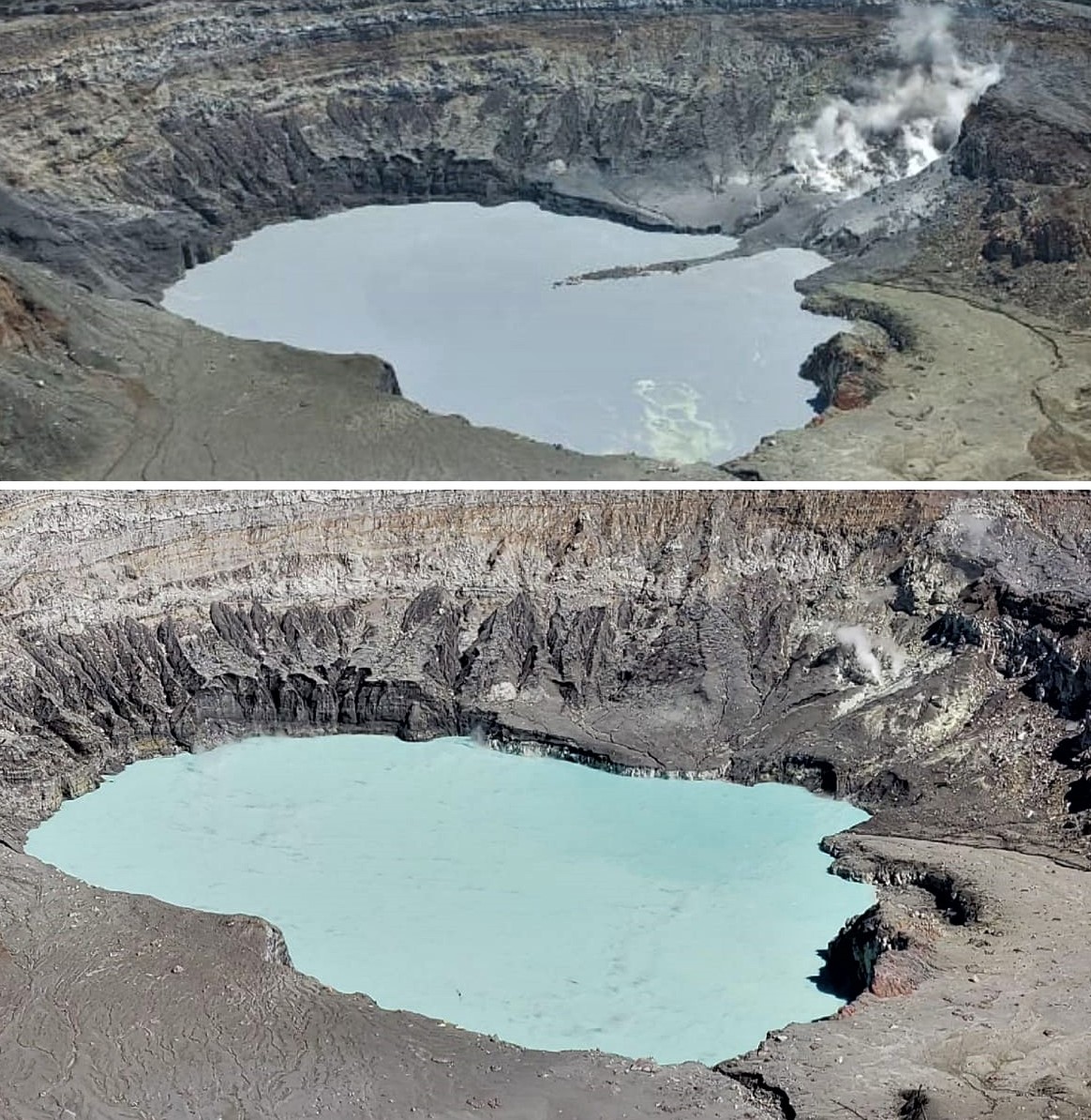
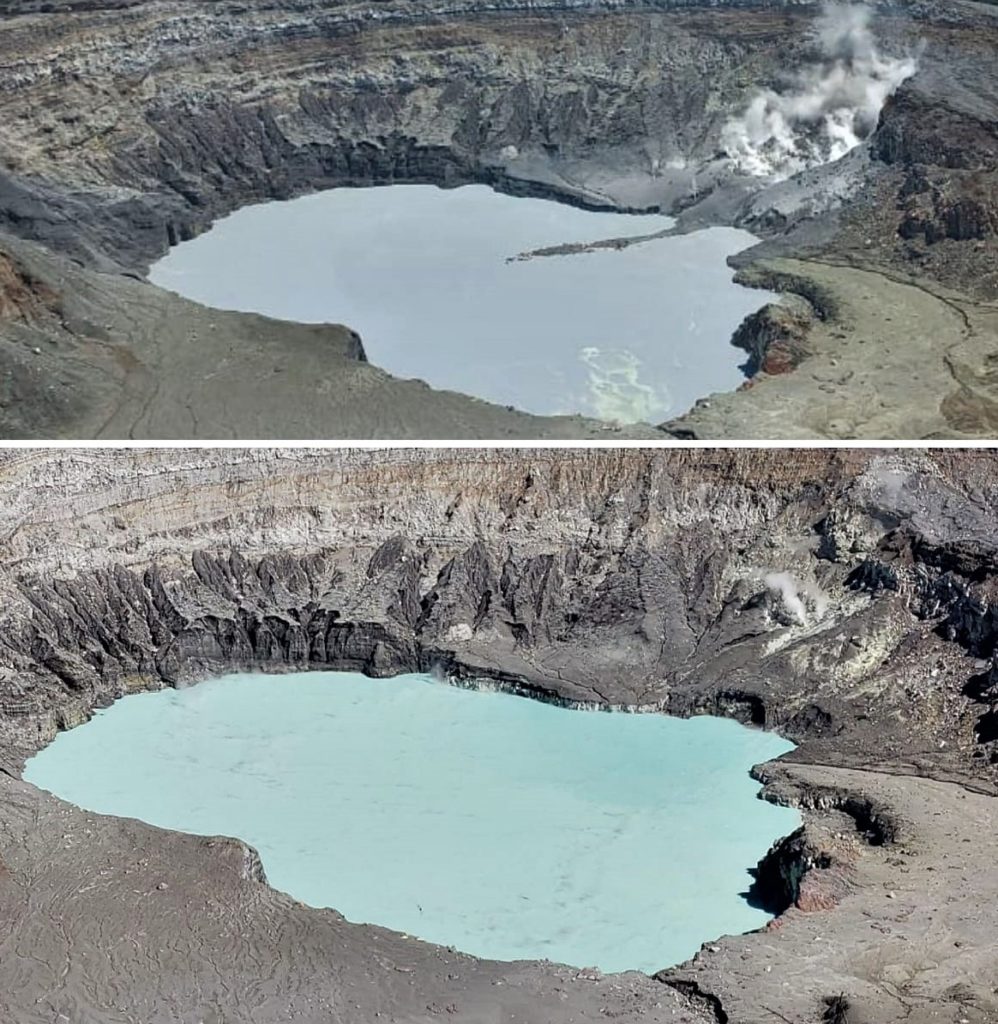
A hydrothermal explosion is recorded in the orange fumarole located on the north wall of the active crater. Materials were dislodged from this wall into the lake. The fumaroles on the North and East walls remain very active, as well as the underwater fumaroles. Frequent earthquakes of low frequency and low amplitude are recorded. The H2S/SO2 ratio and the SO2 concentration remain stable. Geodetic monitoring shows the stability of the volcanic edifice.
OVSICORI-UNA reported that on April 6 at 2:42 a.m., a phreatic explosion was detected on the north wall of the Poás crater, generating a plume that rose 500 m above the crater. The activity lasted three minutes.
Source : Ovsicori , GVP.
Photo : Max Arturo Castillo.
Italy / Sicily , Etna :
WEEKLY BULLETIN, March 28, 2022 to April 03, 2022. (issue date April 05, 2022)
ACTIVITY STATUS SUMMARY
In the light of the surveillance data, it is highlighted:
1) VOLCANOLOGICAL OBSERVATIONS: Variable rate degassing activity at the summit craters.
2) SEISMOLOGY: Low seismic activity of fracturing; average amplitude of the volcanic tremor generally on a medium-low level.
3) INFRASOUND: Weak infrasonic activity.
4) GROUND DEFORMATIONS: Ground deformation monitoring networks have not recorded any significant changes over the past week.
5) GEOCHEMISTRY: SO2 flux at a medium-low level
Soil CO2 flux shows average values.
The partial pressure of dissolved CO2 in groundwater shows values in seasonal variability.
There are no helium isotope ratio updates. The latest available data show high values (sampling of 23.03.2022).
6) SATELLITE OBSERVATIONS: Thermal activity in the summit area was at a low level.
VOLCANOLOGICAL OBSERVATIONS
The monitoring of the volcanic activity of Etna during the week in question was carried out by analyzing the images of the network of surveillance cameras of the INGV, Etna Observatory (INGV-OE). The bad weather conditions made the observation of the activity at the level of the summit craters discontinuous
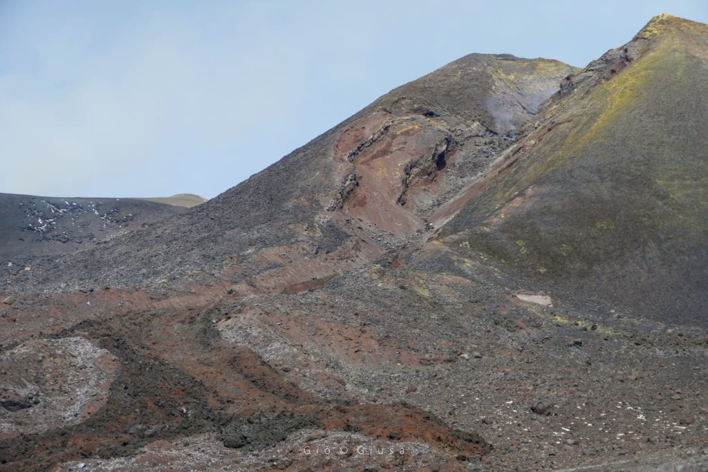
The activity at the level of the summit craters during the period under observation did not show significant changes compared to what had been observed the previous week, the activity consisted of a variable degassing regime and mainly carried out by the Bocca Nuova crater.
VOLCANIC TREMOR:
The average amplitude of the volcanic tremor remained at a medium-low level throughout the week. In particular, the locations of the sources of the tremor are concentrated in the area of the central craters in a depth range mainly between 2500-3000 m above mean sea level.
Source : INGV.
Photo : Gio Giusa.
Colombia , Nevado del Ruiz :
Bulletin of activity level of the Nevado del Ruiz volcano.
The activity level continues at the yellow activity level or (III): changes in the behavior of volcanic activity.
Regarding the monitoring of the activity of the Nevado del Ruiz volcano, the COLOMBIAN GEOLOGICAL SERVICE reports that:
Seismicity associated with rock fracturing decreased in number of earthquakes and seismic energy released, compared to the previous week. This seismic activity was located mainly in the North-North-West and North-East sectors of the volcano and in the Arenas crater and, to a lesser extent, in the South-South-East and South-South-West sectors. The depth of the earthquakes varied between 0.3 and 7.5 km. The maximum magnitude recorded during the week was 0.9 ML (Local Magnitude), corresponding to the earthquake recorded on March 30 at 11:00 a.m. (local time), located 2.1 km north-northwest of the Arenas crater, at a depth of 3.8 km.
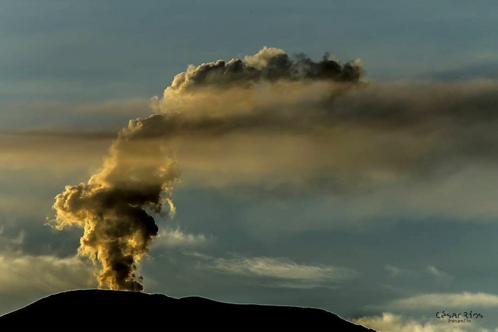
The seismicity related to the dynamics of the fluids inside the volcanic conduits decreased in number of earthquakes and released seismic energy, compared to the previous week. This seismic activity was characterized by the occurrence of continuous volcanic tremors, tremor pulses, long and very long period type earthquakes. In general, these signals exhibited low to moderate energy levels and variable spectral content. Most of these earthquakes were located in the Arenas crater. Thanks to the cameras installed in the area of the volcano and the report of the officials of the National Natural Park of Los Nevados and the Colombian Geological Service, the confirmation of various gas and ash emissions has been associated with some of these signals. Likewise, thanks to the FLIR cameras of the volcanic monitoring network, changes in the relative temperature of the emitted material have been observed.
Source : SGC.
Photo : Cesar Rios
Açores , São Jorge :
Volcano-tectonic tremors recorded for first time on quake-hit Azores island , Apr 6, 2022 | 1:14 PM
Volcano-tectonic tremors, which indicate the movement of magma, were recorded on the earthquake-hit mid-Atlantic Azores island of Sao Jorge for the first time since a worrying seismic crisis began more than two weeks ago, authorities said on Wednesday.
The lush green volcanic island, in Portugal’s Azores archipelago, has been hit by 27,626 small tremors and there are fears the activity could herald an eruption or a powerful earthquake.
Fatima Viveiros, from the region’s CIVISA seismo-volcanic surveillance centre, said volcano-tectonic earthquakes, also known as hybrid, happen when there is a “fusion” of high-frequency tectonic tremors with low-frequency volcanic ones.
“(It) suggests the movement of fluids at depth,” Viveiros explained, adding that more earthquakes of that kind were expected. “These signals show what is to be expected in active volcanic systems.”
The volcanic alert is at Level 4 on a five-step scale, meaning there is a “real possibility” the volcano could erupt for the first time since 1808.
A 2015 study published on the Journal of Volcanology and Geothermal Research said volcano-tectonic earthquakes were “usually the earliest reported seismic precursor for eruptions at volcanoes that have been dormant for decades or more”.
CIVISA said an eruption was not was not imminent but said such a scenario could not be discounted.
So far, all the recorded earthquakes had been purely of tectonic origin rather than volcanic-tectonic as Wednesday’s tremors, reaching a magnitude of up to 3.8 and causing no damage.
A seismic swarm beneath the W half of São Jorge began at 1605 on 19 March, with earthquakes along the Manadas volcanic fissure system between Velas (S side of the island) and Fajã do Ouvidor (N coast). On 31 March there were 714 seismic events detected, according to a preliminary analysis of seismic records. As the week progressed, the number of daily events fluctuated from 397 on 1 April to 592 on 5 April; magnitudes were relatively low. The Alert Level remained at V4 (on a scale of V0-V6).
Sources : wtvbam.com / Report Catarina Demony / Sandra Maler. GVP.
Photo : José Luís Ávila Silveira/Pedro Noronha de Costa.
Japan , Shinmoedake :
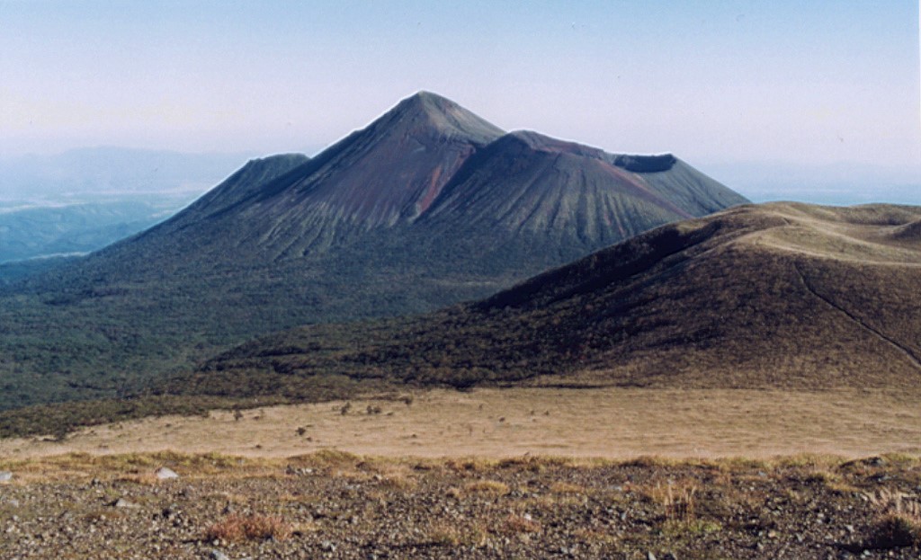
JMA reported a high number of volcanic earthquakes just below Shinmoedake (Shinmoe peak, a stratovolcano of the Kirishimayama volcano group). On 31 March the number of volcanic earthquakes increased below Ebino Kogen (located on the NW flank of the Karakunidake stratovolcano, about 5 km NW of Shinmoedake). Fumarolic plumes continued to rise from a fissure on the W flank. The Alert Level remained at 2 (on a 5-level scale), and residents were warned to stay 2 km away from the crater. The public was warned to stay at least 2 km away from the crater.
Kirishimayama is a large group of more than 20 Quaternary volcanoes located north of Kagoshima Bay. The late-Pleistocene to Holocene dominantly andesitic group consists of stratovolcanoes, pyroclastic cones, maars, and underlying shield volcanoes located over an area of 20 x 30 km. The larger stratovolcanoes are scattered throughout the field, with the centrally located Karakunidake being the highest. Onamiike and Miike, the two largest maars, are located SW of Karakunidake and at its far eastern end, respectively. Holocene eruptions have been concentrated along an E-W line of vents from Miike to Ohachi, and at Shinmoedake to the NE. Frequent small-to-moderate explosive eruptions have been recorded since the 8th century.
Sources : GVP , Japan Meteorological Agency (JMA)
Photo : Ichio Moriya (Kanazawa University)
Indonesia , Agung :
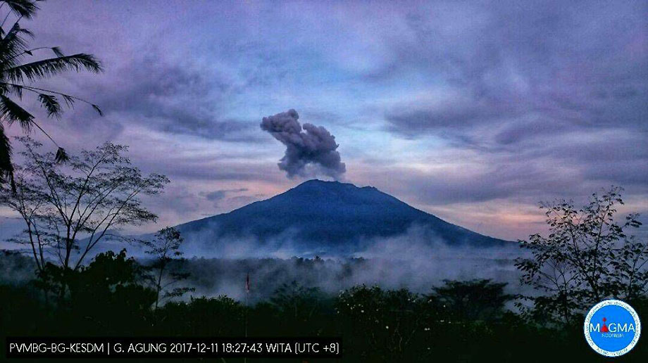
Based on ground reports, satellite imagery, and wind model data, the Darwin VAAC reported that during 3 April an ash plume from Agung rose to 3.7 km (12,000 ft) a.s.l. The Alert Level remained at 1 (on a scale of 1-4).
Symmetrical Agung stratovolcano, Bali’s highest and most sacred mountain, towers over the eastern end of the island. The volcano, whose name means « Paramount, » rises above the SE rim of the Batur caldera, and the northern and southern flanks extend to the coast. The summit area extends 1.5 km E-W, with the high point on the W and a steep-walled 800-m-wide crater on the E. The Pawon cone is located low on the SE flank. Only a few eruptions dating back to the early 19th century have been recorded in historical time. The 1963-64 eruption, one of the largest in the 20th century, produced voluminous ashfall along with devastating pyroclastic flows and lahars that caused extensive damage and many fatalities.
Sources : Darwin Volcanic Ash Advisory Centre (VAAC) , GVP.
Photo : Magma Indonésie , archive 2017.

