September 07 , 2021.
Spain / La Palma , Cumbre Vieja :
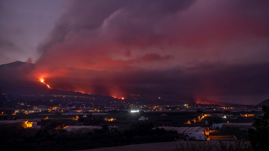
06 October 2021 10:00 UTC. Eruptive activity continues on La Palma.
Since the last declaration, 41 earthquakes have been located in the area affected by the volcanic reactivation of Cumbre Vieja, a number lower than the two previous days. Six of the earthquakes were felt by the population, i.e. the maximum intensity in Epicentral Zone III (EMS) during an earthquake of magnitude 3.5 (mbLg) that occurred yesterday at 12:14 UTC. Five of the recorded earthquakes are greater than magnitude 3.5 (mbLg). Most hypocenters are located 10-15 km deep, except for 4 of the earthquakes with hypocenters at depths greater than 35 km.
The average amplitude of the volcanic tremor remains stable within a range of average values compared to the observations measured during this eruption. No intensification pulse has been recorded during the last 24 hours.
The height of the column measured at 6.30 UTC is 3000 m, showing a slight decrease in the eruptive cloud.
The island’s network of permanent GNSS stations shows slight deflation in the vertical component of stations near eruptive centers.
La Palma airport closed on Thursday due to the build-up of ash in the air, Aena reported. The other Canary Islands airports are operational. As early as Wednesday afternoon, the two main airlines in the region, Binter and CanaryFly, indicated that they were temporarily canceling flights scheduled for Thursday with La Palma because the ash-in-the-air situation « worsened considerably » and is expected to continue at least Thursday, preventing operations with the necessary security requirements from developing.
The technical director of Pevolca, Miguel Angel Morcuende, confirmed on Wednesday that the appearance of a lava tunnel between the volcano and the sea is good news because it allows very fluid contact between the emitting center and the ejection zone at sea. “This ensures that the width of the casting does not increase.
Sources : IGN
Photos : PACO PUENTES (El PAIS). FILMMAKER .
Italy , Stromboli :
06 October 2021. 16:51 (14:51 UTC). Communication on STROMBOLI’s activity.
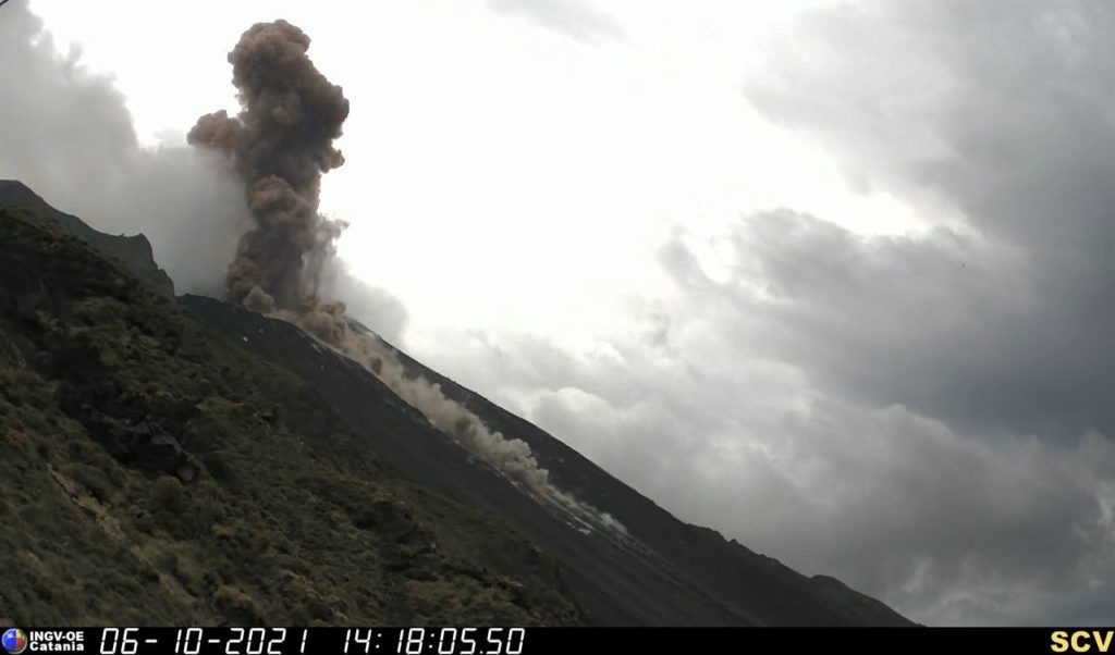
The National Institute of Geophysics and Volcanology, Osservatorio Etneo reports that monitoring networks recorded a major explosion at 2:17 p.m. UTC, which, given the poor visibility due to weather conditions, was likely fed by the North Crater area. The explosion produced a significant emission of coarse pyroclastic materials which crossed the terrace of the crater, affecting the area of Pizzo Sopra la Fossa and Sciara del Fuoco with the rolling of hot materials up to the coast line.
In conjunction with the major explosion, a seismic event with a significantly above average amplitude was recorded.
As for the average amplitude of the tremor, it experienced a rapid increase at 14:17:40 UTC and moved towards high values. Subsequently, this parameter returned to medium-low values.
The explosion generated an ash cloud which quickly dispersed in a northeast direction. In addition, during the event, a small lava overflow from the area of the North crater was also observed, the front of which remained confined to the upper part of the Sciara del Fuoco at an altitude estimated at about 750 m above sea level. . Currently, the lava overflow appears to be cooling
No significant changes were detected from soil deformation monitoring networks.
At 20:33 (18:33 UTC), the settings returned to normal activity.
Further updates will be communicated shortly.
Source : INGV.
Iceland , Reykjanes Peninsula :
The Institute of Earth Sciences reported that lava effusion at Krýsuvík-Trölladyngja volcanic system, close to Fagradalsfjall on the Reykjanes Peninsula, likely ceased during the evening of 18 September. The area of the flow field was about 4.85 square kilometers, and the total volume erupted was 150 million cubic meters, based on 30 September measurements. Parts of lava flows thickened in areas to the S of Geldingadalur and in Nàtthagi valley, and deflated in areas N of Geldingadalur. Points of incandescence were visible at night, at least through 4 October, likely from lava flows that continued to advance downslope.
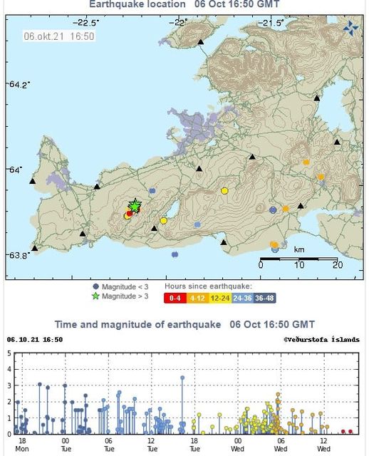
A seismic swarm in an area SW of Keilir (about 10 km NE of the fifth vent), at the N end of the dike intrusion, began on 27 September. According to news reports, over 6,000 earthquakes at depths of 5-6 km had been recorded by 4 October with at least 12 of them over M 3; the largest event was a M 3.8. Some of the larger events were felt in the capital. The seismicity was similar to patterns recorded before the beginning of the eruption to the SW. IMO stated that more data was needed to characterize the data as either indicative of magma movement or due to tectonic stress. The Aviation Color Code remained at Orange due to the lack of ash and tephra emissions, though IMO warned of the potential for lapilli and scoria fallout within a 650 m radius of the active vent. Authorities also warned of gas emission hazards.
Source : GVP.
Hawaii , Kilauea :
19°25’16 » N 155°17’13 » W,
Summit Elevation 4091 ft (1247 m)
Current Volcano Alert Level: WATCH
Current Aviation Color Code: ORANGE
Activity Summary:
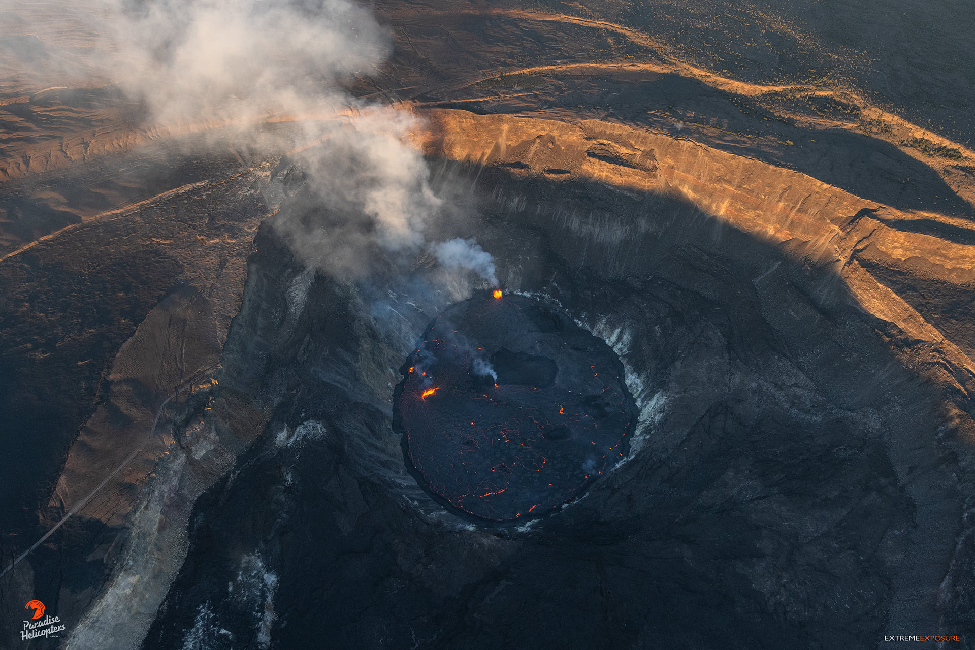
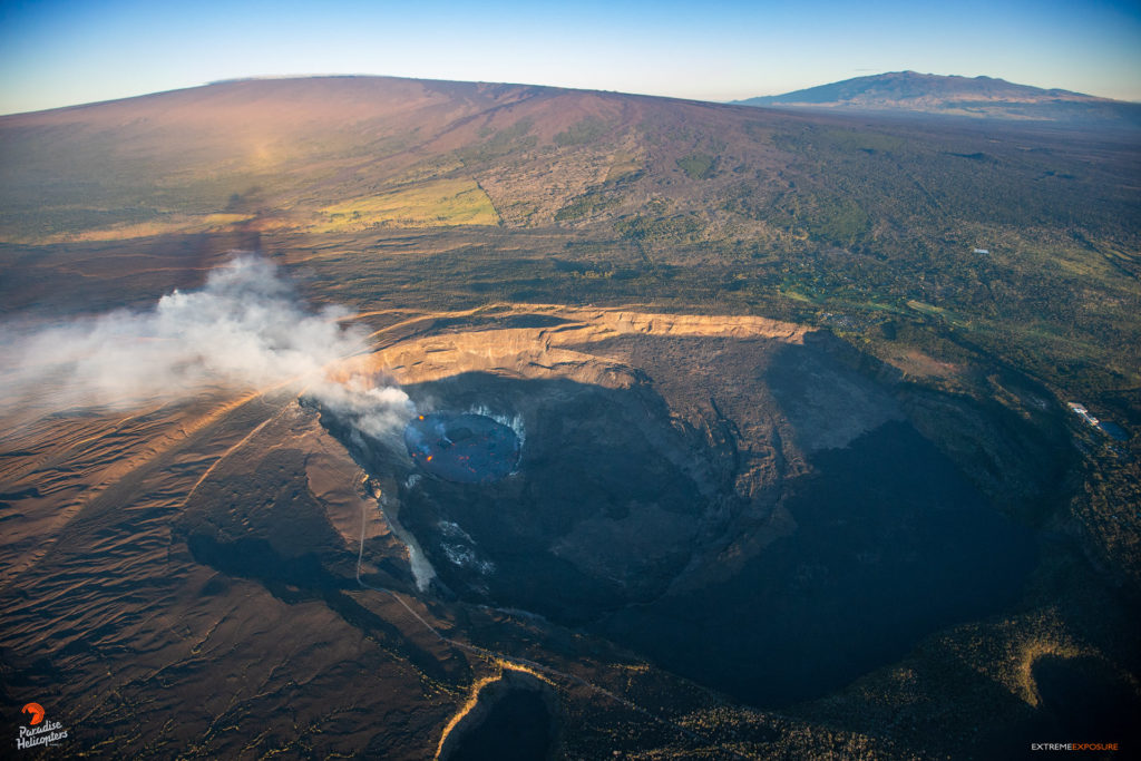
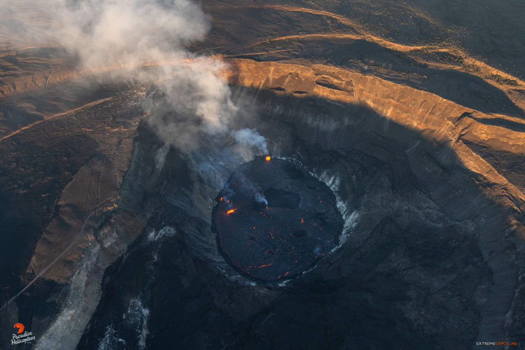
Kīlauea volcano is erupting. Lava continues to erupt from two vents; one along the floor and one in the western wall of Halemaʻumaʻu crater. As of this morning, October 6, 2021, all lava activity is confined within Halemaʻumaʻu crater in Hawai‘i Volcanoes National Park. Seismicity and volcanic gas emission rates remain elevated.
Summit Observations:
Sulfur dioxide (SO2) emission rates remain high, with a measured emission rate of approximately 6,000 tonnes per day on October 5, 2021. Seismicity remains elevated but stable. Summit tiltmeters continue to record deflationary tilt.
Halemaʻumaʻu Lava Lake Observations:
Lava continues to erupt from two vents within Halemaʻumaʻu crater. Over the past 24 hours, the lava lake level rose approximately 2 meters (7 ft) with a total rise of about 31 meters (102 ft) since lava emerged on September 29. The total thickness of lava filling Halemaʻumaʻu is now 256 meters (840 ft ) with a lake surface elevation of approximately 774 meters (2539 ft) above sea level. The west vent continues to have the most vigorous fountain with sustained lava fountain heights of about 14–15 meters (49 ft). The lava lake has risen above the base of the vent and the fountain has built a spatter rampart around most of it. Another vent continues to be active in the southern part of the lake with lava fountain heights averaging 3 meters (10 ft). Due to the location of vents, the lava lake is not level across its surface. Areas closer to vents in the west and south part are about 1–2 m (3–7 ft) higher in elevation compared to the north and east end of the lava lake. Crustal foundering, a process by which cooled lava crust on the lake surface sinks into the hot underlying lake lava, is observed on the active surface of the lava lake. The active lava lake surface is perched 1 meter (3 ft) above a 20-meter-wide (66 ft) ledge that extends outward to the Halemaʻumaʻu crater wall.
East Rift Zone Observations:
No unusual activity has been noted in the Kīlauea East Rift Zone. Ground deformation motion suggests that the upper East Rift Zone—between the summit and Puʻuʻōʻo—has been steadily refilling with magma over the past year. SO2 and hydrogen sulfide (H2S) emissions from Puʻuʻōʻō were below instrumental detection levels when last measured on January 7, 2021.
Source : HVO
Photos : Bruce Omori .
Kamchatka , Sheveluch :
VOLCANO OBSERVATORY NOTICE FOR AVIATION (VONA)
Issued: October 06 , 2021
Volcano: Sheveluch (CAVW #300270)
Current aviation colour code: ORANGE
Previous aviation colour code: orange
Source: KVERT
Notice Number: 2021-120
Volcano Location: N 56 deg 38 min E 161 deg 18 min
Area: Kamchatka, Russia
Summit Elevation: 3283 m (10768.24 ft), the dome elevation ~2500 m (8200 ft)
Volcanic Activity Summary:
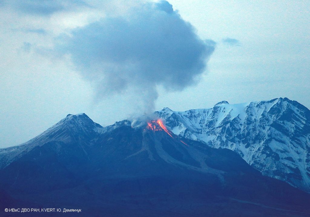
The gas-steam activity of Sheveluch volcano continues. A strong wind raises ash from the southern flank of the volcano. Satellite and video data by KVERT showed a resuspended ash plume extended to the east-southeast of the volcano.
Resuspended ash plumes near Sheveluch volcano can be observed at altitudes of 4-6 km (13,100-19,700 ft) a.s.l. Ongoing activity could affect low-flying aircrafts.
Volcanic cloud height:
3500-5000 m (11480-16400 ft) AMSL Time and method of ash plume/cloud height determination: 20211006/2210Z – Himawari-8
Other volcanic cloud information:
Distance of ash plume/cloud of the volcano: 75 km (47 mi)
Direction of drift of ash plume/cloud of the volcano: ESE / azimuth 110 deg
Time and method of ash plume/cloud determination: 20211006/2210Z – Himawari-8
Source : Kvert .
Photo : Yu. Demyanchuk. IVS FEB RAS, KVERT
Japan , Sakurajima :
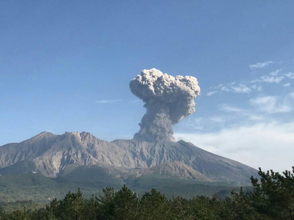
JMA reported that incandescence from Minamidake Crater (at Aira Caldera’s Sakurajima volcano) was visible at night during 27 September-4 October. The trend of inflation that was first detected on 13 September continued. The sulfur dioxide emission rate was 1,500 tons per day on 28 September. A very small eruptive event occurred on 3 October. The Alert Level remained at 3 (on a 5-level scale), and residents were warned to stay 2 km away from the crater.
The Aira caldera in the northern half of Kagoshima Bay contains the post-caldera Sakurajima volcano, one of Japan’s most active. Eruption of the voluminous Ito pyroclastic flow accompanied formation of the 17 x 23 km caldera about 22,000 years ago. The smaller Wakamiko caldera was formed during the early Holocene in the NE corner of the Aira caldera, along with several post-caldera cones. The construction of Sakurajima began about 13,000 years ago on the southern rim of Aira caldera and built an island that was finally joined to the Osumi Peninsula during the major explosive and effusive eruption of 1914. Activity at the Kitadake summit cone ended about 4850 years ago, after which eruptions took place at Minamidake. Frequent historical eruptions, recorded since the 8th century, have deposited ash on Kagoshima, one of Kyushu’s largest cities, located across Kagoshima Bay only 8 km from the summit. The largest historical eruption took place during 1471-76.
Source : GVP
Photo : Rizal M.

