March 17 , 2021.
Iceland , Reykjanes Peninsula :
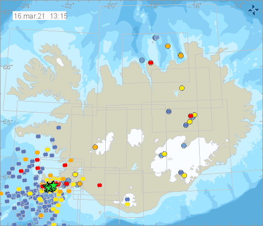
Since midnight yesterday , over 800 earthquakes have been detected on the Reykjanes peninsula, the largest an M3.4 at 08:36. The activity was mostly centered around Mt. Fagradalsfjall and east of Mt. Þorbjörn.
15th of March : At 22:32 an M4.3 earthquake occurred NE of Fagradalsfjall. The IMO received felt report from SW-part of Iceland. It was the largest earthquake of the day, but in total 2100 earthquakes have been detected by IMO’s seismic network, there of seven M3.0 or larger. Most of the earthquakes detected where located close to Fagradalsfjall and in the evening most of them NE of Fagradalsfjall.
Updated 15.03 at 11:00
Since midnight over 1000 earthquakes have been detected on the Reykjanes Peninsula, with the most active area located south of Mt. Fagradalsfjall. The largest earthquakes measured at M3,2, at 01:20 GMT last night and 07:39 GMT this morning.
March the 14th : over 3000 earthquakes were detected in the Reykjanes Peninsula. The largest earthquake measured M5,4 at 14:15 GMT. Yesterday evening four earthquakes measuring M3,3-M3,6 were detected, three of which were located by Mt. Fagradalsfjall and the fourth northwest of Grindavík village.
17/03/2021. At 2:37AM a M3.3 was detected around 1km N of Nátthagi valley. Over 400 earthquakes have occurred since midnight.
16th of March Around 1900 earthquakes were detected in the Reykjanes peninsula yesterday. Three were above M3.0, the largest a M3.4 at 08:35. Most of the earthquakes detected where located close to Fagradalsfjall, Keilir and Þorbjörn.
Source : Vedur.
New Zealand , White Island :
Further minor tremor and steam bursts, explosions .Published: Mon Mar 15 2021 2:30 PM
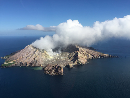
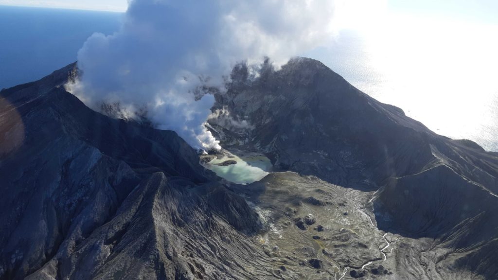
Two short-lived episodes of low-energy volcanic tremor occurred on 11 and 12 March at Whakaari/White Island, following similar episodes in mid-February and early March. Since then activity has returned to typical low-levels. The Volcanic Alert Level remains at 1.
The activity on 11 March started around 8.30 pm and lasted 30 minutes, while the activity on 12 March started at 3.30pm and lasted around 3 hours. The 12 March activity was accompanied by minor steam-gas bursts/explosions from the active vent area. The steam and gas driven activity was recorded by our seismic and air pressure sensors and is interpreted as a series of small explosions, originating within the vent or at shallow depth. Any erupted material from this type of activity is typically limited to a few meters from the vent. No observations were available from the island’s webcams. Both the recent episodes were smaller in size than those recorded on 29 December 2020 and 18 February 2021.
No response has been noted at Whakaari/White Island specific to the M7.3 earthquake on 5 March off East Cape. Gas and observation flights are scheduled this week to measure vent temperatures and gas emissions. The level of seismic tremor remains at background levels. The Volcanic Alert Level remains at 1 and the Aviation Colour Code remains at Green.
The Volcanic Alert Level reflects the current level of volcanic unrest or activity and is not a forecast of future activity. Volcanic Alert Level 1 indicates the primary hazards are those expected during volcanic unrest; including discharge of steam and hot volcanic gases, earthquakes, landslides and hydrothermal activity. While Volcanic Alert Level 1 is mostly associated with environmental hazards, eruptions can still occur with little or no warning. The main plausible triggers for a sudden eruption remain the collapse of unstable material in an active vent and the possible ingress of water underground onto the shallow magma body.
Source : Geonet .
Photos : mynewzealand.co.nz , Geonet .
Guatemala , Pacaya :
SPECIAL VOLCANOLOGICAL BULLETIN, March 16, 2021, 10:22 a.m. local time
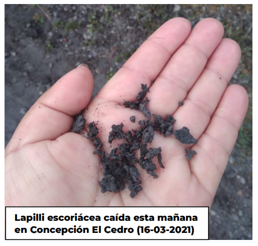
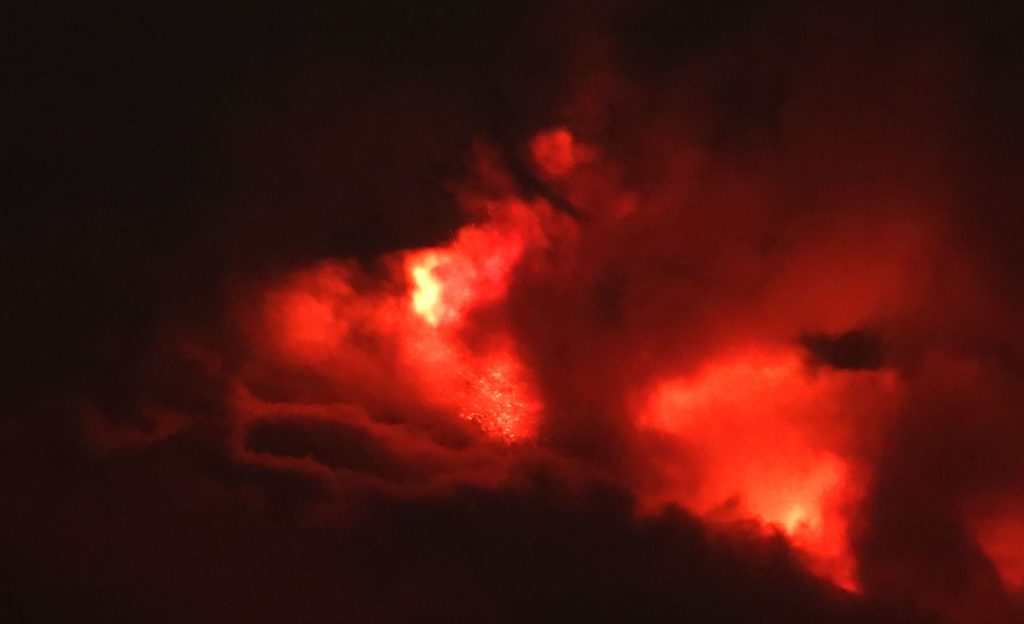
Following the eruption of the Pacaya volcano and the bulletin BEPAC-55-2021, it is reported that in the last hours, the eruptive activity has recorded new pulses of increase, which are of greater energy compared to those which occurred the previous days. These produced the emission of large eruptive columns with tephra, from fine ash to lapilli, 2 cm long (photo).
These materials fell on the villages of El Patrocinio, San José El Rodeo and Concepción El Cedro, and in the municipality of San Vicente Pacaya. Fine ash falls are also reported in the urban area of Amatitlán. Cloudy conditions continue to limit visibility towards the volcanic building, but on GOES-16 satellite images, it is possible to distinguish ash dispersion in a northwest and west direction at altitudes of around 3,700 meters above sea level. (12,000 feet), up to 30 meters away. The pulses of activity also produced explosions, sounds of locomotives and / or aircraft turbines, as well as the detachment of boulders that form weak to moderate avalanches. These descend on the southern flank and reach a distance of up to 1300 meters from the summit of the volcanic cone.
The log seismic amplitude mean (RSAM) of the PCG5 station in the figure above shows the increase in pulse energy this morning.
Taking into account the behavioral model that the Pacaya volcano has shown in recent weeks, it is not excluded that increasing impulses will continue to appear in the coming hours or days, generating explosions, eruptive columns, emissions of incandescent materials. , ash falls, ballistic projections and / or the appearance of new lava flows or the increase in their length.
Source : Insivumeh .
Italy / Sicily , Etna :
Weekly bulletin, from March 08, 2021 to March 14, 2021, (issue date March 16, 2021)
SUMMARY OF THE STATE OF ACTIVITY
In the light of surveillance data, it is highlighted:
1) VOLCANOLOGICAL OBSERVATIONS: Paroxysmal episodes at the Southeast Crater, separated by intervals of relative calm; intracrater explosive activity and degassing of other summit craters.
2) SEISMOLOGY: Modest fracturing activity. Volcanic tremor with values between medium and high (during paroxysmal episodes).
3) INFRASON: high infrasound activity,
4) DEFORMATIONS: The deflationary trend of the volcanic edifice which began with the sequence of lava fountain episodes, showed a slowdown last week.
5) GEOCHEMISTRY: The flow of SO2 at a medium-low level
HCl flow occurs at a medium-high level
Helium isotopic ratio values indicate a continuation of an increasing trend until reaching the highest values of the last 12 months.
The CO2 flux from soils is at average values.
6) SATELLITE OBSERVATIONS: The thermal activity in the summit area is at a high level.
VOLCANOLOGICAL OBSERVATIONS
Etna’s activity during the week in question was monitored by the network of surveillance cameras and by INGV-OE staff in the field on various occasions during and after the eruptive events.
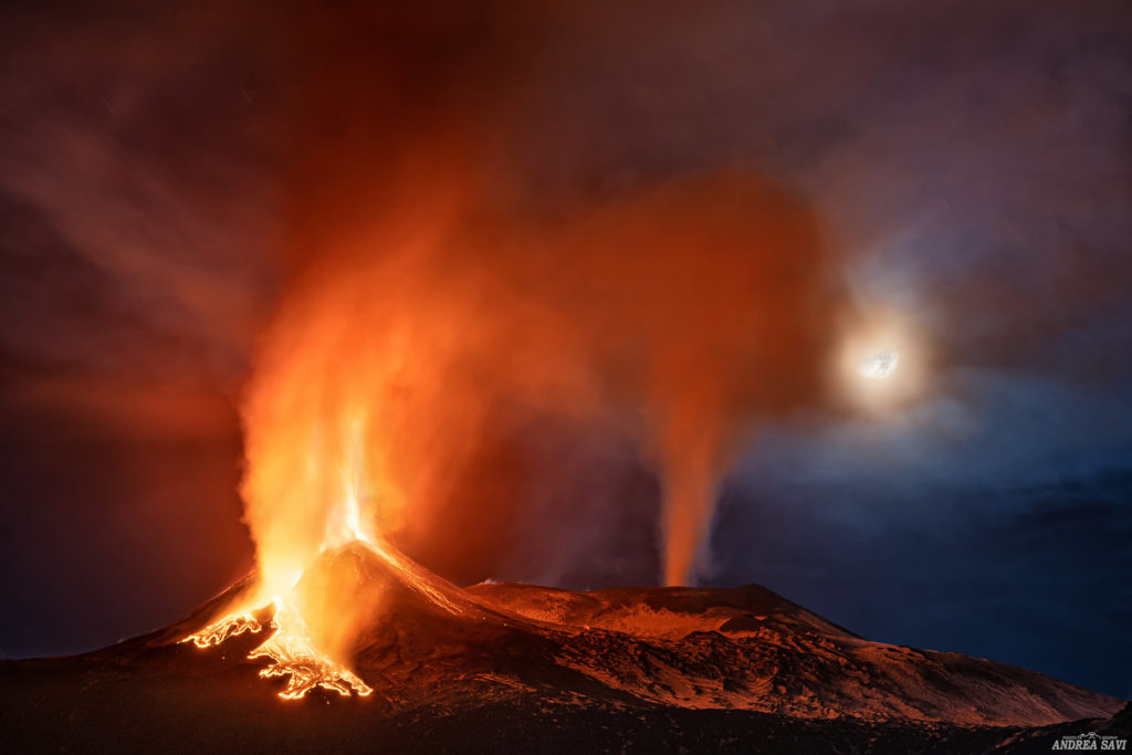
In particular, between March 8 and 14, the Southeast Crater produced two episodes of lava fountains on March 10 and 12 (episodes 11 and 12 of the sequence that began on February 16). The evolutionary phenomenology of these eruptive episodes is common to all the 10 other episodes that have occurred since February 16, and consists of the resumption of Strombolian activity at the Southeast Crater, followed by a gradual intensification which then rapidly passes to the stage of fountain preceded and / or accompanied by the lava overflow fed by the same crater. In the case of the episodes of March 10 and 12, the time elapsed between the resumption of Strombolian activities and the conclusion of the phenomenology was respectively ~ 6:13 h and ~ 6:55 hours with a duration of the fountain episodes only of ~ 02: 43 hours March 10 and 2:55 a.m. on March 12. Both episodes produced eruptive clouds that rose to a height of between 9 and 10 km above sea level, dispersing in the eastern quadrants of Etna with a fall of ash and lapilli in the towns of Mascali, Giarre, Fiumefreddo (March 10) and Milo, Fornazzo, Giarre (March 12;). The lava flows fed by the overflow of the two episodes which preceded the fountain at 2:13 and 5:34 am respectively created lava fields which propagated towards the west side of the Valle del Bove up to an altitude of ~ 1770 meters at above sea level and for an average length of 3 km and with an average erupting volume of approximately 1 x 10⁶ m3.
As for the Northeast, Bocca Nuova and Voragine craters, Strombolian activity continued throughout the period, producing modest ash emissions that quickly dispersed into the atmosphere near the summit area. This eruptive activity was mainly confined to the craters, although in the case of the Bocca Nuova and Voragine some explosions went far beyond the edge of the crater. With respect to effusive intracranial activity at Bocca Nuova reported in Rep. No. 07/2021, during the period in question, there is no evidence of activity.
14th episode:
Communication on the activity of ETNA: 17 March 2021, 02:39 (01:39 UTC).
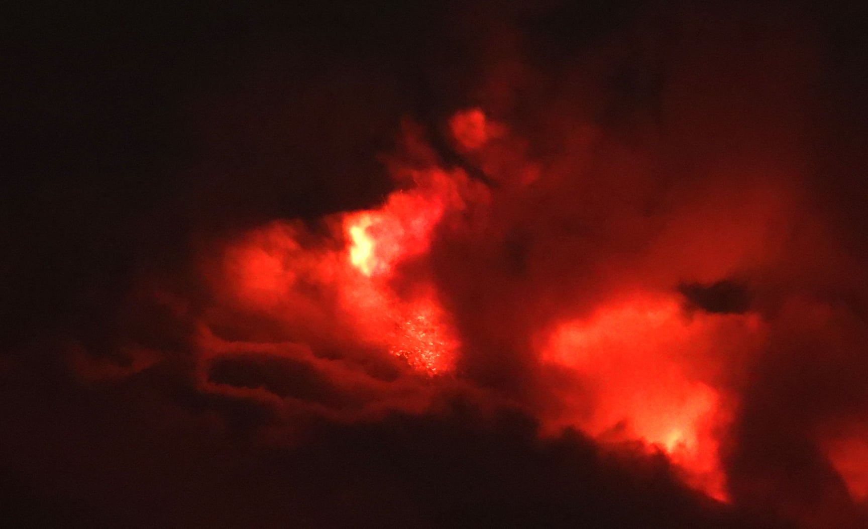
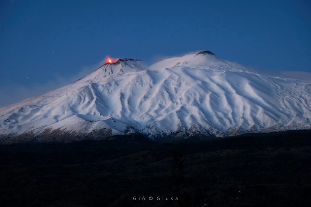
The National Institute of Geophysics and Volcanology, Etneo Observatory, announces that as of 00:55 UTC, there is an increase in Strombolian activity in the Southeast Crater.
The tremor level increases rapidly to reach high values. The source of the quake is located southeast of the Southeast Crater at a level of about 2800 meters above sea level.
The infrasound signal also reveals the presence of volcanic activity.
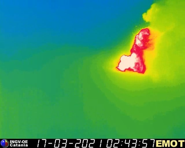
03:19 (02:19 UTC): The amplitude of the tremor continues to increase, reaching the second alarm level. The signal sources are located south of the South East Crater at a level of about 2500 above sea level. The infrasound signal is also constantly increasing. The Strombolian activity of the South East Crater has turned into a lava fountain. Due to the cloud cover, it is not possible to continuously observe the activity in progress. From the surveillance cameras from 02:25 UTC a lava overflow from the South East Crater towards the Valle del Bove is observed.
07:17 (06:17 UTC): The amplitude of the tremor is clearly decreasing and at average levels. The sources are located to the South-East of the South-East Crater at a depth of approximately 2000 m above sea level. The infrasound signal does not detect volcanic activity. The lava fountain activity at the South East Crater is over. Moderate Strombolian activity persists. Due to the cloud cover, the observation of the current activity is very limited and discontinuous.
Source : INGV .
Photos : Gio Giusa , Andrea Savi / Guide Alpine Vulcanologiche Etna , INGV, Boris Behncke .
Peru , Sabancaya :
Analysis period: from March 08, 2021 to March 14, 2021, Arequipa, March 15, 2021.
Alert level: ORANGE
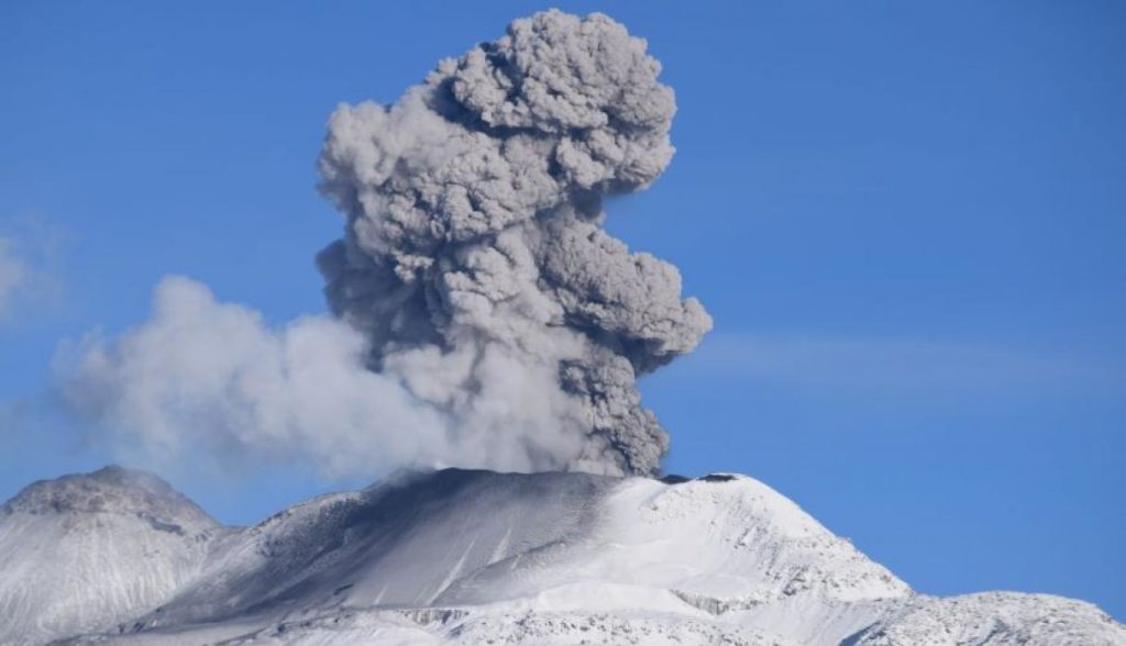
The Geophysical Institute of Peru (IGP) reports that the eruptive activity of the Sabancaya volcano remains at moderate levels, that is to say with the recording of an average of 88 daily explosions, with columns of ash and gas up to 2.5 km altitude above the summit of the volcano and their consequent dispersion. Therefore, for the following days, no significant change is expected in eruptive activity.
The IGP recorded and analyzed the occurrence of 1980 earthquakes of volcanic origin, associated with the circulation of magmatic fluids inside the Sabancaya volcano. An average of 88 explosions was recorded daily. During this period, Volcano-Tectonic (VT) earthquakes associated with rock fracturing were located mainly in the Northwest and West of Sabancaya and presented magnitudes between M2.4 and M3 , 6.
The monitoring of the deformation of the volcanic structure using GNSS techniques (processed with fast orbits) does not present any significant anomalies. However, in general, an inflation process was observed in the northern sector (around the Hualca Hualca volcano). The visual surveillance made it possible to identify columns of gas and ash up to 2.5 km altitude above the summit of the volcano, which were scattered towards the South-West, South, North-East and North sectors. West of Sabancaya. Satellite recordings have identified the presence of 9 thermal anomalies (maximum value of 57 MW) associated with the presence of a lava body on the surface of the volcano’s grate.
RECOMMENDATIONS
• Keep the volcanic alert level in orange.
• Do not approach within a radius of less than 12 km from the crater.
Source : IGP.
Photo : Ingemmet.

