January 05 , 2021 .
Italy / Sicily , Etna :
COMMUNICATION ACTIVITY OF ETNA [UPDATE n. 111]
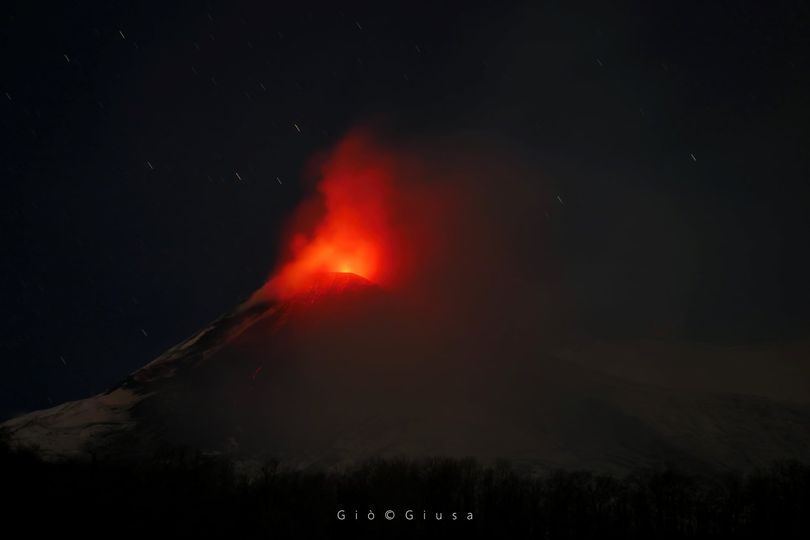
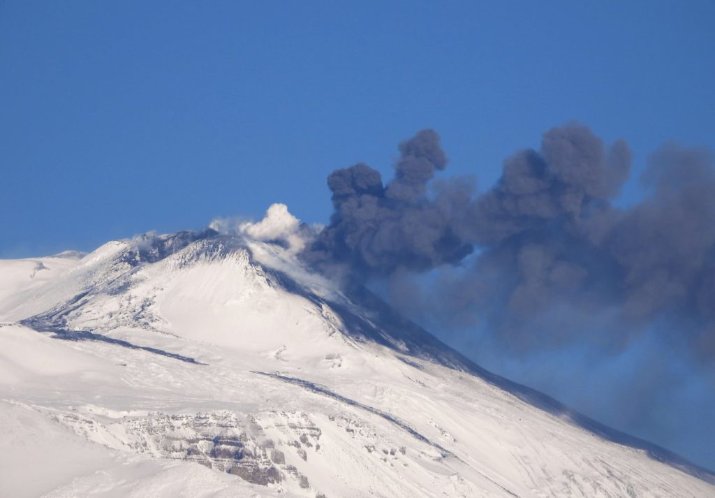
The National Institute of Geophysics and Volcanology, Osservatorio Etneo, announces that from 5:45 UTC the video surveillance network showed a weak and sporadic emission of ash from the craters of Voragine and Southeast. These pulsed emissions quickly dispersed eastwards. From 08:18 UTC, a gradual intensification of Strombolian explosive activity was observed at the eastern mouth of the Southeast crater with an associated abundant emission of dark and dense ash which still disperses in an eastern direction. As with the other craters, activity remains unchanged from previous reports.
Regarding the volcanic tremor, there are no significant variations compared to what was communicated previously and its amplitude fluctuates, sometimes widely, in the range of average values. The source is located in the south-eastern crater area between 2.8 and 3 km above sea level.
Infrasound activity over the past few hours showed no significant change. However, two increases were observed in the number of events located in the Southeast, yesterday afternoon and during the night. The infrasound activity located at the northeast crater remains unchanged.
No significant change is observed in the deformation signals recorded by the permanent GPS and inclinometric networks
COMMUNICATION ACTIVITY OF ETNA [UPDATE n. 112]
The National Institute of Geophysics and Volcanology, Osservatorio Etneo, announces that from surveillance cameras, a decrease in explosive activity at the level of the Southeast crater (SEC) is observed compared to the last update no . 111. The explosive activity of varying intensity produces occasional and light ash emissions which are rapidly dispersed in the summit area.
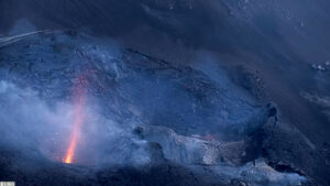
The South-East crater just before dawn in Strombolian activity Etna East, January 5, 2021
Regarding the volcanic tremor and infrasound activity, there are no significant changes from what was reported in the previous press release.
No significant variation is observed in the deformation signals recorded by the permanent GPS and inclinometric networks.
Further updates will be communicated shortly.
Source : INGV , Gio Giusa .
Read the article : http://www.ct.ingv.it/Dati/informative/vulcanico/ComunicatoETNA20210104092541.pdf
Photos : INGV.
Saint Vincent and the Grenadines , Soufrière Saint Vincent :
LA SOUFRIERE BULLETIN 6-January 3, 2021 , 1.00 PM-URGENT!!
The National Emergency Management Organization wishes to advise all citizens and residents of St. Vincent and The Grenadines that no evacuation order has been issued to any section of the population. Several media outlets both locally and abroad have published false information to this effect. These reports are inaccurate, and misleading.
LA SOUFRIERE BULLETIN 7, JANUARY 4, 2021 8:00 PM
No aerial reconnaissance of La Soufriere was done today due to the heavy cloud cover.
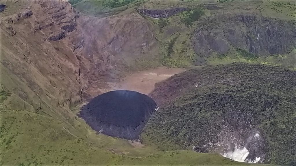
Alert level remains at Orange. The Volcano continues to exude magma on the surface and steam can still be observed from the Belmont Observatory. Persons living in areas close to the volcano should expect strong sulphur smells for several days to weeks, depending on changes in wind direction.
Alert level remains at Orange. The Volcano continues to exude magma on the surface and steam can still be observed from the Belmont Observatory. Persons living in areas close to the volcano should expect strong sulphur smells for several days to weeks, depending on changes in wind direction.
The team from The Seismic Research Centre, University of the West Indies, St. Augustine Campus (UWI-SRC) led by Vincentian Geologist Prof. Richard Robertson spent the day preparing, assembling and testing equipment to be installed at the Wallilabou Station on Tuesday 5th January 2021 in an effort to improve the Monitoring Network System.
The Director of NEMO briefed Opposition Members of Parliament today on the current situation at La Soufriere.
The National Emergency Management Organisation (NEMO) will meet with residents of Fancy and Owia and Point on Tuesday 5th January 2021. The first meeting will be held at the Fancy Government School at 1:00 p.m. Residents of Owia and Point will meet at the Owia Government School from 4:00 p.m. Residents will be updated on the present situation at the La Soufriere Volcano and conduct a review of the Community Volcano Emergency Plan.
NEMO will also meet with residents of Calliaqua and surrounding areas to provide an update on the present situation at the La Soufriere Volcano and to put plans in place to receive persons in the event that evacuation becomes necessary.
Source : Nemo .
Hawaii , Kilauea :
19°25’16 » N 155°17’13 » W,
Summit Elevation 4091 ft (1247 m)
Current Volcano Alert Level: WATCH
Current Aviation Color Code: ORANGE
Activity Summary:
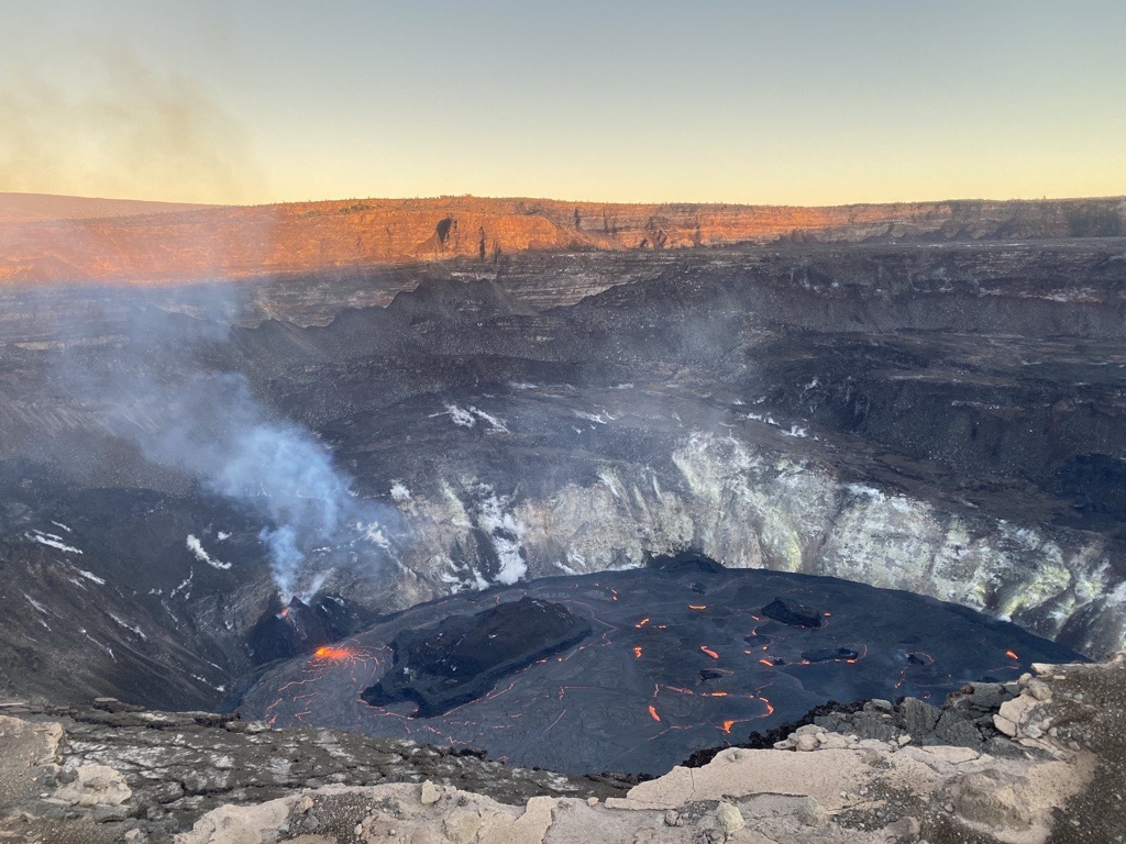
Lava activity is confined to Halemaʻumaʻu with lava erupting from vents on the northwest side of the crater. Yesterday afternoon (Jan. 3), the lava lake was 190 m (623 ft) deep and perched about a meter (yard) above its edge. SO2 emission rates were still elevated.
Summit Observations:
Sulfur dioxide emission rate measurements made Friday (Jan. 1) were about 4,400 t/d and in the range 3,000-6,500 t/d since Sunday (Dec. 27)–the same range of values that was common for emissions from the pre-2018 lava lake. Summit tiltmeters recorded weak deflationary tilt over the past three days. Seismicity remained elevated but stable, with steady elevated tremor and a few minor earthquakes.
The eruption in Halema‘uma‘u, at Kīlauea Volcano’s summit, continues. Lava activity is confined to Halemaʻumaʻu with lava erupting from vents on the northwest side of the crater. Yesterday afternoon (Jan. 2), HVO field geologists observed that the lava lake was 190 m (623 ft) deep and perched about a meter (yard) above its edge. SO2 emission rates were still elevated.
East Rift Zone Observations:
Geodetic monitors indicate that the upper portion of the East Rift Zone (between the summit and Puʻu ʻŌʻō) contracted while the summit deflated at the onset of this eruption. There is no seismic or deformation data to indicate that additional magma is currently moving into either of Kīlauea’s rift zones.
Halemaʻumaʻu lava lake Observations:
The west vents spattered from two places at the top of a small cone plastered on the northwest wall of Halemaʻumaʻu crater. Lava is also emerging as a small dome fountain in front of the west vents probably from a submerged portion of the vent.
The lava lake was 190 m (623 ft) deep Sunday afternoon (Jan. 3) and had a volume of 26 million cubic meters (34 million cubic yards). The most recent thermal map (Dec. 30) provided the lake dimensions as 800 by 530 m (875 by 580 yds) for a total area of 33 ha (82 acres) . The lake is now perched about a meter (yard) above its narrow edges as measured yesterday morning (Jan. 3); overflows onto the narrow edge slowly elevated a low wall around the lake similar to an above-ground swimming pool.
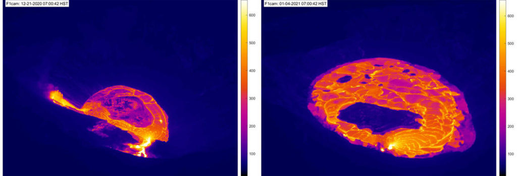
Last night, January 3, at approximately 9:30 p.m. HST marked two weeks since the Kīlauea summit eruption began within Halema‘uma‘u crater (December 20). In the first several hours of the eruption, three fissures opened on the wall of Halema‘uma‘u crater and cascading lava boiled away the water lake—replacing it with a growing lava lake. This F1cam thermal webcam comparison shows two images from 7:00 a.m. HST on December 21 (left) and January 4 (right). The lava lake depth has risen by approximately 102 m (335 ft) between the morning of December 21 (left) measured at about 88 m (289 ft) and last night measured at about 190 m (623 ft). The central and northern vents (center left) have both been drowned by the rising lava lake and only the western vent (lower center) remains active. Note the lava island floating within the lava lake in both images. USGS thermal webcam images.
The main island of cooler, solidified lava floating in the lava lake continued settling in front of the west lava source filling the lake, while the other 10 or so small islands moved a bit around the east end of the lake. The main island measured about 250 m (820 ft) in length, 135 m (440 ft) in width, and about 3 ha (7 acres) in area based on the Dec. 30 thermal map. Measurements Friday afternoon (Jan. 1) showed that the island surface was about 6 m (20 ft) above the lake surface.
Source : HVO.
Photos : USGS photo by F. Trusdell , USGS.
Peru , Sabancaya :
Analysis period: from December 28, 2020 to January 03, 2021, Arequipa, January 04, 2021.
Alert level: ORANGE
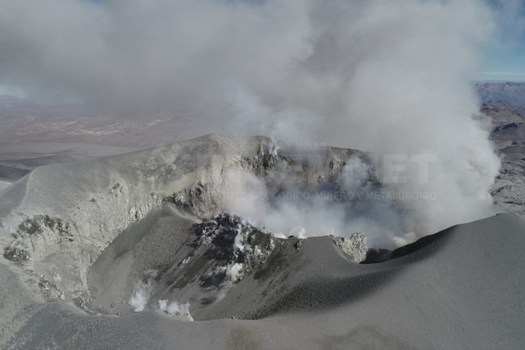
The Geophysical Institute of Peru (IGP) reports that the eruptive activity of the Sabancaya volcano remains at moderate levels, that is, with the continuous recording of explosions with columns of ash and gas up to 3 km altitude above the summit of the volcano and their consecutive dispersion. It has been reported the presence of a second lava dome, visible in the crater of the volcano. Therefore, for the following days, no significant change is expected in eruptive activity.
The IGP recorded and analyzed the occurrence of 1,500 earthquakes of volcanic origin, associated with the circulation of magmatic fluids inside the Sabancaya volcano. An average of 35 explosions were recorded daily of low to medium intensity. During this period, Volcano-Tectonic (VT) earthquakes associated with rock fractures were located mainly in the North-East of Sabancaya and presented magnitudes between M2.2 and M2.6. The most representative earthquake (M2.6) was recorded on January 01 at 07:10 a.m., 15 km northeast of Sabancaya and 8 km deep.
The monitoring of the deformation of the volcanic structure using GNSS techniques (processed with fast orbits) does not present any significant anomalies. However, in general, an inflation process has been observed in the south-eastern sector of Sabancaya and the north sector (Hualca Hualca volcano). Visual surveillance made it possible to identify columns of gas and ash up to 3 km altitude above the summit of the volcano, which were scattered towards the northwest, west and southwest sectors of Sabancaya. Satellite monitoring did not identify the presence of thermal anomalies on the surface of the volcano’s crater.
RECOMMENDATIONS
• Keep the volcanic alert level in orange.
• Do not approach within a radius of less than 12 km from the crater.
Source : IGP.
Photo : Andina

