July 20 , 2020.
Italy , Stromboli :
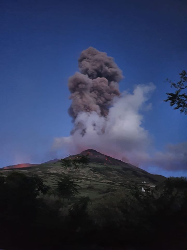
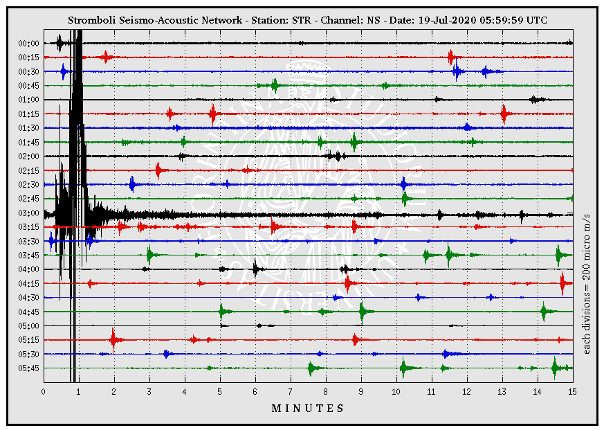
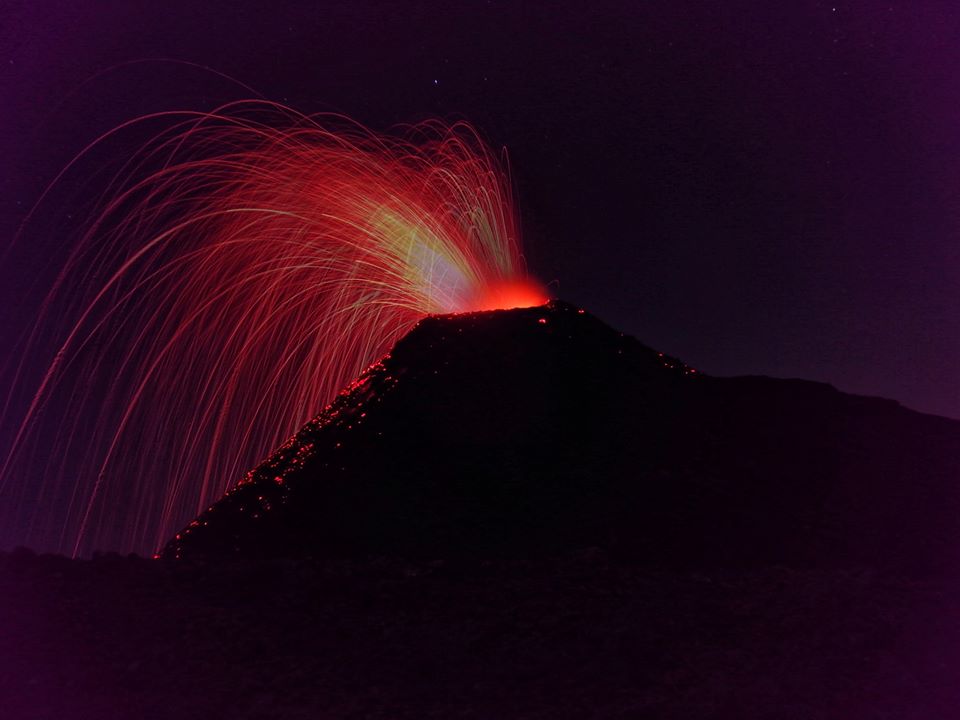
MAJOR EXPLOSION, July 19, 2020, 03:00:45 UTC (05:00:45 local time)
On the morning of July 19, 2020 at 03:00:45 UTC the geophysical monitoring network of the Laboratory of Experimental Geophysics #LGS of the Department of Earth Sciences of the University of Florence recorded a very strong explosive event associated with geophysical parameters (seismic, ground deformation and sound pressure) above ordinary explosive activity and which can be classified as a major explosive event.
The seismic event (4.0×10⁻⁴ m / s in speed and 1 x10⁻⁴ m in displacement) exceeds the values of ordinary activity by more than an order of magnitude.
The infrasonic network indicates that the explosion generated pressures at around 250 Pa, 450 m away and located the explosive event in the sector relating to the Central / Southwest crater.
This event was accompanied by a strong signal of soil deformation (3.5 µrad in the Rina Grande with the OHO tilting meter) preceded by approximately 4 minutes by a clear inflation of the soil.
From the images of thermal cameras, a significant emission of matter is observed beyond the terrace of the crater.
Following the explosive event, there was no significant change in the explosive activity.
STROMBOLI PRESS RELEASE [UPDATE n. 3]
The National Institute of Geophysics and Volcanology, Etneo Observatory, communicates that the monitoring networks recorded at 10:46 (08:46 UTC), the return of the parameters at the level of a normal activity.
Source : LGS , INGV .
Photo : LGS – Laboratorio Geofisica Sperimentale .
Iceland , Reykjanes Peninsula :
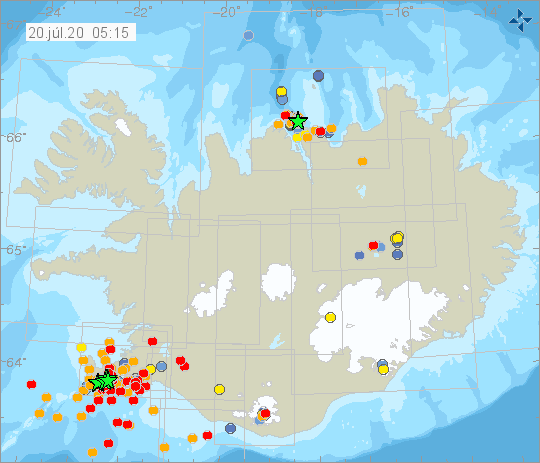
Reykjanes : An earthquake between M5 occurred at 23:36 by Fagradalsfjall in Reykjanes. The earthquake was felt widely in the southwest part of Iceland. A considerable amount of aftershocks have occurred, the largest were M3.5 at 00:08, M3.4 at 00:55, M3.0 at 02:19 and M3.4 at 03:09 and they were also felt in SW Iceland. Rock fall has been reported in Festarfjall, about 6 km SW of the epicenter of the earthquake.
On July 18th at 05:56 an M4.1 earthquake was detected 4.1 km N of Grindavík. Earthquake activity around Grindavík has been ongoing there during the last months due to deformation in the area.
Earthquake swarm offshore N-Iceland :
Earhquakes M4.4 and M3.9 occurred 10 km NNW of Gjögurtá yesterday (19th July). Both of them were felt widely in northern Iceland.
Source : Vedur is.
Indonesia , Raung :
Since July 16, 2020, the number of emissions recorded on the G. Raung has increased, followed by the appearance of other types of volcanic earthquakes (eruption tremors), and accompanied by changes in column heights. gas / ash emissions and the color of these columns. Then since July 19, 2020, the activity level of G. Raung was raised to level II (WASPADA).
The volcano is covered in fog. The smoke from the crater is not observed. The weather is cloudy to rainy, the weak winds oriented towards the West.
According to the seismographs of July 19, 2020, it was recorded:
11 emission / eruption earthquakes
72 harmonic earthquakes
1 distant tectonic earthquake
Recommendation:
The public and visitors / tourists are not allowed to descend into the summit crater or camp around the top / lip of the G. Raung caldera / crater within a radius of 2 km from the center of the crater due to gas volcanics coming out of the crater are dangerous to human life.
VONA:
The last VONA message was sent in the color code ORANGE, published on July 16, 2019 at 3:37 p.m. WIB. Volcanic ash was not observed.
Source : PVMBG.
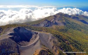
Photo : Wikimapia.
Ecuador , Sangay :
SUNDAY JULY 19, 2020
The Geophysical Institute of the National Polytechnic School reports that:
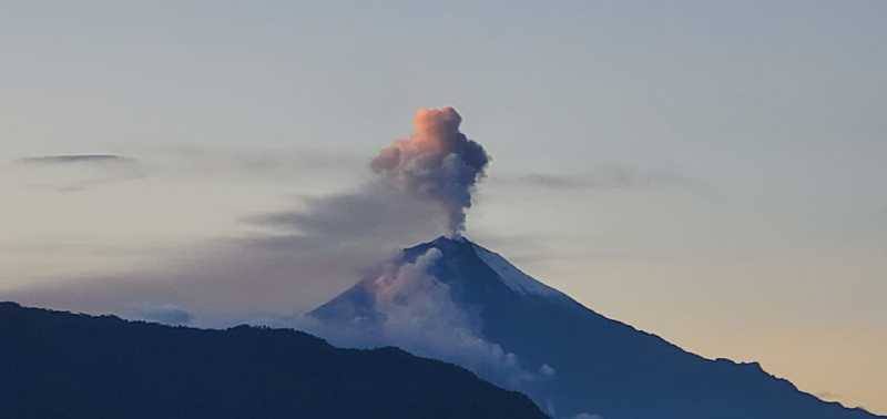
Today, the SAGA seismic station recorded from around 7 a.m. (TL), a high frequency signal, associated with the appearance of mudslides and debris (lahars) that descend through the ravines of the volcano. The climatic conditions of rain in the area were constant and favor the remobilization of the material accumulated from its activity.
eruption since May 2019. Proximity to rivers is not recommended.
The Geophysical Institute of the National Polytechnic School monitors activity on the volcano and will inform of any changes that may be recorded.
DAILY REPORT ON THE STATE OF SANGAY VOLCANO, Sunday July 19, 2020.
Surface activity level: High, Surface trend: No change.
Internal activity level: High, Internal trend: No change.
Seismicity: From July 18, 2020, 11:00 am to July 19, 2020, 11:00 am:
Long-term events: 20
Explosions: 81
Rains / lahars: Moderate rains that occurred overnight and early in the morning in the area recorded a continuous high frequency signal attributed to the descent of mud and debris flows in the channels associated with the volcano. Sangay. There are no external reports on this phenomenon. It is recommended not to approach the rivers in the area. * In case of heavy rains, lahars can be generated in the Volcán, Upano and other tributaries. *
Emission / ash column: The Washington VAAC reported 4 emission alerts observed through satellite images, with heights reaching 870 meters above crater level, and heading west.
Other monitoring parameters: No changes.
Observations: The intense cloudiness of the area makes it impossible to observe the surface activity.
Alert level: yellow.
Source : IGEPN.
Photo : el universo.
Guatemala , Pacaya :
Type of activity: Strombolian
Morphology: composite stratovolcano
Location: 14 ° 22’50’ Latitude N; 90 ° 36’00˝ Longitude W.
Height: 2,552 m.
Atmospheric conditions: clear
Wind: East-South East at 34 km / h
Precipitation: 0.0 mm.
Activity:
The Mackenney crater is observed, with a blue and white degassing fumarole that the wind moves towards the South and the Southwest. This is accompanied by Strombolian explosions which expel incandescent materials to heights of 25, 50 and 75 meters above the crater. The seismic stations of INSIVUMEH constantly record tremors and explosions, with a tendency to increase the energy released in the last hours. This is due to the rise and extrusion of magma and gas to the surface. Currently, there are no active lava flows on the flanks, but these could reappear in the coming days.
Due to the continuity of Strombolian activity, the recommendations of the special BEPAC bulletin n ° 42-2020 are still in force.
Source : Insivumeh .
Photo : Henry Salguero .

