April 02 , 2020.
La Réunion , Piton de la Fournaise :
Activity bulletin for Thursday, April 2, 2020 at 8:35 a.m. (local time)
Recommended level of alert: Alert 1
Since approximately 08:15 local time, a seismic crisis has been recorded on the instruments of the Volcanological Observatory of Piton de la Fournaise.
This seismic crisis is accompanied by rapid deformation, This indicates that the magma is leaving the magmatic reservoir and is propagating towards the surface. A rash is likely soon in the next few minutes or hours.
Additional information will follow regarding the sector impacted by this magmatic propagation towards the surface.
Activity bulletin for Thursday, April 2, 2020 at 9:45 a.m. (local time)
Alert level: Alert 1
A seismic crisis was recorded on the instruments of the Volcanological Observatory of Piton de la Fournaise this morning, with 92 superficial volcano-tectonic earthquakes detected between 8:15 am and 8:51 am local time.
This seismic crisis was accompanied by rapid deformation (of the order of 10-20 micro-radians). This indicates that magma has left the surface magmatic reservoir and has spread to the surface.
This seismic crisis, just like the signals:
1) a resumption of seismicity in general under the Piton de la Fournaise massif since March 30,
2) accompanied by a resumption of building inflation for two days,
show that the superficial magmatic reservoir pressurizes again.
An eruption is therefore not ruled out in the medium term.
As a reminder, the eruptions of October 25-27, 2019, February 18 – March 10, 2019 and April 03-04, 2018 were preceded by a similar magma intrusion which stopped in depth, respectively 4, 2 and 3 days before the start of the eruption .
Source : OVPF.
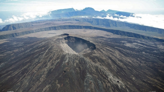
Photo : IPR.
Italy , Stromboli :
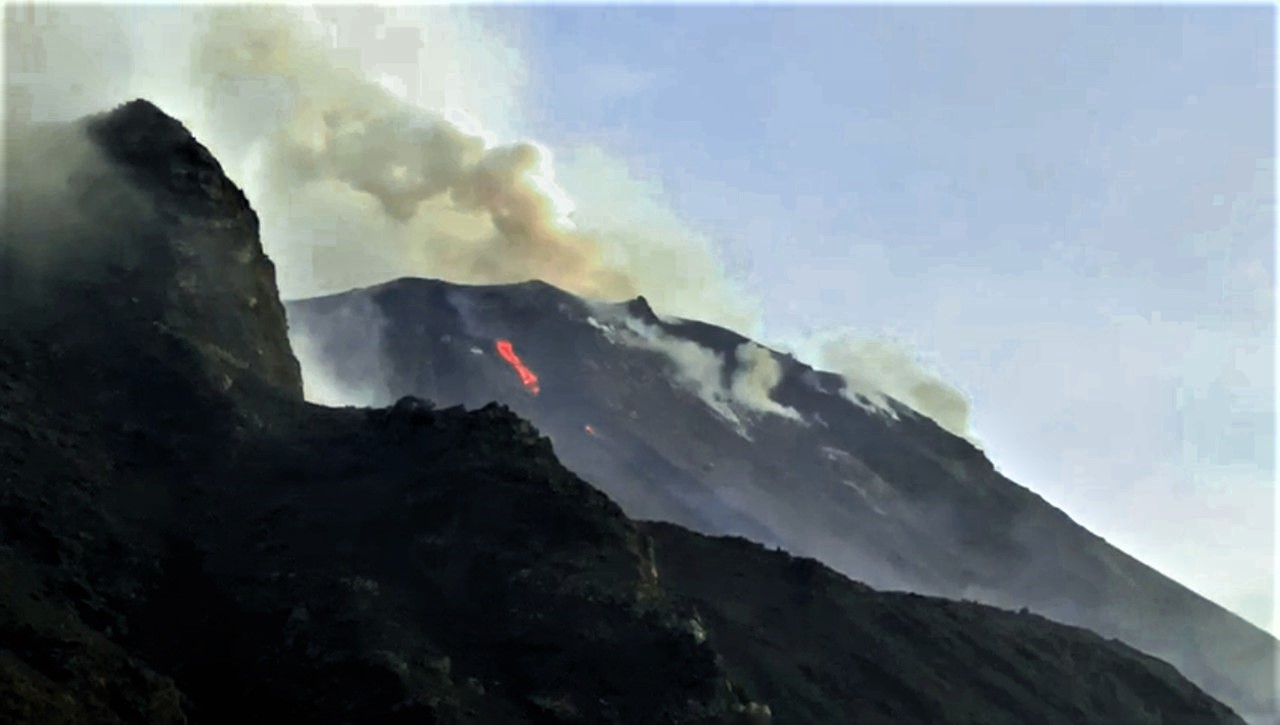
Stromboli eruptive activity, March 31, 2020.
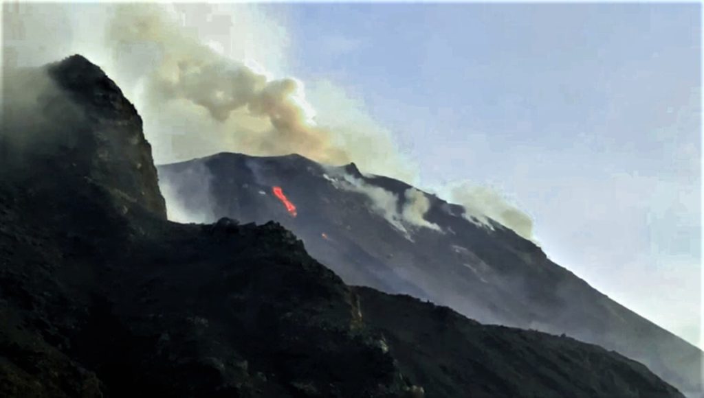
Lava flow at the point of discharge (the most northerly mouth of the North crater area), in the evening of March 31, 2020. Photograph by R. Zaia
The new effusive eruption of Stromboli lasted only 24 hours, from the early hours of March 31 to the early hours of April 1, 2020.
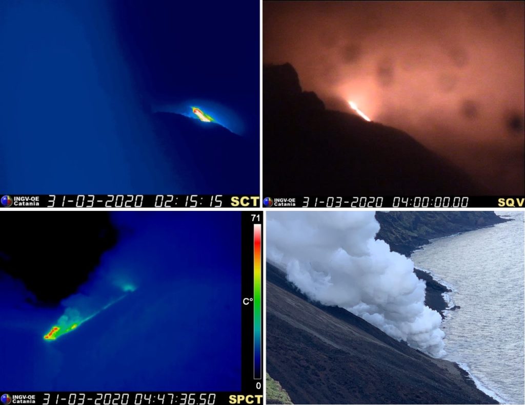
An anomaly was observed in the seismic signal at 03:16 (local time) on March 31 compatible with the start of the emission of a lava flow. The first images available, taken by the surveillance cameras of the INGV-Osservatorio Etneo (Figure 1), show that the lava flow was fed from the area of the North crater producing a flow which quickly traversed the Sciara del Fuoco and reached the coast at 03:50 (local time) on March 31. The effusive phenomenon was preceded by a frequency of Strombolian explosions in the summit area attested to medium-high values (20 explosive events per hour).
Figure 1. From left to right, thermal and visible image recorded by the cameras located at an altitude of 190 m and at an altitude of 400 m, which shows the lava overflowing from the North crater area. Bottom left, image recorded by the thermal camera of Punta dei Corvi, which shows the coast line of the front of the lava overflow; on the right a photo showing the front of the lava flow reaching the sea (photo by R. Zaia).
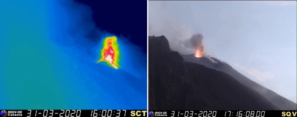
During the afternoon of March 31, it was observed that the lava flow was fed by the most northerly mouth of the area of the North crater, whose edge had significantly lowered (figure 2 ). This mouth continued to produce strombolian explosions of medium and low energy, projecting shreds of incandescent lava into the air up to several tens of meters high, observable by thermal images.
Figure 2. Explosive activity of the mouth that generated the lava flow, the afternoon of March 31, 2020. Thermal image on the left; in the image on the right, you can see how the edge of the mouth has lowered in relation to the height of the crater terrace.
The lava flow continued to be well supplied in the evening of March 31; after 3:00 a.m. (local time) on April 1, using surveillance cameras, it was possible to observe that the flow supply gradually decreased (Figure 3). Subsequently, the crater area was not visible due to bad weather conditions; It was only after 10:20 a.m. (local time) that the supply of the lava flow was found to have stopped. At the time of writing (April 1, 2020 afternoon), Strombolian activity was observed in both the North and Center-South crater areas. There is still a thermal anomaly and the emission of steam downstream of Sciara del Fuoco and near the coast, associated with the cooling of the lava flow.
Source : INGV Vulcani.
Read the article : https://ingvvulcani.com/2020/04/01/attivita-eruttiva-di-stromboli-del-31-marzo-2020/?fbclid=IwAR29ykX3GtCF5puOT8QrsR-kBG9EfIyashY1GTVBe-R4PtgdhpJebtj8FIY
Photos : INGV Vulcani , R. Zaia .
Alaska , Semisopochnoi :
AVO/USGS Volcanic Activity Notice
Current Volcano Alert Level: ADVISORY
Previous Volcano Alert Level: WATCH
Current Aviation Color Code: YELLOW
Previous Aviation Color Code: ORANGE
Issued: Wednesday, April 1, 2020, 12:16 PM AKDT
Source: Alaska Volcano Observatory
Notice Number:
Location: N 51 deg 55 min E 179 deg 35 min
Elevation: 2625 ft (800 m)
Area: Aleutians
Volcanic Activity Summary:
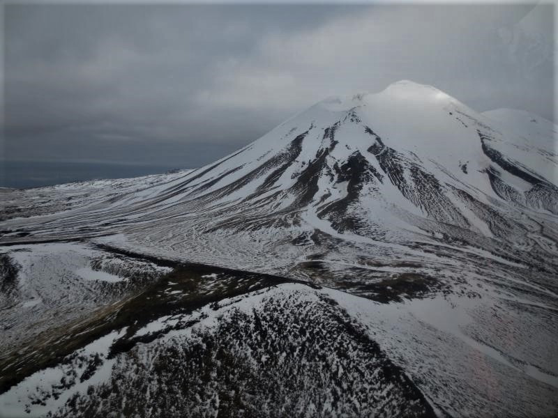
Seismic, infrasound, and satellite data over the past two weeks have shown no signs of eruptive activity at Semisopochnoi. A robust steam plume and a crater lake have been seen in clear satellite images, but no recent ash deposits. Although seismic activity remains above background, it does not appear to be increasing towards an eruption in the short-term. Thus, AVO is reducing the Aviation Color Code to YELLOW and the Volcano Alert Level to ADVISORY. Unrest continues. Seismic activity persists and is characterized by occasional small earthquakes and satellite data show detectable volcanic gas (sulfur dioxide) being emitted from the volcano. Explosive activity could resume with little to no warning.
Recent Observations:
[Volcanic cloud height] n/a
[Other volcanic cloud information] n/a
Remarks:
Semisopochnoi is monitored with an on-island seismic network, and remotely by satellite and lightning sensors. An infrasound array on Adak Island could detect explosive emissions from Semisopochnoi with a 13 minute delay if atmospheric conditions permit.
Source : AVO.
Photo : Kaufman, Max.
Russia / Northern Kuriles , Ebeko :
VOLCANO OBSERVATORY NOTICE FOR AVIATION (VONA).
Issued: April 01 , 2020
Volcano: Ebeko (CAVW #290380)
Current aviation colour code: ORANGE
Previous aviation colour code: orange
Source: KVERT
Notice Number: 2020-37
Volcano Location: N 50 deg 41 min E 156 deg 0 min
Area: Northern Kuriles, Russia
Summit Elevation: 3791.68 ft (1156 m)
Volcanic Activity Summary:
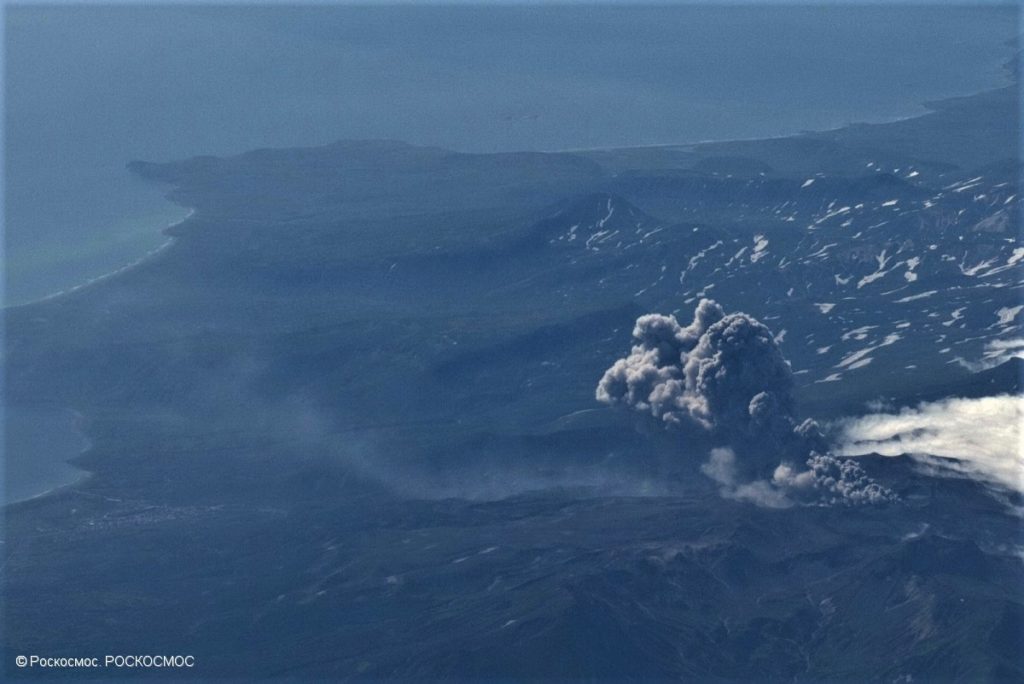
A moderate eruptive activity of the volcano continues. According to visual data by volcanologists from Severo-Kurilsk, explosion sent ash up to 1.7 km a.s.l., an ash cloud is drifting to the north-east of the volcano.
A moderate eruptive activity of the volcano continues. Ash explosions up to 19,700 ft (6 km) a.s.l. could occur at any time. Ongoing activity could affect low-flying aircraft and airport of Severo-Kurilsk.
Volcanic cloud height:
5576 ft (1700 m) AMSL Time and method of ash plume/cloud height determination: 20200401/2300Z – Visual data
Other volcanic cloud information:
Distance of ash plume/cloud of the volcano: 3 mi (5 km)
Direction of drift of ash plume/cloud of the volcano: NE
Source : Kvert.
Photo : roskosmos

