January 11 , 2020.
Colombia , Nevado del Ruiz :
Weekly activity bulletin of the Nevado del Ruiz volcano
The activity level continues at the level: yellow activity level or (III): changes in the behavior of volcanic activity.
Regarding the monitoring of the activity of the Nevado del Ruiz volcano, the COLOMBIAN GEOLOGICAL SERVICE reports that:
The Nevado del Ruiz volcano continues to show unstable behavior. Over the past week, some of the monitored parameters have continued to show changes, reflecting the instability of the volcanic system.
The seismicity generated by the fracturing of the rocks showed a decrease in the number of earthquakes and the seismic energy released, compared to the previous week. This type of seismicity was mainly located in the Northeast, Southwest and Southeast sectors of the volcanic structure and in the Arenas crater. The depths of the earthquakes ranged from 0.6 to 8.2 km. The maximum magnitude recorded during the week was 1.6 ML (local magnitude), corresponding to the earthquake recorded on December 31 at 4:38 a.m. (local time), located 3.3 km northeast of the Arenas crater, 3.4 km deep.
The seismicity linked to the dynamics of the fluids inside the volcanic conduits increased in number of recorded events and in the seismic energy released, compared to the previous week. This type of seismicity exhibited variations in spectral characteristics and was characterized by the presence of continuous volcanic tremors, pulses of volcanic tremors (TR), long period earthquakes (LP) and very long periods (VLP) ). The earthquakes presented varying levels of energy and were located mainly in the Arenas crater and its surroundings. Some of these signals were associated with small emissions of gas and ash, confirmed by cameras installed on the volcano. In the follow-up of the information provided on the web portals, MIROVA and NASA FIRMS, low energy thermal anomalies were present.
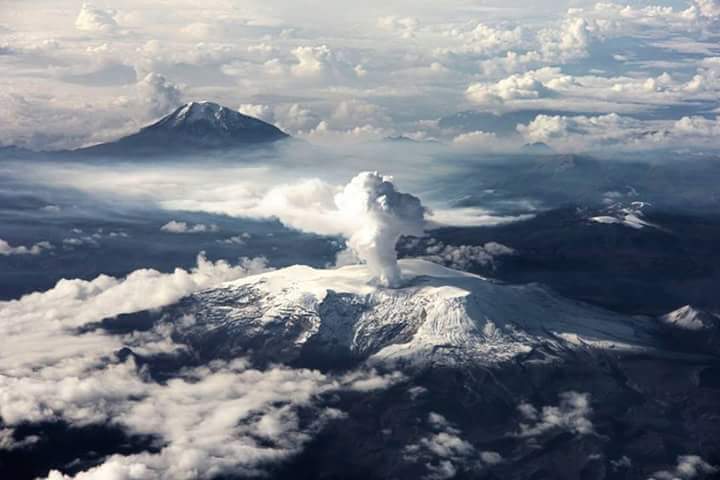
The gas and vapor column reached a maximum height, on December 31, of 1091 m measured at the top of the volcano. The direction of dispersion of the column was governed by the direction of the wind in the region, which was mainly to the west-northwest of the volcano.
The Nevado del Ruiz volcano continues at the yellow activity level,
Source : SGC.
Video : LP.
Photo : Auteur inconnu .
Hawaii , Mauna Loa :
19°28’30 » N 155°36’29 » W,
Summit Elevation 13681 ft (4170 m)
Current Volcano Alert Level: ADVISORY
Current Aviation Color Code: YELLOW
Activity Summary:
Mauna Loa Volcano is not erupting. Rates of deformation and seismicity have not changed significantly over the past week and remain above long-term background levels.
Observations:
During the past week, HVO seismometers recorded 56 small magnitude earthquakes beneath the upper elevations of the volcano. Most earthquakes occurred at shallow depths of less than 5 km (~3 miles) beneath the volcano.
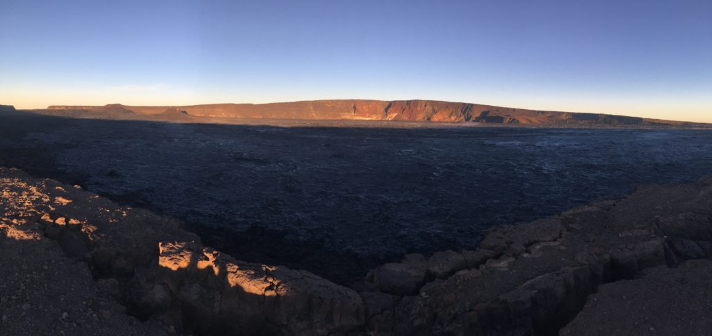
An early morning view looking north across Moku‘āweoweo, Mauna Loa’s summit caldera, from a spot near the summit cabin on the volcano’s south caldera rim. Frost covered much of the caldera floor that was still shadowed, and weak steaming issued from the usual areas. Overall, there were no significant changes observed at the summit. The 1940 and 1949 cones are visible in the sunlit area at left, and the gap that connects the caldera to South Pit is visible at the far left. Photos by M. Patrick, 09-08-2019.
Global Positioning System (GPS) and Interferometric Synthetic Aperture Radar (InSAR) measurements show continued slow summit inflation, consistent with magma supply to the volcano’s shallow storage system.
Gas concentrations at the Sulphur Cone monitoring site on the Southwest Rift Zone remain stable. Fumarole temperatures as measured at both Sulphur Cone and the summit have not changed significantly.
Source : HVO.
Chile , Copahue :
During this period, 148 seismic events classified as volcano-tectonic (VT) type were recorded, associated with fracturing processes of rigid materials. The event with the highest energy obtained a local magnitude equal to M 2.9 and was located 4.5 km north of the active crater El Agrio, 1.8 km deep.
Similarly, 15 earthquakes associated with fluid dynamics were recorded under the volcanic building, classified as long-period type events (LP), with a maximum displacement reduced value (DRC) of 1.0 cm2. In addition, discrete volcanic tremor (TR) events have been recorded, possibly associated with explosions.
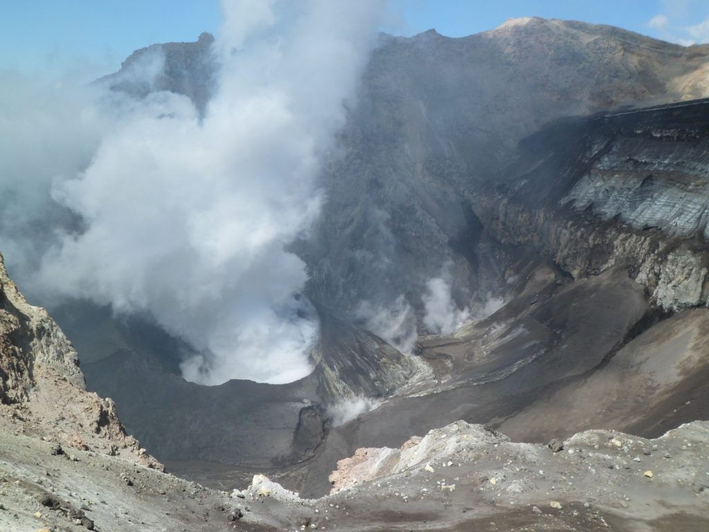
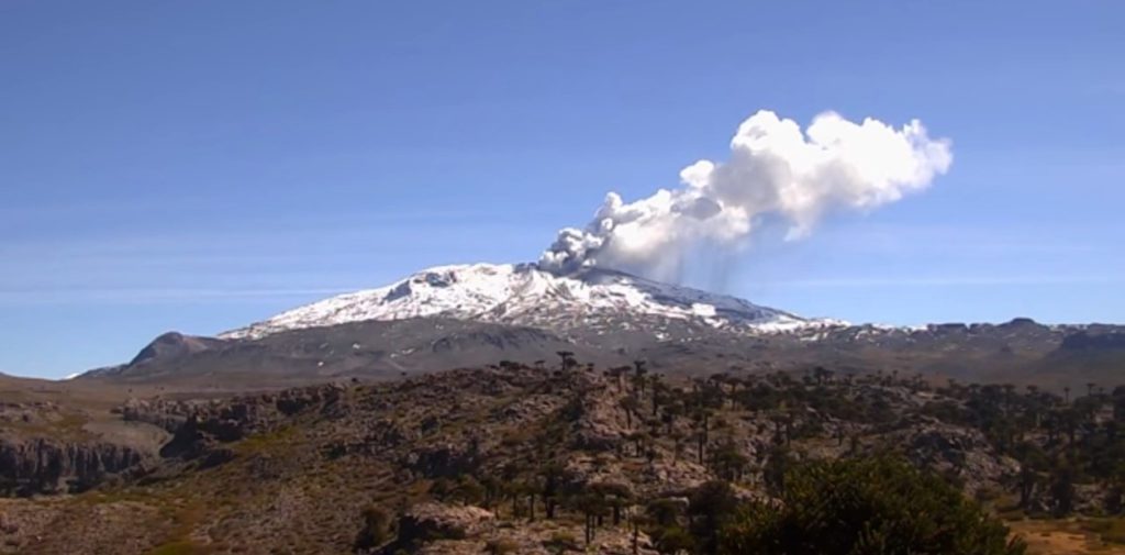
IP cameras installed near the volcano, when weather conditions allowed, made it possible to observe a degassing mainly composed of water vapor. On December 18, the highest emission column was observed, reaching 300 m above the edge of the crater.
According to the analysis of the data obtained by four geodetic monitoring stations, we observe variations of very small amplitude of the stations located north of the active crater, in the vertical direction, with a maximum value of 0.3 cm / month suggesting subtle changes in the volcanic system.
The sulfur dioxide (SO2) emissions recorded by differential absorption spectrometry (DOAS) equipment corresponding to the Hito station, located 5 km east-south-east of the active crater had an average value of 960 + / – 1253 t / day, with a maximum value of 1843 t / day reported on December 24. SO2 emissions are considered moderate if we look at the current state of the volcano.
Two anomalies in sulfur dioxide (SO2) emissions were reported in the area associated with the volcanic building, on December 20 and 21.
No thermal alert was reported in the area associated with the volcanic building during the reporting period, according to data processed by the mid-infrared observation. volcanic activity (MIROVA) (http://www.mirovaweb.it/) and near real-time thermal monitoring of global hot spots (MODVOLC) (http://modis.higp.hawaii.edu/) .
Volcanic activity levels during this period are considered to be low for this volcano. However, the monitoring parameters have shown a decrease since December 2019. No degassing episodes accompanied by ash were observed, although there are thermal anomalies and incandescence. Satellite images show a marked increase in the level of the lake.
Therefore, the alert level is maintained at:
GREEN LEVEL: Active volcano with stable behavior. No immediate risks.
Observation: A radius of 500m around the crater is considered as an assignment area.
Source : Sernageomin .
Photos : Dario G. Lazo , clarin.com .
Japan , Kuchinoerabujima :
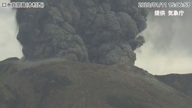
At 3:05 p.m., there was an eruption on the Kuchierabujima in Yakushima-cho today. The plume rose to a height of 2000 meters and entered the clouds.
The eruption is still in progress at 3.30 p.m. According to the Kagoshima Regional Meteorological Observatory, the pyroclastic flows were not confirmed during this eruption. The ash is expected to dissipate east from the crater, with a small amount of ash falling on Kuchierabu Island and a small amount of ash falling on Yakushima in less than an hour.
Up to about 6 km east of the crater, small ash clouds can be blown away. The eruption occurred on the Kuchierabujima is the first since February 2 of last year.
The Meteorological Observatory continued the level of caution of eruption to 3, and calls for caution on the projections of large volcanic blocks and the pyroclastic flows accompanying the eruption in a range of about 2 km around the crater.
Source : mbc.co.jp via Sherine France .
Kamchatka , Klyuchevskoy :
56.06 N, 160.64 E;
Elevation 15580 ft (4750 m)
Aviation Colour Code is ORANGE
A moderate activity of the volcano continues. Ash explosions up to 16,400-23,000 ft (5-7 km) a.s.l. could occur at any time. Ongoing activity could affect low-flying aircraft.
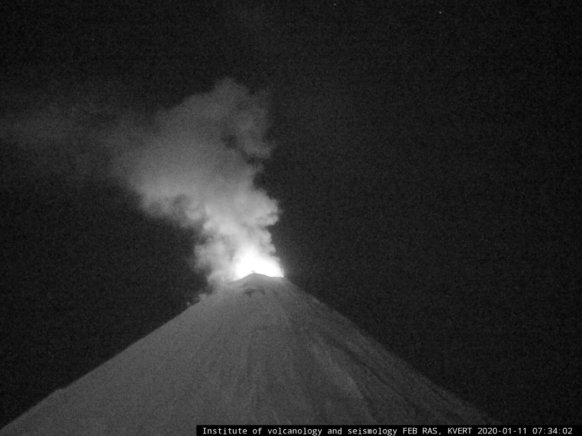
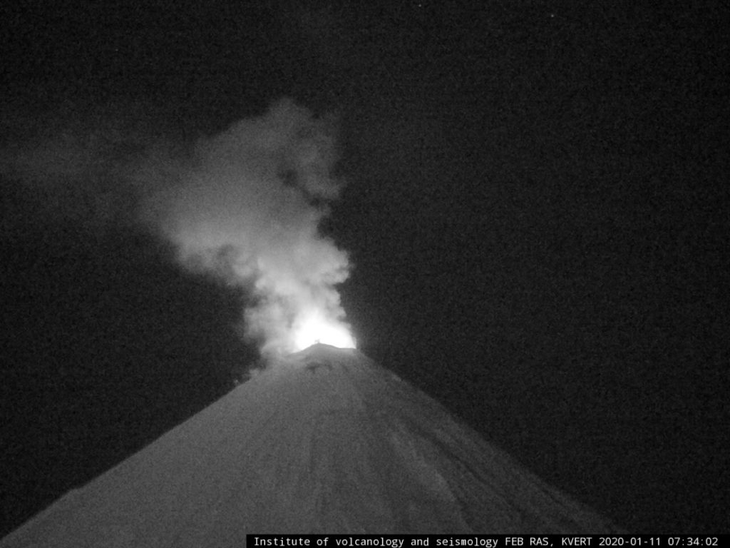
A moderate eruptive activity of the volcano continues. Moderate Strombolian activity of the volcano was observed all week, and Vulcanian activity – on 06 January: according to satellite data, ash plumes extended for 55 km to the east-northeast of the volcano. A weak thermal anomaly over the summit crater was registering all week.
Source : Kvert.
Photo : IVS FEB RAS, KVERT

