January 05 , 2019.
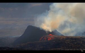
Alaska , Shishaldin :
54°45’19 » N 163°58’16 » W,
Summit Elevation 9373 ft (2857 m)
Current Volcano Alert Level: WATCH
Current Aviation Color Code: ORANGE
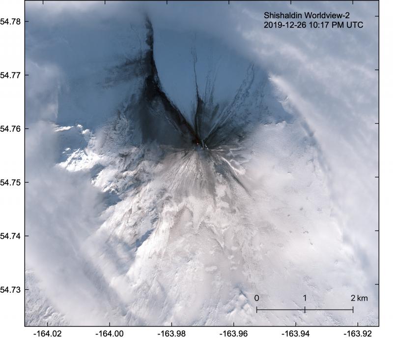
Satellite image of Shishaldin from December 26, 2019. Tephra deposits blanket the upper slopes of the volcano, while a long lava flow extends almost 1.5 km to the NW and a second small lava flow extends ~100 m to the NE.
Low-level eruptive activity is likely continuing at Shishaldin Volcano. Following yesterdays eruption, seismic levels declined abruptly and have remained low over the past day. Elevated surface temperatures were observed in several partly cloudy satellite views of the volcano after yesterdays activity, but since then, no new satellite data were available until a few hours ago. Recent satellite observations indicate that nothing noteworthy is occurring at the volcano and there are no signs of ash emission.
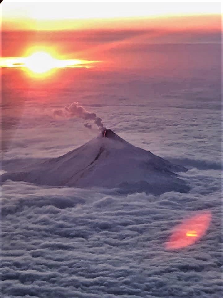
High resolution WorldView satellite data show the upper part of the volcano is mantled with ash. Lahars (volcanic mudflows) are evident on the upper part of the edifice, particularly on the southwest flank. Lava flows are visible on the upper northwest and northeast flanks and extend 1-2 km (0.6-1.2 miles) from the summit crater vent. No other signs of unrest have been observed since yesterdays brief eruption. Web camera views of the volcano remain obscured by clouds and snow.
Although the present level of seismicity is low, it remains possible for unrest to escalate at any time and additional ash producing eruptive events may occur.
Shishaldin is monitored by local seismic and infrasound sensors, satellite data, web cameras, a telemetered geodetic network, and distant infrasound and lightning networks.
Source : AVO.
Photos : Loewen, Matt , U.S. Coast Guard Air Station Kodiak .
Costa Rica , Poas :
No eruption is reported.
Seismic activity is similar to that of yesterday.
At the time of this report, the winds were blowing southwest.
Gas ratios remain stable. At the time of the report, due to the wind speed, the view of the national park is less affected by the gases than in the past 2 days.
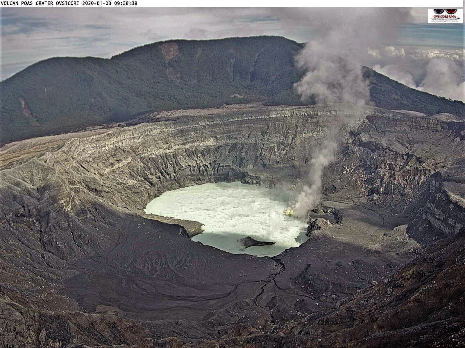
The Poás volcano under surveillance after a gas activity.
The day before yesterday, at 9.45 am, information from the volcanic monitoring of the Poás volcano park, showed that high levels of gas have been recorded in the Mirador del Volcán with values of 20 ppm SO2 and 7 ppm of H2S. However, visits regulated by the Park Rangers and the corresponding security protocol are maintained.
At 12:50 p.m., park officials report that conditions have improved and are operating normally.
Source : Ovsicori , laregion.cr.
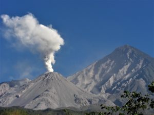
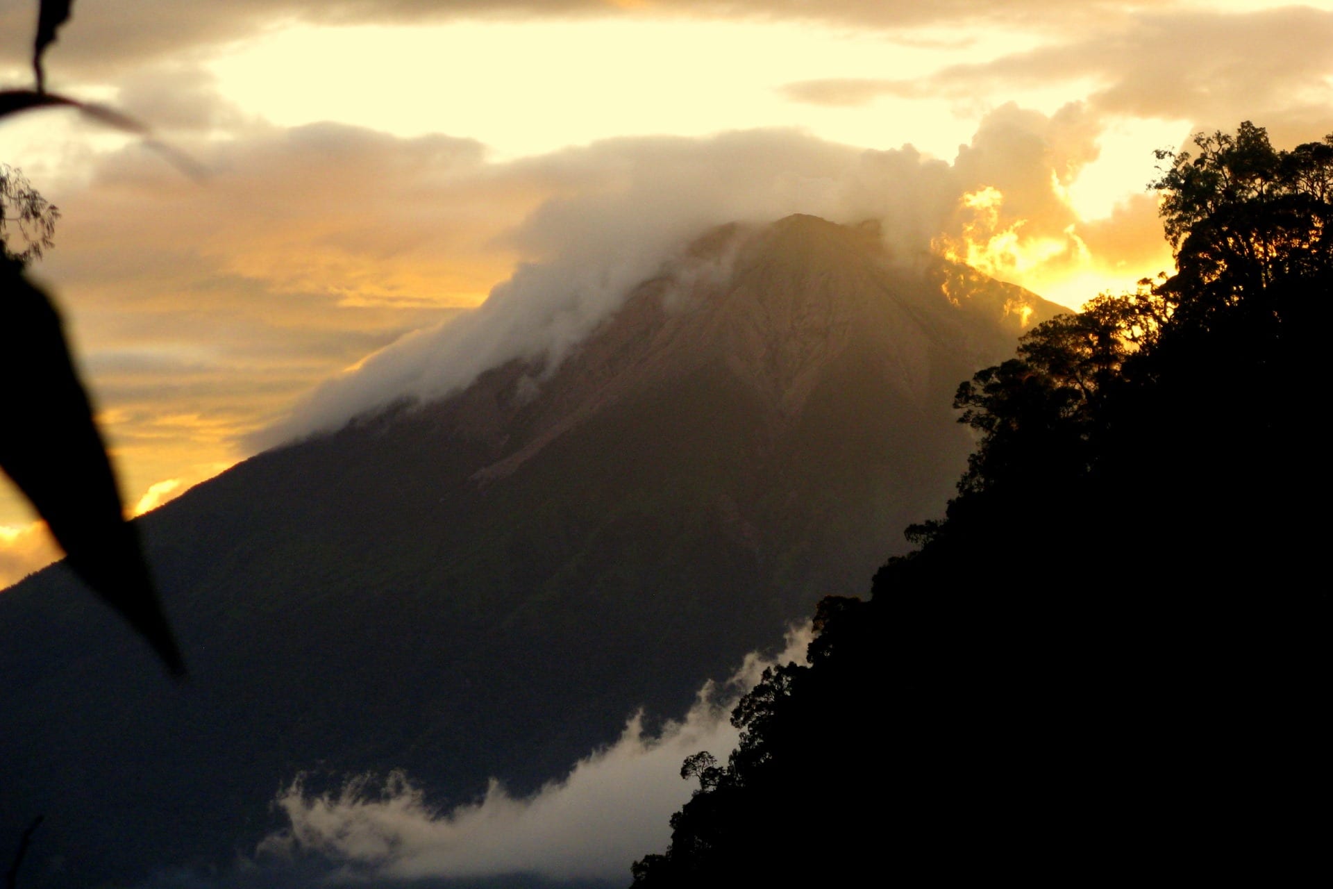
Philippines , Taal :
TAAL VOLCANO BULLETIN 05 January 2020 8:00 A.M.
Taal Volcano’s seismic monitoring network recorded fifty-three (53) volcanic earthquakes during the 24-hour observation period. Two (2) of these were felt events in the volcano island. The first event occurred at 10:59 AM yesterday was felt at Intensity I by residents in Brgy. Calauit, Balete, Batangas. The second event occurred at 8:04 PM yesterday was felt at Intensity I with rumbling sound by residents in Brgy. Calauit, Balete, Batangas and Brgy. Pira-piraso, Talisay, Batangas. Field measurements on 02 January 2020 at the eastern sector of the Main Crater Lake yielded a decrease in water temperature from 31.6°C to 31.5°C, a decrease in water level from 0.34 meters to 0.27 meters, and an increase in acidity from a pH of 2.81 to 2.75. Ground deformation measurements through precise leveling surveys from 21 – 29 November 2019 indicated inflation of the edifice consistent with recent results from continuous GPS data.

Alert Level 1 remains in effect over Taal Volcano. This means that hazardous eruption is not imminent. The public, however, is reminded that the Main Crater should be strictly off-limits because sudden steam explosions may occur and high concentrations of toxic gases may accumulate. The northern portion of the Main Crater rim, in the vicinity of Daang Kastila Trail, may also become hazardous when steam emission along existing fissures suddenly increases. Furthermore, the public is also reminded that the entire Volcano Island is a Permanent Danger Zone (PDZ), and permanent settlement in the island is strongly not recommended.
Source : Phivolcs.
Photo : destination philippines.
Indonesia , Kerinci :
VOLCANO OBSERVATORY NOTICE FOR AVIATION – VONA.
Issued: January 05 , 2020
Volcano: Kerinci (261170)
Current Aviation Colour Code: YELLOW
Previous Aviation Colour Code: yellow
Source: Kerinci Volcano Observatory
Notice Number: 2020KER02
Volcano Location: S 01 deg 41 min 49 sec E 101 deg 15 min 50 sec
Area: Jambi, West Sumatra, Indonesia
Summit Elevation: 12176 FT (3805 M)
Volcanic Activity Summary:
on 5 January 2020, observed brown ash emission at 00:58 UTC (07:58 local time).
Volcanic Cloud Height:
Best estimate of ash-cloud top is around 13456 FT (4205 M) above sea level, may be higher than what can be observed clearly. Source of height data: ground observer.
Other Volcanic Cloud Information:
ash emission moving to East – Southeast.
Remarks:
Seismic activity is dominated by gas emission and continuous volcanic tremor with ampitude 0,5-1 mm (dominan 1mm).
Level of activity at level II (WASPADA). The volcano is clearly visible until it is covered by fog. The smoke from the crater is white / brown with an average to high intensity about 500-600 meters above the summit. Sunny to cloudy weather, moderate southwest winds. The temperature is around 22-24 ° C. Humidity 69-74%.
According to the seismographs of January 4, 2020, it was recorded:
50 earthquakes of explosions.
1 shallow volcanic earthquake
1 distant tectonic earthquake
Continuous tremor, amplitude 0.5-1 mm (dominant value 1 mm)
Recommendation:
Communities around Kerinci volcano and visitors / tourists are not allowed to climb to the crater at the top of Kerinci volcano within 3 km from the active crater (people are prohibited from doing activities within the danger radius / KRB III).
The flight path around the Kerinci volcano should be avoided because at any time, it always has the potential for ash eruptions with an altitude that can interfere with the flight path.
Sources : Magma Indonésia , PVMBG.
Photo : Wild Sumatra