December 10 , 2019.
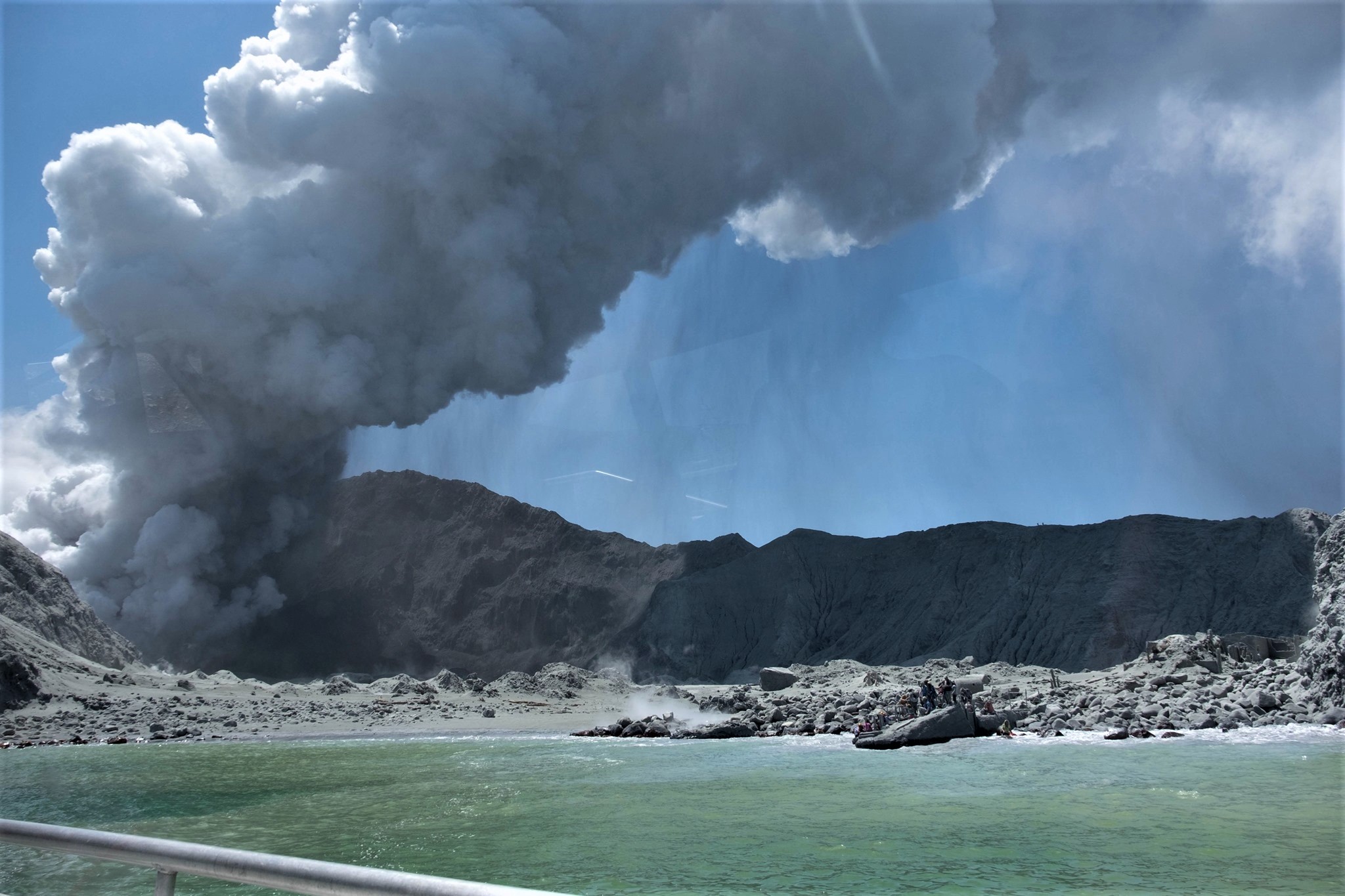
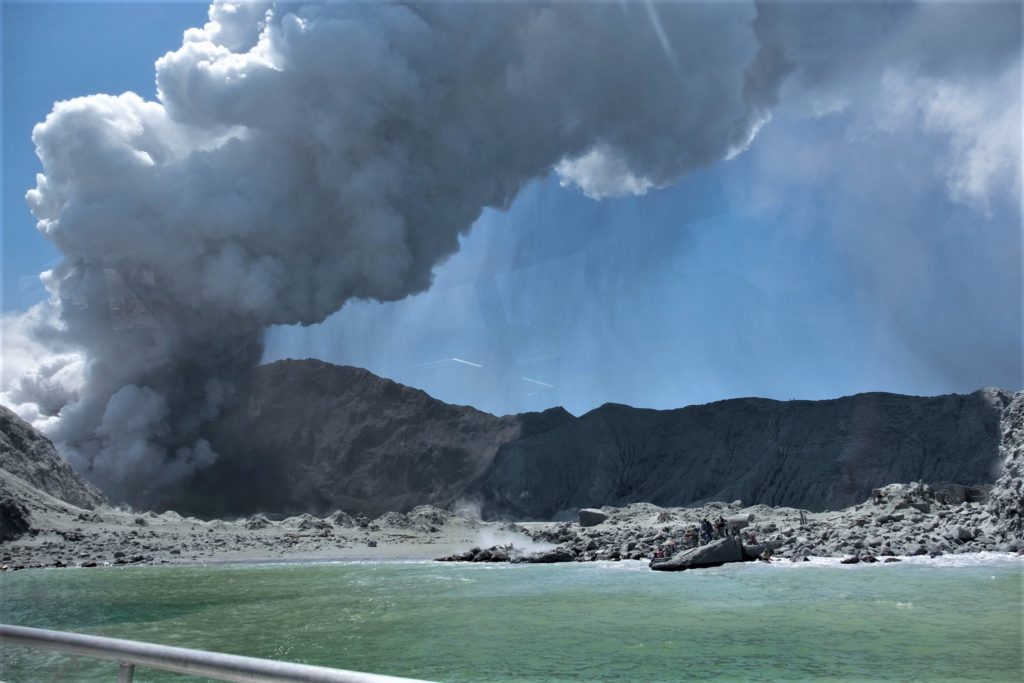
New Zealand , White Island :
Volcanic Alert BulletinWI – 2019/14 , Tue Dec 10 2019 11:40 AM; White Island Volcano
Volcanic Alert Level remains at 3
Aviation Colour Code remains at Orange
Since the eruption yesterday afternoon, no further eruptions have occurred. The steam and gas driven jetting is still occurring from the active vent area. The Volcanic Alert Level stays at Level 3.
An eruption occurred at Whakaari/White Island at 14:11pm on Monday 9 December, unfortunately with tragic consequences. We express our sincere sympathies for those families affected.
Since the eruption, seismic activity has dropped to low levels and there has been no further eruptive activity. However, we are still observing localised steam and mud jetting from the active vent area.
Over the next 24 hours we estimate an equal likelihood of either no eruption or a smaller/similar sized eruption that would impact the main crater floor. There is a high level of uncertainty associated with this estimate. We also estimate the least likely scenario is a larger eruption. There is an extremely low likelihood of any ash impact to the mainland, but gas may be smelt depending on the prevailing wind direction.
Our monitoring equipment is operating and we continue to closely monitor the situation on the island. We will be attempting to collect additional airborne gas (CO2 and SO2) data later this afternoon to aid in future prognosis of the volcano.
Volcanic Alert BulletinWI – 2019/15 . Tue Dec 10 2019 4:20 PM; White Island Volcano
Volcanic Alert Level remains at 3
Aviation Colour Code remains at Orange
Since this morning, the seismic activity has remained weak, yet we continue to see periodic steam and gas driven jetting from the active vent area. The Volcanic Alert Level remains at Level 3.
An eruption occurred at Whakaari/White Island at 14:11pm on Monday 9th December, unfortunately with tragic consequences. We express our sincere sympathies with those families affected.
Over the course of today, there are no substantial changes to report. Seismic activity remains weak and there has been no further eruptive activity. We continue to see localised steam and mud jetting from the active vent area.
Our monitoring equipment is functioning well, despite some sites being covered in ash. We successfully completed an airborne gas (CO2, H2S and SO2) survey and made observations of the vent area and eruption impacts. Results of the gas survey will be included in the next information update.
Over the next 24 hours we still estimate an equal likelihood of either no eruption or a smaller/similar sized eruption that would impact the main crater floor, based on our observations and measurements. There is a high level of uncertainty associated with this estimate and we are working to reduce that uncertainty. We also estimate the least likely scenario is a larger eruption. There is an extremely low likelihood of any ash impact to the mainland, but people may smell gas, depending on the prevailing wind direction.
The Volcanic Alert Level remains at Level 3. The Aviation Colour Code remains at Orange.
Source : Geonet / Geoff Kilgour / Duty Volcanologist.
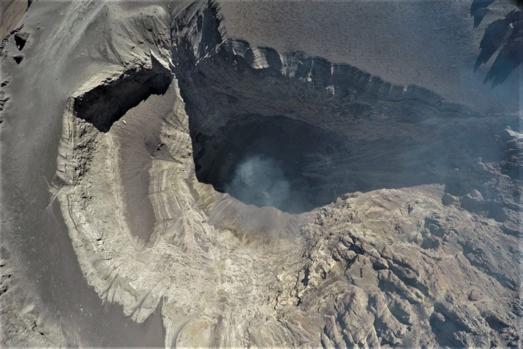
Photos : David McClelland / abc.net.au , Sky Alert / Gamboa Juan.
Kamchatka , Avachinsky :
As reported by « Kam 24 », experts from the Kamchatka branch of the Russian Expert Council on Seismic Prediction, Seismic Hazards and Risk Assessment (KF RES) concluded that the probability of an eruption of the Avachinsky in the next month has increased. The conclusions are based on a set of geophysical and seismological data obtained in the Kamchatka branch of the RAS GÉOPHYSICS SERVICE (KF Fitz EGS RAS).
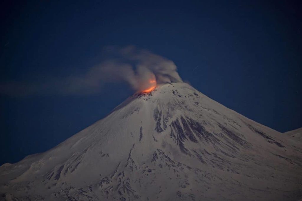
Avachinsky Volcano on the night of 9 December. That’s how the crack shines on the west side of the summit.
The Avachinsky volcano is located next to Petropavlovsk-Kamchatsky at a distance of about 26-30 kilometers. The last time the volcano erupted was in 1991. The Avachinsky, like many stratovolcans, in its history, experienced an explosive eruption, which resulted in its collapse at the top. According to scientists, this happened about 30 thousand years ago. The explosion was directed to the southwest, and its power was such that the debris of the collapsed volcano reached the coast of the avachinskaya guba, where is the northern part of Petropavlovsk-Kamchatsky. Since then, a new peak has formed in the remaining funnel (Caldera).
The activity of the Avachinsky volcano is increasing.
Today, December 9, early in the morning, the first glow was recorded in the crater of the volcano.
As already noted, a group of seismologists composed of: Yakovenko V., Koneva A., Yashchuk V.V and Bichenko A. N., an employee of the Kamchatka Volcanoes Nature Park, attempted to climb the summit of the volcano.
Unfortunately, the scientists could not advance further, a large gas contamination was recorded. The specialists cleaned the solar panels, as well as checked and adjusted the devices located in the bunker at an altitude of 2100 m.
Other signs of increased activity of the Avachinsky volcano have been revealed and confirmed.
Climbing the volcano, while within 5 km of it, is still not recommended.
Source : Kam 24 via Sherine France.
Photos : Kam 24 , Евгений Карпов
Peru , Ubinas :
Period of analysis: December 2 to 8, 2019. Arequipa, December 9, 2019.
Alert level: ORANGE
The Geophysical Institute of Peru (IGP) reports that the eruptive activity of the Ubinas volcano remains at low levels. To date, the energy of earthquakes associated with the rise of magma to the surface has decreased considerably. There are low and sporadic emissions of bluish (magmatic) gas and water vapor observed by surveillance cameras. In this scenario, the possibility of occurrence of volcanic explosions and / or ash emissions is low.
During the period from 2 to 8 December, the IGP recorded and analyzed a total of 128 seismic events associated with the eruptive process of the Ubinas volcano, these mainly of the Volcano-Tectonic (VT) type, related to the fracturing of rocks inside the volcano. On average, 12 earthquakes were recorded per day, all of magnitude lower than M1.8. The seismic signals that are linked to the rise of the magma (hybrid type) have decreased, both in number of events (6 earthquakes daily) and energy they generate. It should be noted that no volcanic explosion has been recorded since September 12th.
The surveillance cameras recorded light and sporadic emissions of blue (magmatic) gas and water vapor with heights less than 500 m above the volcano’s summit. The monitoring of the deformation of the volcanic structure, using GNSS data (processed with fast orbits), does not record anomalies. The MIROVA satellite monitoring also did not record any thermal anomalies in the volcano.
Source et photo : IGP.
Peru , Sabancaya :
Period of analysis: December 2 to 8, 2019. Arequipa, December 9, 2019.
Alert level: ORANGE
The Geophysical Institute of Peru (IGP) reports that the eruptive activity of the Sabancaya volcano has remained at moderate levels; that is to say with the recording of continuous moderate explosions and consequent emissions of ashes. As a result, for the following days, no significant change in their activity is expected.
The analysis of records obtained from the seismic network of Sabancaya volcano for the period from 2 to 8 December 2019 has identified the occurrence of about 1225 earthquakes of volcanic origin, the highest percentage of which is associated with the circulation of fluids (magma, gas, etc.) inside the volcano. During this period, there was an average of 22 medium to low intensity daily explosions.
The monitoring of the deformation of the volcanic structure, using GNSS data (processed with fast orbits), does not present significant anomalies. Visual surveillance using surveillance cameras identified the presence of columns of gas and ash up to 4.2 km above the top of the volcano, which Northeast, North, Southeast and South sectors of Sabancaya. Satellite monitoring has identified 4 volt thermal anomalies on the volcano between 1 MW and 12 MW, associated with the presence of a lava dome in the crater of the volcano, about 240 m of diameter.
OUTLOOK:
For the following week, the presence of a lava dome inside the crater of the volcano on the Sabancaya leads to present three possible scenarios:
Scenario 1: corresponds to a light to moderate explosive activity such as that recorded on the Sabancaya in recent years, associated, of course, with the slow growth or the rise of the lava dome.
Scenario 2: Growth and collapse of the lava dome with generation of low volume pyroclastic flows.
Scenario 3: corresponds to effusive eruptions related to the location of lava flows.
Source : IGP
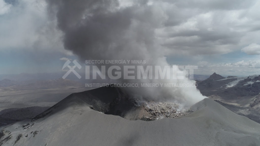
Photo : Ingemmet .
Italy / Sicily , Etna :
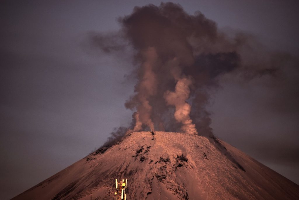
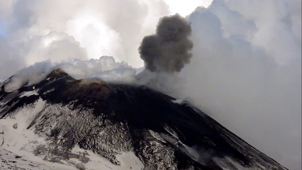
The eruptive activity in the summit craters of Etna continues on December 9, 2019. A few explosions on the New Southeast Crater produced small puffs of dark ash (photo). During the evening, glimmers were also visible in the crater of Voragine, and in the crater of the Northeast. The view on the photo is facing south.
Source : INGV Vulcani.

