November 27 , 2019.
Alaska , Shishaldin :
54°45’19 » N 163°58’16 » W,
Summit Elevation 9373 ft (2857 m)
Current Volcano Alert Level: WATCH
Current Aviation Color Code: ORANGE
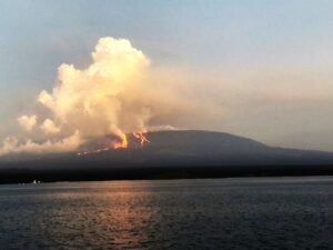
Seismicity at Shishaldin Volcano has decreased over the past day, but remains elevated. Strongly elevated surface temperatures have been observed in multiple satellite images over the past 24 hours, and incandescence was occasionally visible from the summit region in web camera images overnight; low-level eruptive activity from the summit likely continues.
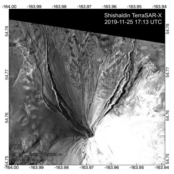
This high-resolution satellite radar image of Shishaldin shows new flowage deposits on the NW flank that formed between between November 24 and 25. The eruption produced a large new > 3.3 km-long pyroclastic flow deposit and lava flow down the northwest flank. These can be seen in the radar data by streaks on the snowy surface and new meltwater channels. Some distortion is caused by the oblique satellite look angles and the terrain correction. This imagery was provided by Simon Plank (German Aerospace Center, DLR) through an ongoing collaboration with the Alaska Volcano Observatory on remote sensing of volcanic eruptions.
Analysis of satellite imagery indicate that a partial collapse of the summit cone sometime around 23:30 UTC on November 24th produced a pyroclastic flow that extended up to 3 km from the summit down the northwest flank of the volcano. A new lava flow also extends several hundred meters down the NW flank. No ash plumes have been detected.
Shishaldin is monitored by local seismic and infrasound sensors, satellite data, web cameras, a telemetered geodetic network, and distant infrasound and lightning networks.
Source : AVO
Photo : Dietterich, Hannah.
Colombia , Nevado del Ruiz :
Weekly bulletin of the Nevado del Ruiz volcano.
The level of activity continues at the level: Yellow activity level or (III): changes in the behavior of volcanic activity.
With regard to monitoring the activity of the Nevado del Ruiz volcano, the COLOMBIAN GEOLOGICAL SERVICE reports that:
The Nevado del Ruiz volcano continues to display unstable behavior. During the past week, some of the monitored parameters showed significant changes, reflecting instability of the volcanic system similar to that seen the previous week. The variations are mainly distinguished in seismicity, associated with the movement of fluids within the volcanic canals and in the surface activity of the volcano. It is not excluded that the monitored parameters continue to change, indicating an acceleration of the process and therefore changes in the activity level of the volcano.

Seismicity related to fluid dynamics within the volcanic system showed an increase in the number and energy of registered earthquakes compared to the previous week. This type of seismicity showed significant changes in spectral characteristics and was characterized by the presence of continuous and sometimes harmonic volcanic tremors, as well as long-period (LP) and very long-lived (VLP) earthquakes recorded individually or in conjunction with impulses of volcanic tremor The earthquakes had variable energy levels and were located mainly in the crater Arenas and its surroundings.
Some of these signals were associated with small gas emissions, confirmed by the cameras installed in the volcano area, reports from Colombian geological service staff and officials from the Parque Nacional Natural Los Nevados in the area and reports published by VAAC (Current Volcanic Ash Advisory).

Seismicity caused by rock fracturing showed a slight increase in the number of earthquakes and similar levels of released seismic energy compared to the previous week. This type of seismicity was mainly located in the crater Arenas and its surroundings and in the south-west sector of the volcanic structure. The depths of the earthquakes ranged from 0.6 to 7.6 km. A slight increase in this type of seismicity is evident on 23 and 24 November, recorded 3.3 km and 0.5 km southwest and east of the crater, respectively. The maximum magnitude recorded during the week was 1.0 ML (local magnitude), which corresponds to the earthquake recorded on November 24 at 07:36 (local time) in the Southwest sector at 2.5 km depth.
The volcano continues to emit water vapor and high levels of gas, mainly sulfur dioxide (SO2). These levels are estimated from data obtained from SCANDOAS stations and the processing of satellite images. In tracking the information provided by the MIROVA and NASA FIRMS portals, low-energy thermal anomalies were recorded on 23 and 24 November.
The column of gas and steam reached November 24 a maximum height of 1400 m measured at the top of the volcano. The direction of dispersal of the column was governed by the direction of the wind in the area, which varied during the week without showing any preference for any area.
The Nevado del Ruiz volcano continues its activity at the level of yellow activity.
Source : SGC.
Photos : archivo/Caracol Radio , SGC.
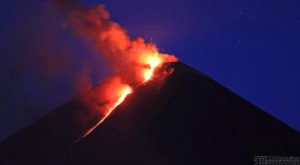
Italy / Sicily, Etna :
In light of the surveillance data, we highlight:
1) VOLCANOLOGICAL OBSERVATIONS: Strombolian intra-crateric activity and ash emissions from the Northeast crater and craters of Voragine and Bocca Nuova. Ordinary degassing activity of the New Southeast Crater, with rare ash emissions.
2) SISMOLOGY: Discrete seismic activity with six Magnitude events equal to or greater than 2, medium-high tremor amplitude.
3) INFRASOUND: Low infrasonic activity with sources closer to the Northeast crater.
4) DEFORMATIONS: The inclination and GPS networks did not show any significant changes in the trends previously reported.
5) GEOCHEMISTRY: SO2 flows are at an average level. Ground CO2 fluxes are set to medium-low values. The partial pressure of CO2 in the soil does not show any significant changes. Helium isotopic ratio values are at medium-high values (latest data available November 21).
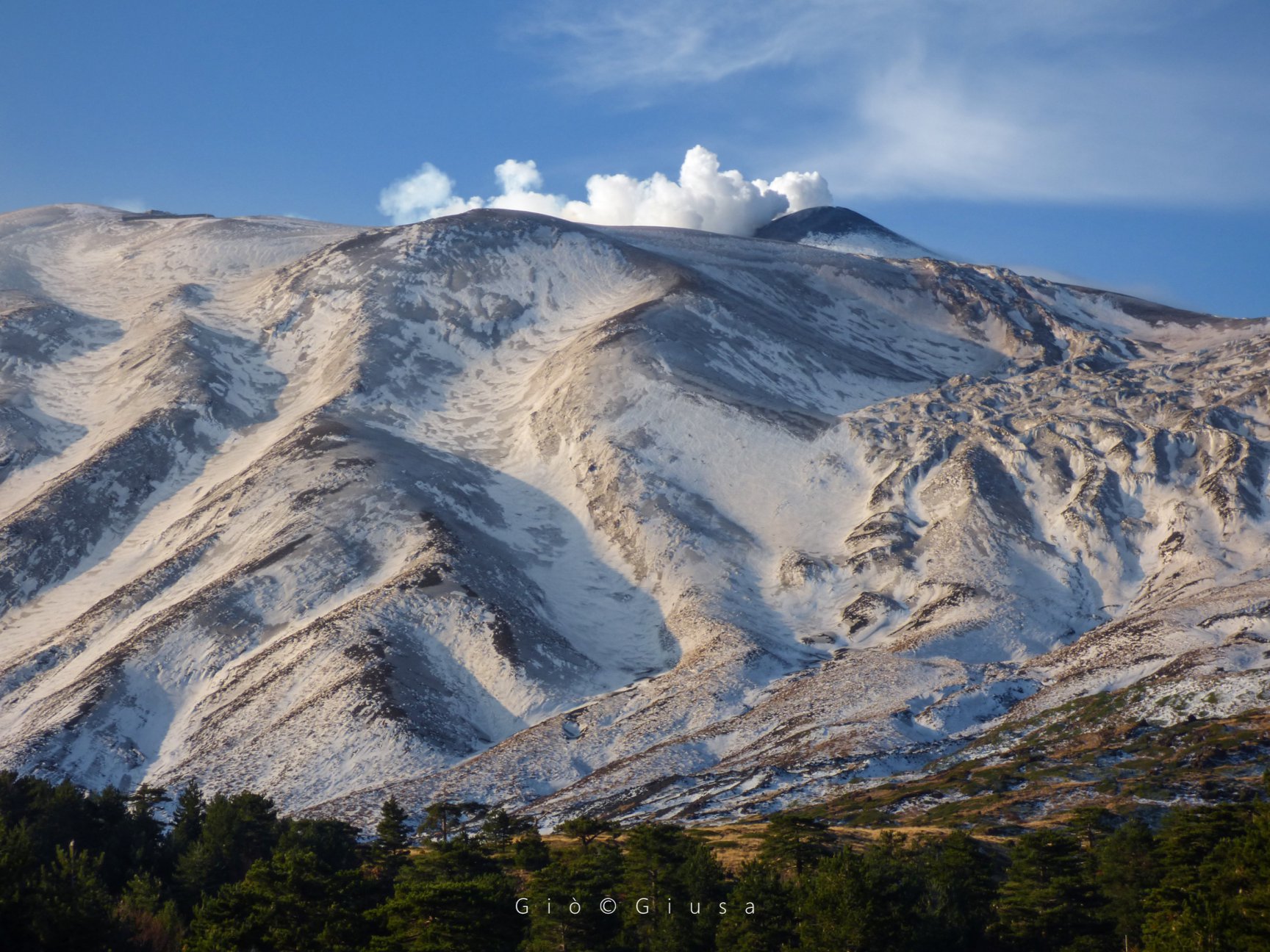
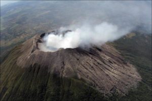
The crater of North-East (approximately 3320 m) with its flows of years 50-70. The North Slope of Mount Etna at the first light of day.
VOLCANOLOGICAL OBSERVATIONS
During the week, the Etna activity was monitored using the surveillance cameras of the INGV Catania section and an inspection by the INGV staff. Observations were discontinuous and virtually impossible for the days of 19 to 24 November due to adverse weather conditions.
During the period under review, Etna activity was characterized by intra-crater eruptive crater activity (Northeast crater – NEC, Voragine crater – VOR and Bocca Nuova BN crater) and regular outgassing. with rare ash emissions. of the new southeastern crater – NSEC.
In detail, during the week, the eruptive activity is more strongly marked by the crater of North-East and Voragine; the NEC generated almost continuous ash emissions, which sometimes seemed more abundant, especially on the morning of 20 November. The crater of Voragine was also the site of ash emissions, which, compared to the NEC, had a character much more impulsive and seemed richer in ashes. The ashes emitted by the two craters quickly dispersed near the summit. In the early hours of November 22, Voragine fueled a busy intra-crater activity, some shreds being projected on its edge.
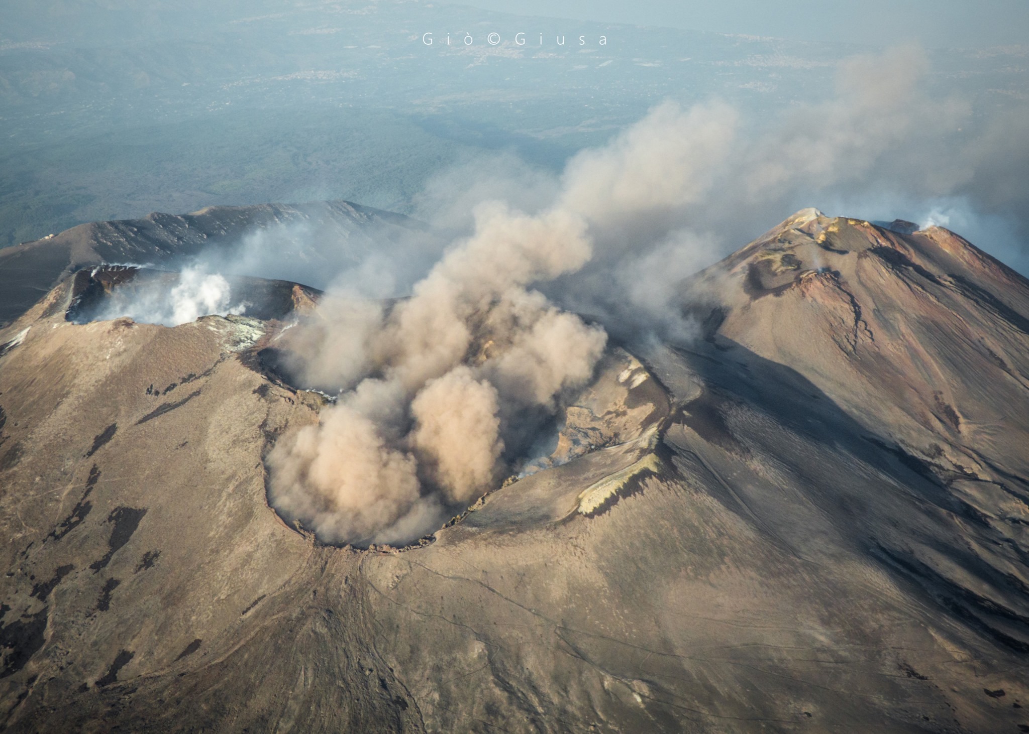
The crater of the Bocca Nuova fueled a pulsating degassing more clearly visible at night and early in the morning. Finally, the New Southeast Crater was characterized by regular degassing, with the exception of November 18, which allowed for the observation of rare and low emissions of very diluted ash.
SISMOLOGY:
Seismicity: During the week of November 18 to 24, 2019, seismic fracturing activity was unobtrusive, with a total of 6 events with Magnitude = 2 or more. The strongest event (24. November, 5:28 UT, M = 2.4) is located below the central craters at a depth of 0.4 km.
Volcanic tremor: the amplitude of the tremor was maintained at a medium-high level. The sources of the tremors are about 0.5 to 1.5 km east of the central craters. The depths of the sources vary between about 1.5 and 3 km at s.l.m.
Source : INGV.
Read the full article : file:///C:/Users/Utilisateur/AppData/Local/Packages/Microsoft.MicrosoftEdge_8wekyb3d8bbwe/TempState/Downloads/BollettinoEtna20191126%20(1).pdf
Photos : Gio Giusa .
Indonesia , Ibu :
VOLCANO OBSERVATORY NOTICE FOR AVIATION – VONA .
Issued: November 26 , 2019
Volcano: Ibu (268030)
Current Aviation Colour Code: ORANGE
Previous Aviation Colour Code: orange
Source: Ibu Volcano Observatory
Notice Number: 2019IBU14
Volcano Location: N 01 deg 29 min 17 sec E 127 deg 37 min 48 sec
Area: North Maluku, Indonesia
Summit Elevation: 4240 FT (1325 M)
Volcanic Activity Summary:
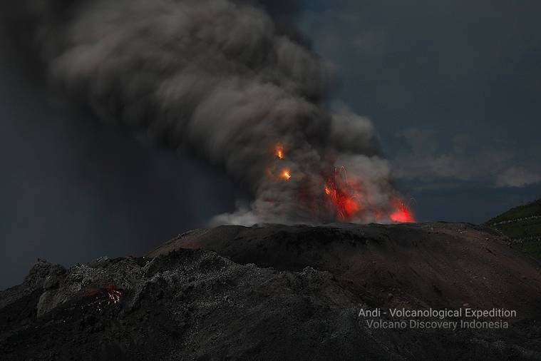
Eruption with volcanic ash cloud at 09h21 UTC ( 18h21 local).
Volcanic Cloud Height:
Best estimate of ash-cloud top is around 5200 FT (1625 M) above sea level, may be higher than what can be observed clearly. Source of height data: ground observer.
Other Volcanic Cloud Information:
Ash-cloud moving to north
Remarks:
Eruption and ash emission is continuing.
Source : Magma Indonésie.
Photo : Andi Rosati / Volcanodiscovery.