November 01 , 2019.
Alaska , Shishaldin :
54°45’19 » N 163°58’16 » W,
Summit Elevation 9373 ft (2857 m)
Current Volcano Alert Level: WATCH
Current Aviation Color Code: ORANGE
Explosive activity at Shishaldin returned this morning. Local seismic and infrasound sensors have recorded multiple bursts of small explosions beginning at 18:39 UTC (10:39 local time) today. Satellite data show elevated surface temperatures through cloudy conditions over the past 24 hours, and webcam views remain obscured by clouds.
Shishaldin is monitored by local seismic and infrasound sensors, satellite data, a web camera, a telemetered geodetic network, and distant infrasound and lightning networks.
Source : AVO
Photo : Mosier, Ben.
Hawaii , Mauna Loa :
19°28’30 » N 155°36’29 » W,
Summit Elevation 13681 ft (4170 m)
Current Volcano Alert Level: ADVISORY
Current Aviation Color Code: YELLOW
Activity Summary:
Mauna Loa Volcano is not erupting. Rates of deformation and seismicity have not changed significantly over the past week and remain above long-term background levels.

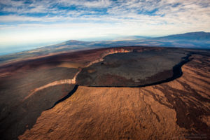
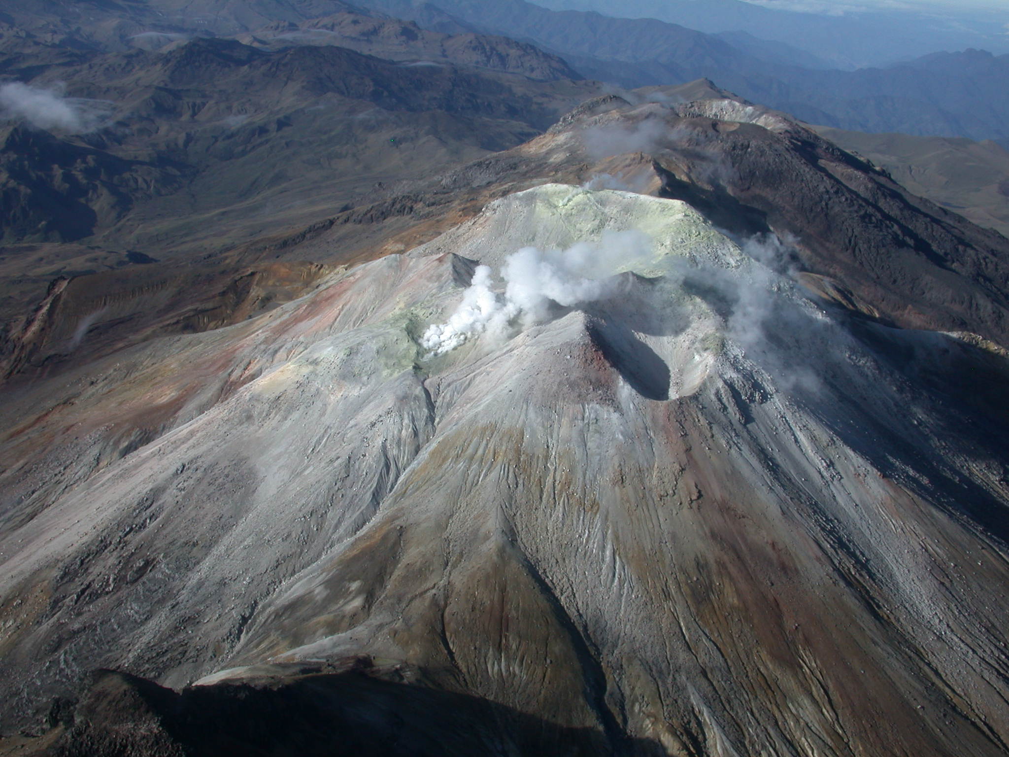
Cones, flows, and fissures mark the uppermost portions of Mauna Loa’s northeast rift zone in the foreground of this aerial image taken by Civil Air Patrol on Sunday, October 20, 2019. In the background, Moku‘āweoweo, Mauna Loa’s summit caldera, is visible. The highest point on Mauna Loa, the true summit, is in the upper right hand corner of the image.
Observations:
During the past week, approximately 147 small-magnitude earthquakes (nearly all smaller than M2.0) were detected beneath the upper elevations of Mauna Loa. Most of the earthquakes occurred at shallow depths of less than 5 km (~3 mi) below ground level, but a couple were as deep as 12 km (~7.5 mi).
Global Positioning System (GPS) and Interferometric Synthetic Aperture Radar (InSAR) measurements show continued summit inflation, consistent with magma supply to the volcano’s shallow storage system.
Readings of fumarole temperature and gas concentrations at the Sulphur Cone monitoring site on the Southwest Rift Zone remain stable.
Source : HVO.
Colombia , Cumbal :
Weekly Activity Bulletin of the Cumbal Volcanic Complex
The level of activity of the volcano continues at the level: YELLOW LEVEL ■ (III): CHANGES IN THE BEHAVIOR OF THE VOLCANIC ACTIVITY.
Following the activity of the CUMBAL VOLCANIC COMPLEX, the COLOMBIAN GEOLOGICAL SERVICE (SGC) reports that:
For the period evaluated between 22 and 28 October 2019, the predominant seismicity of the Cumbal volcanic complex was that associated with the transit of fluids in the volcanic system. The seismic occurrence increased by 18% compared to the previous week, 467 events for the week before against 512 for this week. Similarly, seismic energy increased by 48% compared to the previous week. Of the events associated with fracture processes of rock materials within the volcanic building, only two of them, located near the crater la Plazuela, within 5.2 km of the volcanic crater and at a maximum depth of 12 km from the crater of La Plazuela (4700 m), could be located. The maximum local magnitude was 1.1 on the Richter scale.
Throughout the week, webcams in the Cumbal area of influence recorded gas emissions from the El Verde fumarole field, located northeast of La Plazuela crater. The emission columns were white in color, low in height, low pressure and in variable direction, depending on the action of the winds in the region.
The COLOMBIAN GEOLOGICAL SERVICE remains attentive to the evolution of the volcanic phenomenon and will continue to report the changes observed as soon as possible.
Source et photo : SGC.
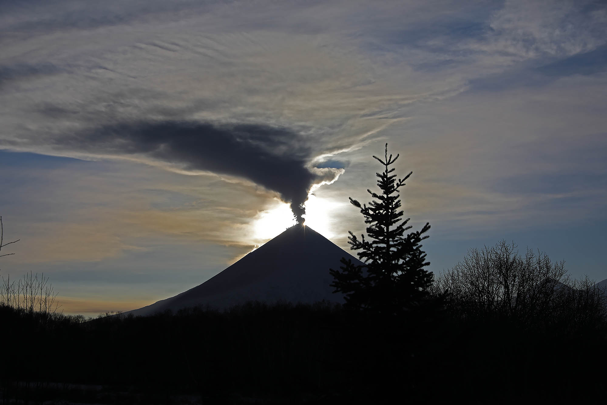
Kamchatka , Klyuchevskoy :
VOLCANO OBSERVATORY NOTICE FOR AVIATION (VONA).
Issued: October 28, 2019.
Volcano: Klyuchevskoy (CAVW #300260)
Current aviation colour code: ORANGE
Previous aviation colour code: orange
Source: KVERT
Notice Number: 2019-166
Volcano Location: N 56 deg 3 min E 160 deg 38 min
Area: Kamchatka, Russia
Summit Elevation: 15580 ft (4750 m)
Volcanic Activity Summary:
A moderate activity of the volcano continues. According to video data, an ash plume is extending for 20 km to the north-west of the volcano.
A moderate activity of the volcano continues. Ash explosions up to 16,400-23,000 ft (5-7 km) a.s.l. could occur at any time. Ongoing activity could affect low-flying aircraft.
Volcanic cloud height:
18040-19680 ft (5500-6000 m) AMSL Time and method of ash plume/cloud height determination: 20191028/0010Z – Video data
Other volcanic cloud information:
Distance of ash plume/cloud of the volcano: 12 mi (20 km)
Direction of drift of ash plume/cloud of the volcano: NW
Time and method of ash plume/cloud determination: 20191028/0010Z – Video data
Source : Kvert.
Photo : Yu Demyanchuck.