August 18 , 2019.
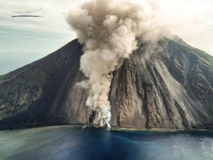
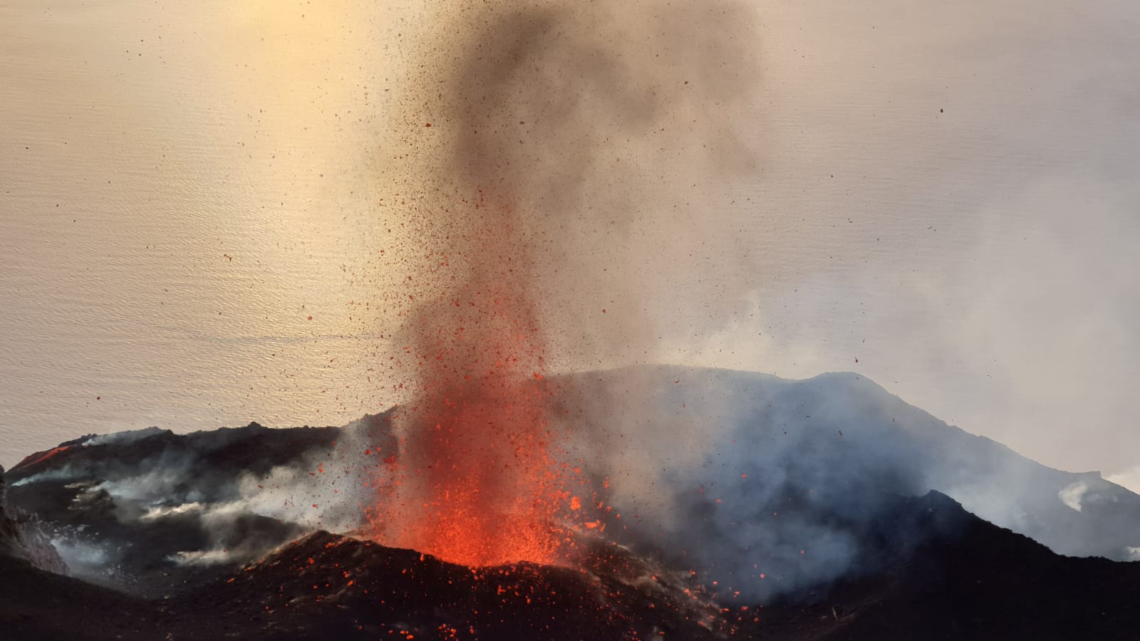
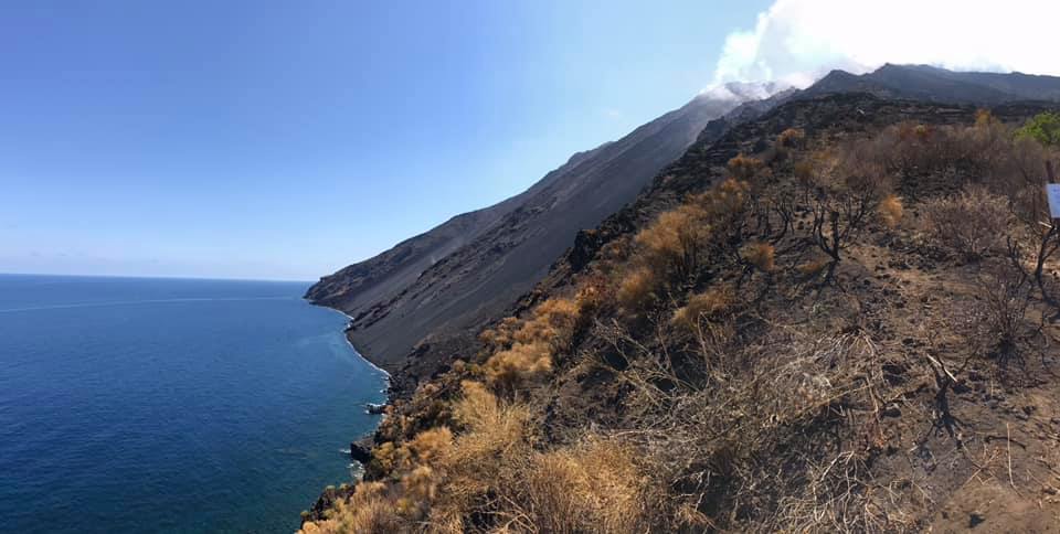
Italy , Stromboli :
DETAILED PRESS RELEASE, STROMBOLI. August 16, 2019, 17:05.
VOLCANOLOGICAL OBSERVATIONS.
The images acquired by the surveillance cameras at Punta Corvi at an altitude of 190 m, as well as the morpho-structural and volcanological observations made by the INGV staff using drone surveys, confirm that the activity Strombolian continues both in the North Central Zone and the South Central Zone. The effusive activity is produced by two ephemeral mouths located in the center-south zone of the crater terrace. During the week, the most advanced fronts reached altitudes between 500 and 600 m.
Investigations by drones – morpho-structural and volcanological observations.
As of July 9, 2019, three drone surveys were conducted in the Sciara del Fuoco region to monitor the eruptive situation and update the topography:
09 July 2019 – Investigations conducted by INGV_OE in collaboration with the GEOMAR Helmholtz group Center for Ocean Research.
August 04, 2019 – Investigations conducted by INGV Roma 1.
August 13-14, 2019 – Measurements made by INGV_OE.
The rapid and preliminary analyzes that it has been possible to carry out in the short time interval from the end of the last survey allow the first morpho-structural evaluations and an update of the evolution of the lava field. In the coming days, these analyzes will be deepened and extended to the whole Sciara del Fuoco.
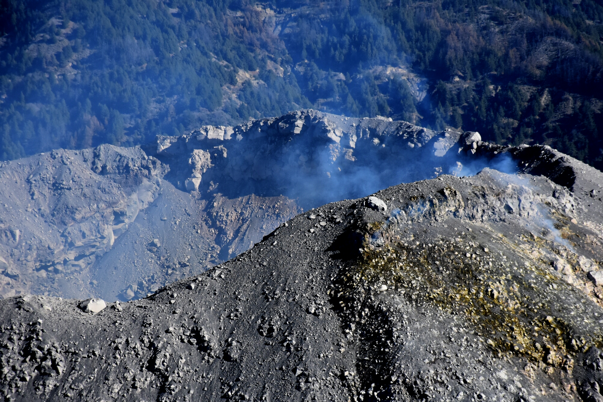
The high-resolution images obtained on 4 August highlighted a fracture field located in the southern zone of Sciara del Fuoco, about 50 meters north of the edge of the stream and at an altitude of between 600 and 650 m above sea level. sea level, a total of ten fractures are identified with an approximately north-south direction of variable length between 2.5 and 21 m.
Previous images, dated July 9, did not highlight this fracture field, with a lower resolution. However, in a subsequent analysis, it was possible to approximate the location of the longest fracture (approximately 20 m).
The images obtained from the survey of 14 August show a non-significant evolution of this fracture field characterized by eleven fractures of direction approximately north-south of variable length between 3.5 and 21 m.
During the surveys carried out on August 13 and 14, thermal images of the lava field were taken and two ephemeral vents at 730 and 710 m were photographed.
On August 14, it is estimated that the position of the most advanced fronts of the lava flows was about 500 m.
Seismicity:
The bulletin is established with data acquired from a maximum of 7 stations. The seismic activity recorded last week has the following characteristics:
0 seismic signals associated with landslides were recorded.
The magnitude of volcanic tremor, estimated at the STRA summit station, was generally between medium-low and medium-high, with medium-high values over the last 24 hours.
Long-period (VLP) event counting provides an average of about 25 events / hour.
The magnitude of the VLP events showed generally low values. The amplitude of the explosion earthquakes showed generally low values, with some events of medium-low amplitude. The dilatometric data do not show any significant changes. … / …
Source : INGV.
Read the full article : http://www.ct.ingv.it/it/comunicati/doc_view/10088-comunicato-di-dettaglio-stromboli-del-16-08-2019.html?fbclid=IwAR0EvXu5JAABAesFToUpdlyoi9lXQreqDvDbc135ac22t81Nf_NrBN6Qunk
Photos : Boris Behncke ( 12 août 2019.) , LGS – Laboratorio Geofisica Sperimentale.
Mexico , Colima :
Weekly technical bulletin of the activity of the Colima volcano . Date: August 16, 2019 Bulletin No. 134
Seismic activity:
Last week, 14 high frequency (HF), 5 long period (LP) events, 9 landslides and 4.3 min of low amplitude tremors were automatically recorded. There were also 4 small lahars in the Montegrande ravine.
Visual observations:
Intermittent emissions of steam and gas mainly from the northeast side of the crater continued to be recorded during the reporting period. When clouds allowed, the fixed thermal camera located to the south of the volcano detected thermal anomalies related to the fumaroles activity that occurred during the last week.
Geochemistry:
No SO2 flow measurements were performed during the last week.
Remote perception:
No thermal anomalies detected by the MIROVA satellite system were observed during the last week.
Diagnostic:
The volcano maintains an explosive activity of low intensity. The occurrence of these events indicates that the gas probably associated with the moving magma has reached surface levels. This activity can continue and increase in intensity over the following days or weeks. The staff in charge of monitoring the volcano monitors any changes and developments in the activity.
Possible scenarios from days to weeks:
1. Low to moderate explosions continue.
2. There is new growth of the lava dome at the top with collapses of incandescent material and lava flows.
Source : RESCO-CUEV-Facultad de Ciencias Universidad de Colima .
Photo : Protección Civil Jalisco Uepcbj
Costa Rica , Poas :
Activity report of Poas volcano, August 17, 2019.
On August 17, 2019 at 6:50 am local time, an eruption was recorded on the Poas volcano, with a column rising to an altitude of 1,000 meters and 3708 meters (meters above sea level , 12162.24 ft) .
Duration of the activity: 1 minute.
Ash fall reported in: No ash fall reported
Sulfur odor reported in: No smell of sulfur.
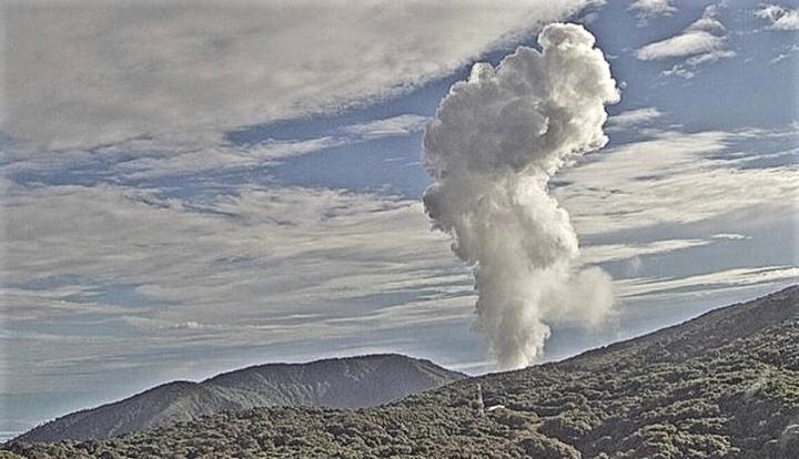
Comments: This is an eruption mainly of water vapor and ash through the Boca A (Red Mouth or old dome). Atmospheric conditions and temperature gradients between the bottom of the crater and the lower layers of the atmosphere favor the vertical movement of steam, gas, and fine particles. This plume has been observed in Coronado, Heredia and San José.
Activity report of Poas volcano, August 18, 2019.
No eruption is reported.
The seismic activity is similar to that of yesterday.
At the time of this report, winds are blowing from the South.
The volcano erupted over 1,000 meters at 17:50 on August 17, 2019. Seismic activity related to tremors is observed and these present a greater amplitude from 5:00 am today (see the VPLC seismogram of http: / /www.ovsicori.una.ac.cr/index.php/helicorders). At 6:35, we observe the passage of seismic waves related to the earthquake of Corinth, Nicaragua, at 6:34.
The degassing of the volcano is continuous.
Source : Ovsicori.
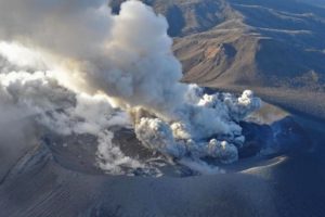
Indonesia , Dukono :
VOLCANO OBSERVATORY NOTICE FOR AVIATION – VONA.
Issued: August 18 , 2019
Volcano: Dukono (268010)
Current Aviation Colour Code: ORANGE
Previous Aviation Colour Code: orange
Source: Dukono Volcano Observatory
Notice Number: 2019DUK56
Volcano Location: N 01 deg 41 min 35 sec E 127 deg 53 min 38 sec
Area: North Maluku, Indonesia
Summit Elevation: 3933 FT (1229 M)
Volcanic Activity Summary:
Eruption with volcanic ash cloud at 00h35 UTC (09h35 local)
Volcanic Cloud Height:
Best estimate of ash-cloud top is around 5213 FT (1629 M) above sea level, may be higher than what can be observed clearly. Source of height data: ground observer.
Other Volcanic Cloud Information:
Ash cloud moving to east
Remarks:
Eruption and ash emission is continuing
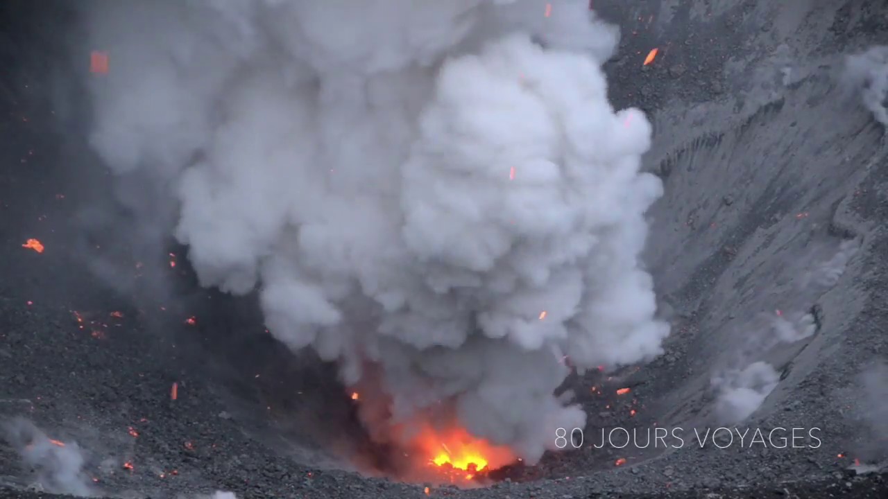
Level of activity at Level II (WASPADA). G. Dukono (1229 m altitude) is experiencing a continuous eruption. The volcano has been covered since yesterday and until this morning by fog. The smoke from the crater was observed at a maximum height of 500 meters above the summit, with a white to gray color and a thick intensity. An eruption was observed 500 meters above sea level from the summit, with gray-white smoke.
Through the seismographic , on August 17, 2019, it was recorded:
1 eruption earthquake
2 distant tectonic earthquakes
Tremor continuous with a dominant amplitude of 2 mm
Recommendation: People around G. Dukono and visitors / tourists should not climb or approach the crater of Malupang Warirang within 2 km.
Sources : Magma Indonesie , PVMBG.
Photo : S Chermette / 80 Jours Voyages.
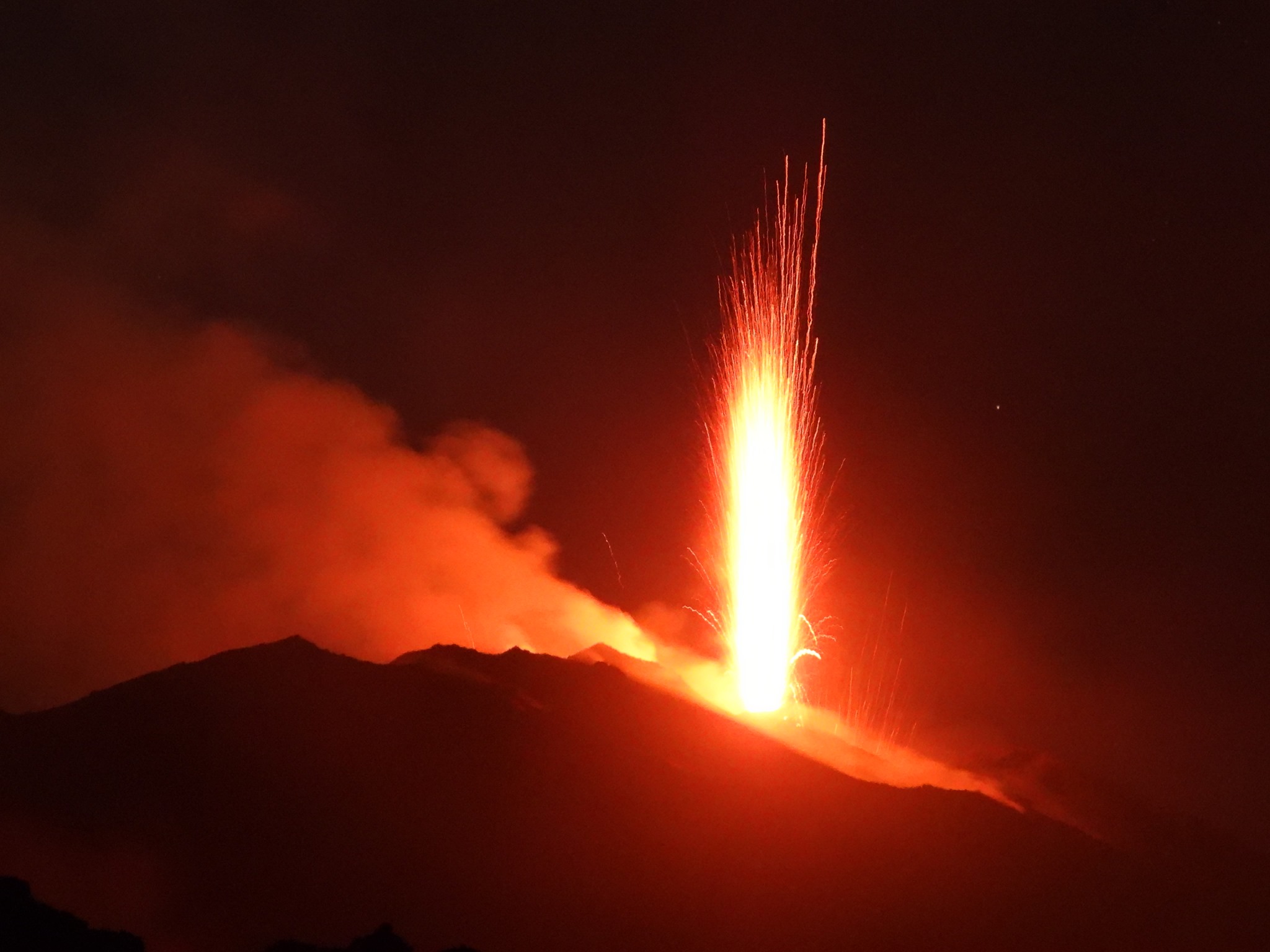
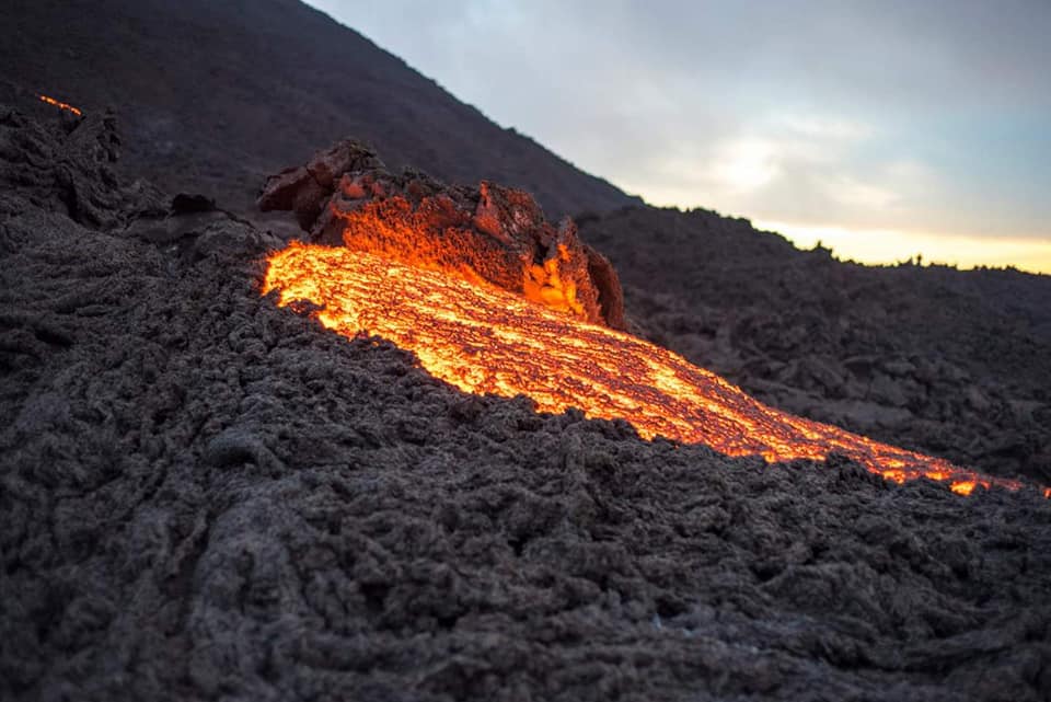
Guatemala , Pacaya :
Type of activity: Strombolian
Morphology: Composite Stratovolcano.
Geographical location: 14 ° 22’50˝ Latitude N; 90 ° 36’00˝ longitude W.
Height: 2,552msnm.
Weather conditions: partly cloudy
Wind: South
Precipitation: 19.3 mm.
Activity:
A moderate white outgassing is observed at an approximate height of 600 meters above the crater, dispersed in a southerly direction on the slopes of the volcano. The seismic station records the internal tremors associated with constant degassing and Strombolian explosions, which elevate the material to an approximate height of 5 to 20 meters above the crater. An incandescent is observed in the Mackenney crater as well as lava flows north-northwest on the slopes of the volcano. There are moderate avalanches at the front of the lava flows.
Source : Insivumeh.
Photo : David Rojas