August 13 , 2019.
La Réunion , Piton de la Fournaise :
Activity Bulletin from Monday, August 12, 2019 at 4:00 pm (local time)
Alert level: Alert 2-2
The eruption started on August 11, 2019 around 16:20 (local time) continues. The intensity of the eruptive tremor (witnessing the intensity of the eruption) is relatively constant since 8:00 am local time (04:00 UT, Figure 1).
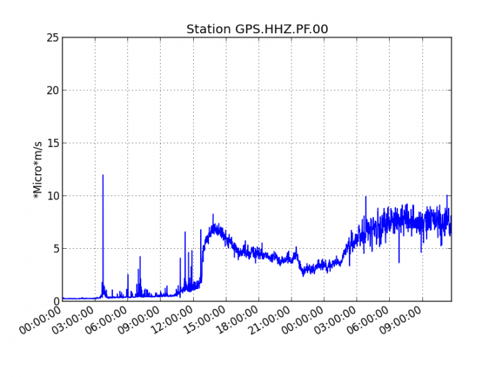
Figure 1: Evolution of the RSAM (indicator of the volcanic tremor and the intensity of the eruption) between 04:00 (00:00 UTC) on August 11 and 16:00 (12:00 UTC) on August 12, 2019 on the GPS seismic station, the most close to the eruptive site (© OVPF-IPGP). (© OVPF-IPGP.)
Due to poor weather conditions since the start of the eruption, no reconnaissance could be done on site.
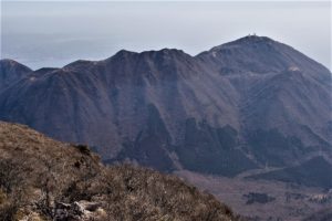
The glow observed from RN2 in the Grand Brûlé and the few observations of this night and today confirm that the crack (s) opened on the east, south-east flank inside the Enclos Fouqué, in the upper part of the Great Slopes, as shown by the tremor maps since the beginning of the eruption (Figure 2).
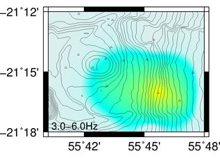
Figure 2: Location map of the source of the erupting tremor on August 12 at 16:00 local time (© OVPF-IPGP).
At 15h, local time the flow front was visible from RN2 and had reached an altitude of about 1000 m (± 200 m, given the uncertainties related to remote observations).
The eruption started Sunday at 16h20, the fourth of the year, was not easily observed. Indeed, it was not until Monday afternoon to see the first flows, parts of one or more cracks on the east flank of the volcano. Due to poor weather conditions, they could not be observed previously.
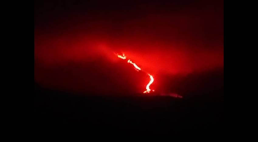
But this Monday night, the weather was more favorable to the observations, especially from the RN2, in the area of Grand Brûlé where spectators flocked. The sky finally came to light, and the clouds dissipated to reveal the spectacle of the flow down the Great Slopes.
The flow front has since Sunday afternoon well advanced: it was this Monday evening about 600m above sea level, but could slow down by reaching the area where the slope is softer.
Source : OVPF. Clicanoo.
Lire l’article : http://www.ipgp.fr/fr/ovpf/bulletin-dactivite-lundi-12-aout-2019-a-16h00-heure-locale
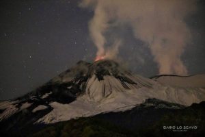
Photo : OVPF / Clicanoo.
Peru , Ubinas :
VOLCANIC ACTIVITY REPORT, Update of August 12, 2019, 08h00.
Alert level: orange
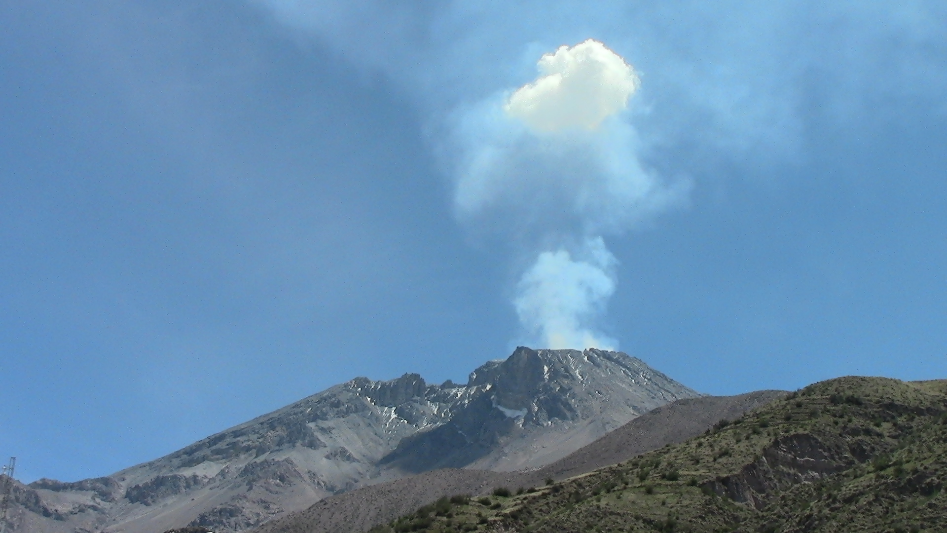
The Geophysical Institute of Peru (IGP) reports that the Ubinas volcano has anomalies on various geophysical parameters, which are associated with the rise of the magma, the presence of a magmatic body in surface of the crater and the increase of the seismic energy (type LP and Hybrid). Currently, it is planned the continuation of the activity, with the occurrence of explosions with the expulsion of fragments of rocks and ashes.
Last 6 hours:
Explosions: 0
Earthquakes: 375
Emissions of ashes: in the case of ash production, the latter will disperse to the eastern and north – eastern sectors of the volcano (Chojata and Lloque district), with moderate winds at 40km / h.
Deformation: Without.
Thermal anomalies: 1 (2 MW)
Recommendations:
Keep the alert level in orange. Do not approach a radius of less than 15 km from the crater. In case of ash fall, cover your nose and mouth with damp cloths or masks. Keep the doors and windows of the houses closed.
Source : IGP Peru.
Photo : Unknown author.
Chile , Villarica :
During this period, 9 volcano-tectonic (VT) seismic events associated with rock fracturing were recorded. The event with the greatest energy had a local magnitude of M 2.3, and was located 4.2 km east of the active crater and 4.6 km deep.
In addition, a total of 5560 long-period seismic events (LPs) were recorded, in relation to fluid dynamics within the volcano, with maximum reduced displacement values of 62 cm2.
Similarly, 768 tremor-type earthquakes (TR), in relation to the circulation of magmatic fluids within the volcanic ducts, were noted with reduced maximum displacement values of 34 cm2. … / …
Therefore, the alert level stays at the level:
GREEN LEVEL: Active volcano with stable behavior – No immediate risk – Time for possible eruption: MONTH / YEARS.
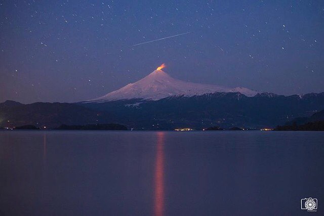
Observation: Due to the fluctuating dynamics of the lava lake, it is recommended to apply precautionary access restrictions to an area close to the crater with a radius of 500 m.
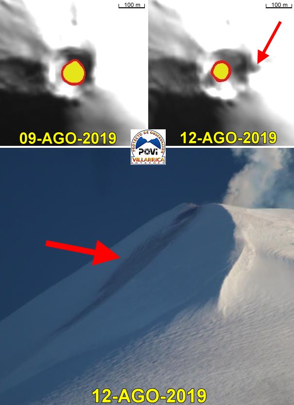
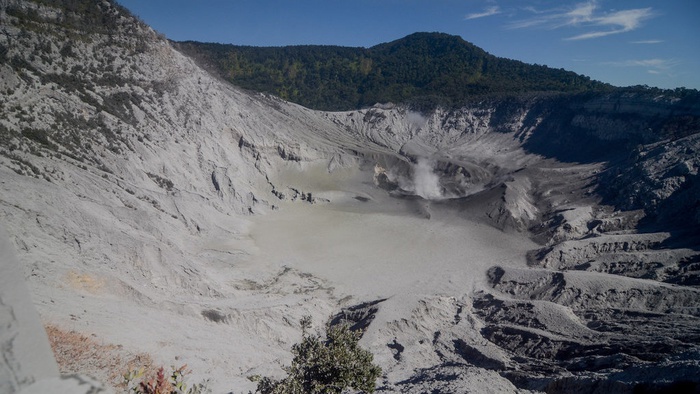
VOLCAN VILLARRICA – 12 AUGUST
Preliminary: the weight of the snow would have caused the collapse of a segment of the eastern edge of the crater visible in the satellite and terrestrial images above.
As shown in the top 2 images, it was also reported that the diameter of the heat surface at the bottom of the crater was halved between 9 and 12 August (SWIR images processed, ESA Copernicus project).
The POVI thanks all the attentive citizen journalists who sent us images of the event.
Sources : Sernageomin. Povi / Werner Keller.
Photos : horadelaluz_martinifotografia , POVI.
Indonesia , Tangkuban Parahu :
Level of activity at Level I (WASPADA). The Tangkuban Parahu (2084 m above sea level) erupted on July 26, 2019 at 15:48:18, western Indonesia time, with a column of ash elevated to within ± 200 m above the summit (± 2284 m above sea level). Following an eruption that occurred on August 1, 2019, at 2046 hours west of Indonesia, the smoke column rose 180 m above the bottom of the crater. This was followed by an eruption on August 2, 2019, starting at 00:43 and another eruption at 04:56 .
Since yesterday and until this morning, the volcano is clearly visible. The smoke from the crater is white to gray with a thick intensity. A column of ash 90 meters high rises from the bottom of the crater.
The seismographs, on August 12, 2019, recorded:
– Continuous tremor with a dominant amplitude of 25 mm
Recommendation:
– People around Mount Tangkuban Parahu and visitors / tourists / mountaineers should not approach the crater atop Mount Tangkuban Parahu within 1.5 km of the active crater. It is recommended that the Tangkuban Parahu Natural Park be temporarily closed for a greater safety distance.
VONA:
The latest VONA report was sent with the color code ORANGE, published on August 1, 2019 at 4:20, relating to volcanic ash emission observations at 1:45, with an unobserved ash column height.
Source : PVMBG .
Photo : ANTARA FOTO/Raisan Al Farisi.
Mexico , Popocatepetl :
August 12, 11:00 am (August 12, 4:00 pm GMT)
During the past 24 hours, 151 exhalations have been identified via the monitoring systems of the Popocatepetl volcano, accompanied by water vapor, gas and small amounts of ash. In addition, 16 explosions were recorded yesterday, yesterday at 14:12, 15:02, 15:56, 16:05, 16:35, 16:54, 17:02, 17:12, 17:37, 17:52, 18:05, 18:27, 18:44 and 19:25 and today at 00:46 and 02:23. In addition, 378 minutes of low amplitude tremor were recorded.

Today, in the morning and at the time of this report, the volcano is observed with a gas emission directed to the southwest.
CENAPRED urges NOT to approach the volcano and in particular the crater because of the risk of falling ballistic fragments, and in case of heavy rains to stay away from the bottom of the ravines due to the risk of mudslides and debris.
The warning light of Popocatépetl is in YELLOW PHASE 2.
Source : Cenapred.
Photo : Enricoguasch