May 26 , 2019.
Mexico , Colima :
Weekly activity bulletin of the Colima Volcano activity, Date: May 24, 2019 Newsletter n ° 122
Seismic activity:
Last week, 41 high-frequency (HF) events, 6 landslides, 23 low-amplitude explosions and 21.8 min of low-amplitude tremors were recorded automatically. An explosion was recorded on May 22 at 8:02 pm (May 23 at 01:02 UTC) at the INCA station located 1.9 km from the volcano crater.
Visual observations:
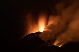
During the reporting period, small explosions and intermittent releases of steam and gas mainly from the northeast side of the crater continue to be recorded. On May 22, there were five flights with an unmanned aerial vehicle (UAV) to the top of the volcano. Several intermittent fumaroles were observed outside the crater rim on the north and northwest sides, as well as constant fumarolic activity on the crater interior wall on the northeast side. In addition, a small crater or trough was observed following the last explosions just in the center of the main crater, in which intermittent fumarolic activity was detected.

The fixed thermal camera located south of the volcano recorded thermal anomalies associated with minor explosions, as well as intermittent fumarolic activity.
Geochemistry:
No SO2 flow measurements were performed during the last week.
Remote perception:
No thermal anomalies detected by the MIROVA satellite system were observed during the last week.
Diagnostic :
The volcano maintains an explosive activity of low intensity. The occurrence of these events indicates that the gas associated with the moving magma has reached superficial levels. This activity can continue and increase in intensity over the next few days or weeks. The staff in charge of monitoring the volcano is attentive to possible changes and changes in activity.
Source : RESCO-CUEV-Facultad de Ciencias Universidad de Colima .
New Zealand, White Island :
Local earthquake swarm near Whakaari/White Island , Published: Sun May 26 2019 8:40 AM
Volcanic Alert BulletinWI – 2019/02
Volcanic Alert Level remains at 1 , Aviation Colour Code remains at Green
A local earthquake swarm near Whakaari/White Island started on Thursday. Over the past 24 hours the rate and magnitude of earthquakes has increased. The swarm does not appear to be linked to volcanic unrest but may result in increased landslide risk on island.
Since Thursday, 196 earthquakes have been located. 22 earthquakes of magnitude 3 or greater have occurred in the last 24 hours, and the largest three are M3.9, M3.8, and M3.8. The swarm appears to be tectonic in nature, unrelated to volcanic processes.
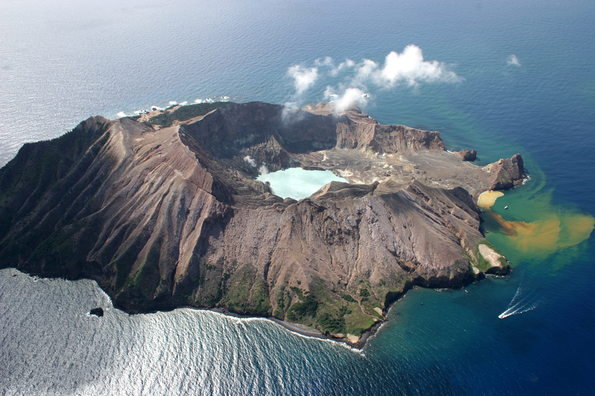
The GeoNet Landslide Duty Officer reports there may be a heightened risk of landslides as the earthquakes are shallow, local, and local material is relatively weak.
There are no changes in volcano monitoring parameters or the level of volcanic activity at Whakaari/White Island. Our observations are consistent with minor volcanic unrest and the Volcanic
Alert Level remains at 1 while the Aviation Colour Code stays at Green.
While Volcano Alert Level 1 is mostly associated with environmental hazards, eruptions can still occur with little or no warning. GNS Science continues to closely monitor Whakaari/White Island and our other active volcanoes. There is no further Volcanic Alert Bulletin planned at this stage.
Source : Natalia Deligne , Volcanologiste de service.
Photo : rfleming.
Guatemala , Fuego :
Type of activity: Vulcanian
Morphology: Composite Stratovolcano
Geographical location: 14 ° 28’54˝ Latitude N; 90 ° 52’54˝ Longitude O.
Height: 3,763msnm.
Weather conditions: partly cloudy
Wind: North at 2 km / h
Precipitation: 51.6 mm.
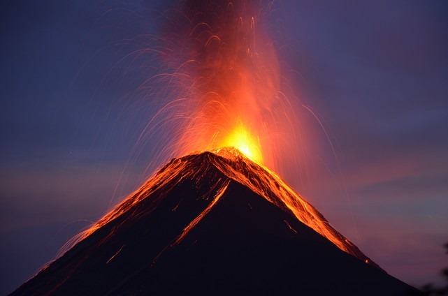
Activity:
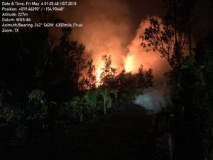
Presence of white degassing fumaroles at a height of 4400 meters that disperse to the west and southwest, 17 to 23 weak and moderate explosions per hour are generated which emit columns of gray ash at a height of 4600 at 4800 meters (15090-15750). feet) scattered 15 to 20 km to the west and southwest. At night and early in the morning, incandescence was observed at a height of 300 to 400 m with weak, moderate and strong avalanches on the crater contour towards the ravines of Seca, Taniluyá, Ceniza and Trinidad. It is possible to perceive weak to moderate rumblings that generate low to moderate shock waves, causing vibrations in the roofs of houses of communities near the volcano, the sounds are similar to those of an airplane turbine with intervals from 2 to 6 minutes. We note the fall of fine particles of ash in the villages Panimache I, Morelia, Santa Sofia, El Porvenir, Panimache II and others.
Source : Insivumeh .
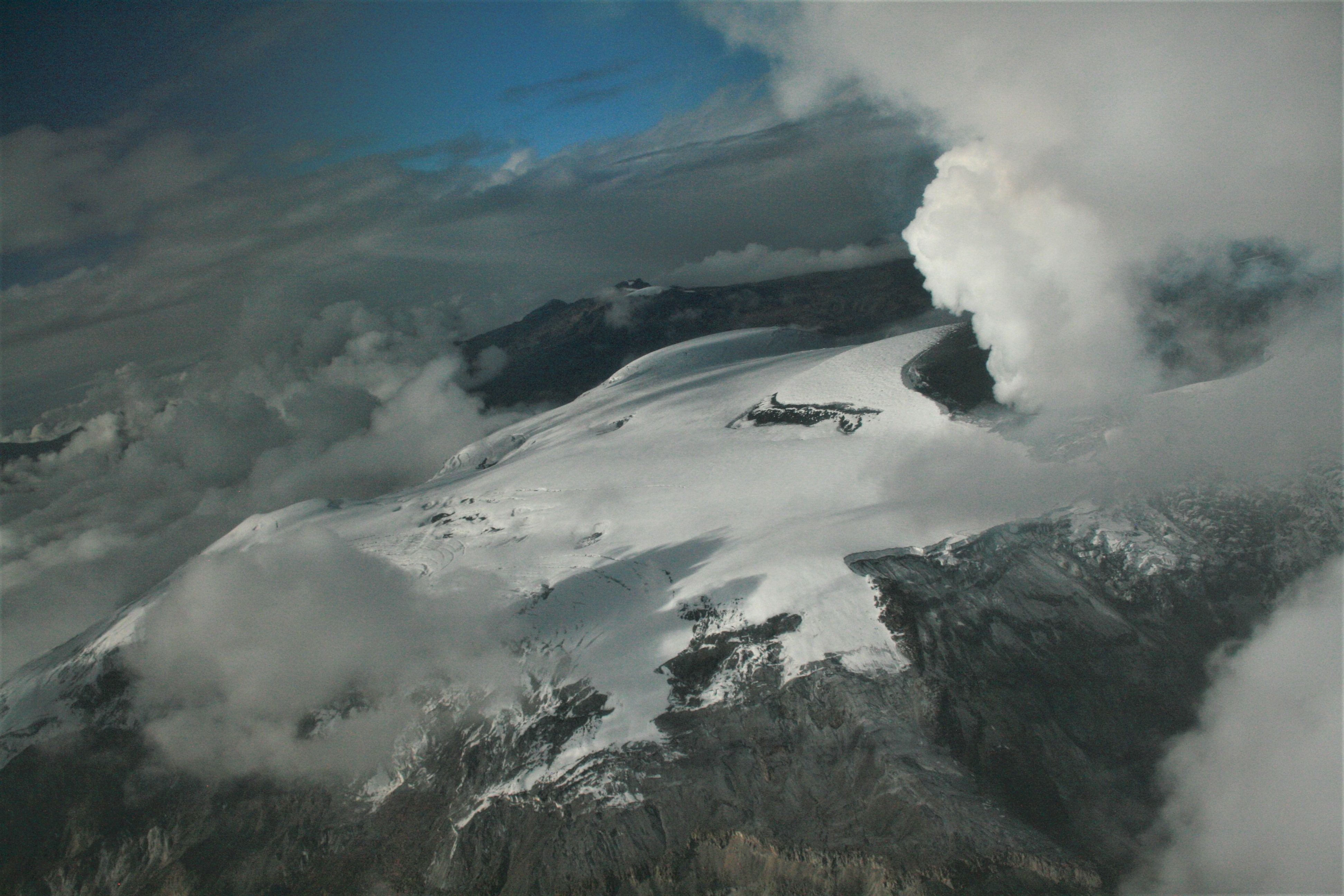
Colombia, Nevado del Ruiz :
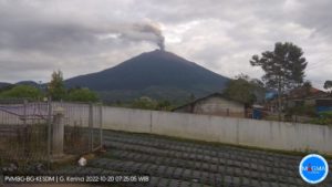
Weekly activity bulletin of the Nevado del Ruiz volcano
The level of activity continues at the level: Yellow activity level or (III): Modifications of the behavior of the volcanic activity.
With regard to monitoring the activity of the Nevado del Ruiz volcano, the COLOMBIAN GEOLOGICAL SERVICE announces that:
The Nevado del Ruiz volcano continues to display unstable behavior. During the past week, the seismicity caused by the fracturing of rocks near the volcanic structure has shown a significant increase, both in the number of earthquakes and the seismic energy released, compared to the previous week. The earthquakes were mainly located in the south-east sector and, to a lesser extent, in the Arenas crater and in the North-East and South-West sectors of the volcano. The depths of the earthquakes ranged from 0.9 to 5.0 km. It is highlighted the occurrence of an increase in this type of activity, recorded May 18 to 3 km southeast of the crater. The maximum magnitude recorded during the week and the seismic increase was 1.3 ML (local magnitude), corresponding to the earthquake recorded on May 18 at 17:57 (local time), located at a depth of 3.6 km in the South East sector.
Seismic activity related to the dynamics of fluids within the volcanic channels continued, characterized by the constant recording of continuous volcanic tremors of very low energy and high frequencies, the appearance of earthquakes type low frequency (LP) and very low frequency (VLP) and volcanic tremor pulses, with varying energy levels. The earthquakes were mainly located in the crater Arenas and its surroundings.
Volcanic deformation measured from electronic inclinometers and Global Navigation Satellite System (GNSS) stations showed stability during the week, without recording significant deformation processes of the volcanic structure.
During the week, the MIROVA portal reported a thermal anomaly of low energy level.
The column of gas and steam reached a maximum height of 1300 m, measured at the top of the volcano on May 16th. The direction of the dispersion of the column was governed by the direction of the wind in the region, which was directed towards the North-West and South-West of the volcano.
The Nevado del Ruiz volcano continues at the level of yellow activity.
Source : SGC.
Photo : Fuerza Aérea Colombiana.