May 15 , 2019.
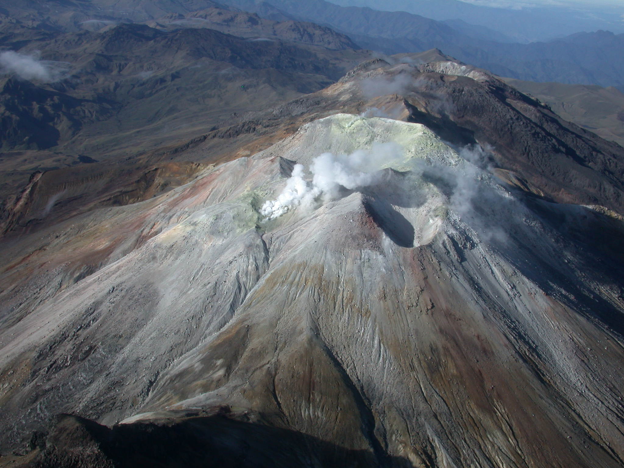
Hawaii , Kilauea :
19°25’16 » N 155°17’13 » W,
Summit Elevation 4091 ft (1247 m)
Current Volcano Alert Level: NORMAL
Current Aviation Color Code: GREEN
Activity Summary:
Kīlauea Volcano is not erupting. Monitoring data over the past nine months have shown relatively low rates of seismicity, deformation, and sulfur dioxide emissions at the summit and East Rift Zone, including the area of the 2018 eruption.
As of March 26, Kīlauea Volcano is at NORMAL/GREEN.
Despite this classification, Kīlauea remains an active volcano, and it will erupt again. Although we expect clear signs prior to a return to eruption, the time frame of warning may be short.
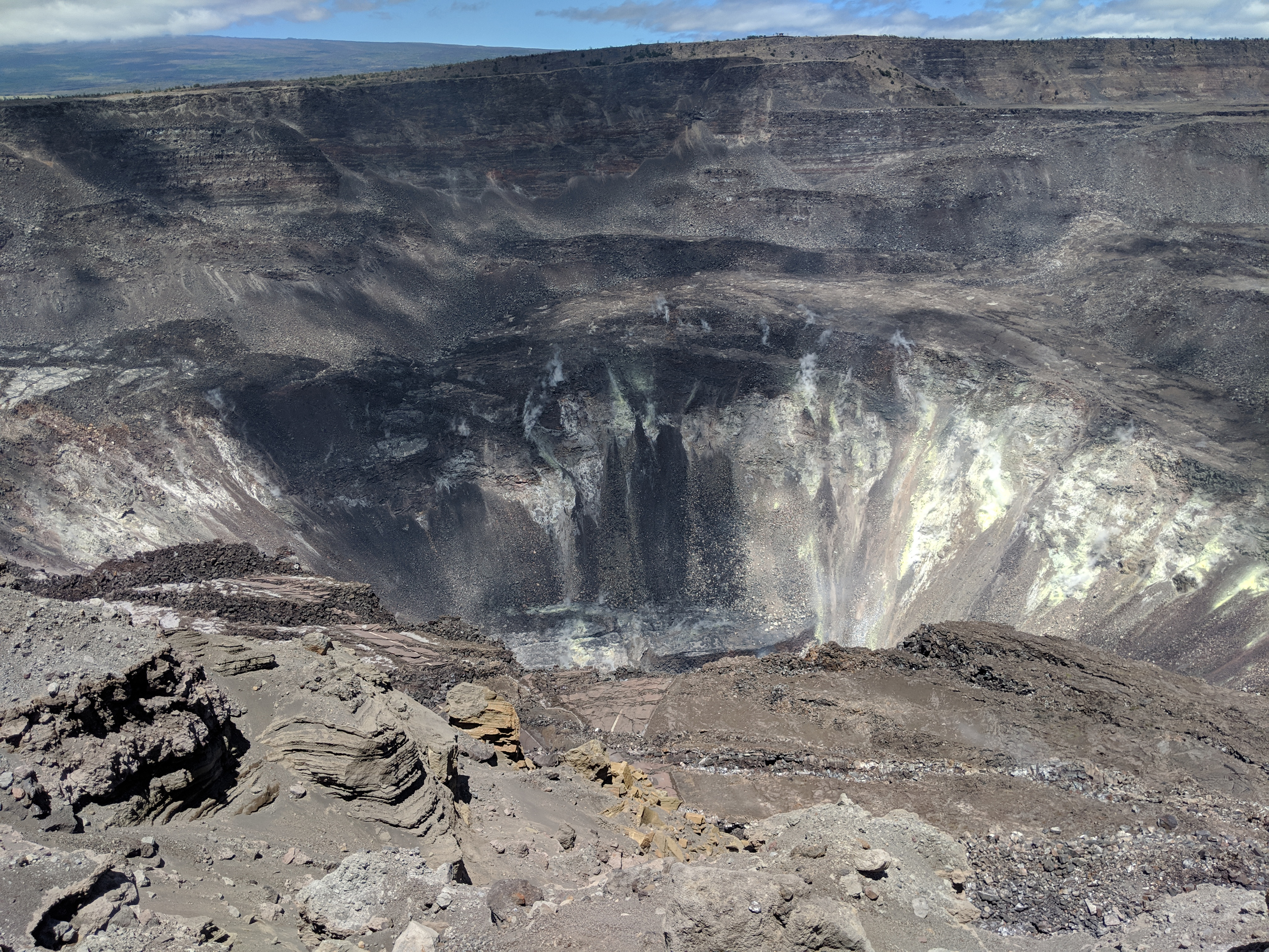
Only small amounts of sulfur dioxide (SO2) and hydrogen sulfide (H2S) are currently being released from Kīlauea, but those gases chemically react with each other to form the bright yellow sulfur deposits on the crater walls within Halema‘uma‘u.
Observations:
Monitoring data have revealed no significant changes in volcanic activity over the past week. Generally low seismicity continues across the volcano, with earthquakes occurring primarily in the summit and south flank regions. The largest Kīlauea earthquake over the past week was a M2.9 event near Keanakākoʻi Crater on May 11, at a depth of 3.1 km (1.9 miles) below ground level. USGS received 6 felt-reports following this event.
Since early March, tiltmeters at the Kīlauea summit have recorded modest inflationary tilt. Over about the same time period, a GPS station within the 2018 collapse area has recorded approximately 5 cm (3 inches) of uplift. Satellite radar data (InSAR) show deformation consistent with inflation of the shallow Halemaʻumaʻu source, confirming the trends noted by both tiltmeters and GPS. One possible interpretation is that magma has begun to slowly accumulate within the shallow portion of the Kīlauea summit magma system, 1-2 km or approximately 1 mile below ground level. However, gas measurements have yet to indicate significant shallowing of large volumes of melt. HVO continues to carefully monitor gas output at the Kīlauea summit and East Rift Zone for important changes.
Further east, GPS stations and tiltmeters continue to show motions consistent with refilling of the deep East Rift Zone magmatic reservoir in the broad region between Puʻu ʻŌʻō and Highway 130. This trend has been observed since the end of the 2018 eruption, and while its significance is unclear, monitoring data do not suggest any imminent change in volcanic hazard for this area.
Source : HVO
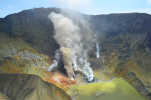
Colombia , Cumbal :
Weekly Activity Bulletin of the Cumbal Volcanic Complex
The level of activity of the volcano continues at the level: YELLOW LEVEL ■ (III): CHANGES IN THE BEHAVIOR OF THE VOLCANIC ACTIVITY.
Following the activity of the CUMBAL VOLCANIC COMPLEX, the COLOMBIAN GEOLOGICAL SERVICE (SGC) reports that:
For the period evaluated between 7 and 13 May 2019, the seismicity of the Cumbal volcanic complex showed an increase in both number of events and released seismic energy, from 181 events the previous week to 526 earthquakes , low energy and associated with fracturing cortical material.
Favorable climatic conditions made it possible to observe gas emissions coming mainly from the El Verde fumarol field, north-northeast of the volcanic complex. These emissions were white, of low height and direction of dispersion variable depending on the action of the winds.
The COLOMBIAN GEOLOGICAL SERVICE is attentive to the evolution of the volcanic phenomenon and will continue to inform in a timely manner of the observed changes.
Source : SGC
Photo : SGC , 11/2017 .
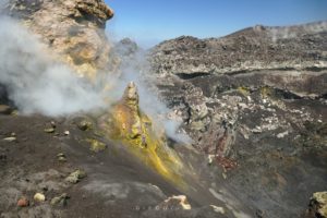
Indonesia , Karangetang :
Level of activity at Level III (SIAGA). G. Karangetang (1,784 m) has resumed eruption since November 25, 2018.
Since yesterday and until this morning, the volcano was clearly visible before being covered with fog. It was observed that the smoke from the main crater was about 100 meters above the summit, white in color and of medium intensity.
The seismographs, on May 14, 2019, recorded:
5 earthquakes of explosion.
12 hybrid earthquakes
1 shallow volcanic earthquake
1 local tectonic earthquake
7 distant tectonic earthquakes
Tremor continuous with a dominant amplitude of 0.5 mm.

Recommendation:
As of March 26, 2019 at 12:00, the technical recommendations are as follows:
The public and visitors / tourists should not approach, climb or move in the hazard forecast area which is 2.5 km from the Kawah Dua (North crater) and the main crater (South) peaks. in the sectoral expansion zone of the Dua Crater at West-Sea, in the North, up to 4 km, an area between Kali Batuare and Kali Saboang.
People living around rivers from the summit of Mount Karangetang need to be prepared for the potential threat of lahars and sudden floods that can spread to the coast.
VONA:
The latest Vona code, YELLOW, was released on November 25, 2018 at 13:32. This code involved the emission of volcanic ash at an altitude of about 2,284 m above sea level or about 500 m above the summit, the wind blowing east.
Source : PVMBG
Photo : VISIT SIAU Island, 12/05/2019.
Guatemala , Fuego :
SPECIAL VOLCANOLOGICAL BULLETIN BEFGO No. 17-2019, Guatemala May 14, 2019 at 12:00 hours (local time)
MODERATE LAHAR IN CANYON CENIZA
Type of activity: Vulcanian
Morphology: Composite Stratovolcano.
Geographical location: 14 ° 28’54˝ Latitude N; 90 ° 52’54˝ Longitude W.
Height: 3,763msnm.
Precipitation during the last hours in the region of Fuego volcano is currently generating the descent of lahars in Ceniza Canyon.
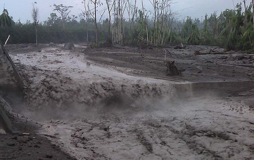
These have weak to moderate characteristics (so far), transport pasty materials with blocks of different sizes, branches and tree trunks. It is possible that these are at the origin of steam columns.
Because of the rains that can occur around the volcano in the hours that follow, the possibility of lahars in one of the main ravines is not excluded. It is therefore recommended not to stay in the ravines or nearby.
Source : Insivumeh
Photo : Caroline Sarrazin , Rés-EAUx . Juin 2018.
United – States , Yellowstone :
YELLOWSTONE NATIONAL PARK, Wyo. (AP) — A noisy geyser in Yellowstone National Park has roared back to life after three years of quiet.
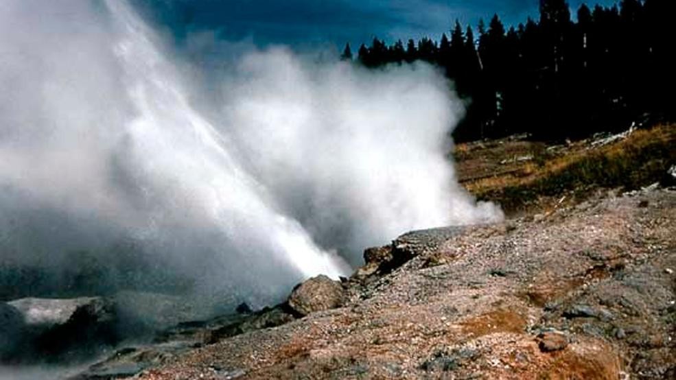
This recent but undated photo provided by the National Park Service shows Ledge Geyser in Yellowstone National Park, within days of its most recent eruption that began on April 28, 2019.
Ledge Geyser is one of the biggest in Yellowstone’s Norris Geyser Basin.
The Billings Gazette reports the geyser shoots hot water at an angle up to 125 feet (38 meters) high and a distance of 220 feet (67 meters).
Yellowstone geologist Jeff Hungerford says Ledge Geyser is noisy because its water and steam must pass through a narrow opening in the ground.
Yellowstone has 1,300 thermal features and 500 geysers, more than anywhere else on Earth. Some geysers such as Old Faithful are predictable but most, like Ledge Geyser, erupt erratically.
Source : KUTV.
Photo : Parc National.