May 11 , 2019.
Hawaii , Kilauea :
19°25’16 » N 155°17’13 » W,
Summit Elevation 4091 ft (1247 m)
Current Volcano Alert Level: NORMAL
Current Aviation Color Code: GREEN
Activity Summary:
Kīlauea Volcano is not erupting. Monitoring data over the past nine months have shown relatively low rates of seismicity, deformation, and gas emission at the summit and East Rift Zone, including the area of the 2018 eruption.
As of March 26, Kīlauea Volcano is at NORMAL/GREEN.
Despite this classification, Kīlauea remains an active volcano, and it will erupt again. Although we expect clear signs prior to a return to eruption, the time frame of warning may be short.
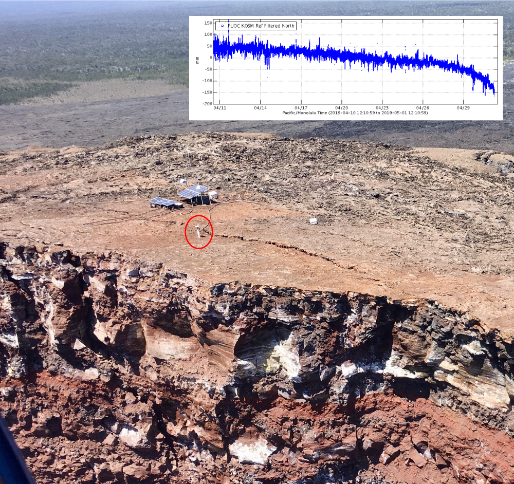
A small collapse of the Pu‘u ‘Ō‘ō crater at 6:14 a.m. HST today (May 1, 2019) was the last ‘hurrah’ for a GPS instrument located on the crater’s edge (red circle). This station, designated PUOC, served faithfully throughout Kīlauea’s 2018 eruption and was an important source of information on the shallow magma system of Pu‘u ‘Ō‘ō. The station’s last reported position showed it moving rapidly to the southeast, consistent with motion into the crater (inset shows data transmissions from April 11 through this morning). Monitoring of Pu‘u ‘Ō‘ō is currently being accomplished by additional GPS and tilt stations farther from the edge of the crater. The larger equipment installation near the solar panels was not affected by this morning’s collapse and continues to function. However, contingency plans are in place in case collapses of the crater edge continue. USGS photo by I. Johanson on March 18, 2019, annotated on May 1, 2019.
Observations:
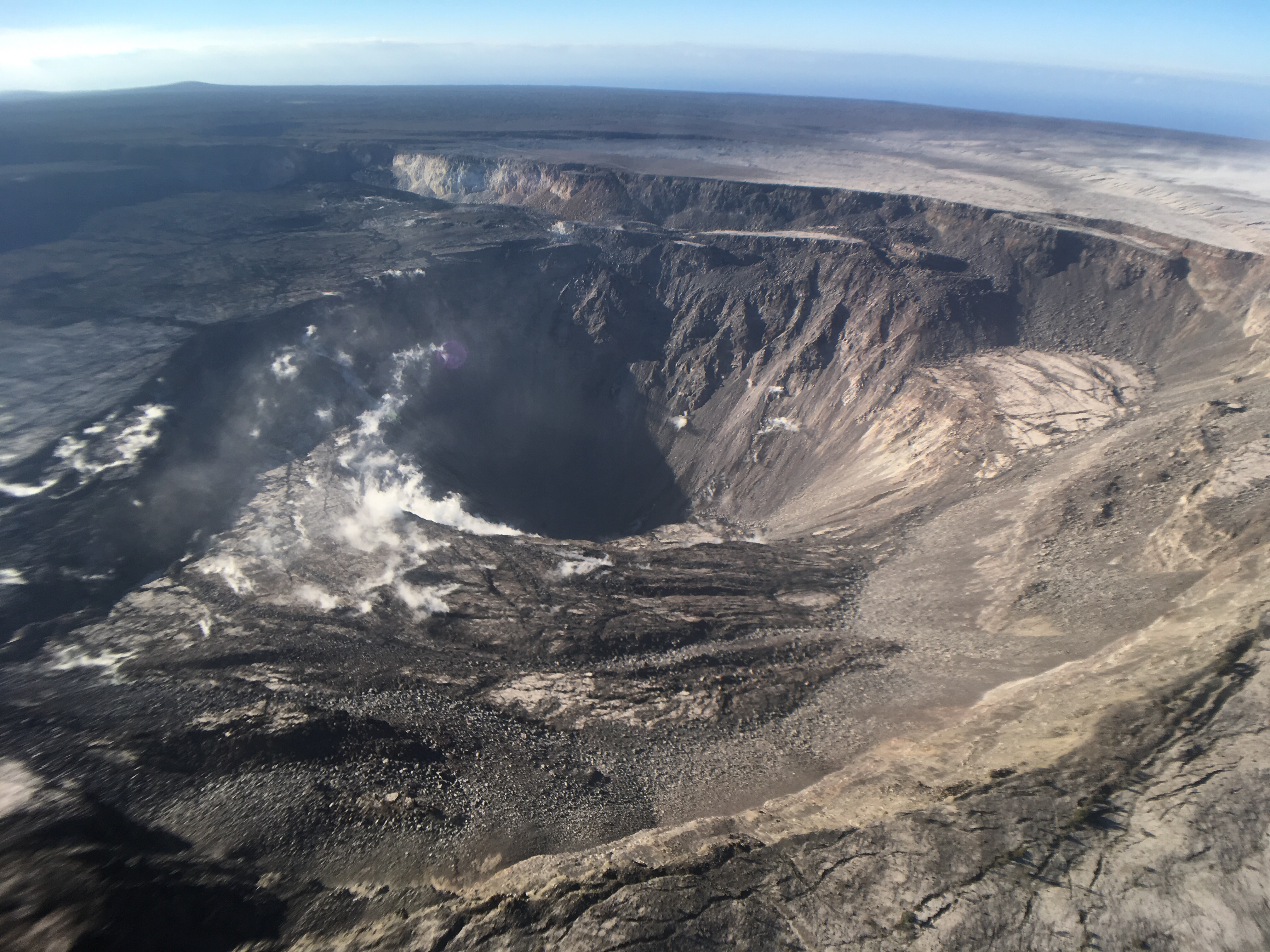
Monitoring data revealed no significant changes in volcanic activity over the past week. On the morning of May 1, web camera images revealed that part of the crater rim on the north side of Puʻu ʻŌʻō had collapsed, destroying a monitoring station’s GPS antenna. The GPS had been showing motions consistent with rim instability for several weeks, so this collapse is not interpreted to be associated with magmatic activity.
Generally low seismicity continues across the volcano, with earthquakes occurring primarily in the summit and south flank regions. The largest Kīlauea earthquake over the past week was a M3.3 event on May 3, approximately 4 km (2.5 mi) south of Puʻu ʻŌʻō, at a depth of 7.5 km (4.7 mi) below ground level. USGS received 18 felt-reports following this event, which was likely an aftershock of larger earthquakes nearby over the past year.
GPS stations and tiltmeters continue to show motions consistent with refilling of the deep East Rift Zone magma reservoir. A common Deflation-Inflation (« DI ») event began at the Kīlauea summit on May 4, which saw two days of deflationary tilt before transitioning to inflationary tilt last night; this behavior is normal and has been observed at the volcano for many years. Sulfur dioxide emission rates from the summit and from Puʻu ʻŌʻō remain low.
Hazards remain in the lower East Rift Zone eruption area and at the Kīlauea summit. Residents and visitors near the 2018 fissures, lava flows, and summit collapse area should heed Hawaii County Civil Defense and National Park warnings. Hawaii County Civil Defense advises that lava flows and features created by the 2018 eruption are primarily on private property and persons are asked to be respectful and not enter or park on private property.
The Hawaiian Volcano Observatory (HVO) continues to closely monitor Kīlauea’s seismicity, deformation, and gas emissions for any sign of increased activity. HVO maintains visual surveillance of the volcano with web cameras and occasional field visits. HVO will continue to issue a weekly update (every Tuesday) until further notice, and will issue additional messages as warranted by changing activity.
Source : HVO
Photos : HVO . ( 01 /05/2019 , 09/08/2018 )
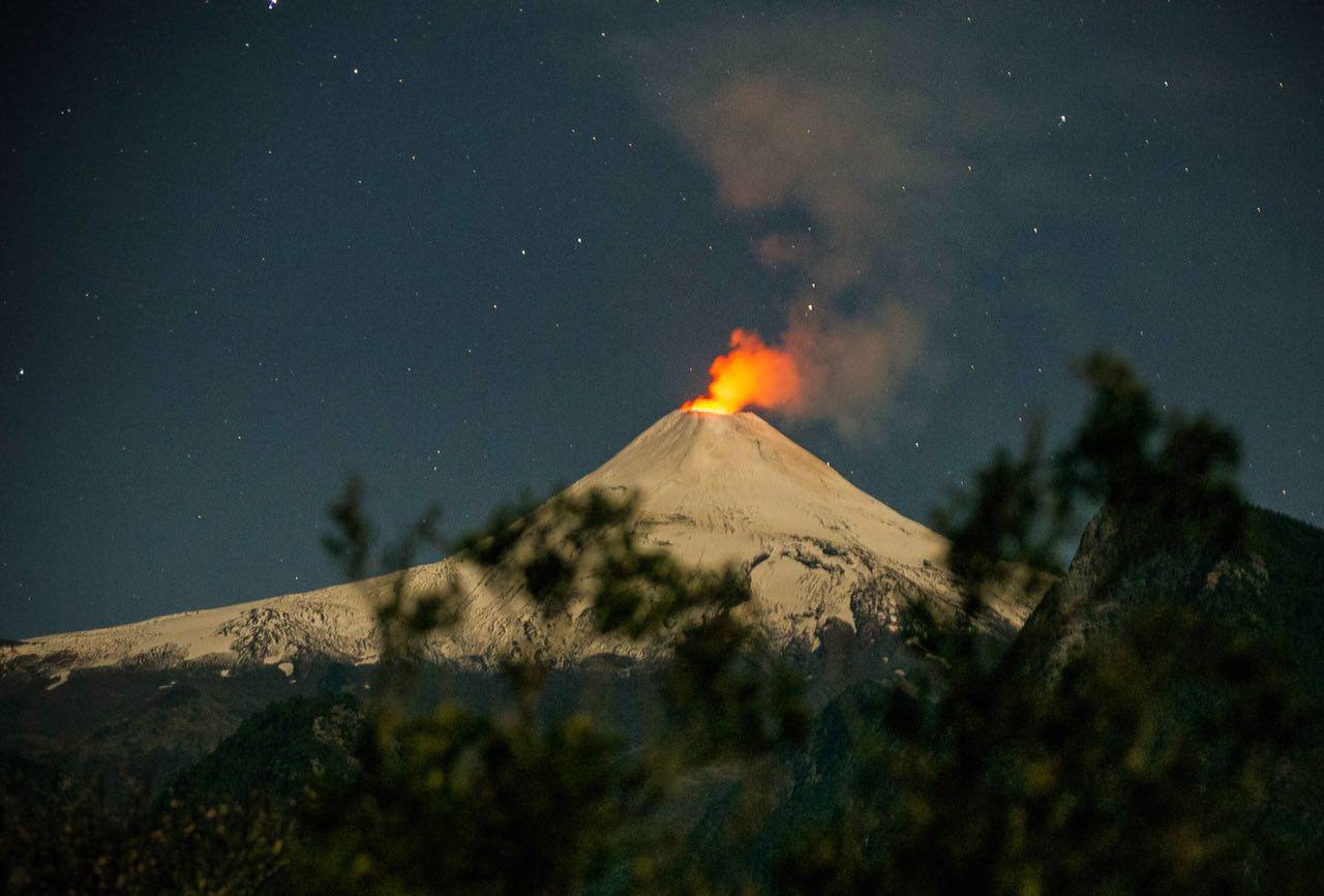
Chile , Villarica :
A total of 5915 seismic events have been recorded, of which 5901 have been classified as long-period type (LP) earthquakes, in relation to fluid dynamics within the volcano, with reduced displacement values of up to 30.4 cm2. In addition, 14 volcano-tectonic (VT) seismic events associated with rock fracturing were recorded. The event with the greatest energy had a local magnitude of M 2.3, and was located 4.7 km east-southeast of the active crater and at a depth of 3.9 km.
The volcanic tremor signal, a seismic signal also associated with the dynamics of the fluids within the volcano during the period considered, remained the same as in previous periods with reduced displacement values of up to 4 cm2. The dominant frequencies are maintained mainly between 1 and 3 Hz.
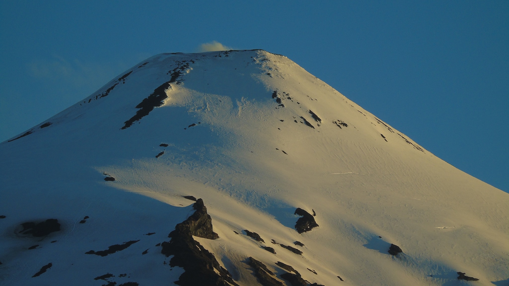
The images recorded with the IP cameras installed near the volcano, when the weather conditions allowed it, showed degassing of predominantly whitish color; this one did not exceed 250 m of height. In addition, a night glow is recorded, when the weather conditions allowed to observe it.
According to data provided by 4 GNSS stations and two (2) electronic inclinometers, there were no lasting variations and due to changes in the internal dynamics of the volcano.
According to the data provided by the differential absorption optical spectrometry equipment (DOAS), Los Nevados and Tralco stations, located 10 km east-north-east and 6 km east-southeast of the crater On the active side, sulfur dioxide emission values of 564 +/- 67 t / d were recorded, with a maximum value of 1226 t / d reported on 16 April. These values are considered as usual for this volcano.
During the period 8 thermal warnings were reported on the volcano, with a maximum observed volcanic radiative power (VRP) of 1.0 MW as of April 1, which is considered moderate, according to the data processed by Observation of volcanic activity (Mirova) (http://www.mirovaweb.it/).
The images obtained on the website POVI (www.povi.cl), show the occurrence of small explosions, type « piston », at the crater, with altitudes lower than 70 m and the emission of ballistic materials.
Although LP-type volcanic seismic activity increased occasionally during this period, other monitoring parameters such as deformation and concentration of SO2 gas suggest that the volcanic system retains its equilibrium. It is noted that the dynamics of the lava lake located in the main crater of the volcano is fluctuating and that it continues to be located near the surface, causing the occurrence of minor explosions affecting the environment of the crater.
Therefore, the alert level stays at the level:
GREEN LEVEL: Active volcano with stable behavior – No immediate risk – Time for possible eruption: MONTH / YEARS.
Observation: Due to the fluctuating dynamics of the lava lake, it is recommended to apply precautionary access restrictions to an area close to the crater with a radius of 500 m.
Source : POVI , Sernageomin.
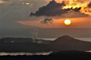
Photos : Franco Vera ( 02/2019) , Auteur Inconnu ( 04/2016).
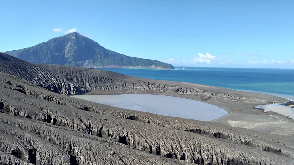
Indonesia , Anak Krakatau :
VOLCANO OBSERVATORY NOTICE FOR AVIATION – VONA.
Issued: May 10 , 2019
Volcano: Anak Krakatau (262000)
Current Aviation Colour Code: ORANGE
Previous Aviation Colour Code: orange
Source: Anak Krakatau Volcano Observatory
Notice Number: 2019KRA75
Volcano Location: S 06 deg 06 min 07 sec E 105 deg 25 min 23 sec
Area: Lampung, Indonesia
Summit Elevation: 502 FT (157 M)
Volcanic Activity Summary:
Eruption with volcanic ash cloud at 22h55 UTC (05h55 local).
Volcanic Cloud Height:
Ash-cloud is not visible
Other Volcanic Cloud Information:
0
Remarks:
Eruption recorded on seismogram with maximum amplitude 45 mm and duration 98 second.
Information on the eruption of G. Anak Krakatau, May 10, 2019.
There was an eruption of Mount Anak Krakatau, Lampung on May 10, 2019 at 12:54 WIB, but the height of the ash column was not observed. This eruption is recorded on a seismogram of maximum amplitude of 54 mm and a duration of ± 13 minutes 6 seconds.
There was no thud.
Currently, G. Anak Krakatau is at level II (Waspada) with recommendations:
People / tourists are not allowed to approach the crater within 2 km.
Source : Magma Indonésie , PVMBG.
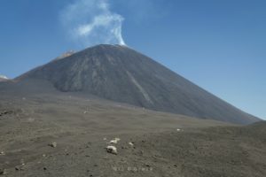
Photo : Yohannes Tyas Galih Jati. ( Mai 2019).
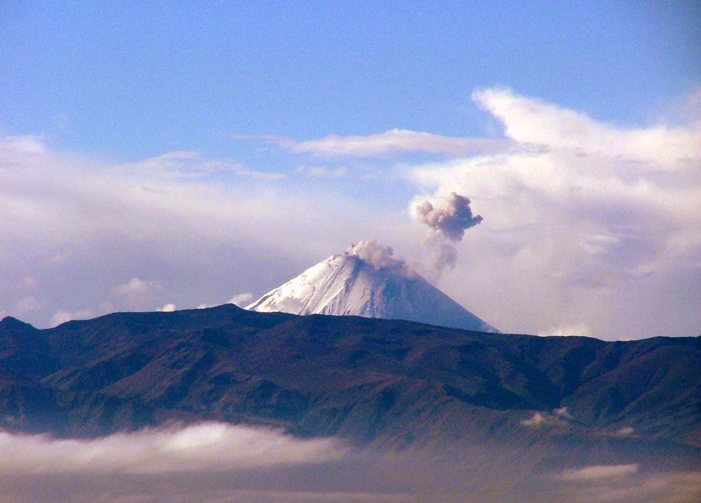
Ecuador , Sangay :
Special Report on the Sangay Volcano N ° 2 – 2019, 10 May 2019.
New activity pulse
Summary :
In the morning, the Sangay volcano, in the province of Morona-Santiago, presented the evidence of a new impulse of activity that could mark the beginning of a new eruptive phase. On the morning of May 10, 2019, new signs of Sangay volcano activity were observed in the visible GOES16 satellite imagery and in the thermal warnings of NASA’s FIRMS system. The Washington Volcanic Ash Advisory Center (VAAC) has not released any ash alert reports. The seismicity recorded on the volcano confirms the presence of activity. Slight ash falls could possibly occur around the volcano, but west of it, this activity could be very dangerous for people near its craters and the summit.
On March 26, 2019, the last impulse of activity on this volcano was also recorded by satellite sensors (Special Report 2019 N ° 1), which was short-lived, unlike the eruptive phase of 2018, which lasted 4 months, from 8 August to 7 December (Special Report 2018 N ° 3).
Satellite Observations:
On the FIRMS system, four thermal warnings were observed at 6:24 UTC (1:24 ECU) (Fig. 1 – a). In a GOES16 satellite image, a westbound emission column (Fig. 1-b) was observed. The column was detected by the satellite at 12:00 UTC (07:00 local time).

Figure 1. Left (a): Four zones with FIRMS thermal alerts (May 10, 2019) at 1:24 local time (TL) around the summit of Sangay volcano. Right (b): Image of the GOES16 satellite for the Sangay Volcano area, note the emission of ash in the red polygon.
In the dispersion and ashfall simulation carried out by the EPN IG with the Ash3D model of the USGS, corresponding to the current day, with a hypothetical height of 1.4 km, it can be noted that the preferential direction of the deposit of Ashes is oriented towards the west, suggesting that light ash falls could occur to the west of the volcano, in communities such as: Inga Corral, Llucshi, Bocatoma, Pancún, Pueblo Viejo, Chaupi Calpa, Samborondón, and others in this area. Being a relatively weak emission, it is expected that it will not affect other populations further away from the volcano. The largest falls will be confined to the periphery of the volcano and other uninhabited areas (Fig. 2).
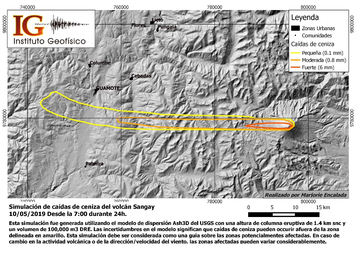
Figure 2. Ash column dispersion simulation reported by Washington VAAC (https://www.ssd.noaa.gov/VAAC/messages.html), using USGS Ash3D software, Source: IG EPN / 2019
Seismic / acoustic activity:
During the morning, 2 seismic events were recorded on the Sangay volcano, at 5h28,21h and 16h16h10 GMT; these events were located on the south and west sides of the volcano, at depths between 3.5 and 9 km below the crater, with respective magnitudes of 2.0 Mlv, which could correspond to explosive activity (Figure 3) .
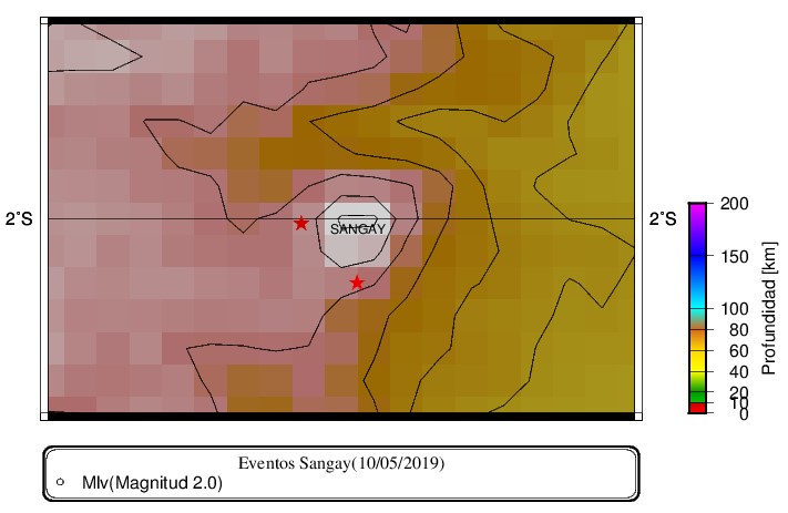
Figure 3. Events located on the Sangay Volcano (red stars).
Figure 4 shows the waveform and spectrum of the event recorded at 0528 GMT, in some of the stations near the Sangay Volcano. In the BPAT station, the spectral content corresponds to a low frequency event.
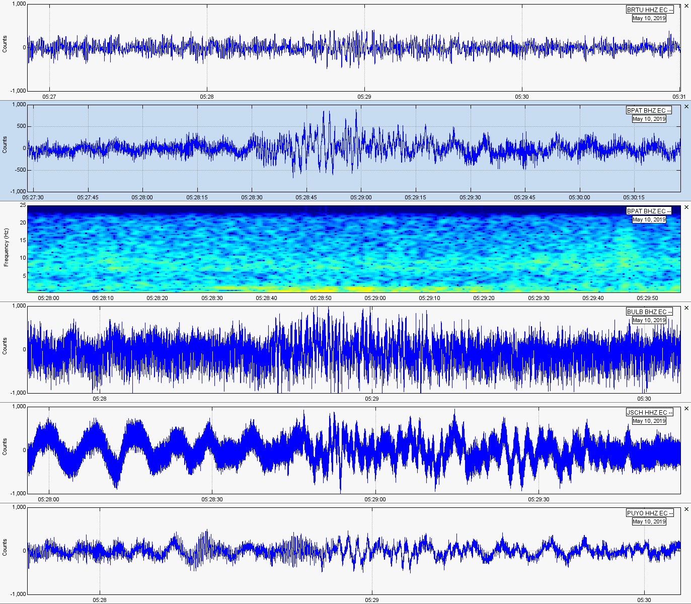
Figure 4. Seismic Stations, Event 05: 28 GMT, Sangay Volcano.
Interpretation:
According to the data available to date, the volcano has presented a new impulse of activity. As was the case on other occasions, this activity could mark the beginning of a new eruptive phase, as in March 2018. The Institute of Geophysics recommends that people who frequent the areas of the upper flanks of the volcano avoid to approach the craters and the top of the volcano, especially it is recommended NOT to climb for any reason to the crater or the flanks located in the upper part of the volcano. If this activity continues, we will continue to communicate on its development.
Source : MA, PR, ME, GV, MR , Institut de géophysique , Ecole Polytechnique Nationale .
Photo : Boriss Andean , Aout 2010 , Summitpost .