February 19 , 2019.
La Réunion , Piton de la Fournaise :
Activity Bulletin from Monday, February 18, 2019 to 2:15 pm (local time).
The eruption started on February 18, 2019 at 9:48 am local time continues (Figure 1).
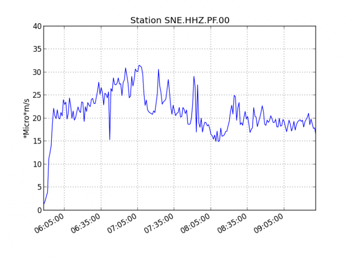
Figure 1: Evolution of the RSAM (indicator of the volcanic tremor and the intensity of the eruption) between 09h48 (05h48 UTC) and 13h30 (9h30 UTC) on 18 February on the seismic station of SNE. (© OVPF / IPGP) (OVPF / IPGP)
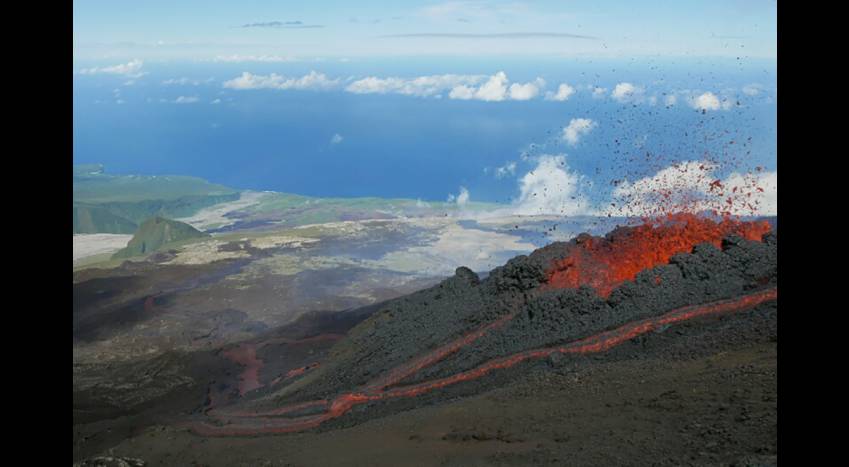
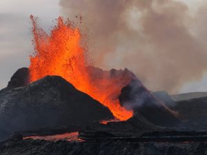
Following a reconnaissance this morning (around 11:30), the eruptive site could be confirmed. At least two eruptive fissures opened on the eastern slope of Dolomieu Crater. The bad weather conditions did not allow to see the presence of other vents especially at higher altitude. Fountains of lava (at least ten to 11:30 spread over the two cracks) less than 30m high and lava flow well active escaped these two cracks. The front of the longest flow was already after an hour of eruption at 1900m altitude. This rapid spread of the flanks is related to steep slopes in this area.
Activity Bulletin from Monday, February 18, 2019 at 16:30 (local time).
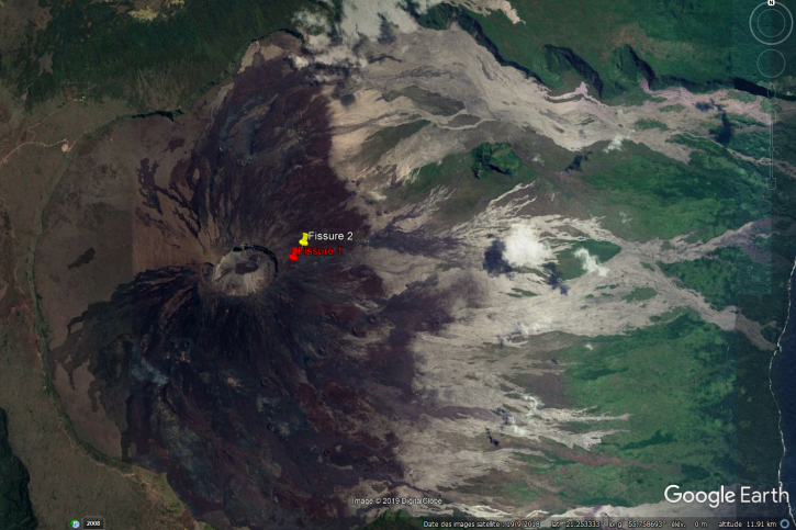
The eruption started on February 18, 2019 at 9:48 am local time continues (Figure 1), with a slight decrease in tremor intensity observed since 14:45 local time (10:45 UTC). This decrease in tremor may be due to a drop in activity on one or other of the two cracks (see location in Figure 2). Field reconnaissance is scheduled tomorrow if weather conditions permit.
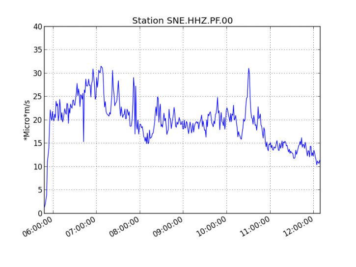 Figure 1: Evolution of the RSAM (indicator of the volcanic tremor and the intensity of the eruption) between 09h48 (05h48 UTC) and 16h15 (12h15 UTC) on 18 February on the seismic station of SNE. (© OVPF / IPGP)
Figure 2: Location of the two eruptive fissures that opened on the outer flank of the Dolomieu crater this morning at 9:48 am local time. (GoogleEarth Background). The location of crack 1 is approximate because of the bad weather conditions prevailing this morning on this sector during the aerial reconnaissance.
Surface flows estimated from the satellite data, via the MIROVA platform (University of Turin) and HOTVOLC (OPGC – University of Auvergne), were included at the beginning of eruption between 25 and 40 m3 / s, values classically observed in beginning of eruption at Piton de la Fournaise.
Alert level: Alert 2-2.
Activity Bulletin from Tuesday, February 19, 2019 to 03:00 (local time).
The eruption started on 18/02/2019 at 09:48 local time stopped on 18/02/2019 at 22:00 local time.
Flows remains nevertheless visible, but these will gradually cool down with the end of their feeding by the eruption.
No assumptions are made about the evolution of the future situation (definitive shutdown, resumption of activity on the same site, resumption of activity further downstream), given the persistence of seismicity.
End of eruption.
Source : OVPF
Photo : FMA / Clicanoo
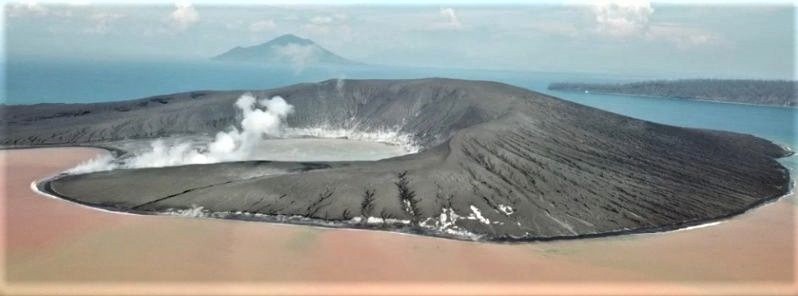
Indonesia , Anak Krakatau :
Information about the eruption of the Anak Krakatau volcano.
Mount Anak Krakatau, Lampung, was erupted on February 18, 2019 at 14:02 WIB. The height of the ash column was observed at ± 500 m above the summit (± 610 m above sea level). It is observed that the column of ash is white / gray with a thick intensity, oriented towards the South and the South-West. This eruption is recorded on a seismogram of maximum amplitude of 22 mm and a duration of ± 2 minutes 28 seconds.
There was no dull noise
Currently, G. Anak Krakatau is at Level III (SIAGA) with recommendations:
People / tourists are not allowed to approach the crater within 5 km.
Level of activity at level III (SIAGA) since December 27, 2018. The Anak Krakatau volcano (110 m altitude) has increased its volcanic activity since June 18, 2018.
Since yesterday and until this morning, the volcano was clearly visible then covered with fog. Smoke from the main crater was not observed above the peak. The wind was weak in the northwest and east.
The seismographs, February 16, 2019 recorded:
1 earthquake emission
17 deep volcanic earthquakes
Tremor continuous amplitude 1 – 12 mm, dominant value 1 mm.
Source : PVMBG.
Photo : EarthuncutTV
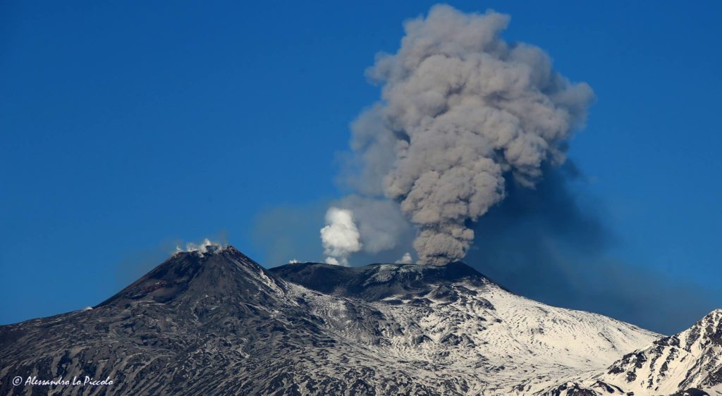
Italy / Sicily , Etna :
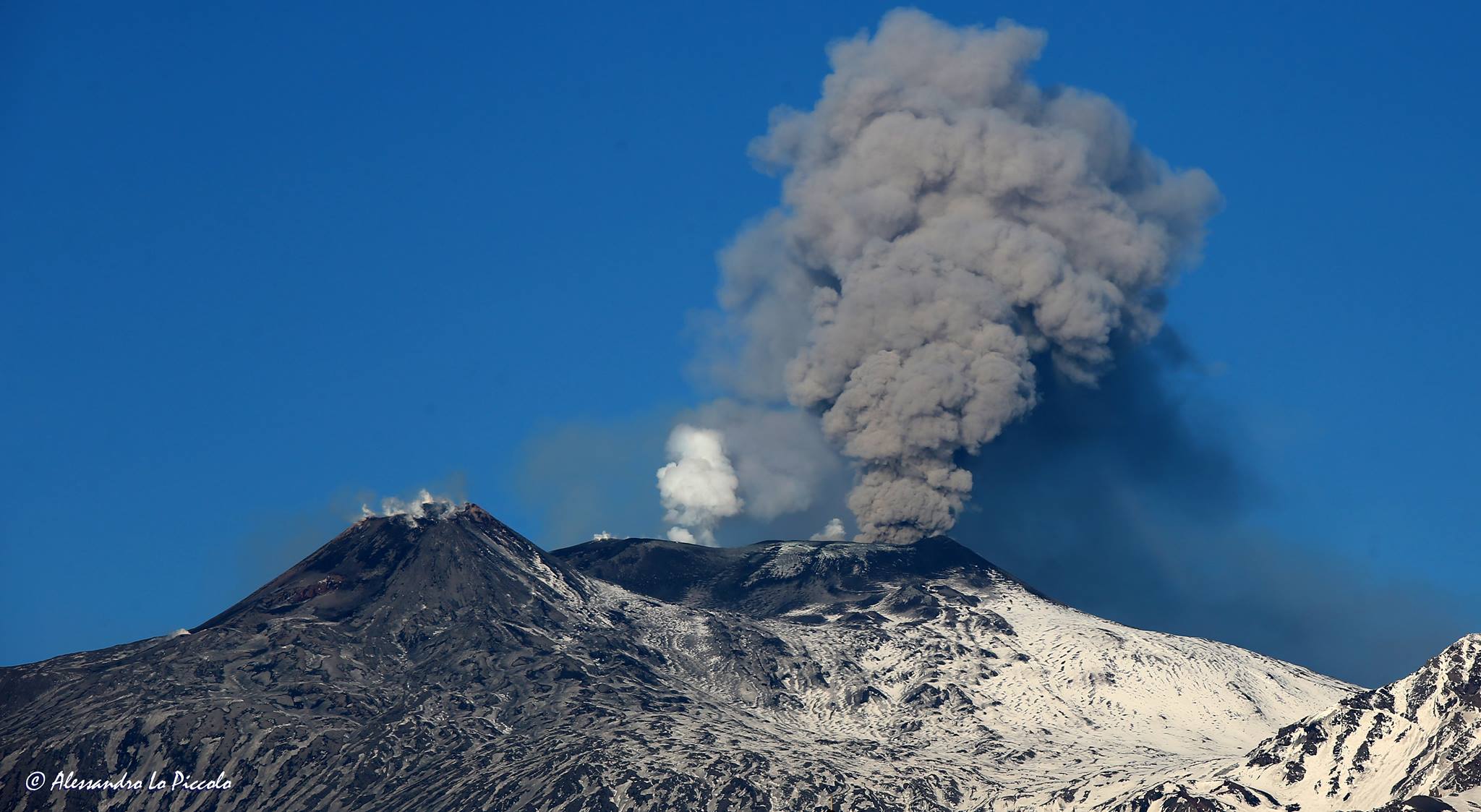
The very favorable weather conditions – excellent visibility and little wind – allow us to see in a spectacular way these ash emissions from the crater North-East of Etna. This allows many people to take beautiful pictures and sometimes even, apparently, impressive, which circulate on social networks, then in the media, sometimes with comments such as « here is the new eruption of Etna », that they translate into alarming messages.
In fact, this is not a new eruption, but intermittent ash emissions – almost exclusively old materials derived from central ducts – that have been occurring since the beginning of January 2019. Although it is true that Etna is, of course, as always, in preparation for its next eruption, we are not there yet, and most importantly, this activity gives us no information on seismic risk, which is different, and in all the cases for us in Sicily are permanent.
The biggest problem with these ash emissions is that they have put a strain on the staff of INGGV-Osservatorio Etneo, as they pose a potential danger to aircraft in the region. We must therefore change every day, sometimes even every few hours, the state of alert for aeronautics (through press releases « VONA »). So since last Thursday, February 14, we have already published three times the red VONA code (warning that ash is abundant in the atmosphere), to return each time after a few hours to the orange level … and we become crazy.
Source : Dr Boris Behncke.
Photo : Alessandro Lo Piccolo .
Peru , Sabancaya / Misti :
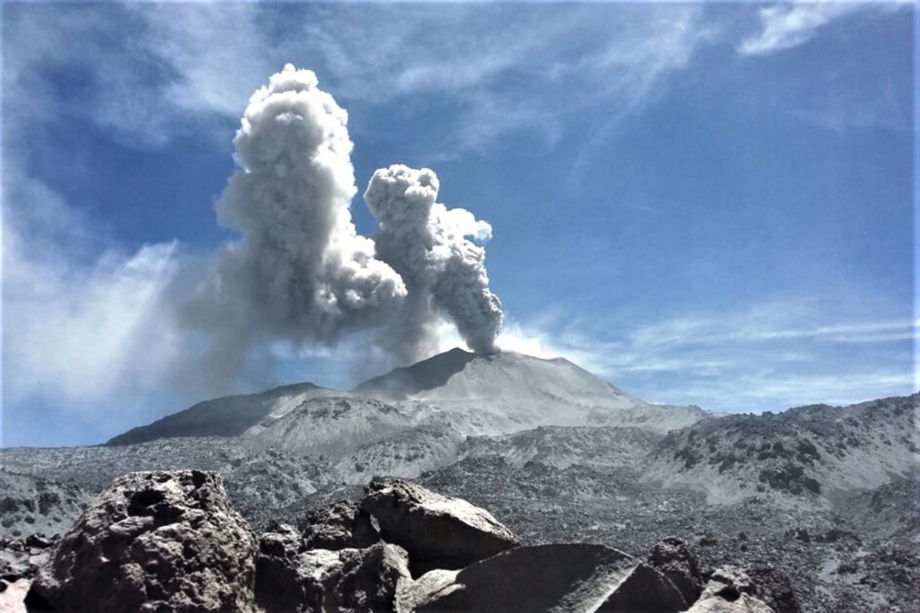
Sabancaya Volcano:
An average of 23 explosions / day was recorded. The activity associated with the movement of fluids (type of long-lived earthquakes) continues to predominate. On the other hand, the earthquakes associated with the rise of the magma (hybrid types) remain very few and not very energetic.
The columns of gas and eruptive ash reached a maximum height of 3,000 m above the crater, determined despite the low visibility in the region. The dispersion of these materials occurred within a radius of about 40 km, mainly in the northwest and southwest direction.
No significant deformation was observed (recorded in the nearest station of the volcanic cone: SBSE).
Two thermal anomalies were recorded according to the MIROVA system, with values between 4 and 7 MW VRP (Radiated Volcano Energy).
In general, eruptive activity maintains moderate levels. No significant changes are expected in the coming days.
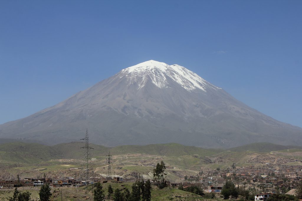
Misti Volcano:
Yesterday afternoon, the Geophysical Institute of Peru (IGP) issued a warning of descent of lahar from the volcano Misti, which descended along the northwest flank of the massif to the bed of the river Chile, far from populated areas . The Volcanoes National Monitoring Center, based in Arequipa, recorded the start of this event at 15:00, which lasted until 15:30. about.
Immediately, the IGP generated an alert that was broadcast via the mobile application « Volcanoes Peru ». SEDAPAR confirmed that the lahar was descended through the Matagente ravine, in the Charcani Grande area, which led to the temporary closure of the water catchment valves to avoid damaging the infrastructure.
The lahar that took place yesterday is a sign of the dangers facing the city of Arequipa during the rainy season. « There is a series of streams that are born on the Misti volcano and cross the city, remembering that the population exposed to these recurring risks is about 250 000 inhabitants, the same on the south and south-west flanks. Misti, in the districts of Chiguata, Paucarpata, Mariano Melgar, Miraflores and Alto Selva Alegre « , details Dr. Hernando Tavera, executive president of the IGP.
Source : IGP
Photos : Ingemmet.
El Salvador , San Miguel , ( Chaparrastique ) :
Special report 3. Decrease in the activity of the Chaparrastique volcano.
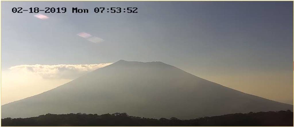
The Chaparrastique volcano exhibited a decrease in seismic amplitude and gas emission values. This indicates that the movement of gases within the volcanic system has decreased considerably (Figure 1).
Figure 1. No plume of gas is observed in the crater of the volcano. And there are only weather clouds in the vicinity
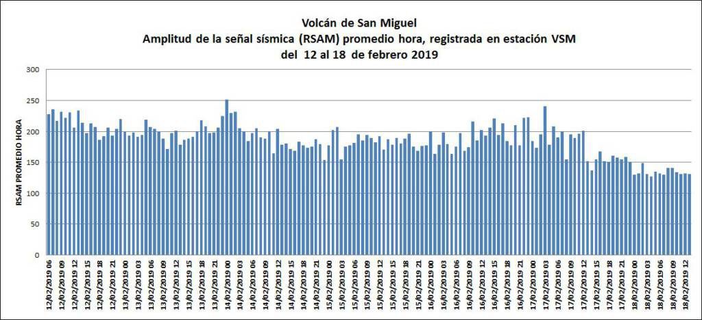
The RSAM values shown in Figure 2 tend to decrease, indicating that the internal system of the volcano is relaxing and can reach equilibrium. However, and depending on the behavior of the volcano, it is not excluded that a new period of increase in seismic activity occurs.
Figure 2. The behavior of volcano seismicity tends to decrease.
The local observers network (ROL) of the volcanic area reports a significant decrease in gas emissions.
Analysis of the current situation suggests that the volcano exhibits a decrease in seismic activity (RSAM) and gas emission, due to the fact that the system tends to reach equilibrium. However, as it has shown at earlier dates, this volcano may exhibit a sudden change in seismic activity, which would be an indicator of a process of depressurization and relaxation of the volcanic system. This situation could lead to higher energy eruptive activity. The most likely scenario therefore remains the generation of gas and ash which, depending on their height and wind direction, could affect the municipalities of San Rafael Oriente, San Jorge and Chinameca.
MARN continues the systematic monitoring of the volcano and maintains close relations with the Directorate General of Civil Protection and with the members of the local observer network. It also calls on people, tourists and mountaineers to stay away from the crater as the volcano undergoes sudden changes in its activity and could emit ashes and gases.
This is the last special report of the series initiated on February 12, 2019, during which the volcano has maintained a significant degassing and tends to decrease in recent days.
If new changes are detected that indicate an increase in activity, it will be informed in due course.
Source: MARN.
Indonesia , Bromo :
VOLCANO OBSERVATORY NOTICE FOR AVIATION – VONA.
Issued: February 19 , 2019
Volcano: Bromo (263310)
Current Aviation Colour Code: ORANGE
Previous Aviation Colour Code: unassigned
Source: Bromo Volcano Observatory
Notice Number: 2019BRO01
Volcano Location: S 07 deg 56 min 31 sec E 112 deg 57 min 00 sec
Area: East java, Indonesia
Summit Elevation: 7453 FT (2329 M)
Volcanic Activity Summary:
Eruption with volcanic ash cloud at 23:00 UTC (06:00 local). Eruption and ash emission is continuing.
Volcanic Cloud Height:
Best estimate of ash-cloud top is around 9373 FT (2929 M) above sea level, may be higher than what can be observed clearly. Source of height data: ground observer.
Other Volcanic Cloud Information:
Thick white and brown Ash-cloud moving to west-south west
Remarks:
Seismic activity is characterized by continuous volcanic tremor.
TIMESINDONESIA, PROBOLINGGO – Mount Bromo in the regency of Probolinggo, East Java, erupted. Although the impact of volcanic ash has still not affected flights, warnings are being issued on the status of Bromo.
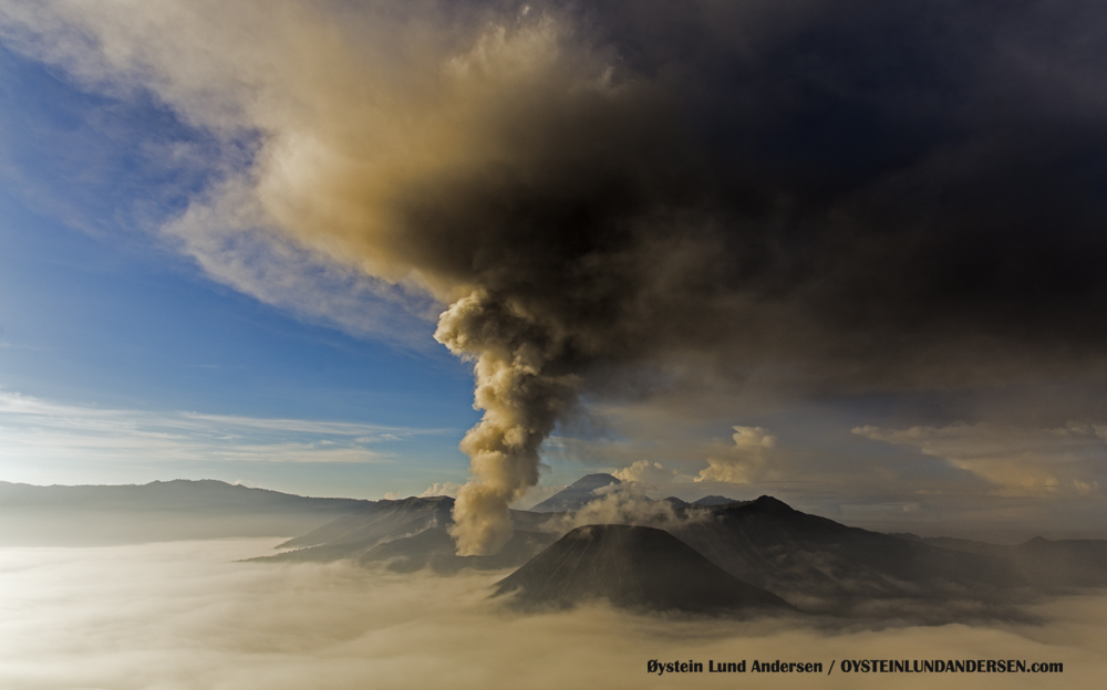
According to reports, an eruption was detected on Tuesday (19/02/2019), around 6:00 WIB. The column of smoke reaches 700 meters above the summit of the mountain and reaches 2,329 m. A light gray / brownish color is observed.
Teguh Tri Susanto, Head of Information and Data for BMKG Juanda, said today the information provided by the Darwin Volcanic Ash Advisory Center (VAAC) does not yet detect volcanic ash distribution. .
« But stay alert for flights, » Teguh said.
At the same time, the direction of the surface wind up to an altitude of 10,000 meters tends to move east of Bromo. The eastern region of Bromo must therefore be the subject of increased awareness. Such as Lumajang and Jember. Because currently, the direction of the wind is always influenced by the west wind.
The BMKG continues to monitor.
Around Bromo, the nearest airport is that of Abdulrachman Saleh in the regency of Malang.
Source : Magma Indonesia , TIMESINDONESIA.
Photo : Oystein Lund Andersen.

