January 19 , 2019.
Indonesia , Agung :
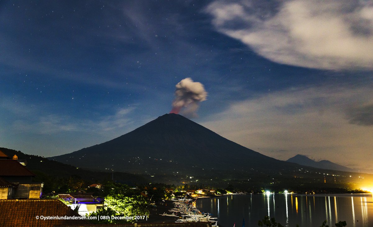
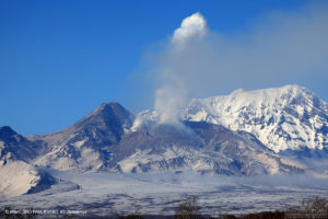
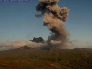
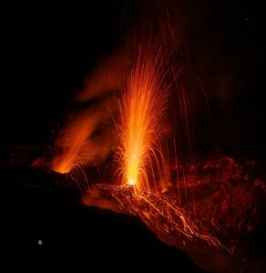
G. Agung was erupted on January 19, 2019 at 02:45 WITA, but the height of the ash column was not observed. This eruption is recorded on a seismogram of maximum amplitude of 23 mm and a duration of ± 2 minutes 8 seconds. The column of ash from eruption was not observed because it was covered with fog.
Currently, G. Agung is at Level III (SIAGA) with these recommendations:
(1) The communities around Mount Agung and mountaineers / visitors / tourists must not climb and have no activity in the estimated danger zone, ie in all areas within 4 km radius of Mount Crater. Agung. The estimated danger zone is dynamic and continues to be evaluated. It can be modified at any time to follow the most recent observation data from G. Agung.
(2) Communities that reside and move around rivers flowing from Gunung Agung must take into account the potential secondary threat of lahar descents that may occur especially during the rainy season and if eruptive material is still exposed in the peak zone The area impacted by the lahars descents follows the rivers upstream of Mount Agung.
VOLCANO OBSERVATORY NOTICE FOR AVIATION – VONA.
Issued: January 18 , 2019 .
Volcano: Agung (264020)
Current Aviation Colour Code: ORANGE
Previous Aviation Colour Code: orange
Source: Agung Volcano Observatory
Notice Number: 2019AGU02
Volcano Location: S 08 deg 20 min 31 sec E 115 deg 30 min 29 sec
Area: Bali, Indonesia
Summit Elevation: 10054 FT (3142 M)
Volcanic Activity Summary:
Eruption with volcanic ash cloud at 18h45 UTC (02h45 local)
Volcanic Cloud Height:
No Ash Cloud Produced.
Other Volcanic Cloud Information:
Ash cloud cannot be observed
Remarks:
Seismic activity recorded with maximum amplitude 23 mm and maximum duration 128 second
Source : PVMBG , Magma Indonesia.
Photo : Oystein Lund Andersen ( 12/2017).
Video : CCTV
Indonesia , Kerinci :
VOLCANO OBSERVATORY NOTICE FOR AVIATION – VONA.
Issued: January 19 , 2019.
Volcano: Kerinci (261170)
Current Aviation Colour Code: ORANGE
Previous Aviation Colour Code: unassigned
Source: Kerinci Volcano Observatory
Notice Number: 2019KER01
Volcano Location: S 01 deg 41 min 49 sec E 101 deg 15 min 50 sec
Area: Jambi, West Sumatra, Indonesia
Summit Elevation: 12176 FT (3805 M)
Volcanic Activity Summary:
ash cloud at 00h34 UTC (07h34 local).
Volcanic Cloud Height:
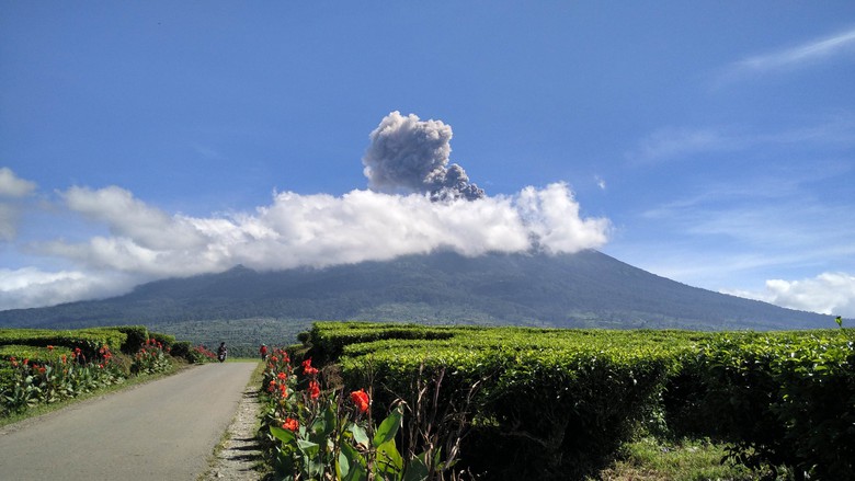
Best estimate of ash-cloud top is around 12816 FT (4005 M) above sea level, may be higher than what can be observed clearly. Source of height data: ground observer.
Other Volcanic Cloud Information:
Ash-cloud moving to east-southeast
Remarks:
Seismic activity is characterized by continuous volcanic microtremor.
The 3800-m-high Gunung Kerinci in central Sumatra forms Indonesia’s highest volcano and is one of the most active in Sumatra. Kerinci is capped by an unvegetated young summit cone that was constructed NE of an older crater remnant. The volcano contains a deep 600-m-wide summit crater often partially filled by a small crater lake that lies on the NE crater floor, opposite the SW-rim summit of Kerinci. The massive 13 x 25 km wide volcano towers 2400-3300 m above surrounding plains and is elongated in a N-S direction. The frequently active Gunung Kerinci has been the source of numerous moderate explosive eruptions since its first recorded eruption in 1838.
This volcano is located within the Tropical Rainforest Heritage of Sumatra, a UNESCO World Heritage property.
Source : Magma Indonesia . GVP.
Photo : News Detik .com
El Salvador , San Miguel ( Chaparrastique) :
Special Report 12. The activity of the Chaparrastique volcano balances its internal system.
The stability of the data obtained thanks to the monitoring with which the activity of the Chaparrastique volcano is monitored indicates that the internal system of the volcano is in equilibrium. Small variations have been observed, but for the moment are at stability thresholds.
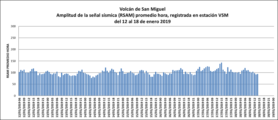
Beginning on Friday, January 11, 2019, recorded seismic amplitude data are stable, indicating that the volcano’s internal system is relaxed and in equilibrium. In the past 24 hours, seismic vibration (RSAM) values have fluctuated between 92 and 143 units, in average hours (Figure 1).
Figure 1. The behavior of seismicity of the volcano remained stable.
The flux of sulfur dioxide emitted by the volcano fluctuated during the month of January 2019 between 214 and 514 tons per day, values considered as normal in the open system of an active volcano.
The images captured by the surveillance camera located on the Pacayal volcano do not show the emission of gas pulses. It is sometimes possible to observe the emanation of vapors and very diffuse gases which disperse rapidly. Typical of the time of year, the volcano maintains a white plume on its crater due to the presence of clouds. The local observers network in the region reported this situation (Figure 2).
Figure 2. The emission of gas is almost imperceptible in the volcano.
Analysis of the current situation suggests that the volcano’s internal system is momentarily in equilibrium, which is reflected in the stability of the monitoring data collected.
Since the Chaparrastique volcano is an active system, changes are frequently detected. The stability that the volcano presents for the time being could change in the future, which is why the MARN continues to monitor the volcano in a systematic way and maintains close communication with the Directorate General of Civil Protection and local observers. In the same way, a call is made to the inhabitants and to the general public so that they stay away from the crater because the volcano can present sudden changes in its activity.
This is the last special report of the series that began on December 24, 2018, during which the volcano released ash and maintained a significant degassing that has decreased until reaching equilibrium in recent days.
If new changes indicating an increase in activity are detected, they will be reported promptly.
Source : Marn .
Spain, Tenerife :
Manual revision of INVOLCAN on the earthquake recorded by the Canary Seismic Network (C7) between Tenerife and Gran Canaria at 06:36:51 today, January 18, 2019. Confirmation that it was of magnitude M 4.4 with a depth of 5 kilometers. The earthquake was also recorded by the existing seismic stations on the island of Madeira.
Earthquake of magnitude 4.4 occurring between Tenerife and Gran Canaria in one of the seismic stations located in Madeira
The tectonic activity related to the fault between Tenerife and Gran Canaria is the most likely cause of this earthquake. Remember that earthquakes of this magnitude were recently recorded between Tenerife and Gran Canaria, a magnitude of M5.2 having occurred on May 9, 1989; therefore, it is normal to record them now and in the future.
The large triangular island of Tenerife is composed of a complex of overlapping Miocene-to-Quaternary stratovolcanoes that have remained active into historical time. The NE-trending Cordillera Dorsal volcanic massif joins the Las Cañadas volcano on the SW side of Tenerife with older volcanoes, creating the largest volcanic complex of the Canary Islands.
Controversy surrounds the formation of the dramatic 10 x 17 km Las Cañadas caldera, which is partially filled by Teide stratovolcano, the highest peak in the Atlantic Ocean. The origin of the caldera has been variably considered to be due to collapse following multiple major explosive eruptions or as a result of a massive landslide (in a manner similar to the earlier formation of the massive La Orotava and Guimar valleys), or a combination of the two processes. The most recent stage of activity beginning in the late Pleistocene included the construction of the Pico Viejo and Teide edifices. Tenerife was perhaps observed in eruption by Christopher Columbus, and several flank vents on the Canary Island’s most active volcano have been active during historical time.
This volcano is located within the Teide National Park, a UNESCO World Heritage property.
Sources : Involcan , GVP.
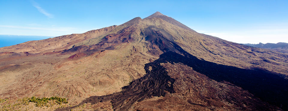
Photo : webtenerifefr.com

