November 26 , 2018.
Chile , Nevados de Chillan :
Volcanic Activity Report (RAV), Volcanological Observatory of the Southern Andes – Ovdas, 24 November 2018 16:00 HL.
Current alert level: ORANGE
Volcanic monitoring:
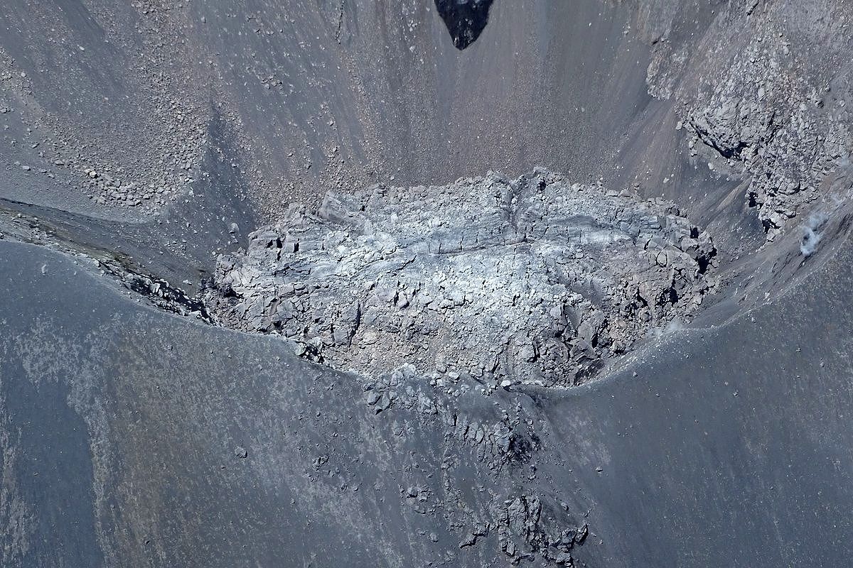
Seismic activity: During the last 24 hours, the monitoring network of the Nevados de Chillan volcanic complex continues to record long-period seismicity (LP) and tremor episodes, with seismic energy remaining at moderate rank . An increase in volcano tectonic (VT) events is observed. LP and TR seismicity are related to the occurrence of explosions that drive surface activity and are associated with the variation between growth and partial destruction of the dome. of viscous lava in the active crater.
A major explosion was recorded at 21:15 on November 24 and was associated with a 1 Pa acoustic signal reduced to 1 km as a reference.
Observations:
Since the crater Nicador, it has been recorded pulsatile emissions mainly white color, with predominance of water vapor.
Other observations:
⦁ No thermal radiation was reported according to the information processed by the MIROVA group.
Danger.
Exposure / Specific risks:
For 11 months, the observations show that the dacitic dome maintains an almost constant extrusion phase at about 0.004 m3 / s in recent times, considered low value. Under these conditions, if a major explosive event occurs and produces the destruction of the dome, the overall statistics indicate that in 64% of cases, the location of the dome will be associated with an explosion of moderate to low explosivity (IEV = 0 to 2)
These facts establish that, given current conditions, the most likely scenario is the generation of sporadic minor eruptive impulses (columns with an elevation not exceeding 5 km) associated with explosions of gas, particles and pyroclastic projections. ballistic whose range fluctuates around 2 or 3 km around the active crater. Similarly, it is likely that the lava dome may extend beyond the active crater, forming a viscous lava flowing towards the north-northeast. It will eventually be sensitive to gravity collapses, generating high-speed heat flows known as pyroclastic flows, with blocks and ashes, which could affect Gato and Las Minas, who in turn could trigger lahares. in the tributaries of the Nubian River.
In addition, it was considered with a lower probability, a moderate explosive eruptive phase (IEV = 3 to 4) associated with partial or total destruction of the lava dome nestled in the active crater … / …
Conclusion
The behavior of the Nevados de Chillan volcanic complex continues to evolve as a result of a minor eruption related to the growth and partial destruction of a lava dome tucked into the active crater « Nicanor », whose internal dynamics lead to activity. explosive hot gases and pulsatile releases, ballistic particles around the crater, while maintaining the production of long – period type seismic events and tremors, in ranges of energy considered moderate for this process. This process could generate a major eruptive event without showing clear precursors.
…/…
Read the full report : http://sitiohistorico.sernageomin.cl/reportesVolcanes/20181125045352420RAV_Ñuble_noviembre_2018_N°80.pdf
Source : Sernageomin.
France / Guadeloupe , La Soufrière :
Sunday, November 25, 2018 at 3:00 pm date: 2018-11-24 / 2018-11-25
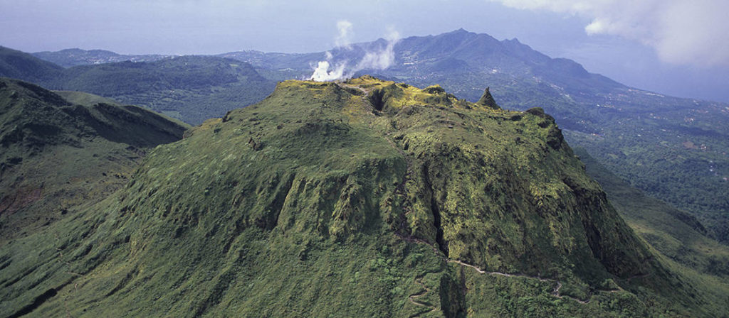
Sequence of earthquakes in La Soufrière area of Guadeloupe – Basse Terre
The sequence of volcanic earthquakes that began November 23, 2018 at 21:16 local time (24 November 01h16 UT * universal time) in the La Soufrière volcano area, continues with the recording of 177 earthquakes since its Inception.
Earthquakes are of very low magnitude (M <1). No earthquake was reported as felt. The events are located at a depth of <2.5 km under the summit of the dome of La Soufrière.
The alert level remains: yellow, vigilance.
Source : Direction de l’OVSG-IPGP .
Photo : P Giraud / CTIG
Guatemala , Santiaguito :
Activity type: Peléan
Morphology: Complex of dacitic domes
Geographical location: 14 ° 44 ’33 ˝ Latitude N; 91 ° 34’13˝ Longitude O.
Height: 2,500msnm.
Weather : Clear
Wind: East at 6 km / h
Precipitation: 0.8 mm.
Activity:
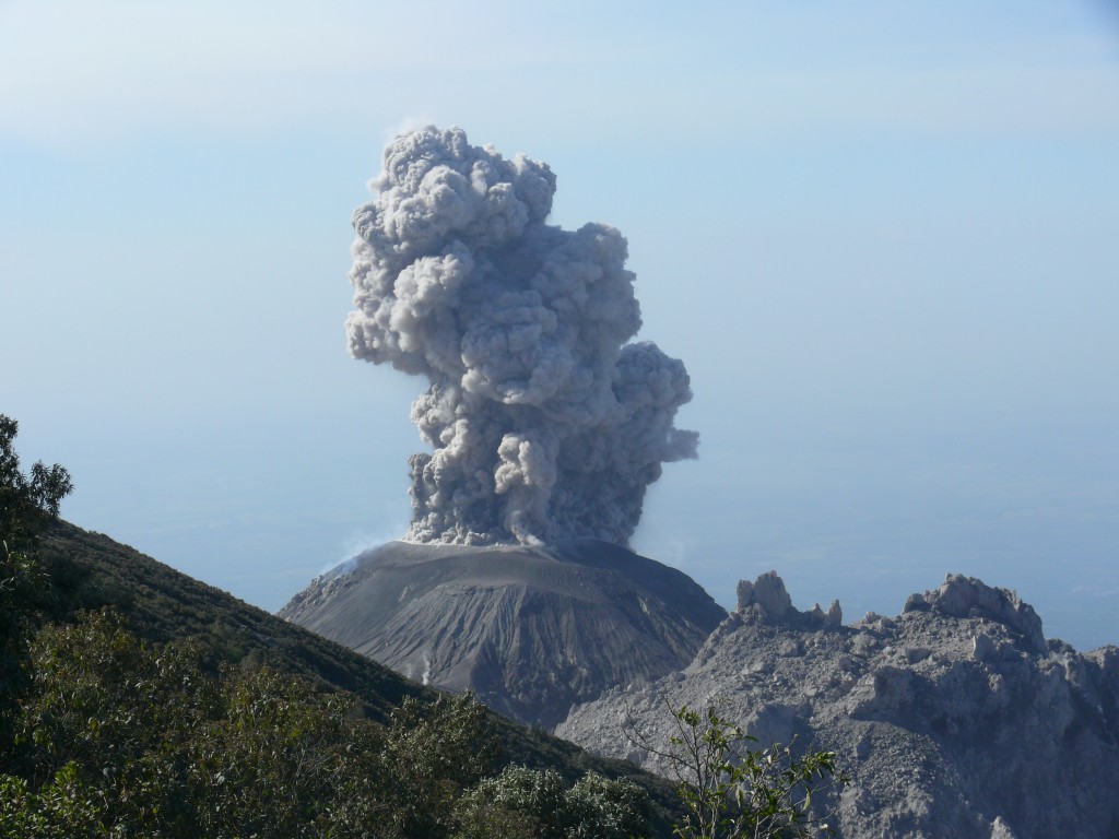
Presence of white degassing fumaroles at an altitude of 2900 meters scattered to the southwest. The seismic stations recorded 11 weak explosions during the last 24 hours raising white ash columns between 3 000 and 3 400 meters of altitude, with a direction of dispersion South-West, according to the direction of the winds. Note ash particles fall in areas of the subdivision of Monte Claro, and to moderate avalanches on the Southeast and Northeast flanks.
Source : Insivumeh.
Philippines , Mayon :
MAYON VOLCANO BULLETIN 26 November 2018 10:15 A.M.
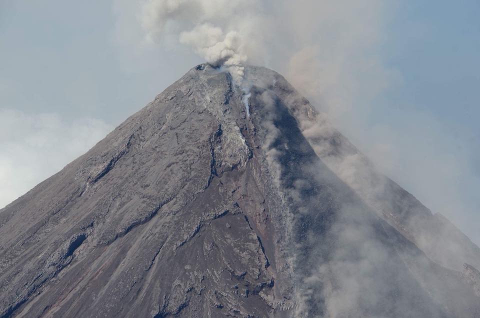
Two (2) phreatic eruption events were observed between 7:59 AM to 8:05 AM today. The events generated grayish to grayish white ash plume that rose 300 to 500 meters above the summit before drifting southwest. Sulfur dioxide (SO2) emission was measured at an average of 1943 tonnes/day on 25 November 2018. Precise leveling data obtained on 22-31 October 2018 indicate inflation of the edifice in the southeast sector while the north sector indicate short-term deflation relative to 30 August to 3 September 2018. The volcano generally remains inflated relative to 2010 baselines. Electronic tilt data further show pronounced inflation of the mid-slopes beginning 25 June 2018, possibly due to aseismic magma intrusion deep beneath the edifice.
Alert Level 2 currently prevails over Mayon Volcano. This means that Mayon is at a moderate level of unrest. DOST-PHIVOLCS reminds the public that sudden explosions, lava collapses, pyroclastic density currents or PDCs and ashfall can still occur and threaten areas in the upper to middle slopes of Mayon. DOST-PHIVOLCS recommends that entry into the six kilometer-radius Permanent Danger Zone or PDZ and a precautionary seven kilometer-radius Extended Danger Zone or EDZ in the south-southwest to east-northeast sector, stretching from Anoling, Camalig to Sta. Misericordia, Sto. Domingo must be strictly prohibited. People residing close to these danger areas are also advised to observe precautions associated with rockfalls, PDCs and ashfall. Civil aviation authorities must advise pilots to avoid flying close to the volcano’s summit as airborne ash and ballistic fragments from sudden explosions and PDCs may pose hazards to aircrafts
Source : Phivolcs
Photo : Auteur Inconnu.

