November 13 , 2018.
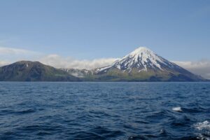
Chile , Osorno :
During this period, 112 seismic events were recorded, of which 109 were classified as long period type (LP) events in relation to fluid dynamics within the volcano and / or glacial dynamics. The larger magnitude event had reduced displacement values (DRC) equal to 6.4 cm2. In addition, it has been classified 3 volcano_tectonic (VT) type events, associated with the fracturing of rigid materials. The event of greatest energy had a local magnitude (ML) equal to M 1.2 and was located 1.3 km north – northwest of the crater at a depth of 4.9 km.
Surveillance camera images did not show any superficial activity when weather conditions allowed observation.
The indications of the electronic inclinometers did not reveal any changes in relation to changes in the internal dynamics of the volcano.
No emissions of sulfur dioxide (SO2) to the atmosphere in the volcano area have been reported, according to data published by the Ozone Monitoring Instrument (OMI) Sulfur Dioxide Group (http: / /so2.gsfc.nasa.gov/) and the National Satellite Environment and Information Data (NESDIS) (http: // satepsanoine nesdis.noaa.gov) ..
No thermal warnings have been reported in the volcano-associated area, according to data processed by Infrared, a means of observing volcanic activity (Mirova) (http://www.mirovaweb.it/) and MODVOLC (http : //modis.higp.hawaii.edu/).
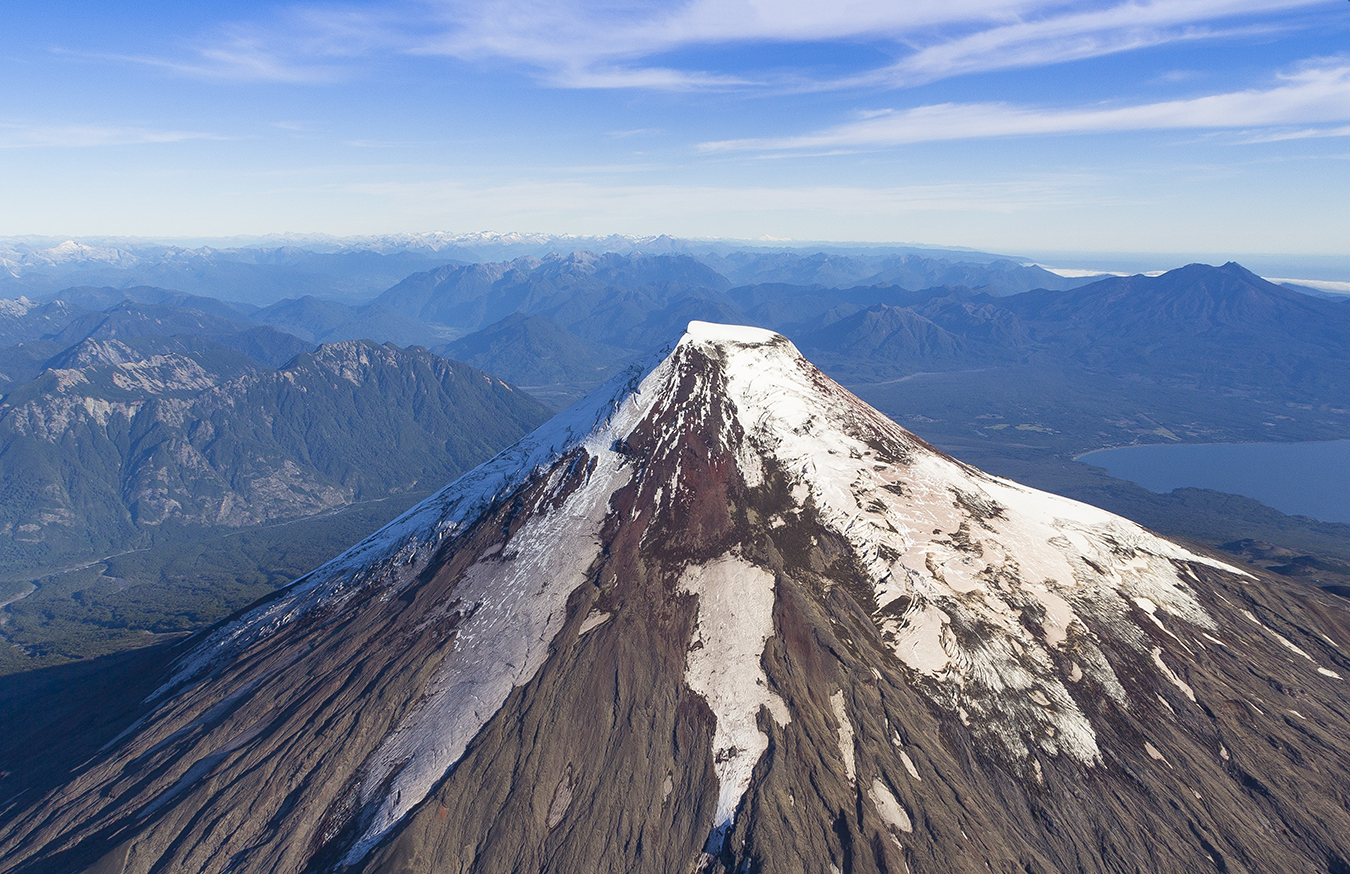
Activity remained at levels considered low, suggesting stable behavior of the volcanic system.
For the above, the volcanic alert is maintained at the level:
GREEN LEVEL: Changes in the behavior of volcanic activity – Probable time for an eruption: WEEKS / MONTH.
Source : Sernageomin.
Photos : Marisa Garrido/marisadechile , noticiasmendoza.com.ar.
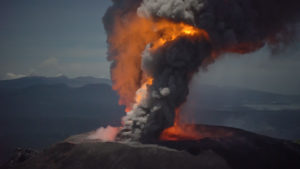
Peru , Sabancaya :
An average of 18 explosions / day was recorded. Earthquakes associated with the rise of magma (hybrid types) remain very few and low energy.
The gas columns and eruptive ash reached a maximum height of 3700 m above the crater. The dispersion of these materials occurred within a radius of about 40 km, mainly in the northwestern, northern and western directions.
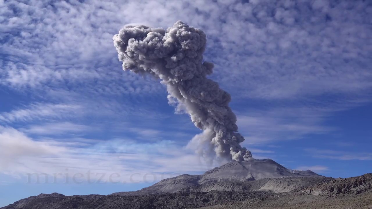
On November 8, the volcanic gas (SO2) flow recorded a maximum value of 2500 tonnes / day, a value considered important.
The deformation of the surface of the volcanic building presented important variations.
The MIROVA satellite system recorded 7 thermal anomalies, with values between 2 and 29 MW VRP (Radiated Volcano Energy).
In general, eruptive activity maintains moderate levels. No significant changes are expected in the coming days.
Source : IGP
Photo : Martin Rietze. ( www.mrietze.com/ )
Montserrat , Soufrière Hills :
The Scientific Advisory Committee (SAC) which annually reviews the Soufriere Hills Volcano met last week on island and according to it’s findings, the volcano remains in a state of unrest.
The following is their preliminary report, released today Monday, November 12, 2018.
“Soufrière Hills volcano has shown no significant changes in its behaviour during the past year. Measurements of sulphur dioxide emission have been carried out by helicopter and the new ground-based spectrometer network, and show a steady outgassing rate. Volcanic gases that escape through fumaroles have remained at a high temperature, as observed in the previous years. Seismicity has remained at a very low level except for occasional short episodes of volcano-tectonic earthquakes. Monitoring of ground deformation indicates a slow but continuous lengthening over the island, with a maximum uplift of about one centimetre over the last year. While this is consistent with the activity we have seen over the previous 7 years, we now begin to see a small reduction in the rate of deformation.
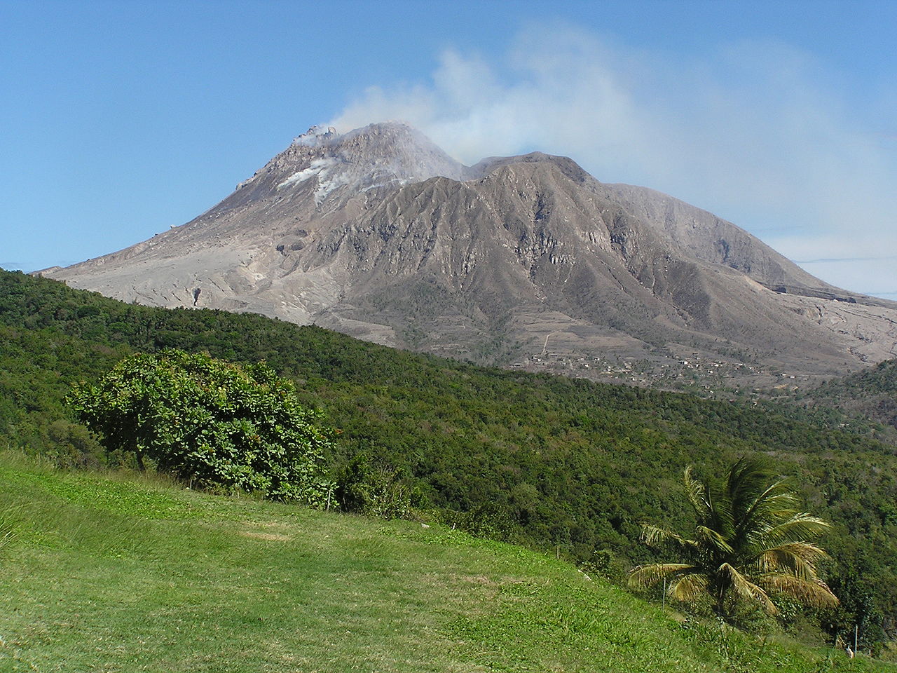
“Taking these observations together, we conclude that the volcano remains in a state of unrest. We consider the most likely cause of this unrest to be a pressurised magma system. While a restart of lava extrusion remains a possibility in the future, there are no signs that this is imminent. We consider that the most likely scenario for the next year is a continuation of the current state.
“The major part of the lava dome remains stable but continuing erosion has the potential to destabilize steep parts of the dome. The chance that pyroclastic flows will occur within the next year remains low. However, the volcano is still a potential source of hazards, some of which could occur at any time with little or no warning and could pose a threat to people working in or visiting certain areas of Zone V.”
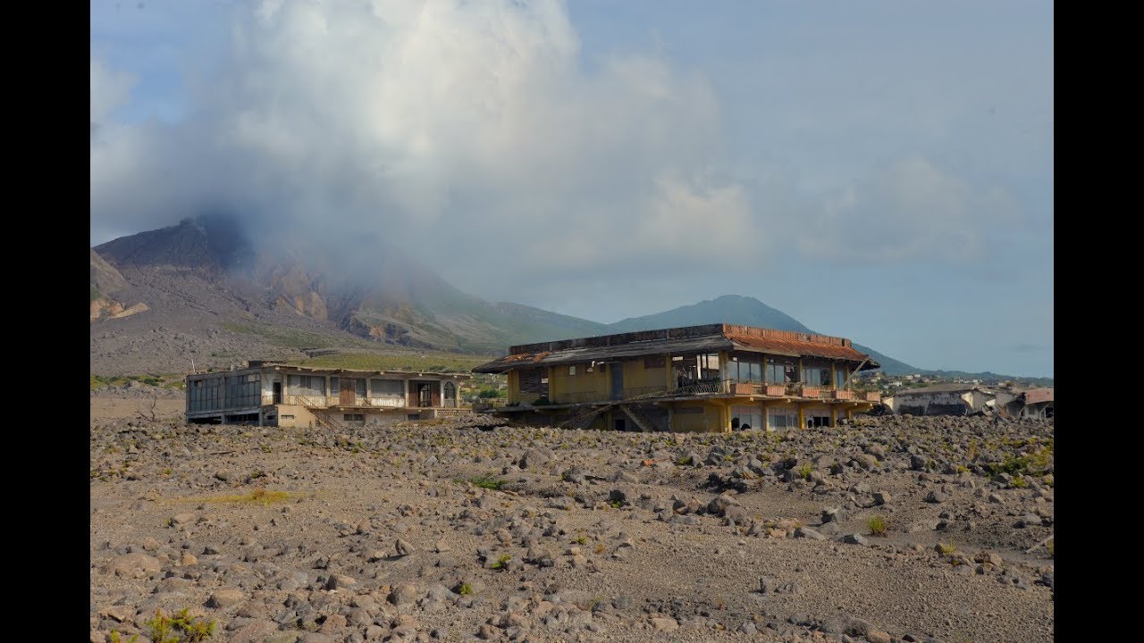
The complex, dominantly andesitic Soufrière Hills volcano occupies the southern half of the island of Montserrat. The summit area consists primarily of a series of lava domes emplaced along an ESE-trending zone. The volcano is flanked by Pleistocene complexes to the north and south. English’s Crater, a 1-km-wide crater breached widely to the east by edifice collapse, was formed about 2000 years ago as a result of the youngest of several collapse events producing submarine debris-avalanche deposits. Block-and-ash flow and surge deposits associated with dome growth predominate in flank deposits, including those from an eruption that likely preceded the 1632 CE settlement of the island, allowing cultivation on recently devegetated land to near the summit. Non-eruptive seismic swarms occurred at 30-year intervals in the 20th century, but no historical eruptions were recorded until 1995. Long-term small-to-moderate ash eruptions beginning in that year were later accompanied by lava-dome growth and pyroclastic flows that forced evacuation of the southern half of the island and ultimately destroyed the capital city of Plymouth, causing major social and economic disruption.
Source : discovermni.com , GVP.
Photos : Wikipédia ( Pas d’auteur ) , BatakLagu.com .
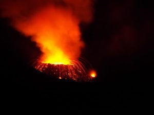
Indonesia , Anak Krakatau :
Level of activity at Level II(WASPADA). G. Anak Krakatau (338 m altitude) has increased its volcanic activity since June 18, 2018.
Since yesterday and until this morning, the volcano was covered with fog. The smoke from the crater was found to be thin, white and 50 m above the summit. An eruption was observed, rising up to 200-700 m above the gray peak. The wind was blowing weakly to the northeast.
Through the seismographs, on November 12, 2018, we recorded:
259 earthquakes of eruption
47 shallow volcanic earthquakes.
8 deep volcanic earthquakes
100 emission earthquakes
A tremor is recorded continuously with an amplitude of 1 – 18 mm (dominant value 3 mm)
Recommendation: People / tourists are not allowed to approach the crater within 2 km

VOLCANO OBSERVATORY NOTICE FOR AVIATION – VONA.
Issued: November 12 , 2018.
Volcano: Anak Krakatau (262000)
Current Aviation Colour Code: ORANGE
Previous Aviation Colour Code: orange
Source: Anak Krakatau Volcano Observatory
Notice Number: 2018KRA66
Volcano Location:
S 06 deg 06 min 07 sec E 105 deg 25 min 23 sec
Area: Lampung, Indonesia
Summit Elevation: 1082 FT (338 M)
Volcanic Activity Summary:
Eruption with ash clouds at 23:36 UTC (06:36 local time). The eruption lasted for 44 seconds. Eruption and ash emission is continuing.
Volcanic Cloud Height:
Best estimate of ash-cloud top is around 2682 FT (838 M) above sea level, may be higher than what can be observed clearly. Source of height data: ground observer.
Other Volcanic Cloud Information:
Ash-cloud moving to east.
Remarks:
Eruption recorded on seismogram with maximum amplitude 57 mm and maximum duration 44 second.
Source : PVMBG , Magma Indonésie .
Photo : Oystein Lund Andersen. ( www.oysteinlundandersen.com/ )