October 27 , 2018.
La Réunion , Piton de la Fournaise :
Activity Bulletin from Thursday, October 25, 2018 at 3:45 pm (local time).
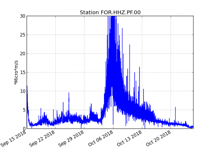
The eruption started on September 15th at 4:25 am local time continues. The intensity of the volcanic tremor (indicator of eruptive intensity at the surface) has stabilized for about 24 hours, at a very low level (Figure 1).
Figure 1: Evolution of the RSAM (indicator of the volcanic tremor and the intensity of the eruption) between 04:00 (00h UTC) September 15 and 15:34 (11:34 UTC) October 25 on the seismic station FOR, located near the crater Château Fort (2000 m altitude on the southeast flank of the terminal cone) (© OVPF / IPGP).
– No volcano-tectonic earthquake was recorded during the day of 24 October or during the current day.
– Inflation (swelling) of the building is always recorded. This inflation reflects the pressurization of a localized source beneath the summit craters (Bory-Dolomieu) at a depth of 1-1.5 km, related to the recharge of the superficial reservoir by deeper magma.
– SO2 emissions from the eruptive vent remain low, close to or even below the detection limit. CO2 emissions from the ground in the area close to the volcano are decreasing.
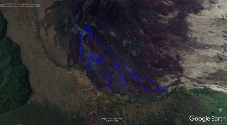
– An outline of the flow could be determined by the OI2 platform (OPGC – Clermont Auvergne University) from the Sentinel 1 satellite data acquired on October 24 (Figure 2). This new contour does not show (or very little) evolution of the flows and their fronts.
Contours of the flows determined from Sentinel satellite data, for the day of October 24, realized by the platform OI2 (University Clermont Auvergne).
– The surface flows could not be estimated today because of lava flows that are too weak at the surface and / or cloud cover.
Activity Bulletin from Friday, October 26, 2018 at 13:00 (local time).
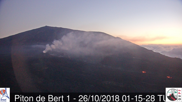
Surface activity is always extremely low. This night of very small resurgences was visible on the downstream part of the main tunnel, about 1 km from the eruptive vent (Figure 2).
Figure 2: Shooting of the eruptive site from the OVPF-IRT webcam located in Piton de Bert on 26/10/2018 at 05h15 local time (01h15 UTC time).
SO2 emissions at the eruptive vent are low (near or below the detection limit). Surface flow rates could not be estimated today because of poor surface flow and / or cloud cover.
Alert level: Alert 2-2 – Eruption in the Enclos .
Source : OVPF. http://www.ipgp.fr/fr/ovpf/bulletin-dactivite-jeudi-25-octobre-2018-a-15h45-heure-locale
Chile , Tupungatito :
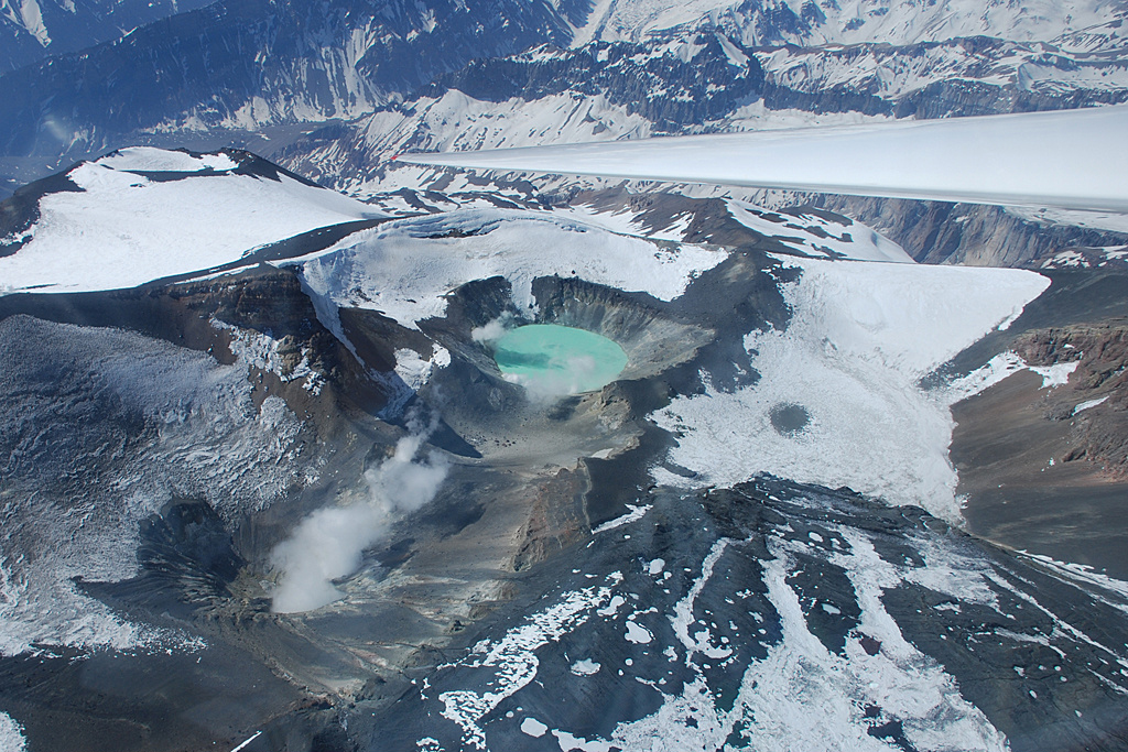
Special Report on Volcanic Activity (REAV), Metropolitan Region of Santiago, Tupungatito Volcano, October 25, 2018, 23:20 local time (mainland Chile).
The National Geological and Mining Service of Chile (Sernageomin) publishes the following PRELIMINARY information, obtained from monitoring equipment of the National Volcanic Monitoring Network (NVRN), processed and analyzed at the Volcanological Observatory of the Southern Andes (OVDAS) :
Today, Friday, October 26, 2018, at 22:59 local time (01:59 UTC), the monitoring stations installed near the Tupungatito volcano recorded an earthquake associated with a fracturing process of rocks (volcano-tectonic type).
The characteristics of the earthquake, after its analysis, are as follows:
TIME OF ORIGIN: 22h59 Local time (01h59 UTC)
LATITUDE: 33.322 ° S
LONGITUDE: 69.722 ° W
DEPTH: 6.8 KM
LOCAL MAGNITUDE: 4.8 (ML)
OBSERVATIONS:
At the time of issuing this report, 70 events of similar characteristics of lower magnitude were recorded. The event was not confirmed as felt by the population.
The level of volcanic technical alert remains at the level: Green.
Sernageomin continues online monitoring and will inform in a timely manner about any changes observed.
Source : Sernageomin .
Alaska , Semisopochnoi :
AVO/USGS Volcanic Activity Notice
Current Volcano Alert Level: WATCH
Previous Volcano Alert Level: ADVISORY
Current Aviation Color Code: ORANGE
Previous Aviation Color Code: YELLOW
Issued: Thursday, October 25, 2018, 9:35 PM AKDT
Source: Alaska Volcano Observatory
Location: N 51 deg 55 min E 179 deg 35 min
Elevation: 2625 ft (800 m)
Area: Aleutians
Volcanic Activity Summary:
Strong seismic tremor from Semisopochnoi consistent with an eruption began at 4:47 UTC (20:47 AKDT) and is currently diminishing. Satellite data through 5:00 UTC (21:00 AKDT) show a small ash cloud at about 12,000 ft asl.
AVO is raising the Aviation Color Code and Alert Level to Orange/Watch for Semisopochnoi.
Recent Observations:
[Volcanic cloud height] about 12,000 ft asl
[Other volcanic cloud information] winds toward the southeast
Remarks: Semisopochnoi is monitored with an on-island seismic network, and remotely by satellite and lightning sensors. An infrasound array on Adak Island could detect explosive emissions from Semisopochnoi with a 13 minute delay if atmospheric conditions permit.
An eruptive event was detected in seismic data beginning at 4:47 UTC on October 26 (20:47 AKDT on October 25) and the Aviation Color Code was increased to Orange and the Volcano Alert Level to Watch as a result. This event was characterized by strong volcanic tremor that lasted for about 20 minutes, followed by about 40 minutes of weaker tremor pulses. The event also produced weak infrasound (pressure wave) that was detected by instruments on Adak Island. A thick meteorological cloud deck obscured observations below 10,000 ft asl and a very faint cloud was observed rising briefly above it in a satellite image. It is unclear whether this cloud was related to the eruptive activity or whether it contained any volcanic ash. Seismic tremor ended following this event and seismicity has returned to low levels with occasional earthquake activity. The nature of this eruptive episode is unclear at present and analysis of satellite images in the coming days may provide additional information. This event was not detected by lightning sensors, as would be expected by a large explosion.
Source : AVO
Kamchaka , Karymsky :
VOLCANO OBSERVATORY NOTICE FOR AVIATION (VONA).
Issued: October 26 , 2018.
Volcano:Karymsky (CAVW #300130)
Current aviation colour code:YELLOW
Previous aviation colour code:orange
Source:KVERT
Notice Number:2018-107
Volcano Location:N 54 deg 2 min E 159 deg 26 min
Area:Kamchatka, Russia
Summit Elevation:4874.08 ft (1486 m)
Volcanic Activity Summary:
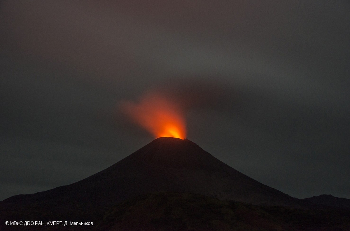
A moderate gas-steam activity of the volcano continues. According to satellite data, a thermal anomaly over the volcano was noted last time on 28 September, 2018, and ash explosions – on 30 September, 2018. The volcano was quiet or obscured by clouds on 01-25 October. KVERT continues to monitor Karymsky volcano.
A moderate gas-steam activity of the volcano continues. The danger of ash explosions up to 13,100-19,700 ft (4-6 km) a.s.l. is remain. Ongoing activity could affect low-flying aircraft.
Volcanic cloud height: NO ASH CLOUD PRODUSED
Other volcanic cloud information: NO ASH CLOUD PRODUSED
NOTA : The color code of aviation is reduced to Yellow.
Source : Kvert.
Photo : D. Melnikov, IVS FEB RAS, KVERT , 12/9/2018 .
Costa Rica , Turrialba / Poas / Rincon de la Vieja :
Turrialba Volcano:
Turrialba Volcano Activity Report, 2018-10-26
On 2018-10-26 at 01:34 local time, there is an eruption on the Turrialba volcano, with a column that stood 500 meters above the crater height and 3840 m. (meters above sea level) (12595.2 ft).
Duration of the activity: in progress.
The winds were from the northeast.
Ash fall reported in: No ash drop
Sulfur odor reported in: No sulfur odor reported
Comments: eruption in progress
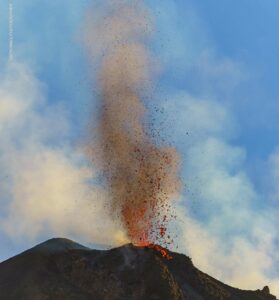
Turrialba
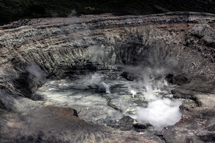
Poas Volcano:
No eruptions are reported.
The seismic activity is similar to that of yesterday.
At the time of this report, the winds are blowing west.
The volcano has a degassing activity, the level of seismicity is similar to that of yesterday with Lp type earthquakes and few tremors. The winds move the gas plume westward. No rash or smell of sulfur is reported.
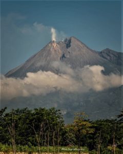
Poas
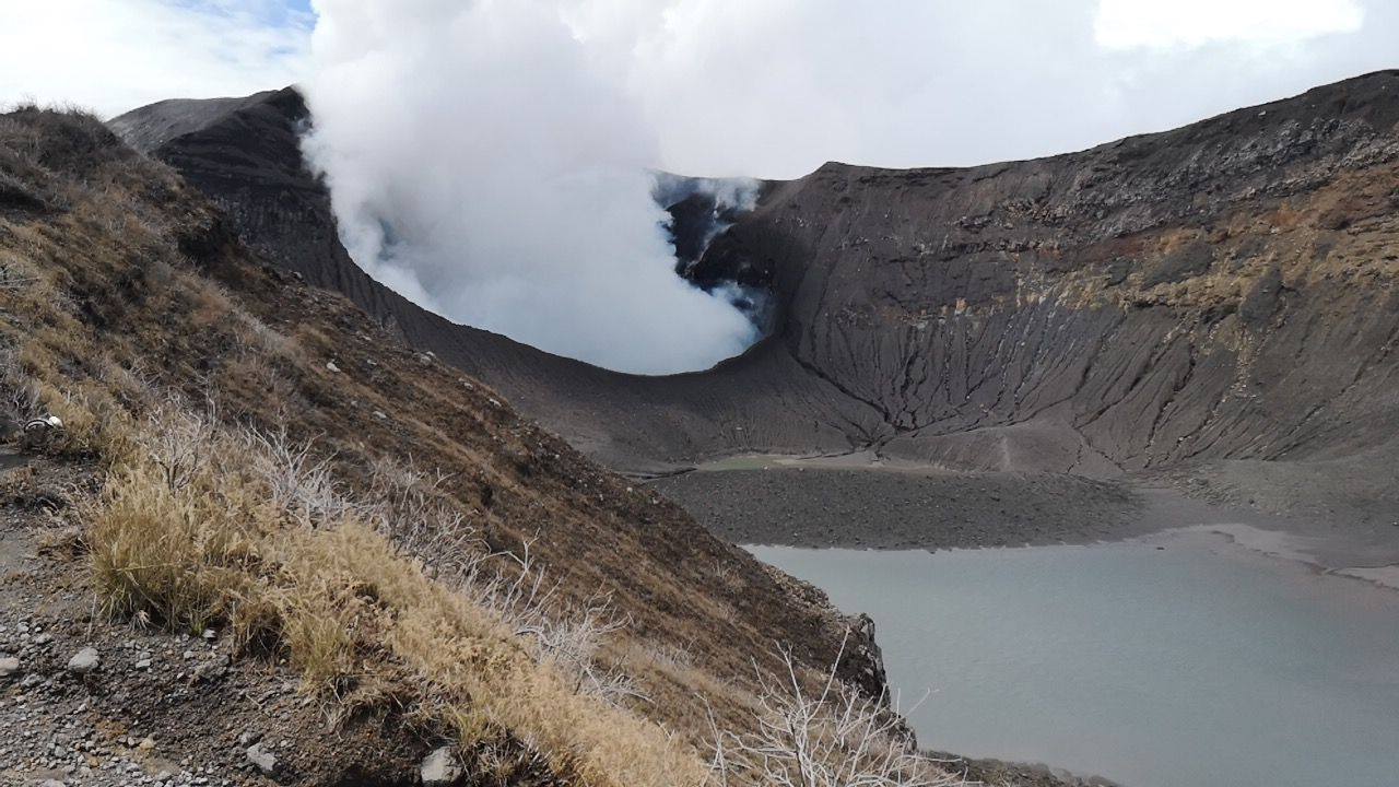
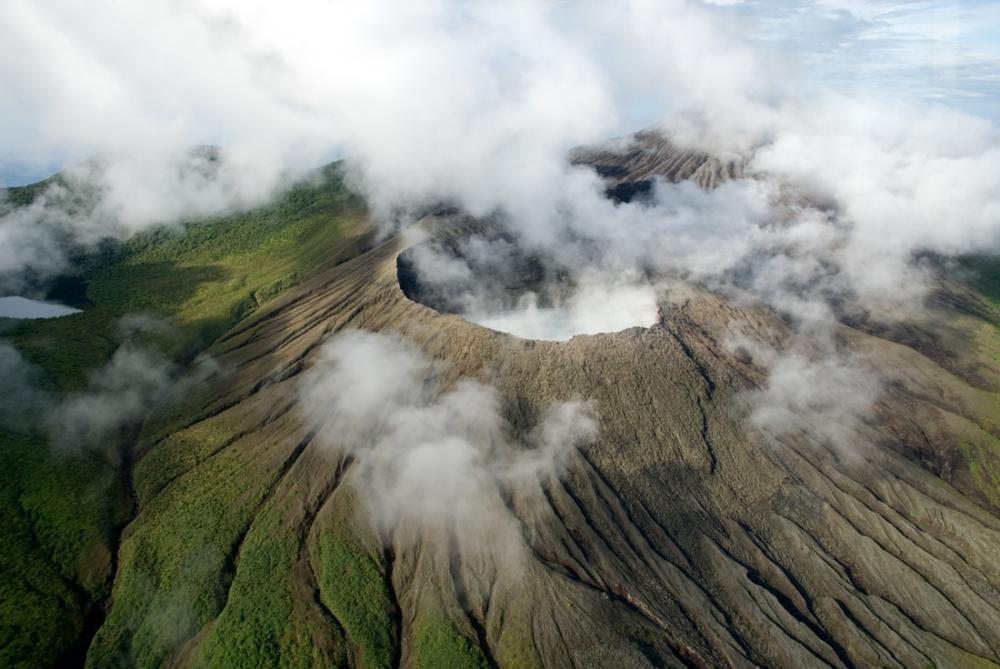
Rincon de la Vieja volcano:
No eruptions are reported.
The seismic activity is similar to that of yesterday.
At the time of this report, winds are blowing from the northwest.
The volcano has a degassing activity, there is no report of eruption, the winds move the gas to the northwest. The seismicity is similar to that of yesterday with the presence of earthquakes type long periods (Lp).
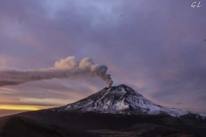
Rincon de la Vieja
Source : Ovsicori.

