October 10 , 2018.
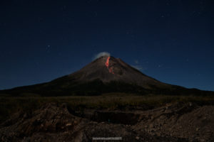
Chile , Villarica :
A total of 1,519 seismic events have been recorded, of which 1,503 have been classified as long-period type (LP) earthquakes, in relation to fluid dynamics within the volcano, with reduced maximum displacement values of 6.7 cm2. In addition, there were 16 volcano-tectonic (VT) seismic events associated with rock fracturing. The event with the greatest energy had a local magnitude of M 3.2, and was located 4.4 km east – southeast of the active crater and at a depth of 4.1 km.
The volcanic tremor signal, a seismic signal also associated with fluid dynamics within the volcano during the period considered, was maintained with reduced displacement values of up to 3 cm2. On the other hand, the dominant frequencies are maintained between 1.0 and 2.1 Hz, sometimes with the presence of frequencies around 5 Hz.
The images recorded with the IP cameras installed near the volcano, when the weather conditions permitted, showed degassing of predominantly whitish color; this one did not exceed 300 m of height. In addition, a night glow is recorded, when the weather conditions allowed to observe it.
The infrasound sensor recorded explosions associated with the surface activity of the lava lake housed in the main crater, with pressures greater than 4 pascal reduced (value considered low).
According to the data provided by 4 GNSS stations and two (2) electronic inclinometers, it is observed that certain variations exist both in the displacement of the stations and in the lengths of the control lines which cross the active crater, which in principle does not suggest a association with volcanic activity. The inclinometers showed no significant changes were detected attributable to changes in the internal activity of the volcano during the period.
No emissions of sulfur dioxide (SO2) to the atmosphere in the volcano area have been reported, according to data published by the Ozone Monitoring Instrument (OMI) Sulfur Dioxide Group (http: / /so2.gsfc.nasa.gov/) and the National Environmental Satellite Information and Data Service (NESDIS) (http://satepsanoine.nesdis.noaa.gov).
During the period it was reported 4 thermal alerts on the volcano, with a maximum of 32MW observed volcanic radiative power (VRP) as of September 25th, which is considered moderate, according to the data processed by Observation of the volcano. volcanic activity (Mirova) (http://www.mirovaweb.it/).
The increase in activity reported in the previous newsletter, in relation to the dynamics of the lava lake located in the main crater of the volcano, decreased progressively during this last period suggesting a lower activity of the lava lake, which is reflected in the low energy of seismic parameters and thermal anomalies. It is noted that the dynamics of the lava lake are fluctuating and that it continues to be located near the surface, so the occurrence of minor explosions affecting the crater environment is not excluded.
As a result, the alert level is maintained at:
GREEN LEVEL: Active volcano with stable behavior – No immediate risk – Time for possible eruption: MONTH / YEARS.
Observation: It is recommended to apply precautionary access restrictions to an area close to the crater with a radius of 500 m.
Source : Sernageomin.
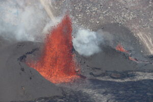
La Réunion , Piton de la Fournaise :
Activity Bulletin from Tuesday, October 9, 2018 at 16:00 (local time).
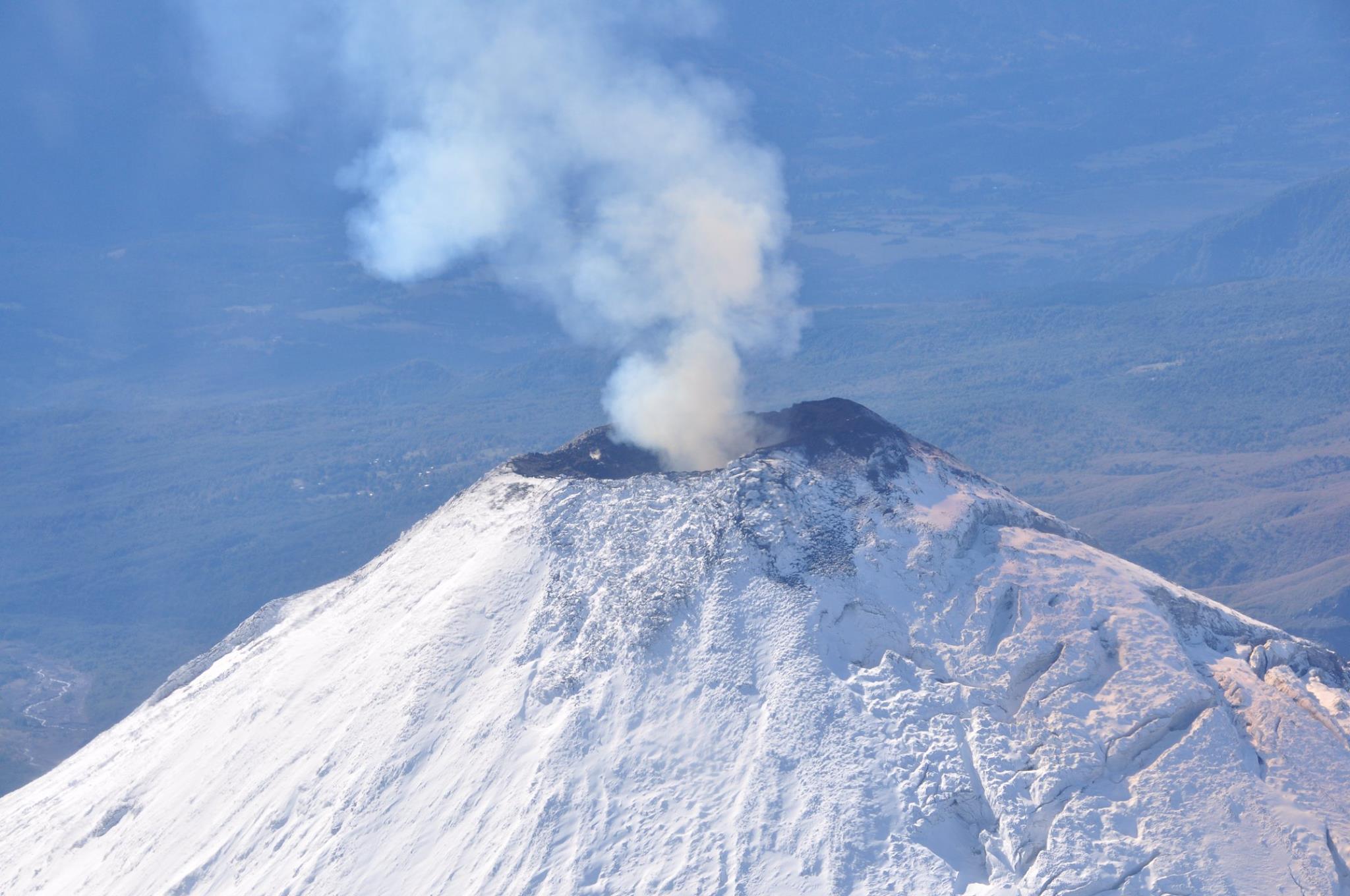
The eruption started on September 15th at 4:25 am local time continues. The intensity of the volcanic tremor (indicator of the eruptive intensity at the surface), after having increased markedly since October 3 at 22h local time (18h UTC) – due to a gradual closure of the entire feeding system, ranging from the dike (« feeding duct » of the eruption) to the eruptive cone, favoring a phenomenon of « resonance » more important) – has been gradually decreasing for four days (Figure 1).
Piston gases (« gas flushes » or « tremor puffs ») at the eruptive site are always recorded by the OVPF seismometers.
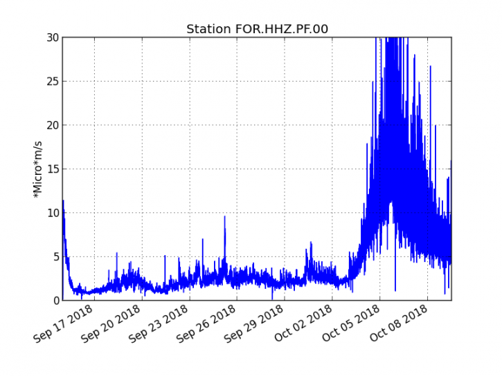
Figure 1: Evolution of the RSAM (indicator of the volcanic tremor and the intensity of the eruption) between 04:00 (00h UTC) on September 15 and 16:00 (12:00 UTC) on October 9 on the FOR seismic station, located near the crater Chateau Fort (2000 m altitude on the southeast flank of the terminal cone). (© OVPF / IPGP)
– No volcano-tectonic earthquake was recorded during the day of 8 October or during the current day.
– Inflation (swelling) of the building is still noticeable (Figure 2). This inflation is accompanied by an increase in the concentrations of CO2 in the soil in the area of the Volcano Cottage. This inflation is indicative of the pressurization of a localized source under the summit craters at a depth of 1-1.5 km linked to the recharge of the superficial reservoir by deeper magma (increase in CO2 concentrations in the soil at outside the Enclos).
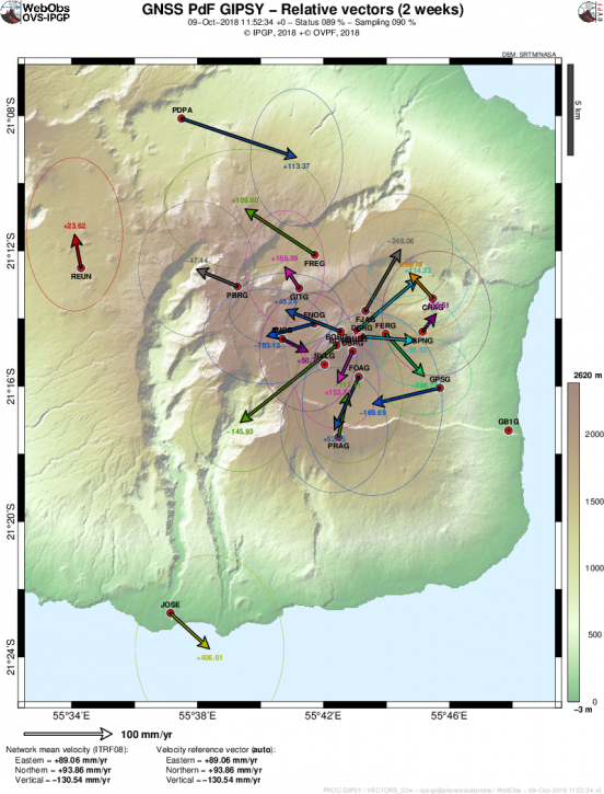
Figure 2: Map of horizontal ground displacements recorded by the permanent GPS network of the OVPF over the last two weeks. (© OVPF / IPGP)
– No land reconnaissance could be done today given the bad weather conditions on the volcano this day.
– The surface flows could not be estimated today because of lava flows that are too weak at the surface and poor weather conditions on the site.
Alert level: Alert 2-2 – Eruption in the Enclos.
Source : OVPF. www.ipgp.fr/fr/ovpf/bulletin-dactivite-mardi-9-octobre-2018-a-16h00-heure-locale
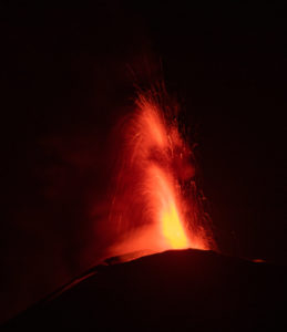
Peru , Sabancaya :
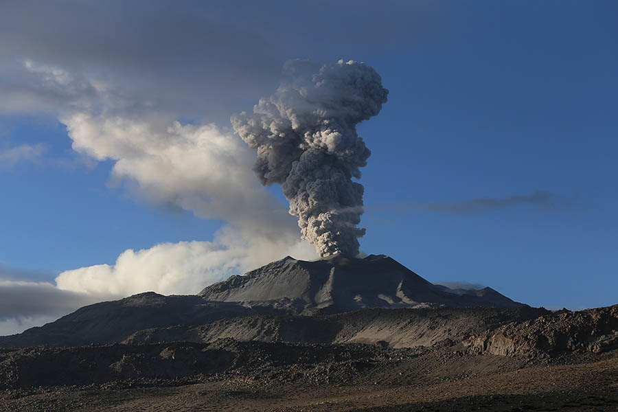
An average of 24 explosions / day was recorded. Earthquakes associated with the rise of magma (hybrid types) remain very few and low energy.
The columns of gas and eruptive ash reached a maximum height of about 3,000 m above the crater. The dispersion of these materials occurred within a radius of about 50 km, mainly in the Southwest, South and Southeast directions. An ashfall has been reported in the Huanca region.
The volcanic gas (SO2) flow recorded on 1 October a maximum value of 5027 tonnes / day, a value considered important.
The deformation in the volcanic building showed a slight deflation.
Five thermal anomalies were recorded according to the MIROVA system, with values between 5 and 28 MW VRP (Radiated Volcano Energy).
In general, eruptive activity maintains moderate levels. No significant changes are expected in the coming days.
Source : IGP
Photo : Ingemmet.
Kuril Islands , Sarychev Peak :
VOLCANO OBSERVATORY NOTICE FOR AVIATION (VONA) .
Issued: October 10 , 2018.
Volcano:Sarychev Peak (CAVW #290240)
Current aviation colour code:ORANGE
Previous aviation colour code:orange
Source:KVERT
Notice Number:2018-102
Volcano Location:N 48 deg 5 min E 153 deg 12 min
Area:Central Kuriles, Russia
Summit Elevation:4906.88 ft (1496 m)
Volcanic Activity Summary:
Activity of the volcano continues. According to data by Tokyo VAAC, and satellite data by KVERT, an ash cloud drift to the east from the volcano. KVERT continues to monitor Sarychev Peak volcano.
An eruptive activity of the volcano continues. Ash explosions up to 32,800-49,200 ft (10-15 km) a.s.l. could occur at any time. Ongoing activity could affect international and low-flying aircrafts.
Volcanic cloud height:
5576-6560 ft (1700-2000 m) AMSL Time and method of ash plume/cloud height determination: 20181010/0230Z – Himawari-8
Other volcanic cloud information:
Distance of ash plume/cloud of the volcano: 43 mi (70 km)
Direction of drift of ash plume/cloud of the volcano: E / azimuth 88 deg
Time and method of ash plume/cloud determination: 20181010/0230Z – Himawari-8
Start time of explosion and how determined: 20181010/0100Z – Satellite data
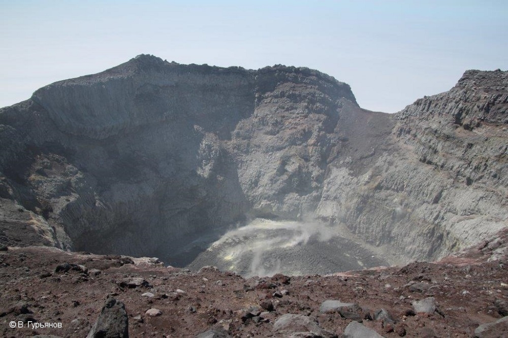
Sarychev Peak, one of the most active volcanoes of the Kuril Islands, occupies the NW end of Matua Island in the central Kuriles. The andesitic central cone was constructed within a 3-3.5-km-wide caldera, whose rim is exposed only on the SW side. A dramatic 250-m-wide, very steep-walled crater with a jagged rim caps the volcano. The substantially higher SE rim forms the 1496 m high point of the island. Fresh-looking lava flows, prior to activity in 2009, had descended in all directions, often forming capes along the coast. Much of the lower-angle outer flanks of the volcano are overlain by pyroclastic-flow deposits. Eruptions have been recorded since the 1760s and include both quiet lava effusion and violent explosions. Large eruptions in 1946 and 2009 produced pyroclastic flows that reached the sea.
Source : Kvert , GVP.
Photo : V. Gurianov , 27/6/2017.
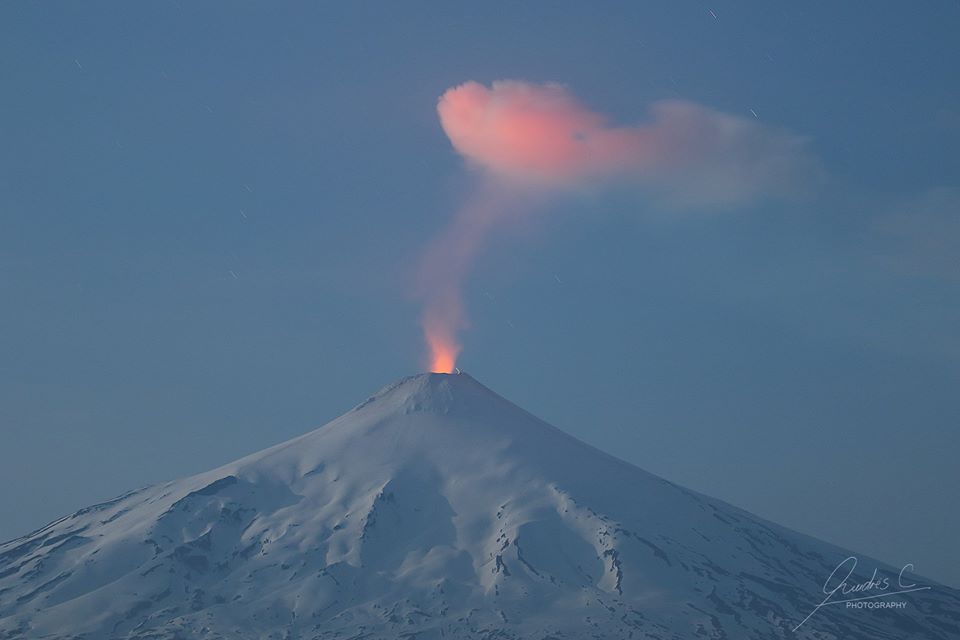
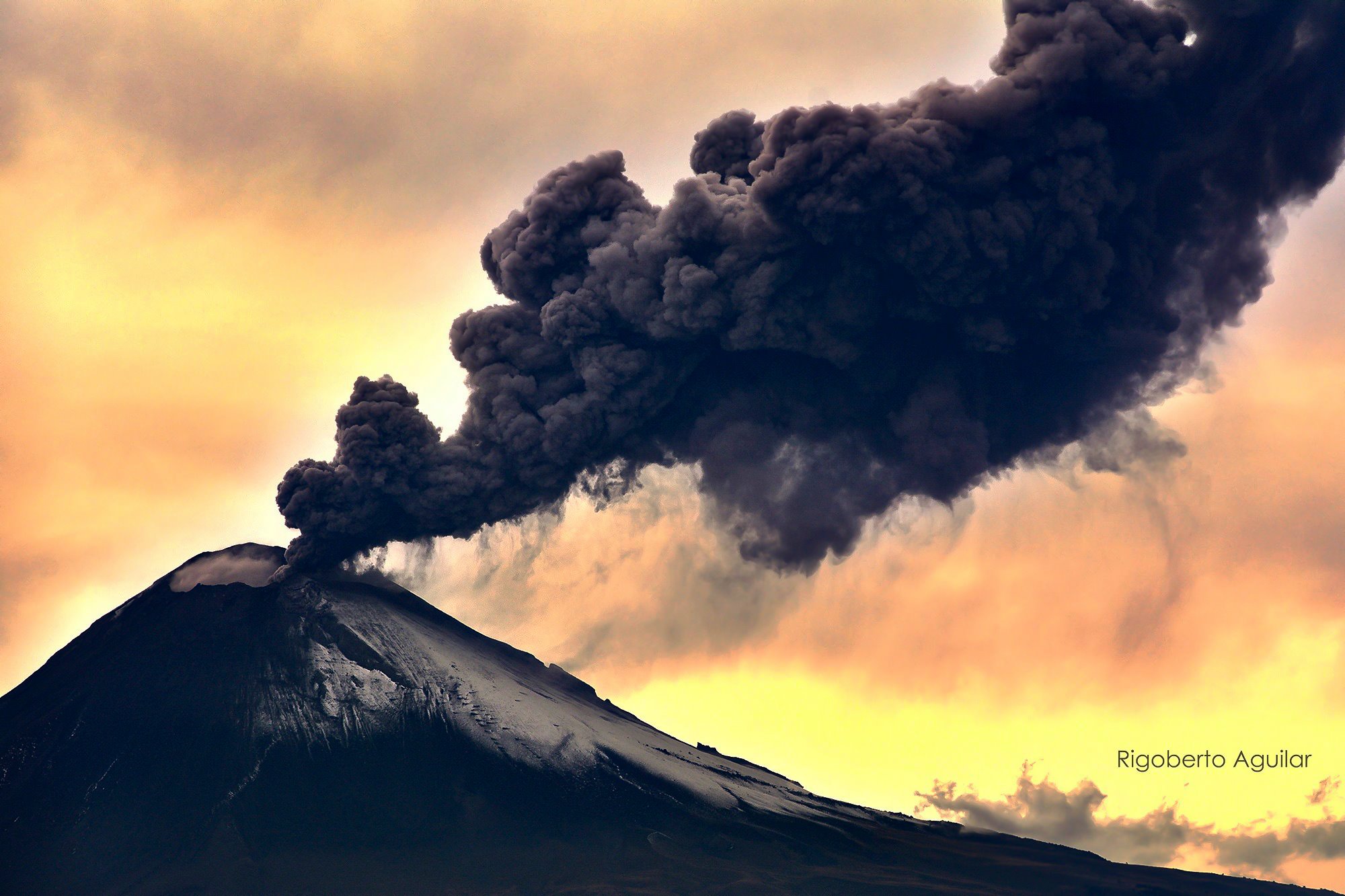
Mexico , Popocatepetl :
October 09, 11:15 (October 09, 16:15 GMT).
During the past 24 hours, 509 exhalations have been identified using the surveillance systems of the Popocatépetl volcano, accompanied by water vapor, gas and ash. In addition, three explosions were recorded yesterday at 5:20 pm, 5:34 pm and 6:34 pm. The first explosion reached a height of 3,500 m, while the third had a height of approximately 2,400 m. These explosions were reported in the update of the previous day’s report. . He also recorded 274 minutes of low to medium amplitude tremor. During the night, visibility was partial, but no glow was observed. At the time of writing this report, visibility is partial and any event will be scattered in the Northeast direction.
CENAPRED urges DO NOT APPROACH the volcano and especially the crater, because of the risk of falling ballistic fragments, and in case of heavy rains to move away from the bottom of the ravines because of the risk of landslides and flows mud.
The Volcano Popocatepetl volcano warning light is located at Amarillo Phase 2.
Source : Popocatepetl
Photo : Rigobero Aguilar.