April 23 , 2018.
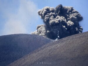
Kusatsu-Shirane , Japan :
Agency raises eruption alert level for Mount Shirane volcano
Apr 23, 2018
The Meteorological Agency said Sunday it has raised the volcanic alert level for Mount Shirane, situated in eastern Japan, from Level 1 to Level 2 to ban entry into areas near the mountain’s crater.
Since Saturday evening, the number of volcanic earthquakes at the Yugama crater has increased and a slight crustal movement has been observed, indicating an increased eruption possibility, the agency said.

Large ash deposits may rain down in areas within 1 km of the crater, it warned.
Mount Shirane is part a cluster of volcanoes located in Gunma and Nagano prefectures collectively called Mount Kusatsu-Shirane.
In the wake of the agency’s announcement, the Gunma Prefectural Government closed an 8.5-km-long stretch of Route 292, a scenic national road connecting the two prefectures.
The Shiga-Kusatsu road is used by many people traveling to the nearby popular Kusatsu hot spring resort area. Local people involved in the area’s tourism industry are concerned it could discourage tourists from coming to Kusatsu, in particular during Golden Week, a period from the end of April to early May during which several public holidays are observed.
“It’s regrettable (the road was closed) right ahead of Golden Week . . . but we need to keep monitoring the situation for a certain period of time,” Kusatsu Mayor Nobutada Kuroiwa said.
In January, Mount Motoshirane, another Kusatsu-Shirane volcano located south of Mount Shirane, erupted, killing one person and injuring 11 others.
The Level 2 warning remains unchanged for Mount Motoshirane, as it has shown no sign of increased volcanic activities, according to the agency.
Source : Japantimes.
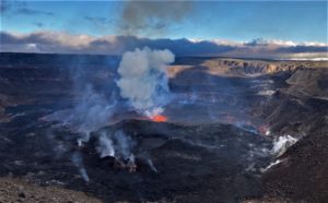
Kilauea , Hawai :
19°25’16 » N 155°17’13 » W,
Summit Elevation 4091 ft (1247 m)
Current Volcano Alert Level: WATCH
Current Aviation Color Code: ORANGE
Activity Summary:
Eruptions continue at Kīlauea Volcano’s summit and East Rift Zone. The summit lava lake level continued to rise over the past day, with one small overflow of the south crater rim about midnight. The summit inflationary tilt began to slow yesterday afternoon, nearly leveling off this morning. Puʻu ʻŌʻō cone continues the inflationary trend of the past several weeks, and the Episode 61g lava flow is active above Pulama pali. The flow does not pose a threat to nearby communities at this time. There is currently no active lava on the pali, the coastal plain, or entering the ocean.
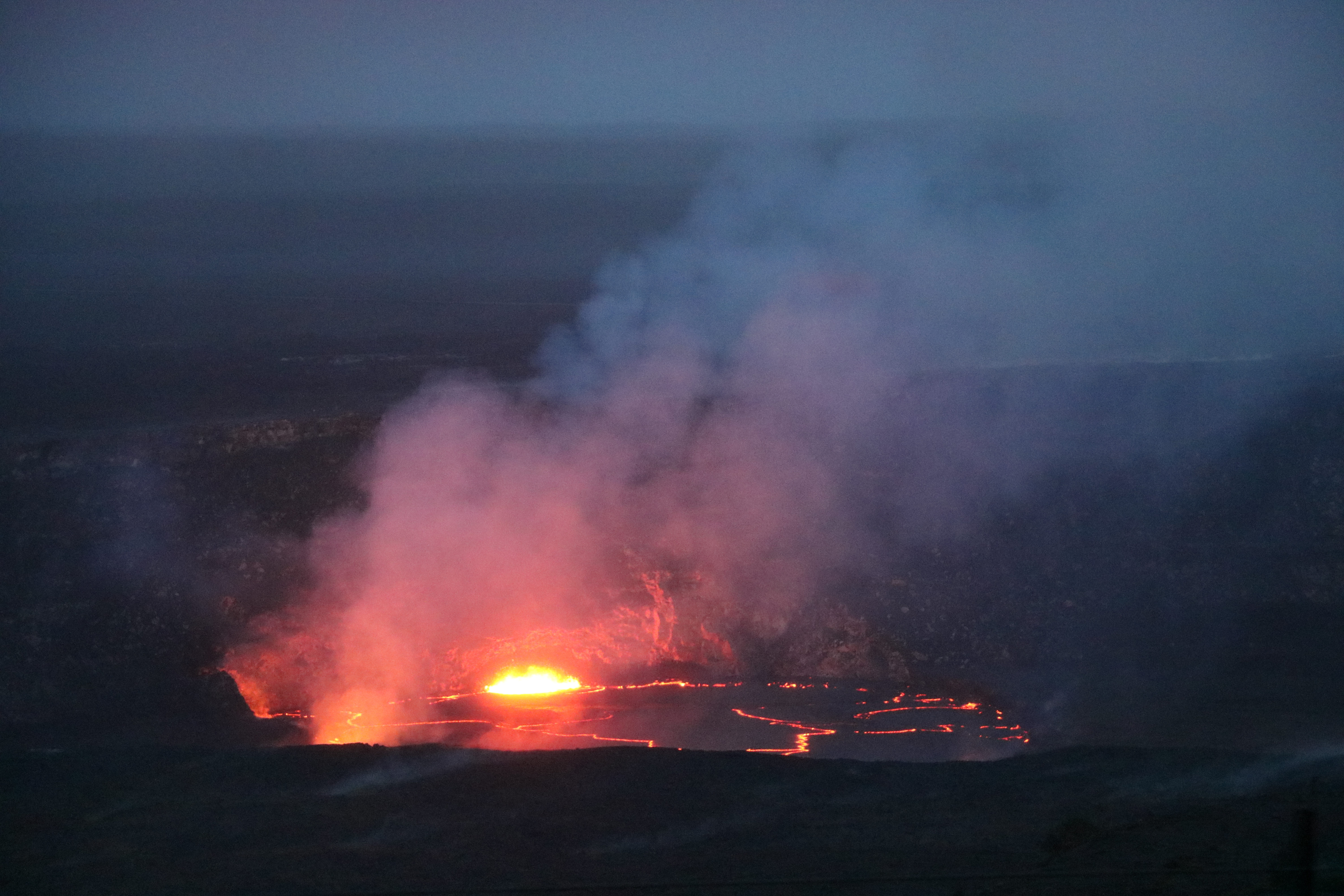
The slowly rising lava lake at Kīlauea’s summit was very close to the rim of the Overlook crater, and floor of Halema‘uma‘u Crater. This afternoon the lava lake was roughly 6 m (20 feet) from the rim. This photo was taken from the Jaggar Museum overlook, which had superb views tonight.
Summit Observations:
The inflationary tilt recorded by summit tiltmeters in the past couple of days slowed yesterday afternoon and has nearly leveled off this monring. When measured yesterday afternoon, the lava lake level was about 6 m (20 ft) below the rim of Overlook crater, a rise of about 4 m (13 ft) from the day before. Webcam images show that a small overflow along the south crater rim occurred about midnight. The lava lake is is below the rim this morning. Seismicity in the summit area is within normal, background rates, with tremor amplitude fluctuations associated with lava lake spattering and a few more small earthquakes in the upper East Rift Zone and south part of the caldera. Elevated summit sulfur dioxide emission rates persist.
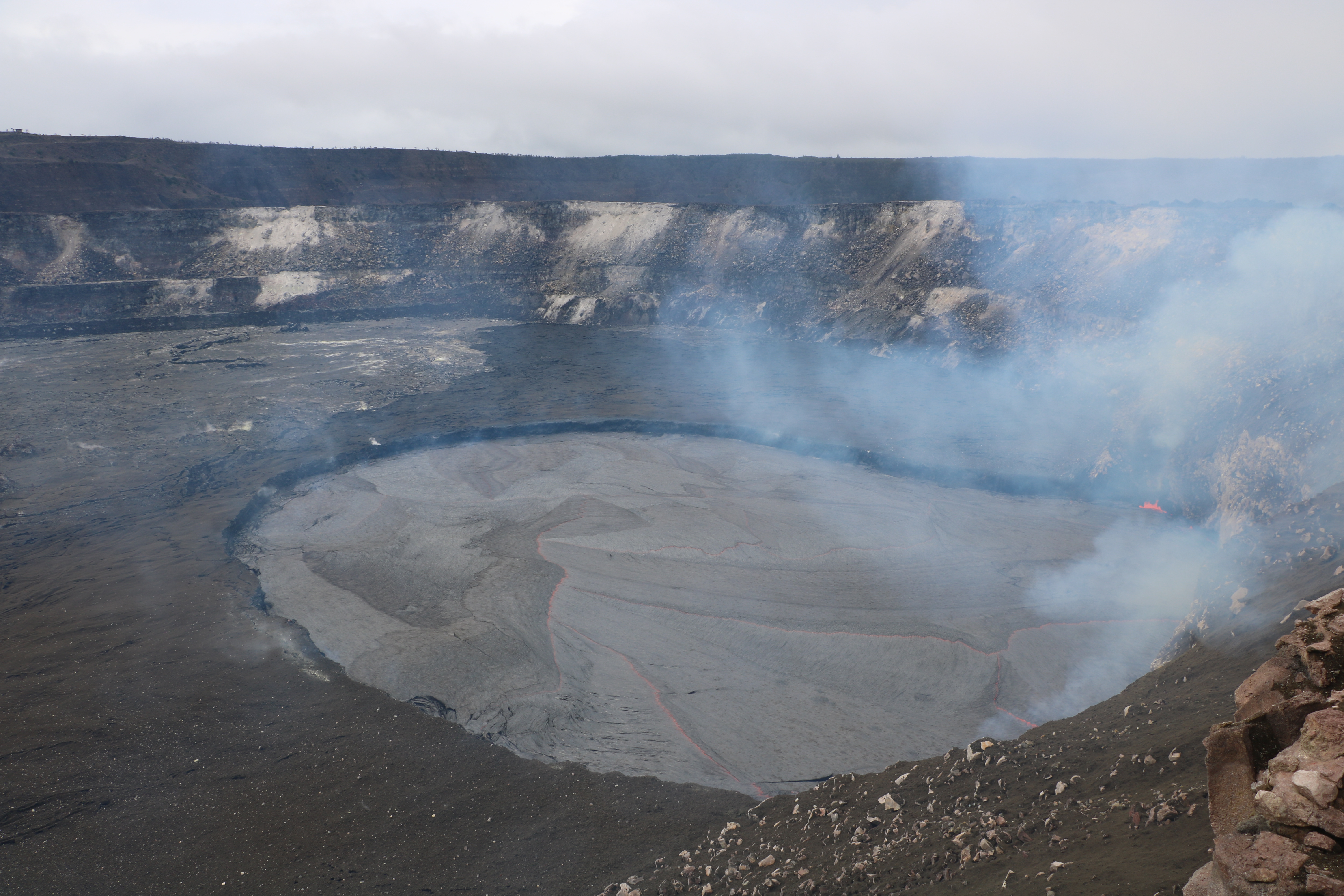
A view of the lava lake this afternoon from the Halema‘uma‘u Crater rim, which remains closed to the public due to ongoing volcanic hazards. Jaggar Museum and HVO are on the skyline in the upper left.
Puʻu ʻŌʻō Observations:
Inflationary tilt continues to be recorded by a tiltmeter at Puʻu ʻŌʻō, continuing the inflationary trend of the past several weeks. Webcam views showed no new flows in the crater in the past 24 hours. Seismicity is at normal, background levels. The sulfur dioxide emission rate from the East Rift Zone vents has been steady over the past several months and remains significantly lower than the summit emission rate.
Source : HVO
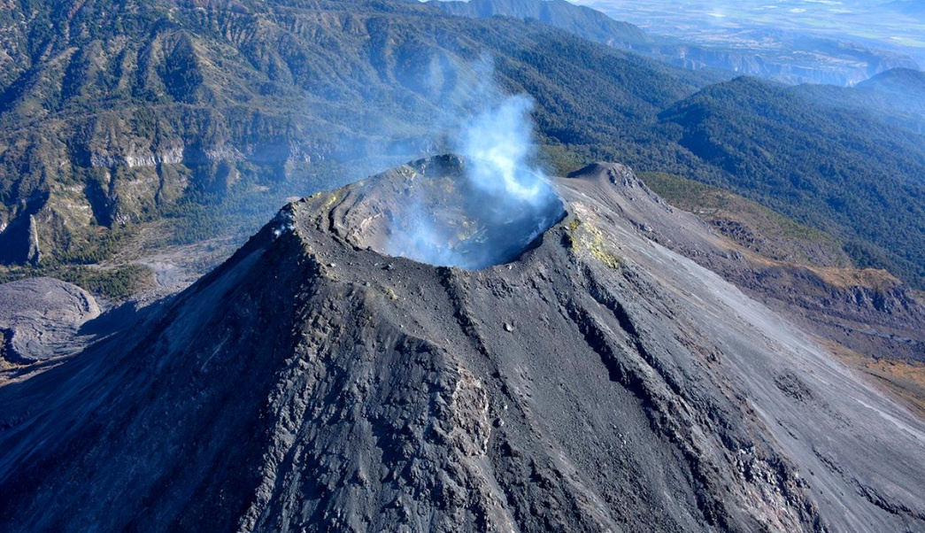
Colima , Mexico :
Weekly Technical Bulletin of the Colima Volcano
Date: April 20, 2018 Bulletin No.65.
Seismic activity:
During the last week, 28 high frequency (HF) events, 10 long period events (LPs), 0.49 h tremor, 13 landslides and 3 events considered low intensity explosions were saved automatically.
Visual observations
During the reported period, no phenomena associated with volcanic activity were detected (incandescence, ash explosions, pyroclastic flows and / or landslides). It was only possible to observe a low emission of steam during certain periods of time.
Overview:
An observation flight was made on April 14, comparing the images to the last flight in January, no significant difference was observed in crater morphology. The most vigorous fumaroles with the highest temperature are on the east wall of the crater. Temperatures were slightly higher than during the last flight, in some areas such as the bottom of the crater (219 ° C, apparent temperature), fumaroles and fumaroles northwest.
Geochemistry:
Several measurements of the SO2 flow were made on April 13 with an average of 3.3 kg / s, some gas pulses were also observed. On April 18, it was also measured and there were values below the detection level (~ 0.1 kg / s), with no observed pulses.
Remote perception:
No thermal anomalies detected by the MIROVA satellite system were observed last week.
Diagnostic:
The seismic and fumarolic activity has increased slightly in recent weeks, although the volcano remains in a phase of passive degassing. The staff in charge of monitoring the volcano remains attentive to the changes and the evolution of the activity.
Possible scenarios:
1. The volcano has a passive degassing, as well as possible low intensity explosions.
2. There is new growth of the lava dome at the top with collapses of incandescent materials and lava flows.
Source : RESCO-CUEIV-Faculté des Sciences , Université de Colima.
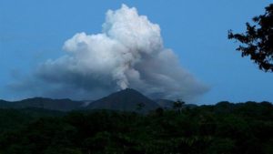
Turrialba , Poas , Costa Rica :
Daily report: Activity of volcanoes Turrialba, Poás: 22 April 2018
Updated at 10:00 am
Turrialba Volcano:
During the last 24 hours the volcano has a very low background seismicity and a very low amplitude volcanic tremor. At the time when the weather allows to see the top of the volcano, a white column of gas and water vapor is observed permanently There is no report so far smell of sulfur or ash fallout in nearby cities.

Poás Volcano:
Very weak seismicity continued with tremors of low amplitude, after the small eruption of yesterday at 10:44. There is no record of new eruptions (while climatic conditions have allowed to see the summit of the volcano). A person declares ash falls without indicating the precise location. At the time of writing this report, the wind direction is from Northeast to Southwest.
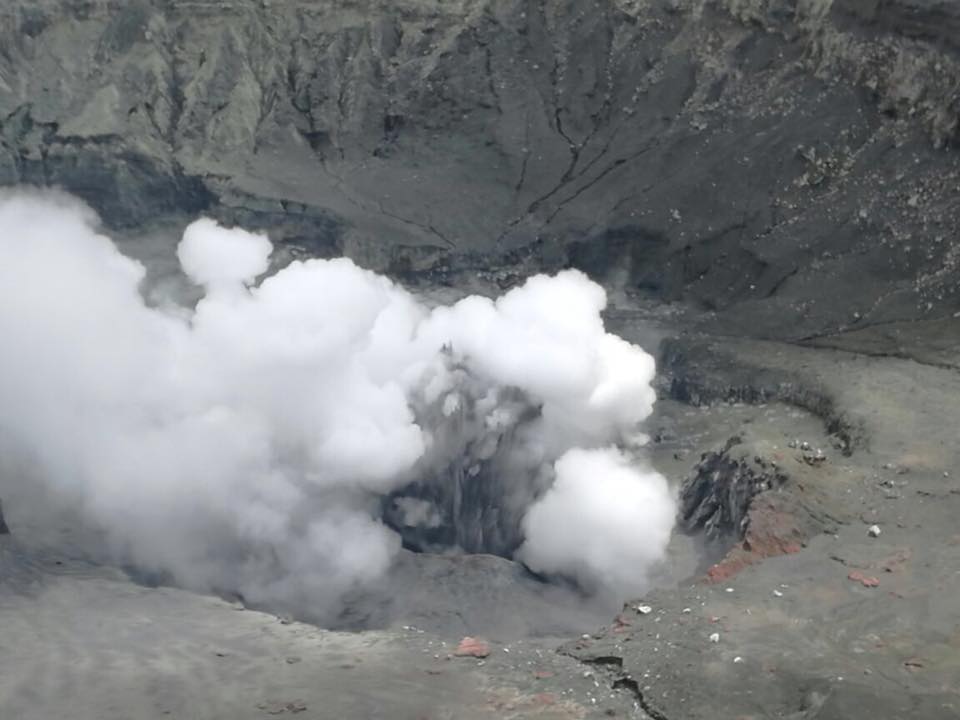
April 21, 2018. Small phreatic eruption on Volcán Poás today at 10:44 am. Image José Pablo Sibaja Brenes.
21-04-2018, 19:10, Poás volcano:
On the morning of today, (21/04), between 10:12 am and 11:00 am, small phreatic eruptions were recorded on the Poás volcano. From the surveillance camera installed in the RSN bunker located on the southern edge of the active crater, it was possible to observe several activity pulses between 10:12 am and 10:20 pm, and in particular between 10: 14 h and 10:17 h, moments when the projection of sediments was observed from the eruptive focus.
Rapport : Dr. Maurice M. Mora
Source : Ovsicori , RSN ,