March 16 , 2018.
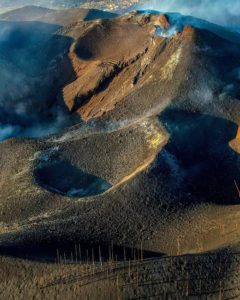
Mayon , Philippines :
MAYON VOLCANO BULLETIN 15 March 2018 08:00 A.M.
Mayon’s activity in the past 24 hours was characterized by a brief period of lava effusion, weak to moderate degassing from the summit crater, gravity-driven lava flow and general quiescence. One (1) lava fountaining event from 0831H to 0832H PST yesterday generated light gray ash plumes that rose 200m above the summit crater before drifting southwest. Lava flows could be observed at night to be moving downslope on the Miisi,Bonga and Basud Gullies within 3.3 kilometers, 4.5 kilometers and 1.9 kilometers of the crater, respectively.
A total of thirty one (31) volcanic earthquakes and thirty (30) rockfall events were recorded by Mayon’s seismic monitoring network. Sulfur dioxide (SO2) emission was measured at an average of 1938 tonnes/day on 14 March 2018. A slight inflation of the lower flanks beginning 11 March 2018 was recorded by electronic tilt, consistent with results of Precise Leveling (PL) surveys on 03 – 06 March 2018. Overall ground deformation data indicate that the edifice is still swollen or inflated relative to pre-eruption baselines.
Alert Level 3 currently prevails over Mayon Volcano. This means that although Mayon’s unrest continues, there is a decreased likelihood of hazardous explosive eruption to occur. PHIVOLCS-DOST reminds the public of sudden explosions, lava collapses, pyroclastic density currents or PDCs and ashfall can still occur and threaten areas in the upper to middle slopes of Mayon. PHIVOLCS-DOST recommends that entry into the six kilometer-radius Permanent Danger Zone or PDZ and a precautionary seven kilometer-radius Extended Danger Zone or EDZ in the south-southwest to east-northeast sector, stretching from Anoling, Camalig to Sta. Misericordia, Sto. Domingo, must be strictly prohibited. People residing close to these danger areas are also advised to observe precautions associated with rockfalls, PDCs and ashfall. Active river channels and those perennially identified as lahar prone areas in the southern and eastern sectors should also be avoided especially during bad weather conditions or when there is heavy and prolonged rainfall. Civil aviation authorities must advise pilots to avoid flying close to the volcano’s summit as airborne ash and ballistic fragments from sudden explosions and PDCs may pose hazards to aircrafts.
PHIVOLCS-DOST is closely monitoring Mayon Volcano’s activity and any new significant development will be immediately communicated to all stakeholders.
Source : Phivolcs
Galeras , Colombia :
Subject: Weekly activity bulletin of Galeras volcano
The level of activity of the volcano continues at the level:
YELLOW LEVEL ■ (III): CHANGES IN THE BEHAVIOR OF VOLCANIC ACTIVITY.
Following the activity of the GALERAS volcano, the COLOMBIAN GEOLOGICAL SERVICE informs that:
In the evaluation period between March 6 and 12, 2018, a low seismicity was recorded with a decrease in the frequency and energy of earthquakes, most of them associated with the fracturing of rocks inside the volcano. The localized earthquakes were scattered in the Galeras area of influence, at depths of less than 5.5 km from the volcanic peak (4200m), at a maximum distance of 6 km and a maximum local magnitude of M 0.6 on the Richter scale.
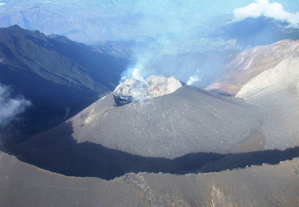
Thanks to the climatic conditions at the top, it was possible to record the processes of gas emission, with columns of variable height and direction of dispersion due to the action of the winds.
The Colombian Geological Survey continues to monitor the evolution of the volcanic phenomenon and will continue to report in a timely manner if a change is detected.
Source : Ingeominas.
Turrialba , Poas , Costa Rica :
Daily report of the state of volcanoes Turrialba, Poás:
March 15, 2018, Updated at 11:00 hours.
Turrialba Volcano: activity over the last 24 hours.
The Turrialba volcano continues to emit small passive pulses of ash.
Seismicity over the past 24 hours has a low level of activity.
The present nebulosity does not allow direct observation of the volcano.
The gas plume is dispersed in the southwest by local winds.

Poás Volcano: activity over the past 24 hours.
The volcano exhibits constant degassing and a low level of seismic activity.
The present nebulosity does not allow direct observation of the volcano.
The gases are scattered in the West by the local winds.
OVSICORI-UNA remains vigilant on seismic and volcanic activity.
Source : Ovsicori
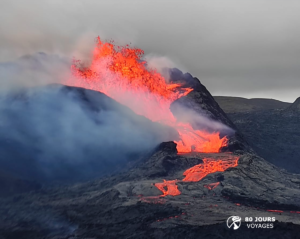
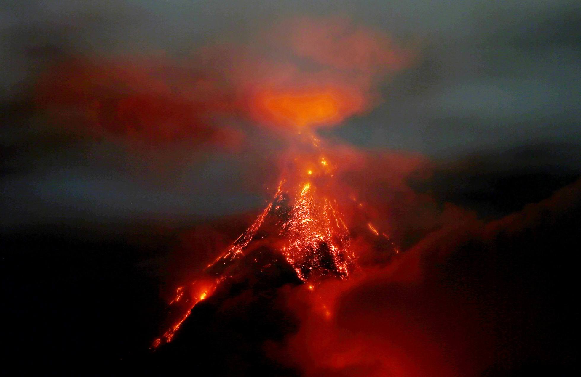
Fuego , Guatemala :
Type of activity: Vulcanian
Morphology: Composite Stratovolcano
Location: 14 ° 28’54˝ Latitude N; 90 ° 52’54˝ Longitude W.
Height: 3,763msnm.
Weather Conditions: Partly Cloudy
Wind: South-South at 5 km / h
Precipitation: 0.0 mm
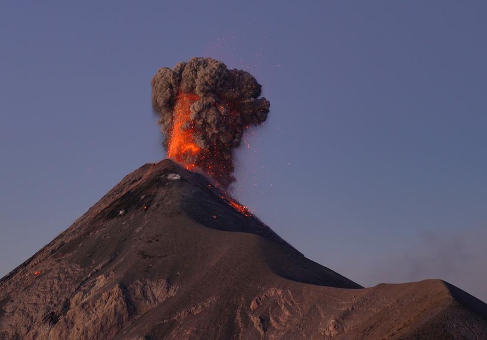
Activity:
Presence of a weak, white, degassing fumarole at a height of 4500 m, with a dispersal direction towards the Southwest and North. Five to eight low to moderate explosions per hour have been observed, which expulses ashes at a height of 4500 to 4700 m (14765 to 15420 feet), which are scattered 8 to 15 km to the west and south-west. Incandescent impulses rising 200 to 250 m above the crater causing weak to moderate avalanches on the crater contour and to the Seca, Ceniza, Lajas, Honda canyons. The explosions have been accompanied by moderate to strong rumblings with low shock waves causing vibrations in the roofs of homes near the volcano, the sounds are similar to aircraft turbine noises with intervals of 3 to 7 minutes . We note the fall of fine particles of ash on Panimache I, Morelia, Santa Sofia, El Porvenir, Palo Verde farm, San Pedro Yepocapa and others.
Source : Insivumeh
Photo : Martin Rietze