October 25 , 2025.
Philippines , Kanlaon :
KANLAON VOLCANO ERUPTION BULLETIN , 25 October 2025 , 2:40 AM
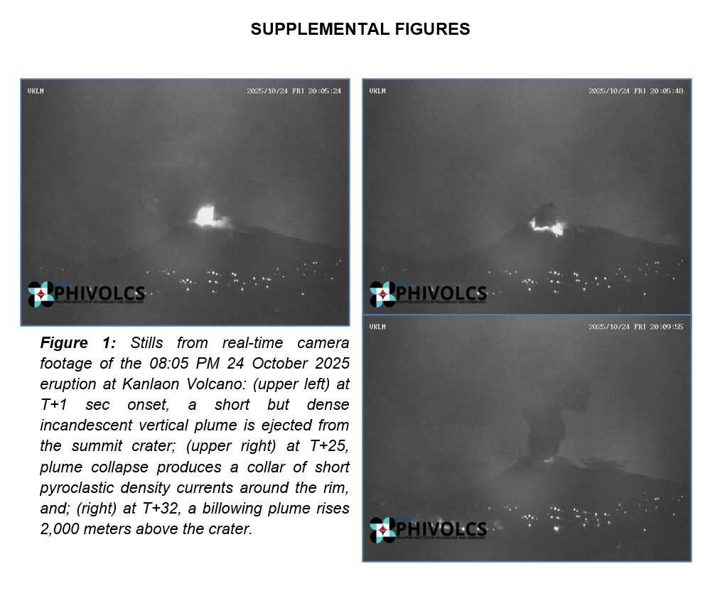
Eruption Data: A short-lived, moderately explosive eruption occurred at the summit crater of Kanlaon Volcano at 08:05 PM of 24 October 2025 that lasted three (3) minutes based on seismic and visual recordings. The eruption generated a short dense incandescent plume followed by a billowing plume that rose 2,000 meters above the vent before drifting northwest. Large ballistic fragments were also observed to have been thrown around the crater within a few hundred meters. Provincial and local authorities have reported ashfall in the following localities of Negros Occidental: Bago City– Brgys. Mailum, Ma-ao, Ilijan, Bacong ang Abuanan; La Carlota City– Sto. Guintubdan, Brgy. Ara-al, and; Pontevedra– Brgy. Zamora. Sulfurous fumes were also experienced strongly in most of these barangays, in Brgy. Cabagnaan, La Castellana and in Brgys. Linothangan, Malaiba and Pula, Canlaon City, Negros Oriental. In addition, the eruption generated a shock wave which was recorded at a maximum of 204 Pascals by an infrasound station five kilometers east of the crater, that was heard as a booming sound within a six-kilometer radius. Incandescent pyroclastic density currents or PDCs descended the southern slopes in the jurisdiction of La Castellana, Negros Occidental within a kilometer of the crater based on visual and thermal camera monitoring.
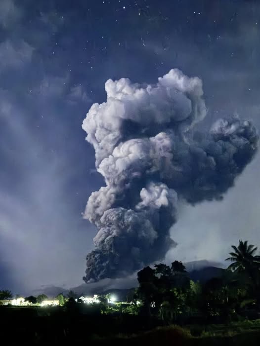
Monitoring Data Prior to the Eruption: The eruption was preceded by a total of 19 ash emission events from 8 September to 23 October as well as by volcanic earthquake swarms that peaked at 90 events on 16 October 2025. DOST-PHIVOLCS issued an advisory on increased seismic activity in response to the latter. Notably, sulfur dioxide or SO2 emission was measured at an exceedingly low average of 189 tonnes/day on 24 October 2025 immediately prior to the eruption. In comparison, SO2 has been continuously degassed at the short-term average rate of 1,699 tonnes/day for October 2025 and at the long-term average rate of 3,119 tonnes/day since 3 June 2024. Finally, the Kanlaon edifice has been swelling or inflating at very low rates since 2022 due to magma intrusion at great depths beneath the volcano. These parameters indicate that the blockage of volcanic gas emission (or closed-system degassing) and resulting pressurization and swelling of the edifice generated the moderately explosive eruption. This has been a repeating eruption mechanism since the volcano’s first moderately explosive activity in June 2024.
Current Outlook: No pronounced increases in volcanic earthquake and ground deformation parameters have followed the eruption as of present. Alert Level 2 (moderate level of unrest) therefore is maintained over Kanlaon Volcano. This means that this most recent explosive eruption may be followed by further moderate intensity activity such as ash emission events or similar short-lived explosive eruptions. Such eruptions could produce dangerous volcanic hazards within the 4-kilometer radius Permanent Danger Zone or PDZ, disperse ash over the general west of the volcano and produce material that could feed lahars in affected drainage channels.
Recommendations: It is strongly recommended that communities within the PDZ remain evacuated due to the life-threatening hazards of pyroclastic density currents or PDCs, ballistic projectiles, rockfalls, volcanic gas and others that could be generated by similar minor explosive eruptions. Local government units must also continue to prepare their communities within the PDC hazard zone for subsequent evacuation in case unrest suddenly escalates and hazardous worst-case explosive eruption becomes imminent. Communities on the southern slopes must remain vigilant in case intense rains occur and erode newly-deposited loose ash or pyroclastic material on the upper slopes to generate hot lahars and sediment-laden streamflows that can cause life-threatening injuries, washout and burial. Civil aviation authorities must also advise pilots to avoid flying close to the volcano’s summit as ash and ballistic fragments from sudden explosive eruptions can be extremely hazardous to aircraft.
DOST-PHIVOLCS maintains close monitoring of Kanlaon Volcano and any new development will be communicated to all concerned stakeholders.
Source : Phivolcs
Photo : Cherry May Libradilla , Phivolcs.
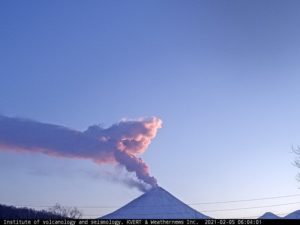
Alaska , Great Sitkin :
Lava continues to erupt within the summit crater at Great Sitkin Volcano. Satellite and webcam observations have been mostly blocked by clouds, but satellite observations from October 23 show continued growth of the lava dome generally toward the south, with the flow advancing a few meters per day. Seismicity has been low, but occasional small earthquakes and signals related to rockfall activity continue to be detected in seismic data.

View of Great Sitkin from the air, taken from the west. Clouds obscure the lower parts of the volcano but the summit crater with the currently growing lava flow is visible, with a bit of steam as well.
The current lava eruption began in July 2021 and has filled most of the summit crater and advanced into valleys below. There have been no explosions at Great Sitkin Volcano since an event in May 2021. The volcano is monitored using local seismic and infrasound sensors, satellite data and web cameras, and regional infrasound and lightning networks.
Source : AVO
Photo : McConnell, Angela
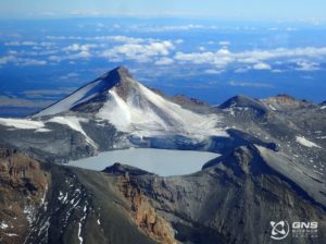
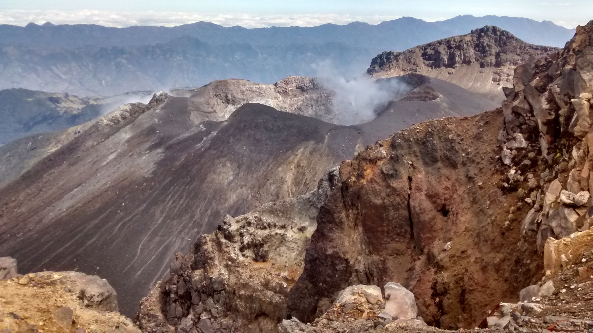
Colombia , Galeras :
San Juan de Pasto, October 21, 2025, 4:50 p.m.
Regarding the monitoring of the activity of the Galeras Volcano, the Colombian Geological Survey (SGC), an entity affiliated with the Ministry of Mines and Energy, reports that:
From October 14 to 20, 2025, the main variations in the monitored parameters compared to the previous week were:
● Among the fluctuations in volcanic activity, a slight increase in seismic occurrence and a decrease in the released seismic energy were observed. The predominance of seismic activity associated with rock fracturing processes within the volcanic edifice continued.
● The earthquakes were of low energy and occurred mainly near the main crater, less than 1 km away, less than 2 km deep from the Galeras summit (4,200 m above sea level), and with magnitudes below 0.7.
● During the week, columns of white gas were observed, low in height and dispersed along the wind direction, originating mainly from the fumarole fields of El Paisita, to the north, and Las Chavas, to the west.
● Other volcanic monitoring parameters remained stable.
Based on the above, the SGC recommends closely monitoring their development through weekly bulletins and other information published through our official channels, as well as instructions from local and departmental authorities and the National Disaster Risk Management Unit (UNGRD).
Volcanic activity remains on alert. Yellow: Active volcano with changes in the basic behavior of monitored parameters and other manifestations.
Source et photo : SGC.
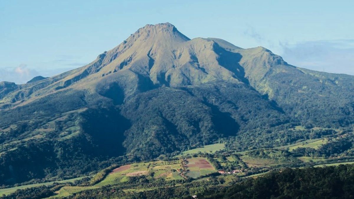
La Martinique , Mount Pelée :
Weekly report, Paris Institute of Earth Physics, Martinique Volcanological and Seismological Observatory
Saint-Pierre, October 24, 2025 at 4:30 p.m. local time (GMT-4)
Volcanic activity decreased this week, with 171 earthquakes of volcanic origin observed.
Between October 17, 2025 at 4:00 p.m. (UT) and October 24, 2025 at 4:00 p.m. (UT), the OVSM recorded:
• 167 shallow volcano-tectonic earthquakes. Of these, 21 had a magnitude (duration magnitude Md or local magnitude Mlv) greater than 0.5, and two had a magnitude greater than 1.0. The largest had a magnitude Mlv = 1.54. The others were of lower energy. These earthquakes are located at depths between 0.4 and 4.0 km below the volcano’s summit. Several of them originate from the well-known seismically active zones at Mount Pelée, located between 1.0 and 1.4 km deep below the volcano’s summit. The superficial volcano-tectonic seismicity is associated with micro-fracturing in the volcanic edifice, linked to the global reactivation of the volcano observed since 2019.
• 4 shallow hybrid earthquakes. Three of these were located approximately 1 km below the volcano’s summit, with local magnitudes ranging from Mlv = 0.45 to Mlv = 1.05. The seismic signals from hybrid earthquakes are enriched in low frequencies and are associated with the circulation of fluids (gas, hydrothermal fluids) within the volcanic edifice.
No earthquakes were felt by the population.
The previous week, the OVSM recorded 408 earthquakes of volcanic origin. As of October 24, 2025, and over the past four weeks, the OVSM has observed a total of 5,830 volcanic earthquakes, an average of 1,457 to 1,458 earthquakes per week.
During phases of volcanic reactivation in volcanoes similar to Mount Pelée, seismic activity of varying intensity and frequency is commonly observed. The probability of short-term eruptive activity remains low. However, given all the observations collected since the end of 2018 and their nature, and based on recent observations by the OVSM-IPGP, we cannot rule out a change in the situation in the medium term (weeks, months).
For more details on observations and interpretations of volcanic activity over the longer term, refer to the OVSM monthly bulletins.
The volcanic alert level, in accordance with the measures planned by the authorities, is currently YELLOW: vigilance.
Source et photo : Direction de l’OVSM-IPGP.
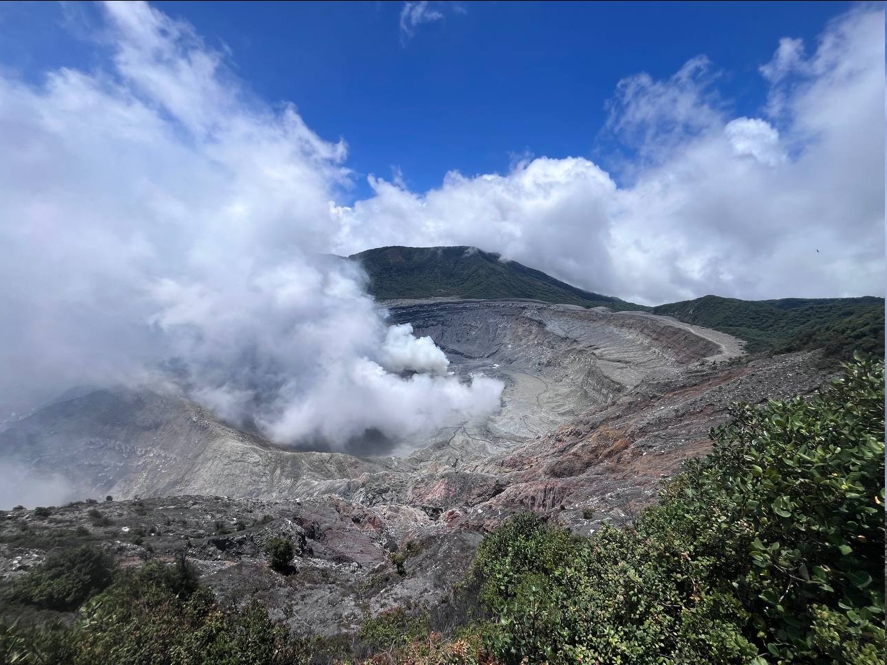
Costa Rica , Poas :
OVSICORI-UNA Weekly Volcano Monitoring Bulletin
October 24, 2025
Latitude: 10.20°N;
Longitude: 84.23°W;
Altitude: 2,687 m.
Current Activity Level: Alert
During the week, a small eruption was recorded on Monday, October 20, 2025, accompanied by ballistic projectiles, and several water-rich phreatic eruptions occurred on Thursday, October 23, 2025. These events are part of the same eruptive period observed since early 2025.
This week, the tremor amplitude remains high compared to previous months. The increase began after the flooding of Mouth A on September 9, and the amplitude remained constant throughout October, with slight fluctuations. The acoustic tremor remains low in intensity, with little variation. This week, an increase in the number of long-period events was observed after Monday’s eruption. Four proximal volcanotectonic events were recorded: three in the southern sector of the national park and one beneath the active crater. Prior to Monday’s eruption, no significant changes were observed in seismological monitoring parameters. The only change observed before Thursday’s eruption was a low-frequency tremor that began 45 minutes before the eruption. The acoustic magnitudes of the eruptions are low (2.9 and 1.6) compared to those of the largest eruptions this year, in March and April (> 3).
The geodetic network does not record any significant deformation. A slight contraction and subsidence of the volcano are detected.
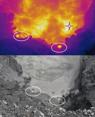
Hot blocks around Inlet A observed on Wednesday, October 21.
MultiGAS stations measured an average SO₂/CO₂ ratio of 2.1 ± 0.6 this week, similar to last week’s (2.3 ± 0.8). The H₂S/SO₂ ratio has remained very low (< 0.1) in recent weeks. The ExpoGAS station, located on the visitor observation deck, measured a maximum of 6.0 ppm SO₂ this week, which represents a high concentration, but within the range observed in recent weeks. DOAS stations measured a slight increase in SO₂ flux (240 ± 139 t/d) compared to the previous week (165 ± 131 t/d). Additionally, satellite measurements of atmospheric SO₂ have returned high levels, exceeding 200 tonnes this week, with a peak of 454 tonnes of SO₂ on October 18. The level of the new lake has dropped by approximately 1.2 m this week despite significant daily rainfall, particularly on October 23. On October 21, the lake temperature was measured at 77 °C, meaning it remains very hot and undergoing heavy evaporation. Ballistic impacts from the October 20 eruption were observed up to 100 m southeast of the eruptive focus.
Source : Ovsicori.
Photos : RSN , Ovsicori .