May 22 , 2025 .
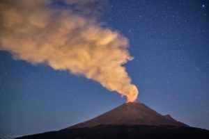
Japan , Sakurajima :
The Japan Meteorological Agency (JMA) reported ongoing eruptive activity at Minamidake Crater (Aira Caldera’s Sakurajima volcano). No eruptive events were recorded during 5-15 May, though inflation continued to be detected in deformation data, notably starting at 20h00 on 12 May. Sulfur dioxide emissions were slightly low, averaging 300 tons per day (t/d); the last measurement was 900 t/d on 2 May. Continuous eruptive activity, including seven explosions, began at around 10h45 on 15 May and ended at around 04h00 on 16 May, producing ash plumes that rose as high has 3 km above the summit and drifted in multiple directions. Large blocks were ejected as far as 1.2 km from the vent. Field observations confirmed notable ashfall on the E part of the island on 15 May and the N side of the island on 16 May. Deformation data showed a period of deflation after explosions on 15 May, then inflation resumed. Eruptive activity occurred intermittently during 16 May through at least 15h00 on 19 May; 86 eruptive events and 44 explosions were detected, generating ash plumes that generally rose as high as 2.9 km above the crater and ejecting blocks as far as 900 m from the crater rim. An ash plume from an explosion at 18h54 on 18 May rose 3.2 km above the crater rim and rifted SE, and large blocks were ejected as far as 1.2 km from the crater rim. The Alert Level remained at 3 (on a 5-level scale), and the public was warned to be cautious within 2 km of both the Minimadake and Showa craters.
The Aira caldera in the northern half of Kagoshima Bay contains the post-caldera Sakurajima volcano, one of Japan’s most active. Eruption of the voluminous Ito pyroclastic flow accompanied formation of the 17 x 23 km caldera about 22,000 years ago. The smaller Wakamiko caldera was formed during the early Holocene in the NE corner of the caldera, along with several post-caldera cones. The construction of Sakurajima began about 13,000 years ago on the southern rim and built an island that was joined to the Osumi Peninsula during the major explosive and effusive eruption of 1914. Activity at the Kitadake summit cone ended about 4,850 years ago, after which eruptions took place at Minamidake. Frequent eruptions since the 8th century have deposited ash on the city of Kagoshima, located across Kagoshima Bay only 8 km from the summit. The largest recorded eruption took place during 1471-76.
Sources : Japan Meteorological Agency (JMA) , GVP.
Photo : Alex Tor ( 15 Mai 2025)
Hawaii , Kilauea :
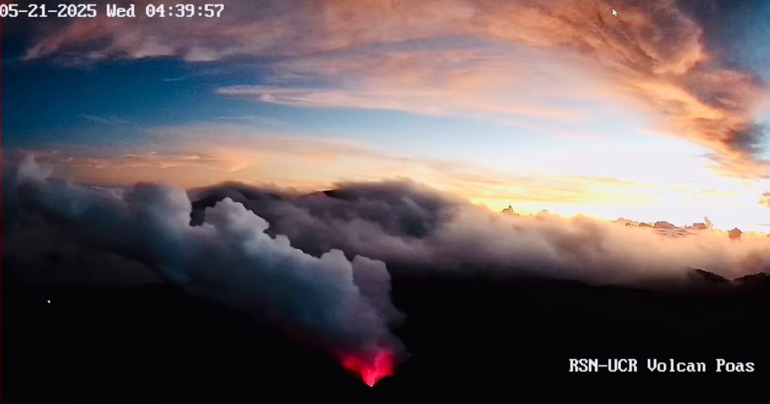
Wednesday, May 21, 2025, 8:56 AM HST (Wednesday, May 21, 2025, 18:56 UTC)
19°25’16 » N 155°17’13 » W,
Summit Elevation 4091 ft (1247 m)
Current Volcano Alert Level: WATCH
Current Aviation Color Code: ORANGE
Activity Summary:
The Halema‘uma‘u eruption is currently paused. Episode 23 is likely to start between today and Friday.
Kīlauea’s current eruption in Halemaʻumaʻu crater within Kaluapele (the summit caldera) began on December 23, 2024. There have now been 22 episodes separated by pauses in activity. All eruptive activity remains within Hawaiʻi Volcanoes National Park.
Kilauea Message 2025-05-21 10:25:46 HST
Episode 23 lava fountaining will likely start between today and Friday. Intermittent lava spattering is occurring in both vents. Precursory low-level activity is expected to increase before the onset of sustained fountains
Kilauea Message 2025-05-21 13:53:04 HST
Episode 23 precursory low-level activity is increasing. Intermittent dome fountaining begain in the north vent at 1:17 PM. Low-level activity is expected to continue increasing before the onset of sustained fountains.
Summit Observations:
Orange glow was visible overnight from both vents, indicating that magma remains close to the surface within the conduits. Intermittent low-level spattering was also observed in the north vent.
The tiltmeter at Uēkahuna (UWD) has recorded approximately 8 microradians of inflationary tilt since the end of episode 22 on May 16. Low level tremor continues along with a small number of shallow earthquakes.
Sulfur dioxide (SO2) emission rates are similar to rates recorded during prior pauses, around 1,200 tonnes per day (t/d).
Source et photo : HVO.
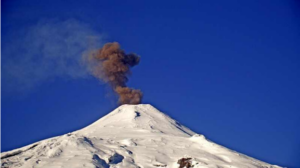
Iceland , Reykjanes Peninsula :
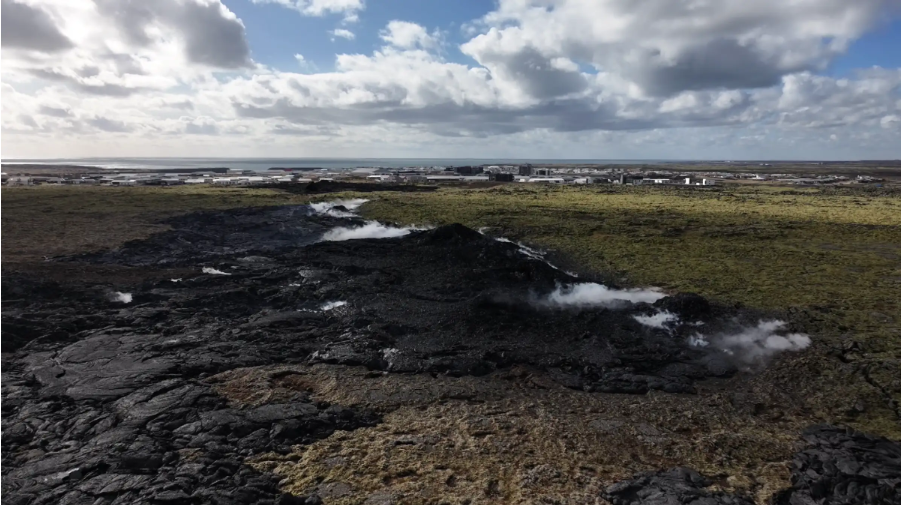
Continued Uplift in Svartsengi , Update 20. May
Based on the rate of magma accumulation in recent weeks, the likelihood of a new eruption may increase as autumn approaches
Earthquake activity near the dike continues to decline
The Hazard assessment remains unchanged and is valid until June 3, provided no changes occur
Continued uplift is being measured in Svartsengi, indicating ongoing magma accumulation in the area. If the rate of uplift continues at the same rate as recent days, it can be assumed that the likelihood of a magmatic dike or eruption will begin to increase as autumn approaches. However, changes in the rate of uplift—and therefore magma accumulation beneath Svartsengi—could affect this assessment .
Scientists at the Icelandic Met Office continue to revise potential future scenarios that may develop from the ongoing magma accumulation in Svartsengi.
Earthquake activity near the dike that formed on April 1st continues to decrease. Most of the earthquakes have occurred at the southern part of the dike, however it has steadily declined in recent days. Seismic activity in Fagradalsfjall has also decreased.
The hazard assessment map has been updated and remains valid until June 3rd, unless conditions change. The next news update will also be on June 3.
Source : IMO
Photo : RÚV – Víðir Hólm Ólafsson Capture d’écran 2025-04-05
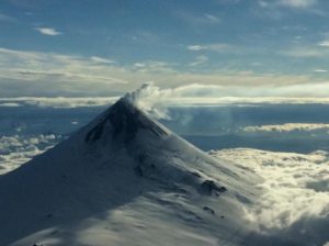
New Zealand , Ruapehu :
Crater Lake cooling, minor volcanic unrest continues at Mt Ruapehu. Volcanic Alert Level remains at 1.
Published: Thu May 22 2025 9:30 AM
Aviation Colour Code remains at Green
Ruapehu’s Crater Lake is slowly cooling and is now 17°C. Heat flux is low while sulphur dioxide gas emissions continue. The Volcanic Alert Level remains at 1 and the Aviation Colour Code at Green.
Since our last update in February, temperatures at Te Wai ā-moe (Ruapehu Crater Lake) have hovered around 20 ºC but are now showing a slow decline to 17°C. Heat flux modelling indicates there is a continuous heat input of about 50 MW. Heat input typically ranges from around 30, to over 300 – 400 MW when the lake is hotter (over 35 °C).
Sulphur dioxide emissions measured by our continuous gas emission detectors continue to show low-level, continuous gas flux of around 100 – 150 tonnes per day. These observations are consistent with background activity at Ruapehu, with some minor input of volcanic gas from depth into the Crater Lake, keeping it warm.
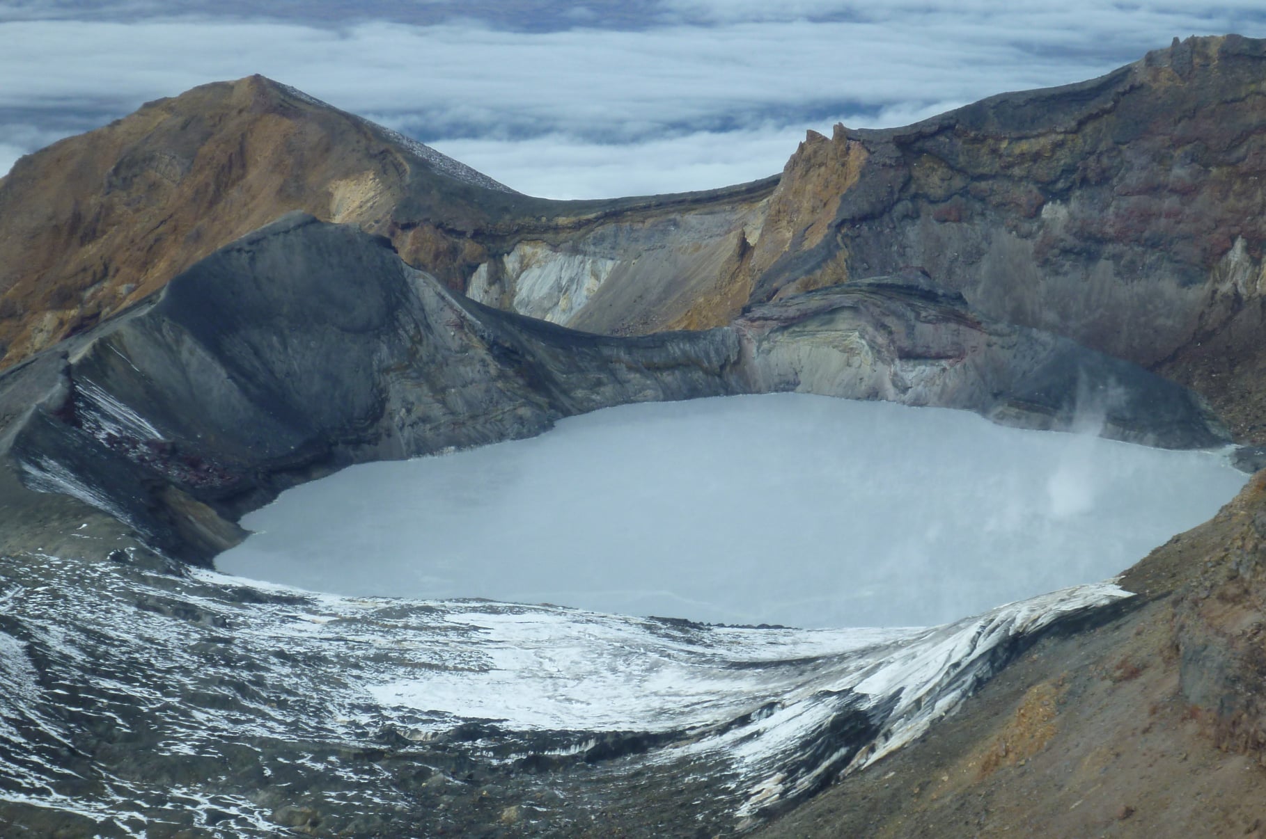
The lake has not heated as much as is expected during a heating cycle, however, the measurable flow of gas through the lake suggests that vents remain open. Crater Lake water samples taken on 6 May 2025 show no departure from long-term trends.
We recently upgraded the data logger system at the outlet of the lake. A key addition is a multi-gas system to measure key volcanic gases at high rate. The lake level and temperature sensors have also been upgraded.
Since February volcanic tremor has remained low, reflecting the low heat input and gas flux from depth. We have detected some occasional small earthquakes beneath the summit which is a typical behaviour at Ruapehu.
Our recent observations are consistent with the ongoing, low-level volcanic unrest at Ruapehu and, therefore, the Volcanic Alert Level remains at 1 and the Aviation Colour Code remains Green.
Source et photo : Geonet / Craig Miller / Duty Volcanologist .
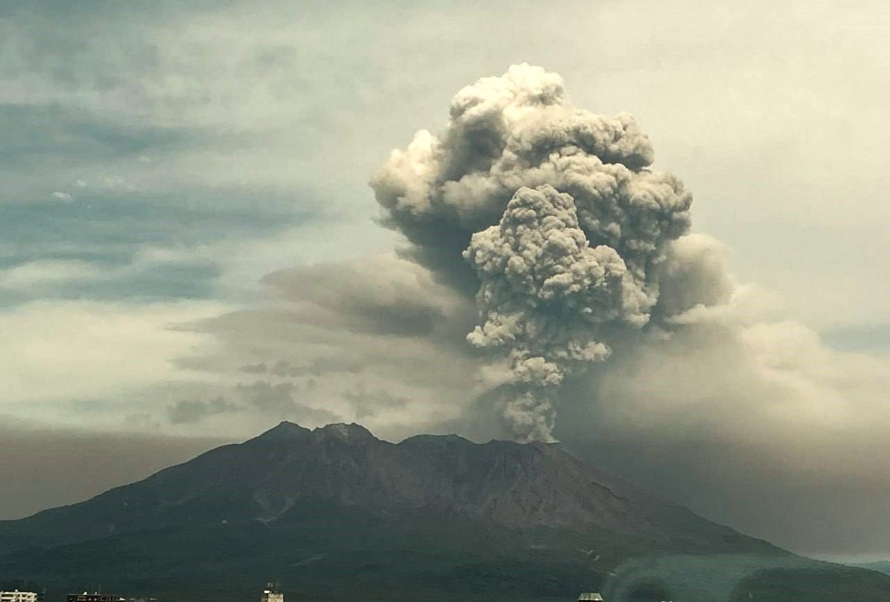
Costa Rica , Poas :
The last energetic eruptive event occurred on Thursday, April 8, at 2:04 p.m. Since then, eruptive activity has ceased, except for a short (5-minute) sequence of small phreatic explosions at Boca C on May 12 at 8 a.m.
Over the past seven days, seismic tremor has remained relatively low compared to recent weeks, although variations have been observed. The most significant event occurred on May 14, in the afternoon and evening, when the intensity of the tremor, monochromatic in character and with a dominant frequency of 2.8 Hz, increased considerably. This episode ended with a sudden collapse in the evening.
The acoustic tremor remained almost constant, with some variations, but generally of low intensity. On May 12, a short (5 min) sequence of infrasound pulses was recorded, associated with small phreatic explosions at Boca C.
The number of long-period events remains low, and no other volcano-tectonic earthquakes have been recorded since May 8. However, only two distal events and one proximal event have been detected.
Geodetic monitoring has detected vertical uplift and expansion of the crater since December 2024, with amplitude varying from week to week. Overall, ground uplift north of the crater reached 3 to 4 cm, which is comparable to what was observed during the 2017 eruptive period. During the past week, no significant vertical deformation has been recorded, but crater contraction has been recorded.
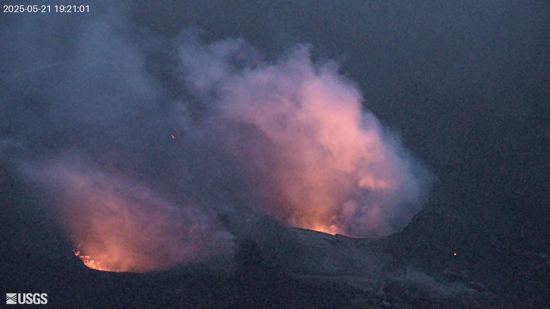
The Poás volcano continues to emit large quantities of magmatic gases, although less compared to recent weeks. The average SO2 flux measured by the DOAS station decreased slightly this week (387 ± 167 t/d) compared to the previous week (437 ± 173 t/d). This week’s DOAS readings indicate SO2 fluxes between 2,000 t/d and 3,000 t/d, significantly lower than the maximum value recorded on April 22 of 11,000 t/d. The mass of SO2 measured in the atmosphere by the TROPOMI sensor on the Sentinel-5P satellite shows a significant decrease since April 26 (> 2,000 tons of SO2) with some variability (200 to 500 tons of SO2 this week), although 200 tons is still a high value for SO2. Water has been observed at Boca C for at least 10 days. This presence increased this week and became a lake on Tuesday, May 13, which continued to grow throughout the rest of the week. Almost no ash was detected in the plume this week. A bright light was observed at night at Boca A by surveillance cameras, of an intensity similar to that of Holy Week. A maximum temperature of approximately 250°C was measured at night.
The Observatorio Vulcanológico y Sismológico de Costa Rica-Universidad Nacional (OVSICORI-UNA) reported continuing gas-and-steam emissions that occasionally contained ash at Poás during 14-20 May. Activity generally decreased during the week, and deformation data indicated deflation. Vigorous gas-and-steam emissions continued at Boca A and incandescence was visible at night. Water that had pooled at Boca C continued to bubble; torrential rains during the beginning of the week continued to fill the crater. A moderate phreatic eruption at 04h08 on 18 May generated a gas-and-steam plume with minor amounts of ash that rose 1 km above the crater rim and drifted SW. Sulfur dioxide emissions detected in satellite data were estimated to be 650 tons per day (t/d) on 18 May, 350 t/d on 19 May, and 598 t/d on 20 May. The volcano’s Alert Level remained at 3 (the second highest level on a four-level scale) and the Aviation Color Code remained at Orange (the second highest color on a four-color scale).
Sources: Observatorio Vulcanologico y Sismologico de Costa Rica-Universidad Nacional (OVSICORI-UNA), GVP
Photo : Capture d’écran RSN-UCR ,22 Mai 2025 .