April 3 , 2025.
Hawaii , Kilauea :
Wednesday, April 2, 2025, 12:23 PM HST (Wednesday, April 2, 2025, 22:23 UTC)
19°25’16 » N 155°17’13 » W,
Summit Elevation 4091 ft (1247 m)
Current Volcano Alert Level: WATCH
Current Aviation Color Code: ORANGE
Activity Summary:
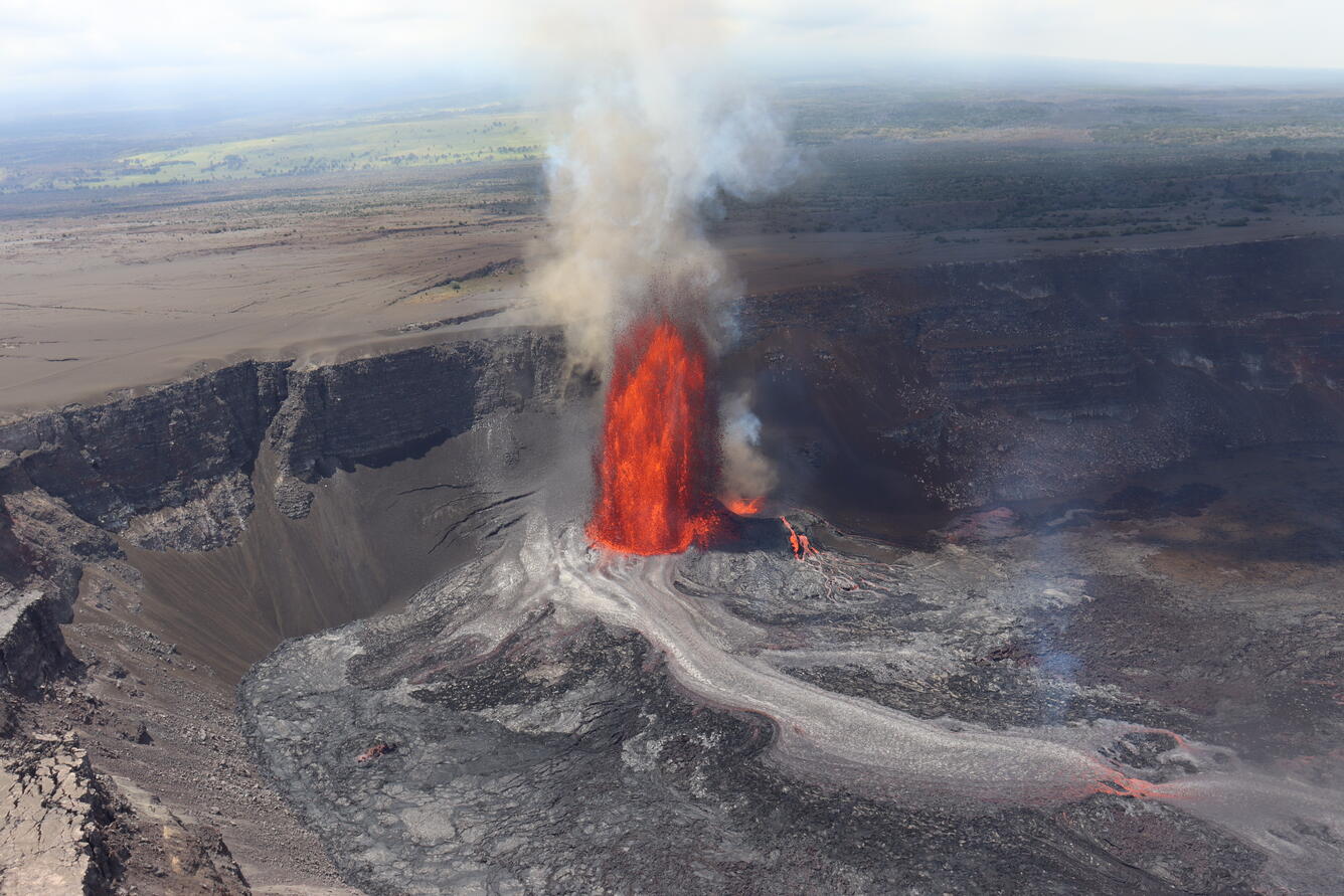
Episode 16 of the ongoing Halemaʻumaʻu eruption ended at 12:03 p.m. HST on April 2 when high fountaining at the south vent stopped. Fountains from the south vent sustained heights of 600-700 feet (180-210 meters) for over 23 hours, then dropped to less than 300 feet (90 meters) at 9:50 a.m. HST this morning, April 2. Overall, episode 16 lasted just over 37 hours with the last 25 hours and 39 minutes consisting of fountains from the south vent.
During episode 16, lava flows covered over 50% of the floor of Halemaʻumaʻu within the southern part of Kaluapele (Kīlauea caldera). Weak winds also resulted in deposition of Pele’s hair and tephra in closed areas of Hawai’i Volcanoes National Park and on Highway 11 between mile marker 35 and 37 on April 1.
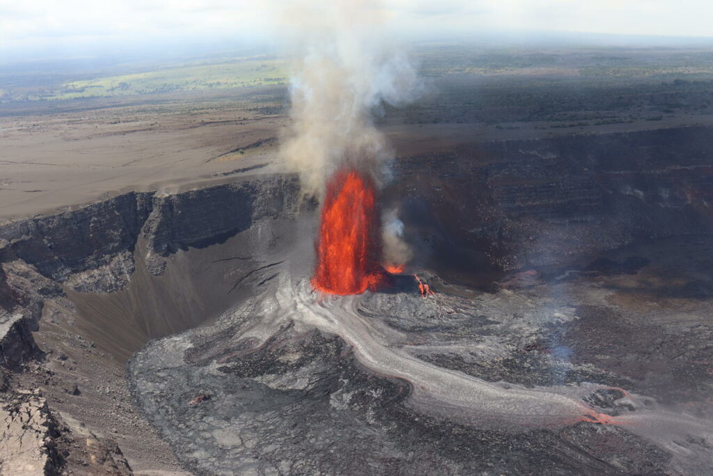
Helicopter overflight view of episode 16 lava fountain and its lava flow on the crater floor of Kaluapele at around noon on April 1, 2025. The lava flow at this time had traveled 2,300 ft (700 m) from the fountain along the floor of Halemaʻumaʻu.
The UWD tiltmeter recorded just over 14 microradians of deflation during episode 16, with 11 microradians lost on the SDH tiltmeter. Deflation rate was constant throughout the first part of the eruption reflecting the stable nature of activity from the south and north vents. The deflation rate slowed slightly after the north vent shut down April 1 at 9:22 p.m. HST. The end of the eruption was coincident with a rapid change in tilt from deflation to inflation at the summit and a decrease in seismic tremor intensity when the fountains ceased at 12:03 p.m. HST.
Each episode of Halemaʻumaʻu lava fountaining since December 23, 2024, has continued for at least 13 hours, and up to 8 days, and episodes have been separated by pauses in eruptive activity lasting less than 24 hours to 12 days.
No changes have been detected in the East Rift Zone or Southwest Rift Zone. HVO continues to closely monitor Kīlauea and will issue an eruption update tomorrow morning unless there are significant changes before then.
Kīlauea Volcano Alert Level/Aviation Color Code remain at WATCH/ORANGE. All current and recent activity is within Hawaiʻi Volcanoes National Park.
Source : HVO
Photo : USGS / D. Downs
Iceland , Reykjanes Peninsula :
No visible activity at the eruptive fissure that opened yesterday
Seismic activity has decreased, although notable micro seismicity persists
Updated April 2, at 15:15 UTC
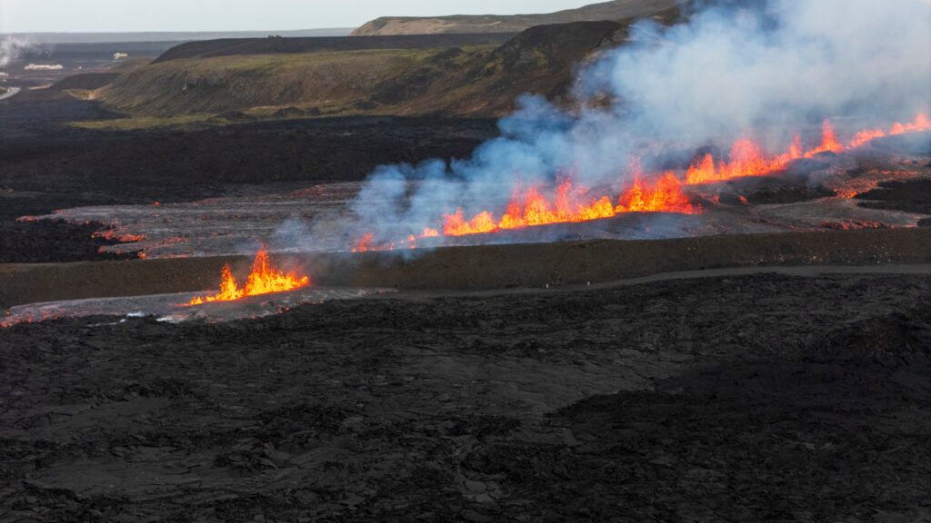
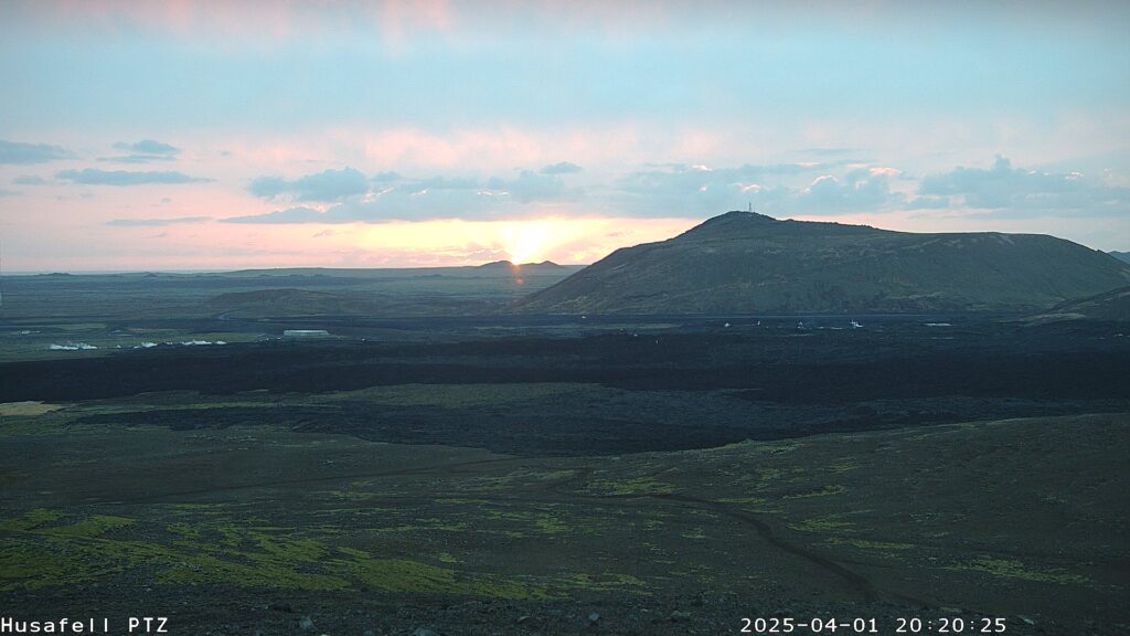
No eruptive activity has been observed at the fissure since yesterday afternoon, although glowing is still visible in the new lava field.
The dike that formed yesterday is nearly 20 km long and is the longest one observed since the seismic unrest began in November 2023.
Since yesterday morning, the ground has subsided more than 25 cm at the GPS station in Svartsengi (SENG) and continues to subside, although at a much slower rate.
Approximately 90% of the magma that had accumulated in the magma chamber beneath Svartsengi since the end of the previous eruption in December 2024 has already transferred into the dike that formed on April 1.
Over time, the likelihood of a new eruptive opening forming along the dike is decreasing, though it cannot be ruled out due to ongoing microseismicity in the area.
Displacements were recorded on several GPS stations within Grindavík in connection with fault movements.
No activity has been observed at the eruptive fissure since yesterday afternoon, though glowing is still visible in the newly formed lava. The area remains unstable and hazardous. Measurements show that the lava volume erupted yesterday was about 0.4 million cubic meters. This estimate is based on data collected by experts from the Icelandic Institute of Natural History during an aerial survey of the eruption site yesterday afternoon. The lava field formed is the smallest one observed since the eruption sequence at Sundhnúkur crater row began in December 2023. Its volume is approximately 1/6 of the lava field from the January 2024 eruption, which was the second smallest event in the sequence.
Despite the small lava field, the dike that formed yesterday is nearly 20 km long—the longest since the onset of seismic unrest in November 2023. This suggests that the vast majority of magma that left the magma chamber beneath Svartsengi, about 90% of the volume accumulated since the previous eruption in December 2024, was used in forming the dike, and only a small portion reached the surface north of Grindavík.
Since yesterday morning, ground subsidence of more than 25 cm has been recorded at the GPS station in Svartsengi (SENG). The latest GPS measurements, from 8 a.m. this morning, confirm that subsidence is ongoing, though it has slowed significantly. Most of the magma that had accumulated since the last eruption has now moved from Svartsengi into the newly formed dike.
Source : IMO
Photos : RUV , IMO.
United-States , Yellowstone :
Tuesday, April 1, 2025, 12:46 PM MDT (Tuesday, April 1, 2025, 18:46 UTC)
44°25’48 » N 110°40’12 » W,
Summit Elevation 9203 ft (2805 m)
Current Volcano Alert Level: NORMAL
Current Aviation Color Code: GREEN
Summary
Yellowstone Caldera activity remains at background levels, with 70 located earthquakes in March (largest = M2.2). Deformation measurements indicate a small amount of caldera subsidence since early October.
Recent Work and News
Although a major eruption of Steamboat Geyser did not occur in March, frequent minor activity started in early March and lasted throughout the month. This pattern of activity suggests that a major eruption will occur in the coming weeks.
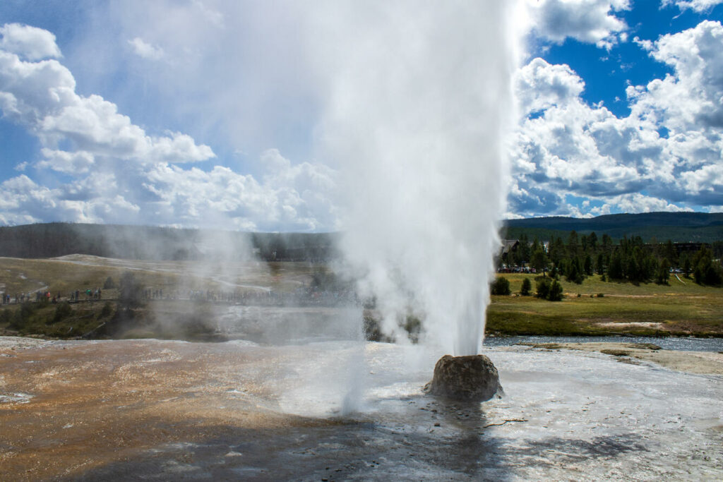
An explosive eruption of silica water erupts from Beehive Geyser located in the Upper Geyser Basin in Yellowstone National Park, Wyoming. The Upper Geyser Basin is also home to the famous Old Faithful geyser which sits just behind Beehive Geyser in the distance.
Seismicity
During March 2025, the University of Utah Seismograph Stations, responsible for the operation and analysis of the Yellowstone Seismic Network, located 70 earthquakes in the Yellowstone National Park region. The largest event of the month was a micro earthquake of magnitude 2.2 located about 6 miles north of West Yellowstone, Montana, on March 20 at 3:26 AM MST.
March seismicity in Yellowstone was marked by two swarms.
A swarm of 22 earthquakes was located approximately 6 miles north-northwest of West Yellowstone, Montana, during March 3 – 4. The largest earthquake in the sequence was a magnitude 0.55 on March 3 at 07:21 PM MST.
A swarm of 11 earthquakes occurred approximately 6 miles north of West Yellowstone, Montana, during March 19 – 22. The largest earthquake in the sequence was also the largest in March (described above).
Yellowstone earthquake activity is currently at background levels.
Ground Deformation
Continuous GPS stations in Yellowstone Caldera recorded a small amount (just over 2 centimeters, or about an inch) of subsidence since October. This pattern and rate of subsidence continues a trend that started in 2015–2016. Minor subsidence (about 1 centimeter, or about half an inch) was also measured by a continuous GPS station near Norris Geyser Basin since the end of last summer.
Source et photo : YVO
Indonesia , Dukono :
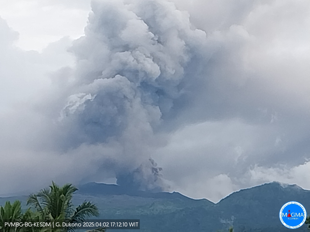
An eruption of Mount Dukono occurred on Wednesday, April 2, 2025, at 4:52 PM WIT with an observed ash column height of ± 1500 m above the peak (± 2587 m above sea level). The ash column was observed to be white to gray in color with a thick intensity, oriented southwest. At the time of writing, the eruption was still ongoing.
The Pusat Vulkanologi dan Mitigasi Bencana Geologi (PVMBG) reported that the eruption at Dukono was ongoing during 19-25 March. White-and-gray or gray ash plumes that were often dense rose as high as 1.1 km above the crater rim and drifted NW, W, E, and NE on all days except 23 March. Rumbling and banging sounds were sometimes accompanied by strong booms during 19 and 24-25 March. Ashfall was reported in Tobelo (15 km ENE) and surrounding areas during 24-25 March. The Alert Level remained at Level 2 (on a scale of 1-4) and the public was warned to stay 4 km away from the Malupang Warirang Crater.
VOLCANO OBSERVATORY NOTICE FOR AVIATION – VONA
Issued : April 02 , 2025
Volcano : Dukono (268010)
Current Aviation Colour Code : ORANGE
Previous Aviation Colour Code : orange
Source : Dukono Volcano Observatory
Notice Number : 2025DUK053
Volcano Location : N 01 deg 41 min 35 sec E 127 deg 53 min 38 sec
Area : North Maluku, Indonesia
Summit Elevation : 3478 FT (1087 M)
Volcanic Activity Summary :
Eruption with volcanic ash cloud at 07h52 UTC (16h52 local).
Volcanic Cloud Height :
Best estimate of ash-cloud top is around 8278 FT (2587 M) above sea level or 4800 FT (1500 M) above summit. May be higher than what can be observed clearly. Source of height data: ground observer.
Other Volcanic Cloud Information :
Ash cloud moving to southwest. Volcanic ash is observed to be white to gray. The intensity of volcanic ash is observed to be thick.
Remarks :
Eruption and ash emission is continuing. Eruption recorded on seismogram with maximum amplitude 34 mm. Tremor recorded on seismogram with maximum amplitude 4 mm.
Source et photo : Magma Indonésie .
Costa Rica , Poas :
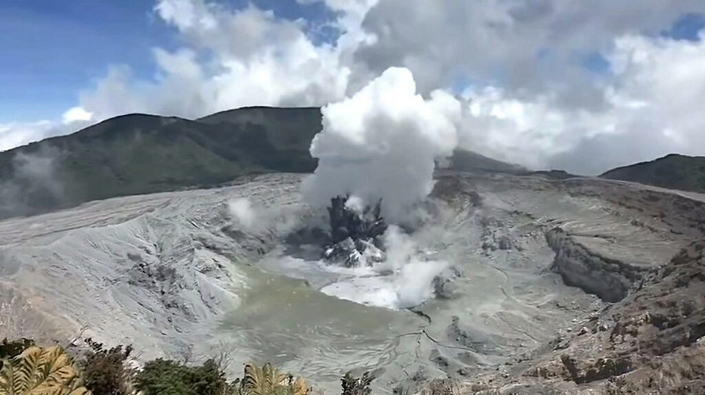
The Observatorio Vulcanológico y Sismológico de Costa Rica-Universidad Nacional (OVSICORI-UNA) reported that eruptive activity at Poás continued at an elevated level during 19-25 March. Significant inflation continued to be detected and gas-and-steam emissions were ongoing. Analysis of the ash revealed a significant amount, around 20 percent, of juvenile material. Sulfur dioxide emissions fluctuated at high levels, with averages ranging from 675-844 tons per day (t/d) during 19-20 March, based on MultiGAS station data. Sulfur dioxide emissions detected in satellite data were as high as 844 t/d on 20 March. Occasional phreatic eruptions were recorded by the seismic and acoustic network. Two small phreatic eruptions on 19 March ejected material 50-100 m high and another recorded at 1815 on 20 March produced a 200-m-high plume. A small phreatic eruption at Boca C on 23 March was followed by a period of small, very frequent events during 23-25 March; weather conditions obscured views of the crater. Video from 0747 on 25 March showed a phreatic eruption ejecting dark material above the vent and a steam plume drifting downwind. Ballistics were ejected onto the crater floor. The Alert Level remained at 3 (the second highest level on a four-level scale) and the Aviation Color Code remained at Orange (the second highest color on a four-color scale).
ERUPTION REPORT – OVSICORI-UNA
Location: N10.20 W84.23
Mass Height: 2687 m (8813 ft)
Date: April 2, 2025 Time: 11:16
Plume Height (above the crater): 1312 ft (400 m)
Observed Activity:
Eruption with a gas and ash column approximately 400 m high.
Northwest winds could transport ash to the southeast of the volcano.
The amplitude of the seismic tremor is variable.
The amount of SO2 emitted remains high. On March 30, the SENTINEL satellite detected a mass of 2,200 tons of SO2, the highest value observed since the last eruptive period of Poás in 2017-2019. The volcanic edifice swelled due to the pressure of magmatic fluids.
The Poás Mountain has continued to erupt almost continuously from March 23 to the present day. Sporadically, ballistic projections of rocks with temperatures of at least 300°C (the typical temperature of the hydrothermal system is between 100 and 400°C) are observed. Rocks fall back into the crater.
Sources : Observatorio Vulcanologico y Sismologico de Costa Rica-Universidad Nacional (OVSICORI-UNA) , GVP.
Photo : Rod Cortes / FB

