January 17 , 2025 .
Hawaii , Kilauea :
Thursday, January 16, 2025, 9:15 AM HST (Thursday, January 16, 2025, 19:15 UTC)
19°25’16 » N 155°17’13 » W,
Summit Elevation : 4091 ft (1247 m)
Current Volcano Alert Level: WATCH
Current Aviation Color Code: ORANGE
Activity Summary:
The summit eruption at Kīlauea volcano that began on December 23 entered its fourth eruptive episode yesterday morning at about 9:15 a.m. H.S.T., and continues this morning. All eruptive activity remains confined within Kaluapele (the summit caldera). No unusual activity has been noted along Kīlauea’s East Rift Zone or Southwest Rift Zone.
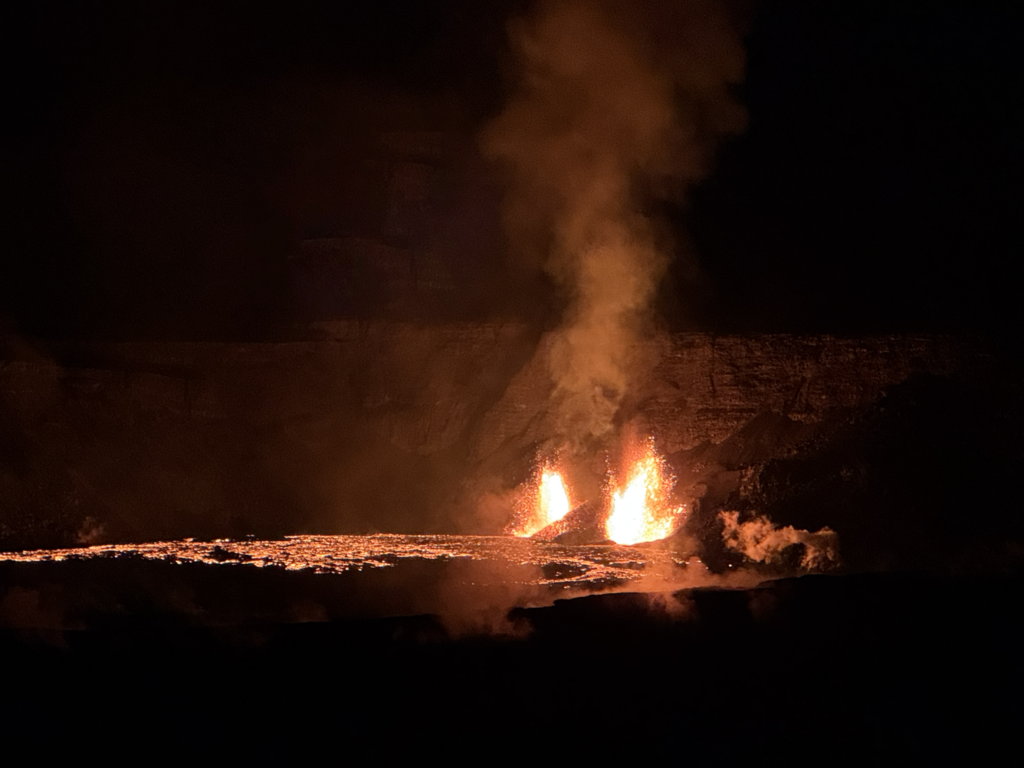
Telephoto view of the two vents erupting in the southwest part of Kīlauea summit caldera at approximately 6 a.m. HST. This view is to the southwest, from Volcano House within Hawaiʻi Volcanoes National Park.
Summit Eruption Observations:
The summit eruption at Kīlauea volcano that began on December 23 entered its fourth eruptive episode (Episode 4) yesterday morning at about 9:15 a.m. H.S.T. with a small sluggish lava flow exiting the north vent. Lava flow activity increase in rigor around 9:50 a.m., and lava fountaining began at north vent around 9:55 a.m. South vent became active around 11:40 a.m., also with lava fountaining and associated lava flows. Yesterday afternoon, field crews reported lava fountain heights of 90 to 100 meters (295 to 330 feet) from the north vent and 40 to 50 meters (130 to 160 feet) from the south vent. Both fountains were active overnight, with the north vent fountain consistently higher than the south vent. This morning, field crews reported lava fountain heights of 50 meters (160 feet) and 40 m (140 feet) from north and south vents, respectively. At about 8:25 a.m. this morning, field crews reported that parts of the south vent collapsed, with an associated reduction of about half in south vent lava fountain height. Lava flow activity has remained confined to the southwest crater floor area near the active vents. There are reports of Pele’s hair falling on nearby communities, specifically the Volcano Golf Course subdivision, this morning .
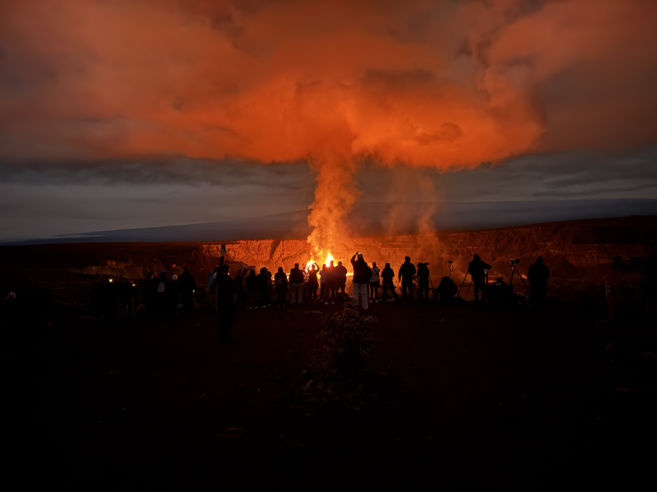
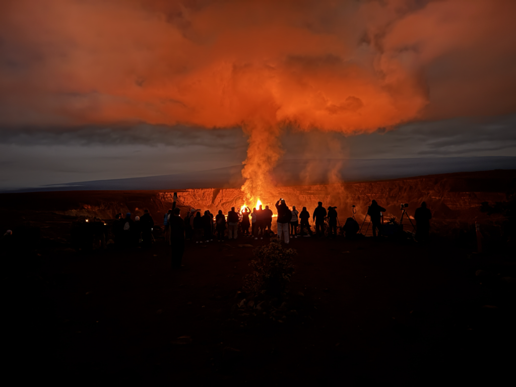
Early morning view of visitors gathered at Keanakākoʻi Overlook in Hawaiʻi Volcanoes National Park to view the ongoing Kīlauea eruption within Halema’uma’u in Kaluapele (the summit caldera). As of the morning on January 16, 2025, both the north and south vents are erupting lava fountains which are feeding lava flows in the southwest part of the caldera. The Keanakākoʻi Overloook is approximately 2.4 km (1.5 miles) away from the erupting vents.
Summit Instrumental Observations:
Seismic tremor in the summit region increased rapidly yesterday around 9:40 a.m. H.S.T., and has remained high since, reflective of ongoing eruptive activity. Seismicity in the summit region remains low, with no earthquakes detected in the past 24 hours. Summit tiltmeters have recorded deflation starting around 10:15 a.m. yesterday morning. The most recently measured sulfur dioxide (SO2) emission rate was approximately 560 tonnes per day Monday, January 14, before the start of Episode 4. It is estimated that the SO2 emission rate was approximately 10,000 tonnes per day yesterday after the start of Episode 4; the resulting hazard will be affected by wind conditions.
Rift Zone Observations:
Seismicity remains low in both the East Rift Zone and Southwest Rift Zone, with counts of shallow earthquakes at background levels. The ESC tiltmeter in the upper East Rift Zone has been recorded neither sustained inflation nor deflation since January 3, 2025. Deformation rates remain low in the middle and lower East Rift Zone and in the Southwest Rift Zone, as recorded by GPS instruments and tiltmeters.
Source : HVO
Photo : USGS / K. Mulliken.
Indonesia , Lewotobi Laki-laki :
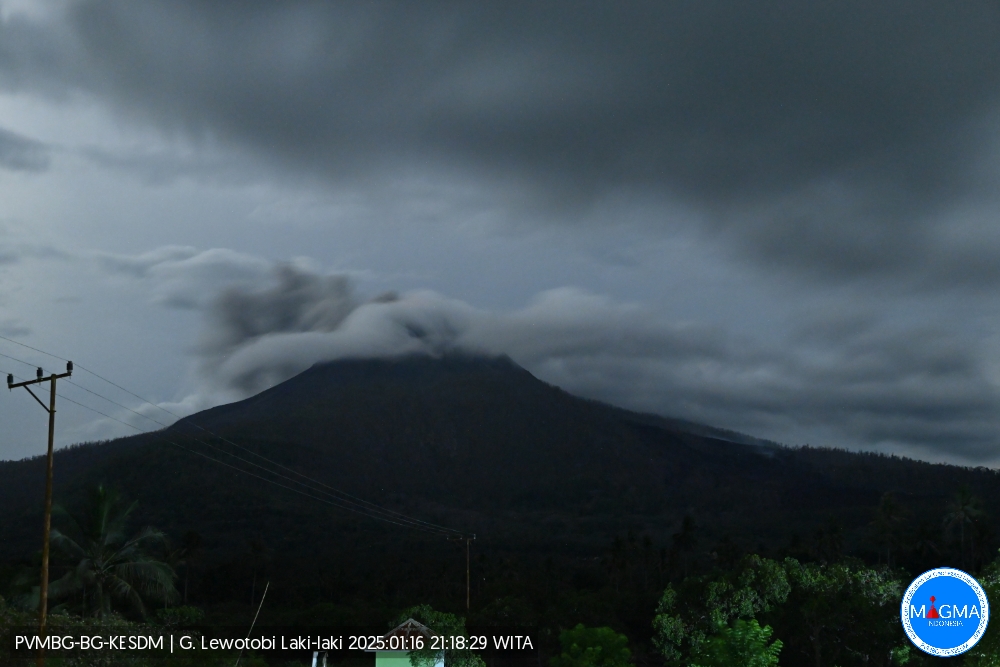
An eruption of Mount Lewotobi Laki-laki occurred on Thursday, 16 January 2025 at 21:10 WITA with an observed ash column height of ±500 m above the peak (±2084 m above sea level). The ash column was observed to be grey in colour with a thick intensity, oriented towards the northeast and east. This eruption was recorded on a seismograph with a maximum amplitude of 14.8 mm and a duration of 270 seconds.
VOLCANO OBSERVATORY NOTICE FOR AVIATION – VONA
Issued : January 16 , 2025
Volcano : Lewotobi Laki-laki (264180)
Current Aviation Colour Code : ORANGE
Previous Aviation Colour Code : orange
Source : Lewotobi Laki-laki Volcano Observatory
Notice Number : 2025LWK016
Volcano Location : S 08 deg 32 min 20 sec E 122 deg 46 min 06 sec
Area : East Nusa Tenggara, Indonesia
Summit Elevation : 5069 FT (1584 M)
Volcanic Activity Summary :
Eruption with volcanic ash cloud at 13h10 UTC (21h10 local).
Volcanic Cloud Height :
Best estimate of ash-cloud top is around 6669 FT (2084 M) above sea level or 1600 FT (500 M) above summit. May be higher than what can be observed clearly. Source of height data: ground observer.
Other Volcanic Cloud Information :
Ash cloud moving from northeast to east. Volcanic ash is observed to be gray. The intensity of volcanic ash is observed to be thick.
Remarks :
Eruption recorded on seismogram with maximum amplitude 14.8 mm and maximum duration 270 second.
Source et photo : Magma Indonésie .
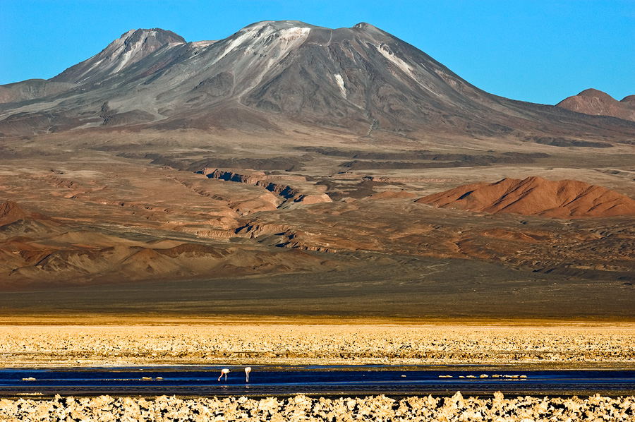
Chile , Lascar :
Seismology
The seismological activity of the period was characterized by the recording of:
55 VT-type seismic events, associated with rock fracturing (Volcano-Tectonic). The most energetic earthquake had a local magnitude (ML) value equal to 0.2, located 0.6 km south-southeast of the volcanic building, at a depth of 4.4 km from the crater.
122 LP-type seismic events, associated with fluid dynamics within the volcanic system (Long Period). The size of the largest earthquake estimated from the reduced displacement parameter (DR) was equal to 10 cm2.
Fluid Geochemistry
Data on sulfur dioxide (SO2) emissions obtained using the Differential Optical Absorption Spectroscopy (DOAS) equipment, corresponding to the Emú station, located 6 km east-southeast (ESE) of the active crater, showed an average value of 293 ± 63 t/d, with a maximum daily value of 717 t/d on December 8.
No anomalies in sulfur dioxide (SO2) emissions into the atmosphere have been reported in the area near the volcano, according to data published by the Tropospheric Monitoring Instrument (TROPOMI) and the Ozone Monitoring Instrument (OMI) Sulfur Dioxide Group.
Thermal anomalies by satellites
During this period, no thermal alerts were recorded in the area associated with the volcano, according to the analytical processing of Sentinel 2-L2A satellite images, in combination with false-color bands.
Geodesy
According to the data provided by two GNSS stations that measure the deformation of the volcano, small-scale displacements can be observed, without any evidence of changes in the internal system of the volcano.
Vertical displacement rates did not exceed 0.1 cm/month, while horizontal displacement rates remained below 0.2 cm/month.
Radar interferometry data available on the MOUNTS platform do not show any deformation in the area of the volcano in the last month.
Surveillance cameras
Images from the fixed camera, installed near the volcano, recorded typical degassing plumes, with a maximum column height of 860 meters during the day of December 30.
Activity has remained at levels considered low, suggesting the stability of the volcano.
The technical volcanic alert remains in effect for:
GREEN TECHNICAL ALERT: Active volcano with stable behavior – No immediate risk
Observation:
Given the behavior of this volcanic system observed over the last ten years, the possibility of sudden explosions of low magnitude and without precursors affecting the immediate vicinity of the active crater cannot be excluded. However, in the context of its base level, this type of event has not been frequent, so it is considered to have a low probability of occurrence. The hazards associated with this minor activity include the ejection of ballistic pyroclasts, the emission of ash and volcanic gases.
Source : Sernageomin
Photo : Gerard Prins ( 2018)
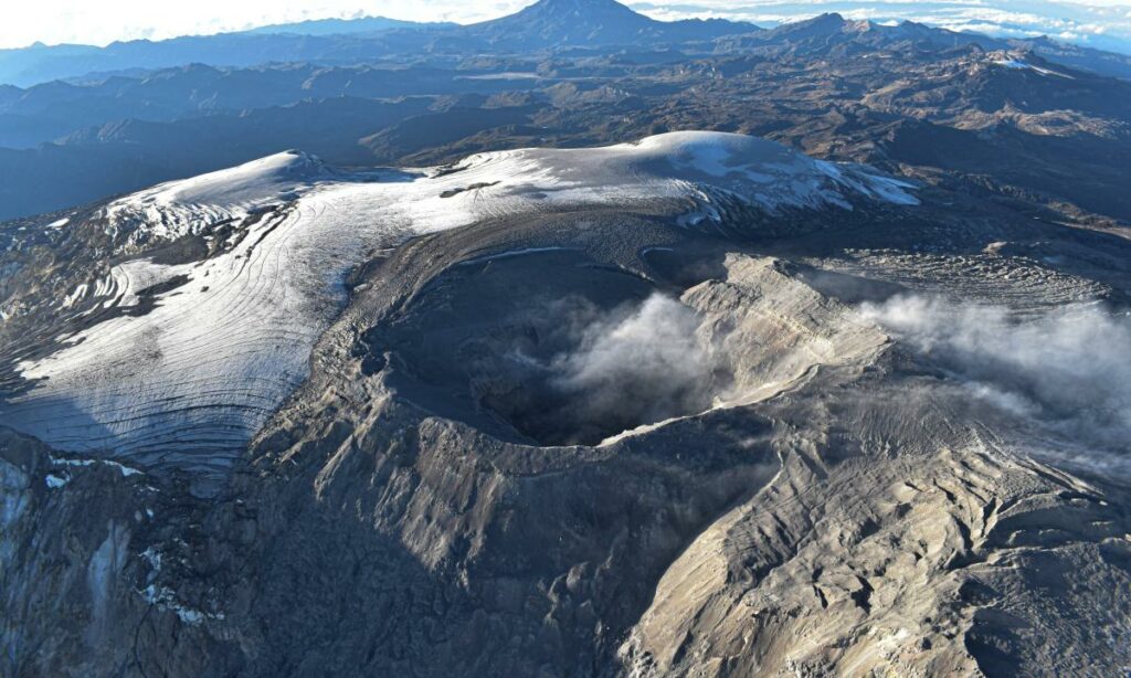
Colombia , Nevado del Ruiz :
Manizales, January 14, 2025, 9:30 p.m.
Following the monitoring of the activity of the Nevado del Ruiz volcano, the Colombian Geological Survey (SGC), an entity attached to the Ministry of Mines and Energy, reports that:
During the week of January 7 to 14, 2025, the volcano continued to display unstable behavior. Compared to the previous week, the main variations in the monitored parameters were:
– The recording of long-period seismicity related to fluid dynamics inside volcanic conduits associated with the continuous emission of ash continued. This seismicity increased in energy levels and was recorded particularly between January 7 and 11. Since dawn today, January 14, the recording has started again from 05:10 a.m. It was possible to visually confirm the continuous emission of ash, a phenomenon that is still occurring at the time of publication of this bulletin. As for the seismic signals associated with the emission of pulsatile ash, these have maintained similar levels in the number of earthquakes recorded and have slightly decreased in the seismic energy released. Thanks to the cameras (conventional or thermographic) used to monitor the volcano, it was possible to confirm some ash emissions and changes in the temperature of the emitted material, related to several of the recorded events. The change in relative temperature recorded on January 7 during the emission of pulsatile ash at 19:47 is highlighted. This change corresponds to the highest estimated value since the start of monitoring of the surface activity of the volcano with thermal cameras (July 1, 2020).
– Seismic activity associated with rock fracturing processes inside the volcanic edifice increased in the number of earthquakes recorded and the seismic energy released. Most of the events of this type of seismicity occurred on January 8 and 9, mainly in the Northeast, East and Southeast sectors, at distances between 2 and 4 km from the Arenas crater and, to a lesser extent, in the crater itself. The depths of the earthquakes varied between 1 km and 6 km. The largest earthquake of the week was of magnitude 2.6 and occurred on January 8 at 7:24 am, during the increase in seismicity, 4 km east of the Arenas crater and at a depth of 5 km. – The emission of water vapor and gas, mainly sulfur dioxide (SO₂), into the atmosphere through the Arenas crater was variable. During the satellite monitoring, carried out in a complementary manner to evaluate this parameter, significant releases of SO₂ were highlighted. – The vertical height of the gas column remained mainly below 800 m measured at the volcanic summit, except on January 7 and 8 when it reached values of 1200 m and 1100 m respectively. In dispersion, it reached 1400 m on January 7, during the pulsatile emission of ash recorded at 07:14. Regarding the direction of dispersion of the gas column, it was oriented towards the West-Northwest side, the North-West side and, to a lesser extent, towards the South-West side of the volcano. Today, there is a continued emission of wind-dispersed ash in a large area southwest of the volcano, which, according to the satellite monitoring report by the VAAC (Volcanic Ash Advisory Center) in Washington, can be seen far north of the department of Valle del Cauca and southern Chocó. We have not yet received any reports of ashfall.
– During the monitoring of thermal anomalies at the bottom of the Arenas crater, using satellite monitoring platforms, some reports of anomalies with low to moderate energy levels were obtained. The detection of these phenomena continued to be limited by the atmospheric conditions of high cloudiness that prevailed in the region for most of the week.
On January 12, it was possible to observe the bottom of the crater from satellite images, in which the thermal anomaly of moderate energy level could be seen, as well as the lava dome, which, according to the comparison made with similar images obtained at the beginning of last year, does not show significant changes in its geomorphology.
Source et photo : SGC
Mexico , Popocatepetl :
January 16, 11:00 (January 16, 17:00 GMT) . Activity in the last 24 hours
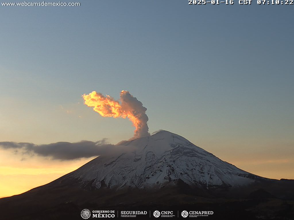
47 low intensity exhalations were detected, accompanied by water vapor, volcanic gases and sometimes light amounts of ash .
In addition, 223 minutes of low amplitude tremor were recorded, including 166 minutes of high frequency and 57 minutes of harmonics .
This morning, an emission of water vapor and other volcanic gases is observed dispersing towards the Northeast .
The Popocatépetl volcanic alert traffic light is at yellow phase 2.
The scenarios anticipated for this phase are:
A few minor to medium-sized explosions
Appearance of a tremor of varying amplitude
Light to moderate ash rains in the surrounding towns and in some more distant towns
Ejection of incandescent fragments within a 12-kilometer exclusion radius
Lahars are likely to occur in the ravines, due to the accumulation of ash on the slopes and their interaction with the rains expected in the coming weeks.
Possibility of pyroclastic flows not reaching the populations
Source et photo : Cenapred.

