October 31 , 2024.
New Zealand , Ruapehu :
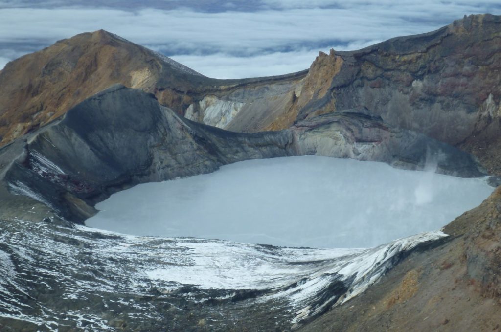
Minor volcanic unrest continues at Mt Ruapehu as lake temperature slowly increases. Volcanic Alert Level remains at 1.
Published: Thu Oct 31 2024 1:00 PM
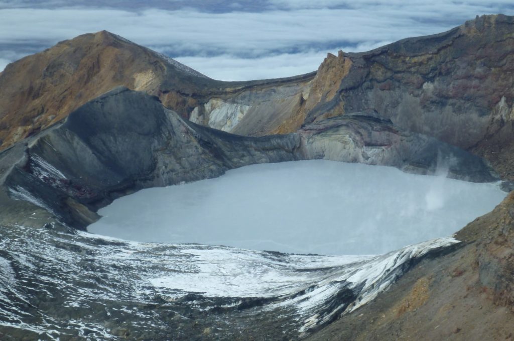
Over recent months Te Wai ā-moe (Ruapehu Crater Lake) has remained cool but recent data suggest a weak heating trend is underway. The lake temperature is now around 10°C to 11°C, slightly up from the low of 8°C. Our gas monitoring sensors continue to measure low–moderate volcanic sulphur dioxide (SO₂) emissions, and volcanic tremor is still weak. An eruption remains unlikely. The Volcanic Alert Level remains at 1 and the Aviation Colour Code at Green.
There are now signs of slow reheating of Te Wai ā-moe (Ruapehu Crater Lake) which has increased in temperature by 2–3ºC since mid-October. The daily average is currently around 10–11ºC, but that is still considered a low temperature.
Te Wai ā-moe started to cool during February, from about 30 ºC, to a low point of 8 ºC in early October. During that cooling, the amounts of sulphur dioxide (SO₂) gas coming out through the lake reduced and volcanic tremor also declined, consistent with the cooling of the hydrothermal system beneath the lake. With decreasing upward heat flow, we also expected some mineral sealing to happen beneath the lake, slowing the rate of gases passing through lake. While the amount of SO₂ gas did decline between February and October 2024, it did not stop which shows that the vent remained partially open throughout that cooling episode. That is consistent with observations of weak upwellings in the lake and floating strands of sulphur on the lake surface.
While the crater lake seems to be heating up again, it is likely that the sub-lake vent remains partially sealed. Should conditions deep inside the volcano change to produce a significant upflow of gas, it is possible a partly sealed zone below the lake could rupture and produce a small eruption. In the past, small eruptions have been seen during heating phases, but we have not recorded any deep seismic changes and in the current state of low-level unrest, the likelihood of an unheralded eruption remains low. Our recent observations are consistent with ongoing, low-level volcanic unrest at Ruapehu. We expect the lake to slowly heat (about 1 ºC per day) during the coming months as part of a typical Ruapehu heating-cooling cycle.
Monitoring indicators remain consistent with a low level of volcanic activity. As a result, the Volcanic Alert Level remains at 1. The Aviation Colour Code remains Green.
Source : Geonet / Mike Rosenburg / Duty Volcanologist
Photo : Geonet
Iceland , Reykjanes Peninsula :
Uplift and Magma Accumulation Continue in Svartsengi at a Steady Rate
Magma accumulation and seismic activity are being closely monitored to evaluate the potential for an upcoming event
Updated 29. October at 18:00 UTC
Recent assessments of magma accumulation suggest that the likelihood of a new intrusion, possibly leading to an eruption, may rise by late November
Seismic activity remains minimal around the Sundhnúkar crater row
The hazard assessment remains unchanged
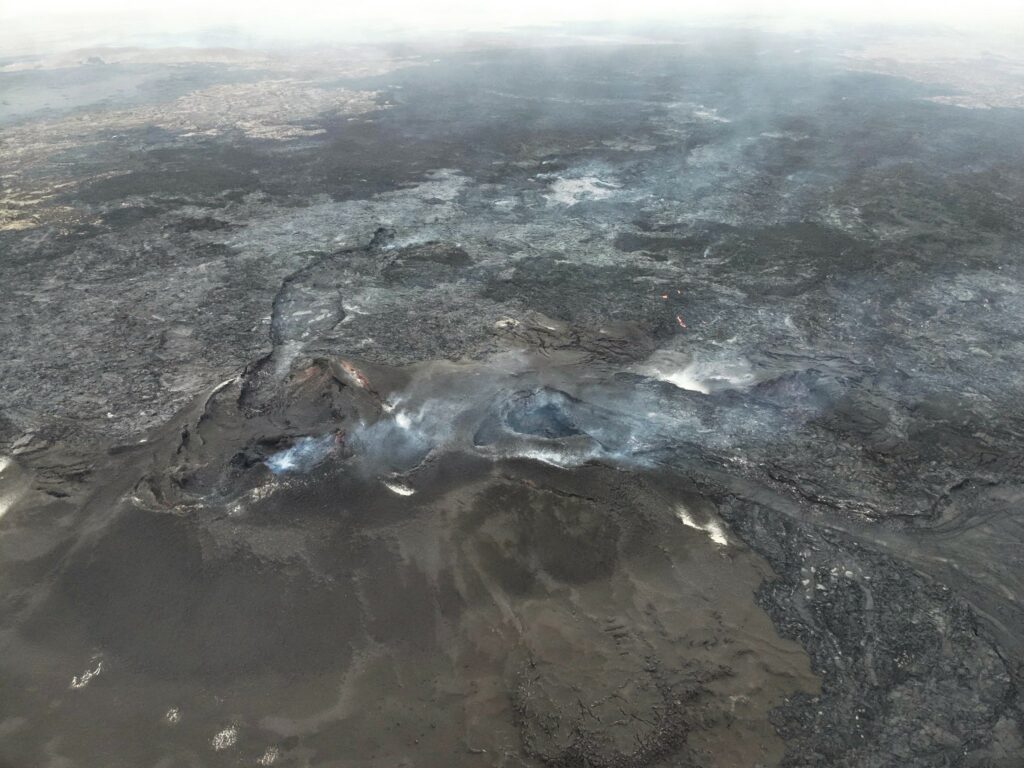
Uplift and magma accumulation have continued steadily in Svartsengi over the past few weeks. Seismic activity around the Sundhnúkar crater row remains very low, with only a few minor earthquakes recorded each day in recent weeks.
The Icelandic Meteorological Office has evaluated how much magma must accumulate beneath Svartsengi to likely trigger the next event. Using model calculations based on GPS and satellite data, this assessment has been updated. This new evaluation suggests that the likelihood of a new magma intrusion—and possibly an eruption—increases toward late November. This estimate relies on the available deformation data. If the rate of uplift in Svartsengi changes, this assessment will be adjusted accordingly.
Monitoring Magma Accumulation and Increasing Seismic Activity to Evaluate the Timing of the Next Event
In the weeks leading up to the past two eruptions, seismic activity in the area northwest of Grindavík increased. This activity likely indicates that pressure is rising in the magma reservoir, suggesting that the next event may be approaching.
Insights from previous intrusions and eruptions in the region facilitate an estimation of how much magma must accumulate beneath Svartsengi to trigger the next event. The timeframe during which there is an increased likelihood of a magma intrusion and possibly an eruption is framed by lower and upper uncertainty bounds. However, it’s also important to monitor how and when seismic activity intensifies in conjunction with magma accumulation.
If a significant increase in seismic activity is recorded when the volume of magma beneath Svartsengi reaches the projected critical thresholds, it’s expected that the likelihood of a new intrusion and potential eruption will begin to increase. This probability will gradually rise as more magma accumulates and seismic activity intensifies. It may be necessary to anticipate a heightened likelihood for an eruption for several weeks before the next event will occur.
The Icelandic Meteorological Office’s hazard assessment remains unchanged from last week. The current hazard assessment is valid through November 12, unless circumstances change.
Source : IMO
Photo : Ljósmynd: Almannavarnir/Björn Oddsson ,( 09/2024) .
Chile , Copahue :
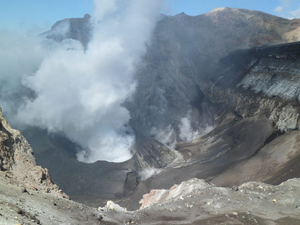
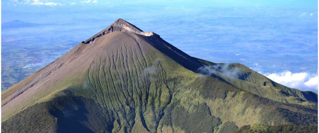
The Servicio Nacional de Geología y Minería (SERNAGEOMIN) reported that during 15-24 October surficial activity at Copahue increased based on analysis by Observatorio Volcánico de los Andes del Sur (OVDAS). Tremor signals slightly intensified on 15 October. Sulfur dioxide emissions increased on 15 October and averaged 2,900-3,000 tons per day (t/d) during 17-19 October, higher than the average of 2,400 t/d more typically observed. Sulfur dioxide emissions were detected with both satellite images and Differential Optical Absorption Spectroscopy (DOAS) instruments. Beginning on 16 October episodic intensifications of a thermal anomaly in El Agrio Crater were identified in satellite data with the most intense anomaly recorded on 19 October. Gas-and-steam emissions rose no higher than 300 m above the crater rim and contained ash starting on 17 October; the ash content was denser on 19 October. Gas-and-ash plumes on 19 October deposited ash in an area extending 2.9 km SE of the vent. By 24 October activity had decreased; sulfur dioxide emissions, a thermal anomaly, and ash emissions were no longer being detected. SERNAGEOMIN noted that an increase may occur again and raised the Alert Level to Yellow (the second lowest level on a four-color scale). SENAPRED declared a Yellow Alert (the middle level on a three-color scale) for residents of the Alto Biobío municipality and access to an area within 500 m of El Agrio Crater was restricted to the public
The Servicio Geológico Minero Argentino (SEGEMAR) maintained an Alert Level of Green (the lowest level on a four-color scale) for Argentina, based on Argentine Volcano Monitoring Observatory (OAVV) analysis. SEGEMAR noted that the crater lake had dried up during the previous few weeks due to seasonal changes in rainfall. Weekly averages of sulfur dioxide emissions were less than 2,000 t/d with a peak of 6,270 t/d on 16 October based on TROPOMI satellite data. Gas-and-steam plumes were visible during 20-24 October when weather conditions allowed for visual observations. Tremor levels decreased after 19 October; an increase recorded on 24 October may have been due to weather. SEGEMAR noted that a possible phreatic eruption could impact an area within 1 km of the crater.
Sources : Servicio Nacional de Geología y Minería (SERNAGEOMIN), Servicio Geológico Minero Argentino (SEGEMAR), Sistema y Servicio Nacional de Prevención y Repuesta Ante Desastres (SENAPRED) , GVP
Photo : Dario G. Lazo ( 2019).
Philippines , Kanlaon :
KANLAON VOLCANO ADVISORY , 31 October 2024 , 10:30 AM
Notice of increased seismic activity at Kanlaon Volcano.
A total of sixty-four (64) volcano-tectonic or VT earthquakes have been recorded by the Kanlaon Volcano Network since 12:00 AM of 31 October 2024. These VT events ranged in strength between ML0.9 and ML2.9 and were generated at 2 to 8 kilometers depths beneath the western flanks of the volcanic edifice. VT earthquakes are generated by rock fracturing processes and the increase in VT activity strongly indicates progressive rock-fracturing beneath the volcano as rising magma drives a path towards the surface. Volcanic sulfur dioxide (SO2) gas emission from the summit crater of Kanlaon based on campaign Flyspec measurements yesterday, 30 October 2024, averaged 7,087 tonnes/day. Kanlaon has been degassing increased concentrations of volcanic SO2 this year at an average rate of 1,273 tonnes/day prior to the 3 June 2024 eruption, but emission since then has been particularly elevated at a current average of 4,234 tonnes/day.
The public is reminded that Alert Level 2 (increasing unrest) prevails over Kanlaon, but that current seismic activity may lead to eruptive unrest and an increase in the Alert Level. The public is strongly advised to be ready and vigilant, and to avoid entry into the four (4) kilometer-radius Permanent Danger Zone (PDZ) to minimize risks from volcanic hazards such as pyroclastic density currents, ballistic projectiles, rockfall and others. In case of ash fall events that may affect communities downwind of Kanlaon’s crater, people should cover their nose and mouth with a damp, clean cloth or dust mask. Civil aviation authorities must also advise pilots to avoid flying close to the volcano’s summit as ash and ballistic fragments from sudden eruption can be hazardous to aircraft. Communities living beside river systems on the southern and western slopes, especially those that have already experienced lahars and muddy streamflows, are advised to take precautionary measures when heavy rainfall over the volcano has been forecast or has begun.
DOST-PHIVOLCS maintains close monitoring of Kanlaon Volcano and any new development will be immediately communicated to all concerned stakeholders.
Source et photo : DOST-PHIVOLCS
Mexico , Popocatepetl :
October 30, 11:00 (October 30, 17:00 GMT), Activity of the last 24 hours
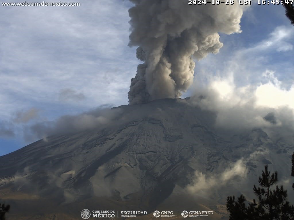
An exhalation was detected, accompanied by water vapor, volcanic gases and ash. In addition, 1,436 minutes of high-frequency tremors of very low to moderate amplitude were recorded.
The National Center for Communication and Civil Protection Operations (Cenacom) reported yesterday a slight ash fall in the municipalities of San Salvador el Verde, Tlahuapan, San Nicolás de los Ranchos, Chiautzingo, San Felipe Teotlalcingo, San Matías Tlalancaleca, San Martín. Texmelucan, Huejotzingo and Calpan, Puebla.
In the last hours, visibility towards the volcano has been partial due to the weather conditions in the area, however, a constant emission has been observed in the Northeast (NE) direction.
The Popocatépetl volcanic alert fire is in yellow phase 2.
Centro Nacional de Prevención de Desastres (CENAPRED) reported that eruptive activity continued at Popocatépetl during 23-29 October. The seismic network recorded 16-50 long-period events per day that were accompanied by steam-and-gas emissions sometimes containing minor amounts of ash. The seismic network also recorded daily tremor, characterized at high-frequency and low-to-moderate amplitude, with periods lasting 14 hours and 20 minutes to as long as almost 24 hours.
According to the Washington VAAC ash plumes visible in webcam and satellite images during 22-25 October rising 5.5-7.3 km (18,000-24,000 ft) a.s.l. and drifting as far as 190 km N, NW, and NNW and 400 km N and NE, extending beyond the coastline. Overnight during 24-26 October webcams recorded the ejection of incandescent fragments short distances onto the upper flanks according to the Secretaría de Seguridad y Protección Ciudadana. Ashfall was reported around 11:30 a.m. on October 25 in several municipalities. The Gobierno de Puebla reported that during 07h00-11h00 on 26 October the Hermanos Serdán Airport (30 km NE) was closed so that workers could clear ash off the runways. The VAAC noted that during 26-27 October several dense ash plumes rose 7.9-8.8 km (26,000-29,000 ft) a.s.l. and drifted NE and NNE over the Gulf of Mexico. Incandescent material was ejected above the crater rim during 27-28 October. The Alert Level remained at Yellow, Phase Two (the middle level on a three-color scale) and the public was warned to stay 12 km away from the crater.
Source : Cenapred , GVP.
Photo : Cenapred

