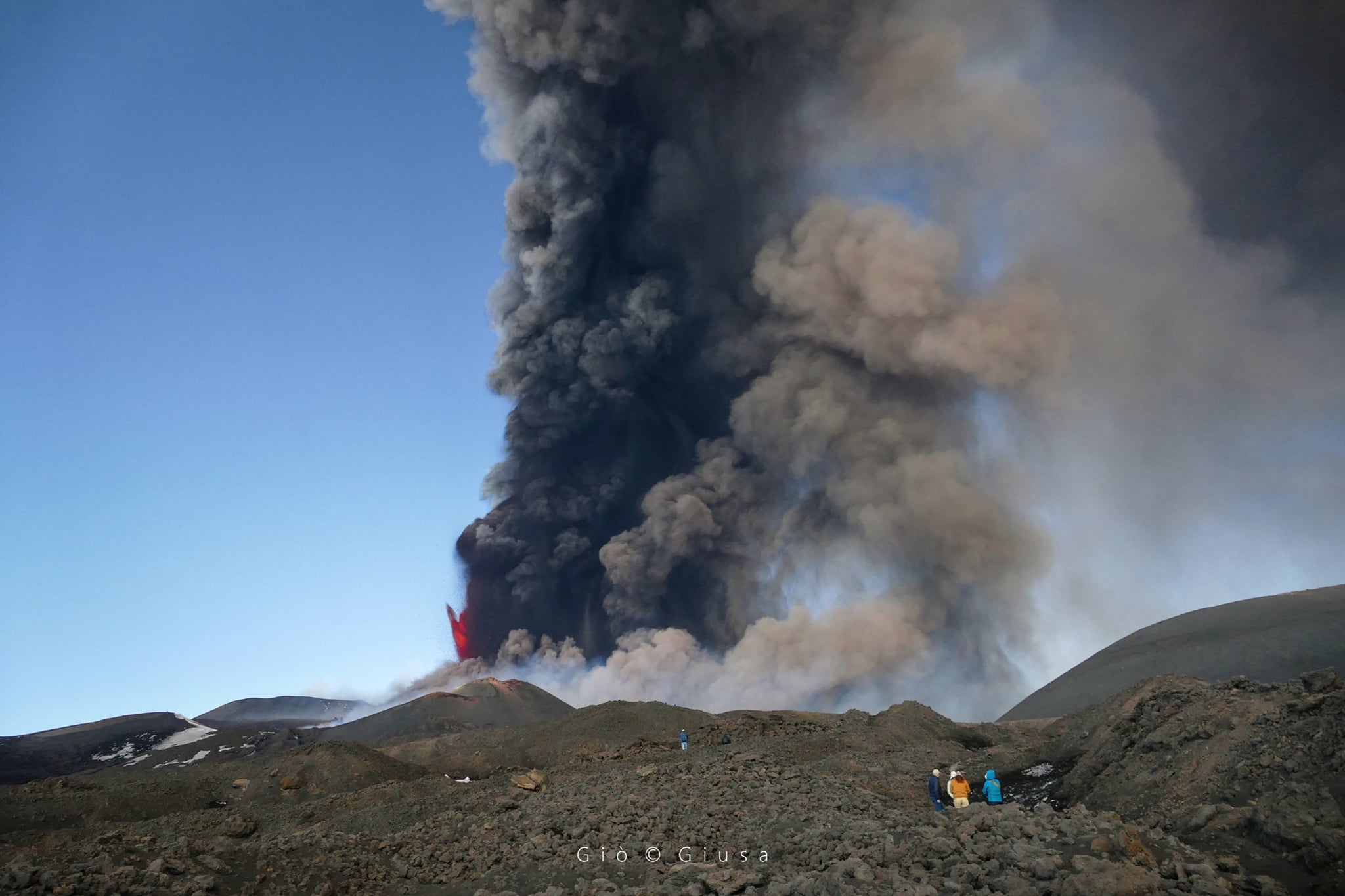
March 25 , 2022. EN . Canary Islands / La Palma : Cumbre Vieja , Philippines : Taal , The Azores : São Jorge , Alaska : Pavlof , Indonesia : Anak Krakatau , Ecuador / Galapagos : Sierra Negra .

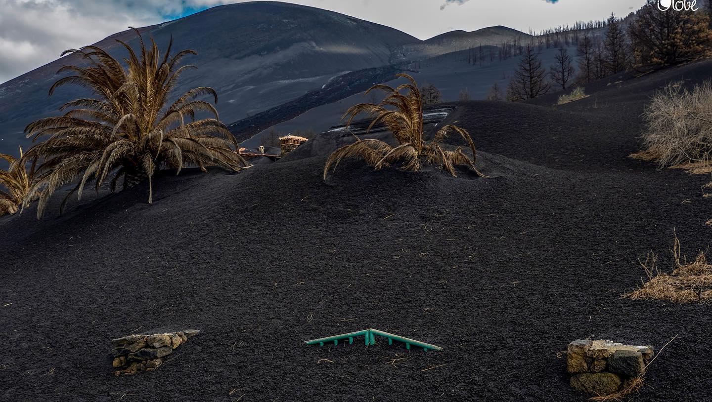
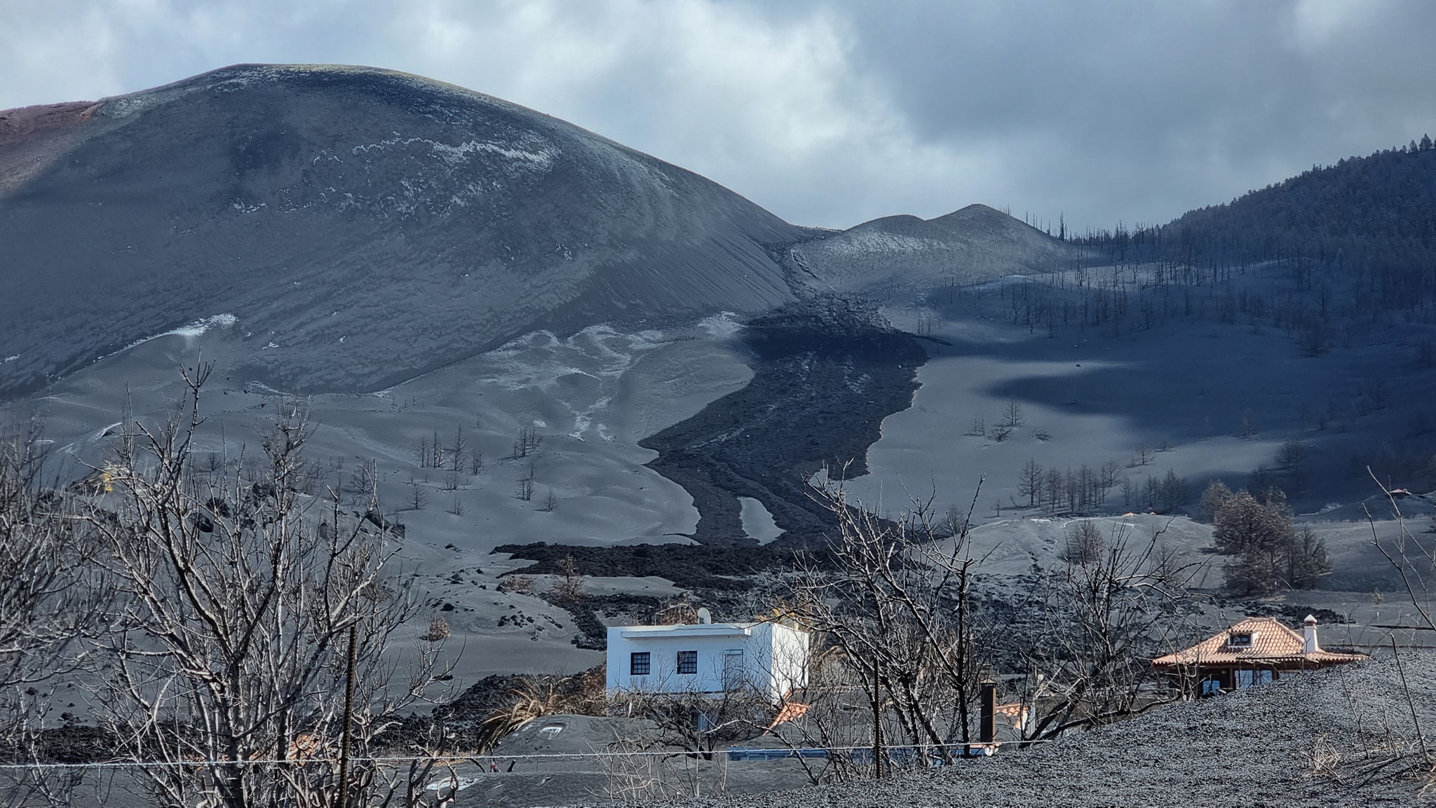
25 Mars 2022.


Canary Islands / La Palma , Cumbre Vieja :

As of 7:01 p.m. on March 24, 2022, the Canaria seismic sensor network, operated by INVOLCAN, records a swarm of long-period type seismic events on the Cumbre Vieja volcano. So far, more than 60 small amplitude events located at depths of about 10-13 km have been recorded. These long-period seismic events do not reflect a process of magmatic intrusion but a release of hydrothermal fluids caused by the cooling of the magmatic reservoir.

A new seismic recovery occurs with a swarm, which experienced a deep earthquake of 2.9 to 28 km (initially 3.1) as the most remarkable event and a few others with magnitudes between 1.7 and 2.3 to shallower depth.
 
 
In principle, having a deep seismicity is not something unusual, it was rather predictable, let’s say it’s a small swarm in depth, and now we will see if it pressurizes or not, for the moment it have to wait to see if it has more seismicity and look at the deformation. With the M3.1, it looks like it’s pressurizing something in the superficial reservoir at 12-9 km…
The amount of gas is appreciable both for the emissions in the cone, with plumes of steam and even some ash, as well as in the area of the port of Naos, where toxic levels of gases such as CO2 and H2S continue to be observed , which makes it advisable not to be living there and if you go there, do it with adequate protective measures and always accompanied with gauges.

Sources : Involcan, Volcanes y Ciencia Hoy .

Photo : Involcan , Micha Fürer.


Philippines , Taal :

TAAL VOLCANO BULLETIN 25 March 2022 8:00 AM

In the past 24-hour period, the Taal Volcano Network recorded two (2) volcanic tremor events having durations of two (2) minutes. One phreatomagmatic burst was recorded at 2:26 AM based on seismic records and visual cameras that produced a 500 meter-tall plume from the Main Crater. Activity at the Main Crater was dominated by upwelling of hot volcanic fluids in its lake which generated plumes 1,000 meters tall that drifted southwest. Sulfur dioxide (SO2) emission averaged 5,751 tonnes/day on 23 March 2022. Temperature highs of 63.7°C were last measured from the Main Crater Lake on 25 February 2022. Based on ground deformation parameters from electronic tilt, continuous GPS and InSAR monitoring, Taal Volcano Island and the Taal region has begun deflating in October 2021.


Alert Level 2 (Increased Unrest) prevails over Taal Volcano. DOST-PHIVOLCS reminds the public that at Alert Level 2, sudden steam- or gas-driven explosions, volcanic earthquakes, minor ashfall, and lethal accumulations or expulsions of volcanic gas can occur and threaten areas within and around TVI. DOST-PHIVOLCS strongly recommends that entry into Taal Volcano Island, Taal’s Permanent Danger Zone or PDZ must be strictly prohibited, especially the vicinities of the Main Crater and the Daang Kastila fissure, and extended stays on Taal Lake.

Source : Phivolcs.

Photo : Seys Marasigan / Seys Channel


Azores , São Jorge :

The President of the Government of the Azores, José Manuel Bolieiro, is traveling this Thursday to São Jorge due to the seismic crisis that has been taking place since Saturday on the island, which has already led to the activation of the regional emergency plan.

On Wednesday, the Civil Protection of the Azores activated the regional emergency plan, after the activation on Monday of the municipal emergency plans of the two municipalities of São Jorge, Calheta and Velas.
Also on Wednesday, the Azores Volcanic Earthquake Information and Monitoring Center (CIVISA) raised the volcanic alert level on the island of São Jorge to V4 (out of a total of five), meaning  » real possibility of eruption,” according to the regional government.

Faced with this scenario, the Azores Executive recommended that the most vulnerable population in the main affected area of São Jorge Island leave their homes.
Since Saturday, there have been more than 2,000 earthquakes on the island of São Jorge, of which 142 are felt by the population.

Earthquakes felt on São Jorge Island (Status Update, March 24, 2022, 10:00 p.m.)
The Azores Seismo-Volcanic Information and Monitoring Center (CIVISA) reports that seismic activity has been recorded since 4:05 p.m. (local time = UTC-1) on March 19 in the central part of the island of São Jorge, more precisely along an area oriented West-North-West / East-South-East, in a sector between Velas and Fajã do Ouvidor. She continues above normal.

The strongest earthquake occurred on March 19 at 6:41 p.m. (local time = UTC-1) and had a magnitude of 3.3 (Richter).
Several earthquakes were felt by the population. From 10:00 a.m. to 10:00 p.m. on March 24, 8 earthquakes were felt.

Sources : OVGA , Civisa .

Photo :  S. Clerc  / Voyagement votre.


Alaska , Pavlof :

55°25’2″ N 161°53’37 » W,
Summit Elevation 8261 ft (2518 m)
Current Volcano Alert Level: WATCH
Current Aviation Color Code: ORANGE

Satellite data showed elevated surface temperatures consistent with minor lava effusion at the active east vent near the summit of Pavlof. Seismic tremor continued with two small explosions detected in local infrasound data over the past day.

Small explosions associated with the current eruption could happen at any time and may be accompanied by small ash plumes within the immediate vicinity of the volcano. The level of unrest at Pavlof can change quickly and the progression to more significant eruptive activity can occur with little or no warning.

Pavlof is monitored by local seismic and infrasound sensors, satellite data, web cameras, and remote infrasound and lightning networks.

Source : AVO

Photo : Aguero Jr, Rafael , avril 2020.


Indonesia , Anak Krakatau :

VOLCANO OBSERVATORY NOTICE FOR AVIATION – VONA

Issued : March 25 , 2022
Volcano : Anak Krakatau (262000)
Current Aviation Colour Code : ORANGE
Previous Aviation Colour Code : orange
Source : Anak Krakatau Volcano Observatory
Notice Number : 2022KRA18
Volcano Location : S 06 deg 06 min 07 sec E 105 deg 25 min 23 sec
Area : Lampung, Indonesia
Summit Elevation : 502 FT (157 M)

Volcanic Activity Summary :
Eruption with ash clouds at 02h55 UTC (09h55 local time). The eruption lasted for 104 seconds.

Volcanic Cloud Height :
Best estimate of ash-cloud top is around 5302 FT (1657 M) above sea level, may be higher than what can be observed clearly. Source of height data: ground observer.

Other Volcanic Cloud Information :
Visuals directly from the cctv were observed eruptions with the color of the thick black eruption smoke 1500m from the top of the volcano, the wind direction slowly moving to east

Remarks :
Eruption recorded on seismogram with maximum amplitude 57 mm and maximum duration 104 second.

Sources : Magma Indonésie , PVMBG.


Ecuador / Galapagos , Sierra Negra :

GRAVIMETRY MEASUREMENT CAMPAIGN ASSOCIATED WITH THE RECENT ERUPTIVE PROCESS OF THE SIERRA NEGRA VOLCANO.

The Sierra Negra volcano, located on Isabela Island in the Galapagos province, is located 23 km southeast of downtown Puerto Villamil. On June 26, 2018, a new eruptive process began and its activity continued until mid-August of the same year, with the emission of lava flows which were directed mainly towards the northern part of the volcano.

Fig. 1: Caldera of the Sierra Negra volcano (Photo: IG-EPN).

Between February 24 and March 9, 2022, technicians from the Geophysical Institute of the National Polytechnic School (IG-EPN) and Simon Fraser University (SFU) of Canada conducted a gravity monitoring campaign on the volcano Sierra Negra. The campaign that was carried out both inside the caldera and in the surrounding areas of the volcano consisted of making measurements with two micro-gravimeters (a Scintrex CG-5 and a LaCoste & Romberg G) in several stations located on the North, North-East, East and South-West flanks. The objective was to measure the anomalies in the local gravitational field, associated with the eruptive process of the volcano.

By means of gravimetric measurements, the minute variations in gravity associated with mass changes produced before, during and after the eruptive process of a volcano can be perceived.

During the campaign, the team established two new measurement points on the Sierra Negra volcano, in addition to the stations previously measured. In addition, the maintenance of the ash measurement monitors installed on the flanks of the Sierra Negra volcano and in its caldera was carried out.

The Geophysical Institute of the National Polytechnic School maintains permanent surveillance in the Sierra Negra volcano and will report anomalies in the activity of the said volcano in a timely manner.

Source et photo : IGEPN

25 Mars 2022. FR. Canaries / La Palma : Cumbre Vieja , Philippines : Taal , Les Açores : São Jorge , Alaska : Pavlof , Indonésie : Anak Krakatau , Equateur / Galapagos : Sierra Negra .

25 Mars 2022.


Canaries / La Palma , Cumbre Vieja :

À partir de 19:01 ce 24 mars 2022, le réseau de capteurs sismiques Canaria, exploité par INVOLCAN, enregistre un essaim d’événements sismiques de type longue période sur le volcan de Cumbre Vieja. Jusqu’à présent, plus de 60 évènements de petite amplitude localisés à des profondeurs d’environ 10-13 km ont été enregistrés. Ces évènements sismiques à longue période ne reflètent pas un processus d’intrusion magmatique mais une libération de fluides hydrothermaux causée par le refroidissement du réservoir magmatique.

Une nouvelle reprise sismique se produit avec un essaim, qui a connu un tremblement de terre profond de 2,9 à 28 km ( initialement 3.1) comme évènement le plus remarquable et quelques autres avec des magnitudes comprises entre 1,7 et 2, 3 à plus faible profondeur.
 
En principe, avoir une sismicité profonde n’est pas quelque chose d’inhabituel, c’était plutôt prévisible , disons que c’est un petit essaim en profondeur, et maintenant on va voir si ça pressurise ou pas, pour l’instant il faut attendre de voir s’il a plus de sismicité et regarder la déformation. Avec le M3.1, on dirait qu’il pressurise quelque chose dans le réservoir superficiel à 12-9 km… 
La quantité de gaz est appréciable tant pour les émissions dans le cône, avec des panaches de vapeur et même quelques cendres, ainsi que dans la zone du port de Naos, où des niveaux toxiques de gaz tels que CO2 et H2S continuent d’être observés, ce qui rend conseillé de ne pas être vivre là-bas et si vous y allez, faites-le avec des mesures de protection adéquates et toujours accompagnés avec des jauges.

Sources : Involcan, Volcanes y Ciencia Hoy .

Photo : Involcan , Micha Fürer.


Philippines , Taal :

BULLETIN D’ACTIVITE DU VOLCAN TAAL , 25 mars 2022 , 08h00 .

Au cours des dernières 24 heures, le réseau de capteurs du volcan Taal a enregistré deux (2) événements de tremors volcaniques d’une durée de deux (2) minutes. Une bouffée phréato-magmatique a été enregistrée à 2h26 du matin sur la base d’enregistrements sismiques et de caméras visuelles , ce qui a produit un panache de 500 mètres de haut depuis le cratère . L’activité du cratère a été dominée par la remontée de fluides volcaniques chauds dans le lac qui a généré des panaches de 1 000 mètres de haut qui ont dérivé vers le Sud-Ouest. Les émissions de dioxyde de soufre (SO2) étaient en moyenne de 5 751 tonnes/jour le 23 mars 2022. Des températures maximales de 63,7 °C ont été mesurées pour la dernière fois depuis le Main Crater Lake le 25 février 2022. Sur la base des paramètres de déformation du sol de l’inclinaison électronique, du GPS continu et de la surveillance InSAR, L’île du volcan Taal et la région du Taal ont commencé à se dégonfler en octobre 2021.


Le niveau d’alerte 2 (agitation accrue) prévaut sur le volcan Taal. Le DOST-PHIVOLCS rappelle au public qu’au niveau d’alerte 2, des explosions soudaines de vapeur ou de gaz, des tremblements de terre volcaniques, des chutes de cendres mineures et des accumulations ou expulsions mortelles de gaz volcanique peuvent se produire et menacer les zones à l’intérieur et autour de TVI. Le DOST-PHIVOLCS recommande fortement que l’entrée sur l’île du volcan Taal, la zone de danger permanent ou PDZ de Taal soit strictement interdite, en particulier aux alentours du cratère principal et de la fissure Daang Kastila, ainsi que les séjours prolongés sur le lac Taal.

Source : Phivolcs.

Photo : Seys Marasigan / Seys Channel


Les Açores , São Jorge :

Le président du gouvernement des Açores, José Manuel Bolieiro, se rend ce jeudi à São Jorge en raison de la crise sismique qui a lieu depuis samedi sur l’île, qui a déjà conduit à l’activation du plan régional d’urgence.

Mercredi, la protection civile des Açores a activé le plan d’urgence régional, après l’activation lundi des plans d’urgence municipaux des deux municipalités de São Jorge, Calheta et Velas.
Mercredi également, le Centre d’information et de surveillance des tremblements de terre volcaniques des Açores (CIVISA) a relevé le niveau d’alerte volcanique sur l’île de São Jorge à V4 (sur un total de cinq), ce qui signifie « possibilité réelle d’éruption », selon le gouvernement régional.

Face à ce scénario, l’exécutif des Açores a recommandé à la population la plus vulnérable de la principale zone touchée de l’île de São Jorge de quitter ses foyers.
Depuis samedi, il y a eu plus de 2 000 tremblements de terre sur l’île de São Jorge, dont 142 sont ressentis par la population.

Tremblements de terre ressentis sur l’île de São Jorge (Point d’état, 24 Mars 2022 , 22:00)
Le Centre d’information et de surveillance sismo-volcanique des Açores (CIVISA) rapporte qu’une activité sismique est enregistrée depuis 16h05 (heure locale = UTC-1) le 19 mars dans la partie centrale de l’île de São Jorge, plus précisément le long d’une zone orientée Ouest-Nord-Ouest / Est-Sud-Est, dans un secteur entre Velas et Fajã do Ouvidor. Elle continue au-dessus de la normale.

Le tremblement de terre le plus énergique s’est produit le 19 mars à 18h41 (heure locale = UTC-1) et avait une magnitude de 3,3 (Richter).
Plusieurs tremblements de terre ont été ressentis par la population. De 10h00 à 22h00 le 24 mars, 8 tremblements de terre ont été ressentis .

Sources : OVGA , Civisa .

Photo :  S. Clerc  / Voyagement votre.


Alaska , Pavlof :

55°25’2″ N 161°53’37 » O,
Altitude du sommet : 8261 pieds (2518 m)
Niveau d’alerte volcanique actuel : ATTENTION
Code couleur actuel de l’aviation : ORANGE

Les données satellitaires ont montré des températures de surface élevées compatibles avec un épanchement de lave mineur à l’évent actif Est près du sommet du Pavlof. Le tremor sismique s’est poursuivi avec deux petites explosions détectées dans les données infrasonores locales au cours de la dernière journée.

De petites explosions associées à l’éruption actuelle peuvent se produire à tout moment et peuvent être accompagnées de petits panaches de cendres à proximité immédiate du volcan. Le niveau d’agitation du Pavlof peut changer rapidement et la progression vers une activité éruptive plus importante peut se produire avec peu ou pas d’avertissement.

Le Pavlof est surveillé par des capteurs sismiques et infrasonores locaux, des données satellitaires, des caméras Web et des réseaux de capteurs d’infrasons et de foudre à distance.

Source : AVO

Photo : Aguero Jr, Rafael , avril 2020.


Indonésie , Anak Krakatau :

AVIS D’OBSERVATION DU VOLCAN POUR L’AVIATION – VONA

Émis : 25 mars 2022
Volcan : Anak Krakatau (262000)
Code Couleur Aviation Actuel : ORANGE
Code Couleur Aviation précédent : orange
Source : Observatoire du volcan Anak Krakatau
Numéro d’avis : 2022KRA18
Emplacement du volcan : S 06 deg 06 min 07 sec E 105 deg 25 min 23 sec
Région : Lampung, Indonésie
Altitude du sommet : 502 FT (157 M)

Résumé de l’activité volcanique :
Eruption avec nuages ​​de cendres à 02h55 UTC (09h55 heure locale). L’éruption a duré 104 secondes.

Hauteur des nuages ​​volcaniques :
La meilleure estimation du sommet du nuage de cendres est d’environ 5302 FT (1657 M) au-dessus du niveau de la mer, peut être plus élevée que ce qui peut être observé clairement. Source des données de hauteur : observateur au sol.

Autres informations sur les nuages ​​volcaniques :
Des visuels directement de la vidéosurveillance ont observés des éruptions avec une épaisse fumée d’éruption de couleur noire à 1500m au dessus du sommet du volcan, la direction du vent se déplaçant lentement vers l’Est

Remarques :
Eruption enregistrée sur sismogramme avec une amplitude maximale de 57 mm et une durée maximale de 104 secondes.

Sources : Magma Indonésie , PVMBG.


Equateur / Galapagos , Sierra Negra :

CAMPAGNE DE MESURES DE GRAVIMÉTRIE ASSOCIÉE AU RÉCENT PROCESSUS ÉRUPTIF DU VOLCAN SIERRA NEGRA.

Le volcan Sierra Negra, situé sur l’île Isabela dans la province des Galapagos, est situé à 23 km au Sud-Est du centre-ville de Puerto Villamil. Le 26 juin 2018, un nouveau processus éruptif a commencé et son activité s’est poursuivie jusqu’à la mi-août de la même année, avec l’émission de coulées de lave qui étaient dirigées principalement vers la partie Nord du volcan.


Fig. 1: Caldeira du volcan Sierra Negra  (Photo : IG-EPN).

Entre le 24 février et le 9 mars 2022, des techniciens de l’Institut géophysique de l’École nationale polytechnique (IG-EPN) et de l’Université Simon Fraser (SFU) du Canada ont mené une campagne de surveillance gravimétrique sur le volcan Sierra Negra. La campagne qui a été menée à la fois à l’intérieur de la caldeira et dans les zones environnantes du volcan a consisté à effectuer des mesures avec deux micro-gravimètres (un Scintrex CG-5 et un LaCoste & Romberg G) dans plusieurs stations situées sur les flancs Nord, Nord-Est, Est et Sud-Ouest. L’objectif était de mesurer les anomalies dans le champ gravitationnel local, associées au processus éruptif du volcan.

Au moyen de mesures gravimétriques, les minuscules variations de gravité associées aux changements de masse produits avant, pendant et après le processus éruptif d’un volcan peuvent être perçues.

Au cours de la campagne, l’équipe a établi deux nouveaux points de mesure sur le volcan Sierra Negra, en plus des stations précédemment mesurées. En outre, l’entretien des moniteurs de mesures des cendres installés sur les flancs du volcan Sierra Negra et dans sa caldeira a été effectué.

L’Institut géophysique de l’École nationale polytechnique maintient une surveillance permanente dans le volcan Sierra Negra et signalera en temps opportun les anomalies dans l’activité dudit volcan.

Source et photo : IGEPN

March 17, 2022 . EN . Italy : Vulcano , Saint Vincent : Soufrière Saint Vincent , Japan : Asosan , Colombia : Cumbal , Ecuador : Wolf / Sangay , La Palma : Cumbre Vieja .

March 17 ,  2022 .


Italy , Vulcano :

WEEKLY NEWSLETTER, from March 07, 2022 to March 13, 2022. (issue date March 15, 2022)

SUMMARY OF STATUS OF ACTIVITY

In the light of the surveillance data, it is highlighted:

1) Temperature of the crater fumaroles: The updated data of the temperatures recorded on the edge of the crater show stable values ​​and confirm the continuation of the thermal anomaly. On the internal side the values ​​are always stable at 114°C.
2) CO2 flux in the crater area: The CO2 flux in the crater area remains at high values.
3) SO2 flux in the crater area: SO2 flux at a medium-high level and decreasing
4) Geochemistry of fumarolic gases: The concentrations of magmatic species (CO2, He) are decreasing and are at medium-high levels.
5) CO2 fluxes at the base of the La Fossa cone and in the Vulcano Porto area: The CO2 fluxes recorded in the Rimessa, C. Sicilia and P4max sites remain at medium-high values; in the Faraglione site, there are values ​​close to the background level.

6) Geochemistry of thermal aquifers: The physico-chemical parameters recorded in the wells of Camping Sicilia and Bambara do not show significant variations, remaining stable at high values.
7) Local seismicity: low occurrence rate of local events.
8) Regional seismicity: No earthquake with Ml >= 1.0 was located in the area of ​​the island of Vulcano.
9) Deformations – GNSS: The network of permanent GNSS stations has not recorded any significant changes.
10) Deformations – Inclinometry: The inclinometric network has not recorded any significant changes
11) Other observations: Gravimetry: During the period considered, no significant variation was recorded.
GB-RAR: GB-RAR monitoring results referring to the period December 14, 2021 – March 14, 2022, show general stability of the area, with deformations along the LOS of less than 1 mm.
Mobile GNSS: Mobile GNSS stations do not appear to show significant changes over the reporting period.

CRATER FUMAROLLES TEMPERATURE .
The reference sensor for the maximum temperature showed a weekly average of 385°C, with the maximum recorded value of 387°C. Locally, the sensor placed in the fumarole of the internal slope did not exceed 114.2°C, suggesting the presence of a liquid phase and a flow influenced by exogenous conditions.

CO2 FLOW IN THE CRATER AREA
The CO2 flux values on the ground in the summit zone on a daily average (VCSCS) show high values around 13,600 g/m2/day (value of March 13, 2022), still on an order of magnitude higher than the averages recorded in over the past 10 years.
The average value of the CO2 flux (monthly average) in March 2022 is 11055 g/m2/day. A stabilization of degassing at high values is therefore observed on a monthly scale. Data is updated as of March 13, 2022.

Source : INGV.

Read the article : https://www.ct.ingv.it/index.php/monitoraggio-e-sorveglianza/prodotti-del-monitoraggio/bollettini-settimanali-multidisciplinari/612-bollettino-settimanale-sul-monitoraggio-vulcanico-geochimico-e-sismico-del-vulcano-Vulcano-del-2022-03-15/file

Photos : INGV , G Vitton.


Saint Vincent , Soufrière Saint Vincent :

VOLCANO ALERT LEVEL IS LOWERED FROM YELLOW TO GREEN

The government of Saint Vincent and the Grenadines, on the advice of scientists at the University of the West Indies Seismic Research Center, has made the decision to lower the volcanic alert level from yellow to green, effective 16 March 2022. A GREEN alert means that the seismic and fumarolic activity (steam emission) of the La Soufrière volcano is at or below historic levels. No other unusual activity was observed.
The activity of the La Soufrière volcano is now considered to be at levels similar to the background activity recorded before the 2020-2021 eruption. The general downward trend in seismicity has continued over the past month.


No change in gas composition has been observed since the measurements were taken in late January. This indicates that the plume chemistry has returned to its pre-eruption chemistry. There has been no significant change in the deformation signal since May 2021.
The alert level was previously lowered from orange to yellow on September 15, 2021 and since then activities have either significantly decreased or ceased.
The La Soufrière trail remains closed due to uneven and dangerous terrain. The National Emergency Management Organization reminds the public of the potential threat to lahars (flood waters mixed with ash, other volcanic materials, mud, debris and rocks) after rainfall and the threat to people living and moving in the river valleys closest to the volcano.
Residents and motorists in areas near the volcano and people crossing rivers and streams during periods of heavy rainfall should always remain vigilant.
 
Source et photo : UWI Seismic Research Centre.


Japan , Asosan :

JMA reported that the amplitude of volcanic tremor signals at Asosan had decreased at around 1540 on 27 February and remained low. White plumes rose 600-800 m above the crater during 7-14 March. During field surveys conducted on 8 and 10 March sulfur dioxide gas emissions were 1,300 and 900 tons per day, respectively; these values were higher than those measured before the October 2021 eruption. No other changes were observed. JMA lowered the Alert Level to 2 (on a scale of 1-5) on 14 March and warned the public to stay at least 1 km away from the crater.

The 24-km-wide Asosan caldera was formed during four major explosive eruptions from 300,000 to 90,000 years ago. These produced voluminous pyroclastic flows that covered much of Kyushu. The last of these, the Aso-4 eruption, produced more than 600 km3 of airfall tephra and pyroclastic-flow deposits. A group of 17 central cones was constructed in the middle of the caldera, one of which, Nakadake, is one of Japan’s most active volcanoes. It was the location of Japan’s first documented historical eruption in 553 CE. The Nakadake complex has remained active throughout the Holocene. Several other cones have been active during the Holocene, including the Kometsuka scoria cone as recently as about 210 CE. Historical eruptions have largely consisted of basaltic to basaltic-andesite ash emission with periodic strombolian and phreatomagmatic activity. The summit crater of Nakadake is accessible by toll road and cable car, and is one of Kyushu’s most popular tourist destinations.

Sources : Agence météorologique japonaise (JMA) , GVP .

Photo : Nakadake , GVP.


Colombia , Cumbal :

Cumbal Volcanic Complex Weekly Activity Bulletin

The activity of the Cumbal Volcanic Complex continues at: YELLOW LEVEL  (III): CHANGES IN THE BEHAVIOR OF VOLCANIC ACTIVITY.

From monitoring the activity of the CUMBAL VOLCANIC COMPLEX (CVC), the COLOMBIAN GEOLOGICAL SERVICE (SGC) reports that:

In low levels and compared to the previous week, during the period between March 8 and March 14, 2022, an increase in the number of earthquakes and a decrease in the energy released were observed. Most of the earthquakes were of low energy, being located mainly southeast of La Plazuela crater at distances between 1.5 and 3 km with depths less than 1 km.

A few other earthquakes were scattered in the area of influence of the Cumbal Volcanic Complex, at distances of up to 13 km, at depths less than 14 km from the height of La Plazuela (4700 m above sea level). altitude) and with a maximum local magnitude of 1.0.
The favorable climatic conditions allowed the recording of the surface activity throughout the week evaluated, with columns of white gases, of low height and variable dispersion due to the action of the winds, emitted from the adventitious crater El Verde, northeast of the Cumbal Volcanic Complex and Los Rastrojos, Boca Vieja and other fumarolic fields of the active Mundo Nuevo cone southwest of the Cumbal Volcanic Complex. No significant variation was observed in the other geophysical and geochemical parameters of volcanic monitoring.

Source et photo : SGC.


Ecuador , Wolf / Sangay :

DAILY REPORT OF THE STATE OF WOLF VOLCANO. Wednesday March 16, 2022.

Surface Activity Level: High, Surface Trend: Unchanged
Internal activity level: High, Internal trend: No change

Seismicity: From March 15, 2022, 11:00 a.m. to March 16, 2022, 11:00 a.m.:
No seismic event has been recorded at the volcano in the past 24 hours.

Other Monitoring Parameters:
The FIRMS system recorded 81 thermal anomalies; Similarly, the MIROVA system recorded 2 strong thermal anomalies (1743 and 1373 MW) and 1 high (124 MW) during the last 24 hours.

Gas:
The MOUNTS system recorded 0.1 tons of SO2, on March 14 at 7:10 p.m. TL.

Observation:
Thanks to the images provided by the GOES-16 satellite, thermal anomalies can be observed due to the effect of advancing lava flows.

Alert level: Without alert.


                                                      ———————————————————————————————————————————————–


DAILY REPORT OF THE STATE OF SANGAY VOLCANO, Wednesday March 16, 2022.
Information Geophysical Institute – EPN.

Surface Activity Level: High, Surface Trend: No change.
Internal activity level: High, Internal trend: No change.

Seismicity: From March 15, 2022, 11:00 a.m. to March 16, 2022, 11:00 a.m.:
Explosion (EXP) 12
Long Periods (LP) 1
Emission Tremors (TREMI) 21

Rains / Lahars:
Thanks to the Windy satellite system, it was possible to verify the possible occurrence of rains in the volcano area. **In the event of heavy rains, these could remobilize the accumulated materials, generating mudslides and debris that would descend on the flanks of the volcano and flow into the adjacent rivers.**


Emission / ash column:
Yesterday afternoon, it was possible to observe a gas emission with a weak ash load, at 1 km altitude above the crater and heading towards the South-East. This morning, the Washington VAAC issued 2 reports of ash emission 870 meters above crater level and in a southwesterly direction.

Gas:
The MOUNTS system recorded 1462 tons of SO2 (March 15 at 2:05 p.m. TL).

Other Monitoring Parameters:
The FIRMS system recorded 31 thermal anomalies; the MIROVA system recorded 1 high thermal anomaly (193 MW) in the last 24 hours.

Alert level: Orange.                                                                                            

Source : IGEPN.

Photos : IGEPN


La Palma , Cumbre Vieja :

Post-eruption activity at Cumbre Vieja, La Palma, March 16, 2022, 09:00 UTC.

In the last 7 days, since the last communication (March 8 at 9:00 UTC), 27 earthquakes have been located on the island of La Palma. The magnitudes are between 0.9 and 2.3 (mbLg). Two of these earthquakes were weakly felt by the population, with a maximum intensity of II (EMS98). The location of hypocenters continues below the central area of Cumbre Vieja, in the same areas as in previous weeks, at depths between 0 and 16 km. No earthquake was located at greater depth.

The network of permanent GNSS stations on the island does not show significant deformations that could be associated with volcanic activity.

Seeing the earthquakes, I have a terrible suspicion that another magma reservoir is forming 7-8 km away. Something is happening there, just below the lava flow area between Tazacorte and Puerto Naos, and it shows that the earthquakes are positioned forming a circle. If I’m right, it won’t take long to pressurize and give more intense seismicity.
The truth is that the deformation to the East (LP05, MAZO and LP05) and South (LP04) of the island is increasing, indicating swelling, due to the contribution of magma at deep levels … the system there seems like he’s balancing himself out and getting ready for his reboot he hasn’t reached yet.
This is how it was described to me today what was perceptible in an area in the North of the Island: « A lot of wobble, up and down, very very strong and shocks, strong too. This will be balancing, I’m not saying no, … but it’s very strong Enrique.
And if we look at the release of the accumulated seismic energy released, we see the rebound from a few days ago and then how the system has relaxed…. we will see if it continues to relax in the next a few days or as it seems from the last symptoms that we have a new rebound. The volcano will tell us.

Sources : IGN es, Volcanes y Ciencia Hoy ( Henrique) .

Photo : I love the world.

17 Mars 2022 . FR. Italie : Vulcano , Saint Vincent : Soufrière Saint Vincent , Japon : Asosan , Colombie : Cumbal , Equateur : Wolf / Sangay , La Palma : Cumbre Vieja .

17 Mars 2022 .


Italie , Vulcano :

BULLETIN HEBDOMADAIRE, du 07 Mars 2022 au 13 Mars 2022. (date d’émission 15 Mars 2022)

SOMMAIRE DE L’ÉTAT D ‘ACTIVITÉ

À la lumière des données de surveillance, il est mis en évidence :

1) Température des fumerolles du cratère : Les données mises à jour des températures enregistrées sur le bord du cratère montrent des valeurs stables et confirment la poursuite de l’anomalie thermique. Du côté interne les valeurs sont toujours stables à 114°C.
2) Flux de CO2 dans la zone du cratère : Le flux de CO2 dans la zone du cratère reste sur des valeurs élevées.
3) Flux de SO2 dans la zone du cratère : flux de SO2 à un niveau moyen-élevé et en diminution
4) Géochimie des gaz fumeroliens : Les concentrations en espèces magmatiques (CO2, He) diminuent et se situent à des niveaux moyens-élevés.
5) Flux de CO2 à la base du cône de La Fossa et dans la zone de Vulcano Porto : Les flux de CO2 enregistrés dans les sites de Rimessa, C. Sicilia et P4max restent à des valeurs moyennes-élevées ; dans le site de Faraglione, il y a des valeurs proches du niveau de fond.

6) Géochimie des aquifères thermiques : Les paramètres physico-chimiques enregistrés dans les puits de Camping Sicilia et Bambara ne présentent pas de variations significatives, restant stables à des valeurs élevées.
7) Sismicité locale : faible taux d’occurrence d’événements locaux.
8) Sismicité régionale : Aucun séisme avec Ml > = 1,0 n’a été localisé dans la zone de l’île de Vulcano.
9) Déformations – GNSS : Le réseau de stations GNSS permanentes n’a pas enregistré de changements significatifs.
10) Déformations – Inclinométrie : Le réseau inclinométrique n’a pas enregistré de changements significatifs
11) Autres observations : Gravimétrie : Au cours de la période considérée, aucune variation significative n’a été enregistrée.
GB-RAR : Les résultats de la surveillance GB-RAR se référant à la période 14 décembre 2021 – 14 mars 2022, montrent une stabilité générale de la zone, avec des déformations le long de la LOS inférieures à 1 mm.
GNSS mobile : les stations GNSS mobiles ne semblent pas présenter de changements significatifs au cours de la période considérée.

TEMPÉRATURE DES FUMÉES DU CRATERE .
Le capteur de référence pour la température maximale a montré une moyenne hebdomadaire de 385 ° C, avec la valeur maximale enregistrée de 387 ° C. Localement, le capteur placé dans la fumerolle du talus interne n’a pas dépassé 114,2°C, suggérant la présence d’une phase liquide et d’un débit influencé par des conditions exogènes.

FLUX DE CO2 DANS LA ZONE DU CRATÈRE
Les valeurs de flux de CO2 au sol dans la zone sommitale en moyenne journalière (VCSCS) montrent des valeurs élevées autour de 13600 g/m2/jour (valeur du 13 mars 2022), toujours sur un ordre de grandeur supérieur à les moyennes enregistrées au cours des 10 dernières années.  
La valeur moyenne du flux de CO2 (moyenne mensuelle) en mars 2022 est de 11055 g/m2/jour. Une stabilisation du dégazage sur des valeurs élevées est donc observée à l’échelle mensuelle. Les données sont mises à jour au 13 mars 2022.

Source : INGV.

Lire l’article : https://www.ct.ingv.it/index.php/monitoraggio-e-sorveglianza/prodotti-del-monitoraggio/bollettini-settimanali-multidisciplinari/612-bollettino-settimanale-sul-monitoraggio-vulcanico-geochimico-e-sismico-del-vulcano-Vulcano-del-2022-03-15/file

Photos : INGV , G Vitton.


Saint Vincent , Soufrière Saint Vincent :

LE NIVEAU D’ALERTE DU VOLCAN EST ABAISSÉ DU JAUNE AU VERT
 
Le gouvernement de Saint-Vincent-et-les Grenadines, sur les conseils de scientifiques du Centre de recherche sismique de l’Université des Antilles, a pris la décision de baisser le niveau d’alerte volcanique de jaune au vert, à compter du 16 mars 2022. Une alerte VERTE signifie que l’activité sismique et fumerolienne (émission de vapeur) du volcan La Soufrière se situe au niveau historique ou en dessous. Aucune autre activité inhabituelle n’a été observée.
L’activité du volcan La Soufrière est désormais considérée comme étant à des niveaux semblables à l’activité de fond enregistrée avant l’éruption 2020-2021. La tendance générale à la baisse de la sismicité s’est poursuivie au cours du mois dernier.
 
 
Aucun changement dans la composition des gaz n’a été observé depuis que les mesures ont été prises à la fin janvier. Ceci indique que la chimie du panache est revenue à sa chimie de pré-éruption. Il n’y a pas eu de changement important dans le signal de déformation depuis mai 2021.
Le niveau d’alerte était précédemment abaissé de l’orange au jaune le 15 septembre 2021 et depuis, les activités ont considérablement diminué ou ont cessé.
Le sentier de La Soufrière reste fermé en raison du terrain inégal et dangereux. L’organisation nationale de gestion des urgences rappelle au public la menace potentielle pour les lahars (eaux d’inondation mélangées de cendres, d’autres matériaux volcaniques, de la boue, des débris et des roches) après les précipitations et la menace pour les personnes vivant et en mouvement dans les vallées fluviales au plus près du volcan.
Les résidents et les automobilistes dans les zones proches du volcan et les personnes traversant les rivières et les cours d’eau pendant les périodes de fortes précipitations devraient toujours rester vigilants.
 
Source et photo : UWI Seismic Research Centre.


Japon , Asosan :

Le JMA a signalé que l’amplitude des signaux de tremor volcanique sur l’ Asosan avait diminué vers 15 h 40 le 27 février et restait faible. Des panaches blancs se sont élevés de 600 à 800 m au-dessus du cratère du 7 au 14 mars. Au cours des enquêtes sur le terrain menées les 8 et 10 mars, les émissions de dioxyde de soufre étaient respectivement de 1 300 et 900 tonnes par jour ; ces valeurs étaient supérieures à celles mesurées avant l’éruption d’octobre 2021. Aucun autre changement n’a été observé. Le JMA a abaissé le niveau d’alerte à 2 (sur une échelle de 1 à 5) le 14 mars et a averti le public de rester à au moins 1 km du cratère.

La caldeira de l’Asosan, large de 24 km, s’est formée lors de quatre éruptions explosives majeures il y a 300 000 à 90 000 ans. Celles-ci ont produit des coulées pyroclastiques volumineuses qui ont couvert une grande partie de Kyushu. La dernière d’entre elles, l’éruption Aso-4, a produit plus de 600 km3 de dépôts de téphra et de coulées pyroclastiques. Un groupe de 17 cônes centraux a été construit au milieu de la caldeira, dont l’un, Nakadake, est l’un des volcans les plus actifs du Japon. C’était le lieu de la première éruption historique documentée du Japon en 553 de notre ère. Le complexe de Nakadake est resté actif tout au long de l’Holocène. Plusieurs autres cônes ont été actifs pendant l’Holocène, y compris le cône de scories de Kometsuka, récemment , aux  environs de 210 CE. Les éruptions historiques ont consisté en grande partie en une émission de cendres basaltiques à basaltiques-andésitique avec une activité strombolienne et phréato-magmatique périodique. Le cratère au sommet , Nakadake , est accessible par une route à péage et un téléphérique, et est l’une des destinations touristiques les plus populaires de Kyushu.

Sources : Agence météorologique japonaise (JMA) , GVP .

Photo : Nakadake , GVP.


Colombie , Cumbal :

Bulletin d’activité hebdomadaire du Complexe Volcanique de Cumbal

L’activité du Complexe Volcanique de Cumbal se poursuit au : NIVEAU JAUNE ■ (III) : CHANGEMENTS DANS LE COMPORTEMENT DE L’ACTIVITÉ VOLCANIQUE.

D’après le suivi de l’activité du COMPLEXE VOLCANIQUE DE CUMBAL (CVC), le SERVICE GÉOLOGIQUE COLOMBIEN (SGC) rapporte que :

Dans des niveaux bas et par rapport à la semaine précédente, durant la période comprise entre le 8 et le 14 mars 2022, une augmentation du nombre de séismes et une diminution de l’énergie libérée ont été observées. La plupart des tremblements de terre étaient de faible énergie, étant situés principalement au Sud-Est du cratère de La Plazuela à des distances comprises entre 1,5 et 3 km avec des profondeurs inférieures à 1 km.

 Quelques autres tremblements de terre ont été dispersés dans la zone d’influence du Complexe Volcanique de Cumbal, à des distances allant jusqu’à 13 km, à des profondeurs inférieures à 14 km par rapport à la hauteur de La Plazuela (4700 m d’altitude) et avec une magnitude locale maximale de 1,0.
Les conditions climatiques favorables ont permis l’enregistrement de l’activité de surface tout au long de la semaine évaluée, avec des colonnes de gaz blancs, de faible hauteur et de dispersion variable due à l’action des vents, émis depuis le cratère adventif El Verde, au Nord-Est du Complexe Volcanique de Cumbal et de Los Rastrojos, Boca Vieja et autres champs fumeroliens du cône actif de Mundo Nuevo au Sud-Ouest du Complexe Volcanique de Cumbal. Aucune variation significative n’a été observée dans les autres paramètres géophysiques et géochimiques de la surveillance volcanique.

Source et photo : SGC.


Equateur , Wolf / Sangay :

RAPPORT QUOTIDIEN DE L’ETAT DU VOLCAN WOLF . Mercredi 16 Mars 2022.

Niveau d’activité Superficiel: Haut , Tendance de surface : Sans changement
Niveau d’activité interne: Haut , Tendance interne : Sans changement

Sismicité : Du 15 Mars 2022 , 11:00h au 16 Mars 2022 , 11:00h : 
Aucun événement sismique n’a été enregistré sur le volcan au cours des dernières 24 heures.

Autres paramètres de surveillance :
Le système FIRMS a enregistré 81 anomalies thermiques ; De même, le système MIROVA a enregistré 2 anomalies thermiques fortes (1743 et 1373 MW) et 1 haute (124 MW) au cours des dernières 24 heures.

Gaz:
Le système MOUNTS a enregistré 0,1 tonne de SO2, le 14 mars à 19h10 TL.

Observation:
Grâce aux images fournies par le satellite GOES-16, des anomalies thermiques peuvent être observées dues à l’effet de l’avancée des coulées de laves.

Niveau d’alerte: Sans alerte.


                                                      ———————————————————————————————————————————————–


RAPPORT QUOTIDIEN DE L’ETAT DU VOLCAN SANGAY ,Mercredi 16 Mars 2022.
Information Geophysical Institute – EPN.

Niveau d’activité Superficiel: Haut , Tendance de surface : Pas de changement .
Niveau d’activité interne: Haut , Tendance interne : Pas de changement .

Sismicité : Du 15 Mars 2022 , 11:00h au 16 Mars 2022 , 11:00h : 
Explosion (EXP) 12
Longues périodes (LP) 1
Tremors d’émissions (TREMI) 21

Pluies / Lahars :
Grâce au système satellitaire Windy, il a été possible de vérifier l’éventuelle occurrence de pluies dans la zone du volcan. **En cas de fortes pluies, celles-ci pourraient remobiliser les matériaux accumulés, générant des coulées de boue et de débris qui descendraient sur les flancs du volcan et se déverseraient dans les rivières adjacentes.**


Émission / colonne de cendres :
Hier après-midi, il a été possible d’observer une émission de gaz avec une faible charge de cendres, à 1 km d’altitude au-dessus du cratère et se dirigeant vers le Sud-Est. Ce matin, le VAAC de Washington a émis 2 rapports d’émission de cendres à 870 mètres au-dessus du niveau du cratère et dans une direction Sud-Ouest.

Gaz:
Le système MOUNTS a enregistré 1462 tonnes de SO2 (le 15 mars à 14h05 TL).

Autres paramètres de surveillance :
Le système FIRMS a enregistré 31 anomalies thermiques ; le système MIROVA a enregistré 1 anomalie thermique élevée (193 MW) au cours des dernières 24 heures.

Niveau d’alerte: Orange.                                                                                                    

Source : IGEPN.

Photos : IGEPN


La Palma , Cumbre Vieja :

Activité post-éruptive sur Cumbre Vieja, La Palma, 16 Mars 2022 ,  09:00 UTC .

Au cours des 7 derniers jours, depuis la dernière communication (8 mars à 9h00 UTC), 27 tremblements de terre ont été localisés sur l’île de La Palma. Les magnitudes sont comprises entre 0,9 et 2,3 (mbLg). Deux de ces séismes ont été faiblement ressentis par la population, avec une intensité maximale de II (EMS98). La localisation des hypocentres se poursuit sous la zone centrale de Cumbre Vieja, dans les mêmes zones que les semaines précédentes, à des profondeurs comprises entre 0 et 16 km. Aucun séisme n’a été localisé à plus grande profondeur.

Le réseau de stations GNSS permanentes sur l’île ne montre pas de déformations importantes qui pourraient être associées à une activité volcanique.

En voyant les tremblements de terre, j’ai un terrible soupçon, qu’un autre réservoir de magma se forme à 7-8 km. Quelque chose se passe là-bas, juste en dessous de la zone de coulée de lave entre Tazacorte et Puerto Naos, et cela montre que les tremblements de terre sont positionnés formant un cercle . SI j’ai raison, il ne faudra pas longtemps pour pressuriser et donner une sismicité plus intense.
La vérité est que la déformation à l’Est (LP05, MAZO et LP05) et au Sud (LP04) de l’île est en augmentation, indiquant un gonflement, dû à la contribution du magma aux niveaux profonds … le système il semble qu’il s’équilibre et se prépare à son redémarrage qu’il n’a pas encore atteint.
C’est ainsi qu’il m’a été décrit aujourd’hui ce qui était perceptible dans une zone du Nord de l’Île : « Beaucoup de vacillement, de haut en bas, très très fort et de chocs, forts aussi. Ce sera de l’équilibrage, je suis ne dis pas non, … mais c’est très fort Enrique.
Et si on regarde la libération de l’énergie sismique accumulée libérée , on voit le rebond d’il y a quelques jours et puis comment le système s’est détendu…. on verra s’il continue à se détendre dans le prochain quelques jours ou comme il semble au vu des derniers symptômes que nous ayons un nouveau rebond. Le volcan nous le dira.

Sources : IGN es, Volcanes y Ciencia Hoy ( Henrique) .

Photo : I love the world.

14 Mars 2022. FR. Hawaii : Mauna Loa , Alaska : Great Sitkin , Guatelama : Santiaguito , Costa Rica : Rincon de la Vieja / Turrialba / Poas / Irazu , Canaries / La Palma : Cumbre Vieja .

14 Mars 2022.


Hawaii , Mauna Loa :

19°28’30 » N 155°36’29 » O,
Altitude du sommet : 13681 pieds (4170 m)
Niveau d’alerte volcanique actuel : AVIS
Code couleur actuel de l’aviation : JAUNE

Résumé de l’activité :
Le volcan Mauna Loa n’est pas en éruption. Les taux de sismicité et les concentrations de CO2 à Sulphur Cone sont légèrement supérieurs aux niveaux de fond à long terme, mais n’ont pas changé de manière significative au cours de la semaine dernière. Les autres flux de données de surveillance du Mauna Loa – déformation du sol, toutes les autres concentrations de gaz, apparence visuelle dans les webcams – ne montrent aucun changement significatif.

Une vue matinale vers le Nord à travers Moku’āweoweo, la caldeira du sommet du Mauna Loa, depuis un endroit près de la cabine du sommet sur le bord Sud de la caldeira du volcan. Le givre couvrait une grande partie du sol de la caldeira qui était encore ombragé, et une faible vapeur sortait des zones habituelles. Dans l’ensemble, aucun changement significatif n’a été observé au sommet. Les cônes de 1940 et 1949 sont visibles dans la zone ensoleillée à gauche, et l’écart qui relie la caldeira à South Pit est visible à l’extrême gauche.

Observations :
Au cours de la semaine dernière, les sismomètres du HVO ont enregistré environ 202 tremblements de terre de faible magnitude (inférieure à M2,5) sous le Mauna Loa , dont 55 sous le sommet et les flancs d’altitude. La majorité de ces tremblements de terre se sont produits à des profondeurs peu profondes inférieures à 10 kilomètres (6 miles) sous le niveau de la mer. Les mesures du système de positionnement global (GPS) montrent des taux de déformation très faibles dans la région du sommet qui se sont poursuivis au cours de la semaine dernière.

Les concentrations de dioxyde de soufre (SO2) et de sulfure d’hydrogène (H2S), ainsi que les températures des fumerolles, restent stables au sommet et à Sulphur Cone, dans la zone supérieure du rift Sud-Ouest. Les concentrations de dioxyde de carbone (CO2) sont également stables au sommet, mais ont lentement augmenté au cours de la dernière année à Sulphur Cone. Les concentrations de CO2 mesurées restent faibles par rapport à de nombreuses autres zones volcaniques dans le monde.

Les vues de la webcam n’ont montré aucun changement dans le paysage volcanique du Mauna Loa au cours de la semaine dernière.

Source : HVO.

Photo : M. Patrick, 09-08-2019.


Alaska , Great Sitkin :

52°4’35 » N 176°6’39 » O,
Altitude du sommet : 5709 pi (1740 m)
Niveau d’alerte volcanique actuel : ATTENTION
Code couleur actuel de l’aviation : ORANGE.

Le faible épanchement de lave continue probablement. Des températures de surface élevées ont été observées dans les données satellitaires, et une robuste émission de vapeur a été observée dans les images des satellites et des caméras Web au cours de la dernière journée. Ces observations sont cohérentes avec la poursuite d’un épanchement de lave. La sismicité reste faible. Il reste possible qu’une activité explosive se produise avec peu ou pas d’avertissement.

Le Great Sitkin est surveillé par des capteurs sismiques et infrasonores locaux, des données satellitaires, des caméras Web et des réseaux de capteurs d’infrasons et de foudre à distance.

Source : AVO

Photo : Loewen, Matt


Guatelama , Santiaguito :

Temps : nuageux
Vent : Nord-Est
Précipitations : 0,0 mm.

Activité :
Le complexe volcanique est totalement recouvert de nuages, les stations sismiques enregistrent des périodes prolongées et abondantes de dégazage provenant du cratère et de la coulée de lave qui se déplace vers l’Ouest et le Sud-Ouest , ainsi que de faibles avalanches qui ont affecté les flancs Sud-Ouest et Ouest. Cela provoque la chute de fines particules de cendres dans le périmètre volcanique. Des explosions, de fortes avalanches et des sons audibles peuvent être générés à plusieurs kilomètres de l’édifice volcanique. En raison de l’extrusion permanente de lave en blocs dans le dôme Caliente, dans une direction Ouest-Sud-Ouest, la survenue d’avalanches plus fortes de blocs et de cendres n’est pas exclue, ainsi que d’éventuelles coulées pyroclastiques sur de longues distances dans différents directions. Les recommandations du bulletin spécial BESAN 003-2022 sont toujours valables.

Source : Insivumeh.

Photo : La Hora


Costa Rica , Rincon de la Vieja / Turrialba / Poas / Irazu :

Bulletin hebdomadaire du programme de surveillance volcanique, 11 mars 2022 .

Volcan Rincón de la Vieja
Latitude : 10,83 ° N ;
Longitude : 85,324 ° O ;
Altitude : 1895 m 
Niveau d’activité actuel : 3 (éruption volcanique)
Dangers potentiellement associés : Lahars, gaz, éruptions phréatiques et phréato-magmatiques, projections balistiques proximales, pluies acides, cendres.

La dernière éruption phréatique a été enregistrée le 20 février 2022. Une explosion d’énergie modérée a été enregistrée à l’intérieur du volcan le 9 mars. Les sismographes continuent d’enregistrer des tremors volcaniques de faible amplitude avec des fréquences comprises entre 2 et 4 Hz. Certains tremblements de terre de type « tornillos (5 événements), un tremblement de terre distal de type VT et un fort tremblement de terre de type LP ont été enregistrés. Les observations géodésiques ne montrent pas de schéma de déformation significatif. Les habitants du Nord du Rincón signalent un changement de couleur de la Quebrada Azufrada, du gris laiteux à l’orange vif. Le changement de couleur est dû au dépôt d’une quantité abondante d’oxydes de fer ocre-orange sur les roches et les sédiments du lit du ruisseau induite par la diminution marquée des précipitations et du débit des rivières.

Volcan Turrialba
Latitude : 10,025 ° N ;
Longitude : 83,767 ° O ;
Altitude : 3340 m 
Niveau d’activité actuel : 3 (éruption volcanique)
Dangers potentiellement associés : gaz, émission de cendres, projections balistiques proximales, pluies acides.

La dernière éruption phréatique s’est produite le 28 février, depuis cette date plusieurs grondements ont été enregistrés, certains associés à de petites émissions de cendres. L’activité sismique reste stable, la fréquence des séismes  a de nouveau diminué après avoir présenté une augmentation pendant plusieurs jours. De nombreux séismes de basse et moyenne fréquence de type LP sont observés (environ 250 événements LF et LPH). Au cours des 3 derniers mois, la surveillance géodésique montre une contraction plus marquée du massif Turrialba-Irazú autour du cratère actif du Turrialba. Le rapport CO2/SO2 montre quelques pics sporadiques. La moyenne hebdomadaire pour le rapport CO2/SO2 est de 24,3 +/- 7,5, une valeur similaire à la semaine précédente, et pour le rapport H2S/SO2, elle est de 0,26 +/- 0,11. Le flux de SO2 a présenté un pic en début de semaine et une diminution par la suite, il est estimé à 229 +/- 120 t/j. L’analyseur de SO2 de la station de surveillance des gaz volcaniques et des aérosols de Coronado, EMVA/OVSICORI-UNA, a enregistré une moyenne horaire maximale de 0,56 ppb de SO2 au cours des dernières 24 heures, bien en dessous de la valeur limite de la réglementation, qui est d’un moyenne horaire de 75 ppb SO2. D’autre part, l’analyseur de poussières a enregistré une moyenne quotidienne de 6,8 ug/m3 de PM10, soit moins d’un dixième de la valeur limite de la réglementation, qui est en moyenne de 100 ug/m3 pendant 24 heures. Les données de la station EMVA indiquent que la qualité de l’air à Coronado est bonne et que les niveaux d’émissions fumeroliennes des volcans Turrialba et Poás sont négligeables.

Volcan Poas
Latitude : 10,2 ° N ;
Longitude : 84,233 ° O ;
Altitude : 2780 m 
Niveau d’activité actuel : 2 (volcan actif calme)
Dangers potentiellement associés : gaz, éruptions phréatiques, projections balistiques proximales, pluies acides, lahars.

Aucune éruption n’a été détectée jusqu’à présent en 2022. La sismicité reste stable, un séisme de type VT proximal a été enregistré le 11 mars. Le réseau géodésique montre la stabilité de l’édifice volcanique au cours des 4 derniers mois. La moyenne hebdomadaire du rapport SO2/CO2 est de 0,58 +/- 0,09 et H2S/SO2 reste stable avec une valeur <0,012. La concentration de SO2 autour du cratère a été faible au cours de la semaine (<2 ppm de SO2 à El Mirador ). Le flux de SO2 a un peu diminué (80 +/- 30 t/j). Le niveau du lac hyper-acide a augmenté d’environ 40 cm. Les eaux du lac restent riches en ion chlorure par rapport à l’ion sulfate, cependant, la composition du lac montre une tendance progressive vers des eaux avec moins de chlorure mais avec des proportions relatives stables de chlorure et de sulfate.

Volcan Irazu
Latitude : 9,979 ° N ;
Longitude : 83,852 ° O ;
Altitude : 3432 m 
Niveau d’activité actuel : 1 (volcan actif calme)
Dangers potentiellement associés : glissements de terrain, lahars, projections balistiques proximales, gaz, pluies acides, chutes de cendres, avalanches de débris.

La campagne de mesures GPS du 3 mars sur le glissement principal dans le secteur de Las Torres montre une tendance stable sauf dans la partie à l’Ouest de la fissure principale où une accélération verticale est observée. N’oubliez pas que la partie proche du bord des falaises reste très instable et peut s’effondrer sans prévenir. Le suivi géochimique des gaz dans le champ fumerolien du secteur Nord du volcan indique que le dégazage reste léger avec des concentrations de ~500 ppm de CO2 et des rapports CO2/H2S de ~350 +/- 304.

Source : Ovsicori.

Photos : Chris Allen, Javier Elizondo ( 2019) , Ovsicori , Herediahoy.com.


Canaries / La Palma , Cumbre Vieja :

Pourquoi l’activité sismique continue-t-elle sur Cumbre Vieja ?
 
La sismicité associée aux volcans actifs peut avoir des origines différentes. Sur Cumbre Vieja, la sismicité enregistrée au cours de la semaine précédant l’éruption était principalement liée à la montée du magma vers la surface. Au contraire, pendant l’éruption, l’intense sismicité observée a été causée par le réajustement des rochers situés autour des réservoirs magmatiques qui se vidaient progressivement. Une fois l’éruption terminée, on observe une sismicité quotidienne caractérisée par quelques dizaines de tremblements de terre, dont l’ampleur est généralement inférieure à 2.
 
Une fois l’éruption terminée, le tremor volcanique, c’est-à-dire le fort rugissement du volcan causé par son activité explosive strombolienne, a soudainement disparu. La disparition du tremor volcanique permet actuellement de détecter des événements de très petite magnitude. Cependant, bon nombre de ces événements ne sont pas des tremblements de terre mais des évènements connus sous le nom d’événements de longue périodes. Ce type d’événement sismique est généralement causé par le mouvement de fluides hydrothermaux dans les fractures des roches dans le sous-sol d’un volcan. Actuellement, le volcan de Cumbre Vieja enregistre une sismicité très active avec des dizaines d’événements de type longues périodes détectés toutes les heures. Certains d’entre eux sont assez forts pour être détectés sur presque tout le réseau sismique, se situant à des profondeurs inférieures à 10 km. Cependant, la plupart d’entre eux sont si petits pour être détectés seulement jusqu’à 1-2 km du bâtiment volcanique nouvellement formé.
 
Les évènements de types longues périodes sur le volcan Cumbre Vieja sont liés au processus de dégazage en cours sur le volcan et sont dus au refroidissement du magma encore présent dans le réservoir magmatique. Le refroidissement du magma libère progressivement les gaz qu’il avait dissous. Ainsi, la sismicité qui continue d’être observée sur le volcan  Cumbre Vieja a pour origine principale le mouvement des fluides hydrothermaux (gaz, eau et vapeur) libérés par la chambre magmatique en profondeur lors de leur ascension à la surface.
Pour une meilleure caractérisation de cette sismicité de si petite magnitude, une équipe INVOLCAN a installé au cours de la semaine dernière un réseau sismique temporaire aux alentours du bâtiment volcanique. La figure ci-dessus montre les centaines d’événements de longue période enregistrés en quelques heures, dont beaucoup sont d’une ampleur assez petite pour être inférieure à zéro.

Source : Involcan.

Photos : I love the world , Involcan.

March 10 , 2022. EN. Indonesia : Merapi , Japan : Shinmoedake , Italy : Vulcano , Guatemala : Fuego , La Palma : Cumbre Vieja .

March 10 , 2022.


Indonesia , Merapi :

VOLCANO OBSERVATORY NOTICE FOR AVIATION – VONA

Issued : February 09 , 2022
Volcano : Merapi (263250)
Current Aviation Colour Code : RED
Previous Aviation Colour Code : unassigned
Source : Merapi Volcano Observatory
Notice Number : 2022MER01
Volcano Location : S 07 deg 32 min 31 sec E 110 deg 26 min 31 sec
Area : Special Region of Yogyakarta, Indonesia
Summit Elevation : 9498 FT (2968 M)

Volcanic Activity Summary :
Eruption with volcanic ash cloud at 16h18 UTC (23h18 local). Eruption and ash emission is continuing

Volcanic Cloud Height :
Best estimate of ash-cloud top is around 19098 FT (5968 M) above sea level, may be higher than what can be observed clearly. Source of height data: ground observer.

Other Volcanic Cloud Information :
Ash cloud moving to the southeast.

Remarks :
PDC moving to the southeast, wind direction to the west.

The Merapi avalanche hot cloud of March 10, 2022 at 7:33 a.m. WIB was recorded on a seismogram with an amplitude of 55 mm and a duration of 172 seconds. The slip distance is ±2,000 m to the southeast (Kali Gendol).

The Merapi erupted overnight, sending hot lava and ash down its slopes and prompting more than 250 nearby residents to evacuate, the country’s disaster mitigation agency (BNPB) said on Thursday.

The BNPB said 253 residents around the volcano in Indonesia’s Yogyakarta province were evacuated, while ash blanketed some villages. No casualties were immediately reported.

The agency said the last hot cloud was sent over the southeast slope of the volcano at 7:33 a.m. local time on Thursday.

Sources : Magma Indonésie , PVMBG , nst.com.my.

Photo : Oystein Lund Andersen.


Japan , Shinmoedake :

JMA reported an increase in volcanic earthquakes just below Shinmoedake (Shinmoe peak, a stratovolcano of the Kirishimayama volcano group). A total of 17 events were recorded during 1-2 March, prompting JMA to raise the Alert Level to 2 (on a scale of 1-5) on 2 March. No changes were seen at the volcano during a field visit that same day. Volcanic earthquakes persisted, with 5-12 events per day recorded through 7 March. Emissions had risen no higher than 30 m above the crater rim since 1 January, and fumarolic plumes continued to rise no higher than 100 m from a fissure on the W flank. During a field survey conducted on 4 March at the base of the volcano, sulfur dioxide emissions were below the detectable limit and no changes to area hot springs were observed.

Kirishimayama is a large group of more than 20 Quaternary volcanoes located north of Kagoshima Bay. The late-Pleistocene to Holocene dominantly andesitic group consists of stratovolcanoes, pyroclastic cones, maars, and underlying shield volcanoes located over an area of 20 x 30 km. The larger stratovolcanoes are scattered throughout the field, with the centrally located Karakunidake being the highest. Onamiike and Miike, the two largest maars, are located SW of Karakunidake and at its far eastern end, respectively. Holocene eruptions have been concentrated along an E-W line of vents from Miike to Ohachi, and at Shinmoedake to the NE. Frequent small-to-moderate explosive eruptions have been recorded since the 8th century.

Sources : GVP , Japan Meteorological Agency (JMA).

Photo : S. Nakano 08.03.2011 / Geological survey of Japan


Italy , Vulcano :

WEEKLY BULLETIN, from February 28, 2022 to March 06, 2022. (issue date March 08, 2022)

ACTIVITY STATUS SUMMARY.

In the light of the surveillance data, it is highlighted:

1) Temperature of the crater fumaroles: The updated data of the temperatures recorded on the edge of the crater show stable values and confirm the continuation of the thermal anomaly. On the internal side, the values are always stable at 114°C.
2) CO2 flux in the crater area: The CO2 flux in the crater area remains at high values.
3) SO2 flux in the crater area: SO2 flux at a medium-high level and decreasing
4) Geochemistry of fumarolic gases: No update is available concerning the geochemistry of fumarolic gases.

5) CO2 fluxes at the base of the La Fossa cone and in the Vulcano Porto area: The CO2 fluxes recorded in the Rimessa, C. Sicilia and P4max sites remain at medium-high values; in the Faraglione site, there are values ​​close to the background level.
6) Geochemistry of thermal aquifers: The physico-chemical parameters recorded in the wells of Camping Sicilia and Bambara remain stable at high values, although showing a very slight downward trend.
7) Local seismicity: Low rate of occurrence of local micro-shocks. Modest increase in the rate of occurrence of VLP-like events.
8) Regional seismicity: Low level fracturing seismicity: 1 single earthquake with Ml = 1.1
9) Deformations – GNSS: The network of permanent GNSS stations has not recorded any significant changes.
10) Deformations – Inclinometry: The inclinometric network has not recorded any significant changes
11) Other observations: Gravimetry: During the period considered, no significant variation was recorded.
Mobile GNSS: Mobile GNSS stations do not appear to show significant changes over the reporting period.
GB-RAR: The GB-RAR monitoring results referring to the period December 14, 2021 – March 07, 2022, show a general stability of the area, with deformations along the LOS of less than 1 mm.


TEMPERATURE OF THE FUMAROLES OF THE CRATER:
The reference sensor for the maximum temperature showed a weak upward trend; the weekly average is 385°C, with a maximum recorded heat of 388°C. Not far from T1, the T2 sensor instead showed a decreasing trend and larger disturbances of exogenous origin.
Locally, the sensor placed in the fumarole of the internal slope did not exceed 114.2°C, suggesting the presence of a liquid phase and a flow influenced by exogenous conditions.

CO2 FLOW IN THE CRATER AREA
The soil CO2 flux values ​​in the summit zone on a daily average (VCSCS) show high values ​​around 9413 g/m2/day (value of March 05, 2022), still on an order of magnitude higher than the averages recorded in over the past 10 years.
The average value of the CO2 flux (monthly average) in the month of February 2022 is 10875 g/m2/day. Thus, on a monthly scale, we observe a stabilization of degassing at high values, with a slight decrease compared to the previous month (January: 13425 g/m2/day).
The data is updated on March 05, 2022.

Source : INGV.

Read the article: https://www.ct.ingv.it/index.php/monitoraggio-e-sorveglianza/prodotti-del-monitoraggio/bollettini-settimanali-multidisciplinari/610-bollettino-settimanale-sul-monitoraggio-vulcanico-geochimico-e-sismico-del-vulcano-Vulcano-del-2022-03-08/file

Photos : INGV , Filippo Parisi .


Guatemala , Fuego :

SPECIAL VOLCANOLOGICAL BULLETIN, March 9, 2022, 3:15 p.m. local time

In the follow-up of the BEFGO bulletin # 013-2022 and on the basis of the instrumental parameters and the field monitoring carried out during the last hours, explosions of weak, moderate and strong characteristics are recorded with abundant ash emissions which move towards the West and the Southwest. These continue to generate weak to moderate avalanches towards the ravines of Ceniza, Trinidad and Las Lajas. In the crater, degassing and incandescence continue to be observed overnight and early in the morning.

No active lava flow is observed. The analysis of satellite images and field monitoring carried out by the staff of the Fuego Volcano Observatory OVFGO, has confirmed that the area affected by the recent pyroclastic flows includes a radius of 7 km around the crater towards the south. -West, South and Southeast, where vegetation and crops affected by high temperature gas and ash clouds are also confirmed. In addition, a large amount of ash falls on the vegetation, the roofs of the houses and the streets of the communities. These ashes can be carried by the wind and remain suspended at low levels in the air, creating a foggy environment for several hours which can be detrimental to the health of people. In the presence of rain, lahars can be generated in all the ravines of the volcano, but they are expected to be more recurrent and more important in the ravines of El Jute, Las Lajas, Ceniza and Trinidad.

It is not excluded that new lava flows will be generated towards other ravines, as well as violent ash-laden explosions and avalanches of moderate characteristics towards one of the ravines of the Fuego volcano, which is why we should not not stay near or in the ravines of the volcano. INSIVUMEH maintains visual and instrumental monitoring of volcanic activity through seismic stations, volcano spotters and web cameras.

Source : Insivumeh.

Photo : Diego Rizzo .


La Palma , Cumbre Vieja :

Post-eruption activity on Cumbre Vieja, La Palma. 09 March 2022, 09:00 UTC
In the last 7 days, since the last communication (March 1 at 9:00 UTC), 64 earthquakes have been located on the island of La Palma. The magnitudes are between 0.7 and 2.5 (mbLg). Three of these earthquakes were weakly felt by the population, with a maximum intensity of II (EMS98). The location of hypocenters continues below the central area of Cumbre Vieja, in the same areas as in previous weeks, at depths between 0 and 18 km. Only two earthquakes of this period, of magnitudes 1.9 and 1.5 mbLg, were located at greater depths (24 and 30 km), respectively.
The network of permanent GNSS stations on the island does not show significant deformations that could be associated with volcanic activity.

The curve of the accumulated seismic energy released shows a small rise from about 4-5 days ago towards the reservoir at 10-14 km, mainly by the gases which followed their way to the surface through the closed conduit, this could be the reason for an increase in the rate of gas emission from the volcanic cone. In fact, there was a little pressurization in the final area of ​​the conduit between 1 and 6 km, mostly from gases or steam, possibly due to water entering the hot areas of the conduits . This certainly caused the deformation yesterday at stations LP03 and LP04 with a swelling of 3-4 cm and some earthquakes in the conduit, highlighting a 2.1 to 6 km in the conduit area this morning that was felt.

Volcanic activity in the Canary Islands:
Throughout the month of February, a total of 273 earthquakes were located in the Canary Islands region, with a maximum magnitude of 3.7 mbLg in the earthquake located on the 19th at 21:22 (UTC), between the islands of Tenerife and Gran Canaria, at a depth of 13 km and which was felt with intensity II (EMS98) in many populations of the two islands.

On the 8th, at 11:54 a.m. (UTC), an earthquake of magnitude 3.3 (mbLg) was located, with an epicenter on the southwest coast of Fuerteventura, felt with intensity II (EMS98) in the towns of La Pared, Majorera. , Toto and Valley of Santa Inés. Further west, between the islands of Fuerteventura and Gran Canaria, this month 13 earthquakes were located, between magnitudes 1.4 and 3.3 (mbLg) and depths between 0 and 41 km . On the coast of Mogan, west of Gran Canaria, on the 19th, an earthquake of magnitude 2.2 (mbLg) and depth of 2 km was located, which was weakly felt with intensity II (EMS98 ) in the city of Maspalomas.


Between the islands of Gran Canaria and Tenerife, 35 earthquakes were located during this period, with magnitudes between 0.7 and 3.7 mbLg and depths between 0 and 44 km. In the interior of the island of Tenerife, the seismic activity was located mainly in the areas near Adeje, Vilaflor de Chasna and Fasnia, with a total of 46 earthquakes located between magnitudes 0.0 and 2 .2 (mbLg) and depths between 1 and 34 km.

In the volcanic process that is developing on the island of La Palma, which began last September 19 and of which we have been in a post-eruptive phase since December 13 at 22:21 (UTC), 163 earthquakes have been located , with magnitudes between 0.2 and 2.5 (mbLg) and depths between 0 and 37 km. In total, 4 of these earthquakes were felt weakly by the population of the island of La Palma, with a maximum intensity of II-III (EMS98).

In the area of ​​El Hierro Island, 3 earthquakes between magnitudes 1.9 and 3.0 (mbLg) and depths between 19 and 36 km were located.

The analyzes of the data obtained at the control points of the geochemical monitoring network of the island of La Palma indicate that, throughout the month of February, variations were detected both in the emission of radon and thoron and in the concentrations and isotopic ratios of helium and carbon from dissolved gases, directly related to the evolution of the post-eruptive process.

The results obtained from the observations made by the Permanent GNSS Stations of the Volcanic Surveillance Network, the InSAR processing and the signal from the inclinometer do not show any significant deformation on any of the islands.

Sources : IGN es , Volcanes y Ciencia Hoy .

Photo : I love the world.

10 Mars 2022. FR. Indonésie : Merapi , Japon : Shinmoedake , Italie : Vulcano , Guatemala : Fuego , La Palma : Cumbre Vieja .

10 Mars 2022.


Indonésie , Merapi :

AVIS D’OBSERVATION DU VOLCAN POUR L’AVIATION – VONA

Émis : 10 Mars 2022
Volcan : Mérapi (263250)
Code Couleur Aviation Actuel : ROUGE
Code couleur aviation précédent : non attribué
Source : Observatoire du volcan Merapi
Numéro d’avis : 2022MER01
Emplacement du volcan : S 07 deg 32 min 31 sec E 110 deg 26 min 31 sec
Région : Région spéciale de Yogyakarta, Indonésie
Altitude du sommet : 9498 FT (2968 M)

Résumé de l’activité volcanique :
Eruption avec nuage de cendres volcaniques à 16h18 UTC (23h18 locale). L’éruption et l’émission de cendres se poursuivent

Hauteur des nuages volcaniques :
La meilleure estimation du sommet du nuage de cendres est d’environ 19098 FT (5968 M) au-dessus du niveau de la mer, peut être plus élevée que ce qui peut être observé clairement. Source des données de hauteur : observateur au sol.

Autres informations sur les nuages volcaniques :
Nuage de cendres se déplaçant vers le Sud-Est.

Remarques :
Nuage chaud d’avalanche se déplaçant vers le Sud-Est, direction du vent vers l’Ouest.

Le nuage chaud d’avalanche du Merapi du 10 mars 2022 à 7h33 WIB a été enregistré sur un sismogramme avec une amplitude de 55 mm et une durée de 172 secondes. La distance de glissement est de ±2 000 m vers le Sud-Est (Kali Gendol).  

Le Merapi est entré en éruption pendant la nuit, envoyant de la lave chaude et des cendres sur ses pentes et incitant plus de 250 habitants des environs à évacuer, a annoncé jeudi l’agence d’atténuation des catastrophes du pays (BNPB).

Le BNPB a déclaré que 253 habitants autour du volcan dans la province indonésienne de Yogyakarta ont été évacués, tandis que des cendres recouvraient certains villages. Aucune victime n’a été signalée dans l’immédiat.

L’agence a déclaré que le dernier nuage chaud avait été envoyé sur le versant Sud-Est du volcan à 7h33.m heure locale jeudi.

Sources : Magma Indonésie , PVMBG , nst.com.my.

Photo : Oystein Lund Andersen.


Japon , Shinmoedake :

Le JMA a signalé une augmentation des tremblements de terre volcaniques juste en dessous du Shinmoedake (pic Shinmoe, un stratovolcan du groupe de volcans Kirishimayama). Au total, 17 événements ont été enregistrés du 1er au 2 mars, ce qui a incité le JMA à relever le niveau d’alerte à 2 (sur une échelle de 1 à 5) le 2 mars. Aucun changement n’a été observé sur le volcan lors d’une visite sur le terrain le même jour. Les tremblements de terre volcaniques ont persisté, avec 5 à 12 événements par jour enregistrés jusqu’au 7 mars. Les émissions n’avaient pas augmenté de plus de 30 m au-dessus du bord du cratère depuis le 1er janvier, et les panaches fumeroliens ont continué à s’élever à moins de 100 m d’une fissure sur le flanc Ouest. Lors d’une enquête sur le terrain menée le 4 mars à la base du volcan, les émissions de dioxyde de soufre étaient inférieures à la limite détectable et aucun changement dans les sources chaudes de la région n’a été observé.

Kirishimayama est un grand groupe de plus de 20 volcans quaternaires situés au Nord de la baie de Kagoshima. Le groupe principalement de nature andésitique datant du Pléistocène tardif à l’Holocène se compose de stratovolcans, de cônes pyroclastiques, de maars et de volcans boucliers sous-jacents situés sur une superficie de 20 x 30 km. Les plus grands stratovolcans sont dispersés dans tout le champ, le Karakunidake situé au centre étant le plus élevé. Onamiike et Miike, les deux plus grands maars, sont situés au Sud-Ouest du Karakunidake et à son extrémité extrême-Est, respectivement. Les éruptions de l’Holocène ont été concentrées le long d’une ligne orientée Est-Ouets d’évents de Miike à Ohachi, et au Shinmoedake au Nord-Est. De fréquentes éruptions explosives petites à modérées ont été enregistrées depuis le 8ème siècle.

Sources : GVP , Japan Meteorological Agency (JMA).

Photo : S. Nakano 08.03.2011 / Geological survey of Japan


Italie , Vulcano :

BULLETIN HEBDOMADAIRE, du 28 Février 2022 au 06 Mars 2022. (date d’émission 08 Mars 2022)

SOMMAIRE DE L’ÉTAT DE L’ACTIVITÉ.

À la lumière des données de surveillance, il est mis en évidence :

1) Température des fumerolles du cratère : Les données mises à jour des températures enregistrées sur le bord du cratère montrent des valeurs stables et confirment la poursuite de l’anomalie thermique. Côté interne, les valeurs sont toujours stables à 114°C.
2) Flux de CO2 dans la zone du cratère : Le flux de CO2 dans la zone du cratère reste sur des valeurs élevées.
3) Flux de SO2 dans la zone du cratère : flux de SO2 à un niveau moyen-élevé et en diminution
4) Géochimie des gaz fumeroliens : Aucune mise à jour n’est disponible concernant la géochimie des gaz fumeroliens.

5) Flux de CO2 à la base du cône de La Fossa et dans la zone de Vulcano Porto : Les flux de CO2 enregistrés dans les sites de Rimessa, C. Sicilia et P4max restent à des valeurs moyennes-élevées ; dans le site de Faraglione, il y a des valeurs proches du niveau de fond.
6) Géochimie des aquifères thermiques : Les paramètres physico-chimiques enregistrés dans les puits de Camping Sicilia et Bambara restent stables à des valeurs élevées, bien que présentant une très légère tendance à la baisse.
7) Sismicité locale : Faible taux d’occurrence de micro-chocs locaux. Augmentation modeste du taux d’occurrence des événements de type VLP.
8) Sismicité régionale : Sismicité de fracturation de faible niveau : 1 seul séisme avec Ml = 1,1
9) Déformations – GNSS : Le réseau de stations GNSS permanentes n’a pas enregistré de changements significatifs.
10) Déformations – Inclinométrie : Le réseau inclinométrique n’a pas enregistré de changements significatifs
11) Autres observations : Gravimétrie : Au cours de la période considérée, aucune variation significative n’a été enregistrée.
GNSS mobile : les stations GNSS mobiles ne semblent pas présenter de changements significatifs au cours de la période considérée.
GB-RAR : Les résultats de la surveillance GB-RAR se référant à la période 14 décembre 2021 – 07 mars 2022, montrent une stabilité générale de la zone, avec des déformations le long de la LOS inférieures à 1 mm.


TEMPÉRATURE DES FUMEROLLES DU CRATERE :
Le capteur de référence pour la température maximale a montré une faible tendance à la hausse ; la moyenne hebdomadaire est de 385°C, avec une chaleur maximale enregistrée de 388°C. Non loin de T1, le capteur T2 a plutôt montré une tendance à la baisse et des perturbations plus importantes d’origine exogène  .
Localement, le capteur placé dans la fumerolle du talus interne n’a pas dépassé 114,2°C, suggérant la présence d’une phase liquide et d’un débit influencé par des conditions exogènes.

FLUX DE CO2 DANS LA ZONE DU CRATERE
Les valeurs de flux de CO2 du sol dans la zone sommitale en moyenne journalière (VCSCS) montrent des valeurs élevées autour de 9413 g/m2/jour (valeur du 05 mars 2022), toujours sur un ordre de grandeur supérieur à la moyennes enregistrées au cours des 10 dernières années.
La valeur moyenne du flux de CO2 (moyenne mensuelle) au mois de février 2022 est de 10875 g/m2/jour. Ainsi, à l’échelle mensuelle, on observe une stabilisation du dégazage sur des valeurs élevées, avec une légère baisse par rapport au mois précédent (janvier : 13425 g/m2/jour).
Les données sont mises à jour le 05 mars 2022.

Source : INGV.

Lire l’article https://www.ct.ingv.it/index.php/monitoraggio-e-sorveglianza/prodotti-del-monitoraggio/bollettini-settimanali-multidisciplinari/610-bollettino-settimanale-sul-monitoraggio-vulcanico-geochimico-e-sismico-del-vulcano-Vulcano-del-2022-03-08/file

Photos : INGV , Filippo Parisi .


Guatemala , Fuego :

BULLETIN SPECIAL VOLCANOLOGIQUE, 9 mars 2022, 15h15 heure locale

Dans le suivi du bulletin BEFGO # 013-2022 et sur la base des paramètres instrumentaux et des suivis de terrain effectués au cours des dernières heures, des explosions de caractéristiques faibles, modérées et fortes sont enregistrées avec des émissions de cendres abondantes qui se déplacent vers l’Ouest et le Sud-Ouest. Celles-ci continuent à générer des avalanches faibles à modérées vers les ravins de Ceniza, Trinidad et Las Lajas. Dans le cratère, le dégazage et l’incandescence continuent d’être observés pendant la nuit et tôt le matin.

Aucune coulée de lave active n’est observée. L’analyse des images satellites et la surveillance de terrain effectuée par le personnel de l’Observatoire du volcan Fuego OVFGO, a permis de confirmer que la zone affectée par les récentes coulées pyroclastiques comprend un rayon de 7 km autour du cratère en direction du Sud-Ouest, du Sud et du Sud-Est, où la végétation et les cultures affectées par des nuages ​​de gaz et de cendres à haute température sont également confirmées. De plus, une grande quantité de cendres tombe sur la végétation, les toits des maisons et les rues des communautés. Ces cendres peuvent être emportées par le vent et rester en suspension à de faibles niveaux dans l’air, créant un environnement brumeux pendant plusieurs heures qui peut être préjudiciable à la santé des personnes. En présence de pluie, des lahars peuvent être générés dans tous les ravins du volcan, mais on s’attend à ce qu’ils soient plus récurrents et plus importants dans les ravins d’El Jute, Las Lajas, Ceniza et Trinidad.

Il n’est pas exclu que de nouvelles coulées de lave soient générées vers d’autres ravins, ainsi que de violentes explosions chargées de cendres et des avalanches de caractéristiques modérées vers l’un des ravins du volcan Fuego, raison pour laquelle il ne faut pas rester à proximité ou dans le ravins du volcan . L’INSIVUMEH maintient une surveillance visuelle et instrumentale de l’activité volcanique grâce à des stations sismiques, des observateurs de volcan et des caméras Web.

Source : Insivumeh.

Photo : Diego Rizzo .


La Palma , Cumbre Vieja :

Activité post-éruptive sur Cumbre Vieja, La Palma . 09 Mars 2022, 09:00 UTC
Au cours des 7 derniers jours, depuis la dernière communication (le 1er mars à 9h00 UTC), 64 tremblements de terre ont été localisés sur l’île de La Palma. Les magnitudes sont comprises entre 0,7 et 2,5 (mbLg). Trois de ces séismes ont été faiblement ressentis par la population, avec une intensité maximale de II (EMS98). La localisation des hypocentres se poursuit sous la zone centrale de Cumbre Vieja, dans les mêmes zones que les semaines précédentes, à des profondeurs comprises entre 0 et 18 km. Seuls deux séismes de cette période, de magnitudes 1,9 et 1,5 mbLg, ont été localisés à des profondeurs plus importantes (24 et 30 km), respectivement.
Le réseau de stations GNSS permanentes sur l’île ne montre pas de déformations importantes qui pourraient être associées à une activité volcanique.

La courbe de l’énergie sismique libérée accumulée montre une petite hausse d’il y a environ 4-5 jours vers le réservoir à 10-14 km, surtout par les gaz qui ont suivi leur chemin vers la surface par le conduit fermé , ce pourrait être la raison d’une augmentation du taux d’émission de gaz par le cône volcanique. En fait, il y a eu une petite pressurisation dans la zone finale du conduit entre 1 et 6 km, principalement à cause des gaz ou de la vapeur,  peut-être à cause de l’entrée d’eau dans les zones chaudes des conduits. Cela a certainement provoqué la déformation hier sur les stations LP03 et LP04 avec un gonflement de 3-4 cm et quelques tremblements de terre dans le conduit, mettant en évidence un 2.1 à 6 km dans la zone du conduit ce matin qui a été ressenti .

Activité volcanique aux îles Canaries:
Tout au long du mois de février, un total de 273 tremblements de terre a été localisés dans la région des îles Canaries, avec une magnitude maximale de 3,7 mbLg dans le tremblement de terre situé le 19 à 21h22 (UTC), entre les îles de Tenerife et Gran Canaria, à une profondeur de 13 km et qui a été ressentie avec une intensité II (EMS98) dans de nombreuses populations des deux îles.

Le 8, à 11h54 (UTC), un tremblement de terre de magnitude 3,3 (mbLg) a été localisé, avec un épicentre sur la côte Sud-Ouest de Fuerteventura, ressenti avec une intensité II (EMS98) dans les villes de La Pared, Majorera. , Toto et Vallée de Santa Inés. Plus à l’Ouest, entre les îles de Fuerteventura et Gran Canaria, ce mois-ci, 13 tremblements de terre ont été localisés, entre des magnitudes 1,4 et 3,3 (mbLg) et des profondeurs comprises entre 0 et 41 km. Sur la côte de Mogan, à l’Ouest de Gran Canaria, le 19, un tremblement de terre de magnitude 2,2 (mbLg) et de profondeur de 2 km a été localisé, qui a été faiblement ressenti avec une intensité II (EMS98) dans la ville de Maspalomas.


Entre les îles de Gran Canaria et Tenerife, 35 tremblements de terre ont été localisés au cours de cette période, avec des magnitudes comprises entre 0,7 et 3,7 mbLg et des profondeurs comprises entre 0 et 44 km. À l’intérieur de l’île de Tenerife, l’activité sismique a été localisée principalement dans les zones proches d’Adeje, Vilaflor de Chasna et Fasnia, avec un total de 46 tremblements de terre situés entre des magnitudes 0,0 et 2,2 (mbLg) et des profondeurs entre 1 et 34 km .

Dans le processus volcanique qui se développe sur l’île de La Palma, qui a commencé le 19 septembre dernier et dont nous sommes dans une phase post-éruptive depuis le 13 décembre à 22h21 (UTC), il a été localisé 163 tremblements de terre, avec des magnitudes entre 0,2 et 2,5 (mbLg) et des profondeurs entre 0 et 37 km. Au total, 4 de ces tremblements de terre ont été ressentis faiblement par la population de l’île de La Palma, avec une intensité maximale de II-III (EMS98).

Dans la zone de l’île d’El Hierro, 3 tremblements de terre entre des magnitudes 1,9 et 3,0 (mbLg) et des profondeurs entre 19 et 36 km ont été localisés.

Les analyses des données obtenues aux points de contrôle du réseau de surveillance géochimique de l’île de La Palma indiquent que, tout au long du mois de février, des variations ont été détectées tant dans l’émission de radon et de thoron que dans les concentrations et les rapports isotopiques de l’hélium et du carbone provenant de gaz dissous, directement liés à l’évolution du processus postéruptif.

Les résultats obtenus à partir des observations faites par les Stations GNSS Permanentes du Réseau de Surveillance Volcanique, le traitement InSAR et le signal de l’inclinomètre ne montrent de déformation significative sur aucune des îles.

Sources : IGN es , Volcanes y Ciencia Hoy .

Photo : I love the world.

March 06 2022. EN. Chile : Puyehue / Cordon Caulle , La Martinique : Mount Pelee , Canary Islands / La Palma : Cumbre Vieja / Tenerife , Ecuador : Reventador , Guatemala : Fuego .

March 06 , 2022.


Chile , Puyehue / Cordon Caulle :

Special Report on Volcanic Activity (REAV), Los Lagos area, Puyehue / Cordon Caulle volcanic complex, March 04, 2022, 7:48 p.m. local time (mainland Chile).

The National Service of Geology and Mines of Chile (Sernageomin) publishes the following PRELIMINARY information, obtained through the monitoring equipment of the National Volcanic Monitoring Network (RNVV), processed and analyzed at the Volcanological Observatory of the Southern Andes ( Ovdas):

On March 04, 2022, at 7:28 p.m. local time (22:28 UTC), the monitoring stations installed near the Puyehue / Cordon Caulle volcanic complex recorded an earthquake associated with the fracturing of rocks (volcano-tectonic type) in the volcanic system.


The characteristics of earthquakes after their analysis are as follows:

ORIGINAL TIME: 7:28 p.m. local time (22:28 UTC)
LATITUDE: 40.492°S
LONGITUDE: 72.095°W
DEPTH: 2.5 km
LOCAL MAGNITUDE: 3.1ml

COMMENTS:

During the publication of this report, volcano-tectonic type events were recorded with lower local magnitudes, after the event above.

The volcanic technical alert remains at the Green level.

Source et photo : Sernageomin. ( Oscar Valderrama)


La Martinique , Mount Pelée :

Weekly report of the activity of Mount Pelée for the period from February 25 to March 04, 2022.

Between February 25, 2022 at 4 p.m. (UTC) and March 4, 2022 at 4 p.m. (UTC), the OVSM recorded at least 27 volcano-tectonic earthquakes of magnitude less than or equal to 1.1. These earthquakes were located inside the volcanic edifice between 0.7 and 0.9 km deep below the surface. This superficial volcano-tectonic seismicity is associated with the formation of micro-fractures in the volcanic edifice.

None of these earthquakes were felt by the population.


The zone of degassing at sea at shallow depth between St Pierre and le Prêcheur is still observed. The IGP took fluid samples in order to understand the origin of this degassing and to assess its possible relationship with the Mount Pelée hydrothermal system.

An extension of two areas of degraded vegetation located between Morne Plumé and the Chaude River was observed during a helicopter flight carried out on February 9, with the support of the Dragon 972, and confirmed by analysis of satellite images.

The alert level remains YELLOW: vigilance.

Source : Direction de l’OVSM IPGP.

Photo :  rci.fm  


Canary Islands / La Palma , Cumbre Vieja / Tenerife :

Post-eruption activity on Cumbre Vieja, La Palma. 01 March 2022, 09:00 UTC.

In the last 7 days, since the last communication (February 22 at 9:00 UTC), 24 earthquakes have been located on the island of La Palma. The magnitudes are between 0.7 and 2.5 (mbLg). Two of these earthquakes were slightly felt by the population, with a maximum intensity of II-III (EMS98).

The location of the hypocenters continues under the central area of Cumbre Vieja, in the same areas as the previous days, at depths between 0 and 17 km. A single earthquake over this period, of magnitude 2.5 (mbLg), was located at a greater depth (34 km).
The network of permanent GNSS stations on the island does not show significant deformations that could be associated with volcanic activity.

March 05, 2022 – 9:45 p.m. Canary Islands. – La Palma had a small seismic swarm at a depth of 11-13 km

– This morning we had a small resumption of seismicity in La Palma, with a seismic swarm in the area of the Cumbre Vieja magmatic reservoir at 11-13 km depth which could indicate to us the closure of this one, this does not doesn’t seem like pressurization.

Tenerife is very quiet

Sources : IGN es , Volcanes y Ciencia Hoy  .

Photo : I love the world.


Ecuador , Reventador :

DAILY REPORT OF THE STATE OF THE REVENTADOR VOLCANO, Saturday March 05, 2022.
Information Geophysical Institute – EPN.

Surface Activity Level: High, Surface Trend: No change.
Internal activity level: Moderate, Internal trend: No change.

Seismicity: From March 04, 2022, 11:00 a.m. to March 05, 2022, 11:00 a.m.:
Explosion (EXP) 19
Long Periods (LP) 23
Emission Tremors (TREMI) 22
Harmonic tremor (TRARM): 5


Rains / Lahars:
Rains were recorded in the volcano area but no lahars were generated.

Emission / ash column:
The Washington VAAC reported 3 emissions whose heights remained around 988 meters above crater level and in a westerly direction.

Gas:
The MOUNTS system recorded low values

Other Monitoring Parameters:
The FIRMS system records 1 thermal anomaly, while the MIROVA system records 1 moderate thermal anomaly (19 MW), during the last 24 hours.

Observation:
An emission from a height that exceeded 1000 meters above the level of the crater in a westerly direction was seen in the early morning. In addition, during the night, an incandescence was observed in the crater, accompanied by the descent of blocks up to 800 meters below the summit on the southeast flank. The sector was cloudy until the end of this press release

Alert level: Orange.

Source : IGEPN.

Photo :  J-L Espinoza Naranjo .


Guatemala , Fuego :

Weather conditions: Clear weather
Wind: East at 25 km/h.
Precipitation: 0.0 mm.

Activity:
The Fuego Volcano Observatory reports 4 to 7 explosions per hour, with weak to moderate characteristics, which raise columns of gray ash to heights of 4,500 to 4,800 meters above sea level (14,764 to 15,748 feet). These spread westward over distances of up to 40 kilometers, causing light ash fall in Santa Sofía, El Porvenir, Panimaché I, Panimaché II and Morelia, as well as possibly on San Pedro Yepocapa and San Miguel Pochuta. The explosions produce moderate to strong avalanches, especially towards the Ceniza ravine, where a lava flow about 200 meters long has formed. Incandescent blocks are detached from the front of this flow and descend to the edge of the vegetation. During the night and early in the morning, incandescent pulses up to 300 meters above the crater were observed. The explosions produce low to moderate rumblings with shock waves that vibrate the roofs and windows of houses in communities near the volcano. Faint locomotive sounds are sometimes heard for periods of 5 to 10 minutes.

Source : Insivumeh.

Photo : Conred.

06 Mars 2022. FR. Chili : Puyehue / Cordon Caulle , La Martinique : Montagne Pelée , Canaries / La Palma : Cumbre Vieja / Tenerife , Equateur : Reventador , Guatemala : Fuego .

06 Mars 2022.


Chili , Puyehue / Cordon Caulle :

Rapport spécial sur l’activité volcanique (REAV), région de Los Lagos, complexe volcanique Puyehue / Cordon Caulle , 04 Mars 2022, 19 h 48, heure locale (Chili continental).

Le Service National de Géologie et des Mines du Chili (Sernageomin) publie les informations PRÉLIMINAIRES suivantes, obtenues grâce à l’équipement de surveillance du Réseau National de Surveillance Volcanique (RNVV), traitées et analysées à l’Observatoire Volcanologique des Andes du Sud (Ovdas):

Le 04 Mars 2022, à 19h28 heure locale (22h28 UTC ), les stations de surveillance installées à proximité du complexe volcanique Puyehue / Cordon Caulle ont enregistré un séisme associé à la fracturation de roches (type volcano-tectonique) dans le système volcanique.


Les caractéristiques des séismes après leur analyse sont les suivantes:

HEURE D’ORIGINE: 19h28 heure locale (22h28 UTC )
LATITUDE: 40.492 ° S
LONGITUDE: 72,095 ° W
PROFONDEUR: 2,5 km
MAGNITUDE LOCALE : 3,1 Ml

OBSERVATIONS :

Durant la publication de ce rapport , il a été enregistré des évènements de type volcano-tectonique avec des magnitudes locales inférieures , postérieurement à l’évènement ci dessus .

L’alerte technique volcanique reste au niveau  Vert .

Source et photo : Sernageomin. ( Oscar Valderrama)


La Martinique , Montagne Pelée :

Bilan hebdomadaire de l’activité de la Montagne Pelée pour la période du 25 Février au 04 Mars 2022 .

Entre le 25 Février 2022 à 16 heures (UTC) et le 04 Mars 2022 à 16 heures (UTC), l’OVSM a enregistré au moins 27 séismes de type volcano-tectonique de magnitude inférieure ou égale à 1,1. Ces séismes ont été localisés à l’intérieur de l’édifice volcanique entre 0,7 et 0,9 km de profondeur sous la surface. Cette sismicité superficielle de type volcano-tectonique est associée à la formation de micro-fractures dans l’édifice volcanique.

Aucun de ces séismes n’a été ressenti par la population .


La zone de dégazage en mer à faible profondeur entre St Pierre et le Prêcheur est toujours observée. L’IGP a procédé à des prélèvements de fluides afin de comprendre l’origine de ce dégazage et d’évaluer sa relation éventuelle avec le système hydrothermal de la Montagne Pelée. 

Une extension de deux zones de végétation dégradée situées entre le Morne Plumé et la rivière Chaude a été constatée lors d’un survol héliporté réalisé le 9 Février , avec le soutien du Dragon 972 , et confirmées par analyse d’images satellites. 

Le niveau d’alerte reste JAUNE : vigilance.

Source : Direction de l’OVSM IPGP.

Photo :  rci.fm  


Canaries / La Palma , Cumbre Vieja / Tenerife :

Activité post-éruptive sur Cumbre Vieja, La Palma . 01 Mars 2022, 09:00 UTC .

Au cours des 7 derniers jours, depuis la dernière communication (22 février à 9h00 UTC), 24 tremblements de terre ont été localisés sur l’île de La Palma. Les magnitudes sont comprises entre 0,7 et 2,5 (mbLg). Deux de ces tremblements de terre ont été légèrement ressentis par la population, avec une intensité maximale de II-III (EMS98).

La localisation des hypocentres se poursuit sous la zone centrale de Cumbre Vieja, dans les mêmes zones que les jours précédents, à des profondeurs comprises entre 0 et 17 km. Un seul séisme sur cette période, de magnitude 2,5 (mbLg), a été localisé à une plus grande profondeur (34 km).
Le réseau de stations GNSS permanentes sur l’île ne montre pas de déformations importantes qui pourraient être associées à une activité volcanique.

05 Mars 2022 – 21:45h Canaries. – la Palma a eu un petit essaim sismique à 11-13 km de profondeur   

– Ce matin, nous avons eu une petite reprise de la sismicité à la Palma, avec un essaim sismique dans la zone du réservoir magmatique de Cumbre Vieja à 11-13 km de profondeur qui pourrait nous indiquer la fermeture de celui-ci , cela ne semble pas une pressurisation.

Tenerife est très calme

Sources : IGN es , Volcanes y Ciencia Hoy  .

Photo : I love the world.


Equateur , Reventador :

RAPPORT QUOTIDIEN DE L’ETAT DU VOLCAN REVENTADOR , Samedi 05 Mars 2022.
Information Geophysical Institute – EPN.

Niveau d’activité Superficiel: Haut , Tendance de surface : Pas de changement .
Niveau d’activité interne: Modéré , Tendance interne : Pas de changement.

Sismicité : Du 04 Mars 2022 , 11:00h au 05 Mars 2022 , 11:00h : 
Explosion (EXP) 19
Longues périodes (LP) 23
Tremors d’émissions (TREMI) 22
Tremor harmonique ( TRARM) : 5


Pluies / Lahars :
Des pluies ont été enregistrées dans la zone du volcan mais aucun lahars n’a été généré .

Emission / colonne de cendres :
Le VAAC de Washington a signalé 3 émissions dont les hauteurs sont restées autour de 988 mètres au-dessus du niveau du cratère et dans une direction Ouest.

Gaz:
Le système MOUNTS a enregistré de faibles valeurs

Autres paramètres de surveillance :
Le système FIRMS enregistre 1 anomalie thermique, tandis que le système MIROVA enregistre 1 anomalie thermique modérée (19 MW), au cours des dernières 24 heures.

Observation:
Une émission d’une hauteur qui dépassait 1000 mètres au-dessus du niveau du cratère en direction Ouest a été vue en début de matinée. De plus, au cours de la nuit, une incandescence a été observée dans le cratère, accompagnée de la descente de blocs jusqu’à 800 mètres sous le sommet sur le flanc Sud-Est. Le secteur était nuageux jusqu’à la fin de ce communiqué

Niveau d’alerte: Orange.

Source : IGEPN.

Photo :  J-L Espinoza Naranjo .


Guatemala , Fuego :

Conditions atmosphériques : Temps clair
Vent : De l’Est à 25 km/h.
Précipitations : 0,0 mm.

Activité:
L’observatoire du volcan Fuego rapporte 4 à 7 explosions par heure, avec des caractéristiques faibles à modérées, qui soulèvent des colonnes de cendres grises à des hauteurs de 4 500 à 4 800 mètres au-dessus du niveau de la mer (14 764 à 15 748 pieds). Ceux ci se propagent vers l’Ouest sur des distances de jusqu’à 40 kilomètres, provoquant de faibles chutes de cendres à Santa Sofía, El Porvenir, Panimaché I, Panimaché II et Morelia, ainsi qu’éventuellement sur San Pedro Yepocapa et San Miguel Pochuta. Les explosions produisent des avalanches modérées à fortes, en particulier vers le ravin de Ceniza, où s’est formée une coulée de lave d’environ 200 mètres de long. Des blocs incandescents se détachent de l’avant de cette coulée et descendent jusqu’à la lisière de la végétation. Pendant la nuit et tôt le matin, des impulsions incandescentes allant jusqu’à 300 mètres au-dessus du cratère ont été observées. Les explosions produisent des grondements faibles à modérés avec des ondes de choc qui font vibrer les toits et les fenêtres des maisons des communautés proches du volcan. De faibles sons de locomotive sont parfois entendus pendant des périodes de 5 à 10 minutes.

Source : Insivumeh.

Photo : Conred.

February 23, 2022. EN. Italy / Sicily : Etna , Italy : Stromboli , Indonesia : Ibu , Chile : Nevados de Chillan , Colombia : Nevado del Ruiz , La Palma : Cumbre Vieja .

February 23 , 2022.


Italy / Sicily , Etna :

The self-harm of the Southeast Crater: the paroxysm of Etna on February 10, 2022, collapses and pyroclastic flows.

Periods of calm on the great Sicilian volcano never last long. At the end of January 2022, the Southeast Crater again gives signs of life: small explosions and puffs of ash, which stop after 48 hours. They then resumed on the evening of February 9, this time more decisively and continuously. During the following day, the volcanic tremor signal, the one that gives the most a measure of the state of « unrest » in the volcanic system, shows a gradual increase…

The southern flank of the cone of the Southeast Crater of Etna, as it appeared on February 12, 2022, with the deep opening created due to the collapse of the flank during the paroxysm of February 10 in the evening. In the left foreground you can see part of the lava flow mixed with the landslide deposit; bottom right, part of the profile of Monte Barbagallo superiore (the double cone formed during the 2002-2003 eruption).

In the afternoon, camera images pointed at the summit craters show a small anomaly, highlighting an overflow of lava flowing out of what in 2021 was known as the « saddle mouth », on the southwest flank of the cone. In the evening, finally, the explosive activity begins to intensify, becoming more and more continuous. Between 8:30 p.m. and 9:15 p.m. (local time), Strombolian activity passes to the stage of pulsating fountains, sometimes 200 to 300 m high, then only a few tens of meters.

Pyroclastic flow (indicated by the yellow arrow) on the southern flank of the cone of the Southeast Crater at 9:34 p.m. on February 10, 2022.

At 9:34 p.m., heavy fallout of coarse pyroclastic material triggered a good amount of hot material to slide down the steep slope of the cone, forming a pyroclastic flow that reached the base of the cone within seconds. A few minutes later, another pyroclastic flow forms, directed towards the Southeast. The explosive activity increases rapidly, the lava fountains reach heights of more than 1000 m and an eruptive column rises up to 10 km. On the southern flank of the cone, the pyroclastic flows are almost continuous, enveloping a large part of the scene in a black veil. The volcanic bombs reach up to almost 2 km to the south, falling on the double cone of 2002-2003, today known as Monti Barbagallo. In a few short intervals of visibility, in the lower part of the deep niche which opened on the southern flank of the cone of the Southeast Crater, explosions and small fountains of lava could be observed, a sign that the collapse of the flank was probably caused by magma pushing through this sector of the cone.

Sequence of images taken by the thermal surveillance camera on Montagnola, showing the progress of the pyroclastic flow produced by the collapse of the southern flank of the cone of the Southeast Crater at 22:26 on February 10, 2022. The high temperature is noted ( white and yellow colors) both in the same flow and in the deposit left by it (f) The cone visible in front of the pyroclastic flow is the lower of the two cones of Mount Barbagallo (2002-2003 eruption), while that the highest is completely enveloped by the flow.

At 10:26 p.m., the south side of the cone of the Southeast Crater was torn, forming an avalanche of volcanic debris and a pyroclastic flow, strongly incandescent, which covered the higher of the two cones of 2002-2003 and extended towards the Southeast and Southwest up to about 1 mile distance. As the pyroclastic flow cloud rises, thermal images reveal the elevated temperature of the deposit it leaves on the ground…/…

WEEKLY BULLETIN from February 14, 2022 to February 20, 2022. (issue date February 22, 2022).

ACTIVITY STATUS SUMMARY.

1) VOLCANOLOGICAL OBSERVATIONS: Ordinary degassing of the summit craters with sporadic and modest ash emissions from the Northeast, Bocca Nuova and Southeast craters
2) SEISMOLOGY: Low seismic activity of fracturing; the amplitude of the volcanic tremor remained mainly at medium-low levels.
3) INFRASONO: moderate infrasonic activity.
4) GROUND DEFORMATIONS: There are no significant variations during the last week.
5) GEOCHEMISTRY: SO2 flux at a medium-low level and moderately increasing
The soil CO2 flux shows average values ​​with an upward trend recorded over the past three days.
The partial pressure of dissolved CO2 in groundwater shows values ​​in seasonal variability with a slight upward trend in the last week
The isotopic ratio of He (Peripheral gases) shows a new increase compared to the previous value, settling on high values ​​(0.66 given on 02/15/2022).
6) SATELLITE OBSERVATIONS: Thermal activity in the summit area was high to very high in correspondence with the February 21, 2022 lava fountain.

The Northeast Crater produced modest ash emissions on February 15 and 18, which were deposited in the summit area. On February 20, there were two small ash emissions from the Southeast Crater, also immediately dispersed in the summit area. Throughout the week, the collapses continued along the unstable walls of the deep notch left by the collapse of the southern flank of the cone of the Southeast Crater on February 10, often generating anomalies in the images of the Montagnola thermal camera (EMOT).

Communication on the activity of ETNA, February 22, 2022, 21:07 (20:07 UTC).

The National Institute of Geophysics and Volcanology, Osservatorio Etneo announces that from around 6 p.m. UTC, the improvement in weather conditions made it possible to observe from surveillance cameras, the resumption of weak Strombolian activity at the South Crater -East and a lava flow that extends along its lower eastern slope. According to the forecast model, the volcanic cloud is dispersing in a southerly direction.
The average amplitude of the volcanic tremor does not show significant changes compared to what is reported in press release n. 549 and remains at medium-low levels. The springs are located in the Bocca Nuova crater area at a depth of approximately 1.5 km above sea level. Infrasound activity is low, however the number of events may be underestimated in due to strong wind.
No significant change is observed in the deformation data measured by the GNSS network.

Further updates will be communicated soon.

Source : INGV.

Read the article : https://www.ct.ingv.it/index.php/monitoraggio-e-sorveglianza/prodotti-del-monitoraggio/bollettini-settimanali-multidisciplinari/604-bollettino-settimanale-sul-monitoraggio-vulcanico-geochimico-e-sismico-del-vulcano-Etna-del-2022-02-22/file

Photos : Francesco Ciancitto , Boris Behncke , INGV, Gio Giusa .


Italy , Stromboli :

WEEKLY BULLETIN from February 14, 2022 to February 20, 2022. (issue date February 22, 2022).

ACTIVITY STATUS SUMMARY
In the light of the surveillance data, it is highlighted:
1) VOLCANOLOGICAL OBSERVATIONS: During this period, normal explosive activity of the Strombolian type was observed with projection activity in the North zone. The total hourly frequency of explosions fluctuated between average values (10 – 15 events / h). The intensity of the explosions was medium and low in the area of the North crater and low in the area of the Center-South crater.

2) SEISMOLOGY: The seismological parameters monitored do not show any significant variations.
3) GROUND DEFORMATIONS: Stromboli ground deformation monitoring networks did not show significant variations
4) GEOCHEMISTRY: SO2 flux at an average level
CO2 flux in the crater area stable at high values.
The C/S value in the plume is 11.54 and is at medium to high values.
There are no updates regarding the isotope ratio of helium.
5) SATELLITE OBSERVATIONS: The thermal activity observed by satellite was at a low level.

VOLCANOLOGICAL OBSERVATIONS
During the observation period, the eruptive activity of Stromboli was characterized through the analysis of images recorded by the INGV-OE surveillance cameras (altitude 190m, Punta Corvi, altitude 400m and Pizzo). The explosive activity was mainly produced by 3 (three) eruptive vents located in the North crater area and 3 (three) eruptive vents located in the Center-South crater area. All the mouths are placed inside the depression which occupies the terrace of the crater.
Due to unfavorable weather conditions on February 16 and 17, 2022, the visibility of the crater terrace was insufficient for a correct description of the eruptive activity.

Sector N1 located in the area of ​​the North crater produced explosions of mainly low intensity (less than 80 m high) and medium (less than 150 m high) emitting coarse materials (lapilli and bombs) sometimes mixed with fine materials (ash). Sector N2, with two emission points, showed low intensity explosive activity (less than 80 m in height) emitting coarse materials with discontinuous and weak projection activity. The average frequency of explosions varied from 4 to 10 events/h.
In the Center-South zone, sector C did not show any significant explosive activity. Sector S1 presented jets of incandescent gas mixed with coarse materials while the two vents placed in sector S2 produced explosions, even simultaneously, of mainly medium-low intensity (sometimes the products of the explosions exceeded 80 m in height) emitting coarse materials mixed with fine materials. The frequency of the explosions varied between 4 and 7 events/h.

Source : INGV.

Read the article : https://www.ct.ingv.it/index.php/monitoraggio-e-sorveglianza/prodotti-del-monitoraggio/bollettini-settimanali-multidisciplinari/602-bollettino-settimanale-sul-monitoraggio-vulcanico-geochimico-e-sismico-del-vulcano-Stromboli-del-2022-02-22/file

Photo : Massimiliano Privitera.


Indonesia , Ibu :

VOLCANO OBSERVATORY NOTICE FOR AVIATION – VONA

Issued : February 23 , 2022
Volcano : Ibu (268030)
Current Aviation Colour Code : ORANGE
Previous Aviation Colour Code : orange
Source : Ibu Volcano Observatory
Notice Number : 2022IBU07
Volcano Location : N 01 deg 29 min 17 sec E 127 deg 37 min 48 sec
Area : North Maluku, Indonesia
Summit Elevation : 4240 FT (1325 M)

Volcanic Activity Summary :
Eruption with volcanic ash cloud at 01h35 UTC (10h35 local).

Volcanic Cloud Height :
Best estimate of ash-cloud top is around 6800 FT (2125 M) above sea level, may be higher than what can be observed clearly. Source of height data: ground observer.

Other Volcanic Cloud Information :
Ash-cloud moving to southwest.

Remarks :
Eruption and ash emission is continuing.

Sources : Magma Indonésie , PVMBG.

Photo : Tempo .


Chile , Nevados de Chillan :

The seismicity parameters associated with the fracturing processes of rigid materials (VT types) presented a significant decrease, returning to values ​​similar to those presented during the month of December 2021, in the same way, the events associated with the dynamics of fluids (LP, VLP and TR types) and explosive (EX) type events maintain a slight continuous decline since December 2021.
The highest energy VT-type event had a local magnitude (ML) of 1.8 and was located 4 km east-southeast of the volcanic edifice, at a depth of 4 km.
From the analysis of the images provided by the surveillance cameras belonging to the OVDAS as well as satellite images, explosions from the active crater were observed, generally characterized by a moderate content of pyroclasts, generally of low impact. The maximum recorded height was 1,880 m above crater level on February 13.
The occurrence of pyroclastic flows on 05, 07, 09, 12 and 13 February stands out, with a proximal slip distance of less than 600 m from the crater.

No ongoing extrusive processes or relevant changes in crater morphology were observed.
Episodes of intermittent night glow continued to be recorded throughout the period and associated with major events.
According to the data obtained by the network of GNSS stations installed on the volcano, a clear trend of shortening between the stations has been observed, with rates of 0.5 cm / month. While a subsidence was recorded in the vertical component, the value of which reaches -0.4 cm/month.
Six (6) thermal alerts were recorded in the area with a maximum value of 7 MW on February 13, a value considered low for this volcano. Finally, luminance anomalies were detected on February 02, 07, 09 and 14 from the analysis of Sentinel 2-L2A images.
DOAS gas measurement equipment recorded a maximum sulfur dioxide (SO2) emission value of 307 t/d corresponding to February 2, while the average recorded emission was 137 t/d, remaining at values ​​similar to those posted in December.

Source : Cegemar .

Photo : Sernageomin


Colombia , Nevado del Ruiz :

Bulletin of activity level of the Nevado del Ruiz volcano.
The activity level continues at the yellow activity level or (III): changes in the behavior of volcanic activity.

Regarding the monitoring of the activity of the Nevado del Ruiz volcano, the COLOMBIAN GEOLOGICAL SERVICE reports that:

The seismicity related to fluid dynamics inside the volcanic conduits showed a decrease in the number of earthquakes and an increase in the seismic energy released, compared to the previous week. This seismic activity was characterized by the occurrence of continuous volcanic tremors, harmonic tremors, pulses of tremors, some with spasmodic characteristics, earthquakes of long period and very long period types. In general, these signals exhibited moderate to low energy levels, variable spectral content, and were located primarily within Arenas Crater. According to cameras installed in the volcano area, gas and ash emissions associated with some of these signals have been confirmed. Likewise, thanks to the FLIR cameras of the volcanic monitoring network, significant changes in the relative temperature of the emitted materials could be observed.


Seismicity generated by rock fracturing showed a similar number of earthquakes recorded and a decrease in seismic energy released, compared to the previous week. This seismic activity was located mainly in the Arenas crater and in the northeast and east sectors of the volcano and, to a lesser extent, in the southwest and southeast sectors. The depth of the earthquakes varied between 0.5 and 8.0 km. The maximum magnitude recorded during the week was 0.9 ML (Local Magnitude), corresponding to the earthquake recorded on February 15 at 06:32 (local time), located in the Arenas crater, at a depth of 1.7 km.
During the week, there were two episodes of low energy « drumbeat » type seismicity, which were recorded on February 19. This seismicity has been linked to processes of elevation, emplacement-growth and evolution of a lava dome at the bottom of the Arenas crater.

Source : SGC.

Photo : Diana M Bustamante.


La Palma , Cumbre Vieja :

Post-eruption activity on Cumbre Vieja, La Palma. February 22, 2022, 09:00 UTC.

During the last 7 days, since the last communication (15 at 9:00 UTC), 17 earthquakes have been located on the island of La Palma. The magnitudes are between 0.8 and 2.4 (mbLg). None of the earthquakes located in this period were felt by the population.
The location of the hypocenters continues under the central area of Cumbre Vieja, in the same areas as the previous days, at depths between 1 and 16 km. Only one earthquake over this period was located at a greater depth (26 km).

IGN continues to monitor the geochemical network of abnormal carbon dioxide emission control points in the La Bombilla area. Gaseous emission values continue to be very high in certain areas, reaching the saturation limit of CO2 sensors (50,000 ppm). The existence of zones with low oxygen concentrations is also confirmed.

The network of permanent GNSS stations on the island does not show significant deformations that could be associated with volcanic activity.

Source : IGN es

Photo : Involcan.