April 28 , 2020.
Peru , Sabancaya :
Analysis period: April 20 to 26, 2020. Arequipa, April 27, 2020
Alert level: ORANGE
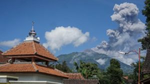
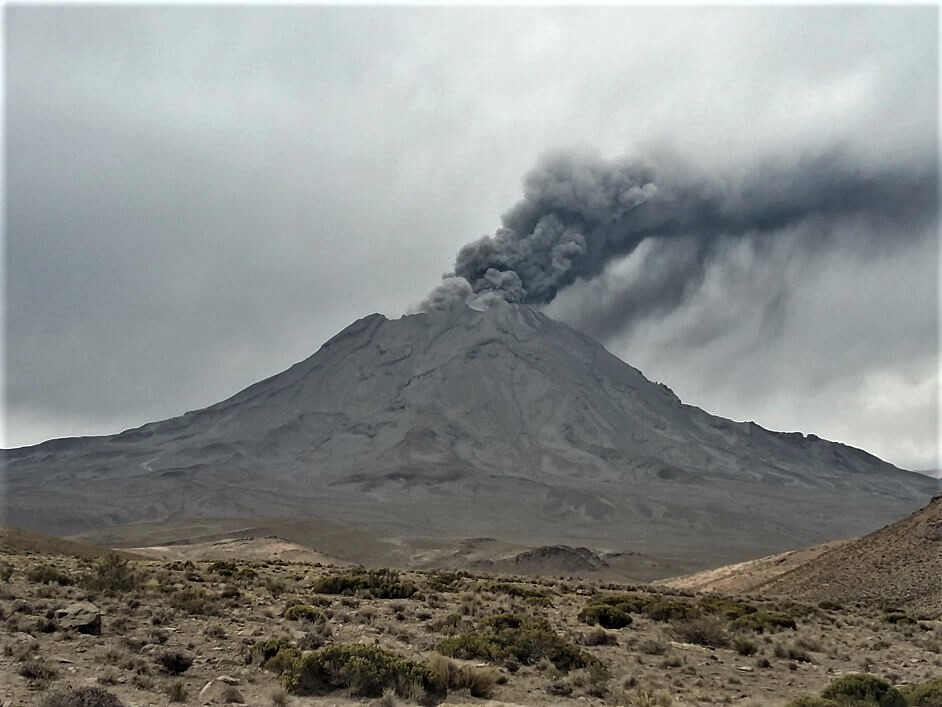
The Peruvian Geophysical Institute (IGP) reports that the eruptive activity of the Sabancaya volcano remains at moderate levels; that is to say with the continuous recording of explosions with columns up to 2 km high above the summit of the volcano and consequent emissions of ash and gas. Consequently, for the following days, no significant change is expected regarding its activity.
The IGP recorded and analyzed the occurrence of approximately 297 earthquakes of volcanic origin, associated with the circulation of fluids (magma, gas, etc.) inside the volcano. In addition, on average 9 explosions of low to medium intensity were recorded daily. Between April 21 and 25, major earthquakes were recorded in the Colca Valley region, with magnitudes between M3.2 and M4.1, associated with tectonic and volcanic activity; the epicenters of these earthquakes were located within a radius of 20 km around the crater of the Sabancaya volcano.
The monitoring of the deformation of the volcanic structure, using GNSS data (processed with fast orbits), does not present any significant anomalies; however, the presence of slight inflation in the area of the Sabancaya volcano and in its northern sector (near the Hualca Hualca volcano) has been observed. Visual surveillance made it possible to identify columns of gas and ash up to 2 km high above the summit of the volcano, which were dispersed towards the Southwest, South and Southeast sectors of the Sabancaya. Satellite surveillance identified the presence of 8 thermal anomalies with values between 3 MW and 15 MW, associated with the presence of a body of lava (dome) on the surface of the crater of the volcano.
Source : IGP.
Photo : archive ingemmet.
Peru , Ubinas :
Analysis period: April 20 to 26, 2020. Arequipa, April 27, 2020.
Alert level: ORANGE
The Geophysical Institute of Peru (IGP) reports that the dynamic behavior of the Ubinas volcano remains at low levels. To date, the recording of earthquakes associated with the ascent of the magma towards the surface is rare. There are light and sporadic emissions of blue gases (of magmatic origin) and water vapor. According to this scenario, the possibility of the appearance of explosions and / or ash emissions is low.
Between April 20 and 26, the IGP recorded and analyzed a total of 55 seismic events associated with the dynamic behavior of the Ubinas volcano, with the predominance of seismic signals of the Volcano-Tectonic (VT) type, related to the fracturing of rocks inside the volcano. On average, 7 earthquakes were recorded per day with magnitudes below M1.6.
Surveillance cameras recorded light and sporadic emissions of volcanic gases and water vapor, with heights less than 300 m above the summit of the volcano. Monitoring the deformation of the volcanic structure does not record any significant anomalies. MIROVA satellite monitoring did not record any thermal anomalies.
Source : IGP.
Photo : archive ingemmet.
Italy , Vésuve :
In March 2020, Vesuvius’ activity remained weak. 95 earthquakes were recorded (maximum magnitude = 2.4). Of these, 94 events (98.94% of the total) had a magnitude less than or equal to 1.5 and a single event had a magnitude greater than or equal to 2.0 confirming a level of seismic activity of very low energy. Overall, in March 2020, it was possible to locate 85 earthquakes (89% of those recorded) located mainly in the crater area at depths not exceeding 2.5 kilometers.

Data from geodetic monitoring networks do not show deformations attributable to volcanic sources but only to gravitational effects, processes of compaction of incoherent surface material or local effects that can influence the inclination of the ground. Thermographic measurements made in the crater area show a constant trend of the maximum temperature. The geochemical analyzes carried out on the edge and on the bottom of the crater do not show significant variations.
Source : INGV.
Photo : Wikipédia.
Guatemala , Pacaya :
Special volcanological bulletin
Updated by Fredy Arnoldo Esquit Chiquitá on April 27, 2020, 11.58pm local time
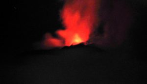
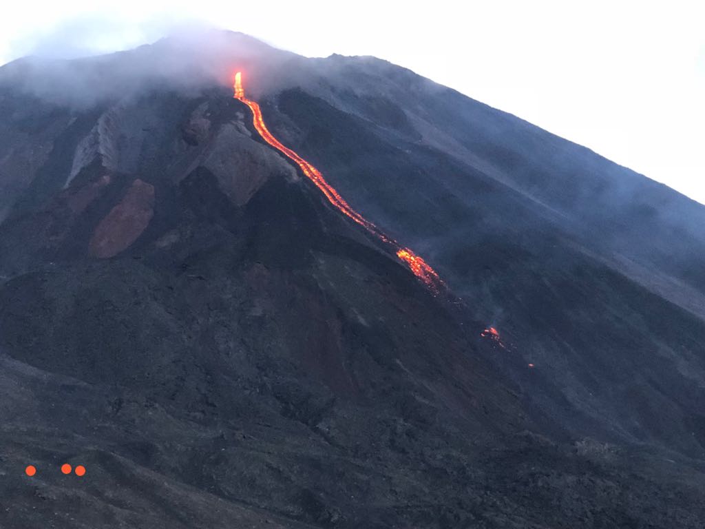
INCREASE IN EFFUSIVE ACTIVITY, VOLCAN PACAYA.
Type of activity: Strombolian
Morphology: composite stratovolcano
Location: 14 ° 22’50˝ Latitude N; 90 ° 36’00˝ Longitude W.
Height: 2,552 m above sea level.
The INSIVUMEH seismic network located on the Pacaya volcano recorded an increase in seismic activity today, April 27 at 9:40 p.m. This increase in seismicity is linked to a lava flow which extends in a south-west direction over a distance of 400 meters from the MacKenney crater. Simultaneously, Strombolian type explosions are recorded which emit incandescent materials at a height of up to 100 meters.
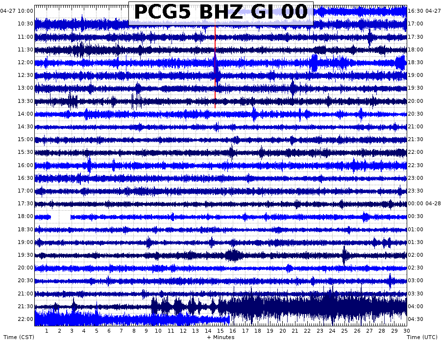
Figure 1: Seismic signal from the PCG5 station
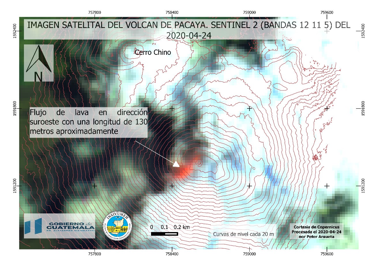
Figure 2: Satellite image of April 24. a 130-meter southwest lava flow is observed.
Lava flows are a common volcanic product on the Pacaya volcano, but they can cause an increase in seismicity when the magma rises and fractures parts of the volcanic building that were not previously open and which now expel incandescent materials.
Source : Insivumeh .
Photos : tn8.tv , Insivumeh.
Mexico , Popocatepetl :
April 27, 11:00 a.m. (April 27, 4:00 p.m. GMT)
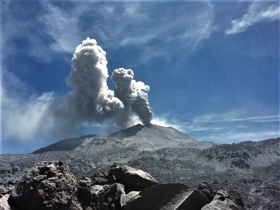
In the past 24 hours, using the Popocatépetl volcano monitoring system, 129 exhalations have been identified, accompanied by water vapor, volcanic gases and slight amounts of ash. The ash emissions were dispersed in the South (S) sector. A minor explosion was also detected yesterday at 11 p.m. Local. In addition, 303 minutes of tremors were recorded.
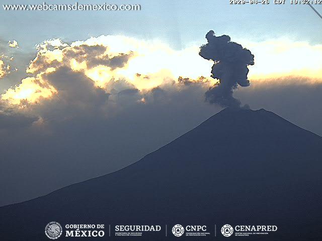
During the night, a slight glow was observed in the crater area.
At the time of this report, there is visibility. During the morning there were volcanic gas emissions and small amounts of ash dispersed in the South (S).
CENAPRED urges NOT to get close to the volcano and especially the crater, because of the danger involved in the fall of ballistic fragments and, in the event of heavy rain, to move away from the bottom of the ravines because of the danger of mud and rubble.
The Popocatépetl volcanic alert signaling light is in YELLOW PHASE 2.
Source : Cenapred.