April 10 , 2020.
Indonesia , Merapi :
VOLCANO OBSERVATORY NOTICE FOR AVIATION – VONA.
Issued: April 10 , 2020
Volcano: Merapi (263250)
Current Aviation Colour Code: ORANGE
Previous Aviation Colour Code: orange
Source: Merapi Volcano Observatory
Notice Number: 2020MER12
Volcano Location: S 07 deg 32 min 31 sec E 110 deg 26 min 31 sec
Area: Special Region of Yogyakarta, Indonesia
Summit Elevation: 9498 FT (2968 M)
Volcanic Activity Summary:
Eruption with volcanic ash cloud at 09h10 (02h10 UT).
Volcanic Cloud Height:
Best estimate of ash-cloud top is around 19098 FT (5968 M) above sea level, may be higher than what can be observed clearly. Source of height data: ground observer.
Other Volcanic Cloud Information:
Ash cloud moving to North-West
Remarks:
Eruption recorded on the seismogram with amplitude max 75 mm and 103 second duration. Eruption has stopped.
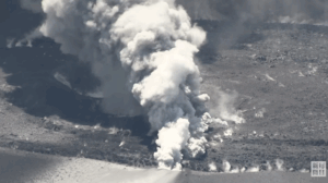
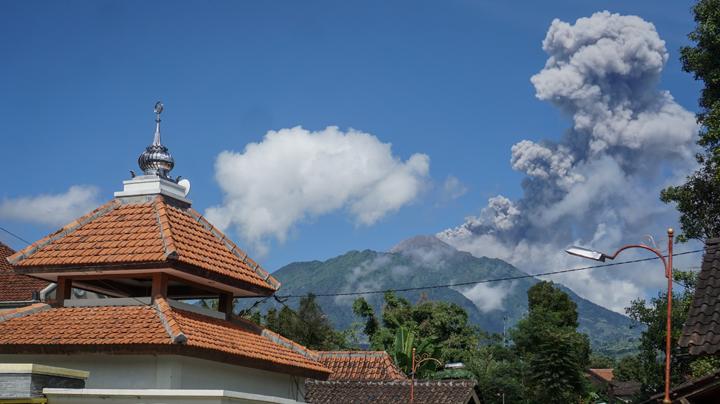
Eruption of Mount Merapi on April 10, 2020 at 9:10 a.m.
This morning, Mount Merapi erupted again, recorded on a seismogram with an amplitude of 75 mm and a duration of 103 seconds. Gray smoke with an eruption column 3000 meters above the summit was observed. These ash eruptions have occurred 13 times since September 2019, which marked the intrusion of new magmas. The impact of the eruption is around the peak, so it does not endanger humans outside the 3 km radius around the Merapi.
The public must anticipate the danger of volcanic ash in the event of ash rain.
According to the WHO, so far there is no evidence that volcanic ash can destroy / kill the COVID-19 virus. Volcanic ash can cause health problems including respiratory problems, eye problems, skin irritation, nasal and throat irritation, coughing, illnesses such as bronchitis and discomfort when breathing. Therefore, the COVID-19 propagation prevention protocol should always be applied by performing physical spacing.
People are advised to stay calm, not to panic, and to carry out their activities as usual.
Source : Magma Indonésie, BPPTKG.
Photo : tempo.co
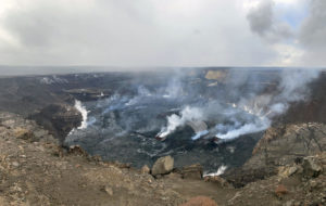
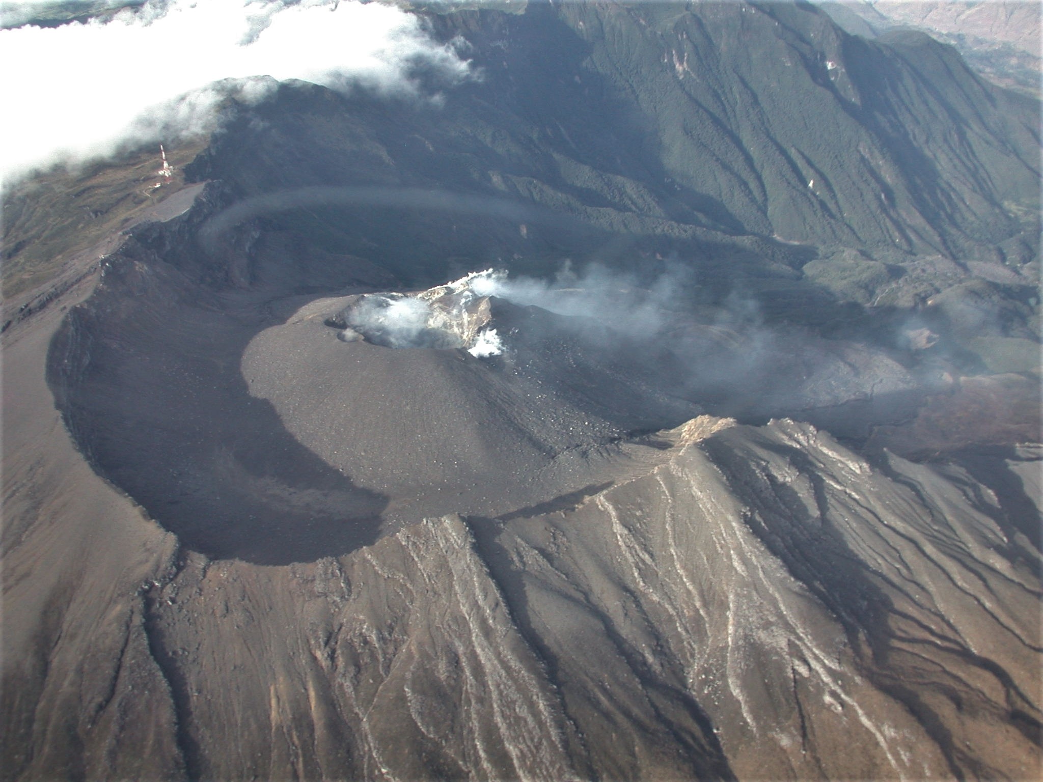
Hawaii , Mauna Loa :
19°28’30 » N 155°36’29 » W,
Summit Elevation 13681 ft (4170 m)
Current Volcano Alert Level: ADVISORY
Current Aviation Color Code: YELLOW
Activity Summary:
Mauna Loa Volcano is not erupting. Rates of deformation and seismicity have not changed significantly over the past week and remain above long-term background levels.
Observations:
During the past week, HVO seismometers recorded 37 small-magnitude earthquakes on the volcano’s summit and upper-elevation flanks. Most of these earthquakes occurred at shallow depths of less than 8 kilometers (~5 miles) below ground level. The largest earthquake was a magnitude 2.3 on the volcano’s upper Southwest Rift Zone.
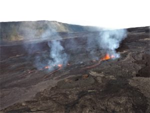
Close-up view of the 1984 crack that cuts the southwest side of the 1940 cone.
Global Positioning System (GPS) measurements show continued slow summit inflation, consistent with magma supply to the volcano’s shallow storage system.
Gas concentrations at the Sulphur Cone monitoring site on the Southwest Rift Zone remain stable. Fumarole temperatures as measured at both Sulphur Cone and the summit have not changed significantly.
Source : HVO.
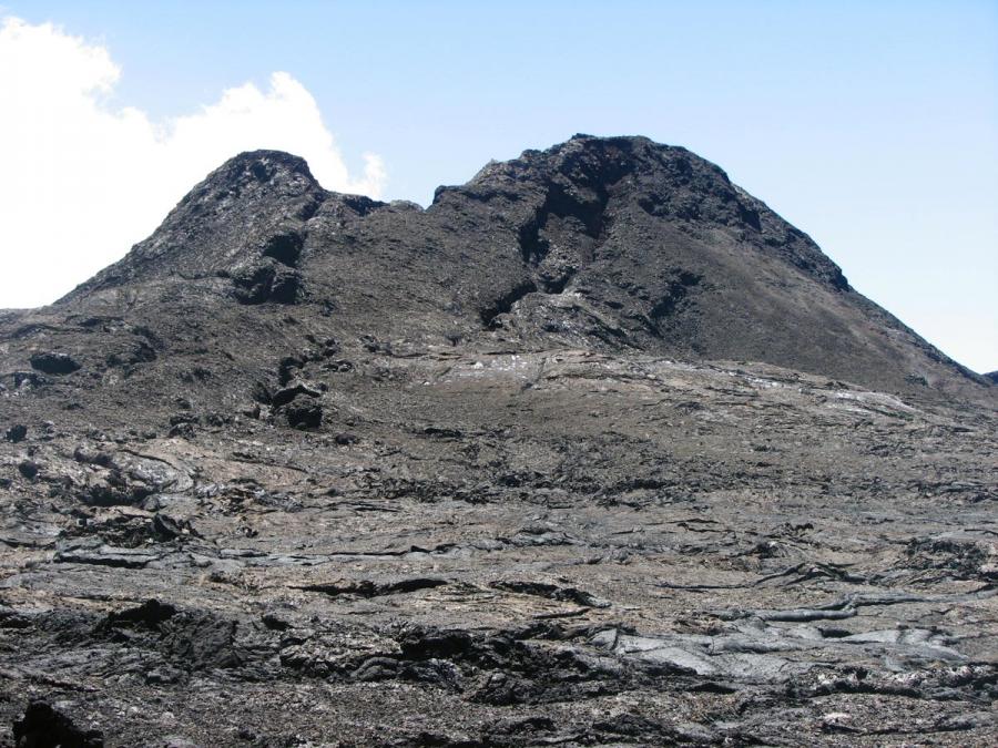
Colombia, Galeras :
Galeras Volcano Weekly Activity Bulletin
Volcanic activity continues at the YELLOW LEVEL ■ (III): CHANGES IN THE BEHAVIOR OF VOLCANIC ACTIVITY.
According to the monitoring of the activity of the GALERAS volcano, the COLOMBIAN GEOLOGICAL SERVICE (SGC) reports that:
At low levels, for the period evaluated between March 31 and April 6, 2020, a decrease in the number and an increase in the energy of earthquakes were observed, all associated with fracturing of the rock inside of the volcanic building. Some of these events were located dispersed in the area of influence of the Galeras, at distances between 0.5 and 13 km, with depths between 2.5 and 12 km from its summit (4200 m ) and with a maximum local magnitude of 1.5 on the Richter scale.
The favorable weather conditions from April 1 to 5 made it possible to record gas emissions from the main crater and the fumarole fields on the periphery of the active cone, Las Chavas in the West and El Paisita in the North, with small white columns , low height and variable dispersion according to the wind. The other geophysical and geochemical monitoring parameters of the Galeras volcano did not show significant changes.
Source : SGC.
Photo : SGC.
Guatemala , Fuego :
Atmospheric conditions: clear.
Wind: northeast at 5 k / h.
Precipitation: 0.0 mm
Activity:
The volcano is observed with weak to moderate explosions, in a range of 8 to 14 per hour, accompanied by ash columns at 4,500 to 4,800 m above sea level (14,763 to 15,748 feet) which move west and south -West, about 18 kilometers. The explosions generate rumblings and shock waves which cause vibrations in the roofs and windows of houses, mainly on the south-west and west sides.
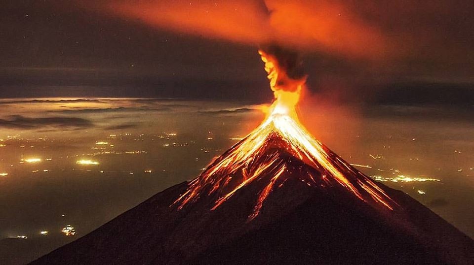
This activity is also accompanied by sounds similar to a train locomotive, for periods of 3 to 6 minutes. Ash falls are reported in the villages of Morelia, Panimache, Santa Sofía, Sangre de Cristo and others in this area. At night, the crater was observed with incandescent pulses 200 and 300 meters high. As has been reported since April 6, a lava flow of about 600 meters is observed, accompanied by avalanches of solid blocks, some reaching the vegetation and can cause forest fires.
Source : Insivumeh .
Photo : David Rojas ( 2017) .