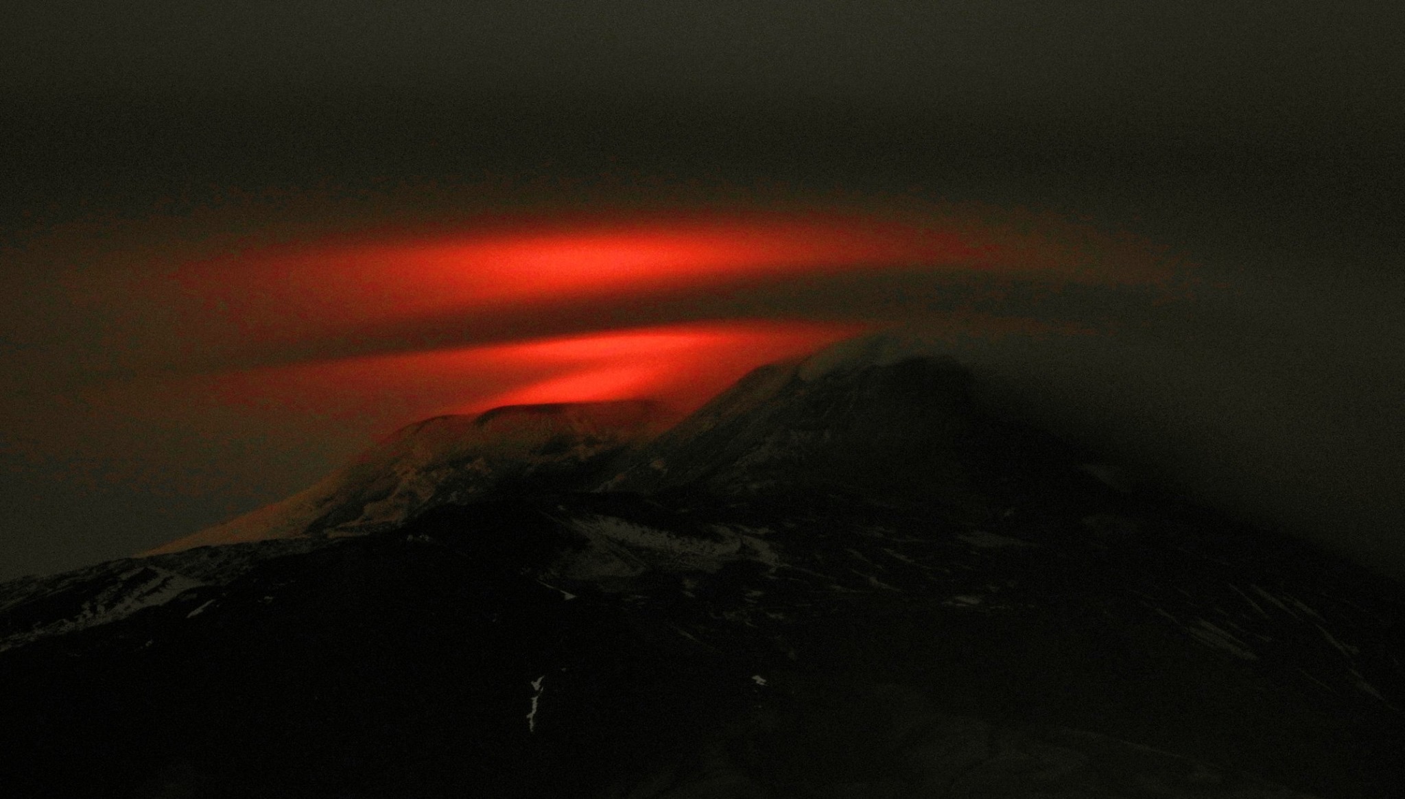
March 11, 2020. EN . Italy / Sicily : Etna , Philippines : Kanlaon , Peru : Ubinas , Colombia : Nevado del Ruiz , Hawaii : Mauna Loa .

March 11 , 2020 .


Italy /Sicily , Etna :

Weekly bulletin from 02/03/2020 to 08/03/2020 (issue date 10/03/2020).

SUMMARY OF ACTIVITY STATUS

In light of the monitoring data, it is highlighted:
1) VOLCANOLOGICAL OBSERVATIONS: Strombolian and effusive intra-crater activity of the Voragine crater. Discontinuous ash emissions and discontinuous strombolian activity in the Northeast crater and the New Southeast crater.
2) SEISMOLOGY: Low seismic fracturing activity; stationarity of the parameters of the volcanic tremor.

3) INFRASOUND: Moderate infrasonic activity.
4) DEFORMATIONS: The Etna soil deformation monitoring networks have not shown any significant variation to report during the last week.
5) GEOCHEMISTRY: The flow of SO2 is at an average level. The flow of CO2 from soils is at medium-low levels. The partial pressure of dissolved CO2 does not show significant variations. The isotopic ratio of helium is fixed at medium-high values. No update on the CO2 / SO2 ratio is available.

VOLCANOLOGICAL OBSERVATIONS
During the week, monitoring of volcanic activity in the summit craters of Etna (Fig. 3.1) was carried out by analyzing images from the network of surveillance cameras from the INGV Catania section, Etneo Observatory (INGV- OE).

Fig. 3.1 – Map of the area of the summit crater (DEM 2014, Laboratory of aerogeophysics – Section Rome 2, mod.). Scalloped black lines = edge of upper craters: BN = Bocca Nuova, inside which BN-1 and BN-2 are observed; VOR = Voragine ; NEC = Northeast Crater; SEC = Southeast Crater; NSEC = New southeast crater. Yellow dots = degassing vents. Red dots = mouths with eruptive activity. Red line = active flows. Yellow lines = flows in cooling. Gray circle = ash cone.

During the period considered, the upper craters were mainly characterized by an explosive strombolian and effusive activity of Voragine (VOR), and by a degassing with a discontinuous strombolian activity and intermittent ash emissions from the New Southeast Crater (NSEC) and the Northeast Crater (NEC) (Fig.3.1).

Volcanic tremors:
The time trend of the average amplitude of volcanic tremor remained at an average level during the week while from March 7, it showed a slight increase, reaching a high level. The location of the source of the tremor is located under the summit craters, at a depth of about 2200-2600 meters above sea level.

Source : INGV.

Read the whole article : file:///C:/Users/Utilisateur/AppData/Local/Packages/Microsoft.MicrosoftEdge_8wekyb3d8bbwe/TempState/Downloads/BollettinoEtna20200310%20(1).pdf

Photos : INGV, Boris Behncke.


Philippines , Kanlaon :

KANLAON VOLCANO BULLETIN: 11 March 2020 10:00 A.M. – Alert Level 0 (normal) to Alert Level 1 (abnormal)

This serves as a notice for the raising of the alert status of Kanlaon from Alert Level 0 (normal) to Alert Level 1 (abnormal).

Kanlaon Volcano’s seismic monitoring network recorded a total of eighty (80) volcanic earthquakes since 9 March 2020 dominated by seventy-seven (77) low frequency events that are associated with magmatic fluids beneath the edifice. The increased seismic activity could be succeeded by steam-driven or phreatic eruptions at the summit crater, despite the absence of visible degassing or steaming from the active vent this year. Ground deformation data from continuous GPS measurements indicate a period of long-term slow inflation of the edifice since 2017, while short-term electronic tilt monitoring on the southeastern flanks recorded slow inflation of the lower slopes since May 2019 and pronounced inflation of the upper slopes in the end of January 2020. These parameters indicate that volcanic processes are underway deep beneath the edifice that may be caused by deep-seated degassing or hydrothermal activity or magmatic intrusion.

Alert Level 1 status now currently prevails over Kanlaon Volcano, which means that it is at an abnormal condition and has entered a period of unrest. The local government units and the public are strongly reminded that entry into the 4-kilometer radius Permanent Danger Zone (PDZ) must be strictly prohibited due to the further possibilities of sudden and hazardous steam-driven or phreatic eruptions. Civil aviation authorities must also advise pilots to avoid flying close to the volcano’s summit as ejecta from any sudden phreatic eruption can be hazardous to aircraft.

DOST-PHIVOLCS is closely monitoring Kanlaon Volcano’s activity and any new development will be relayed to all concerned.

Source : Phivolcs.

Photo : Bongbong Woo Tadifa.


Peru , Ubinas :

Analysis period: March 2 to 8, 2020. Arequipa, March 9, 2020.
Alert level: ORANGE

The Geophysical Institute of Peru (IGP) reports that the eruptive activity of the Ubinas volcano remains at low levels. To date, the recording of earthquakes associated with the rise of magma to the surface is rare. There are weak and sporadic emissions of bluish gases (of magmatic origin) and water vapor. According to this scenario, the possibility of volcanic explosions and / or ash emissions is low.

Between March 2 and 8, the IGP recorded and analyzed a total of 112 seismic events associated with the dynamic behavior of the Ubinas volcano, with the predominance of seismic signals of the Volcano-Tectonic (VT) type, related to the fracturing of rocks inside the volcano On average, 8 earthquakes per day were recorded with magnitudes below M1.6. The seismic activity linked to the rise of magma (hybrid type) decreased both in number of events (2 daily earthquakes) and in energy.

Surveillance cameras recorded light and sporadic emissions of blue gases (of magmatic origin) and water vapor, with heights less than 300 m above the summit of the volcano. Monitoring the deformation of the volcanic structure does not record any significant anomalies. MIROVA satellite surveillance did not record any thermal anomalies.

Source : IGP.

Photo : Auteur inconnu.


Colombia , Nevado del Ruiz :

Weekly newsletter of the Nevado del Ruiz volcano
The level of activity continues at the level of yellow activity or (III): changes in the behavior of volcanic activity.

Regarding the monitoring of the activity of the Nevado del Ruiz volcano, the COLOMBIAN GEOLOGICAL SERVICE reports that:

According to the results obtained from the monitoring of the activity, through the different parameters, the Nevado del Ruiz volcano continued to show unstable behavior during the last week. An acceleration of the volcanic process and therefore changes in the level of activity of the volcano are not excluded.

The seismicity linked to the dynamics of the fluids, inside the volcanic channels, showed an increase in the number of recorded events and the seismic energy released, compared to the previous week. This seismic activity has been characterized by the presence of continuous volcanic tremors, pulses of volcanic tremors, earthquakes of long type and very long period recorded individually or jointly with pulses of volcanic tremor. The earthquakes presented varying energy levels and spectral content. Some of these signals were associated with gas and ash emissions, such as those reported today, with column heights measured at the top of the volcano up to 700 m and dispersion influenced by wind direction and speed. , which varied from the Southwest to the Southeast of the volcano. These emissions were confirmed by cameras installed in the volcano area and reports from officials of the Los Nevados National Natural Park.

The seismicity generated by the fracturing of rocks (volcano-tectonic type) increased in number of earthquakes and decreased in the seismic energy released, compared to the previous week. This type of seismicity was located mainly to the northeast of the volcano and to a lesser extent, in the Arenas crater, to the south and southeast of it. The depths of the earthquakes ranged from 0.4 to 6.2 km. The maximum magnitude recorded during the week was 0.7 ML (local magnitude), for the earthquakes located northeast of the Arenas crater.

It should also be noted, the occurrence of several episodes of seismicity of the « drumbeat » type, volcano-tectonic earthquakes, of short duration and of very low energy level. This type of seismicity is linked to the processes of ascent and evolution of a dome on the surface of the volcano.

It is important to note that some minor changes were observed in the data obtained by the inclinometers.
In tracking information from the Mirova and NASA FIRMS web portals, they have reported low to moderate energy thermal anomalies on the volcano in the past week.

The Nevado del Ruiz volcano continues at the yellow activity level.

Source : SGC.

Photos : SGC , archivo/Caracol Radio .


Hawaii , Mauna Loa :

19°28’30 » N 155°36’29 » W,
Summit Elevation 13681 ft (4170 m)
Current Volcano Alert Level: ADVISORY
Current Aviation Color Code: YELLOW

Activity Summary:
Mauna Loa Volcano is not erupting. Rates of deformation and seismicity have not changed significantly over the past week and remain above long-term background levels.

Sulphur Cone

Observations:
During the past week, HVO seismometers recorded around 70 small-magnitude earthquakes beneath the volcano’s upper elevations. Most of these events occurred at shallow depths of less than 5 kilometers (~3 miles) below ground level. Separately, a flurry – totaling around 70 small-magnitude earthquakes so far – has been occurring just south of the Mauna Loa Northeast Rift Zone, where known fault structures commonly produce shallow seismicity.

The strongest earthquake on Mauna Loa in this period was a magnitude-3.7 event in the early morning of 28 February, for which the USGS received 64 felt-reports. This earthquake was located approximately 10 kilometers (~6 miles) northeast of Hawaiian Ocean View Estates, in a region where earthquakes of similar magnitude normally occur several times per year.

Global Positioning System (GPS) measurements show continued slow summit inflation, consistent with magma supply to the volcano’s shallow storage system.

Gas concentrations at the Sulphur Cone monitoring site on the Southwest Rift Zone remain stable. Fumarole temperatures as measured at both Sulphur Cone and the summit have not changed significantly.

Source : HVO.

11 Mars 2020 . FR . Italie / Sicile : Etna , Philippines : Kanlaon , Pérou : Ubinas , Colombie : Nevado del Ruiz , Hawaii : Mauna Loa .

11 Mars 2020 .


Italie /Sicile , Etna :

Bulletin hebdomadaire du 02/03/2020 au 08/03/2020 (date d’émission 10/03/2020).

RÉSUMÉ DU STATUT D’ACTIVITÉ

À la lumière des données de surveillance, il est mis en évidence:
1) OBSERVATIONS VOLCANOLOGIQUES: Activité intra-cratère strombolienne et effusive du cratère de la Voragine. Émissions de cendres discontinues et activité strombolienne discontinue du cratère Nord-Est et du Nouveau Cratère du Sud-Est.
2) SISMOLOGIE: Faible activité de fracturation sismique; stationnarité des paramètres du tremor volcanique.

3) INFRASONS: Activité infrasonore modérée.
4) DÉFORMATIONS: Les réseaux de surveillance des déformations du sol de l’Etna n’ont montré aucune variation significative à signaler au cours de la dernière semaine.
5) GÉOCHIMIE: Le flux de SO2 est à un niveau moyen. Le flux de CO2 des sols se situe à des niveaux moyens-bas. La pression partielle de CO2 dissous ne présente pas de variations importantes. Le rapport isotopique de l’hélium est fixé sur des valeurs moyennes-élevées. Aucune mise à jour sur le rapport CO2 / SO2 n’est disponible.

OBSERVATIONS VOLCANOLOGIQUES
Au cours de la semaine, le suivi de l’activité volcanique dans les cratères sommitaux de l’Etna (Fig. 3.1) a été effectué en analysant les images du réseau de caméras de surveillance de la section INGV Catania, Observatoire Etneo (INGV-OE ).

Fig. 3.1 – Carte de la zone du cratère sommital (DEM 2014, Laboratoire d’aérogéophysique – Section Rome 2, mod.). Lignes noires échancrées = bord des cratères supérieurs: BN = Bocca Nuova, à l’intérieur duquel BN-1 et BN-2 sont observés; VOR = Voragine; NEC = Northeast Crater; SEC = Cratère Sud-Est; NSEC = Nouveau cratère du sud-est. Points jaunes = bouches dégazantes. Points rouges = bouches à activité éruptive. Ligne rouge = flux actifs. Lignes jaunes = coulée en refroidissement. Cercle gris = cône de cendre.

Au cours de la période considérée, les cratères supérieurs se sont principalement caractérisés par une activité explosive strombolienne et effusive de la Voragine (VOR), et par un dégazage avec une activité stromboliennes discontinue et des émissions de cendres intermittentes du Nouveau Cratère du Sud-Est (NSEC) et du Cratère Nord-est (NEC) (Fig.3.1).

Tremors volcaniques:
La tendance temporelle de l’amplitude moyenne du tremor volcanique est restée à un niveau moyen au cours de la semaine tandis qu’à partir du 7 mars, elle a montré une légère augmentation, atteignant un niveau élevé . L’emplacement de la source du tremor est situé sous les cratères sommitaux, à une profondeur d’environ 2200-2600 mètres au-dessus du niveau de la mer .

Source : INGV.

Lire l’article en entier : file:///C:/Users/Utilisateur/AppData/Local/Packages/Microsoft.MicrosoftEdge_8wekyb3d8bbwe/TempState/Downloads/BollettinoEtna20200310%20(1).pdf

Photos : INGV, Boris Behncke.


Philippines , Kanlaon :

BULLETIN D’ACTIVITE DU VOLCAN KANLAON , 11 mars 2020 , 10h00 – Niveau d’alerte 0 (normal) au niveau d’alerte 1 (anormal).

Ce bulletin sert à signaler l’augmentation du statut d’alerte du Kanlaon qui passe du niveau d’alerte 0 (normal) au niveau d’alerte 1 (anormal).

Le réseau de surveillance sismique du volcan Kanlaon a enregistré un total de quatre-vingt (80) tremblements de terre volcaniques depuis le 9 mars 2020 dominés par soixante-dix-sept (77) événements de basse fréquence associés à des fluides magmatiques sous l’édifice. L’augmentation de l’activité sismique pourrait être remplacée par des éruptions de vapeur ou phréatiques dans le cratère du sommet, malgré l’absence de dégazage ou de vapeur visible de l’évent actif cette année. Les données de déformation du sol provenant de mesures GPS continues indiquent une période de lente inflation sur le long terme de l’édifice depuis 2017, tandis que la surveillance électronique à court terme de l’inclinaison sur les flancs Sud-Est a enregistré une lente inflation des pentes inférieures depuis mai 2019 et une inflation prononcée des pentes supérieures fin janvier 2020. Ces paramètres indiquent que des processus volcaniques sont en cours en profondeur sous l’édifice qui peuvent être provoqués par un dégazage en profondeur ou une activité hydrothermale ou une intrusion magmatique.

Le statut d’alerte de niveau 1 prévaut actuellement sur le volcan Kanlaon, ce qui signifie qu’il se trouve dans un état anormal et est entré dans une période d’agitation. Il est vivement rappelé aux collectivités locales et au public que l’entrée dans la zone de danger permanent (PDZ) d’un rayon de 4 kilomètres doit être strictement interdite en raison des possibilités supplémentaires d’éruptions soudaines et dangereuses ( vapeur ou phréatiques ) . Les autorités de l’aviation civile doivent également conseiller aux pilotes d’éviter de voler près du sommet du volcan, car les éjectas d’une éruption phréatique soudaine peuvent être dangereux pour les avions.

Le DOST-PHIVOLCS surveille de près l’activité du volcan Kanlaon et tout nouveau développement sera relayé à toutes les personnes concernées.

Source : Phivolcs.

Photo : Bongbong Woo Tadifa.


Pérou , Ubinas :

Période d’analyse: 2 au 8 mars 2020 . Arequipa, 9 mars 2020 .
Niveau d’alerte: ORANGE

L’Institut géophysique du Pérou (IGP) rapporte que l’activité éruptive du volcan Ubinas reste à de faibles niveaux. À ce jour, l’enregistrement de tremblements de terre associés à la remontée du magma vers la surface est rare. Il y a des émissions faibles et sporadiques de gaz bleutés (d’origine magmatique) et de vapeur d’eau. Selon ce scénario, la possibilité d’explosions volcaniques et / ou d’émissions de cendres est faible.

Entre le 2 et le 8 mars, l’IGP a enregistré et analysé un total de 112 événements sismiques associés au comportement dynamique du volcan Ubinas, avec la prédominance de signaux sismiques de type Volcano-Tectonique (VT), liés à la fracturation des roches à l’intérieur du volcan En moyenne, 8 tremblements de terre par jour ont été enregistrés avec des magnitudes inférieures à M1,6. L’activité sismique liée à la remontée du magma (type hybride) a diminué à la fois en nombre d’événements (2 tremblements de terre quotidiens) et en énergie.

Les caméras de surveillance ont enregistré des émissions légères et sporadiques de gaz bleus (d’origine magmatique) et de vapeur d’eau, avec des hauteurs inférieures à 300 m au-dessus du sommet du volcan. Le suivi de la déformation de la structure volcanique n’enregistre pas d’anomalies significatives. La surveillance par satellite MIROVA n’a pas enregistré d’anomalies thermiques.

Source : IGP.

Photo : Auteur inconnu.


Colombie , Nevado del Ruiz :

Bulletin hebdomadaire du volcan Nevado del Ruiz
Le niveau d’activité se poursuit au niveau d’activité jaune ou (III): changements dans le comportement de l’activité volcanique.

Concernant le suivi de l’activité du volcan Nevado del Ruiz, le COLOMBIAN GEOLOGICAL SERVICE rapporte que:

Selon les résultats obtenus du suivi de l’activité, à travers les différents paramètres, le volcan Nevado del Ruiz a continué à montrer un comportement instable au cours de la dernière semaine. Une accélération du processus volcanique et par conséquent des changements dans le niveau d’activité du volcan ne sont pas exclus.

La sismicité liée à la dynamique des fluides, à l’intérieur des canaux volcaniques, a montré une augmentation du nombre d’événements enregistrés et de l’énergie sismique libérée, par rapport à la semaine précédente. Cette activité sismique a été caractérisée par la présence de tremors volcaniques continus, d’impulsions de tremors volcaniques, de tremblements de terre de type longue et de très longue période enregistrés individuellement ou conjointement avec des impulsions de tremor volcanique . Les tremblements de terre ont présenté des niveaux d’énergie et un contenu spectral variables. Certains de ces signaux étaient associés à des émissions de gaz et de cendres, telles que celles signalées aujourd’hui, avec des hauteurs de colonne mesurées au sommet du volcan jusqu’à 700 m et une dispersion influencée par la direction et la vitesse du vent, qui variait du Sud-Ouest au Sud-Est du volcan. Ces émissions ont été confirmées par les caméras installées dans la zone du volcan et les rapports des responsables du parc naturel national de Los Nevados .

La sismicité générée par la fracturation des roches (type volcano-tectonique) a augmenté en nombre de tremblements de terre et diminué dans l’énergie sismique libérée, par rapport à la semaine précédente. Ce type de sismicité était localisé principalement au Nord-Est du volcan et dans une moindre mesure , dans le cratère Arenas, au Sud et au Sud-Est de celui-ci. Les profondeurs des tremblements de terre variaient entre 0,4 et 6,2 km. La magnitude maximale enregistrée au cours de la semaine était de 0,7 ML (magnitude locale), pour les tremblements de terre situés au Nord-Est du cratère Arenas.

Il est également à noter, la survenue de plusieurs épisodes de séismicité de type « drumbeat » , séismes volcano-tectoniques, de courte durée et de très faible niveau d’énergie. Ce type de sismicité est lié aux processus d’ascension et d’évolution d’un dôme à la surface du volcan.

Il est important de noter que quelques changements mineurs ont été observés dans les données obtenues par les inclinomètres. 
 Dans le suivi des informations fournies dans les portails Web Mirova et NASA FIRMS, ceux-ci ont signalé des anomalies thermiques d’énergie faible à modérée sur le volcan au cours de la dernière semaine.

Le volcan Nevado del Ruiz continue au niveau d’activité jaune.

Source : SGC.

Photos : SGC , archivo/Caracol Radio .


Hawaii , Mauna Loa :

19 ° 28’30 « N 155 ° 36’29 » O,
Élévation du sommet : 13681 pi (4170 m)
Niveau actuel d’alerte volcanique: AVIS
Code couleur actuel de l’aviation: JAUNE

Résumé de l’activité:
Le volcan Mauna Loa n’est pas en éruption . Les taux de déformation et de sismicité n’ont pas changé de façon significative au cours de la semaine dernière et restent supérieurs aux niveaux de fond à long terme.

Sulphur Cone


Observations:
Au cours de la semaine dernière, les sismomètres du HVO ont enregistré environ 70 tremblements de terre de petite magnitude sous les altitudes supérieures du volcan. La plupart de ces événements se sont produits à des profondeurs peu profondes de moins de 5 kilomètres (~ 3 milles) sous le niveau du sol. Par ailleurs, une rafale – totalisant jusqu’à 70 tremblements de terre de faible ampleur jusqu’à présent – s’est produite juste au Sud de la zone de Rift Nord-Est du Mauna Loa, où les structures de failles connues produisent généralement une sismicité peu profonde.

Le tremblement de terre le plus fort sur le Mauna Loa au cours de cette période a été un événement de magnitude 3,7 au petit matin du 28 février, pour lequel l’USGS a reçu 64 rapports de séisme ressenti. Ce tremblement de terre était situé à environ 10 kilomètres (~ 6 miles) au Nord-Est de Hawaiian Ocean View Estates, dans une région où des tremblements de terre de magnitude similaire se produisent normalement plusieurs fois par an.

Les mesures du système de positionnement mondial (GPS) montrent une lente inflation continue du sommet, compatible avec l’approvisionnement en magma du système de stockage peu profond du volcan.

Les concentrations de gaz au site de surveillance de Sulphur Cone dans la zone de Rift Sud-Ouest restent stables. Les températures des fumerolles mesurées à la fois à Sulphur Cone et au sommet n’ont pas changé de manière significative.

Source : HVO.