January 02 , 2020 .
Happy New Year 2020.
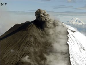
Kamchatka , Ebeko :
VOLCANO OBSERVATORY NOTICE FOR AVIATION (VONA).
Issued: January 02 , 2020
Volcano: Ebeko (CAVW #290380)
Current aviation colour code: ORANGE
Previous aviation colour code: orange
Source: KVERT
Notice Number: 2020-03
Volcano Location: N 50 deg 41 min E 156 deg 0 min
Area: Northern Kuriles, Russia
Summit Elevation: 3791.68 ft (1156 m)

Volcanic Activity Summary:
A moderate eruptive activity of the volcano continues. According to visual data by volcanologists from Severo-Kurilsk, explosion sent ash up to 2.9 km a.s.l., an ash cloud is drifting to the north from the volcano.
A moderate eruptive activity of the volcano continues. Ash explosions up to 19,700 ft (6 km) a.s.l. could occur at any time. Ongoing activity could affect low-flying aircraft and airport of Severo-Kurilsk.
Volcanic cloud height:
9512 ft (2900 m) AMSL Time and method of ash plume/cloud height determination: 20200102/0040Z – Visual data
Other volcanic cloud information:
Distance of ash plume/cloud of the volcano: 18 mi (29 km)
Direction of drift of ash plume/cloud of the volcano: NNE / azimuth 27 deg
Time and method of ash plume/cloud determination: 20200102/0120Z – Himawari-8
Source : Kvert.
Photo : Кирилл Баканов.
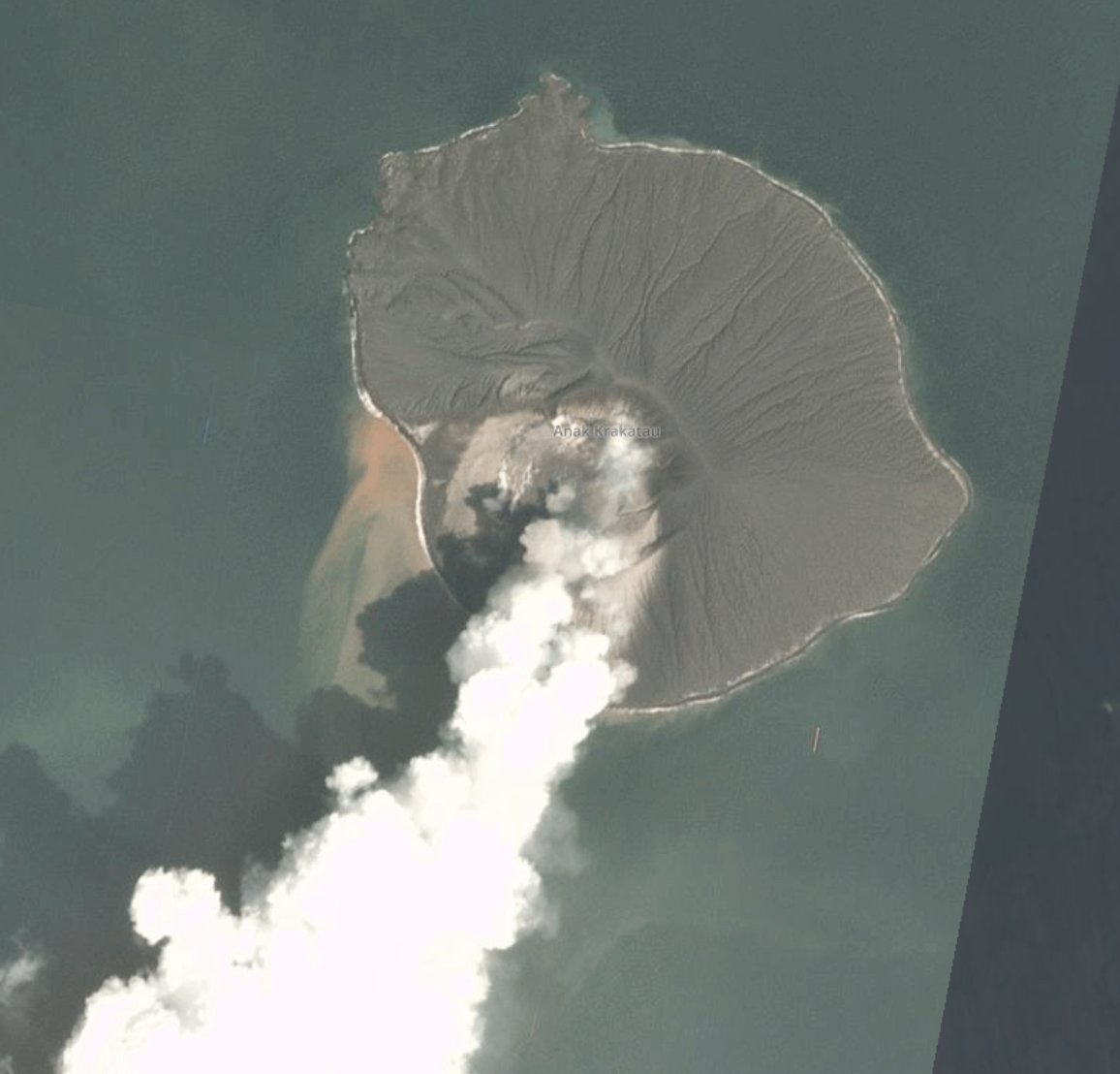
Indonesia , Anak Krakatau :
VOLCANO OBSERVATORY NOTICE FOR AVIATION – VONA.
Issued: January 01 , 2020.
Volcano: Anak Krakatau (262000)
Current Aviation Colour Code: ORANGE
Previous Aviation Colour Code: unassigned
Source: Anak Krakatau Volcano Observatory
Notice Number: 2020KRA01
Volcano Location: S 06 deg 06 min 07 sec E 105 deg 25 min 23 sec
Area: Lampung, Indonesia
Summit Elevation: 502 FT (157 M)
Volcanic Activity Summary:
Eruption with volcanic ash cloud at 03h45 UTC (10h45 local).
Volcanic Cloud Height:
Best estimate of ash-cloud top is around 2742 FT (857 M) above sea level, may be higher than what can be observed clearly. Source of height data: ground observer.
Other Volcanic Cloud Information:
Thick gray volcanic ash from the top of the crater. Ash cloud is moving to southeast.
Remarks:
Eruption recorded on seismogram with maximum amplitude 37mm and duration 51 second.
Press release on the volcanic activity of Anak Krakatau, December 31, 2019.
… / …
Seismicity:
Seismicity is dominated by surface earthquakes (emissions and eruptions). Volcanic earthquakes (shallow volcanics, deep volcanics, low frequency and tremors) always occur with fluctuating amounts and above normal conditions.
Deformation: The observation of the deformation using inclinometers fluctuated and showed a slight inflation pattern before the eruption of December 30 and 31, 2019. Between October and November 2019, observations of the inclinometer records showed stable conditions.
https://www.facebook.com/rodolfomartin.brenessalvatierra.5/videos/176635630244892/
Analysis:
Eruption earthquakes and volcanic earthquakes in the past three months indicate that there is still a deep supply of fluid. It is suspected that the type of fluid is dominated by gas / water vapor but is not yet significant.
Observations of seismic energy fluctuate and generally show an increase in the last two days, related to the eruptions on December 30 and 31, 2019. However, this increase is much smaller than the energy of the series of December eruptions. 2018 to January 2019. Fluctuations in the seismic energy graph indicate that the migration of fluids with relatively low intensity is still in progress. This migration of fluid is also detected from the increase in the value of the tiltmeter before the eruption.
Source : PVMBG. Magma Indonésie .
Photos : Simon Carn / planetlabs ,
Video : Rodolfo Martin Brenes Salvatierra .
Italy / Sicily , Etna :
A slight eruptive activity continues in the summit craters of Etna until 2020. The image shows an emission of ashes from the Voragine crater on the evening of January 1, 2020, viewed from the South
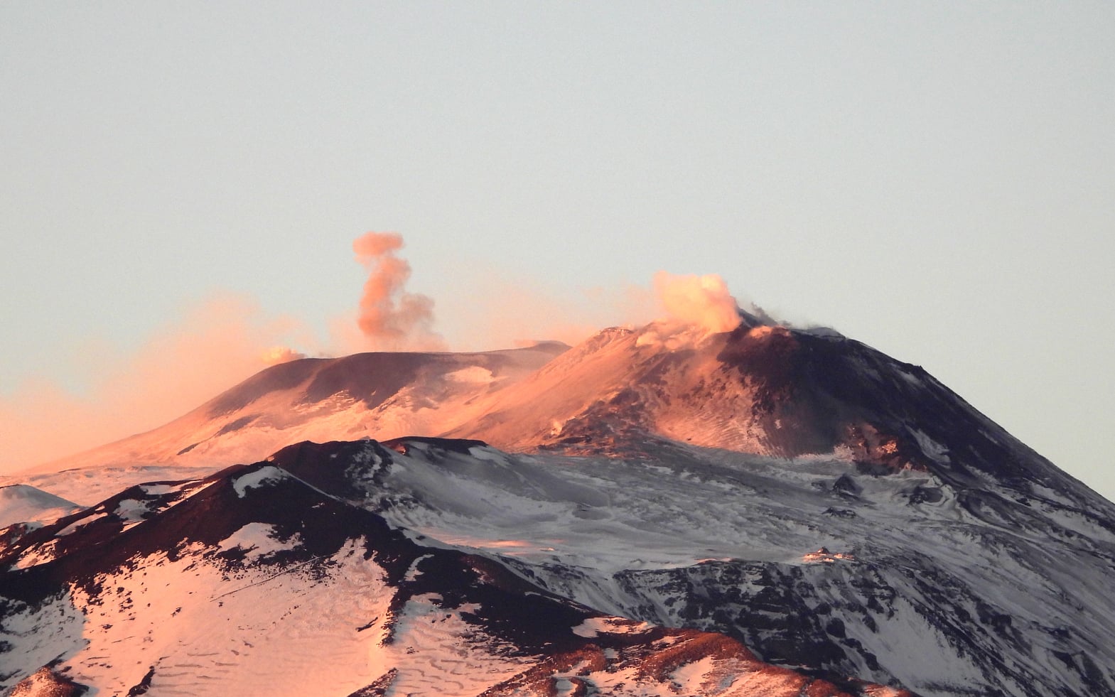
We also note strombolian explosions of the same crater, at the dawn of January 2, which were recorded by the high sensitivity camera of the Montagnola (EMOH); ash emissions from the vent that recently formed on the « saddle cone » of the New Southeast Crater in the afternoon of January 1 as well as a Strombolian activity in the Northeast crater at 6.30 am (local time) on January 2, recorded by the high resolution camera of Monte Cagliato (EMCH), on the eastern flank of Etna.
Source : INGV Vulcani .
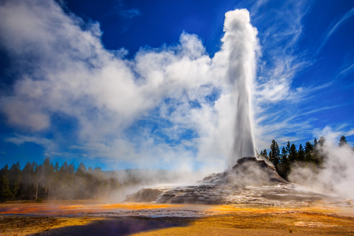
United – States , Yellowstone :
44°25’48 » N 110°40’12 » W,
Summit Elevation 9203 ft (2805 m)
Current Volcano Alert Level: NORMAL
Current Aviation Color Code: GREEN
Recent work and news
Happy New Year, from the member agencies of the Yellowstone Volcano Observatory: U.S. Geological Survey, National Park Service, University of Utah, University of Wyoming, UNAVCO, Wyoming State Geological Survey, Idaho Geological Survey, and Montana Bureau of Mines and Geology. We hope that 2020 has started off well for everyone!
Steamboat kept up its activity in December, with water eruptions on December 8, 18, and 26. This brings the total number of eruptions for 2019 to 48 and smashes the previous record of eruptions for a calendar year, which was set in 2018 when the geyser erupted 32 times.
Overall, 2019 was a year of diminished seismicity, with 1217 located earthquakes—well below the annual average of 1500-2500 earthquakes—and 7 events greater than M3.
For the first time in several years, there was no significant uplift in the Yellowstone area during 2019. The caldera continued to subside, as it has since 2015, and the area around Norris Geyser Basin transitioned from no deformation to subsidence in September 2019.
Seismicity
During December 2019, the University of Utah Seismograph Stations, responsible for the operation and analysis of the Yellowstone Seismic Network, located 87 earthquakes in the Yellowstone National Park region. The largest event was a minor earthquake of magnitude 3.5 located 10 miles south of West Yellowstone, MT, on December 15 at 5:32 AM MST. This event was reported felt in Island Park, ID, and surrounding areas.
No swarm activity was observed in December.
Yellowstone earthquake activity remains at background levels.
Ground deformation
Ground deformation in the Yellowstone area has been variable but minor over the last few months. Overall subsidence of Yellowstone caldera is indicated by GPS stations on both the Sour Creek and Mallard Lake resurgent domes, with about 2 cm of subsidence during 2019. In the area of Norris Geyser Basin, GPS data show subsidence of about 2.5 cm (1 in) since September.
Source : YVO.
Photo : Park National