November 14 , 2018.
Iceland , Bárðarbunga :
Two powerful earthquakes in Bárðarbunga yesterday evening.
A sharp earthquake swarm was detected in the monster volcano Bárðarbunga yesterday evening, Monday. The swarm included two 3.0+ magnitude quakes in the northeastern part of the volcano shield. A 3.6 magnitude quake with an epicenter 2.5 km (1.6 mi) north of Bárðarbunga peak, at a depth of 10 km (6.2 mi) at 19:21 yesterday evening, followed less than two minutes later by a second powerful 3.3 magnitude quake 3 km (1.9 mi) northeast of Bárðarbunga peak at a depth of 3 km (1.9 miles).
More than a dozen smaller aftershocks were detected in the volcano .

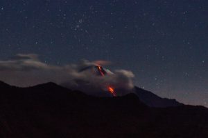
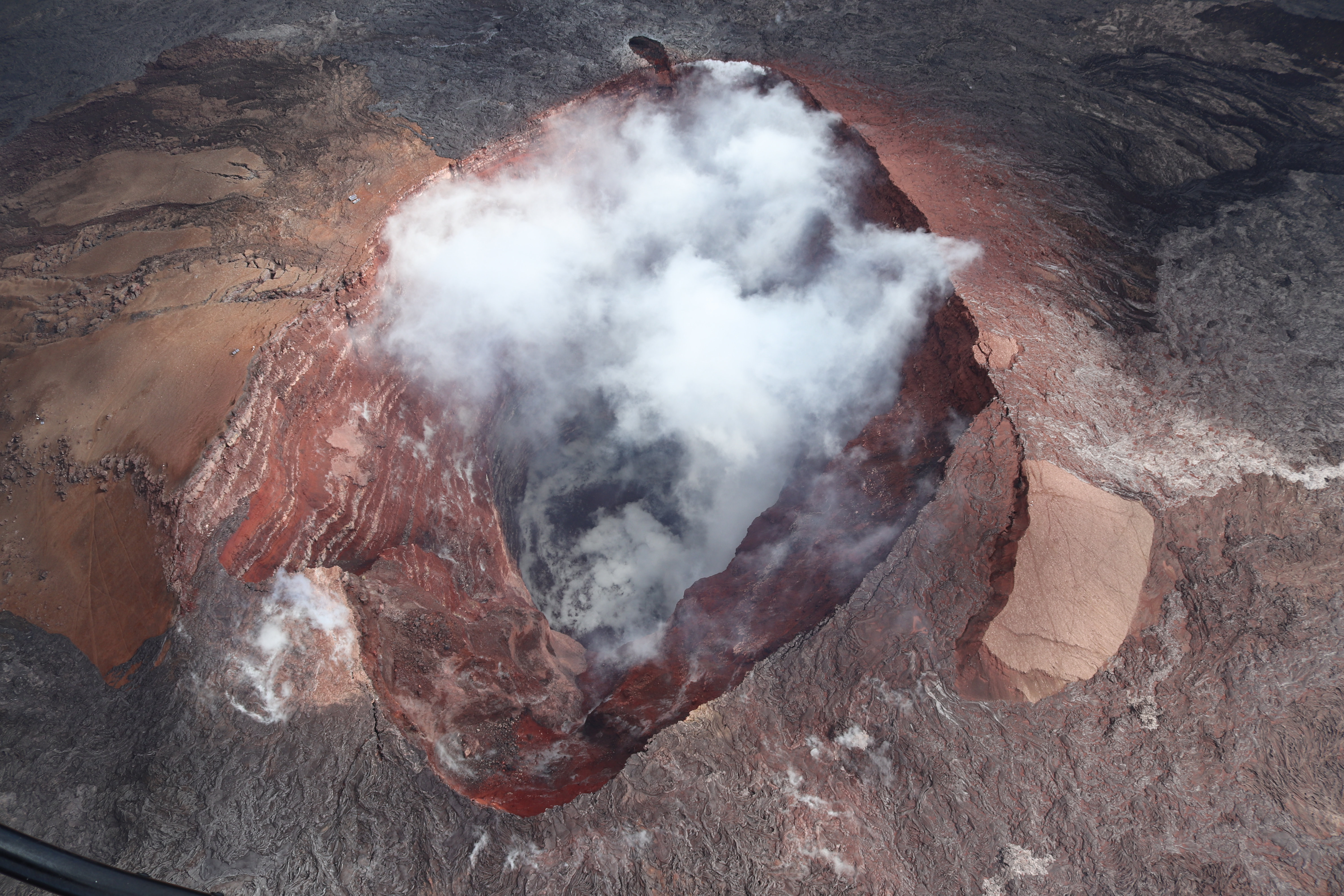
Bárðarbunga One of Iceland’s most powerful volcanoes lies hidden beneath the ice cap of Vatnajökull glacier. Geothermal activity in the volcano’s caldera has melted cauldrons in the glacier, with steam escaping through vents in the ice. Photo/Jóhann K Jóhansson
According to a statement from the seismologist on duty at the Icelandic Meteorological Office there are no immediate signs of volcanic activity in Bárðarbunga, and the activity appears to be a continuation of geological processes which have been underway for some time now.
The Bárðarbunga system has been showing increasing levels of activity for the past year or so, following the 2014-15 Holuhraun eruption at the northern edge of the system
Source : icelandmag.is
Photo : Jóhann K Johansson.
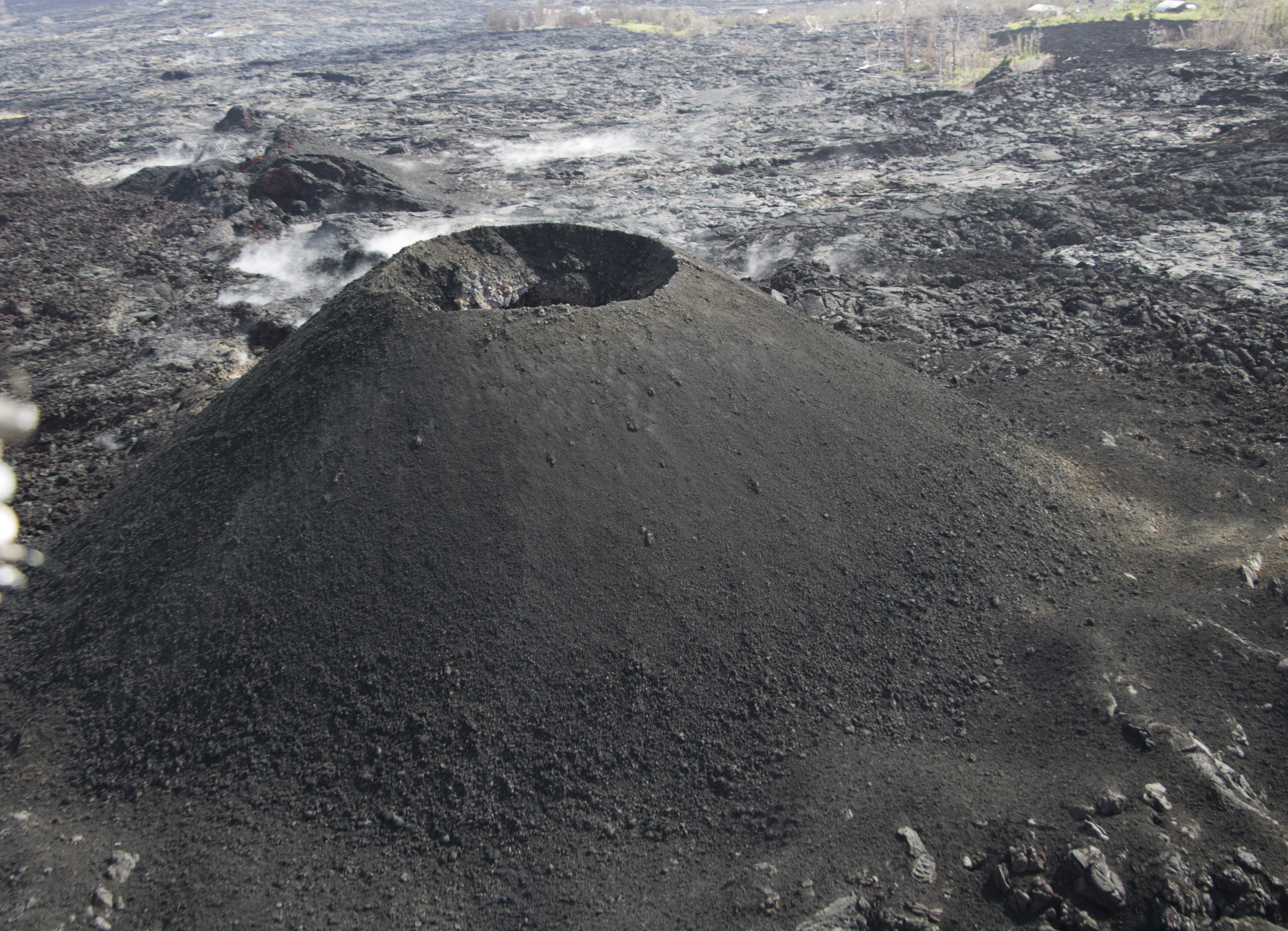
Colombia , Chiles / Cerro Negro :
Weekly activity bulletin of volcanoes Chiles and Cerro Negro.
The activity level of the volcanoes is maintained at the level: YELLOW LEVEL ■ (III): CHANGES IN THE BEHAVIOR OF THE VOLCANIC ACTIVITY
Following the activity of the CHILE volcanoes and CERRO NEGRO, the COLOMBIAN GEOLOGICAL SERVICE (SGC) reports that:
Between November 6 and 12, 2018, seismic activity in the Chiles – Cerro Negro volcano region recorded a decrease in the frequency of earthquakes, from about 2600 earthquakes to nearly 1400, the seismic energy being now at levels similar to those reported in previous weeks. The predominance of seismicity related to fracturing of the rock inside the volcanic building continues (volcano-tectonic earthquakes).
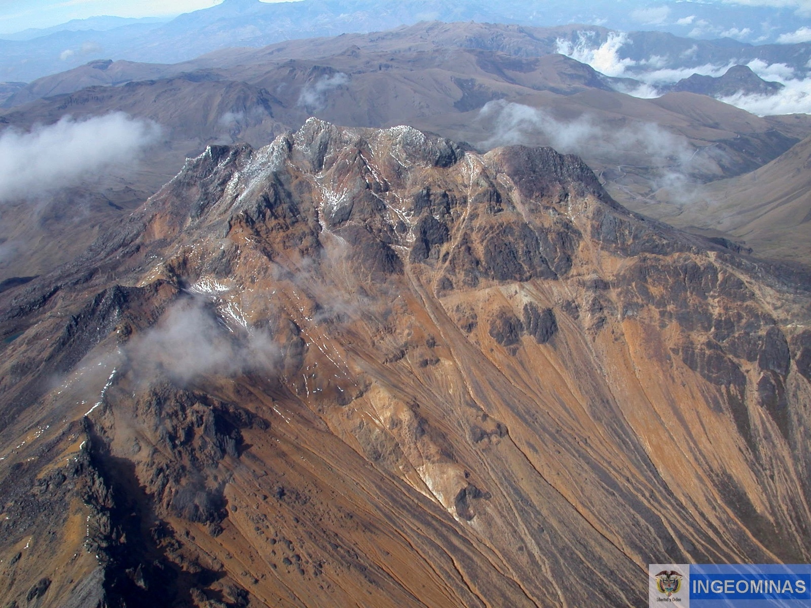
Most of the earthquakes were located to the south and south-west of the Chiles volcano, at distances of up to 10 km, depths between 0.6 and 13 km from the summit (4700 meters above sea level) and a maximum local magnitude of M 2.7 on the Richter scale. It is worth noting the event that occurred on November 8, which was reported as felt by the inhabitants of the volcano’s influence zone, the event was located 7 km deep, about 15 km southeast of the volcano .
The Colombian Geological Service and the Institute of Geology of the National Polytechnic School of Ecuador closely monitor the evolution of this seismic activity and the volcanic phenomenon and inform in a timely manner on the detected changes.
Source : SGC
Photo : Ingeominas.
Kilauea , Hawaii :
19°25’16 » N 155°17’13 » W,
Summit Elevation 4091 ft (1247 m)
Current Volcano Alert Level: ADVISORY
Current Aviation Color Code: YELLOW
Activity Summary:
Kīlauea Volcano is not erupting. Rates of seismicity, deformation, and gas release have not changed significantly over the past week. Deformation signals are consistent with refilling of the middle East Rift Zone.
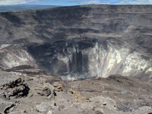
Clear conditions provided good views into the deep crater at Pu‘u ‘Ō‘ō. No active lava or signs of increased activity were observed here. The crater walls expose a clear sequence of lava flows and cinder that built the cone in the early 1980s.
Observations:
HVO monitoring during the past week shows low rates of seismicity at the summit and East Rift Zone (ERZ). Earthquakes continue to occur primarily at Kīlauea’s summit area and south flank, with continued small aftershocks of the magnitude-6.9 quake on May 4, 2018. Seismicity remains low in the lower ERZ.
In the ERZ, tiltmeters near Puʻu ʻŌʻō and farther east reveal no change over the last week. At the summit, tiltmeters have also shown little change this week, with the exception of a small DI (deflation-inflation) event.
Sulfur dioxide gas emissions at the summit averaged 50 tonnes/day as reported on October 24, and 75 tonnes/day at Puʻu ʻŌʻō on October 23. There was no sulfur dioxide detected by our instruments in the lower ERZ.
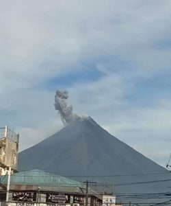
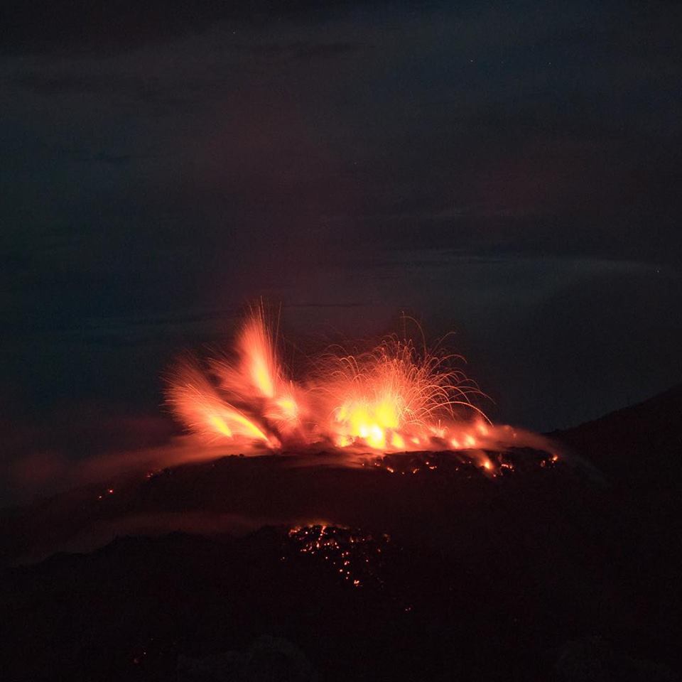
Fissure 22 was active in late May near Lanipuna Gardens subdivision, which is now mostly buried by lava flows. During the later stages of Fissure 22 activity, small strombolian-style explosions built a symmetric cinder cone over the vent.
Hazards are still present in the lower East Rift Zone (LERZ) eruption area and at the Kīlauea summit. Residents and visitors near recently active fissures and lava flows should stay informed, heed Hawaii County Civil Defense and National Park warnings, and be prepared, if necessary, to self-evacuate in the unlikely event of renewed activity. Please note that Hawaii County maintains a closure of the entire flow field and the vents and prohibits access to the area unless authorized through Civil Defense.
The Hawaiian Volcano Observatory (HVO) continues to closely monitor Kīlauea’s seismicity, deformation, and gas emissions for any sign of reactivation, and maintains visual surveillance of the summit and the East Rift Zone. HVO will continue to issue a weekly update (every Tuesday) and additional messages as warranted by changing activity.
Source : HVO
Photos : HVO
Indonesia , Ibu :
Level of Activity at Level II (WASPADA). G. Ibu (1340 m altitude) has been continuously erupting since 2008.
Since yesterday and until this morning, the volcanic peak has been clearly observed until the appearance of fog. The smoke from the crater is white / gray, the pressure is low to medium and low to medium intensity; it is around 200 to 800 m above the summit. The wind is blowing weak to moderate towards the Northeast.
Thanks to the seismographs, on November 13, 2018 it was recorded:
102 earthquakes of eruption
200 earthquake emission
24 avalanche earthquakes
3 distant tectonic earthquakes (including an earthquake felt, at MMI I-II on the scale)
Recommendation:
Communities around G. Ibu and visitors / tourists should not have activities, climb and approach within 2 km of the crater, with a sectoral expansion of 3.5 km to openings in the northern part of the active crater of G. Ibu.
VONA:
The last VONA code was sent with ORANGE color code on October 22, 2018 at 4:30 pm, for an eruption with a column of ash about 1725 m high or about 400 m above the top, the column of ashes moved eastward.
For the normal status of the volcano: People / tourists / mountaineers do not spend the night and do not camp in the crater to avoid the potential threat of toxic gases.
Source : PVMBG
Photo : Malmeuh on the road via Matthias Vollmer.