October 25 , 2018.
Sicily, Italy , Etna :
37.748°N, 14.999°E
Elevation 3295 m
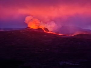
INGV reported that during 15-21 October activity at Etna was characterized by gas emissions at the summit craters, with periodic Strombolian activity from vents in Bocca Nuova, Northeast Crater (NEC), Southeast Crater (SEC), and New Southeast Crater (NSEC). Strombolian activity at the N vent in the W part of Bocca Nuova’s (BN-1) crater floor ejected incandescent material higher that the crater rim.
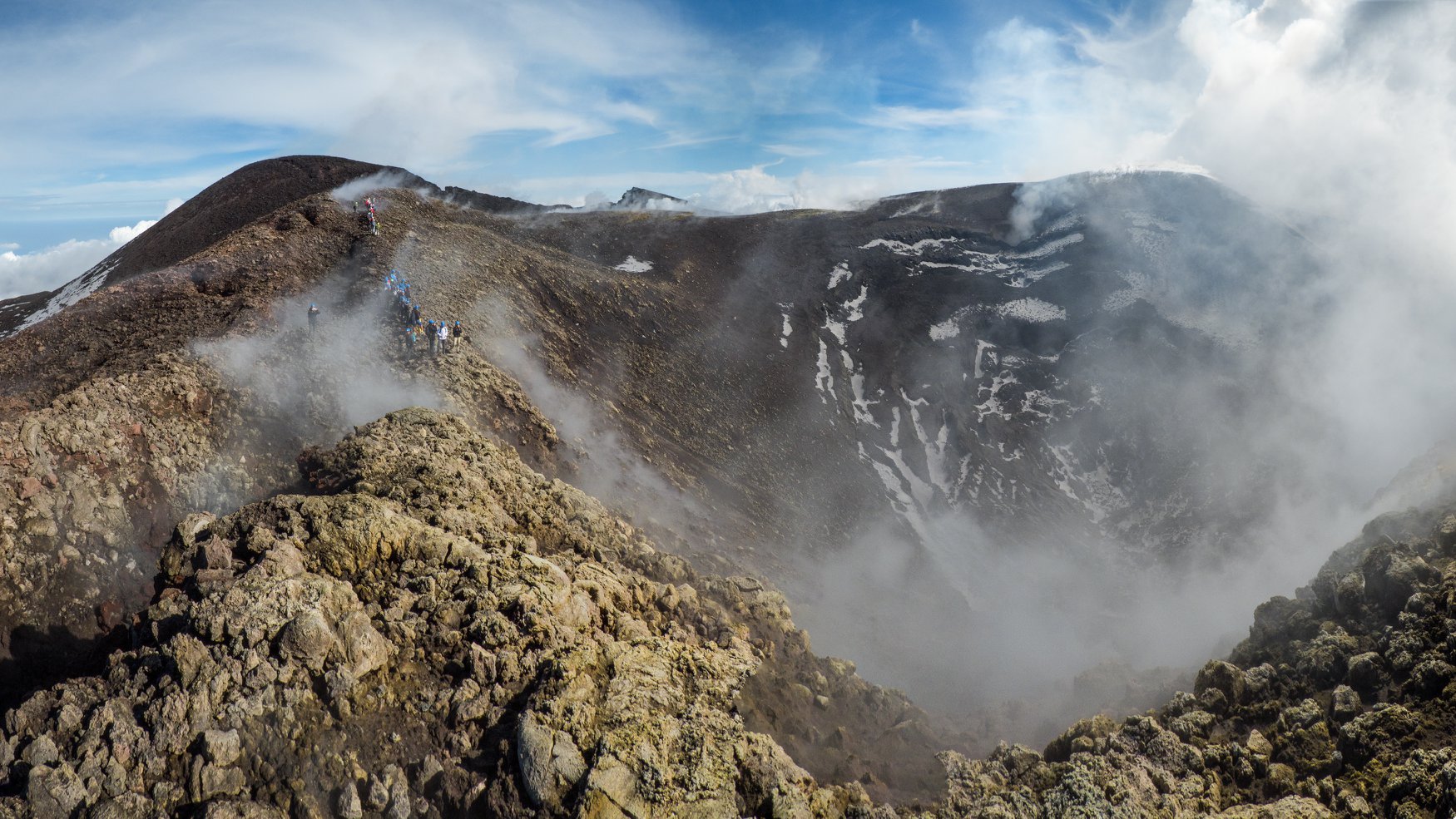
Overview of the crater of Voragine, with the crater of the North-East (current summit of Etna) which is visible at the top left.
Etna summit craters, October 11, 2018.
Spattering from the southernmost vent was also visible. Gas emissions increased at Voragine Crater from a vent that formed on 7 August 2016 on the E rim of the crater, and the crater continued to gradually widen and deepen. NEC activity was characterized by gas emissions and explosive activity of variable frequency and intensity. Fumarolic plumes rose from the rim and crater walls of NSEC and SEC. The E vent in NSEC produced Strombolian explosions and ash emissions which rapidly dispersed.
Source: Section de Catane – Osservatorio Etneo (INGV) , GVP.
Photo : Gio Giusa.
Hawai , Kilauea :
19°25’16 » N 155°17’13 » W,
Summit Elevation 4091 ft (1247 m)
Current Volcano Alert Level: ADVISORY
Current Aviation Color Code: YELLOW
Activity Summary:
Kīlauea Volcano is not erupting. Rates of seismicity, deformation, and gas release have not changed significantly over the past week. Deformation signals are consistent with refilling of the middle East Rift Zone.
Observations:
HVO monitoring during the past week shows low rates of seismicity at the summit and East Rift Zone (ERZ). Earthquakes continue to occur primarily at Kīlauea’s summit area and south flank (magnitude-3.8 was the largest) with continued small aftershocks of the magnitude-6.9 quake on May 4, 2018. Seismicity remains low in the lower ERZ.
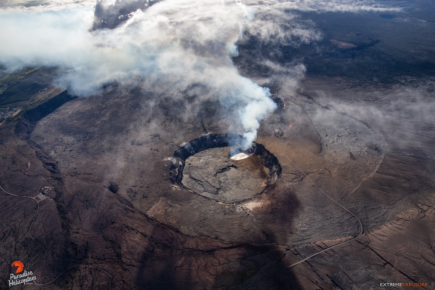
The crater Halema’uma’u before the crisis.
In the ERZ, tiltmeters near Puʻu ʻŌʻō and farther east continue to record an inflationary trend, consistent with refilling of the middle East Rift Zone. At the summit, tiltmeters have recorded a slight inflationary trend. At the summit, UWE tiltmeter started a deflationary trend around 2018-10-18 18:30, and seems to have completed a DI cycle over 3-4 days since.
Sulfur dioxide gas emissions at the summit, Puʻu ʻŌʻō, and the ERZ remain drastically reduced. The most recent SO2 emission measurements, from late September, show a combined rate of less than 300 tonnes/day. Bad weather has prevented new SO2 emission rate measurements; however, downwind SO2 concentrations suggest that no major changes have occurred over the last Week.
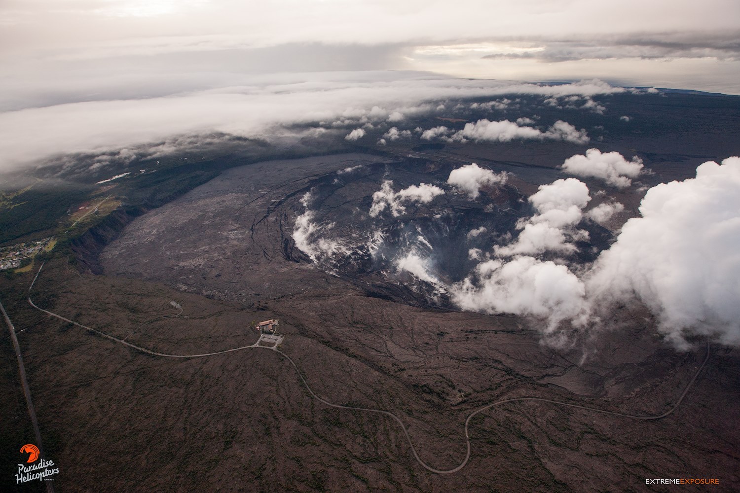
Although not from the same spot and elevation, the direction this is shot is close enough to give one a perspective on the magnitude of change… Absolutely mind-blowing!!!
Hazards are still present in the lower East Rift Zone (LERZ) eruption area and at the Kīlauea summit. Residents and visitors near recently active fissures and lava flows should stay informed, heed Hawaii County Civil Defense and National Park warnings, and be prepared, if necessary, to self-evacuate in the unlikely event of renewed activity. Please note that Hawaii County maintains a closure of the entire flow field and the vents and prohibits access to the area unless authorized through Civil Defense.
The Hawaiian Volcano Observatory (HVO) continues to closely monitor Kīlauea’s seismicity, deformation, and gas emissions for any sign of reactivation, and maintains visual surveillance of the summit and the East Rift Zone. HVO will continue to issue a weekly update (every Tuesday) and additional messages as warranted by changing activity.
Source : HVO
Photos : Bruce Omori / Extreme Exposure Fine Art Gallery
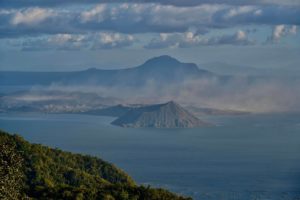
Colombia , Chiles / Cerro Negro :
Weekly activity bulletin of volcanoes Chiles and Cerro Negro.
The activity level of the volcanoes is maintained at the level: YELLOW LEVEL ■ (III): CHANGES IN THE BEHAVIOR OF THE VOLCANIC ACTIVITY
Following the activity of the CHILE volcanoes and CERRO NEGRO, the COLOMBIAN GEOLOGICAL SERVICE (SGC) reports that:
During the period evaluated, from October 16 to 22, 2018, seismic activity in the Chile – Cerro Negro volcano region decreased from 2 548 volcanic earthquakes that occurred the previous week to 2 145 earthquakes. this week, although this activity has remained at high levels.
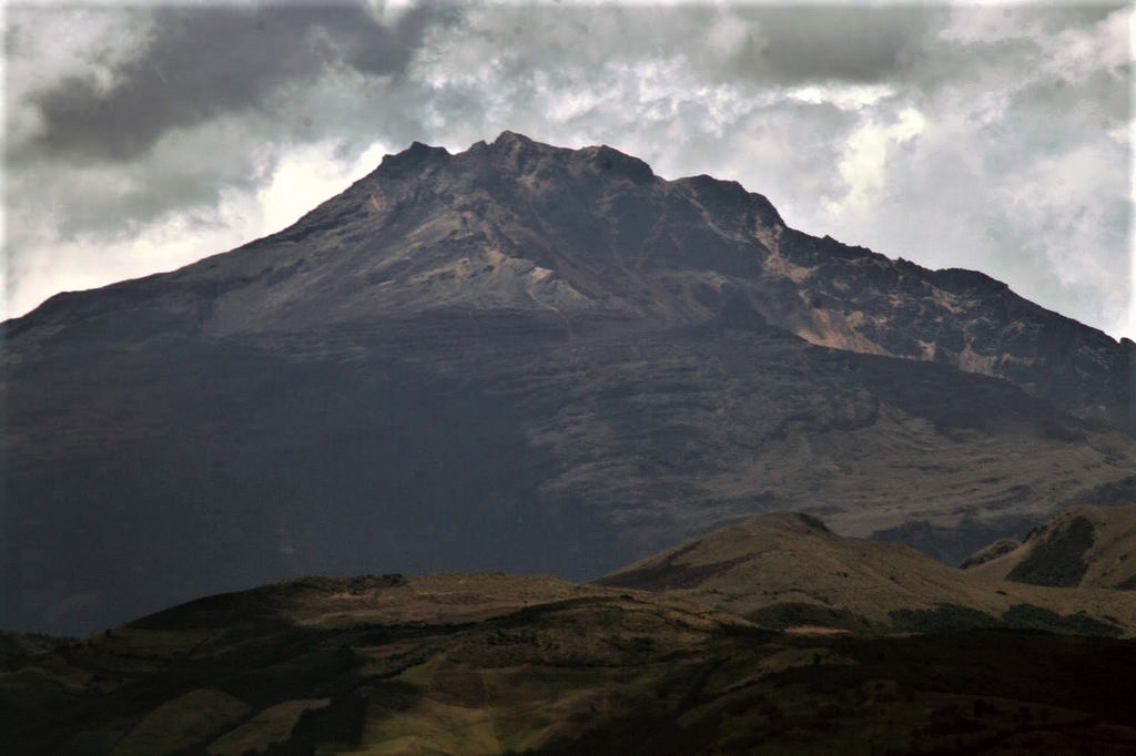
The predominant seismicity has remained linked to fracturing processes, which are mainly located in two zones: one towards the South-South-West sector of the Chiles volcano, at a maximum distance of 3 km and at a depth of less than 5 km from the Chiles summit, and another elongated one, towards the southeast sector of the volcanic complex, at distances between 6 and 11 km and depths between 7 and 12 km. The estimated local magnitudes for these events ranged up to M 2.4 on the Richter scale, none of which were reported as being felt by the inhabitants of the region.
The Colombian Geological Service and the Institute of Geology of the National Polytechnic School of Ecuador closely monitor the evolution of this seismic activity and the volcanic phenomenon and inform in a timely manner on the detected changes.
Source : GVP
Photo : Colonia Nariñense
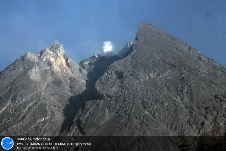
Indonesia , Merapi :
7.54°S, 110.446°E
Elevation 2910 m
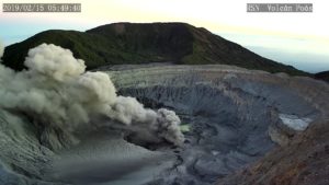
PVMBG reported that during 12-18 October the lava dome in Merapi’s summit crater grew at a rate of 6,200 cubic meters per day, faster than the previous week. By 18 October the volume of the dome, based on photos from the SE sector, was an estimated 201,000 cubic meters. White emissions of variable density rose a maximum of 100 m above the summit. The Alert Level remained at 2 (on a scale of 1-4), and residents were warned to remain outside of the 3-km exclusion zone.

Level II Activity Level (WASPADA). The Merapi (2968 m above sea level) is not in continuous eruption.
Since yesterday and until this morning, the volcano was visually covered with mist. The smoke from the crater is not observed. Winds are weak in the east and north-west
Through the seismographs dated October 24, 2018, it was recorded:
40 avalanche earthquakes.
5 low frequency earthquakes
4 hybrid earthquakes
17 earthquakes
2 distant tectonic earthquakes.
Recommendations:
Climbing activities on Mount Merapi are temporarily not recommended, except for investigation and research related to disaster mitigation efforts.
An area with a radius of 3 km around the summit is prohibited for the activities of the population.
If there is a significant change in Mount Merapi activity, the status of Mount Merapi activity will be immediately reviewed.
Local governments are advised to publicize the current state of Mount Merapi to the community.
VONA:
The last message VONA was given the color code Green, published on June 3, 2018 at 8:39 pm WIB, which dealt with the presence of gusts of white smoke whose smoke column reached 3768 m above sea level or approximately 800 m above the summit.
Source: Pusat Vulkanologi dan Mitigasi Bencana Geologi (PVMBG, également connu sous le nom de CVGHM), GVP.
Photos : Mads/ Oystein Lund Andersen ,