October 15 , 2018.
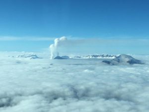
Kamchatka , Ebeko :
VOLCANO OBSERVATORY NOTICE FOR AVIATION (VONA).
Issued: October 15 , 2018.
Volcano:Ebeko (CAVW #290380)
Current aviation colour code:ORANGE
Previous aviation colour code:orange
Source:KVERT
Notice Number:2018-105
Volcano Location:N 50 deg 41 min E 156 deg 0 min
Area:Northern Kuriles, Russia
Summit Elevation:3791.68 ft (1156 m)
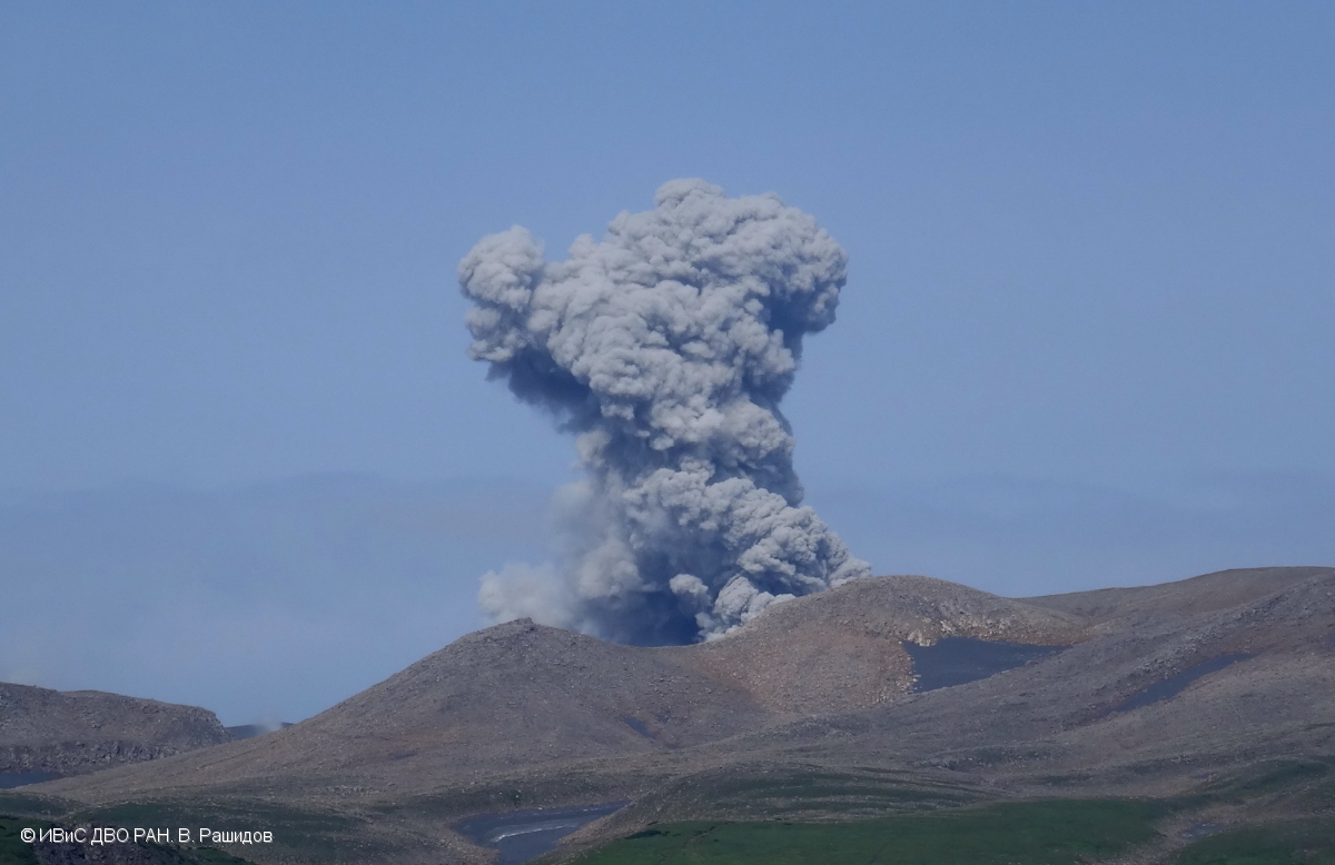
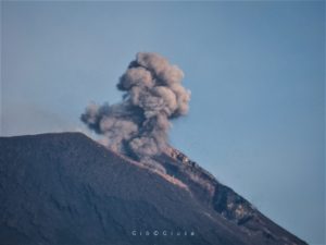
Explosive event of Ebeko volcano on 10 August, 2017.
Volcanic Activity Summary:
A moderate explosive activity of the volcano continues. Visual data from Severo-Kurilsk showed an explosion sent ash up to 3.5-4 km a.s.l., an ash plume is extending to the east from the volcano.
A moderate eruptive activity of the volcano continues. Ash explosions up to 19,700 ft (6 km) a.s.l. could occur at any time. Ongoing activity could affect low-flying aircraft and airport of Severo-Kurilsk.
Volcanic cloud height:
11480-13120 ft (3500-4000 m) AMSL Time and method of ash plume/cloud height determination: 20181015/0012Z – Visual data
Other volcanic cloud information:
Distance of ash plume/cloud of the volcano: 3 mi (5 km)
Direction of drift of ash plume/cloud of the volcano: E
Source : Kvert .
Photo : V. Rashidov, IVS FEB RAS , 10/8/2017 .
La Réunion , Piton de la Fournaise :
Activity Bulletin from Sunday, October 14, 2018 at 13:00 (local time).
The eruption started on September 15th at 4:25 am local time continues. The intensity of the volcanic tremor (indicator of surface eruptive intensity) is still very slightly decreasing (Figure 1).
Piston gases (« gas flushes » or « tremor puffs ») at the eruptive site are always recorded by the OVPF seismometers.
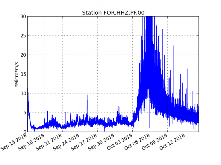
Figure 1: Evolution of the RSAM (indicator of the volcanic tremor and the intensity of the eruption) between 04h00 (00h UTC) on September 15th and 12h30 (08h30 UTC) on October 14th on the FOR seismic station, located near the crater Chateau Fort (2000 m altitude on the southeast flank of the terminal cone). (© OVPF / IPGP)
– No volcano-tectonic earthquake was recorded during the day of 13 October or during the current day.
– Inflation (swelling) of the building is always recorded. This inflation reflects the pressurization of a localized source beneath the summit craters (Bory-Dolomieu) at a depth of 1-1.5 km, related to the recharge of the superficial reservoir by deeper magma.
– The surface flow rates could not be estimated today because of lava flows that are too weak at the surface.
– Field reconnaissance could be done today.
Most of the activity is still conducted in lava tunnels, no major channel was observed and only small and rare resurgences were visible. No projections were observed at the eruptive cone and the level of the lava lake inside the vent was relatively low. Strong degassing was still present at the vent as well as at the main lava tunnel just downstream (Figure 2).
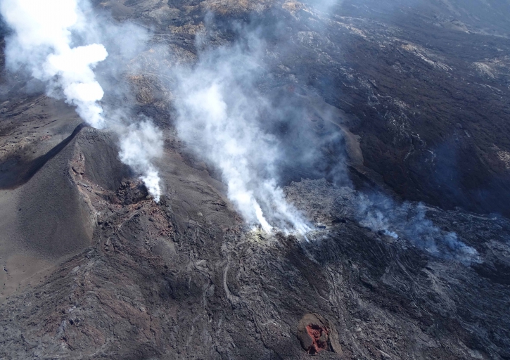
Figure 2: Shooting of the eruptive site on October 14, 2018 at 09:45 local time. (© OVPF / IPGP)
During this reconnaissance, a team from the OVPF was able to take samples of lava from a small active resurgence located about 600m from the flow front (Figure 3).
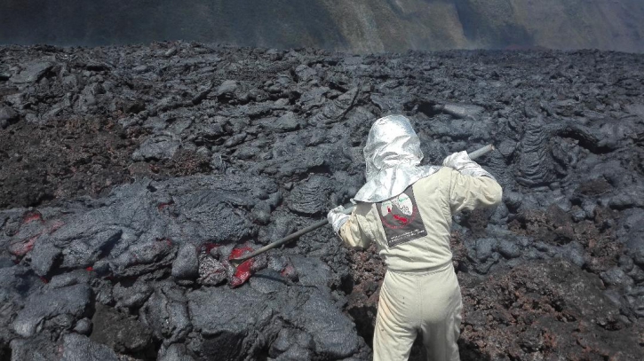
Figure 3: Lava sampling on 14 October 2018 at 10.15 local time by an OVPF team. (© OVPF / IPGP)
The flow front has not changed since the last sightings and this morning was still 500m from the Grandes Pentes , the latter was completely frozen (Figure 4).
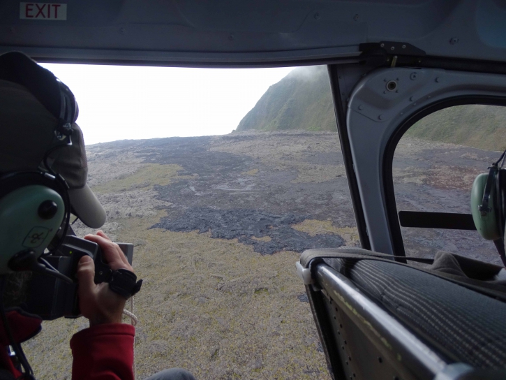
Figure 4: Shot of the flow front on October 14, 2018 at 10:45 am local time. (© OVPF / IPGP).
Alert level: Alert 2-2 – Eruption in the Enclos .
Source : OVPF. http://www.ipgp.fr/fr/ovpf/bulletin-dactivite-dimanche-14-octobre-2018-a-13h00-heure-locale
Guatemala , Fuego :
Type of activity: Vulcanienne
Morphology: Composite Stratovolcan
Geographical location: 14 ° 28’54˝ N Latitude; 90 ° 52’54˝ Longitude O.
Height: 3,763msnm
Weather conditions: Clear
Wind: Northeast
Precipitation: 42.5 mm
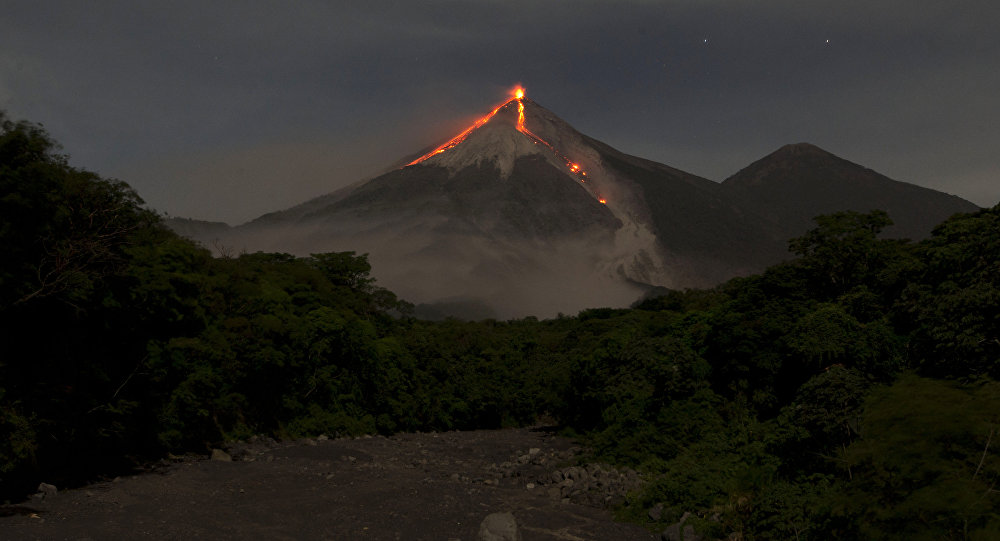
Activity:
Presence of white fumaroles reaching an approximate height of 4400 m (14435 feet), dispersing in the South, West and Southwest directions. There were 9 to 18 low to moderate explosions per hour, ejecting columns of gray ash at an approximate height of 4600 to 4700 meters (15091 to 15420 feet) and dispersing in a southerly, westerly, and southwestward direction. , over a distance of approximately 8 km to 12 kilometers. Incandescent pulses at an approximate height of between 150 and 200 meters above the crater generate weak avalanches on the crater contour. The remains of the lava flow towards Canyon Seca, on its way, generates weak avalanches. Ash falls are reported in the communities of Sangre de Cristo, Palo Verde, Panimache I and II and others located in this direction.
Source : Insivumeh.
Photo : Moises Castillo
Indonesia , Anak Krakatau :
40 Volcanic Tremors Recorded on Mount Anak Krakatau
Jakarta – At least 40 volcanic tremors were recorded on active Mount Anak Krakatau located in the Sunda Strait, South Lampung District,Lampung Province, from Saturday evening until early Sunday.
Fresh lava flows were also seen descending the southeastern flank of Anak Krakatau in the evening, according to a statement of the local meteorology, climatology and geophysics office, quoting Windi Cahya Untuk from the Mount Anak Krakatau observation post, Sunday.
The authorities have declared the volcano is in an alert status and closed to the public within a radius of two kilometers from the mountain`s crater.
Level of activity at Level II (WASPADA). G. Krakatau (338 m) has been experiencing an increase in volcanic activity since 18 June 2018.
Since yesterday and until this morning, the volcano was visually covered with mist. The weak winds were oriented to the East – Southeast. The smoke from the crater was found to be thick gray-white and 50 to 200 m above the summit.
Thanks to the seismographs, on October 14, 2018, it was recorded:
41 earthquakes of eruption
A distant tectonic earthquake
A continuous tremor of amplitude 1 to 3 mm (dominant value 1 mm)
Recommendation: People / tourists are not allowed to approach the crater within 2 km of the crater.
VONA: The latest VONA code was given the ORANGE color code, published on September 22, 2018 at 6:56 am, for an eruption with ash column height of approximately 538 m above sea level or approximately 200 m above the summit. The column of ashes was moving south.
Source : TEMPO.CO, PVMBG.
Video : Yohannes Tyas Galih Jati