Octobre 08 , 2018.
Chile , Copahue :
Special Report on Volcanic Activity (REAV)
Del Bio Bio Region, Copahue Volcano, 07 October 2018, 03:10 local time (mainland Chile).
The National Geological and Mining Service of Chile (Sernageomin) publishes the following PRELIMINARY information, obtained from monitoring equipment of the National Volcanic Monitoring Network (NVRN), processed and analyzed at the Volcanological Observatory of the Southern Andes (OVDAS) :
Today, Sunday 07 October 2018 at 02:44 local time (05h44 UTC), the monitoring stations installed near the Copahue volcano recorded 14 earthquakes associated with a fracturing process of rocks (Volcano-tectonic type).
The characteristics of the earthquakes of higher energy, after their analysis are as follows:
TIME OF ORIGIN: 02h44 Local time (05h44 UTC).
LATITUDE: 37,823 ° S
LONGITUDE: 71,157 ° W
DEPTH: 3.5 KM
LOCAL MAGNITUDE: 3.2 (ML)
OBSERVATIONS:
At the time of issuing this report, the event was not confirmed as felt by the population. The superficial activity of the volcano did not show any changes.
The level of volcanic technical alert remains at the level: GREEN.
Sernageomin continues online monitoring and will inform in a timely manner about any changes observed.
Source : Sernageomin.
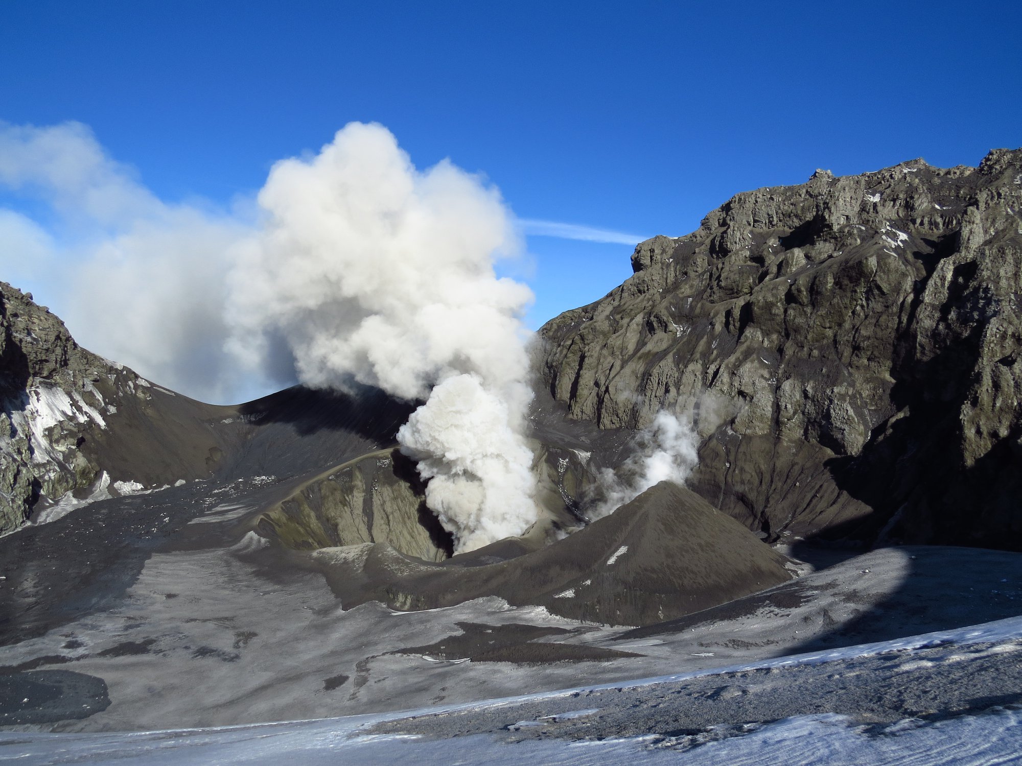
Chile , Nevados de Chillan :
Volcanic Activity Report (RAV), Volcanological Observatory of the South Andes – Ovdas, 06 October 2018 16:00 HL.
Current alert level: ORANGE
Volcanic monitoring
Seismic activity: During the last 24 hours, the monitoring network of the Nevados volcanic complex of Chillan continues to record a seismicity type volcano tectonic (VT) type long period (LP) and episodes of tremor, with seismic energy who remains at a rank considered moderate. The seismicity LP and TR being related to the occurrence of explosions which impulses the surface activity and is associated with the variation between the growth and the partial destruction of the viscous lava dome in the crater Nicanor.
Observations: The most energetic VT event was located 1.0 km north-northwest of the active crater at a depth of 5.01 km.
Observations:
The weather conditions made it possible to visualize a column of mainly white colored gas and sometimes with greyish tones. During the night, incandescence is observed associated with a high temperature degassing produced from the active crater and the exit of projectiles produced by the explosions and deposited on the periphery of the crater.
Other observations
⦁ Infrasound sensors recorded acoustic signals associated with explosions (EX) with maximum values and less than 2.08 Pa (reduced to 1 km as a reference).
⦁ No thermal radiation was reported according to the information processed by the MIROVA group.
Danger
Exposure / Specific risks:
These facts establish that, given current conditions, the most likely scenario is the generation of sporadic minor eruptive impulses (columns with an elevation not exceeding 5 km) associated with explosions of gas, particles and pyroclastic projections. ballistic whose range fluctuates around 2 or 3 km around the active crater. Similarly, it is likely that the lava dome may extend beyond the active crater, forming a viscous lava flowing towards the north-northeast. It will eventually be sensitive to gravity collapses, generating high-speed heat flows known as pyroclastic flows, with blocks and ashes, which could affect Gato and Las Minas, who in turn could trigger lahares. in the tributaries of the Nubian River.
In addition, it was considered with a lower probability, a moderate explosive eruptive phase (IEV = 3 to 4) associated with partial or total destruction of the lava dome nestled in the active crater … / …
Conclusion
The behavior of the Nevados de Chillan volcanic complex continues to evolve as a result of a minor eruption related to the growth and partial destruction of a lava dome tucked into the active crater « Nicanor », whose internal dynamics lead to activity. explosive hot gases and pulsatile releases, ballistic particles around the crater, while maintaining the production of long – period type seismic events and tremors, in ranges of energy considered moderate for this process. This process could generate a major eruptive event without showing clear precursors.
…/…
Read the full report: sitiohistorico.sernageomin.cl/reportesVolcanes/20181006041304107RAV_Ñuble_octubre_2018_N°30.pdf
Source : Sernageomin.
Video et photo : Cristian Farías et Nicolás Luengo.
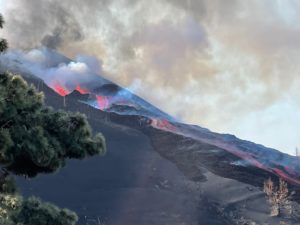
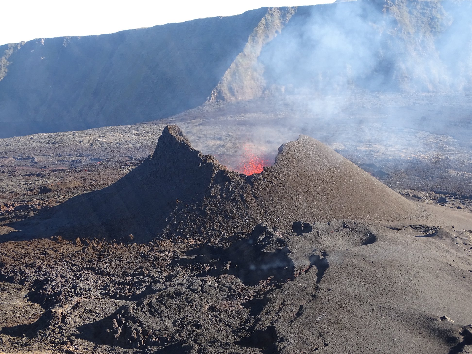
La Réunion , Piton de la Fournaise :
Activity bulletin of Sunday, October 7, 2018 at 14:15 (local time).
The eruption started on September 15th at 4:25 am local time continues. The intensity of the volcanic tremor (indicator of eruptive intensity at the surface), after having increased markedly since October 3 at 22:00 local time (18:00 UTC), has been decreasing for two days (Figure 1).
Piston gases (« gas flushes » or « tremor puffs ») at the eruptive site are always recorded by the OVPF seismometers. These « piston gases » mark a change of regime in the degassing of the eruption, and are generally observed when the quantity of available gas is exhausted, and often synonymous with a decrease of activity on the surface.
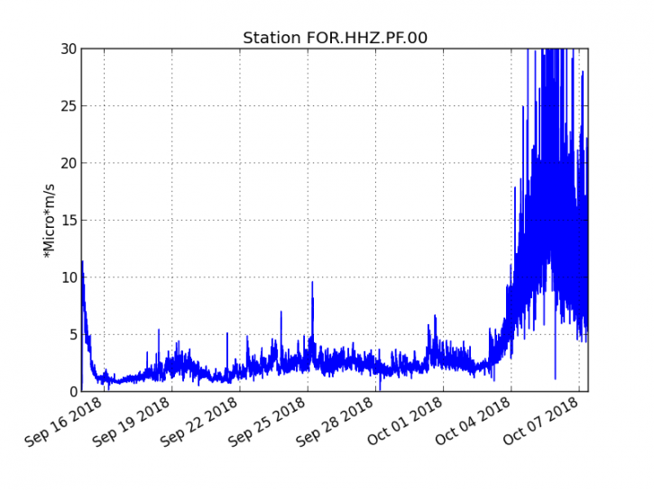
Figure 1: Evolution of the RSAM (indicator of the volcanic tremor and the intensity of the eruption) between 04h00 (00h UTC) on September 15th and 14h00 (10h00 UTC) on October 7th on the seismic station FOR, located near the crater Chateau Fort (2000 m altitude on the southeast flank of the terminal cone). (© OVPF / IPGP)
– No volcano-tectonic earthquake was recorded during the day of October 6, nor during the current day.
– An inflation (swelling) of the building, witnessing the influence of a source of pressure at the foot of the volcano, is still perceptible. This inflation is now accompanied by an increase in CO2 concentrations in the soil in the Volcano Cottage area.
– The surface flow rates could not be estimated today because of lava flows that are too weak at the surface.
– The OVPF NOVAC network stations located around the Enclos still record SO2 flows. Even though their concentrations are 5 times lower than at the beginning of eruption, these flows confirm that there is still magma present at low pressure.
– The surface activity is still very limited with very few lava projections inside the cone and no major resurgence visible from the main tunnel. Nevertheless, the activity continues in lava tunnels, with a particularly visible degassing along their path from the eruptive vent to the flow front.
Alert level: Alert 2-2 – Eruption in the Enclos.
Source : OVPF www.ipgp.fr/fr/ovpf/bulletin-dactivite-dimanche-7-octobre-2018-a-14h15-heure-locale
Hawaï , Mauna Loa :
19°28’30 » N 155°36’29 » W,
Summit Elevation 13681 ft (4170 m)
Current Volcano Alert Level: NORMAL
Current Aviation Color Code: GREEN
Earthquake activity remained at low levels in September, with scattered shallow events located in the summit region and upper Southwest Rift Zone, and a cluster of earthquakes located on the northwest flank of the volcano. These latter earthquakes started in late September in an area that has been intermittently active during the past few years; the largest earthquake was a magnitude-3.4 (preliminary) quake on September 30.
There was no significant change in deformation trends across the volcano in September.
HVO continues to monitor the volcano closely.
Source : HVO
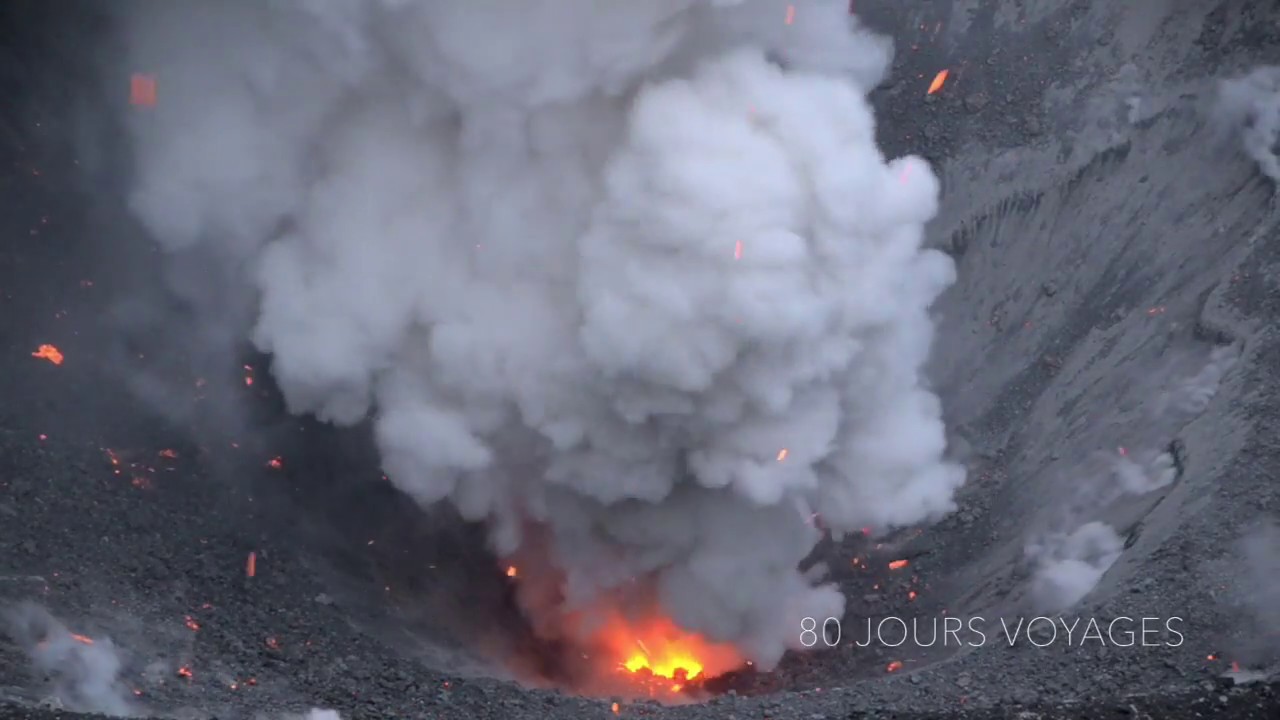
Indonesia , Dukono :
Level of activity at Level II (WASPADA). The Dukono (1229 m above sea level) is experiencing a continuous eruption.
Since yesterday and until this morning, the peak of the volcano has been observed visually until it is covered with mist. The smoke from the crater was white to gray in color, with medium pressure, thick intensity, and height 700 m above the summit. The wind was weak in the west.
The seismographs of October 5, 2018 noted:
1 eruption earthquake
3 distant tectonic earthquakes
A continuous tremor of amplitude 0.5 to 8 mm (dominant value 2 mm)
Recommendation: People around Mount Dukono and visitors / tourists should not climb and approach the Malupang Warirang crater within 2 km.
VOLCANO OBSERVATORY NOTICE FOR AVIATION – VONA.
Issued: October 08 , 2018.
Volcano: Dukono (268010)
Current Aviation Colour Code: ORANGE
Previous Aviation Colour Code: orange
Source: Dukono Volcano Observatory
Notice Number: 2018DUK188
Volcano Location: N 01 deg 41 min 35 sec E 127 deg 53 min 38 sec
Area: North Maluku, Indonesia
Summit Elevation: 3933 FT (1229 M)
Volcanic Activity Summary:
Eruption with volcanic ash cloud at 03h25 UTC (12h25 local).
Volcanic Cloud Height:
Best estimate of ash-cloud top is around 7133 FT (2229 M) above sea level, may be higher than what can be observed clearly. Source of height data: ground observer.
Other Volcanic Cloud Information:
Ash cloud moving to west.
Remarks:
Eruption and ash emission is continuing.
Source : PVMBG , Magma Indonesia
Photo : S Chermette / 80 Jours Voyages. https://80joursvoyages.com/