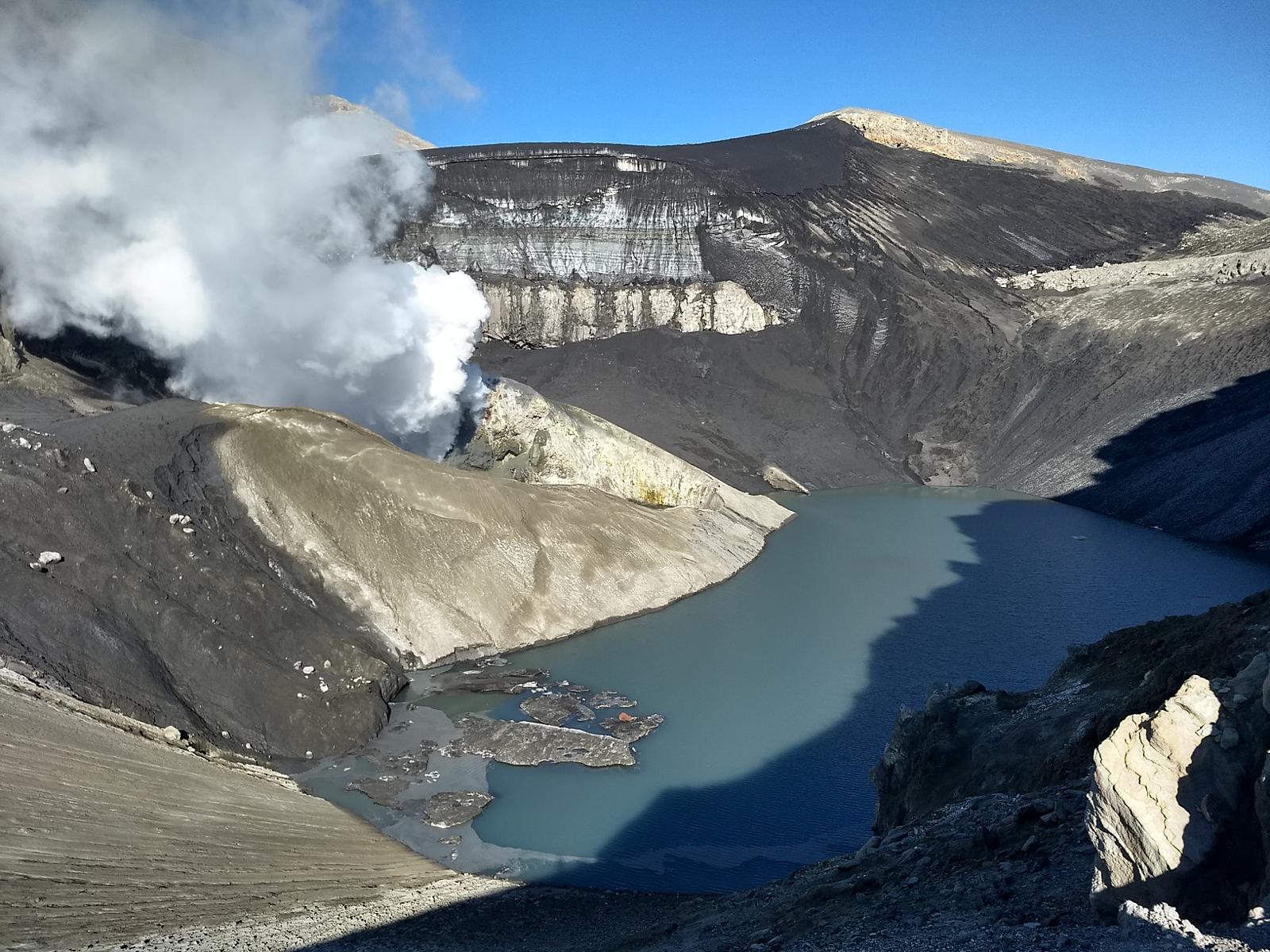
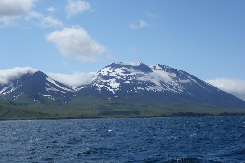
March 28, 2024. EN. Aleutian Islands : Atka , Iceland : Reykjanes Peninsula , Indonesia : Dukono , Japan : Sakurajima , Costa Rica : Poas .

March 28 , 2024.


Aleutian Islands , Atka :

AVO/USGS Volcanic Activity Notice

Current Volcano Alert Level: ADVISORY
Previous Volcano Alert Level: NORMAL
Current Aviation Color Code: YELLOW
Previous Aviation Color Code: GREEN

Issued: Wednesday, March 27, 2024, 9:06 PM AKDT
Source: Alaska Volcano Observatory
Notice Number: 2024/A287
Location: N 52 deg 19 min W 174 deg 8 min
Elevation: 5030 ft (1533 m)
Area: Aleutians

Volcanic Activity Summary:
A small, short-lived explosion was detected at the Atka volcanic complex this evening at 19:36 AKDT March 27 (03:36 UTC March 28), and AVO is increasing the Aviation Color Code to YELLOW and the Volcano Alert Level to ADVISORY. The event was detected in local infrasound and seismic data and was followed by a few minutes of elevated seismic tremor. Processing of the local infrasound data indicates the explosion originated from the summit crater of Korovin, one of several volcanoes within the Atka volcanic complex. No ash emissions have been observed in satellite images.

East flank of Korovin volcano as viewed off the NE shore of Atka Island from the M/V Steadfast. From left to right, volcanic features are Konia and Korovin.

Remarks:
The Atka volcanic complex forms the northern part of Atka Island, located about 16 km north of the community of Atka and 1,761 km southwest of Anchorage. The Atka volcanic complex includes a possible older caldera and several younger vents, including Korovin Volcano, Mount Kliuchef, and Sarichef Volcano. Korovin Volcano, a 1553-m-high (5030 ft) stratovolcano, has been the site of most historical volcanic activity, and has a small, roiling crater lake that occasionally produces energetic steam emissions. Korovin has erupted several times in the past 200 years, including 1973, 1987, and 1998, and has likely had small ash emissions as recently as 2005. Typical recent Korovin eruptions produce minor amounts of ash and occasional but small lava flows. Reports of the height of the ash plume produced by the 1998 eruption ranged as high as 10,600 m (35,000 feet) above sea level. Mount Kliuchef is composed of a series of five vents aligned northeast–southwest. The two main summit vents of Kliuchef appear relatively young and the easternmost was probably the source of an 1812 eruption that is sometimes attributed to Sarichef.

Source : AVO

Photo : Schaefer, Janet ( courtesy of the AVO/ADGGS. )


Iceland : Reykjanes Peninsula :

Activity of the volcanic eruption remains steady . Continued hazard due to volcanic gas
Updated 27. March at 14:00 UTC

High levels of SO2 (Sulfur Dioxide) were measured over the weekend. Gas dispersion forecast can be followed here .
This concentration of SO2 is considered very unhealthy. It is important to pay close attention to developments in air quality.
Eruption tremor has remained consistent since then, as has the activity in the three craters. Lava continues to flow southward from the craters mostly atop the lava field formed during the first days of the eruption. The following image shows the extension of the lava field as extrapolated from satellite images (ICEYE). The latest acquisition was on 26 March and it shows the widening of lava field towards the west, south of Hagafell, as well as further lava advancement towards the east and the south of the active vents.

Striped areas indicate regions where changes occurred in the lava field between March 20 and 26. The red-striped part of the area signifies area where lava had not flowed previously in this eruption. Light purple areas denote areas where lava flowed from eruptions in February and January.

Uplift continues in Svartsengi but at a slower rate than prior to previous eruptions or dike intrusions in recent months. This suggests that magma is still accumulating beneath Svartsengi despite ongoing eruption. Little to no seismic activity has been detected in the area.

High levels of SO2 measured past few days
Since friday (22 mars) two additional stations to monitor the concentrations of SO2 at the ground have been installed. VÍ, in collaboration with Almannavarnir, located them at Blue Lagoon and in the harbour area in Grindavík. Both stations are streaming data to the UST website, loftgæði.is.

Early yesterday morning, at around 03:00, the station in BL revealed levels of SO2 up to 7000 microgram/m3, and this morning at around 04:00 the station in Grindavík (Nesvegur) measured concentrations up to 9000 micrograms/m3. Such concentrations are considered unhealthy and people are recommended to follow the instructions provided by UST and Embætti landlæknis (link). On the 26th March, the station in Hafnir also showed high concentrations of SO2 up to about 2000 microgram/m3 around midday. The amount of SO2 released by the eruption and the meteorology in the area are still creating the conditions for severe gas pollution in the peninsula.

Source : IMO.

Photos : IMO , mbl.is’s webcams.


Indonesia , Dukono :

An eruption of Mount Dukono occurred on Thursday, March 28, 2024 at 2:44 p.m. WIT with the height of the ash column observed at ±1,200 m above the summit (±2,287 m above the level of the sea). The ash column was observed to be white to gray in color with thick intensity, oriented towards the North-West. At the time of writing, the eruption was still ongoing.

Seismicity:
26 eruption/explosion earthquakes with an amplitude of 4 to 25 mm and an earthquake duration of 29.67 to 54.89 seconds.
1 local tectonic earthquake with an amplitude of 5 mm, and duration of the earthquake 43.23 seconds.
4 distant tectonic earthquakes with an amplitude of 4-20 mm, earthquake duration 69.92-97.36 seconds.
1 Continuous tremor with an amplitude of 0.5 to 2 mm, dominant value of 1 mm.

RECOMMENDATION
(1) People around Mount Dukono and visitors/tourists are advised not to do activities, climb or approach Malupang Warirang Crater within a 3 km radius.
(2) Since eruptions with volcanic ash occur periodically and the distribution of ash follows the wind direction and speed, so the ash landing area is not fixed, it is recommended for People around Mount Dukono always wear masks/nose and mouth coverings to use when needed to avoid the threat of volcanic ash on the respiratory system.

Pusat Vulkanologi dan Mitigasi Bencana Geologi (PVMBG) reported that Dukono continued to erupt during 20-26 March. Gray-and-white emissions rose as high as 450 m above the summit. The Alert Level remained at Level 2 (on a scale of 1–4), and the public was warned to remain outside of the 3-km exclusion zone.

Sources : Magma Indonésie , GVP

Photo : PVMBG


Japan , Sakurajima :

JMA reported ongoing eruptive activity at Minamidake Crater (Aira Caldera’s Sakurajima volcano) during 18-25 March. An explosion at 1952 on 18 March produced an ash plume that rose 1.2 km above the crater rim and drifted SE and ejected large blocks 800-1,100 m from the vent. Very small eruptions and nighttime incandescence were observed at the summit crater during other days of the report period. The Alert Level remained at 3 (on a 5-level scale), and the public was warned to stay 2 km away from both craters.

The Aira caldera in the northern half of Kagoshima Bay contains the post-caldera Sakurajima volcano, one of Japan’s most active. Eruption of the voluminous Ito pyroclastic flow accompanied formation of the 17 x 23 km caldera about 22,000 years ago. The smaller Wakamiko caldera was formed during the early Holocene in the NE corner of the caldera, along with several post-caldera cones. The construction of Sakurajima began about 13,000 years ago on the southern rim and built an island that was joined to the Osumi Peninsula during the major explosive and effusive eruption of 1914. Activity at the Kitadake summit cone ended about 4,850 years ago, after which eruptions took place at Minamidake. Frequent eruptions since the 8th century have deposited ash on the city of Kagoshima, located across Kagoshima Bay only 8 km from the summit. The largest recorded eruption took place during 1471-76.

Sources : Agence météorologique japonaise (JMA) , GVP.

Photo : Rizal M.


Costa Rica , Poas :

Latitude: 10.2
Longitude: -84,233
Altitude: 2,687 meters

Activity observed:
A small eruption was recorded by a network of seismographs and infrasound sensors on March 25, 2024 at 3:28 p.m. local time. Fumarolic degassing remains strong and vigorous through the fumaroles that lie at the almost dry bottom of the active crater. The seismic signal of volcanic tremor with frequencies between 0.8 and 4 Hz continues to be recorded continuously. This tremor is associated with the strong release of jets or jets of vapors, gases and aerosols through narrow fumarole ducts, which produces a loud noise in the fumarole vents. On March 25, the temperature of the fumarole, which features glowing light and pink-lilac-blue flames, was measured remotely with an infrared camera, recording 302 degrees Celsius. The SO2 concentration at Visitor’s Viewpoint recorded a maximum of 3 parts per million this morning according to the ExpoGAS sensor. Meanwhile, the MultiGAS system located on the western rim of the crater indicates gas ratios around stable values, SO2/CO2 between 0.3 and 0.9 and H2S/SO2 between 0.2 and 0.6.

Between March 22 and 25, 2024, the SENTINEL 5 satellite detected significant quantities of SO2 gas emitted by Poás: on March 22, 277 tons and on March 25, 252 tons. Several officials from the Poás Volcano National Park and neighbors in the vicinity of the volcano to the west have reported health problems in recent days, especially at night: headaches, nausea, irritation of the mucous membranes (eyes, nose, mouth, skin), nosebleeds. It is recommended to take measures to minimize or avoid health effects, such as reducing exposure time to gases and volcanic particles, sleeping in spaces with quality air, and using masks to protect the respiratory system from gases and particles.

Environmental conditions:
The predominant wind direction is from the South-South-West with a speed of 8 km/h (IMN). The summit of Poás remains clear.
Activity Level: Warning (2)

Source : Ovsicori.

August 29, 2021. EN. Alaska : Atka Volcanic Complex , Alaska : Katmai , Kamchatka : Sheveluch , Hawaii : Kilauea , Italy / Sicily : Etna .

August 29 , 2021.


Alaska , Atka Volcanic Complex :

AVO/USGS Volcanic Activity Notice

Current Volcano Alert Level: NORMAL
Previous Volcano Alert Level: ADVISORY
Current Aviation Color Code: GREEN
Previous Aviation Color Code: YELLOW

Recent earthquake hypocenters at Atka volcanic complex, August 11, 2021 (M. Loewen, AVO/USGS)

Issued: Friday, August 27, 2021, 9:24 AM AKDT
Source: Alaska Volcano Observatory
Notice Number: 2021/A710
Location: N 52 deg 19 min W 174 deg 8 min
Elevation: 5030 ft (1533 m)
Area: Aleutians

Volcanic Activity Summary:
The Alaska Volcano Observatory is lowering the Aviation Color Code and Alert Level at the Atka volcanic complex to GREEN/NORMAL. On August 10, AVO detected an increase in small earthquakes, located between 6 and 2 km (4 and 1 miles) below sea level, about 5 km (3 miles) west of Kliuchef volcano within the Atka volcanic complex.. After several days of increased seismicity, the earthquake rate began to drop, and has subsequently returned to background levels.


Previous alerts by the Alaska Volcano Observatory for unrest at the Atka volcanic complex have been for Korovin Volcano, the site of the most recent historical eruptions. The location of earthquakes, however, is not specific to Korovin and could be related to several other volcanic vents that are part of the Atka volcanic complex, including Mount Kliuchef.

The Alaska Volcano Observatory will continue to monitor the Atka volcanic complex for signs of volcanic activity. The area is monitored by local seismic and infrasound sensors, satellite data, and regional lightning detection instruments.

Source : AVO.

Photos : M. Loewen / AVO-USGS , T. Lopez, AVO/UAF.


Alaska , Katmai :

58°16’44 » N 154°57’12 » W,
Summit Elevation 6716 ft (2047 m)
Current Volcano Alert Level: NORMAL
Current Aviation Color Code: GREEN

Strong northwesterly winds in the vicinity of Katmai and the Valley of Ten Thousand Smokes have picked up loose volcanic ash erupted during the 1912 Novarupta-Katmai eruption and carried it to the southeast toward Kodiak Island today. The National Weather Service has issued a SIGMET for this low-level event and suggests that the maximum cloud height is 6,000 ft above sea level.

This phenomenon is not the result of recent volcanic activity and occurs during times of high winds and dry snow-free conditions in the Katmai area and other young volcanic areas of Alaska. No eruption is in progress. All of the volcanoes of the Katmai area (Snowy, Griggs, Katmai, Novarupta, Trident, Mageik, Martin) remain at color code GREEN.

Resuspended volcanic ash should be considered hazardous and could be damaging to aircraft and health.

Source : AVO.

Photo : Cyrus Read.


Kamchatka , Sheveluch :

VOLCANO OBSERVATORY NOTICE FOR AVIATION (VONA).

Issued: August 28 , 2021
Volcano: Sheveluch (CAVW #300270)
Current aviation colour code: ORANGE
Previous aviation colour code: orange
Source: KVERT
Notice Number: 2021-105
Volcano Location: N 56 deg 38 min E 161 deg 18 min
Area: Kamchatka, Russia
Summit Elevation: 3283 m (10768.24 ft), the dome elevation ~2500 m (8200 ft)

Volcanic Activity Summary:
The growth of the lava dome continues, a strong fumarolic activity , an incandescence of the lava dome and hot avalanches accompanies this process. Satellite data showed an ash cloud 14×15 km in size is extending for 30 km to the west-northwest of the volcano.
This extrusive eruption of the volcano continues. Ash explosions up to 10-15 km (32,800-49,200 ft) a.s.l. could occur at any time. Ongoing activity could affect international and low-flying aircraft.

Volcanic cloud height:
2500-3000 m (8200-9840 ft) AMSL Time and method of ash plume/cloud height determination: 20210828/2300Z – Himawari-8

Other volcanic cloud information:
Distance of ash plume/cloud of the volcano: 30 km (19 mi)
Direction of drift of ash plume/cloud of the volcano: WNW / azimuth 301 deg
Time and method of ash plume/cloud determination: 20210828/2300Z – Himawari-8
Start time of explosion and how determined: 20210828/2200Z – Satellite data

Source : Kvert.

Photo : Yu. Demyanchuk, IVS FEB RAS, KVERT ( 26 Aout 2021 ).


Hawaii , Kilauea :

19°25’16 » N 155°17’13 » W,
Summit Elevation 4091 ft (1247 m)
Current Volcano Alert Level: ADVISORY
Current Aviation Color Code: YELLOW

Activity Summary:
Kīlauea volcano is not erupting. However, intrusive activity that began on August 23 continues south of Kīlauea caldera. Starting on the evening of August 26, ground deformation in Kīlauea’s south summit region resumed at the higher rates seen in the first intrusive pulse spanning August 23-25. In contrast, current earthquake activity remains low compared to the earlier pulses of this intrusive activity. The East Rift Zone remains quiet.

Nice weather allowed for clear views of Kīlauea Caldera and this photo, looking west, shows the collapse area that formed during 2018, as well as the summit of Mauna Loa in the background. Lava flows that erupted in 1971 and 1974 (darker colored relative to other lava flows on Kīlauea Caldera floor) border the foreground in this image.

Observations:
The rate of ground deformation beneath the south part of Kīlauea summit region, within Hawaiʻi Volcanoes National Park, began increasing again on the evening of August 26 and continues at this time. These observations suggest that magma is continuing to be supplied to the ongoing intrusion.

Over the past 24 hours, approximately 80 earthquakes were recorded at Kīlauea summit and south of Kīlauea caldera. Most of the earthquakes were less than magnitude 2 and occurred approximately 1-4 km (0.6-2.5 mi) below the surface. These small earthquakes have occurred at up to 7 detected earthquakes per hour. These earthquake rates are significantly lower than the rates observed earlier this week.

At the time of this statement, activity continues but there is no indication of upward migration of earthquakes toward the surface or change in deformation that would indicate shallowing of the source intrusive activity. Accordingly, Kīlauea’s Volcano Alert Level and Aviation Color Code remain at ADVISORY/YELLOW.

The Hawaiian Volcano Observatory (HVO) continues to closely monitor Kīlauea for changes in activity. HVO will continue to issue Kīlauea status reports and additional messages as needed.

Source and photo : HVO


Italy / Sicily , Etna :

For the past few days, Etna has been on a volcanic break.

The tremor is desperately flat, he who had accustomed us to many mood swings since the beginning of the year.

Since August 28, we have noticed many irregularities on the RMS route. This one blooming with the high level of amplitude since yesterday. The ingv has not yet commented, which will soon be. These will of course be communicated on the site.

Source : Tremor INGV.

Photo : Rosario Catania. 28.08.2021 10:14 .


29 Aout 2021. FR. Alaska : Complexe Volcanique d’Atka , Alaska : Katmai , Kamchatka : Sheveluch , Hawaii : Kilauea , Italie / Sicile : Etna .

29 Aout 2021.


Alaska , Complexe Volcanique d’Atka :

Avis d’activité volcanique AVO/USGS

Niveau d’alerte volcan actuel : NORMAL
Niveau d’alerte volcanique précédent : AVIS 
Code couleur de l’aviation actuel : VERT
Code couleur aviation précédent : JAUNE

Hypocentres sismiques récents sur le complexe volcanique d’Atka, 11 août 2021 (M. Loewen, AVO/USGS)

Émis: vendredi 27 août 2021, 9h24 AKDT
Source : Observatoire des volcans de l’Alaska
Numéro d’avis : 2021/A710
Emplacement : N 52 deg 19 min W 174 deg 8 min
Altitude : 5030 pi (1533 m)
Région : Aléoutiennes

Résumé de l’activité volcanique :
L’observatoire volcanique de l’Alaska abaisse le code de couleur de l’aviation et le niveau d’alerte au complexe volcanique d’Atka à VERT/NORMAL. Le 10 août, l’AVO avait détecté une augmentation de petits tremblements de terre, situés entre 6 et 2 km (4 et 1 miles) sous le niveau de la mer, à environ 5 km (3 miles) à l’Ouest du volcan Kliuchef au sein du complexe volcanique d’Atka. Après plusieurs jours de sismicité accrue, le taux de tremblement de terre a commencé à baisser et est ensuite revenu à des niveaux de fond.


Les alertes précédentes de l’Alaska Volcano Observatory concernant les troubles sur le complexe volcanique d’Atka concernaient le volcan Korovin, le site des éruptions historiques les plus récentes. L’emplacement des tremblements de terre, cependant, n’est pas spécifique au Korovin et pourrait être lié à plusieurs autres cheminées volcaniques faisant partie du complexe volcanique d’Atka, notamment le mont Kliuchef.

L’Alaska Volcano Observatory continuera de surveiller le complexe volcanique d’Atka pour détecter des signes d’activité volcanique. La zone est surveillée par des capteurs sismiques et infrasons locaux, des données satellitaires et des instruments régionaux de détection de la foudre.

Source : AVO.

Photos : M. Loewen / AVO-USGS , T. Lopez, AVO/UAF.


Alaska , Katmai :

58°16’44 » N 154°57’12 » O,
Altitude du sommet : 6716 pi (2047 m)
Niveau d’alerte volcan actuel : NORMAL
Code couleur de l’aviation actuel : VERT

Des vents forts du Nord-Ouest à proximité du Katmai et de la vallée des dix mille fumées ont remis en suspension des cendres volcaniques  qui ont été émises lors de l’éruption Novarupta-Katmai de 1912 et les ont transportées vers le Sud-Est en direction de l’île Kodiak aujourd’hui. Le National Weather Service a émis un message SIGMET pour cet événement à basse altitude et suggère que la hauteur maximale des nuages est de 6 000 pieds au-dessus du niveau de la mer.

Ce phénomène n’est pas le résultat d’une activité volcanique récente et se produit pendant les périodes de vents violents et de conditions sèches et sans neige dans la région du Katmai et d’autres zones volcaniques jeunes de l’Alaska. Aucune éruption n’est en cours. Tous les volcans de la région du Katmai (Snowy, Griggs, Katmai, Novarupta, Trident, Mageik, Martin) restent au code couleur VERT.

Les cendres volcaniques remises en suspension devraient être considérées comme dangereuses et pourraient nuire aux aéronefs et à la santé.

Source : AVO.

Photo : Cyrus Read.


Kamchatka , Sheveluch :

AVIS D’OBSERVATION DU VOLCAN POUR L’AVIATION (VONA).

Date d’émission : 28 août 2021
Volcan : Sheveluch (CAVW #300270)
Code couleur aviation actuel : ORANGE
Code couleur aviation précédent : orange
Source : KVERT
Numéro d’avis : 2021-105
Emplacement du volcan: N 56 deg 38 min E 161 deg 18 min
Région : Kamchatka, Russie
Altitude du sommet : 3 283 m (10 768,24 pi), élévation du dôme ~2 500 m (8 200 pi).

Résumé de l’activité volcanique :
La croissance du dôme de lave se poursuit, une forte activité fumerolienne,  une incandescence du dôme de lave et des avalanches chaudes accompagnent ce processus. Les données satellitaires ont montré qu’un nuage de cendres de 14 x 15 km s’étendait sur 30 km à l’Ouest-Nord-Ouest du volcan.
Cette éruption extrusive du volcan se poursuit. Des explosions de cendres jusqu’à 10-15 km (32 800-49 200 pieds) d’altitude pourraient survenir à tout moment. L’activité en cours pourrait affecter les aéronefs internationaux volant à basse altitude.

Hauteur des nuages ​​volcaniques :
2500-3000 m (8200-9840 ft) AMSL Heure et méthode de détermination de la hauteur du panache de cendres/du nuage : 20210828/2300Z – Himawari-8

Autres informations sur les nuages ​​volcaniques :
Distance du panache de cendres/nuage du volcan : 30 km (19 mi)
Direction de dérive du panache de cendres/nuage du volcan : WNW / azimut 301 deg
Heure et méthode de détermination du panache de cendres/nuage : 20210828/2300Z – Himawari-8
Heure de début de l’explosion et mode de détermination : 20210828/2200Z – Données satellitaires.

Source : Kvert.

Photo : Yu. Demyanchuk, IVS FEB RAS, KVERT ( 26 Aout 2021 ).


Hawaii , Kilauea :

19°25’16 » N 155°17’13 » O,
Altitude du sommet : 4091 pi (1247 m)
Niveau d’alerte volcanique actuel : AVIS 
Code couleur de l’aviation actuel : JAUNE

Résumé de l’activité :
Le volcan Kīlauea n’est pas en éruption. Cependant, l’activité intrusive qui a commencé le 23 août se poursuit au Sud de la caldeira du Kīlauea. À partir du soir du 26 août, la déformation du sol dans la région du sommet Sud du Kīlauea a repris aux taux les plus élevés observés lors de la première impulsion intrusive du 23 au 25 août. En revanche, l’activité sismique actuelle reste faible par rapport aux impulsions antérieures de cette activité intrusive. La zone du Rift Est reste calme.

Le beau temps a permis une vue dégagée sur la Caldeira et cette photo, en regardant vers l’Ouest, montre la zone d’effondrement qui s’est formée en 2018, ainsi que le sommet du Mauna Loa en arrière-plan. Les coulées de lave qui ont été émises en 1971 et 1974 (de couleur plus foncée par rapport aux autres coulées de lave sur le sol ) bordent le premier plan de cette image.

Remarques :
Le taux de déformation du sol sous la partie Sud de la région du sommet du Kīlauea, dans le parc national des volcans d’Hawai’i, a recommencé à augmenter dans la soirée du 26 août et continue en ce moment . Ces observations suggèrent que le magma continue d’être fourni à l’intrusion en cours.

Au cours des dernières 24 heures, environ 80 tremblements de terre ont été enregistrés au sommet du Kīlauea et au Sud de la caldeira du Kīlauea. La plupart des séismes étaient inférieurs à la magnitude 2 et se sont produits à environ 1 à 4 km (0,6 à 2,5 mi) sous la surface. Ces petits tremblements de terre se sont produits jusqu’à 7 tremblements de terre détectés par heure. Ces taux de séismes sont nettement inférieurs aux taux observés plus tôt cette semaine.

Au moment de cette déclaration, l’activité se poursuit, mais il n’y a aucune indication de migration ascendante des tremblements de terre vers la surface ou de changement de déformation qui indiquerait une diminution de la profondeur de l’activité de la source intrusive . En conséquence, le niveau d’alerte volcanique et le code de couleur de l’aviation du Kīlauea restent à AVIS/JAUNE.

L’Observatoire du volcan hawaïen (HVO) continue de surveiller de près le Kīlauea pour détecter les changements d’activité. Le HVO continuera à émettre des rapports d’état du Kīlauea et des messages supplémentaires si nécessaire.

Source : HVO


Italie / Sicile , Etna :

Depuis quelques jours , l’Etna est en pause volcanique.

Le tremor est désespérément plat , lui qui nous avait habitué à de nombreuses sautes d’humeur depuis le début de l’année.

Depuis le 28 Aout , on remarque de nombreuses irrégularités sur le tracé RMS . Celui ci fleurtant avec le niveau d’amplitude haut depuis hier. L’ingv n’a pas encore fait de commentaires , ce qui ne saurait tarder. Ceux ci seront bien sur communiqués sur le site.

Source : Tremor INGV.

Photo : Rosario Catania. 28.08.2021 10:14 .


August 12, 2021. EN . Alaska : Atka Volcanic Complex , Chile : Copahue , Philippines : Pinatubo , Indonesia : Merapi , Guatemala : Pacaya .

August 12 , 2021 . 


Alaska , Atka Volcanic Complex :

AVO/USGS Volcanic Activity Notice

Current Volcano Alert Level: ADVISORY
Current Aviation Color Code: YELLOW

Issued: Wednesday, August 11, 2021, 2:22 PM AKDT
Source: Alaska Volcano Observatory
Notice Number: 2021/A629
Location: N 52 deg 19 min W 174 deg 8 min
Elevation: 5030 ft (1533 m)
Area: Aleutians

Volcanic Activity Summary:
The Alaska Volcano Observatory is raising the Aviation Color Code and Alert Level at the Atka volcanic complex to YELLOW/ADVISORY after detecting an increased number of small, shallow earthquakes over the past day. These earthquakes have been located 3 to 6 km (1.9 to 3.7 miles) deep and around 7 km (4.3 miles) southwest of Korovin Volcano. The earthquakes represent an increase from background seismic activity, but may not necessarily lead to an eruption.

Previous alerts by the Alaska Volcano Observatory for unrest for the Atka volcanic complex have been for Korovin Volcano, the site of the most recent historical eruptions. The location of earthquakes, however, is not specific to Korovin and could be related to several other volcanic vents that are part of the Atka volcanic complex, including Mount Kliuchef.

The Alaska Volcano Observatory will continue to monitor the Atka volcanic complex for signs of volcanic activity. The area is monitored by local seismic and infrasound sensors, satellite data, and regional lightning detection instruments.

The largest volcanic center in the central Aleutians, Atka consists of a central shield and Pleistocene caldera with several post-caldera volcanoes. A major dacitic explosive eruption accompanied formation of the caldera about 500,000 to 300,000 years ago. The most prominent of the post-caldera stratovolcanoes are Kliuchef and Sarichef, both of which may have been active in historical time. Sarichef has a symmetrical profile, but the less eroded Kliuchef is the source of most if not all historical eruptions. Kliuchef may have been active on occasion simultaneously with Korovin volcano to the north. Hot springs and fumaroles are located on the flanks of Mount Kliuchef and in a glacial valley SW of Kliuchef.

Sources : AVO. GVP.

Photo : Schaefer, Janet /  Alaska Volcano Observatory / Alaska Division of Geological & Geophysical Surveys


Chile , Copahue :

The Argentine Geological Mining Service (SEGEMAR) through its Argentine Volcanic Monitoring Observatory (OAVV) reports that since Monday, August 9, 2021, surveillance cameras installed near the Copahue volcano have started to record an increase in surface activity, characterized by an increase in gas emissions, an intense nocturnal incandescence, and an increase in the energy of the continuous volcanic tremor signal.

OBSERVATIONS:
According to the analysis carried out on high-resolution satellite images from Planet Scope in recent weeks, it has been possible to observe a gradual decrease in the remains of the lake from the volcano’s crater. This information was correlated by a decrease in the SO2 emission values obtained by the DOAS equipment, lower than the values normally recorded during periods of absence from the crater lagoon.

In addition, at the beginning of last weekend, an increase in the energy and frequency of the continuous tremor signal began to be recorded, which may indicate a clogging of the emission ducts and a consequent overpressure caused by the hot gases accumulated.

Finally, during the first hours of Monday, August 9, an increase in the surface activity of the volcano began to be recorded, accompanied by the release of gas and water vapor, causing depressurization of the system. This is evidenced by an increase in SO2 emissions, reaching maximum values ​​of 7,200 tonnes, according to information provided by images from the Tropomi satellites, and an intense night-time incandescence, produced by the combustion of gases.

This recorded increase in the tremor signal, accompanied by incandescence, and an increase in gas emission, is a phenomenon that has been recorded in previous years and on similar dates, and is mainly associated with the disappearance of the crater lagoon and over-pressurization. of the surface system.

It should be noted that based on information from the monitoring network installed near the volcano, there was no increase in the volcano-tectonic (VT) seismic activity of the volcano, nor any other increase in any other monitoring parameter. could indicate a new rise of magmatic material to the surface.

With the current scenario, it is possible to expect, as in previous years, that minor volcanic ash pulses could be recorded, like the one recorded on July 2, or small explosions inside the volcanic crater. This is why it is advisable to respect the exclusion radius around the crater of the volcano, and to check with the civil protection authorities.

Any type of major eruptive activity is excluded, the volcano being within the parameters expected for the current activity level of the Copahue volcano.

Source : Cegemar .

Photos : Carpediem1971 , Sernageomin .


Philippines , Pinatubo :

PINATUBO VOLCANO BULLETIN , 12 August 2021 , 08:00 A.M.

This serves as a notice for the lowering of the alert status of Pinatubo Volcano from Alert Level 1 (Low-level Unrest) to Alert Level 0 (Normal).

Since 1 July 2021, there has been a continued decline in earthquake activity and a return to baseline seismic parameters in Pinatubo Volcano. A total of 104 volcanic earthquakes or an average of 2-3 events/day having magnitudes of ML0.8 to ML1.3 was recorded by the Pinatubo Volcano Network from 1 July to 11 August 2021. This is a significant decrease compared to the period from 28 January to 30 June 2021 when earthquake activity averaged 12-13 events/day and ranged in strength from ML 0.7 to ML3.2. In addition, diffuse CO2 flux from the Pinatubo Crater lake, which is an indication of deep magma degassing, was measured at 263 tonnes/day in mid-April 2021, well within the background range of <1000 tonnes/day recorded since 2008. Lastly, data from continuous GPS monitoring of the Pinatubo edifice that began in March 2021 indicate that ground deformation detected by InSAR data analysis for the period June 2020 to May 2021 is likely tectonic, rather than volcanic, in origin.

In view of the above, PHIVOLCS-DOST is now lowering the alert status of Pinatubo Volcano from Alert Level 1 to Alert Level 0. This means observational parameters have returned to baseline levels and the volcano has returned to a period of quiescence. However, in the event of a renewed increase in any one or combination of the above monitoring parameters, the alert status may step up once again to Alert Level 1. Entry into the Pinatubo Crater area must always be conducted with caution due to the perennial hazards of rockfalls, landslides and lethal expulsions of volcanic CO2. Furthermore, people living in valleys and active river channels are cautioned to remain vigilant against sediment-laden streamflows and lahars in the event of prolonged and heavy rainfall.

DOST-PHIVOLCS is closely monitoring the volcano’s condition and any new development will be relayed to all concerned.

Source : Phivolcs .

Photo : GVP , Ray Punungbayan, 1994 (Philippine Institute of Volcanology and Seismology).


Indonesia , Merapi :

BPPTKG reported that the lava dome just below Merapi’s SW rim and the lava dome in the summit crater both remained active during 30 July-5 August. The SW rim dome volume was an estimated 1.895 million cubic meters and about 3 m tall. A total of seven pyroclastic flows descended the SW flank as far as 2 km and as many as 84 lava avalanches traveled a maximum of 2 km SW. Multiple pyroclastic flows traveled 2-3 km down the SW flank on 8 August and ash plumes rose 1 km above the summit. According to a news article ashfall was reported in several local communities. Pyroclastic flows traveled up to 3 km down the SW flanks multiple times during 9-10 August. BNPB noted that a small fire on the SW flank, 2.5 km from the crater, was set by ejected incandescent material; the fire burned an area of only 30 square meters during 25-26 August. The Alert Level remained at 3 (on a scale of 1-4), and the public was warned to stay 5 km away from the summit.

1. The hot cloud of the Merapi avalanche on August 12, 2021 at 01.07 WIB was recorded on a seismogram with an amplitude of 67 mm and a duration of 157 seconds. The glide distance is 2500 m to the southwest.
2. The hot cloud of the Merapi avalanche on August 12, 2021 at 01.16 WIB was recorded on a seismogram with an amplitude of 43 mm and a duration of 111 seconds. The glide distance is 1800 m to the southwest.
3. The hot cloud of the Merapi avalanche on August 12, 2021 at 01:53 WIB was recorded on a seismogram with an amplitude of 57 mm and a duration of 232 seconds. The glide distance is 3000 m to the southwest.
4. The hot cloud of the Merapi avalanche on August 12, 2021 at 02:46 WIB was recorded on a seismogram with an amplitude of 19 mm and a duration of 110 seconds. The glide distance is 1800 m to the southwest.

Validation of the sliding distance of the hot clouds of Mount Merapi on August 10, 2021:
On Sunday (8/8) at 4:58 am WIB, there was a series of hot clouds over Mount Merapi which slid southwest (Kali Bebeng) with a slide distance of 3000m. An eruption column was observed up to 1000 m above the peak.
This hot cloud was recorded on a seismogram with an amplitude of 20 mm and a duration of 222 seconds. At the time of the incident, the wind was blowing west and caused ash rain in several places, including Babadan Post, Krinjing, Patent, Sengi, Tlogolele, Ketep and Magelang City.
On August 9, 2021, the BPPTKG and a team from the UGM flew a drone in the Kali Bebeng channel to validate the glide distance of the hot avalanche clouds. Based on the mapping results, the furthest slide distance is 3 km from the summit of Mount Merapi.
The sliding distance of this hot cloud is still within the recommended potential danger zone, which is 3 km from the peak for Kali Woro channel, and 5 km from the peak for Kali Gendol, Kuning, Boyong, Bedog, Krasak , Bebeng.
The level of volcanic activity of Mount Merapi is currently still high. Explosive eruptions are still likely to occur with the threat of a danger in the form of ejection of volcanic material within a radius of 3 km around the peak of Merapi.
The public is advised not to carry out activities in designated areas of potential risk. Stay alert and always watch for information about BPPTKG’s Mount Merapi activity.

Source : GVP , BPPTKG.

Photos : Andi Volcano , ANTARA FOTO/Hendra Nurdiyansyah


Guatemala , Pacaya :

Type of activity: Strombolian.
Morphology: Composite Stratovolcano
Geographical location: 14 ° 22’50˝ Latitude N; 90 ° 36’00˝ Longitude W.
Altitude: 2,552 meters above sea level.
Atmospheric conditions: clear
Wind: North-East
Precipitation: 0.00 mm.

ACTIVITY:
In the Mackenney crater, a weak degassing is generated and at moderate times, of white and blue color which moves towards the southwest. No generation of ash is observed, nor expulsion of incandescent material. INSIVUMEH’s seismic stations record short, low-frequency events due to the movement of magma and gases inside the volcanic edifice, as well as to interruptions in the abundant degassing in the crater. It is not excluded that lava flows or degassing columns with abundant ash are generated.

Source : Insivumeh

Photo : noticias san vincente pacaya.

12 Aout 2021 . Fr . Alaska : Complexe Volcanique d’Atka , Chili : Copahue , Philippines : Pinatubo , Indonésie : Merapi , Guatemala : Pacaya .

12 Aout 2021 . 


Alaska , Complexe Volcanique d’Atka :

Avis d’activité volcanique AVO/USGS

Niveau d’alerte volcanique actuel : AVIS 
Code couleur de l’aviation actuel : JAUNE

Émis: mercredi 11 août 2021, 14h22 AKDT
Source : Observatoire des volcans de l’Alaska
Numéro d’avis : 2021/A629
Emplacement : N 52 deg 19 min W 174 deg 8 min
Altitude : 5030 pi (1533 m)
Région : Aléoutiennes.

Résumé de l’activité volcanique :
L’Alaska Volcano Observatory augmente le code de couleur de l’aviation et le niveau d’alerte au complexe volcanique d’Atka à JAUNE/AVIS  après avoir détecté un nombre accru de petits tremblements de terre peu profonds au cours de la dernière journée. Ces tremblements de terre ont été localisés à 3 à 6 km (1,9 à 3,7 miles) de profondeur et à environ 7 km (4,3 miles) au Sud-Ouest du volcan Korovin. Les tremblements de terre représentent une augmentation par rapport à l’activité sismique de fond, mais ne conduisent pas nécessairement à une éruption.

Les alertes précédentes de l’Alaska Volcano Observatory concernant des troubles pour le complexe volcanique d’Atka concernaient le volcan Korovin, le site des éruptions historiques les plus récentes. L’emplacement des tremblements de terre, cependant, n’est pas spécifique au Korovin et pourrait être lié à plusieurs autres cheminées volcaniques faisant partie du complexe volcanique d’Atka, notamment le mont Kliuchef.

L’Alaska Volcano Observatory continuera de surveiller le complexe volcanique d’Atka pour détecter des signes d’activité volcanique. La zone est surveillée par des capteurs sismiques et infrasons locaux, des données satellitaires et des instruments régionaux de détection de la foudre.

Le plus grand centre volcanique des Aléoutiennes centrales, Atka se compose d’un bouclier central et d’une caldeira datant du Pléistocène avec plusieurs volcans post-caldeira. Une éruption explosive dacitique majeure a accompagné la formation de la caldeira il y a environ de 500 000 à 300 000 ans. Les plus importants des stratovolcans post-caldeira sont Kliuchef et Sarichef, qui peuvent tous deux avoir été actifs dans le temps historique. Le Sarichef a un profil symétrique, mais le Kliuchef moins érodé est la source de la plupart sinon de toutes les éruptions historiques. Le Kliuchef a peut-être été actif à l’occasion en même temps que le volcan Korovin au Nord. Des sources chaudes et fumerolles sont situées sur les flancs du mont Kliuchef et dans une vallée glaciaire au Sud-Ouest du Kliuchef.

Sources : AVO. GVP.

Photo : Schaefer, Janet /  Alaska Volcano Observatory / Alaska Division of Geological & Geophysical Surveys


Chili , Copahue :

Le Service géologique minier argentin (SEGEMAR) à travers son Observatoire argentin de surveillance volcanique (OAVV) rapporte que depuis le lundi 9 août 2021, les caméras de surveillance installées à proximité du volcan Copahue ont commencé à enregistrer une augmentation d’activité en surface, caractérisée par une augmentation des émissions gazeuses, une intense incandescence nocturne, et une augmentation de l’énergie du signal de tremor volcanique continu.

OBSERVATIONS :
Selon l’analyse réalisée sur des images satellites à haute résolution de Planet Scope au cours des dernières semaines, il a été possible d’observer une diminution progressive des vestiges du lac du cratère du volcan. Cette information était corrélée par une diminution des valeurs d’émission de SO2 obtenues par les équipements DOAS, inférieures aux valeurs normalement enregistrées lors des périodes d’absence du lagon du cratère.

De plus, au début du week-end dernier, une augmentation de l’énergie et de la fréquence du signal de tremor continu a commencé à être enregistrée, ce qui peut indiquer un colmatage des conduits d’émission et une surpression conséquente causée par les gaz chauds accumulés.

Enfin, durant les premières heures du lundi 9 août, une augmentation de l’activité de surface du volcan a commencé à être enregistrée, accompagnée d’un dégagement de gaz et de vapeur d’eau, provoquant une dépressurisation du système. En témoigne une augmentation des émissions de SO2, atteignant des valeurs maximales de 7 200 tonnes, selon les informations fournies par les images du satellites Tropomi, et une intense incandescence nocturne, produit de la combustion des gaz.

Cette augmentation enregistrée du signal de tremor, accompagnée d’incandescence, et d’une augmentation de l’émission de gaz, est un phénomène qui a été enregistré les années précédentes et à des dates similaires, et est principalement associé à la disparition de la lagune du cratère et à la sur-pressurisation. du système de surface.

Il convient de noter que sur la base des informations du réseau de surveillance installé à proximité du volcan, il n’y a pas eu d’augmentation de l’activité sismique volcano-tectonique (VT) du volcan, ni aucune autre augmentation de tout autre paramètre de surveillance. pourrait indiquer une nouvelle remontée de matière magmatique à la surface.

Avec le scénario actuel, il est possible de s’attendre, comme les années précédentes, à ce que des impulsions de cendres volcaniques mineures puissent être enregistrées, comme celle enregistrée le 2 juillet, ou de petites explosions à l’intérieur du cratère volcanique. C’est pourquoi il est conseillé de respecter le rayon d’exclusion autour du cratère du volcan, et de se renseigner auprès des autorités de protection civile.

Tout type d’activité éruptive majeure est exclu, le volcan étant dans les paramètres attendus pour le niveau d’activité actuel du volcan Copahue.

Source : Cegemar .

Photos : Carpediem1971 , Sernageomin .


Philippines , Pinatubo :

BULLETIN D’ACTIVITE DU VOLCAN PINATUBO , 12 août 2021 , 08:00

Cela sert d’avis pour l’abaissement de l’état d’alerte du volcan Pinatubo du niveau d’alerte 1 (troubles de bas niveau) au niveau d’alerte 0 (normal).

Depuis le 1er juillet 2021, il y a eu une baisse continue de l’activité sismique et un retour aux paramètres sismiques de base sur le volcan Pinatubo. Un total de 104 tremblements de terre volcaniques ou une moyenne de 2-3 événements/jour ayant des magnitudes de ML0.8 à ML1.3 ont été enregistrés par le Pinatubo Volcano Network du 1er juillet au 11 août 2021. Il s’agit d’une diminution significative par rapport à la période du 28 janvier au 30 juin 2021, lorsque l’activité sismique était en moyenne de 12 à 13 événements/jour et variait en intensité de 0,7 ML à 3,2. De plus, le flux diffus de CO2 du lac du cratère Pinatubo, indice d’un dégazage profond du magma, a été mesuré à 263 tonnes/jour à la mi-avril 2021, bien dans la fourchette de fond de <1000 tonnes/jour enregistrée depuis 2008. Enfin , les données de la surveillance GPS continue de l’édifice Pinatubo qui a commencé en mars 2021 indiquent que la déformation du sol détectée par l’analyse des données InSAR pour la période de juin 2020 à mai 2021 est probablement d’origine tectonique plutôt que volcanique.

Compte tenu de ce qui précède, Le PHIVOLCS-DOST abaisse maintenant le statut d’alerte du volcan Pinatubo du niveau d’alerte 1 au niveau d’alerte 0. Cela signifie que les paramètres d’observation sont revenus aux niveaux de base et que le volcan est revenu à une période de repos. Cependant, en cas de nouvelle augmentation de l’un ou de la combinaison des paramètres de surveillance ci-dessus, le statut d’alerte peut à nouveau passer au niveau d’alerte 1. L’entrée dans la zone du cratère du Pinatubo doit toujours être effectuée avec prudence en raison des dangers permanents de chutes de pierres, de glissements de terrain et d’expulsions mortelles de CO2 volcanique. En outre, les personnes vivant dans les vallées et les canaux fluviaux actifs sont priés de rester vigilantes contre les écoulements et les lahars chargés de sédiments en cas de pluie prolongée et abondante.

Le DOST-PHIVOLCS surveille de près l’état du volcan et tout nouveau développement sera relayé à toutes les personnes concernées.

Source : Phivolcs .

Photo : GVP , Ray Punungbayan, 1994 (Philippine Institute of Volcanology and Seismology).


Indonésie , Merapi :

Le BPPTKG a rapporté que le dôme de lave juste en dessous du bord Sud-Ouest du cratère du Merapi et le dôme de lave dans le cratère sommital sont tous deux restés actifs du 30 juillet au 5 août. Le volume du dôme du bord Sud-Ouest était estimé à 1,895 million de mètres cubes et à environ 3 m de haut. Au total, sept coulées pyroclastiques ont descendu le flanc Sud-Ouest jusqu’à 2 km et pas moins de 84 avalanches de lave ont parcouru un maximum de 2 km au Sud-Ouest. De multiples coulées pyroclastiques ont parcouru 2 à 3 km sur le flanc Sud-Ouest le 8 août et des panaches de cendres se sont élevés à 1 km au-dessus du sommet. Selon un article de presse, des chutes de cendres ont été signalées dans plusieurs communautés locales. Les coulées pyroclastiques ont parcouru jusqu’à 3 km le long des flancs Sud-Ouest à plusieurs reprises les 9 et 10 août. Le BNPB a noté qu’un petit incendie sur le flanc Sud-Ouest, à 2,5 km du cratère, a été déclenché par des matériaux incandescents éjectés ; l’incendie a brûlé une superficie de seulement 30 mètres carrés du 25 au 26 août. Le niveau d’alerte est resté à 3 (sur une échelle de 1 à 4) et le public a été averti de rester à 5 km du sommet.

1. Le nuage chaud de l’avalanche du Merapi le 12 août 2021 à 01.07 WIB a été enregistré sur un sismogramme d’une amplitude de 67 mm et d’une durée de 157 secondes. La distance de plané est de 2500 m au Sud-Ouest.
2. Le nuage chaud de l’avalanche du Merapi le 12 août 2021 à 01.16 WIB a été enregistré sur un sismogramme d’une amplitude de 43 mm et d’une durée de 111 secondes. La distance de plané est de 1800 m au Sud-Ouest.
3. Le nuage chaud de l’avalanche du Merapi le 12 août 2021 à 01h53 WIB a été enregistré sur un sismogramme d’une amplitude de 57 mm et d’une durée de 232 secondes. La distance de plané est de 3 000 m au Sud-Ouest.
4. Le nuage chaud de l’avalanche du Merapi le 12 août 2021 à 02h46 WIB a été enregistré sur un sismogramme d’une amplitude de 19 mm et d’une durée de 110 secondes. La distance de plané est de 1800 m au Sud-Ouest.

Validation de la distance de glissement des nuages ​​chauds du mont Merapi le 10 août 2021 :
Dimanche (8/8) à 4h58 WIB, il y a eu une série de nuages ​​chauds  sur le mont Merapi qui ont glissé vers le Sud-Ouest (Kali Bebeng) avec une distance de glissement de 3 000 m. Une colonne d’éruption a été observée jusqu’à 1 000 m au-dessus du pic.
Ce nuage chaud a été enregistré sur un sismogramme d’une amplitude de 20 mm et d’une durée de 222 secondes. Au moment de l’incident, le vent soufflait vers l’Ouest et a provoqué une pluie de cendres à plusieurs endroits, notamment Babadan Post, Krinjing, Patent, Sengi, Tlogolele, Ketep et Magelang City.
Le 9 août 2021, le BPPTKG et une équipe de l’UGM ont fait voler un drone dans le canal de Kali Bebeng pour valider la distance de plané des nuages ​​chauds d’avalanche. Sur la base des résultats de la cartographie, la distance de glissement la plus éloignée est de 3 km depuis le sommet du mont Merapi.
La distance de glissement de ce nuage chaud est toujours dans la zone de danger potentiel recommandée, qui est à 3 km du pic pour le canal de Kali Woro, et à 5 km du pic pour le Kali Gendol, Kuning, Boyong, Bedog, Krasak, Bebeng .
Le niveau d’activité volcanique du mont Merapi est actuellement encore élevé. Des éruptions explosives sont encore susceptibles de se produire avec la menace d’un danger sous forme d’éjection de matière volcanique dans un rayon de 3 km autour du pic du Merapi.
Il est conseillé au public de ne pas effectuer d’activités dans les zones à risque potentiel désignées. Restez vigilant et surveillez toujours les informations sur l’activité du mont Merapi du BPPTKG.

Source : GVP , BPPTKG.

Photos : Andi Volcano , ANTARA FOTO/Hendra Nurdiyansyah


Guatemala , Pacaya :

Type d’activité : Strombolienne.
Morphologie : Stratovolcan composite
Situation géographique : 14°22’50˝ Latitude N ; 90° 36’00˝ Longitude O.
Altitude : 2 552 mètres au-dessus du niveau de la mer.
Conditions atmosphériques : clair
Vent : Nord-Est
Précipitations : 0,00 mm.

ACTIVITE :
Dans le cratère Mackenney, un faible dégazage est généré et par instants modérés, de couleur blanche et bleue qui se déplace vers le Sud-Ouest. Aucune génération de cendres n’est observée, ni expulsion de matière incandescente. Les stations sismiques de l’INSIVUMEH enregistrent des événements courts et à basse fréquence dus au mouvement du magma et des gaz à l’intérieur de l’édifice volcanique, ainsi qu’à des interruptions de dégazage abondant dans le cratère. Il n’est pas exclu que des coulées de lave ou des colonnes de dégazage avec des cendres abondantes soient générées.

Source : Insivumeh

Photo : noticias san vincente pacaya.