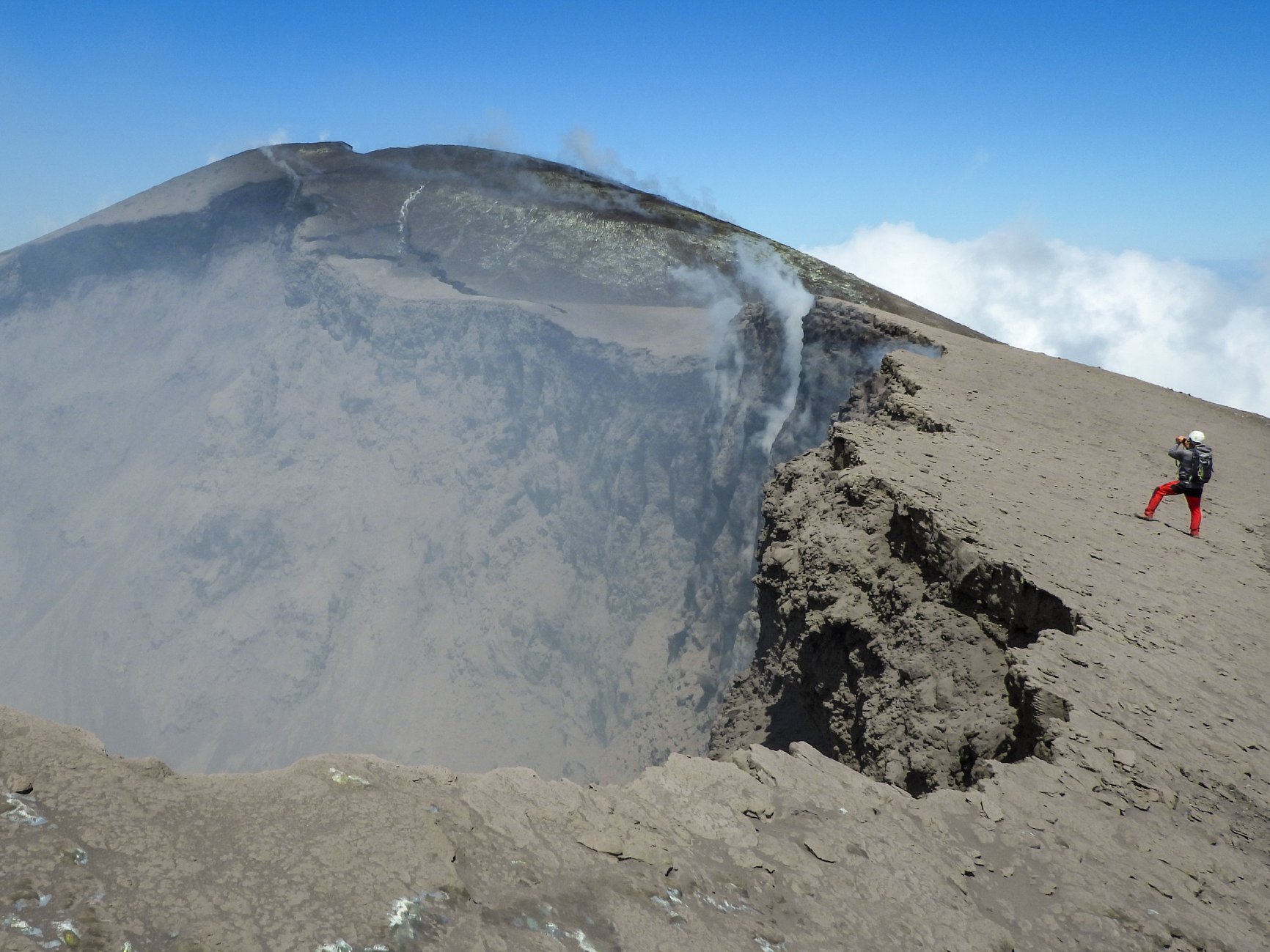
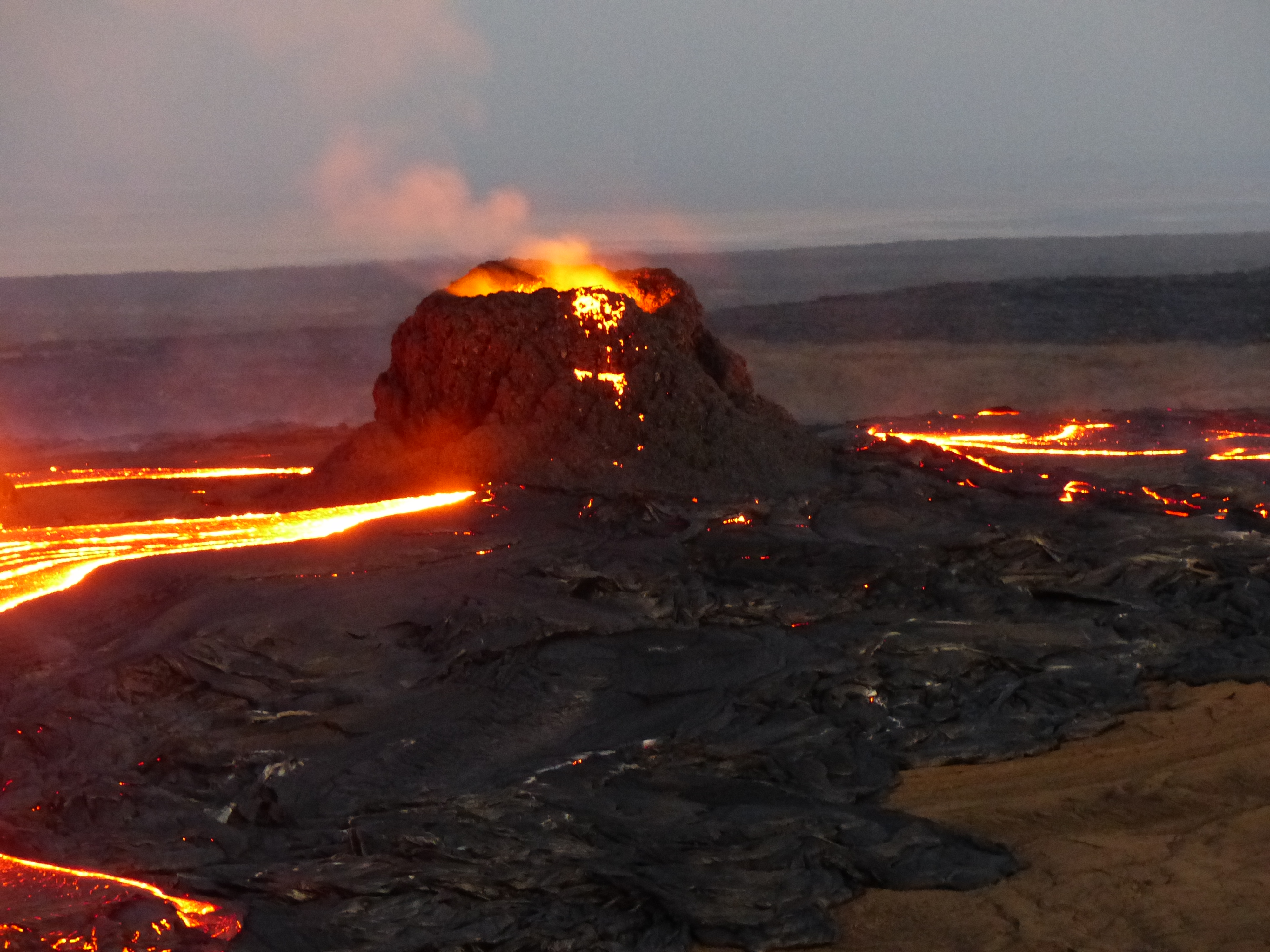
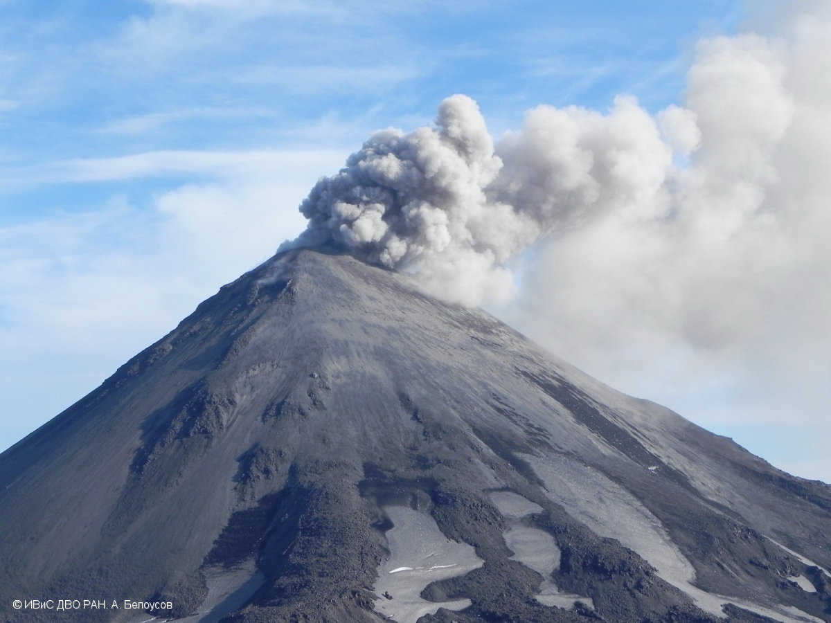
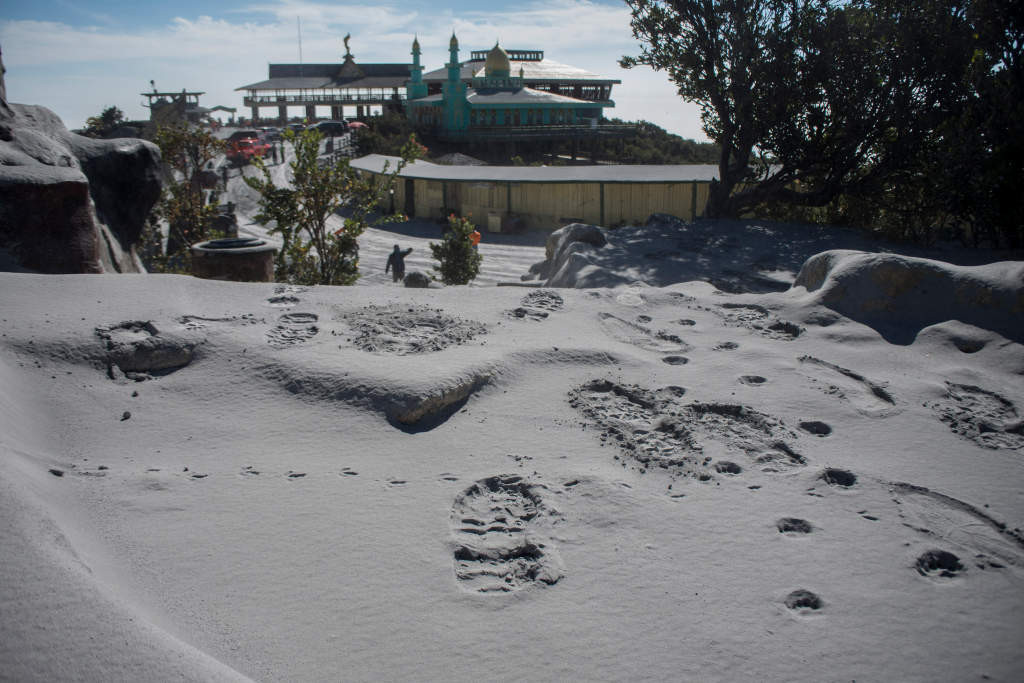
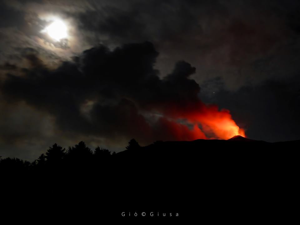
22 Aout 2018. FR. Kamchatka : Ebeko , Colombie : Chiles / Cerro Negro , Hawai : Kilauea , Guatemala : Pacaya .

22 Aout 2018.


Kamchatka , Ebeko :

AVIS D’OBSERVATION DE VOLCAN POUR L’AVIATION (VONA).

Publié: 21 Aout 2018 .
Volcan: Ebeko (CAVW # 290380)
Code couleur actuel de l’aviation: ORANGE
Code couleur de l’aviation précédente: orange
Source: KVERT
Numéro de l’avis: 2018-73
Emplacement du volcan: N 50 deg 41 min E 156 deg 0 min
Région: Northern Kouriles, Russie
Altitude du sommet: 3791.68 ft (1156 m).

Résumé de l’activité volcanique:
Selon les données satellitaires, une activité explosive modérée se poursuit sur le volcan Ebeko  . Le nuage de cendres a dérivé pendant environ 25 km au Sud-Est du volcan.
L’ activité vapeur / gaz modérée avec une certaine de cendres continue sur le volcan . Des explosions de cendres jusqu’à 16 400 ft (5 km)  pourraient se produire à tout moment. L’activité en cours pourrait affecter les avions volant à basse altitude et l’aéroport de Severo-Kurilsk.

Hauteur des nuages ​​volcaniques:
6560 ft (2000 m) AMSL . Temps et méthode de détermination du panache de cendres / hauteur de nuage: 20180821 / 0850Z – Himawari-8
Autres informations sur les nuages ​​volcaniques:
Distance du panache de cendres / nuage du volcan: 16 mi (25 km)
Direction de la dérive du panache de cendres / nuage du volcan: ESE / azimut 121 deg
Temps et méthode de détermination du panache de cendres / nuages: 20180821 / 0850Z – Himawari-8

Source : Kvert.


Colombie , Chiles / Cerro Negro :

Objet: Bulletin d’activité des volcans Chiles et Cerro Negro

Le niveau d’activité des volcans est maintenu au niveau:
NIVEAU JAUNE ■ (III): CHANGEMENTS DANS LE COMPORTEMENT DE L’ACTIVITÉ VOLCANIQUE

Suite à l’activité des volcans CHILES e  CERRO NEGRO, le COLOMBIAN GEOLOGICAL SERVICE (SGC) rapporte que:

Au cours de la période évaluée, entre le 14 et le 20 août 2018, la sismicité dans la région des volcans Chiles – Cerro Negro a montré une augmentation notable du nombre et de l’énergie libérée par rapport à la semaine précédente, passant de 31 à 580  tremblements de terre. Presque dans leur totalité, ces tremblements de terre ont correspondu à des évènements de rupture de roches dans le bâtiment volcanique.


Les séismes localisés ont leurs épicentres vers le Sud et le Sud-Ouest du volcan Chiles, avec des distances comprises entre 0,5 et 7,5 km, des profondeurs comprises entre 1 et 7 km par rapport au sommet du Chiles (4700 mètres d’altitude). En général, l’ampleur de ces séismes n’a pas dépassé 1,8 sur l’échelle de Richter, cependant, un séisme s’est produit le 18 août à 02h45, à 2,5 km au Sud-Ouest du volcan Chiles, avec une profondeur de 4,5 km et une magnitude de M 2,7,  qui n’a pas été signalé comme ressenti.

Le SERVICE GÉOLOGIQUE COLOMBIEN et l’INSTITUT GÉOPHYSIQUE DE L’ÉCOLE POLITECHNIQUE NATIONALE D’ÉQUATEUR suivent de près l’évolution de cette activité sismique et du phénomène volcanique et informeront opportunément des changements détectés.

Source : SGC

Photo : Ingeominas.


Hawai , Kilauea :

Mardi 21 août 2018, 13h06 HST (mardi 21 août 2018, 23h06 UTC)

19 ° 25’16 « N 155 ° 17’13 » W,
Altitude : 4091 ft (1247 m)
Niveau d’alerte du volcan actuel: ATTENTION
Code couleur actuel de l’aviation: ORANGE

Sommet du Kīlauea et zone inférieure du Rift Est:

La sismicité et la déformation du sol sont négligeables au sommet du volcan Kīlauea. Dans la partie inférieure de la zone du rift oriental du volcan (LERZ), seules quelques entrées de lave en mer dégagent de la vapeur; les panaches de dégazage sont minimes. Les taux d’émission de dioxyde de soufre au sommet et dans la LERZ sont considérablement réduits; le taux combiné est plus bas que depuis la fin de 2007.


L’Observatoire hawaïen des volcans (HVO) continuera à surveiller de près la sismicité, la déformation et les émissions de gaz du Kīlauea pour détecter tout signe de réactivation et à surveiller visuellement le sommet et la LERZ.

Le HVO continuera à publier des mises à jour quotidiennes et des messages supplémentaires si nécessaire. Le prochain rapport sera publié demain matin, à moins que des changements importants ne se produisent.

Source : HVO


Guatemala , Pacaya :

Type d’activité: Strombolienne .
Morphologie: stratovolcan composite
Situation géographique: 14 ° 22’50˝ Latitude N; 90 ° 36’00˝ Longitude W.
Hauteur: 2,552msnm.
Conditions météorologiques: Claires
Vent: du sud à 10 km / h
Précipitations: 0.0 mm

Activité:
Présence de fumeroles de dégazage de couleur blanche à une hauteur de 600 m au-dessus du cratère qui sont dispersées par les vents vers le Sud-Ouest. Le tremor interne associé à la remontée du magma et des gaz à la surface est enregistré, en maintenant une coulée de lave dans la direction Nord avec une longueur approximative de 300 m.

Source : Insivumeh


August 16 , 2018. EN. Hawai : Kilauea , Colombia : Chiles / Cerro Negro , Costa Rica : Rincon de la Vieja , Philippines : Kanlaon .

August 16 ,  2018.


Hawai , Kilauea :

Tuesday, August 14, 2018, 9:31 AM HST (Tuesday, August 14, 2018, 19:31 UTC)

19°25’16 » N 155°17’13 » W,
Summit Elevation 4091 ft (1247 m)
Current Volcano Alert Level: WARNING
Current Aviation Color Code: ORANGE

Activity and Hazards Overview

Kīlauea Volcano has remained quiet for over a week now, with no further collapse events at the summit, and, with the exception of a small, crusted-over pond of lava deep inside the fissure 8 cone and a few scattered ocean entries, no lava flowing in the lower East Rift Zone (LERZ).
Earthquake and deformation data show no net accumulation, withdrawal, or significant movement of subsurface magma or pressurization as would be expected if the system was building toward a resumption of activity.

Sunday, Aug 12, 2018, 6:00 am – Kilauea’s lower east rift zone overflight: Just a couple glowing spots within fissure 8 remain, as the pond’s surface has almost completely crusted over. Gases continue to diffuse from fumaroles within the pu‘u, and along the rift.


It is too soon to tell if this change represents a temporary lull or the end of the LERZ eruption and/or summit collapse activity. In 1955, similar pauses of 5 and 16 days occurred during an 88-day-long LERZ eruption. During the Mauna Ulu eruption (1969-1974), a 3.5 month pause occurred in late 1971.

Despite the eruptive pause, hazardous conditions remain in the LERZ and at the summit as described below:

– The fissure 8 crater still hosts a small amount of lava that currently does not enter the existing channel. Should the eruption rate increase, the configuration of outflow around the vent could change, sending lava in new directions. Possible flow paths to the north have been outlined in HVO’s 2018 lower East Rift Zone hazard assessment ).

– Resupply of magma could lead to the reactivation of fissures other than fissure 8, or the opening of entirely new fissures along the ERZ, potentially leading to new areas being inundated by lava.

– The new lava flow field in the LERZ includes large areas of still-hot, rugged, and unstable lava surfaces that are subject to collapse.

– Sulfur dioxide (SO2) gas emissions have greatly decreased from LERZ vents, but high levels of SO2 may persist in downwind areas.

– Tephra (fragments of glassy lava) have accumulated to thicknesses of more than several feet near fissure 8. This material breaks down over time into small, glassy particles that can be blown on the wind and create an eye, respiratory, and skin irritant. Disturbing the tephra by sweeping, shoveling, or driving over it will break the fragile pieces into a glassy dust. The tephra can also conceal underlying hazards such as ground cracks, holes, and debris from destroyed structures.

Kīlauea caldera and Halema‘uma‘u are dwarfed by Mauna Loa in the distance.

– The LERZ ocean entry is minimally active at this time, but continued laze and lava delta collapses remain a concern. Hydrovolcanic explosions are much less of a concern now, as they require high eruption rates with lava entering the ocean, but they may still occur.

– At the summit, additional earthquakes, rockfalls, and ground cracking can occur with no warning. Steep crater walls destabilized by months of earthquakes could be prone to collapse for weeks or months to come, even without further ground shaking ).

– Summit SO2 emissions rates are lower than at any time since late 2007 and are not currently a hazard.

– Resuspended ash in the summit region remains a local hazard during strong winds.

– As the summit continues to adjust to changes in the underlying magmatic system, additional, and potentially damaging, earthquakes are possible. Hawai’i is known for frequent earthquakes, so all residents should be prepared for damaging earthquakes.

– If magma returns to the shallow reservoir beneath Kilauea’s summit, groundwater could encounter subsurface regions of high temperature, prompting explosions of uncertain size.

Pu‘u ‘O‘o looks entirely different from before this eruption…

– More dangerous explosive activity at the summit remains very unlikely in the near term.

– Aftershocks from the May 4, 2018 M6.9 earthquake below Kilauea’s south flank will continue for months more and could produce moderate, damaging events at any time.

The Hawaiian Volcano Observatory (HVO) will continue to closely monitor Kīlauea’s activity, including overflights of the rift zone and summit as needed, supplemented with unmanned aerial systems (UAS) flights and daily visual observations. Field crews will be deployed to the LERZ and the summit areas to collect data and to install and repair monitoring instruments. HVO will continue to issue daily updates and additional messages as needed.

Source : HVO

Photo : Bruce Omori


Colombia, Chiles / Cerro Negro :

Subject: Activity bulletin of Chiles and Cerro Negro volcanoes

The level of activity of volcanoes is maintained at the level:
YELLOW LEVEL ■ (III): CHANGES IN THE BEHAVIOR OF VOLCANIC ACTIVITY

Following the activity of the CHILE volcanoes and CERRO NEGRO, the COLOMBIAN GEOLOGICAL SERVICE (SGC) reports that:

In the period between August 7 and 13, 2018, seismicity in the region of Chiles – Cerro Negro volcanoes, showed a considerable decrease in the frequency of earthquakes of about 80% compared to the previous week. The predominance of earthquakes associated with rock fracturing inside the volcanic building continues (VT type earthquakes).

The events, which by their characteristics could be located, were dispersed, with distances up to 8 km and depths less than 7 km from the average height of the summit of the Chiles volcano (4700 m). The local magnitude of seismicity under these volcanoes ranged from -0.2 to 1.6 on the Richter scale.

The Colombian Geological Service and the ECUADOR INSTITUTO GEOFÍSICO DE LA ESCUELA POLITECNICA NACIONAL closely follow the evolution of this seismic and volcanic activity and will report without delay on the changes detected.

Source : Ingeominas


Costa Rica , Rincon de la Vieja :

10.83°N, 85.324°W
Elevation 1916 m

OVSICORI-UNA reported that a three-minute-long eruption at Rincón de la Vieja began at 1828 on 14 August. Foggy conditions prevented webcam views and an estimate of a plume height.

Activity report of the Rincón de la Vieja volcano
2018-08-14

On 14/08/2018 at 18:28 local time, there is an eruption on the volcano Rincón de la Vieja. The height reached by the column is unknown because of the visibility conditions of the site.
Duration of the activity: 3 minutes.

Ashfall: There are no reports
Sulfur odor: There are no reports

Comments: The volcano is shrouded in fog and is therefore not appreciated by the webcam.

Source : GVP , Ovsicori


Philippines , Kanlaon :

KANLAON VOLCANO BULLETIN 16 August 2018 08:00 A.M.

Kanlaon Volcano’s seismic monitoring network recorded forty-four (44) volcanic earthquakes during the past 24 hours. Ground deformation data from continuous GPS measurements indicate a more pronounced inflation of the edifice since December 2017, signifying pressurization beneath the edifice. Sulfur dioxide (SO2) emission was measured at an average of 2,131 tonnes/day on 04 July 2018.

Alert Level 2 status prevails over Kanlaon Volcano, which means that the volcano is undergoing a moderate level of unrest due to probable intrusion of magma at depth that may or may not lead to a magmatic eruption. The local government units and the public are strictly reminded that entry into the 4-kilometer radius Permanent Danger Zone (PDZ) is strictly prohibited due to the further possibilities of sudden and hazardous steam-driven or phreatic eruptions. Civil aviation authorities must also advise pilots to avoid flying close to the volcano’s summit as ejecta from any sudden phreatic eruption can be hazardous to aircraft.

DOST-PHIVOLCS is closely monitoring Kanlaon Volcano’s activity and any new development will be relayed to all concerned.

Source : Phivolcs

Photo : BongBong Woo Tadifa

16 Aout 2018. FR. Hawai : Kilauea , Colombie : Chiles / Cerro Negro , Costa Rica : Rincon de la Vieja , Philippines : Kanlaon .

16 Aout 2018.


Hawai , Kilauea :

Mardi 14 août 2018, 9h31 HST (mardi 14 août 2018, 19h31 UTC)

19 ° 25’16 « N 155 ° 17’13 » W,
Altitude : 4091 ft (1247 m)
Niveau d’alerte de volcan actuel: AVERTISSEMENT
Code couleur actuel de l’aviation: ORANGE

Aperçu de l’activité et des dangers

Le volcan Kīlauea est resté silencieux pendant plus d’une semaine, sans plus d’effondrement au sommet et, à l’exception d’un petit étang de lave recouvert de croûtes à l’intérieur du cône de la fissure 8 et de quelques entrées dans d’océan éparses, aucune lave ne coule dans la zone inférieure du Rift Est (LERZ).

Les données sur les séismes et les déformations ne montrent aucune accumulation nette, aucun retrait ou mouvement significatif du magma ou de pressurisation du sous-sol, comme on pourrait s’y attendre si le système se préparait à une reprise d ‘activité.

Dimanche 12 août 2018, 6 h 00 – survol de la zone de faille Est du Kilauea: il ne reste que quelques points lumineux dans le cône de la fissure 8, la surface de l’étang étant presque complètement encroutée. Les gaz continuent à diffuser des fumerolles à l’intérieur du cône et le long de la faille.


Il est trop tôt pour dire si ce changement représente une accalmie temporaire ou la fin de l’éruption et / ou de l’effondrement du sommet. En 1955, des pauses similaires de 5 et 16 jours ont eu lieu pendant une éruption de la LERZ de 88 jours. Pendant l’éruption du Mauna Ulu (1969-1974), une pause de 3,5 mois s’est produite à la fin de 1971 .

Malgré la pause éruptive, des conditions dangereuses subsistent dans la LERZ et au sommet, comme décrit ci-dessous:

– Le cratère 8 contient encore une petite quantité de lave qui n’entre pas actuellement dans le canal existant. Si le taux d’éruption augmentait, la configuration de l’écoulement autour de l’évent pourrait changer, envoyant de la lave dans de nouvelles directions. 

– Le réapprovisionnement en magma pourrait entraîner la réactivation de fissures autres que la fissure 8, ou l’ouverture de fissures entièrement nouvelles le long de la ZRE, conduisant potentiellement à l’inondation de nouvelles zones par la lave.

– Le nouveau champ de coulée de lave dans la LERZ comprend de grandes surfaces de lave encore chaudes, rugueuses et instables, susceptibles de s’effondrer.

– Les émissions de dioxyde de soufre (SO2) ont fortement diminué par rapport aux évents de la LERZ, mais des niveaux élevés de SO2 peuvent persister dans les zones sous le vent.

– Le téphra (fragments de lave vitreuse) s’est accumulé à des épaisseurs de plus de plusieurs pieds près de la fissure 8. Ce matériau se décompose avec le temps en petites particules vitreuses qui peuvent être soufflées par le vent et créer un irritant oculaire, respiratoire et cutané. Déranger le téphra en le balayant, en le pelletant ou en le projetant brisera les morceaux fragiles en une poussière vitreuse. Le tephra peut également dissimuler les dangers sous-jacents tels que des fissures, des trous et des débris au sol de structures détruites.

La caldera du Kilauea et le cratère Halema’uma’u sont éclipsés par le Mauna Loa au loin.

– L’entrée de lave de la LERZ dans l’océan est peu active à ce moment, mais la poursuite du dégazage et des effondrements du delta de lave reste préoccupante. Les explosions hydro-volcaniques sont beaucoup moins préoccupantes à l’heure actuelle, car elles exigent des taux d’éruption élevés, la lave pénétrant dans l’océan, mais elles peuvent toujours se produire.

– Au sommet, les tremblements de terre, les chutes de pierres et des fissures peuvent se produire sans avertissement. Les murs de cratère abrupts déstabilisés par des mois de tremblement de terre pourraient s’effondrer pendant des semaines ou des mois, même en l’absence de nouvelles secousses .

– Les taux d’émission de SO2 du Sommet sont inférieurs à ceux enregistrés depuis la fin de 2007 et ne constituent pas actuellement un danger.

– Les cendres remises en suspension dans la région du sommet demeurent un danger local lors de vents forts.

– À mesure que le sommet continue de s’adapter aux changements du système magmatique sous-jacent, des séismes supplémentaires et potentiellement dommageables sont possibles. Hawai’i est connue pour ses tremblements de terre fréquents, donc tous les résidents doivent être préparés à des dégâts causés par des séismes.

– Si le magma retourne dans le réservoir peu profond sous le sommet du Kilauea, les eaux souterraines pourraient rencontrer des régions souterraines à haute température, provoquant des explosions de taille incertaine.

Le Pu’u ‘O’o est tout à fait différent d’avant cette éruption ..

– Une activité explosive plus dangereuse au sommet reste très improbable à court terme. 

– Les répliques du séisme de M6.9 du 4 mai 2018 situé sous le flanc Sud du Kilauea se poursuivront pendant des mois et pourraient provoquer des événements modérés et dommageables à tout moment.

L’observatoire des volcans de Hawaï (HVO) continuera à suivre de près l’activité du Kīlauea, y compris les survols de la zone de rift et des sommets si nécessaire, complétés par des vols de systèmes aériens sans pilote et des observations visuelles quotidiennes. Des équipes de terrain seront déployées dans la LERZ et les zones de sommet pour collecter des données , installer et réparer les instruments de surveillance. Le HVO continuera à publier des mises à jour quotidiennes et des messages supplémentaires si nécessaire.

Source : HVO

Photo : Bruce Omori


Colombie , Chiles / Cerro Negro :

Objet: Bulletin d’activité des volcans Chiles et Cerro Negro

Le niveau d’activité des volcans est maintenu au niveau:
NIVEAU JAUNE ■ (III): CHANGEMENTS DANS LE COMPORTEMENT DE L’ACTIVITÉ VOLCANIQUE

Suite à l’activité des volcans CHILES et CERRO NEGRO, le COLOMBIAN GEOLOGICAL SERVICE (SGC) rapporte que:

Dans la période comprise entre le 7 et le 13 Août 2018 , la sismicité dans la région des volcans Chiles – Cerro Negro, a montré une diminution considérable de la fréquence des séismes d’environ 80% par rapport à la semaine précédente. La prédominance des séismes associés à la fracturation des roches à l’intérieur du bâtiment volcanique se poursuit (séismes de type VT).

Les événements qui, par leurs caractéristiques, pouvaient être localisés, étaient dispersés, avec des distances allant jusqu’à 8 km et des profondeurs inférieures à 7 km par rapport à la hauteur moyenne du sommet du volcan Chiles (4700 m). L’ampleur locale de la sismicité survenue sous ces volcans se situait entre -0,2 et 1,6 sur l’échelle de Richter.

Le Service géologique colombien et l’INSTITUTO GEOFÍSICO DE LA ESCUELA POLITÉCNICA NACIONAL DE ECUADOR suivent de près l’évolution de cette activité sismique et volcanique  et rendra compte sans délai des changements détectés.

Source : Ingeominas


Costa Rica , Rincon de la Vieja :

10,83 ° N, 85,324 ° O
Altitude 1916 m

L’OVSICORI-UNA a signalé qu’une éruption de trois minutes sur le Rincón de la Vieja avait commencé à 18h28 le 14 août. Les conditions brumeuses ont empêché l’affichage de la webcam et une estimation de la hauteur du panache.

Rapport d’activité du volcan Rincón de la Vieja
2018-08-14
Le 14 / 08 / 2018  à 18h28 heure locale, il y a une éruption sur le volcan Rincón de la Vieja. La hauteur atteinte par la colonne est inconnue en raison des conditions de visibilité du site.
Durée de l’activité: 3 minutes.

Chute de cendres  : Il n’y a pas de rapports
Odeur de soufre  : Il n’y a pas de rapports

Commentaires: Le volcan est enveloppé dans le brouillard et n’est donc pas apprécié par la webcam.

Source : GVP , Ovsicori


Philippines , Kanlaon :

BULLETIN D’ACTIVITE DU VOLCAN KANLAON , 16 août 2018 08:00 AM.

Le réseau de surveillance sismique du volcan Kanlaon a enregistré quarante-quatre (44) séismes volcaniques au cours des 24 dernières heures. Les données de déformation du sol provenant de mesures GPS continues indiquent un gonflement plus prononcé de l’édifice depuis décembre 2017, ce qui signifie une pressurisation sous l’édifice. Les émissions de dioxyde de soufre (SO2) ont été mesurées en moyenne à 2 131 tonnes / jour le 4 juillet 2018.

Le niveau d’alerte de niveau 2 prévaut sur le volcan Kanlaon, ce qui signifie que le volcan subit un niveau modéré de troubles dû à une intrusion probable de magma en profondeur pouvant mener ou non à une éruption magmatique. Il est rappelé aux administrations locales et au public que l’entrée dans la zone de danger permanent (PDZ) d’un rayon de 4 kilomètres est strictement interdite en raison des nouvelles possibilités d’éruptions soudaines et dangereuses dues à la vapeur ou à la nappe phréatique. Les autorités de l’aviation civile doivent également conseiller aux pilotes d’éviter de voler à proximité du sommet du volcan, car les éjecta de toute éruption phréatique soudaine peuvent être dangereux pour les aéronefs.

Le DOST-PHIVOLCS suit de près l’activité du volcan  Kanlaon  et tout nouveau développement sera transmis à toutes les parties concernées.

Source : Phivolcs

Photo : BongBong Woo Tadifa

July 27 , 2018. EN. Vanuatu : Ambae , Hawai : Kilauea , Philippines : Kanlaon , Colombia : Chiles / Cerro Negro , Japan : Asamayama .

July 27 , 2018.


Vanuatu , Ambae :

VANUATU VOLCANO ALERT BULLETIN N°7 – AMBAE ACTIVITY , Saturday July 21st 2018

Ambae volcano is in the minor eruption state. The Volcanic Alert Level is raised to Level 3 .

The volcanic eruption at Ambae confined inside the Lake Voui is consistent with the Volcanic Alert Level 3. Scientific analyses confirm that the current activity is similar to the volcanic activity of March 2018 with more and sustained emissions of volcanic ashes. The possibility of imminent increasing activity is low. The Danger Zone for life safety is now limited at 3 km radius from the active vent and areas located in the Yellow Zone (See Map below).

Observations flights on 13th and 20th July 2018 confirm the activity at the volcano is only occurring in one of the summit crater lakes (Lake Voui) and is not changing. Photographs taken during observation flights show the activity consists of explosions and ejection of hot rocks from the eruptive vents accompanied by ash emission. A small –scale eruption continues in Lake Voui.

The presence of ash that has fallen on Ambae during the last eruptive phases and now will continue to change the behaviour of streams and creeks when it rains. The creeks and streams can produce floods and carry a lot more debris (sands, gravel and boulders). The flow path of streams and creeks could change due to the flood debris. Landslide may occur at some areas during heavy rain fall.

These observations and the analysis of seismic data confirm that the volcano activity is in the minor eruption state. The volcano activity consist of ongoing emission of steam and/or gases and ashes. The local population from Ambae and from neighbouring island can hear rumbling, volcanic explosions from volcano, smelt volcanic gases, see volcanic ash and gas plume and glows over the mountain at night.

Source : Geohazard

Photo : Yvonne Fries.


Hawai , Kilauea :

Wednesday, July 25, 2018, 9:15 AM HST (Wednesday, July 25, 2018, 19:15 UTC)

19°25’16 » N 155°17’13 » W,
Summit Elevation 4091 ft (1247 m)
Current Volcano Alert Level: WARNING
Current Aviation Color Code: ORANGE

Kīlauea Volcano Lower East Rift Zone

Fissure 8 continues to erupt lava into the channel leading northeastward from the vent.

Lava advancing in the direction of Dead Trees, Isaac Hale Beach Park and the boat ramp at Pohoiki, appear to have not advanced significantly since yesterday, but spots of activity inland continue to creep along.


No new overflows were reported yesterday following the summit collapse event at 6:41 HST; no overflows were reported this morning. In the last day, the lava flow in the Ahalanui area has not extended significantly westward. The flow remains less than 0.1 miles from the Pohoiki boat ramp in Isaac Hale Park. The active ocean entry is still a few hundred yards to the east of this lava flow edge.

No other fissures are active this morning.

Kīlauea Volcano Summit

The most recent collapse event occurred at 6:41 AM HST yesterday, July 24, and was similar in character and magnitude to previous events. Seismicity has increased steadily since then; since yesterday afternoon the number of events per hour has fluctuated between about 20 and 40. The next collapse event is expected this afternoon or evening.

Source : HVO.

Photo : Bruce Omori


Philippines , Kanlaon :

KANLAON VOLCANO BULLETIN 26 July 2018 08:00 A.M

Kanlaon Volcano’s seismic monitoring network recorded five (5) volcanic earthquakes during the past 24 hours. Ground deformation data from continuous GPS measurements indicate a more pronounced inflation of the edifice since December 2017, signifying pressurization deep beneath the edifice. Sulfur dioxide (SO2) emission was measured at an average of 2,131 tonnes/day on 04 July 2018.

Alert Level 2 status prevails over Kanlaon Volcano, which means that the volcano is undergoing a moderate level of unrest due to probable intrusion of magma at depth that may or may not lead to a magmatic eruption. The local government units and the public are strictly reminded that entry into the 4-kilometer radius Permanent Danger Zone (PDZ) is strictly prohibited due to the further possibilities of sudden and hazardous steam-driven or phreatic eruptions. Civil aviation authorities must also advise pilots to avoid flying close to the volcano’s summit as ejecta from any sudden phreatic eruption can be hazardous to aircraft.

DOST-PHIVOLCS is closely monitoring Kanlaon Volcano’s activity and any new development will be relayed to all concerned.

Source : Phivolcs.


Colombia , Chiles / Cerro Negro :

Subject: Activity bulletin of Chiles and Cerro Negro volcanoes

The level of activity of volcanoes is maintained at the level:
YELLOW LEVEL ■ (III): CHANGES IN THE BEHAVIOR OF VOLCANIC ACTIVITY

Following the activity of VOLCANS CHILES and CERRO NEGRO, the COLOMBIAN GEOLOGICAL SERVICE (SGC) reports that:

For the period evaluated between July 17 and 23, 2018 seismicity in the region of Chiles volcanoes – Cerro Negro, showed a slight increase in both the number and in the released energy compared to the previous week by maintaining the predominance of the seismicity associated with the fracturing of rocks inside the volcanic building.


These earthquakes are preferably located southwest of the Chiles volcano, with distances between 0.2 and 1.7 km from the summit (4700 m). Other events were located scattered in the area of influence of the two volcanoes, with a depth of between 2.1 and 9.5 km and a maximum epicentral distance of 12 km. The local magnitude of this seismicity ranged from -0.5 to 1.9 on the Richter scale.

The Colombian Geological Service and the ECUADOR INSTITUTO GEOFÍSICO DE LA ESCUELA POLITECNICA NACIONAL closely follow the evolution of this seismic and volcanic activity and will report without delay on the changes detected.

Source : SGC.


Japan , Asamayama :

36.406°N, 138.523°E
Elevation 2568 m

JMA stated that during 16-23 July white plumes rose as high as 300 m above Asamayama’s summit crater. Weak crater incandescence was visible for the first time since 23 December 2017. The Alert Level remained at 2 (on a scale of 1-5).

Asamayama, Honshu’s most active volcano, overlooks the resort town of Karuizawa, 140 km NW of Tokyo. The volcano is located at the junction of the Izu-Marianas and NE Japan volcanic arcs. The modern Maekake cone forms the summit and is situated east of the horseshoe-shaped remnant of an older andesitic volcano, Kurofuyama, which was destroyed by a late-Pleistocene landslide about 20,000 years before present (BP). Growth of a dacitic shield volcano was accompanied by pumiceous pyroclastic flows, the largest of which occurred about 14,000-11,000 BP, and by growth of the Ko-Asama-yama lava dome on the east flank. Maekake, capped by the Kamayama pyroclastic cone that forms the present summit, is probably only a few thousand years old and has an historical record dating back at least to the 11th century CE. Maekake has had several major plinian eruptions, the last two of which occurred in 1108 (Asamayama’s largest Holocene eruption) and 1783 CE.

Source: Agence météorologique japonaise (JMA) , GVP.

July 06 , 2018 . EN. Indonesia : Anak Krakatau , Guatemala : Pacaya , Hawai : Kilauea , Colombia : Chiles / Cerro Negro , Indonesia : Agung .

July 06 , 2018 .


Indonesia , Anak Krakatau :

VOLCANO OBSERVATORY NOTICE FOR AVIATION – VONA.

Issued: July 05 , 2018 .
Volcano: Anak Krakatau (262000)
Current Aviation Colour Code: ORANGE
Previous Aviation Colour Code: orange
Source: Anak Krakatau Volcano Observatory
Notice Number: 2018KRA13
Volcano Location: S 06 deg 06 min 07 sec E 105 deg 25 min 23 sec
Area: Lampung, Indonesia
Summit Elevation: 976 FT (305 M)

Ash plume of Krakatau yesterday (Black Carita via Volcanist Andi / VolcanoDiscovery)


Volcanic Activity Summary:
Eruption with ash clouds at 07:25 UTC (14:25 local time). The eruption lasted for 33 seconds. Eruption and ash emission is continuing.

Volcanic Cloud Height:
Best estimate of ash-cloud top is around 1936 FT (605 M) above sea level, may be higher than what can be observed clearly. Source of height data: ground observer.

Other Volcanic Cloud Information:
Ash cloud is moving to north

Remarks:
Eruption recorded on seismogram with maximum amplitude 41 mm and maximum duration 33 second.

Level II Activity Level (WASPADA). G. Anak Krakatau has increased his activity since June 18, 2018.
Since yesterday until this morning, visually the mountain seems clear without fog. The wind is blowing weakly to moderately to the west, north-west, north-east.

The seismographs of July 5, 2018 recorded:
116 earthquakes of eruption
153 emission earthquakes
5 shallow volcanic earthquakes
2 deep volcanic earthquake
Continuous tremor, amplitude 1-4 mm (dominant value 1 mm)

Source : Magma Indonésie. PVMBG.

Photo : Black Carita via Andi Volcanist / VolcanoDiscovery / Jeannie Curtis.


Guatemala , Pacaya :

Type of activity: Strombolian
Morphology: Composite Stratovolcano
Location: 14 ° 22’50˝ Latitude N; 90 ° 36’00˝ Longitude W.
Height: 2,552msnm.
Weather Conditions: Partly Cloudy
Wind: South West at 5 km / h
Precipitation: 0.0 mm

Activity:
The Pacaya volcano has a lava flow 700 meters long and 60 meters wide, which descends from the crater on the north flank. In the Mackenney crater, small Strombolian explosions are observed, reaching 25 meters, depositing material inside. The PCG seismic station records the tremor (internal vibration) generated by the gas pressure and the descent of the lava flows.

INSIVUMEH reported that from 28 to 29 June and from 1 to 3 July, strombolian explosions on Pacaya’s Mackenney crater ejected materials up to 30 m above the edge of the crater. Plumes of white gas have drifted South.

Source : Insivumeh , GVP.

Vidéo : Adrenaline tour Guatemala.

Photo : Lared


Hawai , Kilauea :

Thursday, July 5, 2018, 10:07 AM HST (Thursday, July 5, 2018, 20:07 UTC)

19°25’16 » N 155°17’13 » W,
Summit Elevation 4091 ft (1247 m)
Current Volcano Alert Level: WARNING
Current Aviation Color Code: ORANGE

Kīlauea Volcano Lower East Rift Zone

The eruption in the lower East Rift Zone (LERZ) continues with no significant change during the past 24 hours.

Fountains from Fissure 8 spatter cone continue to supply lava to the open channel with intermittent small, short-lived overflows. The spatter cone is now about 55 m (180 ft) tall at its highest point, and fountains rarely rise above that point. The crew on this morning’s overflight thought that the fountain and lava level in the upper channel were lower than on past mornings. North of Kapoho Crater, small overflows from the channel continued active and nearly reached the Beach Rd about 0.3 km (0.2 mi) north of Four Corners. Between Kapoho Crater and the coast, the northern margin of the flow field is still oozing pasty lava at several points in the area of Kapoho Ag and Beach Lots. Drone overflights in the early morning and a later morning helicopter overflight found a increase in lava flow rate at Beach Lots. Lava was entering the sea over a broad area this morning primarily on the northern side of the flow front. As shown by the July 02n thermal map of the flow field, the lava channel has crusted over about 0.8 km (0.5 mi) inland of the ocean entry; lava is oozing from the flow’s molten interior into the ocean along most of its broad front.

A view of the 4 corners area where a significant overflow occurred two days ago, due to a blockage. Majority of the volume is now flowing around and back into the original channel, while just downslope the flow expands significantly to the north (to the left of the frame). A few spots of activity are pushing to the south in the upper left middle of the image.


Fissure 22 is sporadically spattering this morning; its flow was not incandescent overnight and possibly stalled.

Pele’s hair and other lightweight volcanic glass fragments from the lava fountain at Fissure 8 continue to fall downwind of the fissure, dusting the ground within a few hundred meters (yards) of the vent. High winds may waft lighter particles to greater distances. Residents are urged to minimize exposure to these volcanic particles, which can cause skin and eye irritation similar to volcanic ash.
HVO field crews are on site tracking the fountains, lava flows, and spattering from Fissure 8 as conditions allow and are reporting information to Hawaii County Civil Defense. Observations are also collected on a daily basis from cracks in the area of Highway 130; no changes in temperature, crack width, or gas emissions have been noted for several days.

The ocean entry is a hazardous area. Venturing too close to an ocean entry on land or the ocean exposes you to flying debris from sudden explosive interaction between lava and water. Also, the lava delta is unstable because it is built on unconsolidated lava fragments and sand. This loose material can easily be eroded away by surf, causing the new land to become unsupported and slide into the sea. Additionally, the interaction of lava with the ocean creates « laze », a corrosive seawater plume laden with hydrochloric acid and fine volcanic particles that can irritate the skin, eyes, and lungs.

Magma continues to be supplied to the Lower East Rift Zone. Seismicity remains relatively low in the area with numerous small magnitude earthquakes and low amplitude background tremor. Low amplitude tremor increased slightly on June 29 associated with renewed activity at Fissure 22. Higher amplitude tremor is occasionally being recorded on seismic stations close to the ocean entry.

A huge a’a lava flow enters the sea at Kapoho, generating a strong plume degassing


Additional ground cracking and outbreaks of lava in the area of the active fissures are possible. Residents downslope of the region of fissures should heed all Hawaii County Civil Defense messages and warnings.

Kīlauea Volcano Summit

Another collapse explosion event occurred 10:19 AM HST on July 4 at Kīlauea’s summit. Seismicity dropped abruptly for several hours afterwards, but has since returned to 25-35 earthquakes per hour, a number of which are in the magnitude 2-3 range. Another collapse explosion is expected later today. Inward slumping of the rim and walls of Halemaʻumaʻu continues in response to ongoing subsidence at the summit.


At 1:20 PM HST on July 5, a collapse explosion event occurred at Kīlauea’s summit. The energy released by the event was equivalent to a M5.2 earthquake. The shaking produced rockfall from Halema‘uma‘u’s steep crater walls (brown dust), as viewed from a temporary observation post at Volcano House.

Sulfur dioxide emissions from the volcano’s summit have dropped to levels that are about half those measured prior to the onset of the current episode of eruptive activity. This gas and minor amounts of ash are being transported downwind, with small bursts of ash and gas accompanying intermittent explosive activity.

Source : HVO

Photo : Bruce Omori , USGS.

Vidéo : Seelava /Shane Turpin.


Colombia , Chiles / Cerro Negro :

Subject: Activity bulletin of Chiles and Cerro Negro volcanoes

The level of activity of volcanoes is maintained at the level:
YELLOW LEVEL ■ (III): CHANGES IN THE BEHAVIOR OF VOLCANIC ACTIVITY

Following the activity of VOLCANS CHILES and CERRO NEGRO, the COLOMBIAN GEOLOGICAL SERVICE (SGC) reports that:

For the evaluation period between June 26 and July 2, 2018 and last week, seismicity in the region of Chiles volcanoes – Cerro Negro, showed an increase in frequency from 656 to 1,003 events, mainly associated with the fracturing of rocks inside the volcano.

These earthquakes were located in the southwest and farthest to the southeastern areas of the Chiles volcano, with epicentral distances of up to 14 km. The depths were less than 8 km below the summit (4700 m) and the maximum local magnitude of M 1.6 on the Richter Scale.

The COLOMBIAN GEOLOGICAL SERVICE and the GEOPHYSICAL INSTITUTE OF THE NATIONAL POLYTECHNICAL SCHOOL OF ECUADOR closely monitor the evolution of this seismic activity and the volcanic phenomenon and will inform timely changes detected.

Source : SGC


Indonesia , Agung :

VOLCANO OBSERVATORY NOTICE FOR AVIATION – VONA .

Issued: July 06 , 2018.
Volcano: Agung (264020)
Current Aviation Colour Code: ORANGE
Previous Aviation Colour Code: orange
Source: Agung Volcano Observatory
Notice Number: 2018AGU47
Volcano Location: S 08 deg 20 min 31 sec E 115 deg 30 min 29 sec
Area: Bali, Indonesia
Summit Elevation: 10054 FT (3142 M)

Volcanic Activity Summary:
Eruption with volcanic ash cloud at 04h49 UTC (12h49 local).

Volcanic Cloud Height:
Ash cloud not visible.

Other Volcanic Cloud Information:

Remarks:
Eruption recorded on seismogram with maximum amplitude 24 mm dan maximum duration 90 second.

Source : Magma Indonésie .

Photo : Øystein Lund Andersen


06 Juillet 2018 . FR. Indonésie : Anak Krakatau , Guatemala : Pacaya , Hawai : Kilauea , Colombie : Chiles / Cerro Negro , Indonésie : Agung .

06 Juillet 2018 .


Indonésie , Anak Krakatau :

AVIS D’OBSERVATION DU VOLCAN POUR L’AVIATION – VONA.

Délivré: 05 Juillet 2018.
Volcan: Anak Krakatau (262000)
Code couleur actuel de l’aviation: ORANGE
Code couleur aviation précédent: orange
Source: Observatoire du volcan Anak Krakatau
Numéro de l’avis: 2018KRA13
Localisation du volcan  : S 06 deg 06 min 07 sec E 105 deg 25 min 23 sec
Région: Lampung, Indonésie
Altitude du sommet: 976 FT (305 M)

Panache de cendres du Krakatau hier (Black Carita via Andi Volcanist / VolcanoDiscovery)


Résumé de l’activité volcanique:
Éruption avec des nuages de cendres à 07:25 UTC (14:25 heure locale). L’éruption a duré 33 secondes. L’éruption et l’émission de cendres se poursuivent.

Hauteur du nuage volcanique:
La meilleure estimation du sommet des nuages de cendres est d’environ 605 M (1936 pi) au-dessus du niveau de la mer, peut être plus élevée que ce qui peut être observé clairement. Source de données de hauteur: observateur au sol.

Autres informations sur le nuage volcanique:
Le nuage de cendres se déplace vers le Nord

Remarques:
Éruption enregistrée sur sismogramme avec une amplitude maximale de 41 mm et une durée maximale de 33 secondes.

Niveau d’activité de niveau II (WASPADA). le G. Anak Krakatau   a augmenté son activité depuis le 18 juin 2018.
Depuis hier jusqu’à ce matin, visuellement la montagne semble claire sans brouillard. Le vent souffle faiblement à modérément vers l’Ouest, le Nord-Ouest, le Nord-Est.

Les sismographes du 5 juillet 2018 ont enregistré:
116 séismes d’éruption
153 tremblements de terre d’émission
5 tremblements de terre volcaniques peu profonds
2 tremblement de terre volcanique profonds
Tremor continu, amplitude 1-4 mm (valeur dominante 1 mm )

Source : Magma Indonésie. PVMBG.

Photo : Black Carita via Andi Volcanist / VolcanoDiscovery / Jeannie Curtis.


Guatemala , Pacaya :

Type d’activité: Strombolienne.
Morphologie: Stratovolcan composite
Situation géographique: 14 ° 22’50˝ Latitude N; 90 ° 36’00˝ Longitude  W.
Hauteur: 2,552msnm.
Conditions météo: Partiellement nuageux
Vent: Sud à 5 km / h
Précipitations: 0.0 mm

Activité:
Le volcan Pacaya présente une coulée de lave de 700 mètres de long et de 60 mètres de large, qui descend du cratère sur le flanc Nord. Dans le cratère Mackenney, de petites explosions stromboliennes sont observées, atteignant 25 mètres, déposant des matériau à l’intérieur. La station sismique de PCG enregistre le tremor (vibration interne) généré par la pression des gaz et la descente des coulées de lave.

L’INSIVUMEH a rapporté que du 28 au 29 juin et du 1er au 3 juillet, des explosions stromboliennes sur le cratère Mackenney du Pacaya ont éjecté des matériaux atteignant 30 m au-dessus du bord du cratère. Des panaches de gaz blancs ont dérivé vers le Sud .


Source : Insivumeh , GVP.

Vidéo : Adrenaline tour Guatemala.

Photo : Lared


Hawai , Kilauea :

Jeudi 5 juillet 2018, 10 h 07 HNT (jeudi 5 juillet 2018, 20:07 UTC)

19 ° 25’16 « N 155 ° 17’13 » W,
Sommet : 4091 pi (1247 m)
Niveau d’alerte volcanique actuel: AVERTISSEMENT
Code couleur actuel de l’aviation: ORANGE

Volcan Kīlauea , Lower East Rift Zone

L’éruption dans la zone inférieure du Rift Est (LERZ) se poursuit sans changement significatif au cours des dernières 24 heures.

Les fontaines de la Fissure 8 continuent de fournir de la lave au canal ouvert avec de petits débordements intermittents de courte durée. Le cône de projection atteint maintenant environ 55 m (180 pi) à son point le plus haut et les fontaines dépassent rarement ce point. L’équipage du survol de ce matin pensait que le niveau de la fontaine et de la lave dans le chenal supérieur était plus bas que les matins passés. Au nord du cratère Kapoho, de petits débordements du chenal ont continué d’être actifs et ont presque atteint Beach Rd à environ 0,3 km (0,2 mi) au nord de Four Corners. Entre le cratère de Kapoho et la côte, la marge Nord du champ d’écoulement suinte encore de la lave pâteuse à plusieurs endroits dans la région de Kapoho Ag et Beach Lots. Des survols de drones tôt le matin et un survol d’hélicoptère plus tard dans la matinée ont permis de constater une augmentation du débit de lave à Beach Lots. La lave entrait dans la mer au large d’une large zone ce matin principalement sur le côté Nord du front d’écoulement.  

Une vue de la zone de 4 corners où un débordement significatif s’est produit il y a deux jours, en raison d’un blocage. La majorité du volume circule maintenant et revient dans le canal d’origine, tandis que juste en aval, le flux s’étend de manière significative vers le nord (à gauche de la photo). Quelques points d’activité poussent vers le sud dans le milieu en haut à gauche de l’image.


La fissure 22 éclabousse sporadiquement ce matin; son flux n’était pas incandescent pendant la nuit et éventuellement calé.

Les cheveux de Pelé et d’autres fragments de verre volcanique léger provenant de la fontaine de lave de la Fissure 8 continuent de retomber sous le vent de la fissure, recouvrant le sol à quelques centaines de mètres de l’évent. Les vents violents peuvent projeter des particules plus légères sur de plus grandes distances. Les résidents sont invités à minimiser l’exposition à ces particules volcaniques, qui peuvent causer une irritation de la peau et des yeux semblable à celle des cendres volcaniques.

Les équipes de terrain du HVO sont sur place pour suivre les fontaines, les coulées de lave et les éclaboussures de la Fissure 8 lorsque les conditions le permettent et rapportent ces informations à la Défense Civile du Comté d’Hawaii. Les observations sont également recueillies quotidiennement à partir de fissures dans le secteur de la route 130; aucun changement de température, de largeur de fissure ou d’émission de gaz n’a été constaté depuis plusieurs jours.

L’entrée dans l’océan est une zone dangereuse. S’aventurer trop près d’une entrée océanique sur terre ou dans l’océan vous expose à des débris volants provenant d’une interaction explosive soudaine entre la lave et l’eau. De plus, le delta de lave est instable parce qu’il est construit sur des fragments de lave non consolidés et du sable. Ce matériau meuble peut facilement être érodé par le ressac, ce qui fait que la nouvelle terre n’est plus supportée et glisse dans la mer. De plus, l’interaction de la lave avec l’océan crée un «laze», un panache d’eau de mer corrosif chargé d’acide chlorhydrique et de fines particules volcaniques qui peuvent irriter la peau, les yeux et les poumons.

Le magma continue d’être approvisionné dans la zone du Lower East Rift. La sismicité reste relativement faible dans la zone avec de nombreux séismes de faible magnitude et des tremors de fond de faible amplitude. Le tremor de faible amplitude a légèrement augmenté le 29 juin, en raison d’une activité renouvelée à la fissure 22. Des tremors de plus grande amplitude sont parfois enregistrés dans les stations sismiques près de l’entrée de l’océan.

Un énorme flux de lave a’a entre dans la mer à Kapoho, générant un immense panache de dégazage.


Des fissures au sol supplémentaires et des éruptions de lave dans la zone des fissures actives sont possibles. Les résidants  de la région des fissures devraient tenir compte de tous les messages et avertissements de la défense civile du comté d’Hawaii.

Sommet du volcan Kīlauea

Un autre événement d’explosion s’est produit à 10 h 19 HST le 4 juillet au sommet du Kīlauea. La sismicité a chuté brusquement pendant plusieurs heures après, mais est revenue depuis à 25-35 tremblements de terre par heure, dont un certain nombre sont dans la gamme de magnitude 2-3. Une autre explosion d’effondrement est attendue plus tard aujourd’hui.


À 13h20 HST le 5 juillet, un événement d’explosion s’est produit au sommet du Kīlauea. L’énergie libérée par l’événement était équivalente à un séisme de M5.2. Les secousses ont produit des chutes de pierres sur les parois abruptes du cratère Halema’uma’u (poussière brune), vues depuis un poste d’observation temporaire à Volcano House.

Les émissions de dioxyde de soufre du sommet du volcan ont chuté à des niveaux qui sont environ la moitié de ceux mesurés avant le début de l’épisode actuel d’activité éruptive. Ce gaz et des quantités mineures de cendres sont transportés sous le vent, avec de petites rafales de cendre et de gaz accompagnant une activité explosive intermittente.

Source : HVO

Photo : Bruce Omori , USGS.

Vidéo : Seelava /Shane Turpin.


Colombie , Chiles / Cerro Negro :

Objet: Bulletin d’activité des volcans Chiles et Cerro Negro

Le niveau d’activité des volcans est maintenu au niveau:
NIVEAU JAUNE ■ (III): CHANGEMENTS DANS LE COMPORTEMENT DE L’ACTIVITÉ VOLCANIQUE

Suite à l’activité des VOLCANS CHILES et CERRO NEGRO, le SERVICE GÉOLOGIQUE COLOMBIEN (SGC) rapporte que:

Pour la période d’évaluation comprise entre le 26 Juin et le 2 Juillet 2018 et à la semaine dernière, la sismicité dans la région des volcans Chiles – Cerro Negro, a montré une augmentation de  fréquence, passant de 656 à 1 003 événements, principalement associée à la fracturation des roches à l’intérieur du volcan.

Ces tremblements de terre étaient situés au Sud-Ouest et les plus éloignés vers les secteurs au Sud-Est du volcan Chiles, avec des distances épicentrales allant jusqu’à 14 km. Les profondeurs étaient de moins de 8 km au dessous du sommet (4700 m) et l’ampleur locale maximale de M 1,6 sur l’ Échelle de Richter.

Le SERVICE GÉOLOGIQUE COLOMBIEN et l’INSTITUT GÉOPHYSIQUE DE L’ÉCOLE POLYTECHNIQUE NATIONALE DE L’ÉQUATEUR suivent de près l’évolution de cette activité sismique et du phénomène volcanique et informeront opportunément des changements détectés.

Source : SGC


Indonésie , Agung :

AVIS D’OBSERVATION DU VOLCAN POUR L’AVIATION – VONA.

Délivré: 06 Juillet 2018 .
Volcan: Agung (264020)
Code couleur actuel de l’aviation: ORANGE
Code couleur aviation précédent: orange
Source: Observatoire du volcan Agung
Numéro de l’avis: 2018AGU47
Localisation du volcan : S 08 deg 20 min 31 sec E 115 deg 30 min 29 sec
Région: Bali, Indonésie
Altitude du sommet: 10054 FT (3142 M)

Résumé de l’activité volcanique:
Éruption avec nuage de cendres volcaniques à 04h49 UTC (12h49 locales).

Hauteur du nuage volcanique:
Le nuage de cendres n’est pas visible.

Autres informations sur le nuage volcanique:

Remarques:
Eruption enregistrée sur sismogramme avec une amplitude maximale de 24 mm et une durée maximale de 90 secondes.

Source : Magma Indonésie .

Photo : Øystein Lund Andersen


June 26 , 2018. EN. Indonesia : Anak Krakatau , Hawai , Kilauea , Chile : Osorno , Ecuador / Galapagos : Sierra Negra , Peru : Sabancaya .

June 26 , 2018.


Anak Krakatau , Indonesia : 

VOLCANO OBSERVATORY NOTICE FOR AVIATION – VONA.

Issued: June 25 , 2018.
Volcano: Anak Krakatau (262000)
Current Aviation Colour Code: ORANGE
Previous Aviation Colour Code: orange
Source: Anak Krakatau Volcano Observatory
Notice Number: 2018KRA02
Volcano Location: S 06 deg 06 min 07 sec E 105 deg 25 min 23 sec
Area: Lampung, Indonesia
Summit Elevation: 976 FT (305 M)

Volcanic Activity Summary:
Eruption with volcanic ash cloud at 07h42 UTC (14h42 local)

Volcanic Cloud Height:
Best estimate of ash-cloud top is around 1936 FT (605 M) above sea level, may be higher than what can be observed clearly. Source of height data: ground observer.

Other Volcanic Cloud Information:
Ash cloud moving to South.

Remarks:
Eruption recorded on seismogram with maximum amplitude 30 mm and maximum duration 14 second.


Information on the eruption of G. Anak Krakatau June 25, 2018, at 19:14
June 25, 2018 09:43
There was an eruption of G. Anak Krakatau, Lampung, on June 25, 2018 at 07:14 with a height of ash column observed at ± 1,000 m above the peak (± 1,305 m above sea level) ). The column of ash is observed in black with a strong intensity dissipating towards the North. This eruption is recorded on seismograms with a maximum amplitude of 30 mm and a duration of ± 45 seconds.

Recommendations:
The company / tourists are not allowed to approach within a radius of 1 km around the crater.

The Chief of the East Region Volcano Monitoring Mitigation Subdivision, Center for Vulnerabilities Vulnerability and Geology Mitigation (PVMBG), Geological Agency, Department of Energy and Mineral Resources, Devy Kamil Syahbana, confirmed an increase in volcanic activity of Anak Krakatau since the beginning of the week of June 18, 2018.
According to him, the eruption that has occurred is common for volcanoes entering the growth phase.

The PVMBG noted that since June 18, 2018, there has been an increase in activity with recorded volcanic and tectonic earthquakes and continuous tremors. On June 19, 2018, it was observed an increase in earthquakes, from an average of one per day to 69 per day.
In addition, it was recorded 12 low frequency earthquake. Then on June 20, 2018, there was a gust of 88 earthquakes, 11 low-frequency earthquakes, and 36 shallow volcanic earthquakes.
Finally, on June 21, 2018 there was a swarm of 49 earthquakes, 8 earthquakes of low frequency type, 50 shallow volcanic earthquakes, and 4 volcanic earthquakes. On June 22, 2018, smoke was visible over the main crater, reaching 100 to 200 meters above the summit. This smoke was gray, accompanied by volcanic ash.

Source : Centre de Volcanologie et d’Atténuation des Risques Géologiques , Magma Indonésie , senayanpost.

Photo : PVMBG , Oystein Lund Andersen.


Kilauea , Hawai :

HVO/USGS Volcanic Activity Notice

Current Volcano Alert Level: WARNING

Current Aviation Color Code: ORANGE
Previous Aviation Color Code: RED

Issued: Sunday, June 24, 2018, 8:35 PM HST
Source: Hawaiian Volcano Observatory
Location: N 19 deg 25 min W 155 deg 17 min
Elevation: 4091 ft (1247 m)
Area: Hawaii

Volcanic Activity Summary: Kīlauea Volcano Summit

Episodic collapse of Kīlauea Volcano’s caldera floor continues, at times accompanied by bursts of small amounts of volcanic ash. The most recent of these occurred today at 4:12 pm.

Since late May, these collapse/explosion events have rarely produced significant ash plumes rising more than 10,000 feet above sea level where they can pose a significant hazard to aviation. For this reason, HVO is reducing the aviation color code from RED to ORANGE.

Collapse/explosion events that may produce ash plumes are expected to continue as long as subsidence is occurring at the volcano’s summit. At any time, activity could intensify producing more ash and higher ash plumes. During these events, ash may be transported downwind to impact communities.

Sulfur dioxide emissions from the volcano’s summit have dropped to levels below those measured during the high stand of the summit lava lake. Air quality in the summit area is, however, impacted by emissions from the Lower East Rift Zone.

Kīlauea Volcano Lower East Rift Zone

Eruption of lava and gas from the lower East Rift Zone (LERZ) continues into its seventh week. The eruption remains hazardous and therefore HVO is maintaining alert level WARNING.

The fissure 8 cone continues to feed a lava flow reaching the ocean at the Kapoho area coastline. Short-lived overflows of lava from an established channel occur periodically but generally do not travel beyond the existing flow field.

Pele’s hair and other lightweight volcanic glass fragments from the lava fountain at fissure 8 continue to fall downwind of the fissure, dusting the ground within a few hundred meters (yards) of the vent. High winds may waft lighter particles to greater distances. Residents are urged to minimize exposure to these volcanic particles, which can cause skin and eye irritation similar to volcanic ash.

Fissure 8 continues building a tephra cone and producing a robust channelized lava flow on Kīlauea Volcano’s Lower East Rift Zone.

Volcanic gas emissions remain very high in the Lower East Rift Zone. Shifting wind conditions can bring VOG to nearly all of the Island of Hawaii.

The ocean entry is a hazardous area. Interaction between lava and ocean water can produce sudden explosions of dangerous debris and steam. The growing lava delta is unstable and can slide into the sea without warning. Additionally, the interaction of lava with the ocean creates a towering plume of « laze », a corrosive seawater plume laden with hydrochloric acid and fine volcanic particles that can irritate the skin, eyes, and lungs.

Fissure 22, near PGV, resumes spattering, and some effusion of lava from its sides.


Additional ground cracking and outbreaks of lava in the area of the active fissures are possible. Residents downslope of the region of fissure vents should remain informed and heed all Hawaii County Civil Defense messages and warnings.

Monday, June 25, 2018, 12:59 PM HST (Monday, June 25, 2018, 22:59 UTC)

19°25’16 » N 155°17’13 » W,
Summit Elevation 4091 ft (1247 m)
Current Volcano Alert Level: WARNING
Current Aviation Color Code: ORANGE

Kīlauea Volcano Lower East Rift Zone

The eruption in the lower East Rift Zone (LERZ) continues with no significant change during the past 24 hours.

Fountains from Fissure 8 spatter cone continue to supply lava to the open channel with only small, short-lived overflows. The spatter cone is now 180 ft tall at its highest point, and fountains only occasionally rise above that point. The lava flow front at the coast broadened southward and is now nearly 2 miles in width. Lava is entering the sea this morning on the southern side of the flow front primarily through the open channel, but also along a 1-kilometer (0.6 mi) wide area marked by billowing laze plumes. Fissure 22 is weakly active and Fissure 16/18 was not observed this morning.

Kilauea’s east rift zone overflight: The massive channelized flow feeds the ocean entry at Kapoho, generating a large plume of laze, a mixture of steam, hydrochloric acid, and tiny bits of volcanic glass.  The lighter colored lava in the lower right of the frame is from the 1955 flow.

Kīlauea Volcano Summit

At 4:12 p.m. HST on June 24, after approximately 17 hours of elevated seismicity, a collapse explosion occurred at the summit producing an ash-poor steam plume that went undetected by the weather radar. Visual observations suggested the plume rose less than 2000 ft above the caldera before drifting downwind to the southwest. The energy released by the event was equivalent to a magnitude 5.3 earthquake. Seismicity dropped abruptly from a high of 25-35 earthquakes per hour (many in the magnitude 2-3 range) prior to the collapse explosion down to less than 10 per hour afterwards. Within 3 hours seismicity began to creep up again averaging about 30 earthquakes per hour by daybreak (June 25). Inward slumping of the rim and walls of Halemaʻumaʻu continues in response to ongoing subsidence at the summit.

Source : HVO

Photos : USGS , Bruce Omori.


Osorno , Chile :

Special Report on Volcanic Activity (REAV)
Lake District. June 23, 2018, 11:00 am (local time).

The National Geological and Mining Service (SERNAGEOMIN) of Chile publishes the following information obtained by the monitoring teams of the National Volcanoes Surveillance Network (RNVV), processed and analyzed at the Volcanological Observatory of the Southern Andes (OVDAS):

On Saturday, June 23, 2018 at 10:30 local time (14:30 GMT), monitoring stations near the Osorno volcano recorded one (1) earthquake associated with rock fracturing (volcano-tectonic type) .

The location obtained was as follows:

TIME OF ORIGIN: 10:30 (GMT-4)
LATITUDE: 41 ° 5,37 ‘South
LONGITUDE: 72 ° 30.38 ‘West
DEPTH: 2.9 km
LOCAL MAGNITUDE: M3,0
Crater distance: 1.9 North-West

OBSERVATIONS
At the time of publication of this report, no new replicas have been recorded. There is no report from the authorities or the community in general, about the perceptions of the earthquake in neighboring areas.
Volcanic technical warning is maintained at the YELLOW level,
The Sernageomin continues with online monitoring, and will inform about possible changes in volcanic activity in the region.

Source : Sernageomin


 Sierra Negra , Ecuador / Galapagos :

Special Report Volcán Sierra Negra Nº 5 – 2018
Increased seismic activity in the last hours

The Sierra Negra volcano (0.81 ° S, 91.13 ° W, 1124 m), located in the province of Galapagos, 23 km northwest of Puerto Villamil and 90 km northeast of Puerto Ayora , has presented a significant seismic activity since mid-2016, and also presents a large deformation as indicated in the special report DOSSIER SIERRA NEGRA N.- 4.

In the last 12 hours, the Sierra Negra volcano has experienced an increase in seismic activity. The largest recorded event occurred at 6:24 am Galapagos time (Ecuador time -1 pm), with a magnitude of M4.2. According to reports from the Galapagos National Park, this event was felt in the area known as El Cura and San Joaquín (site to the northeast of the volcano). The increase in seismic activity could be a precursor of eruptive activity. It should be noted that it is not possible to predict when an eruption will occur, nor its exact location, nor its size.

The IGEPN continues volcanic monitoring and will inform if changes in the internal or external activity of the volcano are observed.

Figure 1. Location of the magnitude 4.2 earthquake on the Sierra Negra volcano (source IGEPN 06/22/2018).


Figure 2. Recorded increase in seismic activity at VCH1 at the northeastern limit of the Sierra Negra volcano caldera.

Source : SV, BB, SH

Institute of Geophysics
National Polytechnic School


Sabancaya , Peru :

An average of 29 explosions / day was recorded. The earthquakes associated with the rise of the magma (type Hybrids) remain very weak in number and energy. 
The eruptive columns of gas and ash reached a maximum height of 1800 m above the crater. The dispersion of these materials occurred within a radius of about 30 km, mainly in the Southeast, South and East directions.

The volcanic gas (SO2) flow recorded on June 21st has a maximum value of 4900 tonnes / day, a value considered large. 
The deformation of the surface of the volcanic building does not present any significant variations. 
The MIROVA satellite system recorded 11 thermal anomalies, with values between 1 MW and 60 MW VRP (Radiated Volcano Power).
In general, eruptive activity maintains moderate levels. No significant changes are expected for the following days.

Source : IGP

June 21 , 2018. EN. Hawai : Pu’u ‘Ō’ō / Kilauea , Chile : Puyehue / Cordon Caulle , Indonésia : Ibu , Colombia , Chiles / Cerro Negro .

June 21 ,  2018.


 Pu’u ‘Ō’ō / Kilauea , Hawai :

Tuesday, June 19, 2018, 10:32 PM HST (Wednesday, June 20, 2018, 08:32 UTC)

19°25’16 » N 155°17’13 » W,
Summit Elevation 4091 ft (1247 m)
Current Volcano Alert Level: WARNING
Current Aviation Color Code: RED

Kīlauea Volcano Lower East Rift Zone

The eruption in the lower East Rift Zone (LERZ) continues with little change.

Fountains 165-246 ft high at Fissure 8 continue to feed the established channel that transports lava to the ocean at the Kapoho coastline, where several entries are active. Upslope, short-lived overflows occur periodically but generally do not travel beyond the existing flow field. Fissures 6, 15, and 16 are periodically oozing lava and steaming.

Pele’s hair and other lightweight volcanic glass fragments from the lava fountain at Fissure 8 continue to fall downwind of the fissure, dusting the ground within a few hundred meters (yards) of the vent. High winds may waft lighter particles to greater distances. Residents are urged to minimize exposure to these volcanic particles, which can cause skin and eye irritation similar to volcanic ash.

HVO field crews are on site tracking the fountains, lava flows, and spattering from Fissure 8 as conditions allow and are reporting information to Hawaii County Civil Defense. Observations are also collected on a daily basis from cracks in the area of Highway 130; no changes in temperature, crack width, or gas emissions have been noted for several days.

Volcanic gas emissions remain very high from Fissure 8 eruptions. Winds are expected to bring VOG to the central, south, and western parts of the Island of Hawaii.

Magma continues to be supplied to the Lower East Rift Zone. Seismicity remains relatively low in the area with numerous small magnitude earthquakes and low amplitude background tremor. Higher amplitude tremor is occasionally being recorded on seismic stations close to the ocean entry.

Kīlauea Volcano Summit

The 5:05 a.m. HST subsurface explosion at Kīlauea’s summit this morning was followed by 4 hours of low seismicity (<10 events/hour). Seismicity gradually increased thereafter reaching, 30-35 events per hour by 10:00 p.m. HST. If the pattern of the past several days holds, another subsurface explosion is likely within the next few hours. Inward slumping of the rim and walls of Halemaʻumaʻu continues in response to ongoing subsidence at the summit.
Sulfur dioxide emissions from the volcano’s summit have dropped to levels that are about half those measured prior to the onset of the current episode of eruptive activity. This gas and minor amounts of ash are being transported downwind, with small bursts of ash and gas accompanying intermittent explosive activity.

Wednesday, June 20, 2018, 9:02 AM HST (Wednesday, June 20, 2018, 19:02 UTC)

Kīlauea Volcano Lower East Rift Zone

The eruption in the lower East Rift Zone (LERZ) continues with little change.

Lava fountains from the Fissure 8 spatter cone continue to feed the established channel that transports lava to the ocean at the Kapoho coastline, where several entries are active. Upslope, short-lived overflows occur periodically but generally do not travel beyond the existing flow field. Fissures 6, 15, and 16 are periodically oozing lava and steaming.

Kīlauea Volcano Summit

At 4:22 AM HST, a gas and ash emission from a collapse event occurred at Kīlauea’s summit, producing a small plume that was blown downwind at less than 6,000 ft above sea level. Inward slumping of the rim and walls of Halemaʻumaʻu continues in response to ongoing subsidence at the summit.

Wednesday, June 20, 2018, 5:04 PM HST (Thursday, June 21, 2018, 03:04 UTC)

Kīlauea Volcano Lower East Rift Zone

The eruption in the lower East Rift Zone (LERZ) continues with little change.

Lava fountains from the Fissure 8 spatter cone continue to feed the established channel that transports lava to the ocean at the Kapoho coastline with one main entry area active at the south end of the flow front at the ocean. Upslope, short-lived overflows occur periodically but generally do not travel beyond the existing flow field. Fissures 6 and 16 appeared to be only fuming during our early afternoon overflight.

View of the southern edge of the growing Halema‘uma‘u crater (middle right) during yesterday’s helicopter-assisted work at Kīlauea’s summit. The once-popular parking lot (closed since 2008) that provided access to Halema‘uma‘u is no longer–the parking lot fell into the crater this past week as more and more of the Kīlauea Crater floor slides into Halema‘uma‘u. The Crater Rim Drive road (middle) now ends at Halema‘uma‘u instead of the parking lot. The view is toward the west-northwest.


Kīlauea Volcano Summit

Seismicity at the summit continues to increase after abruptly decreasing after this morning’s gas and ash emission. Inward slumping of the rim and walls of Halemaʻumaʻu continues in response to ongoing subsidence at the summit.

Source : HVO

Video : Ikaika Marzo

Photo : Andrew Hara , 


Puyehue / Cordon Caulle , Chile :  

The National Service of Geology and Mining (Sernageomin) publishes the following information, obtained thanks to the monitoring equipment of the National Network of Volcanic Surveillance treated and analyzed at the Volcanological Observatory of the South Andes, center of interpretation of the Sernageomin data:

On the basis of the analyzes dated 01 to 15 June, it is informed that a total of 272 seismic events have been recorded, of which 48 have been classified as long-period type (LP) earthquakes in relation to the dynamics of fluids inside the volcanic building. The higher energy event had reduced displacement values ​​(DRc) equal to 12.5 cm2. Also, there were recorded215 volcano-tectonic earthquakes (VT) associated with rock fracturing phenomena. The event of greatest energy had a local magnitude equal to M 2.3 and was located 0.6 km west of the emission center of 2011, at a depth of 2.9 km. Finally, 9 hybrid-type events (HB) were recorded characterized by a complex process (rock fracturing process and fluid dynamics within the volcanic edifice). The event of greatest energy had a local magnitude equal to M 2.3 and reduced displacement values ​​(DRc) equal to 300 cm2. It was located 5.2 km southeast of the emission center of 2011, at a depth of 1.7 km

The images provided by the IP cameras installed around the volcano did not show any superficial changes.
According to the geodetic data provided by 3 GNSS stations, the previously reported inflationary process is maintained. The maximum rates recorded for this period correspond to a maximum of 0.8 cm / month in the vertical component and 0.6 cm / month in the horizontal component.

In addition, the interferometry data made with radar images show a deflation in the area close to the lava emission point during the eruption of 2011, active to this day.

No emissions of sulfur dioxide (SO2) to the atmosphere in the volcano area have been reported, according to data published by the Ozone Monitoring Instrument (OMI) Sulfur Dioxide Group (http: / /so2.gsfc.nasa.gov/) and the National Environmental Satellite Information and Data Service (NESDIS) (http://satepsanoine.nesdis.noaa.gov).

No thermal warning was reported in the volcano-associated area throughout the period, according to data processed by infrared, a means of observing volcanic activity (Mirova) (http://www.mirovaweb.it/) and MODVOLC (http://modis.higp.hawaii.edu/).
Hybrid earthquake recordings of moderate magnitude, associated with signs of deformation in the volcanic building, are indicators of the development of processes that can lead to imbalance of the volcanic system, particularly due to the presence of a magmatic body relatively shallow (lacolite) dating from the 2011 eruption.

As a result, the volcanic alert level is changed to:
YELLOW alert level

Sernageomin is continuing its online monitoring and will report in a timely manner on possible changes in volcanic activity in the region.

Source : Sernageomin


Ibu , Indonesia :

VOLCANO OBSERVATORY NOTICE FOR AVIATION – VONA .

Issued: June 21 2018.
Volcano: Ibu (268030)
Current Aviation Colour Code: ORANGE
Previous Aviation Colour Code: orange
Source: Ibu Volcano Observatory
Notice Number: 2018IBU07
Volcano Location: N 01 deg 29 min 17 sec E 127 deg 37 min 48 sec
Area: North Maluku, Indonesia
Summit Elevation: 4240 FT (1325 M)

Volcanic Activity Summary:
Eruption with volcanic ash cloud at 2357 UTC (0857 local).

Volcanic Cloud Height:
Best estimate of ash-cloud top is around 6160 FT (1925 M) above sea level, may be higher than what can be observed clearly. Source of height data: ground observer.

Other Volcanic Cloud Information:
Ash cloud moving to north.

Remarks:
Seismic activity is characterized by explosion and rock avalanches earthquakes.

Source : Magma Indonésia.


Chiles / Cerro Negro , Colombia :

Subject: Activity bulletin of Chiles and Cerro Negro volcanoes

The level of activity of volcanoes is maintained at the level:
YELLOW LEVEL ■ (III): CHANGES IN THE CONDUCT OF VOLCANIC ACTIVITY

Following the activity of VOLCANS CHILES and CERRO NEGRO, the COLOMBIAN GEOLOGICAL SERVICE (SGC) reports that:

For the period evaluated between June 12 and 18, 2018 and compared with previous periods, seismicity in the region of Chiles – Cerro Noire volcanoes, showed an increase from 1528 to 1802 events. Most of these earthquakes are associated with rock fracturing inside the volcanic building. These events were located south and southwest of the summit of the Chiles volcano at epicentral distances between 0.5 and 9 km, with depths less than 9 km from the summit (4700 m) and M2 on the Richter scale.

The Colombian Geological Survey and the National Institute of Geophysics of the Ecuador Polytechnic University are closely monitoring the evolution of this seismic and volcanic activity and will report immediately on the changes detected.

Source : SGC

21 Juin 2018. FR . Hawai : Pu’u ‘Ō’ō / Kilauea , Chili : Puyehue / Cordon Caulle , Indonésie : Ibu , Colombie : Chiles / Cerro Negro.

21 Juin 2018.


 Pu’u ‘Ō’ō / Kilauea , Hawai :

Mardi 19 juin 2018, 22 h 32 HST (mercredi 20 juin 2018, 08:32 UTC)

19 ° 25’16 « N 155 ° 17’13 » W,
Sommet : 4091 pi (1247 m)
Niveau d’alerte volcanique actuel: AVERTISSEMENT
Code couleur actuel de l’aviation: RED

Volcan Kīlauea , Lower East Rift Zone :

L’éruption dans la zone inférieure du Rift Est (LERZ) continue avec peu de changement.

Des fontaines de 165 à 246 pieds de hauteur à la Fissure 8 continuent à alimenter le chenal établi qui transporte la lave vers l’océan sur la côte de Kapoho, où plusieurs entrées sont actives. En amont, les débordements de courte durée surviennent périodiquement, mais ne se propagent généralement pas au-delà du champ d’écoulement existant. Les fissures 6, 15 et 16 suintent périodiquement de la lave et de la vapeur.

Les cheveux de Pelé et d’autres fragments de verre volcanique léger provenant de la fontaine de lave de la Fissure 8 continuent de retomber sous le vent de la fissure, recouvrant le sol à quelques centaines de mètres de l’évent. Les vents violents peuvent projeter des particules plus légères sur de plus grandes distances. Les résidents sont invités à minimiser l’exposition à ces particules volcaniques, qui peuvent causer une irritation de la peau et des yeux semblable à celle des cendres volcaniques.

Les équipes de terrain du HVO sont sur place pour suivre les fontaines, les coulées de lave et les éclaboussures de la Fissure 8 lorsque les conditions le permettent et rapportent ces informations à la Défense Civile du Comté d’Hawaii. Les observations sont également recueillies quotidiennement à partir de fissures dans le secteur de la route 130; aucun changement de température, de largeur de fissure ou d’émission de gaz n’a été constaté depuis plusieurs jours.

Les émissions de gaz volcaniques restent très élevées à cause des éruptions de la Fissure 8. Les vents devraient amener VOG dans les parties centrale, Sud et Ouest de l’île d’Hawaï.

Le magma continue d’être approvisionné dans la zone du Lower East Rift. La sismicité reste relativement faible dans la zone avec de nombreux séismes de faible magnitude et des tremors de fond de faible amplitude. Des tremors d’amplitude plus élevée sont parfois enregistrés sur des stations sismiques proches de l’entrée de l’océan.

Sommet du volcan Kīlauea

L’explosion du sous-sol de 5h05  au sommet du Kīlauea ce matin a été suivie par 4 heures de faible sismicité (<10 événements / heure). La sismicité a progressivement augmenté par la suite, atteignant 30 à 35 événements par heure avant 22 heures . Si le modèle des derniers jours tient, une autre explosion souterraine est probable dans les prochaines heures.  L’affaissement vers l’intérieur du bord et des parois du cratère Halema’uma’u se poursuit en réponse à l’effondrement continu du sommet.

Les émissions de dioxyde de soufre du sommet du volcan ont chuté à des niveaux qui sont environ la moitié de ceux mesurés avant le début de l’épisode actuel d’activité éruptive. Ce gaz et des quantités mineures de cendres sont transportés sous le vent, avec de petites rafales de cendre et de gaz accompagnant une activité explosive intermittente.

Mercredi 20 juin 2018, 9 h 02 HNT (mercredi 20 juin 2018, 19:02 UTC)

Volcan Kīlauea , Lower East Rift Zone

L’éruption dans la zone inférieure du Rift Est (LERZ) continue avec peu de changement.

Les fontaines de lave du cône de la Fissure 8 continuent d’alimenter le chenal établi qui transporte la lave vers l’océan sur la côte de Kapoho, où plusieurs entrées sont actives. En amont, les débordements de courte durée surviennent périodiquement, mais ne se propagent généralement pas au-delà du champ d’écoulement existant. Les fissures 6, 15 et 16 suintent périodiquement de la lave et de la vapeur.

Sommet du volcan Kīlauea

À 4 h 22 HST, une émission de gaz et de cendres provenant d’un événement d’effondrement s’est produite au sommet du Kīlauea, produisant un petit panache qui a été soufflé sous le vent à moins de 6 000 pi au-dessus du niveau de la mer. L’affaissement vers l’intérieur du bord et des parois du cratère Halema’uma’u se poursuit en réponse à l’effondrement continu du sommet.

Mercredi 20 juin 2018, 17 h 4 HST (jeudi 21 juin 2018, 03:04 UTC)

Volcan Kīlauea , Lower East Rift Zone

L’éruption dans la zone inférieure du Rift Est (LERZ) continue avec peu de changement.

Les fontaines de lave du cône de la Fissure 8 continuent d’alimenter le chenal établi qui transporte la lave vers l’océan sur la côte de Kapoho avec une entrée principale active à l’extrémité Sud du front d’écoulement de l’océan. En amont, les débordements de courte durée surviennent périodiquement, mais ne se propagent généralement pas au-delà du champ d’écoulement existant. Les fissures 6 et 16 semblaient seulement dégazer au cours de notre survol en début d’après-midi.

Vue de la bordure Sud du cratère Halema’uma’u en pleine croissance (au milieu à droite) lors du survol d’hélicoptère d’hier au sommet du Kīlauea. Le parking populaire (fermé depuis 2008) qui donnait accès à l’Halema’uma’u n’est plus – le parking est tombé dans le cratère la semaine dernière alors que de plus en plus de zones du cratère Kīlauea glissent dans l’Halema’uma ‘ u . La route du Crater Rim Drive (au milieu) se termine maintenant dans l’ Halema’uma’u au lieu du parking. La vue est  orientée vers l’Ouest-Nord-Ouest.


Sommet du volcan Kīlauea

La sismicité au sommet continue d’augmenter après avoir brusquement diminué après l’émission de gaz et de cendres ce matin. L’affaissement vers l’intérieur du bord et des parois du cratère Halema’uma’u se poursuit en réponse à l’effondrement continu du sommet.

Source : HVO

Video : Ikaika Marzo

Photo : Andrew Hara , 


Puyehue / Cordon Caulle , Chili :  

Le Service National de Géologie et d’Exploitation Minière (Sernageomin) publie les informations suivantes, obtenues grâce à l’équipement de surveillance du Réseau National de Surveillance Volcanique traité et analysé à l’Observatoire Volcanologique des Andes du Sud, centre d’interprétation des données du Sernageomin:

Sur la base des analyses en date du 01 au 15 Juin, il est informé qu’il a été enregistré un total de 272 évènements sismiques , parmi lesquels 48 ont été classés comme séismes de type longue période ( LP) en relation avec la dynamique des fluides à l’intérieur de l’édifice volcanique . L’évènement de plus grande énergie présentait des valeurs de déplacements réduits ( DRc) égales à 12,5 cm2. Egalement , il a été enregistre215 séismes de type volcano-tectoniques ( VT) associés à des phénomènes de fracturation de roches. L’évènement de plus grande énergie présentait une magnitude locale égale à M 2,3 et a été localisé à 0,6 km à l’Ouest du centre d’émission de l’année 2011 , à une profondeur de 2,9 km. Enfin il a été enregistré 9 évènements de type hybrides ( HB) caractérisés par un processus complexe ( processus de fracturation de roches et dynamique des fluides à l’intérieur de l’édifice volcanique) . L’évènement de plus grande énergie présentait une magnitude locale égale à M 2,3 et des valeurs de déplacements réduits ( DRc) égales à 300 cm2. Il a été localisé à 5,2 km au Sud-Est du centre d’émission de l’année 2011 , à une profondeur de 1,7 km.

Les images fournies par les caméras IP installées autour du volcan n’ont pas montré de changements superficiels.
Selon les données géodésiques fournies par 3 stations GNSS, le processus inflationniste précédemment signalé est maintenu. Les taux maximaux enregistrés pour cette période correspondent à un maximum de 0,8 cm / mois dans la composante verticale et de 0,6 cm / mois dans la composante horizontale.

De plus, les données d’interférométrie réalisées avec des images radar montrent une déflation dans la zone proche du point d’émission de lave lors de l’éruption de l’année 2011, active à ce jour.

Aucune émissions de dioxyde de soufre (S02) dans l’atmosphère dans le secteur du volcan n’ont été signalés, selon les données publiées par l’instrument de surveillance de l’ozone (OMI) Groupe de dioxyde de soufre (http://so2.gsfc.nasa.gov/ ) et le Service national d’information et de données par satellite sur l’environnement (NESDIS) (http://satepsanoine.nesdis.noaa.gov).

Aucune alerte thermique n’a été signalé dans la zone associée au volcan pendant toute la période, selon les données traitées par infrarouge , moyen d’observation de l’activité volcanique (Mirova) (http://www.mirovaweb.it/) et  MODVOLC (http://modis.higp.hawaii.edu/).  

Les enregistrements de tremblements de terre de type  hybrides de magnitude modérée, associés à des signes de déformation dans le bâtiment volcanique, sont des indicateurs du développement de processus pouvant conduire au déséquilibre du système volcanique, notamment du fait de la présence d’un corps magmatique relativement superficiel (lacolite) datant de l’éruption de 2011.

Par conséquent, le niveau d’alerte volcanique est changée en:
Niveau d’alerte JAUNE

Le Sernageomin poursuit sa surveillance en ligne et rendra compte en temps opportun des changements possibles dans l’activité volcanique dans la région.

Source : Sernageomin


Ibu , Indonésie :

AVIS D’OBSERVATION DU VOLCAN POUR L’AVIATION – VONA.

Délivré: 21 Juin 2018 .
Volcan: Ibu (268030)
Code  couleur actuel de l’aviation: ORANGE
Code couleur aviation précédent: orange
Source: Observatoire du volcan Ibu
Numéro de l’avis: 2018IBU07
Localisation du volcan : N 01 deg 29 min 17 sec E 127 deg 37 min 48 sec
Région: Maluku du Nord, Indonésie
Altitude du sommet: 4240 FT (1325 M)

Résumé de l’activité volcanique:
Éruption avec nuage de cendres volcaniques à 23h57 UTC (08h57 local).

Hauteur du nuage volcanique:
La meilleure estimation du sommet des nuages de cendres est d’environ 1925 M (1960 M) au-dessus du niveau de la mer, peut être supérieure à ce qui peut être observé clairement. Source de données de hauteur: observateur au sol.

Autres informations sur le nuage volcanique:
Nuage de cendres se déplaçant vers le Nord.

Remarques:
L’activité sismique est caractérisée par des explosions et des tremblements de terre d’avalanches de roches.

Source : Magma Indonésia.


Chiles / Cerro Negro , Colombie :

Objet: Bulletin d’activité des volcans Chiles et Cerro Negro

Le niveau d’activité des volcans est maintenu au niveau :
NIVEAU JAUNE ■ (III): CHANGEMENTS DANS LE COMPORTEMENT DE L’ACTIVITÉ VOLCANIQUE

Suite à l’activité des VOLCANS CHILES et CERRO NEGRO, le SERVICE GÉOLOGIQUE COLOMBIEN (SGC) rapporte que:

Pour la période évaluée entre les 12 et 18 Juin 2018 et par rapport aux périodes antérieures, la sismicité dans la région des volcans Chiles – Cerro Noire, a présenté une augmentation , passant de 1528 à 1802 événements. La plupart de ces tremblements de terre sont associés à des fracturations de roches à l’intérieur du bâtiment volcanique. Ces événements étaient situés vers les secteurs Sud et Sud-Ouest du sommet du volcan Chiles à des distances épicentrales comprises entre 0,5 et 9 km, avec des profondeurs inférieures à 9 km par rapport au sommet (4700 m) et de magnitudes inférieures à M2 sur l’échelle de Richter .

Le Service géologique colombien et l’Institut National de Géophysique de l’école polytechnique d’ ÉQUATEUR  suivent de près l’évolution de cette activité sismique et volcanique  et rendra compte sans délai des changements détectés.

Source : SGC

May 23 , 2018. EN. Pu’u ‘Ō’ō / Kilauea , Chiles / Cerro Negro , Piton de la Fournaise , Mérapi , Pacaya .

May 23 ,  2018.


Pu’u ‘Ō’ō / Kilauea , Hawai :


This is a Civil Defense Message for May 22 at 3:55 AM for the area of Kau.

Hawaiian Volcano Observatory reports that an explosive eruption at Kilauea summit has occurred at about 3:45 AM. The resulting ash plume may affect the surrounding areas. The wind may carry the ash plume to the southwest toward Wood Valley, Pahala, Naalehu and Waiohinu.
The danger from this eruption is ash fallout. The major response is to protect yourself from fallout.

If you are at home, stay indoors with the windows closed. Turn on your radio and listen for updates from authorities.
If you are in your car, keep the windows closed. Ash fallout may cause poor driving conditions, due to limited visibility and slippery driving conditions. Drive with extreme caution, or pull over and park.
After the hazard has passed, do check your home, and especially your catchment system for any impact that may affect your water quality.

052218 6:00am Civil Defense Message, community meeting tonight 5:30pm @Pahoa School Cafeteria:

This is a Civil Defense Message for Tuesday, May 22 at 6:00 in the morning.
Hawaiian Volcano Observatory continues to monitor active flows. Fissure 6 reactivated last night and has been erupting since around midnight. The flows from Fissure 6 are slowly flowing closer to PGV property.
Due to this activity, the following policies are in effect:
At this time this situation will be closely monitored. There is no immediate threat to any of the wells at PGV.
Due to the laze hazard at the lava ocean entry stay out of the plume.


Aerial view of erupting fissure 22 and lava channels flowing southward from the fissure during an early morning overflight. View is toward the southwest. Photo courtesy of Volcano Helicopters.

Tuesday, May 22, 2018, 5:04 PM HST (Wednesday, May 23, 2018, 03:04 UTC)

LOWER EAST RIFT ZONE

Moderate-level eruption of lava continues from multiple points along the central and northeast end of the active fissure system. Residents in lower Puna should remain informed and heed Hawaii County Civil Defense closures, warnings, and messages (http://www.hawaiicounty.gov/active-alerts)

Fissure 6 through 22 are erupting lava fountains. The fountains from Fissure 22 feed a single lava channel that reaches the coast just north of MacKenzie State Park. The actual point of entry has been shifting to the west today. Spattering continues from Fissures 5, 6, and 19 that fed a lava flow to the south that is now stalled and a smaller flow to the north along and south of Pohoiki Rd. Fissures 17 continue weak spattering.

A new area of fountaining started this afternoon along the fissure line between Kaupili and Mohala Streets near Fissure 23.


HVO field crews are on site tracking the lava flows and spattering from multiple fissures as conditions allow and reporting information to Hawaii County Civil Defense.

Volcanic gas emissions have tripled as a result of the voluminous eruptions from the erupting fissures so SO2 concentrations are likely elevated to higher levels throughout the area downwind of the vents. Moderate trade winds today means that areas downwind of Kilauea gas emission sources may experience varying levels of vog.
This eruption is still evolving and additional outbreaks of lava are possible. Ground deformation has slowed and seismicity levels have decreased in the area.

Map as of 11:00 a.m. HST, May 22. The flow field has not expanded significantly during the past day because most of erupted lava moved southward through the active lava channels and into the ocean. Note a new lava flow that was observed during this morning’s overflight west of the active channels (see label). There was a single ocean entry this morning. Shaded purple areas indicate lava flows erupted in 1840, 1955, 1960, and 2014-2015.


Future outbreaks could occur both uprift (southwest) and downrift (northeast) of the existing fissures, or, existing fissures can be reactivated. Communities downslope of these fissures could be at risk from lava inundation. Activity can change rapidly.

Conditions around the erupting fissures can change very quickly. Residents in lower Puna should remain informed and heed Hawaii County Civil Defense closures, warnings, and messages (http://www.hawaiicounty.gov/active-alerts).
The ocean entry is a hazardous area. Hazards include walking on uneven, glassy lava flow surfaces and around unstable, vertical sea cliffs. Venturing too close to an ocean entry on land or the ocean exposes you to flying debris from sudden explosive interaction between lava and water. Also, the lava delta is unstable because it is built on unconsolidated lava fragments and sand. This loose material can easily be eroded away by surf, causing the new land to become unsupported and slide into the sea. In several instances, such collapses have also incorporated parts of the older sea cliff. Additionally, the interaction of lava with the ocean creates « laze », a corrosive seawater plume laden with hydrochloric acid and fine volcanic particles that can irritate the skin, eyes, and lungs.


KILAUEA SUMMIT

Multiple small eruptions of ash occurred over the past day, all ejecting ash to under 10,000 ft above sea level. Additional explosions possible at any time.
Seismic levels, which abruptly decreased after the recent explosive eruptions, are again slowly increasing.

At this time, based on HVO web cameras, a robust plume of gas and steam is billowing out of the Overlook vent and drifting generally southwest.
At any time, activity may again become more explosive, increasing the intensity of ash production and producing ballistic projectiles very near the vent. Communities downwind should be prepared for ashfall as long as this activity continues.

Seismicity and deformation continue at the Kilauea summit. Deflation is ongoing. Additional earthquakes in the Kilauea summit area are expected as long as the summit continues to deflate.

REMARKS

USGS/HVO continues to monitor the situation at the Kilauea summit and the lower East Rift Zone 24/7 in coordination with Hawaii County Civil Defense and other emergency authorities. HVO geologists are onsite in the area this morning conducting overflights, examining the fissure vent activity for significant changes, and searching for any signs of new or resumed activity.

052218 12:00noon County of Hawaii Civil Defense:
A message from COUNTY OF HAWAII
This is a Civil Defense Message for Tuesday, May 22 at noon.

Hawaiian Volcano Observatory continues to monitor highly active vents and lava flows. Fissure 20 is feeding one flow entering the ocean, while other fissures are supplying additional flows. Sulfur dioxide emissions remain high, causing elevated levels in areas downwind of the vents.
The explosive eruption that occurred at 3:45 this morning at the Kilauea summit resulted in an ash plume that reached a height of 8,000 feet. Ash has been reported in communities downwind of Kilauea. Take action to avoid exposure to ash.
Fissures near Puna Geothermal Venture are active and producing lava slowly flowing onto the property. This activity has destroyed the former Hawaii Geothermal Project site area adjacent to PGV.

Source : Défense civile , HVO.

Photo : HVO , Andrew Hara , Bruce Omori.

Vidéo : Big Island Vidéo News , Apauhawaitours .


Chiles / Cerro Negro , Colombia :

Subject: Activity bulletin of Chiles and Cerro Negro volcanoes

The level of activity of volcanoes is maintained at the level:
YELLOW LEVEL ■ (III): CHANGES IN THE BEHAVIOR OF VOLCANIC ACTIVITY

Following the activity of VOLCANS CHILES and CERRO NEGRO, the COLOMBIAN GEOLOGICAL SERVICE (SGC) reports that:
For the period from May 15 to 21, 2018, seismic activity recorded energy and occurrence levels slightly lower than those reported the previous week, maintaining the predominance of seismicity associated with rock fracturing at the same time. interior of the volcanic building. Most of these events are located south and southwest of the Chiles volcano, with epicentral distances of less than 6 km, to a depth of 12 km below the volcanic peak (reference level at 4700 meters), and quantities up to M1,3 on the Richter scale. The occurrence, on May 18, of a low-energy fracturing seismicity (maximum magnitude of 0.8 on the Richter scale), located towards the west flank of the Chiles volcanic building, at epicentral distances not exceeding 2.5 km, is highlighted with depths of nearly 4 km.

Sporadic recording of seismicity associated with fluid motions within the volcanic system continues, although no surface manifestations have been observed so far.

The Colombian Geological Service and the ECUADOR INSTITUTO GEOFÍSICO DE LA ESCUELA POLITECNICA NACIONAL closely follow the evolution of this seismic and volcanic activity and will report without delay on the changes detected.

Source : SGC

Photo : Ingeominas


Piton de la Fournaise , La Réunion :

Activity bulletin from Tuesday, May 22, 2018 at 8:15 pm (local time).

The eruption started on April 27, 2018 at 23:50 local time continues. The intensity of the volcanic tremor (indicator of eruptive intensity at the surface) continues to decrease gradually.
– The rare episodes of good weather this day have seen from the webcams of the OVPF and the OVPF / IRT a low activity at the two eruptive mouths.
The upstream vent no longer appears active while the main cone emits only a few surface projections.
No active flow could be observed on the surface, most of the activity taking place in lava tunnels.

– Surface discharges could not be estimated from satellite data in the last 24 hours due to cloud cover on the volcano.
– The inflation of the building continues.
– No volcano-tectonic earthquake recorded during the last 24 hours under the Piton de la Fournaise building

Alert level: Alert 2-2 – Eruption in the Enclos.

Source : OVPF

Photo : Fournaise info


Merapi , Indonesia :

VOLCANO OBSERVATORY NOTICE FOR AVIATION – VONA.

Issued: May 22 , 2018
Volcano: Merapi (263250)
Current Aviation Colour Code: ORANGE
Previous Aviation Colour Code: green
Source: Merapi Volcano Observatory
Notice Number: 2018MER05
Volcano Location: S 07 deg 32 min 31 sec E 110 deg 26 min 31 sec
Area: Special Region of Yogyakarta, Indonesia
Summit Elevation: 9498 FT (2968 M)

Volcanic Activity Summary:
Eruption with volcanic ash cloud at 20h31 UTC (03h31 local). Not continuing.

Volcanic Cloud Height:
Best estimate of ash-cloud top is around 15898 FT (4968 M) above sea level, may be higher than what can be observed clearly. Source of height data: ground observer.

Other Volcanic Cloud Information:
Ash-cloud moving to south-west

Activity Level atLevel II  (WASPADA).
Since yesterday until this morning, the volcano can be observed clearly until it is covered with fog. Emission smoke was observed white, low pressure and strong intensity with a height of 25 m above the peak. The wind is blowing weakly in the West and Southwest. There was 1 eruption at 3500 meters high with a gray smoke color.

Smoke emanates from Mount Merapi crater in Magelang, central Java, on May 22nd. The volcano went from normal yesterday to ‘waspada’ (caution), or level two, following a series of phreatic eruptions and volcanic earthquakes. (JP / Bambang Muryanto)

According to the seismograph on May 22, 2018, it was recorded:
1 earthquake of eruption.
2 avalanche earthquakes.
1 hybrid earthquake.
3 emission earthquakes
1 distant tectonic earthquake.
The eruption occurred on May 23, 2018 at 3:31 pm with a column height of ash at about 2000 m above the summit. Recorded duration of the eruption earthquake: 4 minutes.

Recommendations:
Climbing activities are temporarily not recommended, except for the benefit of investigation and research related to disaster mitigation efforts.
A limited access radius of 3 km around the summit is set up.
If there is a significant change in the activity of the Merapi volcano, then the activity status of Mount Merapi will be examined immediately.

VONA:
It was issued the color code ORANGE, published on May 23, 2018 at 4:28 WIB, related eruption with the height of the eruption column at 4968 m above sea level or about 2000 m above the Mountain peak. Wind southwest.

Source : Magma, VSI.

Photo : JP / Bambang Muryanto.


Pacaya , Guatemala :

Type of activity: Strombolian
Morphology: Composite Stratovolcano
Location: 14 ° 22’50˝ Latitude N; 90 ° 36’00˝ Longitude W.
Height: 2,552msnm.
Weather Conditions: Partly Cloudy
Wind: North at 10 km / h
Precipitation: 53.1 mm

Activity:
Presence of white and blue degassing at a height of about 400 m above the crater scattered northwest. The PCG station records tremors due to the rise of magma and gases. Some strombolian explosions are recorded that reach 50 to 100 meters above sea level.

Source : Insivumeh.

Photo : DR