December 21 , 2025.
Colombia , Puracé – Los Coconucos volcanic chain :
Popayán, December 20, 2025, 9:45 AM
Regarding the monitoring of activity in the Los Coconucos volcanic chain, the Colombian Geological Survey (SGC), an agency under the Ministry of Mines and Energy, reports the following:
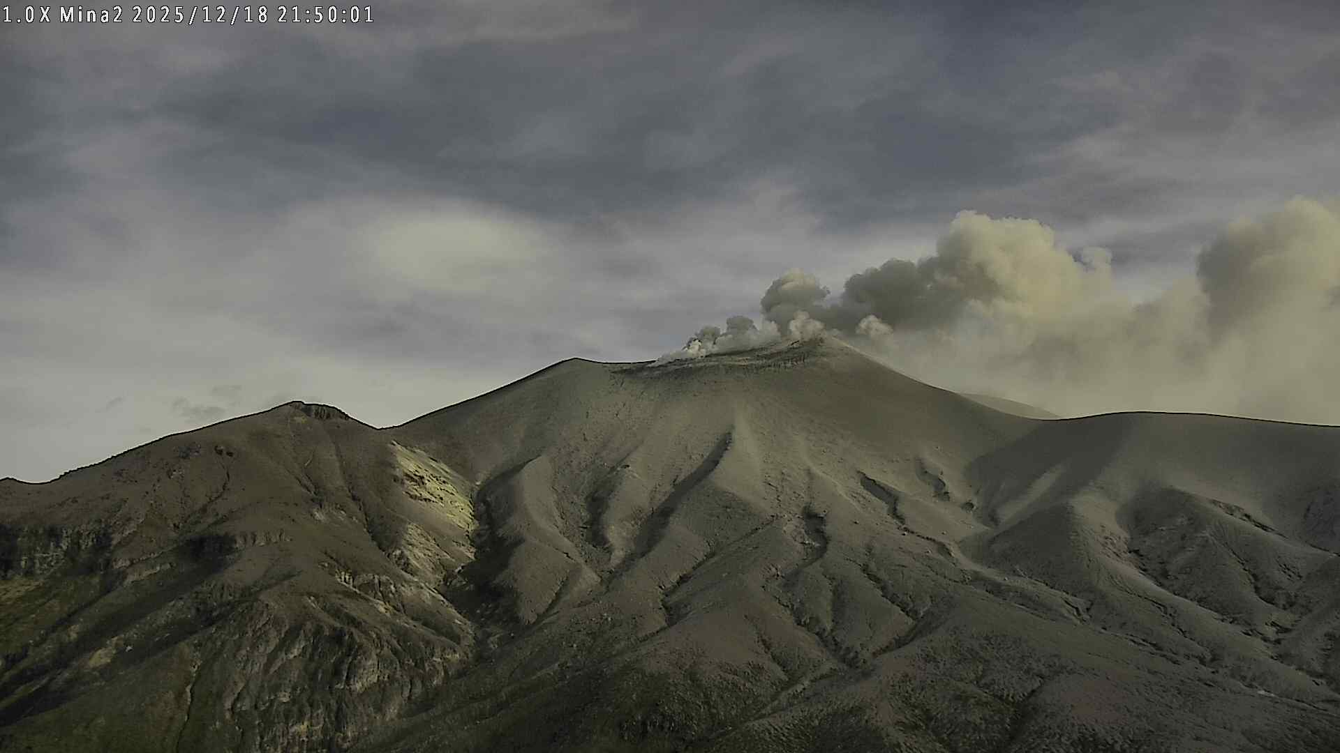
Since the publication of yesterday’s extraordinary bulletin, and continuing to this day, seismic activity related to fluid movements within the volcanic edifice has persisted. This includes long-period (LP) earthquakes, seismic pulses (TR), and continuous tremor. This seismicity, located beneath the Puracé volcano crater at a depth of less than 1 km, is linked to the internal dynamics of gases and their emission into the atmosphere. Some of these seismic signals were associated with ash emissions that dispersed mainly to the Northwest and West, following the wind direction, and reached an altitude of 900 m above the summit of the volcano. In total, four (4) ash emissions were recorded, triggering alerts sent to the Civil Aviation Authority.
In addition, low-magnitude seismic signals associated with rock fracturing have been recorded, primarily beneath the Purace and Piocollo volcanoes, at depths of 1 to 2 km.
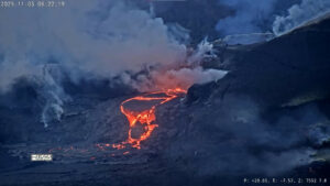
Significant emissions of sulfur dioxide (SO2) into the atmosphere continue to be detected by satellite. Similarly, temperatures comparable to those observed in previous days are still being recorded in the crater area, possibly linked to the emission of hot gases from within the volcano. According to surface activity monitoring of the Curiquinga volcano, continuous degassing continues at the fissure located on the northern wall of the crater’s interior, which began on November 18, 2025, without any ash emissions being observed.
As long as the orange alert remains in effect, temporary fluctuations in volcanic activity are possible, meaning that it may sometimes decrease compared to previous days or weeks. However, this does not necessarily mean that the volcano has returned to a stable level of activity. A return to the yellow alert level (increased stability) requires a reasonable amount of time to assess all monitored parameters and determine any trends indicating such a return.
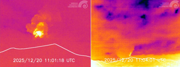
Recordings from the Mina2 and El Púlpito thermal cameras, located 2 km northwest and 6 km south-southwest of the Puracé volcano, respectively. Gas and ash plume recorded at 6:01 a.m. on December 20, 2025.
Given the above, the Colombian Geological Survey (SGC) recommends staying away from the Puracé volcano crater and its surroundings, closely monitoring the situation through special bulletins and information published on our official channels, and following the instructions of local and departmental authorities and the National Unit for Disaster Risk Management (UNGRD).
The volcanic activity level remains at ORANGE alert: Volcano exhibiting significant variations in monitored parameters.
Source et photo : SGC.
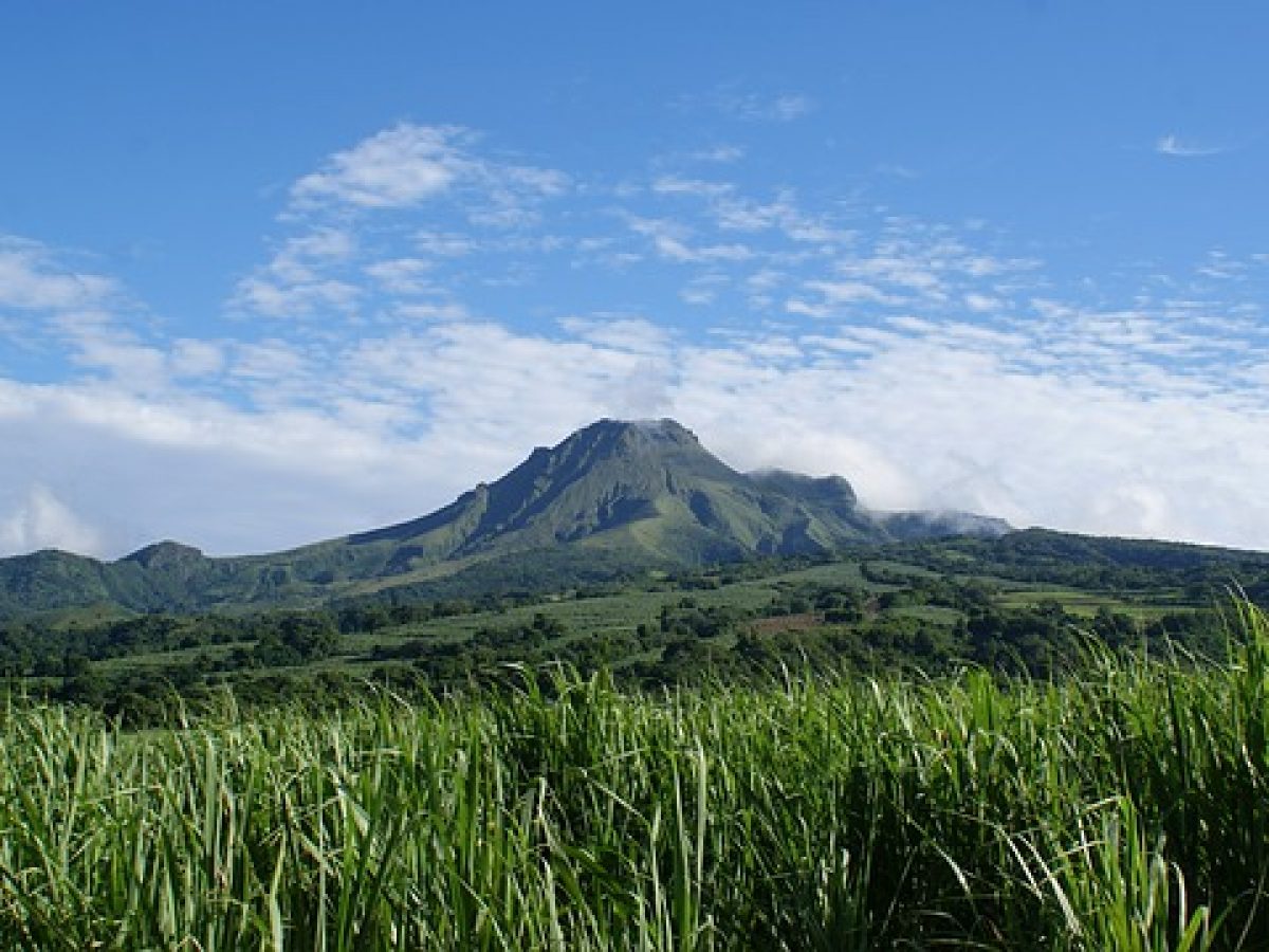
La Martinique Island , Mount Pelée :
Weekly Report. Paris Institute of Earth Physics / Martinique Volcanological and Seismological Observatory
Saint-Pierre, December 19, 2025, 2:30 p.m. local time (GMT-4)
Volcanic activity is slightly increasing this week with 60 volcanic earthquakes observed.
Between December 12, 2025, 4:00 p.m. UTC and December 19, 2025, 4:00 p.m. UTC, the Martinique Volcanological and Seismological Observatory recorded:
• 60 shallow volcano-tectonic earthquakes. Among them, 4 have a magnitude (duration magnitude Md or local magnitude Mlv) greater than 0.5. The largest has a magnitude Mlv of 1.0. The others are of lower energy. These earthquakes originate from the well-known seismically active zones of Mount Pelée, located between 1.0 and 1.4 km below the summit of the volcano.
Shallow volcano-tectonic seismicity is associated with microfracturing within the volcanic edifice, linked to the overall reactivation of the volcano observed since 2019.
No earthquakes have been felt by the population.
The previous week, the OVSM (Swiss Volcanic Observatory) recorded 19 volcanic earthquakes. As of December 19, 2025, and over the past four weeks, the OVSM has therefore observed a total of 124 volcanic earthquakes, an average of 31 earthquakes per week.
During phases of volcanic reactivation of volcanoes similar to Mount Pelée, it is common to observe seismic activity that varies in intensity and frequency. The probability of an eruptive activity in the short term remains low. However, considering all the observations collected since the end of 2018 and their nature, and based on recent observations from the OVSM-IPGP, we cannot rule out a change in the situation in the medium term (weeks, months).
For more details on observations and interpretations of volcanic activity over the longer term, please refer to the OVSM’s monthly bulletins.
The volcanic alert level, in accordance with the measures put in place by the authorities, is currently YELLOW: vigilance.
Source : OVSM-IPGP.
Photo : Antilles prestige
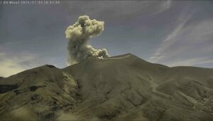
Indonesia , Semeru :
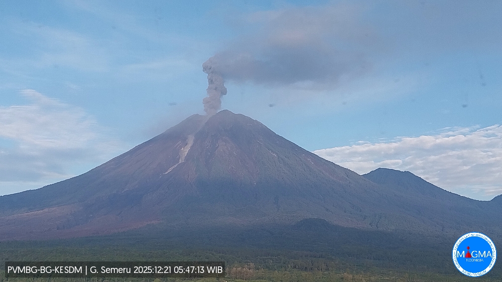
Mount Semeru erupted on Sunday, December 21, 2025, at 5:46 AM WIB. An ash column was observed approximately 1,200 meters above the summit (at an altitude of about 4,876 meters). This ash column, white to gray in color, was of moderate intensity and directed towards the northeast. At the time of writing, the eruption was still ongoing.
VOLCANO OBSERVATORY NOTICE FOR AVIATION – VONA
Issued : December 21 , 2025
Volcano : Semeru (263300)
Current Aviation Colour Code : ORANGE
Previous Aviation Colour Code : orange
Source : Semeru Volcano Observatory
Notice Number : 2025SMR3614
Volcano Location : S 08 deg 06 min 29 sec E 112 deg 55 min 12 sec
Area : East java, Indonesia
Summit Elevation : 11763 FT (3676 M)
Volcanic Activity Summary :
Eruption with volcanic ash cloud at 22h46 UTC (05h46 local).
Volcanic Cloud Height :
Best estimate of ash-cloud top is around 15603 FT (4876 M) above sea level or 3840 FT (1200 M) above summit. May be higher than what can be observed clearly. Source of height data: ground observer.
Other Volcanic Cloud Information :
Ash cloud moving to northeast. Volcanic ash is observed to be white to gray. The intensity of volcanic ash is observed to be medium.
Remarks :
Eruption recorded on seismogram with maximum amplitude 22 mm and maximum duration 132 second.
Source et photo : Magma Indonésie
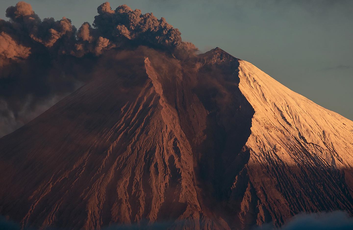
Ecuador , Sangay :
DAILY REPORT ON THE STATE OF SANGAY VOLCANO, Saturday, December 20, 2025.
Geophysical Information Institute – EPN.
Surface Activity Level: Moderate, Surface Trend: No Change
Internal Activity Level: Moderate, Internal Trend: No Change
Seismicity: From December 19, 2025, 11:00 AM to December 20, 2025, 11:00 AM:
Seismicity:
Below is the count of seismic events recorded at the reference station:
Explosion (EXP): 110
Rainfall/Lahars:
Rainfall was recorded in the region, but no lahars were generated. **Heavy rain could remobilize accumulated material and trigger debris-laden mudflows (lahars), which could cascade down the volcano’s flanks and flow into nearby rivers.**
Emissions/Ash Plume:
Due to cloud cover, no gas and/or ash emissions were observed by surveillance cameras or the GOES-19 satellite system. Similarly, the Washington VAAC agency did not issue any emissions reports.
Gas:
The MOUNTS satellite system detected no sulfur dioxide (SO₂).
Other monitoring parameters:
The FIRMS satellite system detected 8 thermal anomalies, while the MIROVA-VIIRS 750 and MIROVA-VIIRS 375 systems each recorded 4.
Note:
From yesterday afternoon until the time of writing this report, the volcano remained shrouded in clouds.
Alert level: Yellow
Source : IGEPN
Photo : #Eqphos_fotografía.( archive )
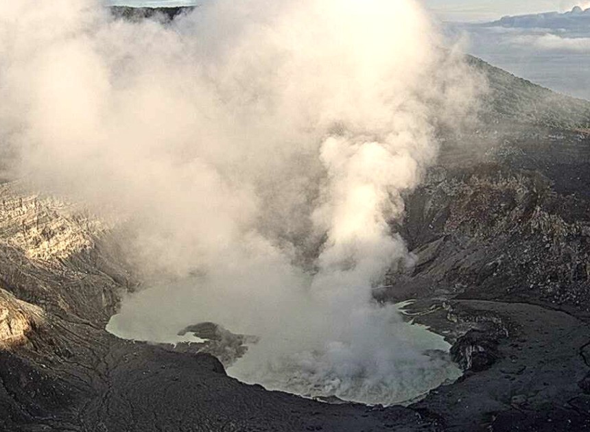
Costa Rica , Poas / Rincon de la Vieja :
Daily Volcanic Activity Bulletin. OVSICORI-UNA, Update: 10:47 AM
Volcano: Poás
Latitude: 10.200
Longitude: -84.233
Altitude: 2,687 m
Observed Activity:
No eruptive activity recorded. The gas flow and composition remain stable. The tremor amplitude is slightly higher than in previous weeks. Slight crater expansion has been recorded.
Environmental Conditions:
Clear skies; southwest wind
Activity Level: Alert (2)
Volcano: Rincón de la Vieja
Latitude: 10.83
Longitude: -85.324
Altitude: 1,916 m
Observed Activity:
A small eruption was recorded last night at 11:18 PM. Shaking remains weak, while deformation is spreading slightly. The SO2 flux has increased slightly in recent days.
Environmental Conditions:
Partly cloudy skies; southwest wind
Activity Level: Alert (2)
Source : Ovsicori
Photo : Poas ( archive ovsicori)