November 1 , 2025.
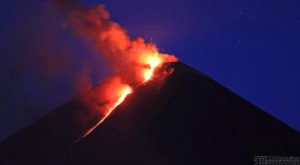
Alaska , Shishaldin :
Signs of volcanic unrest at Shishaldin continued this week. Low-level seismicity is ongoing, with frequent small earthquakes occurring daily. Infrasound signals were detected on several days when wind noise did not obscure them. The infrasound signals are likely caused by gas bubbles bursting through magma deep within the conduit. Sulfur dioxide emissions were detected in satellite data on several days, when clouds did not block views of the volcano.
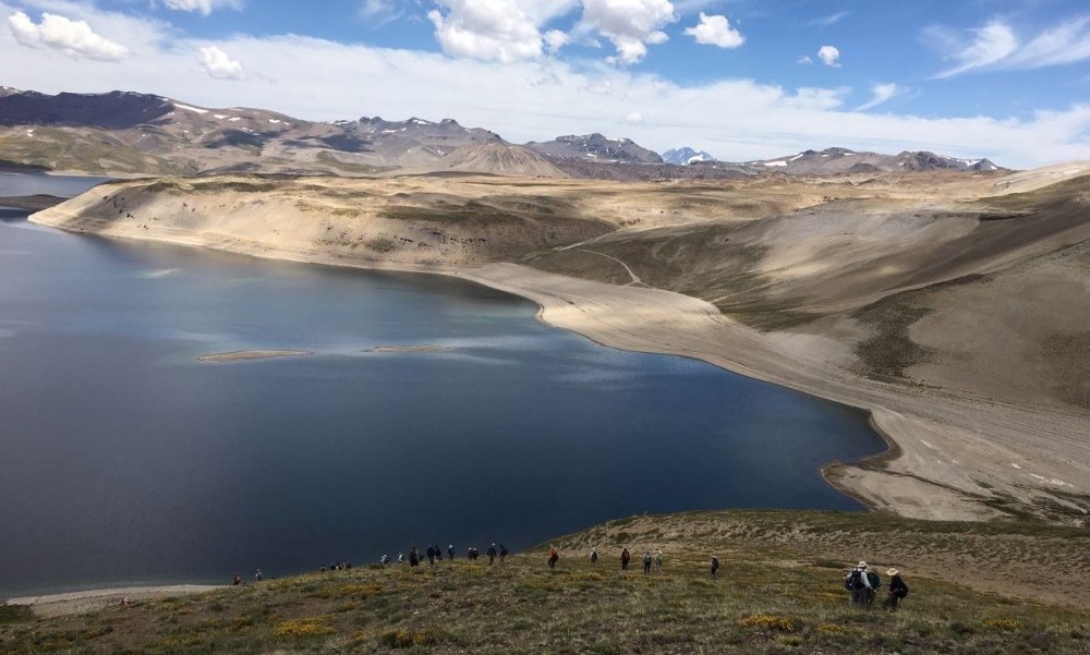
West flank of the Shishaldin Volcano summit viewed during an overflight on August 17, 2025. Steam and gas are venting from the summit crater. The visible notch in the crater formed during the 2023 eruption.
Satellite data show no evidence of elevated temperatures in the summit crater, indicating no lava at or near the surface. A few clear web camera views of the volcano during the week showed steam emissions at the summit.
Shishaldin Volcano is monitored by local seismic and infrasound sensors, web cameras, and a telemetered geodetic network. In addition to the local monitoring network, AVO uses nearby geophysical networks, regional infrasound and lighting data, and satellite images to monitor the volcano.
Source : AVO.
Photo : Loewen, Matt
Chile , Laguna del Maule :
Special Volcanic Activity Report (REAV), Maule Region, Laguna del Maule Volcanic Complex, October 31, 2025, 12:15 PM local time (Continental Chile)
The Chilean National Geology and Mining Service (Sernageomin) announces the following PRELIMINARY information, obtained through the monitoring equipment of the National Volcanic Monitoring Network (RNVV), processed and analyzed at the Southern Andean Volcano Observatory (OVDAS):
On Friday, October 31, 2025, at 11:56 AM (2:56 PM UTC), monitoring stations installed near the Laguna del Maule volcanic complex recorded activity associated with rock fracturing within the volcanic system.
The characteristics of the strongest earthquake after analysis are as follows:
TIME OF ORIGIN: 11:56 local time (14:56 UTC)
LATITUDE: 36.012° S
LONGITUDE: 70.428° W
DEEP: 7.4 km
LOCAL MAGNITUDE: 3.2 (ML)
Observation:
The recurring seismic activity observed at the Laguna del Maule volcanic complex, with volcano-tectonic (VT) events, continues at a moderate to low intensity, without any significant variations.
The volcanic technical alert remains at YELLOW.
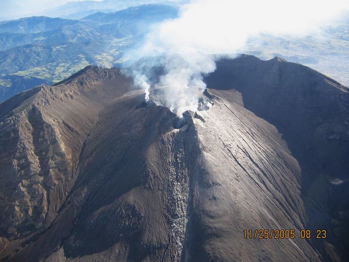
Source : Sernageomin
Photo : auteur inconnu.
Colombia , Galeras :
San Juan de Pasto, October 28, 2025, 5:20 PM
Regarding the monitoring of activity at the Galeras volcano, the Colombian Geological Survey (SGC), an agency under the Ministry of Mines and Energy, reports the following:
During the week of October 21-28, 2025, the main variations in monitored parameters compared to the previous week were as follows:
• An increase in seismic activity and energy release was recorded, although the levels remained low. Seismicity associated with rock fracturing remains predominant.
• Seismicity was primarily localized to two sources. The first source was located within a 1 km radius of the crater of Galeras volcano (4,200 m altitude), with low energy and a shallow depth (less than 2 km). The second source was located northeast of Galeras volcano, at a distance of 18 km. Earthquakes in this area of activity were characterized by greater depth (between 8 and 14 km) and higher magnitude. The largest earthquake of this period (magnitude 3.1) occurred in this area, located northeast of the volcano’s crater, at a depth of 11 km. This earthquake was felt by the population near the volcano’s ripple zone. The remaining seismic activity occurred in this same area.
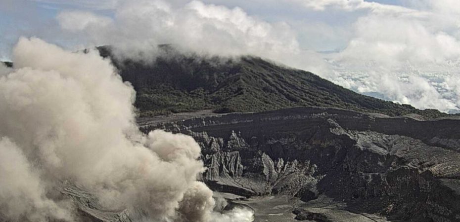
Low-altitude plumes of white gas were observed, primarily originating from the fumarole fields of El Paisita (North) and Las Chavas (West). The dispersion of these plumes varied depending on wind direction and strength.
Other volcanic monitoring parameters showed stability. Given these findings, the Colombian Geological Survey (SGC) recommends closely monitoring the situation by consulting weekly bulletins and other information published through its official channels, as well as instructions from local and departmental authorities and the National Unit for Disaster Risk Management (UNGRD).
Volcanic activity remains at the yellow alert level: active volcano with changes in the baseline behavior of monitored parameters and other manifestations.
Source et photo : SGC.
Costa Rica , Poas :
OVSICORI-UNA Volcanic Monitoring Weekly Bulletin, October 31, 2025
Latitude: 10.20°N
Longitude: 84.23°W
Altitude: 2687 m
Current Activity Level: Alert
This week, the tremor amplitude decreased significantly starting on the 28th. Acoustic tremor remains low in intensity and relatively stable. The number of long-period (LP) events remained high, except for the last 24 hours, when a significant decrease was observed. Following these changes in tremor and LP events, an unusual, high-amplitude, broad-spectral-band seismic-volcanic event lasting 40 seconds was observed today at 06:52 (local time). Cloud cover prevents observation of surface volcanic activity associated with this event. Two distal volcano-tectonic events were recorded.
The geodetic network does not record any significant deformation. A contraction and subsidence of the volcano have been observed.
MultiGAS stations measured an average SO₂/CO₂ ratio of 1.3 ± 0.4 this week, a decrease compared to last week (2.1 ± 0.6). The H₂S/SO₂ ratio has remained very low (< 0.1) in recent weeks. The ExpoGAS station, located at the Visitor Lookout, measured a maximum SO₂ concentration of 6.0 ppm this week, which is high but consistent with values observed in recent weeks. DOAS stations detected a decrease in SO₂ flux (127 ± 94 t/d) compared to the previous week (240 ± 139 t/d). Furthermore, satellite measurements of atmospheric SO₂ showed a slight decrease despite a peak of 458 tonnes of SO₂ on October 24.
The level of the new lake dropped by about 0.4 m this week, but has fluctuated considerably. This surface water body is fed by the heat and chemical components of magmatic and hydrothermal fluids, as well as by rock erosion. Its temperature, measured remotely on October 27, 2025, from the visitor observation deck using a FLIR SC660 thermal imaging camera, is between 70 and 78 degrees Celsius.
Source : Ovsicori .
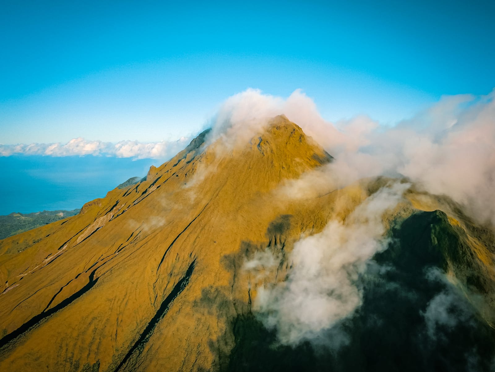
Photo : Ovsicori archive.
La Martinique , Mount Pelée :
Weekly Report, Paris Institute of Earth Physics / Martinique Volcanological and Seismological Observatory
Saint-Pierre, October 31, 2025, 4:30 p.m. local time (GMT-4)
Volcanic activity this week was characterized by 148 observed volcanic earthquakes.
Between October 24, 2025, at 4:00 p.m. UTC and October 31, 2025, at 4:00 p.m. UTC, the Martinique Volcanological and Seismological Observatory recorded:
• 145 shallow volcano-tectonic earthquakes. Among them, 10 had a magnitude (duration magnitude Md or local magnitude Mlv) greater than 0.5. The largest had a magnitude Md = 0.96. The others were of lower energy. These earthquakes were located at depths between 0.8 and 3.7 km below the volcano’s summit. Several of these originate from the well-known seismically active zones of Mount Pelée, located between 1.0 and 1.4 km below the volcano’s summit. This shallow volcano-tectonic seismicity is associated with microfracturing within the volcanic edifice, linked to the overall reactivation of the volcano observed since 2019.
• Three deep, long-period earthquakes. They were located at a depth of approximately 28 km in the vicinity of Mount Pelée, and their local magnitude ranged from Mlv = 0.5 to Mlv = 1.14.
Deep, long-period earthquakes are characterized by signals containing only low frequencies and are associated with the circulation of magmatic fluids deep within the Mount Pelée volcanic system.
No earthquakes were felt by the population.
The previous week, the OVSM (Swiss Volcanic Observatory) recorded 171 volcanic earthquakes. As of October 31, 2025, and over the past four weeks, the OVSM has observed a total of 3,393 volcanic earthquakes, an average of 848 to 849 earthquakes per week.
During periods of volcanic reactivation in volcanoes similar to Mount Pelée, seismic activity of varying intensity and frequency is common. The probability of a short-term eruptive activity remains low. However, considering all the observations collected since the end of 2018 and their nature, and based on recent observations from the OVSM-IPGP (Paris Institute of Earth Observatory), we cannot rule out a change in the situation in the medium term (weeks, months).
For more details on observations and interpretations of volcanic activity over the longer term, please refer to the OVSM’s monthly bulletins.
The volcanic alert level, in accordance with the measures implemented by the authorities, is currently YELLOW: vigilance.
Source : Direction de l’OVSM-IPGP.
Photo : rci.fm