October 28 , 2025.
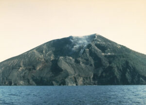
Chile / Argentina , Planchón Peteroa :
The Argentine Geological Mining Survey (SEGEMAR), through its Argentine Volcanic Monitoring Observatory (OAVV), reports that today, Saturday, October 25, 2025, at 6:50 a.m. local time (9:50 a.m. UTC), volcanic monitoring stations installed near the Planchón Peteroa Volcanic Complex recorded an increase in surface activity, characterized by a pulse of gas and fine particle (volcanic ash) emissions that reached 600 m above the crater level, which dispersed in a north-northwest (NNW) direction.
OBSERVATIONS:
Seismological monitoring: At the time of publication of this report, no significant changes in the volcano’s seismic activity have been observed. The energy of the tremor (TR) seismic signal, assessed by real-time seismic amplitude measurement (RSAM), remains at values similar to those observed in recent days.
In the hours preceding the onset of the event, a volcano-tectonic (VT) event was recorded, associated with rock fracturing within the volcano. It occurred at 01:00:12 local time (04:12 UTC). It had a magnitude of 1.9 ML and was located 4.7 km northwest (NW) of the active crater sector, at a depth of 5.5 km.
RSAM (Real-Time Seismic Amplitude) display, associated with the Tremor (TR) seismic signal
Similarly, regarding the recording of seismic activity, mainly associated with fluid dynamics within the volcano (LP and Tremor seismic events), over the past week, there has been a slight decrease in the number of recorded events, although there has been a slight increase in the energy released.
Visual monitoring: Over the past few days, surveillance cameras installed near the volcano have observed the continuous recording of a column of volcanic gas and water vapor emissions, with low columns; this mainly affects the areas near the crater, sometimes with a slightly darker coloration that could indicate particulate matter content.
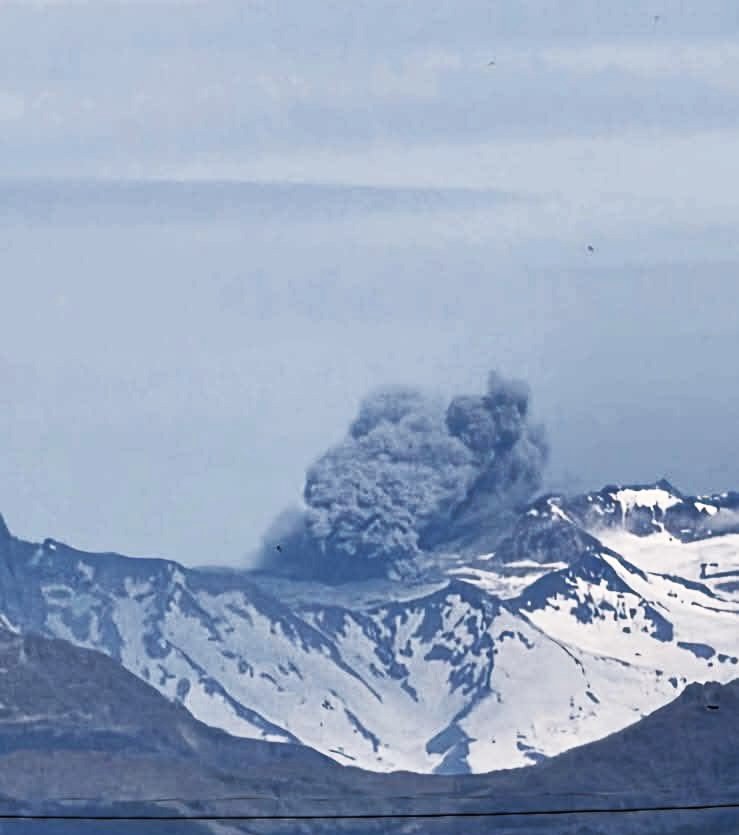
The event recorded in this report began at 6:50 a.m. local time (9:50 a.m. UTC) with a column height reaching 600 m above the crater level, with a predominantly north-northwest (NNW) dispersal direction toward Chilean territory, and which has continued until the time of publication of this report.
Considering the general information presented and previous reports, as well as the reported monitoring information and the current eruptive activity of this volcano, it cannot be ruled out that the system could evolve into higher-energy events, with the recording of low- to moderate-magnitude explosions, which could affect the immediate environment in the area of the active craters.
CONCLUSIONS
The technical alert level remains in place, and monitoring of the volcano will continue in constant communication with the Volcanological Observatory of the Southern Andes (OVDAS) of Chile. Any changes that occur will be reported.
Source et photos : Segemar.
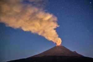
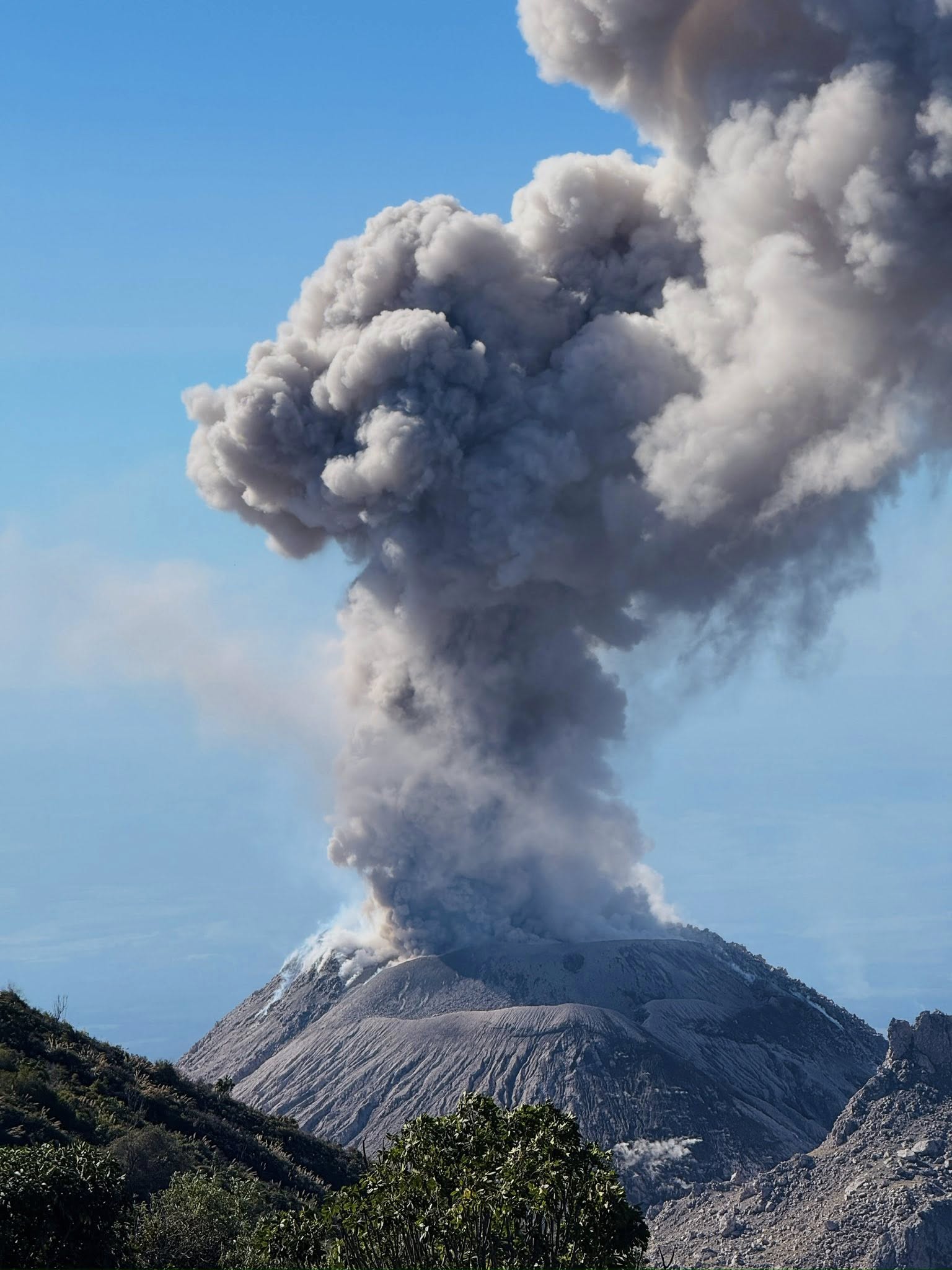
Indonesia , Semeru :
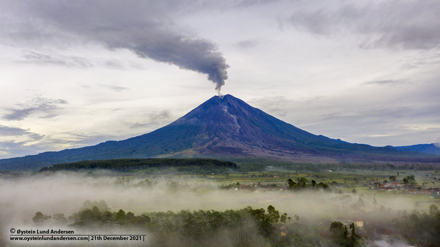
Mount Semeru erupted on Sunday, October 26, 2025, at 5:22 PM (local time). An ash column was observed about 1,000 m above the summit (about 4,676 m above sea level). The ash column, white to gray in color, was dense and extended northward. This eruption was recorded by seismograph with a maximum amplitude of 22 mm and a duration of 140 seconds.
VOLCANO OBSERVATORY NOTICE FOR AVIATION – VONA
Issued : October 26 , 2025
Volcano : Semeru (263300)
Current Aviation Colour Code : ORANGE
Previous Aviation Colour Code : orange
Source : Semeru Volcano Observatory
Notice Number : 2025SMR3174
Volcano Location : S 08 deg 06 min 29 sec E 112 deg 55 min 12 sec
Area : East java, Indonesia
Summit Elevation : 11763 FT (3676 M)
Volcanic Activity Summary :
Eruption with volcanic ash cloud at 10h22 UTC (17h22 local).
Volcanic Cloud Height :
Best estimate of ash-cloud top is around 14963 FT (4676 M) above sea level or 3200 FT (1000 M) above summit. May be higher than what can be observed clearly. Source of height data: ground observer.
Other Volcanic Cloud Information :
Ash cloud moving to north. Volcanic ash is observed to be white to gray. The intensity of volcanic ash is observed to be thick.
Remarks :
Eruption recorded on seismogram with maximum amplitude 22 mm and maximum duration 140 second.
Source : Magma Indonésie.
Photo : Oystein Lund Andersen
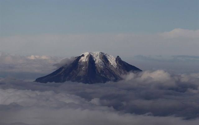
Colombia , Cerro Machin :
Manizales, October 21, 2025, 5:55 p.m.
Regarding the monitoring of the activity of the Cerro Machín volcano, the Colombian Geological Survey (SGC), an entity affiliated with the Ministry of Mines and Energy, reports that:
From October 14 to 20, 2025, seismic activity associated with rock fracturing within the volcanic edifice continued to be recorded. This seismic activity remained at levels similar to those of the previous week, both in terms of the number of events recorded and the seismic energy released. The earthquakes were located beneath the main dome and on the southwest, west-southwest, south, and south-southeast flanks, less than 3 km from the main dome and at depths between 2 and 8 km from the volcano’s summit. The maximum magnitude event of the week occurred on October 19 at 3:32 a.m., with a magnitude of 1.4, beneath the main dome, at a depth of 6 km.
The other parameters measured and used to diagnose volcanic activity did not show any significant changes during the assessment period.
Based on the above, the SGC recommends closely monitoring developments through weekly bulletins and other information published through our official channels, as well as instructions from local and departmental authorities and the National Disaster Risk Management Unit (UNGRD).
The alert status remains unchanged. Yellow: Active volcano with changes in the baseline behavior of monitored parameters and other manifestations.
Source et photo : SGC.
La Guadeloupe , Soufrière :
Preliminary Earthquake Report for Guadeloupe and the Northern Islands
Monday, October 27, 2025, 12:38 UT
Magnitude 6.6, 16.56°N, 59.51°W, depth 32 km
A strong earthquake (magnitude 6.6 ± 0.3) was recorded on Monday, October 27, 2025, at 08:38 (local time) and identified as tectonic. The epicenter was located 168 km east of La Désirade, at a depth of 32 km (a hypocentral distance of approximately 171 km).
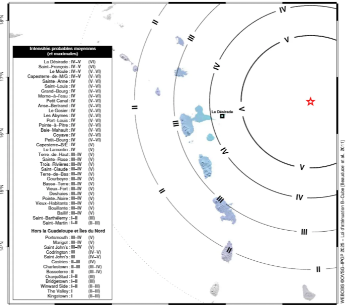
This earthquake may have generated, in the nearest affected areas, an average ground acceleration of 15 mg (*), corresponding to a macroseismic intensity IV-V (widely felt). Depending on the type of soil, the intensities may however have locally reached intensity VI (potential slight damage).
Source : Observatoire Volcanologique et Sismologique de Guadeloupe − IPGP
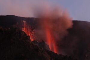
Guatemala , Santiaguito :
Atmospheric Conditions: Clear
Wind: Northeast
Precipitation: 15.8 mm
Activity
Activity is being recorded at the Caliente dome of the Santa María-Santiaguito volcanic complex, with white outgassing reaching up to 500 m above the crater and dispersing southwestward. One or two weak to moderate explosions are observed per hour, generating columns of gas and ash that rise up to 3,500 meters above sea level. These columns move southwestward, causing ashfall on surrounding farms and communities. During the night and early morning, incandescence is observed in the crater, as well as the collapse and descent of incandescent volcanic material toward the flanks.
Due to the high activity, the generation of pyroclastic flows over long distances in different directions cannot be ruled out; it is therefore recommended to follow Special Bulletin BESAN-063-2025. In addition, lahars could descend into the volcano’s various channels in the afternoon and evening, so it is recommended to avoid approaching their channels and follow the recommendations of Special Bulletin BESAN-012-2025.*
Source : Insivumeh.
Photo : ELEVA ixcan / FB .