October 22 , 2025.
Italy , Stromboli :
WEEKLY BULLETIN, from October 13, 2025 to October 19, 2025. (Publication date: October 21, 2025)
ACTIVITY SUMMARY
Monitoring data includes the following:
1) VOLCANOLOGICAL OBSERVATIONS: During this period, Strombolian-type eruptive activity was observed. The total hourly frequency fluctuated between medium (6 events/h) and high (18 events/h). The intensity of the explosions was low and medium in the North Crater area, and low to high in the Central-South Crater area.
2) SEISMOLOGICAL: The monitored seismic parameters show no significant variation.
NOTE: Due to technical issues, the Stromboli seismic network data are frozen at 07:15 UTC on October 14, 2025. Therefore, the information and associated graphs presented below are updated as of October 15.
3) GROUND DEFORMATION: Ground deformation monitoring networks have not shown any significant changes.
4) GEOCHEMISTRY: SO2 fluxes at an average level.
Soil CO2 fluxes in the Pizzo area (STR02) are at medium to high values.
C/S ratio in the plume: No update.
The dissolved helium isotope ratio (R/Ra) in the thermal aquifer is in the high range.
Soil CO2 fluxes in the San Bartolo area: Low.
Soil CO2 fluxes in the Scari area: High.
5) SATELLITE OBSERVATIONS: Thermal activity observed by satellite in the summit area was generally low, with some isolated moderate-level thermal anomalies.
VOLCANOLOGICAL OBSERVATIONS
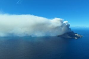
During the observation period, Stromboli’s eruptive activity was characterized by analyzing images recorded by the INGV-OE surveillance cameras located at 190 m (SCT-SCV) and at Punta dei Corvi (SPCT). The explosive activity was mainly produced by five eruptive vents located in the northern area of the crater and by at least two vents located in the central-southern area.
Due to the adverse weather conditions on October 17, visibility of the crater terrace was insufficient to accurately describe the eruptive activity.
Observations of explosive activity captured by surveillance cameras
In the northern (N) crater area, five active vents were observed: two in sector N1 and three in sector N2. These vents produced low-intensity (less than 80 m high) and sometimes medium-intensity (less than 150 m high) explosive activity. The eruptive products were mainly coarse materials (bombs and lapilli). The average explosion frequency ranged from 5 to 13 events per hour.
In the area of the Central-South (CS) crater, two main vents were observed, exhibiting explosions of fine materials mixed with coarse materials, ranging from low to high intensity, respectively.
The average explosion frequency ranged from less than one to 5 events per hour.
Source : INGV
Photo : Stromboli stati d’animo / Sebastiano Cannavo
Colombia , Chiles / Cerro Negro :
San Juan de Pasto, October 21, 2025, 4:50 p.m.
Regarding the monitoring of the Chiles-Cerro Negro Volcanic Complex (CVCCN) activity, the Colombian Geological Survey (SGC), an entity affiliated with the Ministry of Mines and Energy, reports that:
From October 14 to 20, 2025, the main variations in the monitored parameters compared to the previous week were:
● In the fluctuating behavior of seismic activity, a decrease in seismic occurrence and an increase in released energy were recorded. Seismicity associated with rock fracture processes continued to predominate, followed by seismicity related to fluid dynamics.
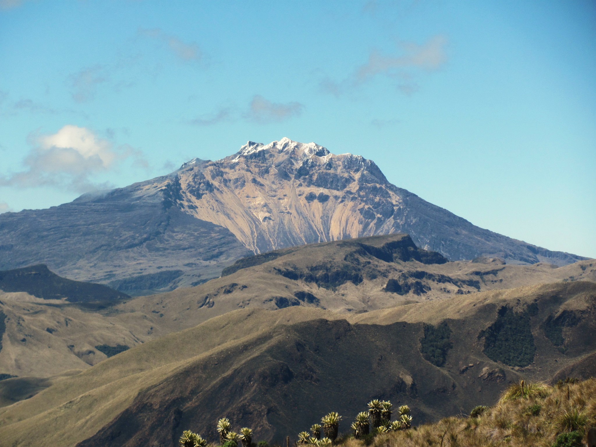
● Most of the earthquakes were concentrated at the summit of Chiles Volcano and on its western and southern flanks, over an area of approximately 3 km, at depths ranging from 0.7 to 5.2 km from the summit (4,700 m above sea level). During this period, 14 earthquakes with a magnitude greater than 2.0 were located. The maximum magnitude, 3.7, was recorded on October 19, 2025, at 1:01 p.m., on the southwest flank of the summit of Chiles Volcano, at a depth of 4 km.
● Analysis of data obtained from satellite sensors and ground stations continues to indicate variations related to deformation processes in the volcanic area.
Based on the assessment and correlation of monitored parameters, the SGC recommends closely monitoring their developments through weekly bulletins and other information published through our official channels, as well as instructions from local and departmental authorities and the National Disaster Risk Management Unit (UNGRD).
Volcanic activity remains on yellow alert: active volcano with changes in the baseline behavior of monitored parameters and other manifestations.
Source et photo : SGC.
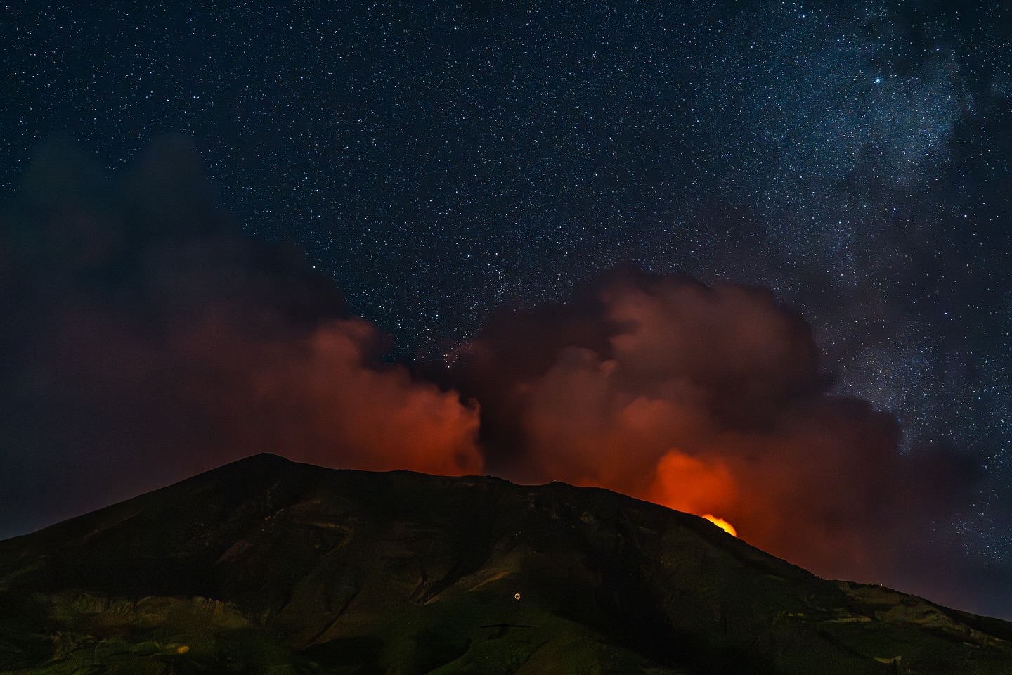
Italy , Vulcano :
MONTHLY BULLETIN, SEPTEMBER 2025
ACTIVITY SUMMARY
Monitoring data highlight the following:
1) Crater fumarole temperature: Crater fumarole temperatures recorded in September are slightly increasing.
2) CO2 flux in the crater area: CO2 flux in the crater area has shown high degassing values over the past month, with a progressively decreasing trend.
3) SO2 flux in the crater area: SO2 flux is at an average and decreasing level.
4) Fumarolic gas geochemistry: CO2 concentrations are slightly decreasing.
5) CO2 flux at the base of La Fossa cone and in the Vulcano Porto area: Monitoring stations at the base of the cone show an increase in CO2 flux.

6) Thermal aquifer geochemistry: In the C. Sicilia well, temperatures are constant, while conductivity decreases slightly. In the Bambara well, a negative trend in the water table and conductivity was recorded in September.
7) Local seismicity: Decrease in the occurrence rate of local microseismicity.
8) Regional seismicity: Low seismicity due to fracturing associated with earthquakes with Ml >= 1.0.
9) Deformations – GNSS: No significant changes in GNSS data.
10) Deformations – Inclinometry: No significant changes.
11) Gravimetry: No updates available during the observation period.
LOCAL SEISMICITY
A decrease in seismic activity associated with hydrothermal fluid dynamics was observed in September. This decrease is reflected in a decrease in the frequency of occurrence of local seismic events, both high frequency (spectral peak above 1 Hz) and low frequency (spectral peak below 1 Hz, mainly VLP type). This phase of decrease had already been observed from the second half of August. Despite this downward trend, the rate of occurrence of events remains higher than the levels recorded during the months preceding the seismic increase phase of early August.
Source et photo : INGV Vulcani
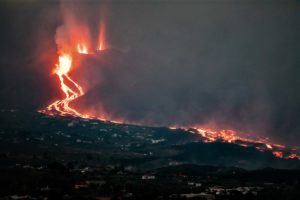
Costa Rica , Poas :
Latitude: 10.2
Longitude: -84.233
Altitude: 2,687 m
Observed Activity:
This Monday at 7:47 p.m., a small eruption was recorded, ejecting incandescent material up to 100 m high and a column of gas and water vapor up to 500 m above the crater. However, no precursor signs of the eruption were observed. No significant changes were observed in the seismic or acoustic signals. The background tremor is still present, stable, and of low intensity. The CO₂/SO₂ and H₂S/SO₂ ratios of the emitted gases are stable.
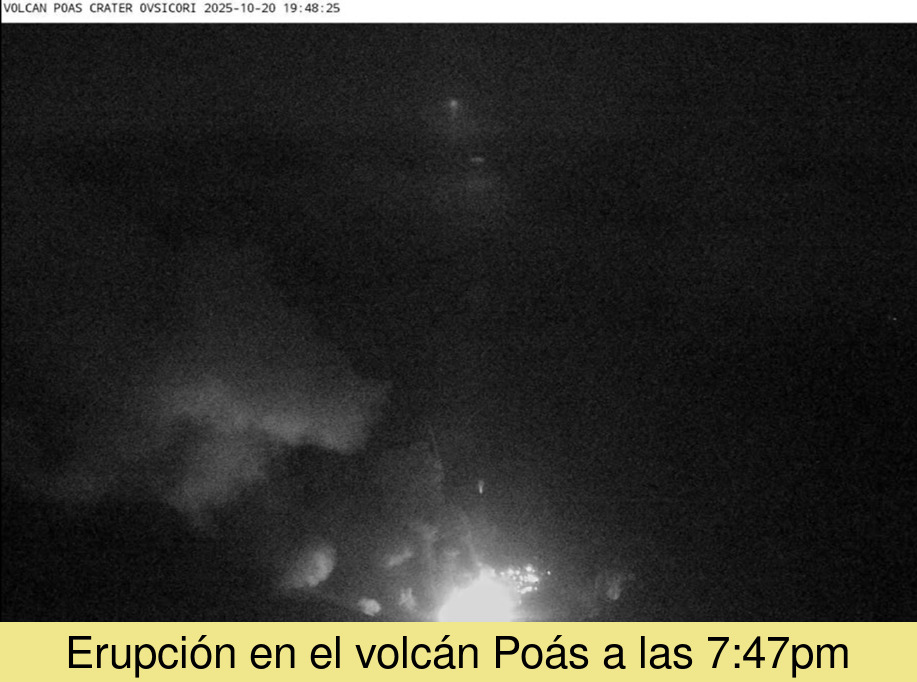
A small eruption was recorded, ejecting incandescent material up to 100 m high and a column of gas and water vapor up to 500 m above the crater.
Activity Level: Warning (2)
Source et photo : Ovsicori
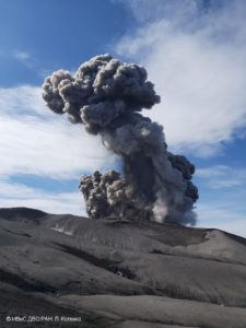
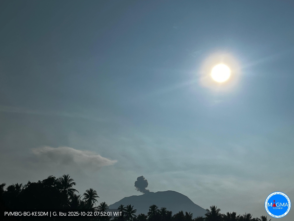
Indonesia , Ibu :
Mount Ibu erupted on Wednesday, October 22, 2025, at 7:48 a.m. (local time). An ash column was observed about 400 m above the summit (about 1,725 m above sea level). The ash column was white to gray in color, with a moderate to thick intensity, oriented northeast. This eruption was recorded by seismograph with a maximum amplitude of 28 mm and a duration of 49 seconds.
Seismic Observations
78 eruptive earthquakes with amplitudes ranging from 14 to 28 mm and durations ranging from 34 to 76 seconds.
3 emission earthquakes with amplitudes ranging from 4 to 11 mm and durations ranging from 32 to 52 seconds.
17 harmonic tremors with amplitudes ranging from 2 to 20 mm and durations ranging from 34 to 189 seconds.
118 low-frequency earthquakes with amplitudes ranging from 2 to 10 mm and durations ranging from 17 to 29 seconds.
225 shallow volcanic earthquakes with amplitudes ranging from 2 to 8 mm and durations ranging from 7 to 21 seconds.
3 local tectonic earthquakes with amplitudes ranging from 2 to 4 mm and durations ranging from 27 to 31 seconds.
25 distant tectonic earthquakes with amplitudes ranging from 2 to 28 mm and lasting from 32 to 153 seconds.
Recommendation
Residents of the vicinity of Mount Ibu and visitors/tourists are advised to avoid all activity within a 2 km radius and within a 3.5 km radius of the crater opening, in the northern part of the active crater of Mount Ibu.
In the event of ashfall, people engaging in outdoor activities are advised to wear a mask and protective eyewear.
Source et photo : Magma Indonésie .