October 12 , 2025.
Alaska , Great Sitkin :
Friday, October 10, 2025, 12:04 PM AKDT (Friday, October 10, 2025, 20:04 UTC)
52°4’35 » N 176°6’39 » W,
Summit Elevation 5709 ft (1740 m)
Current Volcano Alert Level: WATCH
Current Aviation Color Code: ORANGE
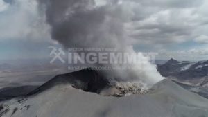
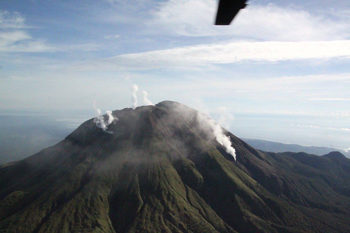
Lava continues to erupt at Great Sitkin Volcano. Satellite observations from earlier this week show continued growth of the lava dome to the southwest, south, and southeast. The flow front continues to advance up to a few meters per day. Elevated surface temperatures were also observed from the active lava dome and rockfalls from the steep flow margins are building a debris field in front of the flow. All activity remains confined within the summit crater. Occasional small earthquakes and signals related to these rockfalls continue to be detected in seismic data.
A close up view of the summit crater of Great Sitkin, taken from the air. The currently growing lava flow is steaming in places.
The current lava eruption began in July 2021 and has filled most of the summit crater and advanced into valleys below. There have been no explosions at Great Sitkin Volcano since an event in May 2021. The volcano is monitored using local seismic and infrasound sensors, satellite data and web cameras, and regional infrasound and lightning networks.
Great Sitkin Volcano is a basaltic andesite volcano that occupies most of the northern half of Great Sitkin Island, a member of the Andreanof Islands group in the central Aleutian Islands. It is located 26 miles (42 km) east of the community of Adak. The volcano is a composite structure consisting of an older dissected volcano and a younger parasitic cone with a ~1 mile (1.6 km)-diameter summit crater. A steep-sided lava dome, emplaced in the crater during an eruption in 1974, has been mostly buried by the ongoing eruption. The 1974 eruption produced at least one ash cloud that likely exceeded an altitude of 25,000 ft (7.6 km) above sea level. A poorly documented eruption also occurred in 1945, producing a lava dome that was partially destroyed in the 1974 eruption. Within the past 280 years a large explosive eruption produced pyroclastic flows that partially filled the Glacier Creek valley on the southwest flank.
Source : AVO.
Photo : McConnell, Angela.
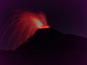
Philippines , Bulusan :
BULUSAN VOLCANO ADVISORY , 12 October 2025 , 09:00 AM
This is a notice of the increase in seismic activity at Bulusan Volcano.
A total of seventy-two (72) volcanic earthquakes were recorded by the Bulusan Volcano Network (BVN) since 12:00 AM of 11 October 2025. These volcano-tectonic (VT) earthquakes are associated with rock fracturing and are occurring at depths less than 10 kilometers beneath the northern sector of the volcano. Degassing activity from the active vents ranged from very weak to weak when the volcano was visible for the past days. Sulfur dioxide or SO2 emission was recorded at an average of 31 tonnes/day, measured on 09 October 2025. This is below the baseline of 200 tonnes/day. These parameters indicate shallow hydrothermal activity beneath the volcano.
Alert Level 1 (low-level unrest) is maintained over Bulusan Volcano, but presently there are increased chances of steam-driven or phreatic eruptions occurring from the crater and/or its active vents on the summit that could occur suddenly and without warning. Local government units and the public are reminded that entry into the 4-kilometer radius Permanent Danger Zone (PDZ) must be strictly prohibited and that vigilance in the 2-kilometer Extended Danger Zone (EDZ) on the southeast sector must be exercised due to the possible impacts of volcanic hazards such as pyroclastic density currents or PDCs, ballistic projectiles, rockfall, avalanches, ashfall and others on these danger areas. Communities that experience ashfall must take all necessary precautions and use protective masks or wet cloth to prevent ash inhalation, with special attention given to vulnerable persons including the elderly, persons with respiratory or cardio-vascular diseases, expecting mothers and infants. Civil aviation authorities must also advise pilots to avoid flying close to the volcano’s summit as ash from any sudden phreatic eruption can be hazardous to aircraft. Furthermore, people living within valleys and along river/stream channels especially on the western sectors of the edifice should be vigilant against sediment-laden stream flows and lahars in the event of heavy and prolonged rainfall should phreatic eruption occur.
DOST-PHIVOLCS is closely monitoring Bulusan Volcano’s condition, and any new development will be relayed to all concerned.
Source et photo : Phivolcs.
Ecuador , Sangay :
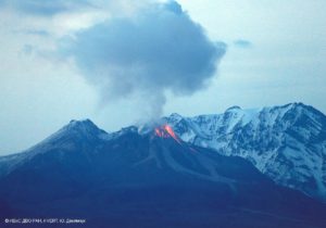
DAILY STATUS REPORT OF SANGAY VOLCANO, Saturday, October 11, 2025.
Information Geophysical Institute – EPN.
Surface Activity Level: Moderate, Surface Trend: No Change
Internal Activity Level: Moderate, Internal Trend: No Change
Seismicity: From October 10, 2025, 11:00 a.m. to October 11, 2025, 11:00 a.m.:
Seismicity:
Below is the count of seismic events recorded at the reference station.
Explosion (EXP): 40
Rainfall/Lahars:
No rainfall was recorded in the volcanic area. **Heavy rainfall could remobilize accumulated material, generating mud and debris flows that would cascade down the volcano’s flanks and flow into adjacent rivers**.
Emission/Ash Column:
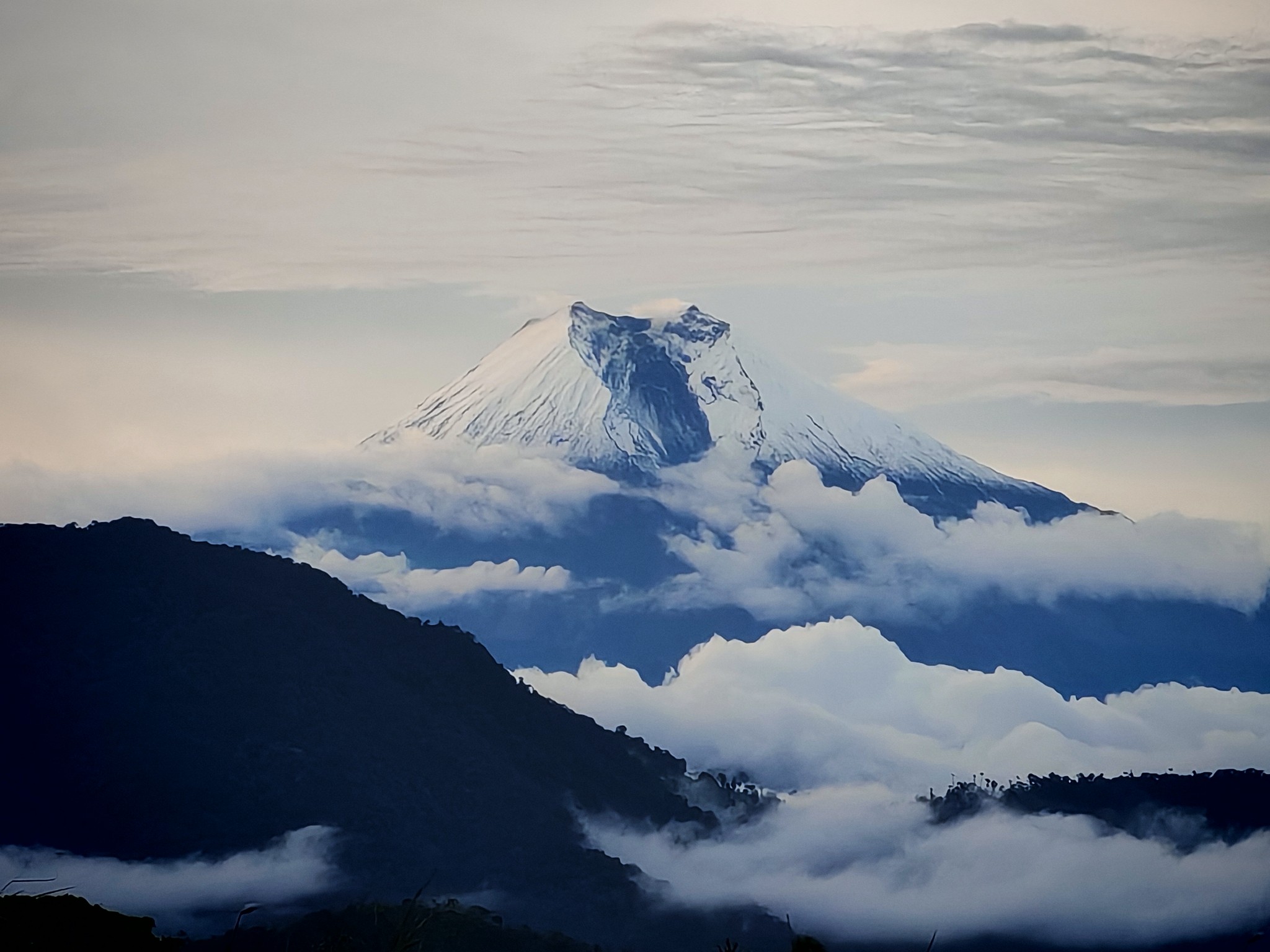
Due to weather conditions, no gas or ash emissions could be observed by surveillance cameras. Furthermore, the Washington VAAC agency generated an emission report from 1,100 meters above the crater level in a northwesterly direction.
Observation:
From yesterday afternoon until the closing of this report, the volcano remained completely cloudy.
Alert Level: Yellow
Source : IGEPN
Photo : Fabricio Cadena Gómez/ Volcan Sangay / FB.
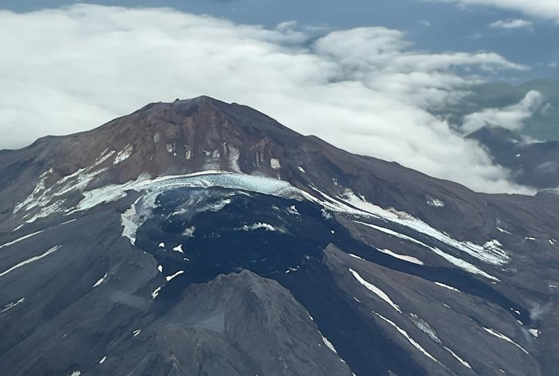
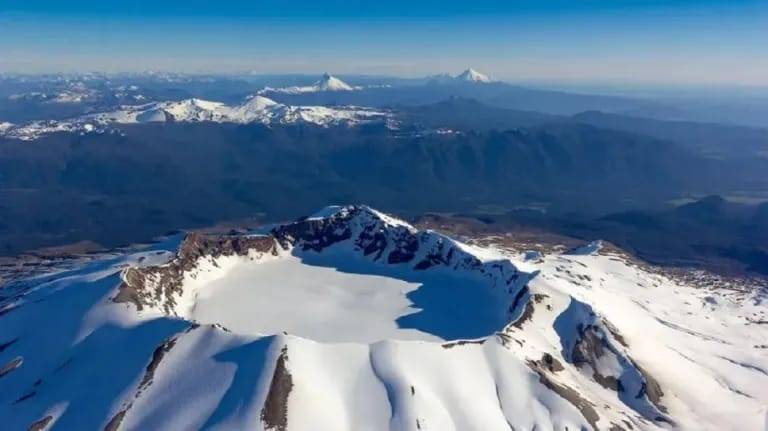
Chile , Puyehue / Cordon Caulle :
Seismology
Seismological activity during this period was characterized by:
220 VT-type earthquakes, associated with rock fracturing (volcano-tectonics). The most energetic earthquake, with a local magnitude (LM) of 2.8, was located 4.2 km to the south-southwest and at a depth of 5.2 km from the 2011 emission center.
Three LP-type earthquakes, associated with fluid dynamics within the volcanic system (Long Period). The magnitude of the strongest earthquake, assessed by the reduced displacement (RD) parameter, was 6 cm².
Fluid Geochemistry
No anomalies in sulfur dioxide (SO₂) emissions into the atmosphere have been reported in the area near the volcanic complex, according to data published by the Tropospheric Monitoring Instrument (TROPOMI) and the Sulfur Dioxide Group of the Ozone Monitoring Instrument (OMI).
Geodesy
Deformation monitoring carried out over the period indicates:
– A continuation of the inflationary process in the graben area, northwest of the 2011 emission center, with an increase in uplift rates compared to the previous period, but similar to that observed over the rest of 2025, reaching a maximum of 2.0 cm/month.
– A continuation of the deflationary process in the area of the 2011 emission center, recorded by the stations installed in this area, indicates deflation values greater than –3.0 cm/month during this period, which is considered a high magnitude.
The data suggest two sources of deformation generated by different processes: one, located in the graben area, responds to magma injection processes deeper into the crust, and the other, around the 2011 emission center, is due to the loss of gas and temperature from a more superficial body located in this area. The observations reflect the continuity of both processes, with some seasonal variations, without significant alterations.
Satellite Thermal Anomalies
During this period, low-power thermal anomalies were recorded in the area where the laccolith (an intrusion of magmatic rocks that forms parallel to the surrounding rock, deforming the upper layer) is located, northeast of the 2011 emission center. These anomalies recorded a maximum volcanic radiant power (VRP) of 1.1 MW on September 24 and 25, according to data processed by the VIIRS 750 and VIIRS 375 sensors of the Mid-Infrared Volcanic Activity Observation Platform (MIROVA). Images from the Sentinel 2-L2A and Landsat 8-9 satellites did not detect any significant radiance anomalies in the volcanic complex.
The volcanic complex continues to exhibit activity similar to that observed over the previous two weeks. Deformation processes—inflationary in the graben area and deflationary near the 2011 emission center—continue at similar rates. This deformation is accompanied by low-energy volcanic seismicity, the variations of which are within the limits considered normal for the volcanic system.
During the assessment period, under the yellow volcanic technical alert, no signs of evolution toward a more intense state of activity were observed, suggesting the stability of the system.
Consequently, the volcanic technical alert has been modified to:
GREEN TECHNICAL ALERT: Active volcano with stable behavior – No immediate risk
Source : Sernageomin .
Photo : bariloche2000.
Colombia , Galeras :
San Juan de Pasto, September 30, 2025, 3:21 p.m.
Regarding the monitoring of the activity of the Galeras Volcano, the Colombian Geological Survey (SGC), an entity attached to the Ministry of Mines and Energy, reports that:
During the week of September 30 to October 6, 2025, the main variations in the monitored parameters compared to the previous week were:
● A slight increase in seismic activity and a decrease in energy release were recorded compared to the previous week. Seismicity associated with rock fracturing remains predominant.
● Regarding seismicity, two groups can be distinguished. In the first, the events were located close to the main crater, at distances less than 1.0 km, at depths less than 2.0 km from the summit of Galeras (4,200 m above sea level) and with magnitudes less than 0.4. The second group of earthquakes was located scattered throughout the volcanic edifice within a radius of 15 km, with depths between 4.0 and 12 km, and a maximum magnitude of 1.1.
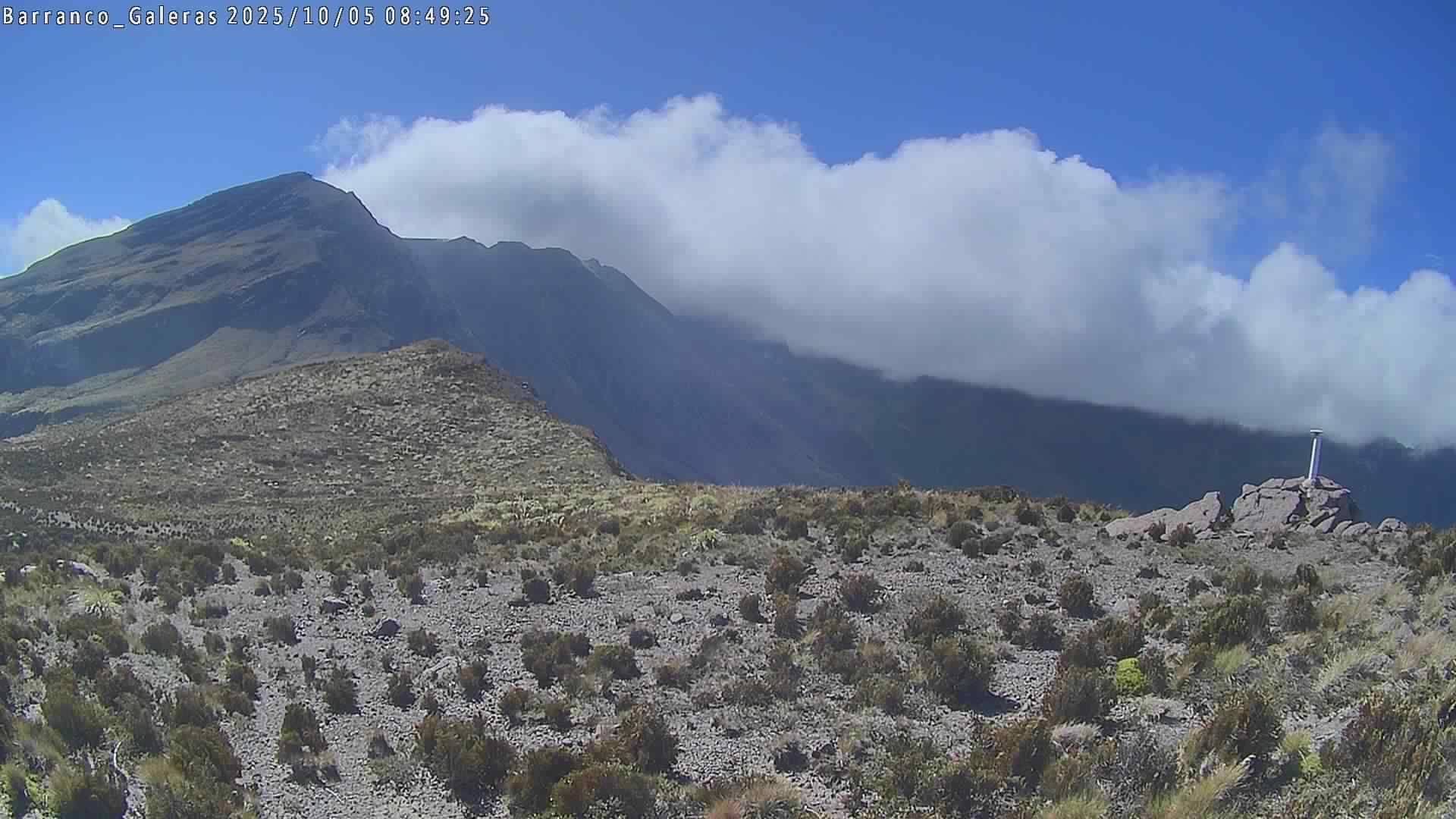
● Low gas emissions were observed, mainly from the fumarole fields of El Paisita, to the north, and Las Chavas, to the west of the active cone. The plumes were white in color, with variable dispersion influenced by wind direction and speed.
● Other volcanic monitoring parameters showed stability.
In view of the above, the SGC recommends closely monitoring developments through weekly bulletins and other information published through our official channels, as well as instructions from local and departmental authorities and the National Disaster Risk Management Unit (UNGRD).
Volcanic activity remains on yellow alert: active volcano with changes in the baseline behavior of monitored parameters and other manifestations.
Source et photo : SGC.