August 16 , 2025.
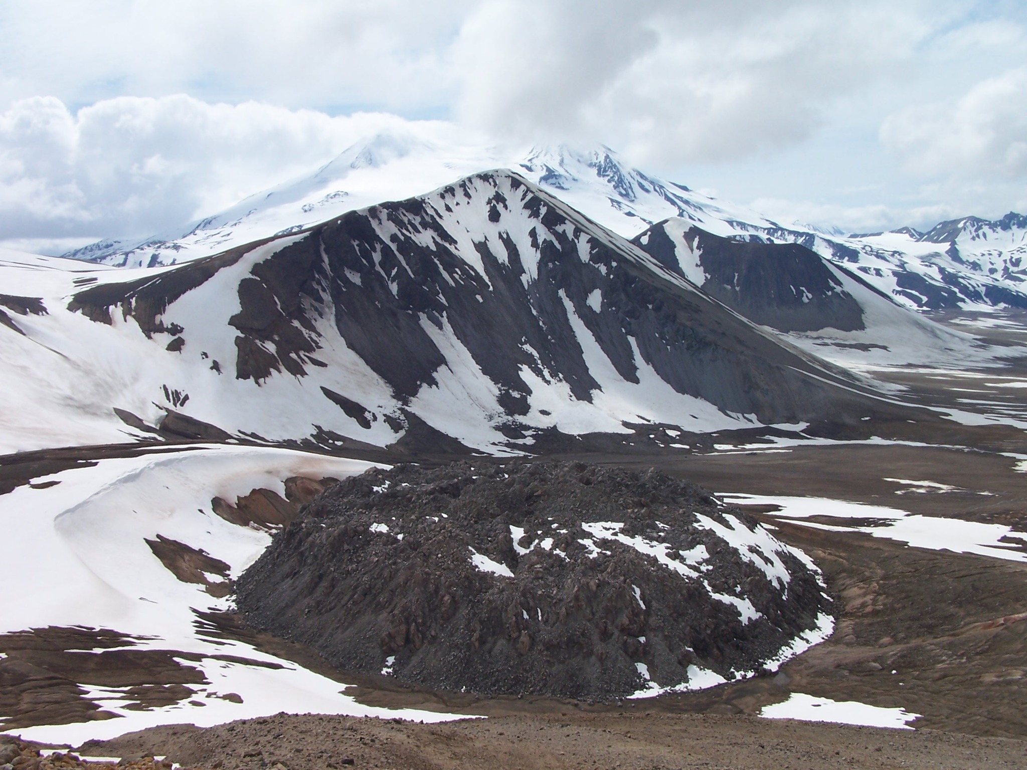
Italy / Sicily , Etna :
Etna Activity Statement, August 15, 2025, 4:46 PM (14:46 UTC).
The National Institute of Geophysics and Volcanology, Osservatorio Etneo, announces that analysis of surveillance and satellite camera images, as well as volcanological observations, indicates that the lava flow fed by the eruptive vent located at an estimated altitude of approximately 2,980 meters above sea level, is still active (see Statement No. 3 of August 14, 2025). More precisely, at 8:00 GMT today, the lava flow had an estimated extension of approximately 500 meters and was spreading southward. The most advanced front was located at an altitude of approximately 2,770 meters. Moderate explosive activity continues in the Southeast Crater, with variable intensity, with episodic production of ash that disperses rapidly in the summit area.
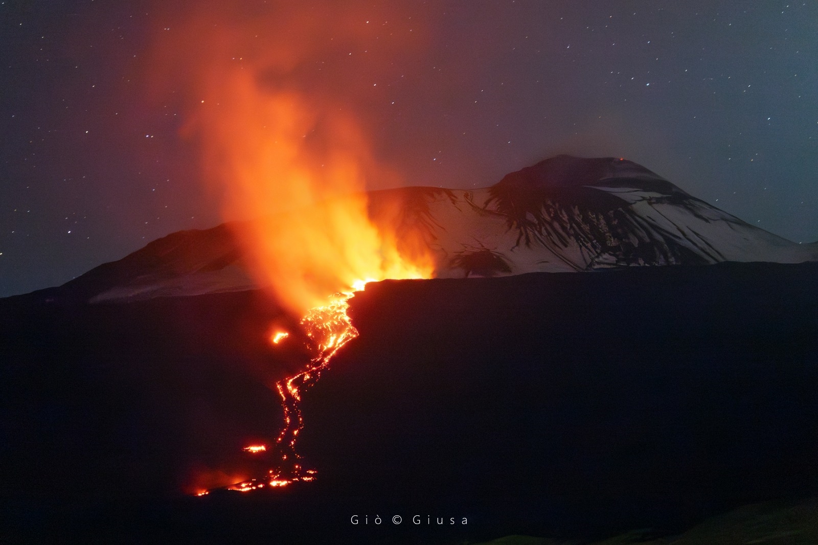
Volcanic tremor remained average, with strong fluctuations, only rarely reaching slightly elevated values. The sources are located between 2,800 and 3,000 meters above sea level, in an area between the Southeast and Northeast craters. Infrasound activity is moderate, with events located in the Southeast and Northeast craters; in both cases, their amplitude is low. The counting and location of infrasound events can be affected by meteorological conditions. Signals from ground deformation monitoring networks show no significant variation.
New information will be communicated shortly.
Source : INGV
Photo : Gio Giusa .
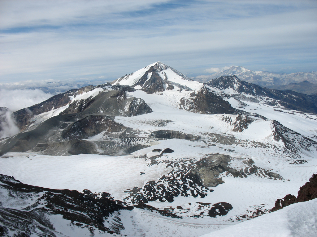
Alaska , Katmai :
ALASKA VOLCANO OBSERVATORY INFORMATION STATEMENT , U.S. Geological Survey
Friday, August 15, 2025, 1:32 PM AKDT (Friday, August 15, 2025, 21:32 UTC)
58°16’44 » N 154°57’12 » W,
Summit Elevation 6716 ft (2047 m)
Current Volcano Alert Level: NORMAL
Current Aviation Color Code: GREEN
Strong northwesterly winds in the vicinity of Katmai and the Valley of Ten Thousand Smokes have picked up loose volcanic ash erupted during the 1912 Novarupta-Katmai eruption and are carrying it to the southeast toward Kodiak Island. The National Weather Service has issued a SIGMET for this low-level event and suggests that the maximum cloud height is 6,000 ft (1.8 km) above sea level.
This phenomenon is not the result of recent volcanic activity and occurs during times of high winds and dry snow-free conditions in the Katmai area and other young volcanic areas of Alaska. No eruption is in progress. All of the volcanoes of the Katmai area (Griggs, Katmai, Novarupta, Mageik, Martin, Snowy and Trident) remain at Aviation Color Code GREEN and Alert Level NORMAL. Resuspended volcanic ash should be considered hazardous and could be damaging to aircraft and health.
Source : AVO
Photo : P. Izbekov, AVO/UAF-GI. USGS, DGGS .
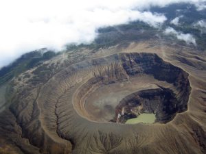
Chile , Planchon Peteroa :
Seismology
Seismological activity during this period was characterized by:
69 VT-type earthquakes, associated with rock fracturing (volcano-tectonics). The most energetic earthquake, with a local magnitude (LM) of 2.6, occurred 9.2 km south-southwest of the volcanic edifice, at a depth of 0.8 km.
7,476 LP-type earthquakes, associated with fluid dynamics within the volcanic system (Long Period). The magnitude of the largest earthquake, evaluated using the reduced displacement (RD) parameter, was 17 cm².
2,760 TR-type earthquakes, associated with sustained fluid dynamics within the volcanic system (TRemor). The magnitude of the largest earthquake, evaluated using the reduced displacement (RD) parameter, was 8 cm².
Two VLP-type earthquakes were associated with the dynamics of large fluid volumes within the volcanic system (Very Long Period). The magnitude of the largest earthquake, estimated using the reduced displacement (RD) parameter, was 3 cm².
Satellite Thermal Anomalies
In July, no thermal anomalies attributable to volcanic activity were recorded for the volcanic complex, according to the Mid-Infrared Volcanic Activity Observation, reported by MIROVA. No other thermal radiance anomalies were identified from the analytical processing of Sentinel 2-L2A satellite images, using false-color band combinations.
Geodesy
Geodetic activity for the period was characterized by:
– GNSS vertical deformation rates with magnitude variations of less than 0.3 cm/month, a value considered low.
– Horizontal deformation rates at GNSS monitoring stations vary by approximately 0.4 cm/month, a value considered low.
– Radar interferometry (InSAR) of Sentinel 1A (Single Look Complex-SLC) images shows no signs of deformation due to poor coherence caused by the high presence of snow in the area.
Therefore, no significant changes associated with the deformation of the volcanic system are observed.
Surveillance cameras
Images provided by the fixed camera installed near the volcanic complex recorded degassing events at a maximum altitude of 40 m above crater level on July 24, 2025.
The Planchón-Peteroa volcanic complex remains active above its base level. Seismicity associated with fluid dynamics (PL and tremor) continues to be recorded, with occurrence and energy characteristics similar to those previously reported. It is hypothesized that this activity could be due to heat transfer from deeper levels, activating the hydrothermal system, a hypothesis supported by the characteristics of the source of this seismic activity and by evidence of increased degassing at the surface. Although other monitoring parameters remain stable, this type of behavior preceded previous eruptive cycles, characterized primarily by ash emissions.
In light of the above, the Volcanic Technical Alert remains in effect:
YELLOW TECHNICAL ALERT: Changes in volcanic activity behavior
Source et photo : Sernageomin .
Colombia , Nevado del Ruiz :
Manizales, August 12, 2025, 3:10 p.m.
Regarding the monitoring of the activity of the Nevado del Ruiz volcano, the Colombian Geological Survey (SGC), an entity attached to the Ministry of Mines and Energy, reports that:
During the week of August 5 to 11, 2025, the volcano continued to exhibit unstable behavior. Compared to the previous week, the main variations in the monitored parameters were:
– Seismicity related to fluid dynamics in volcanic conduits increased in number and in the seismic energy released, particularly seismic events associated with ash emissions and long-duration signals, which had not been recorded since the first week of June. The energy levels of the seismic signals were mostly low, sometimes moderate. Thanks to the cameras used for visual surveillance of the volcano (conventional or thermographic), as well as reports from SGC personnel working in the field and officials of the Nevados National Natural Park (PNN), several pulsed ash emissions and variations in the apparent temperature of the emitted materials were confirmed, associated with this seismic activity.

– Seismic activity associated with rock fracturing processes within the volcanic edifice increased the number of recorded earthquakes and the seismic energy released. The earthquakes were mainly located in the Arenas Crater, in the south-southwest and east sectors, at distances of up to 6 km from the crater. To a lesser extent, seismic activity was recorded on the northeast, northwest, and southeast flanks, within a radius of 11 km around the crater. The depth of the earthquakes ranged from less than 1 km to 8 km from the volcanic summit. The earthquake that occurred on August 8 at 10:16 a.m., with a magnitude of 1.6, was the largest of the week. It was located in the Arenas Crater, at a depth of 2 km.
– The emission of water vapor and gases, mainly sulfur dioxide (SO₂), into the atmosphere through the Arenas crater varied throughout the week. Estimated SO₂ degassing flux values decreased slightly compared to those recorded the previous week.
– The vertical height of the gas, water vapor, and ash column generally remained below the 500 m measured above the volcano’s summit and reached a maximum height of 1,200 m. During dispersal, the column reached 1,600 m. This value was estimated during the ash emission recorded on August 8 at 1:56 a.m. During the week, the direction of dispersion varied, but the preferred direction was toward the northwest flank of the volcano. Consistent with this dispersion direction and the strong winds in the region, ashfall was reported on August 6 and 9 in the Valle de las Tumbas, Brisas, and Lunares sectors, in the P.N.N.N. zone, and on August 10 in the municipality of Manizales (Caldas department).
– Monitoring of thermal anomalies at the floor of the Arenas crater using satellite monitoring platforms allowed continued detection for several days, limited by persistent cloudy skies in the volcanic area. However, some low-energy anomalies were reported.
Source et photo : SGC.
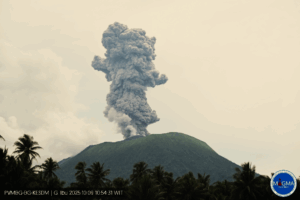
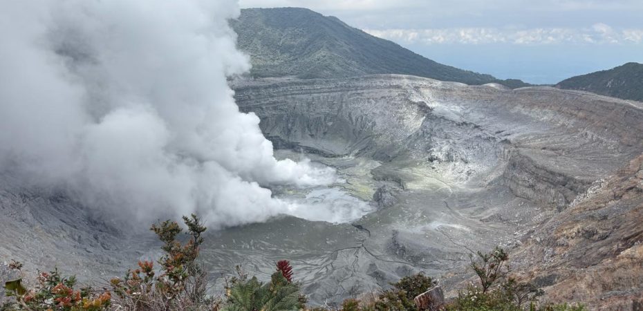
Costa Rica , Poas :
OVSICORI-UNA Weekly Volcano Monitoring Bulletin, August 14, 2025
Latitude: 10.20°N;
Longitude: 84.23°W;
Altitude: 2,687 m (8,687 ft)
Current Activity Level: Alert
This week, a small eruption was recorded at Boca A on August 8 at 8:50 pm.
This eruption was characterized by low ash emissions and projections of ballistic rocks (boulders or bombs) reaching a horizontal height of 50 to 100 m from the mouth. Given the persistent significant gas and heat flux at Boca A, as well as recent phreatomagmatic activity, a large and sudden eruption cannot be ruled out, even in the absence of precursor signals, and could affect the visited areas of the national park (e.g., projections of ballistic rocks towards the viewpoint). Level 2 (alert) does not exclude ballistic events in the visited areas. Any phase of activity carries a residual risk. The amplitude of seismic tremors remains low, with no significant change in recent weeks.
Weak acoustic tremors from Vent A are also recorded, with little variation. The number of long-period events remains similar to that of the previous week. This week, five proximal tectonic earthquakes were recorded, located on the southwest flank of Botos Cone, 0.5 km below sea level, and a deeper earthquake (4 km) was recorded on the eastern flank of Von Frantzius Cone. In recent weeks, the volcano has been subsiding. MultiGAS stations measured an average SO2/CO2 ratio of 1.5 ± 0.3 this week, similar to last week’s. The H2S/SO2 ratio has remained very low (< 0.1) in recent weeks.
Based on the observed sources, it is interpreted that the gases originate from a surface magmatic source. DOAS stations measured an SO2 flux of 431 ± 40 t/d, slightly higher than the previous week’s (371 ± 46 t/d). Satellite measurements of atmospheric SO2 show a significant decline since early July.
The lagoon level at Boca C remains stable.
Source et photo : Ovsicori.