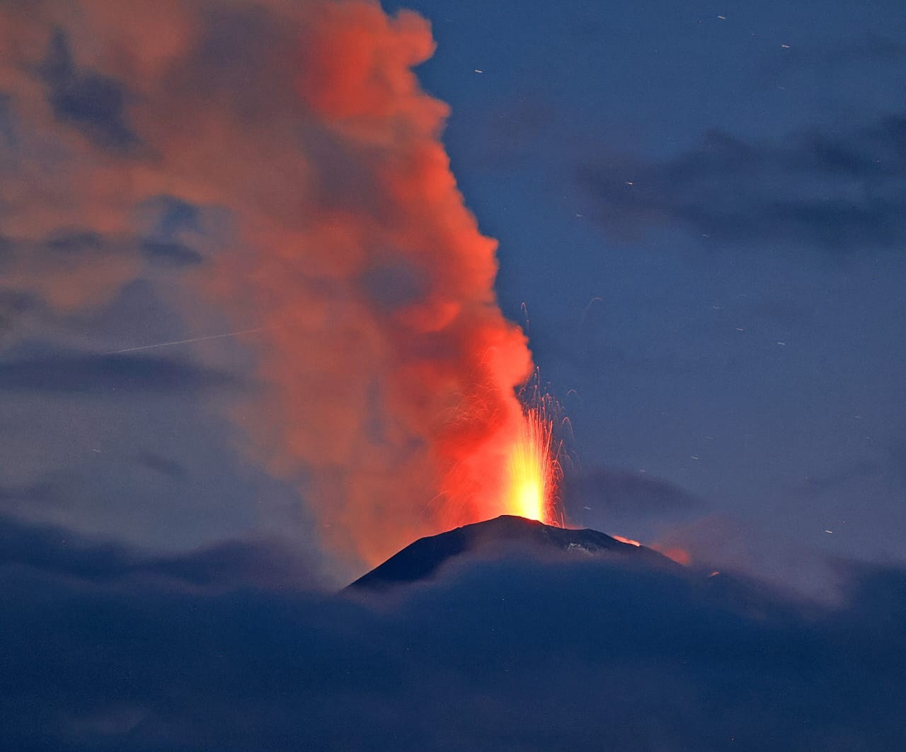
August 10 , 2025.
Kamchatka , Klyuchevskoy :
VOLCANO OBSERVATORY NOTICE FOR AVIATION (VONA)
Issued: August 10 , 2025
Volcano: Klyuchevskoy (CAVW #300260)
Current aviation colour code: RED
Previous aviation colour code: red
Source: KVERT
Notice Number: 2025-62
Volcano Location: N 56 deg 3 min E 160 deg 38 min
Area: Kamchatka, Russia
Summit Elevation: 4750 m (15580 ft)
Volcanic Activity Summary:
A summit explosive-effusive eruption of the volcano continues. Activity of the volcano has decreased slightly, but remains high. Satellite data by KVERT showed explosions sent ash up to 11 km a.s.l., and ash plume is extending for 500 km to the north-east of the volcano. A move of lava flows and ash emission from summit crater of the volcano continues.
A summit explosive-effusive eruption of the volcano continues. Ash explosions up to 15 km (49,200 ft) a.s.l. could occur at any time. Ongoing activity could affect international and low-flying aircraft.
Volcanic cloud height:
11000 m (36080 ft) AMSL Time and method of ash plume/cloud height determination: 20250810/0043Z – NOAA-20 15m16
Other volcanic cloud information:
Distance of ash plume/cloud of the volcano: 500 km (311 mi)
Direction of drift of ash plume/cloud of the volcano: NE / azimuth 35 deg
Time and method of ash plume/cloud determination: 20250810/0150Z – Himawari-9 14m15
Source : Kvert .
Photo : Vulcaniya
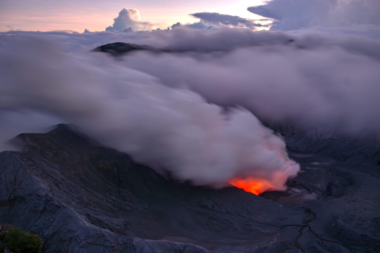
Costa Rica , Poas :
Date: 08/08/2025 Time: 20:56
Observed Activity:
Low-energy eruption with emission of moderate amounts of ash and incandescent rock blocks, which fell near Vent A, inside the active crater.
The volcanic plume turned gray due to the ash load, and the ash was dispersed by westerly winds near the ground.
Between May and August 2025, Poás Volcano passively released a significant flow of gas and heat, mainly through Vent A, with sporadic eruptions of small amounts of ash and ballistic projections. Between March and mid-May 2025, activity was explosive, with frequent emissions of ash, gas, and ballistic projections.
Latitude: 10.2
Longitude: -84.233
Altitude: 2,687 m
Observed Activity:
Seismographs and infrasound sensors recorded another low-energy eruption last night, August 8, 2025, with the release of moderate amounts of ash and abundant water vapor and magmatic gases. The eruption ejected hot rock fragments that fell near Mouth A. This eruption occurred at very shallow depth. Poás seismographs recorded three volcano-tectonic (VT) earthquakes yesterday in the region south of the Botos volcanic cone. VT earthquakes were also recorded in the Platanar-Porvenir-Viejo volcanic complex.
The ExpoGAS gas sensor, located at the visitor observation point south of the crater, detected a maximum concentration of 1 ppm in the ambient air today. On August 7, 2025, the SENTINEL satellite first detected the Boca A thermal anomaly at the bottom of the Poás crater, with improved resolution thanks to weather conditions and perfectly clear skies. On August 8, SENTINEL detected a mass of 270 tons of SO2. Last night, August 8, the National Emergency Commission was able to remotely measure the temperature of Boca A using a drone, exceeding 800 degrees Celsius. This high temperature indicates the presence of a magmatic body near the surface. The outgassing of water vapor, gases, and aerosols, as well as the heat flux, remain at high levels to this day.
Environmental conditions:
At the summit of Poás, the wind blows predominantly westward.
Niveau d’activité : Alerte (2)
Source : Ovsicori .
Photo : RSN ( archive)
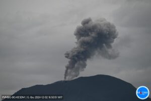
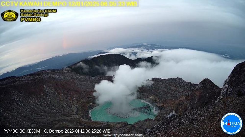
Indonesia , Dempo :
SPECIAL REPORT ON THE ERUPTION OF DEMPO VOLCANO, SOUTH SUMATRA, AUGUST 7, 2025, 9:38 PM WIB
Dempo Volcano is an active volcano. This stratovolcano rises to an altitude of 3,173 meters. Volcanic activity is currently concentrated in the Marapi crater.
An eruption of Dempo Volcano occurred on August 7, 2025, at 9:38 PM WIB. An ash column was observed, reaching approximately 1,200 meters above the summit (approximately 4,373 meters above sea level). The ash column was gray and thick, oriented toward the north. This eruption was recorded on a seismogram with a maximum amplitude of 30 mm and a duration of approximately 3 minutes and 59 seconds.
The Geological Survey released a special report on the increase in volcanic earthquakes on Mount Dempo on July 10, 2025, during which volcanic activity reached a rate of four events per day. These deep volcanic earthquakes were recorded on July 8 and 9, 2025, with a magnitude of 0.76 to 1.05 and a duration of 4.4 to 4.8 km below the summit of Mount Dempo.
Seismic monitoring from July 25 to August 7, 2025, recorded one eruption earthquake, three emission earthquakes, three low-frequency earthquakes, three deep volcanic earthquakes, four local tectonic earthquakes, one felt earthquake on the MMI II scale, nine distant tectonic earthquakes, and continuous tremors with amplitudes of 0.5 to 1 mm, mainly 0.5 mm. Deep volcanic seismicity since July 8, 2025, has been quite high, followed by local tectonic earthquakes leading to the eruption on August 7, 2025, at 9:38 PM WIB.
Observations of the deformation of Mount Dempo using GNSS methods over a two-week period indicate an inflationary trend in the volcano’s body. Tiltmeter deformation data for the week preceding the eruption also indicate an inflationary trend. This indicates the migration of magma from the depths to the surface since early July 2025.
Visual monitoring of Mount Dempo from July 25 to August 7, 2025, showed that the mountain was clearly visible until it was covered by fog. No crater smoke was observed. On clear days, the water in the Marapi crater lake on Mount Dempo was green and gray.
Eruptions at Mount Dempo are characterized by phreatic eruptions, which can occur suddenly without obvious volcanic symptoms. Based on analysis of visual and instrumental data, Mount Dempo’s activity level remains at Level II (Alert). The public, visitors and tourists are advised to avoid approaching the centre of activity, the Marapi Crater, or spending the night there, within a radius of 1 km and 2 km around the northern opening of the crater, due to the risk of phreatic eruptions and potentially fatal volcanic gases.
Source : PVMBG
Photo : Archive Magma Indonésie .( 12/2025)
Colombia , Galeras :
San Juan de Pasto, August 5, 2025, 3:50 p.m.
Regarding the monitoring of the activity of the Galeras Volcano, the Colombian Geological Survey (SGC), an entity affiliated with the Ministry of Mines and Energy, reports that:
During the week of July 29 to August 4, 2025, the main variations in the monitored parameters compared to the previous week were:
• A slight decrease in seismic activity was recorded, while the energy released increased, characterized by the predominance of seismic activity associated with rock fracturing within the volcanic edifice.
• The recorded seismic activity was scattered throughout the volcanic edifice at distances of up to 7.0 km and at depths between 2 and 7 km from the summit of Galeras (4,200 m above sea level), with a maximum magnitude of 1.6.
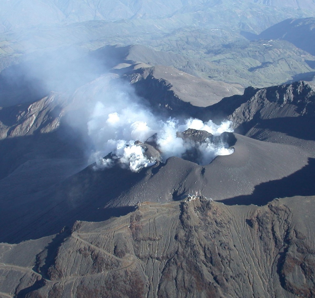
• Low gas emissions were observed, mainly from the fumarole fields of El Paisita, to the north, and Las Chavas, to the west of the active cone. The plumes were characterized by a white color with variable dispersion influenced by wind direction.
• Other volcanic monitoring parameters remained stable.
In view of the above, the SGC recommends closely monitoring their evolution through weekly bulletins and other information published through our official channels, as well as instructions from local and departmental authorities and the National Disaster Risk Management Unit (UNGRD).
Volcanic activity remains on yellow alert: active volcano with changes in the baseline behavior of monitored parameters and other manifestations.
Source et photo : SGC.
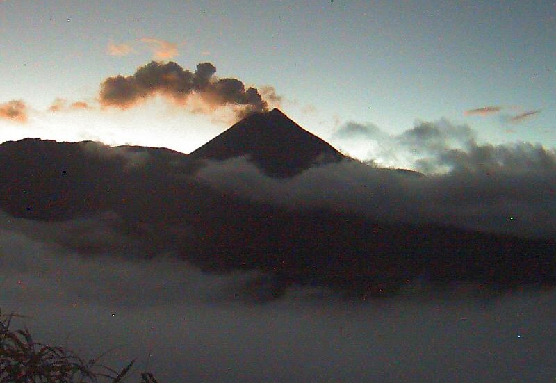
Ecuador , El Reventador :
DAILY STATUS REPORT OF REVENTADOR VOLCANO, Saturday, August 9, 2025.
Information Geophysical Institute – EPN.
Surface Activity Level: High, Surface Trend: No change
Internal Activity Level: Moderate, Internal Trend: No change
From August 8, 2025, 11:00 a.m. to August 9, 2025, 11:00 a.m.:
Seismicity:
Below is the count of seismic events recorded at the reference station.
Explosion (EXP) 102
Long Period (LP) 8
Emission Tremor (TREMI) 9
Harmonic Tremor (TRARM) 2
Rainfall/Lahars:
Yesterday afternoon, rain fell in the volcanic area, but did not generate mudflows or debris flows. **Heavy rains could remobilize accumulated material, generating mudflows and debris flows that would cascade down the volcano’s flanks and flow into adjacent rivers.**
Plume Emissions/Ash:
Over the past 24 hours, several gas and ash emissions were observed by surveillance cameras, reaching heights between 400 and 1,000 meters above the crater, in northwest, north-northwest, and northeast directions. Regarding this activity, the Washington VAAC has issued two reports of ash plumes reaching heights between 710 and 1,010 meters above the crater, in a northwest direction.
Observation:
Last night and early this morning, several episodes of incandescent material falling up to 1,000 meters below the crater level were recorded along the southeast and east-southeast flanks. The volcano remained partly cloudy to completely cloudy.
Alert Level – SGR: Orange
Source : IGEPN
Photo : archive igepn