April 12 , 2025.
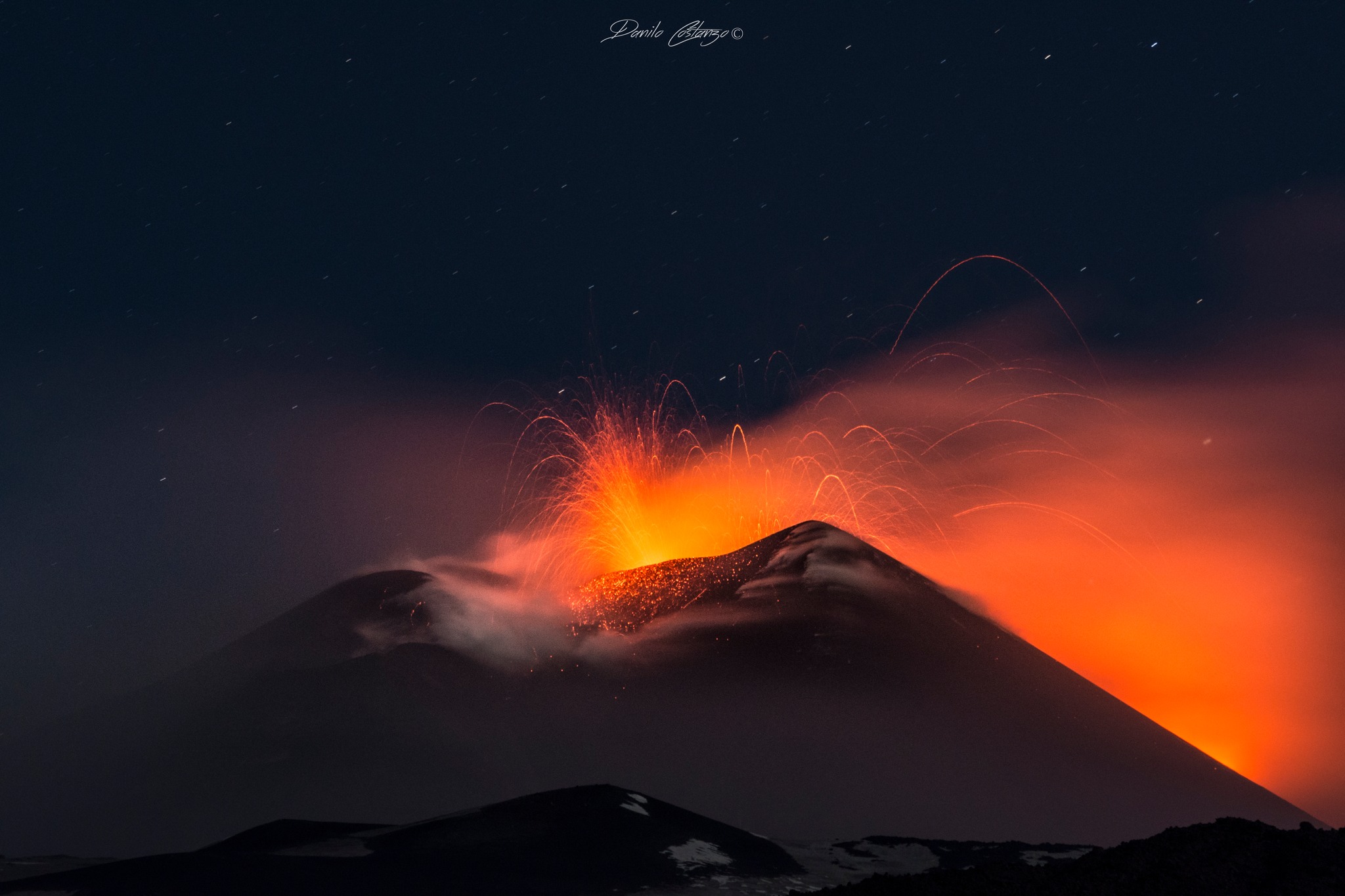
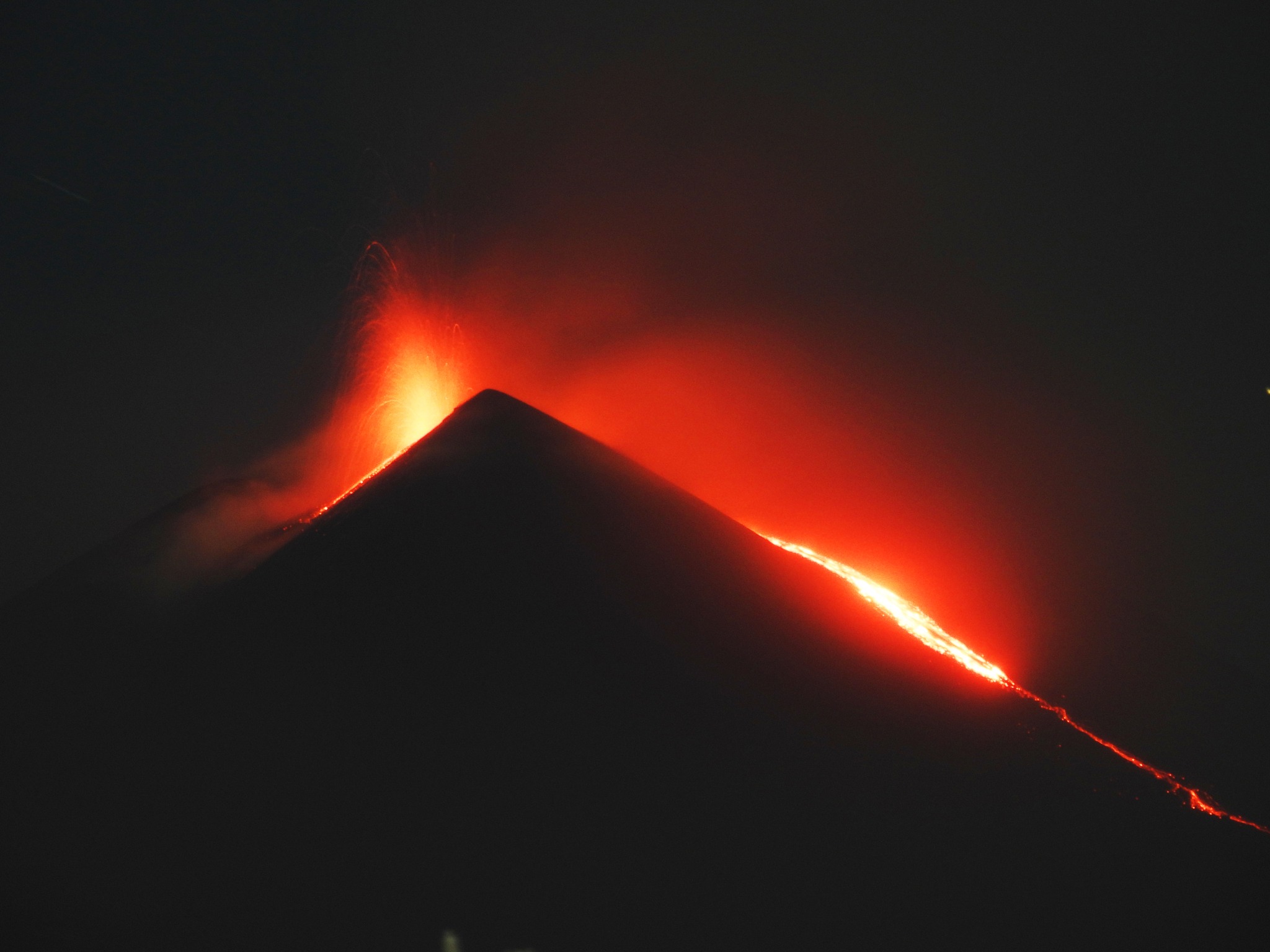
Italy / Sicily , Etna :
Etna Activity Update, April 11, 2025, 3:56 PM (1:56 PM UTC)
The National Institute of Geophysics and Volcanology, Osservatorio Etneo, reports that due to weather conditions, it is not possible to observe the summit area and therefore detect the onset of ongoing activity. The forecast model indicates that any eruption clouds would disperse in a southeasterly direction.
Volcanic tremor from 9:30 AM UTC showed a steady increase, reaching high levels around 1:30 PM and continuing to increase. The location of the tremor sources corresponds to the Southeast Crater, at an altitude of approximately 2,900 meters above sea level. Infrasound activity is located in the Southeast Crater. Deformation monitoring observation systems do not detect significant variations.
Etna Activity Update, April 11, 2025, 4:20 PM (2:20 PM UTC)
The Etna Observatory of the National Institute of Geophysics and Volcanology reports that surveillance cameras are observing Strombolian activity in the Southeast Crater. The forecast model indicates that any eruption clouds would disperse in a southeasterly direction.
Volcanic tremor from 9:30 AM UTC showed a continuous increase, reaching high values around 1:30 PM and continuing to increase. The location of the tremor sources corresponds to the Southeast Crater, at an altitude of approximately 2,900 meters above sea level. Infrasound activity is localized in the Southeast Crater.
Observation systems monitoring deformation do not detect any significant variations.
Etna Activity Statement, April 11, 2025, 6:52 PM (16:52 UTC)
The National Institute of Geophysics and Volcanology, Osservatorio Etneo, reports that Strombolian activity continues in the Southeast Crater with moderate ash emission. In the event of an increase in eruptive activity, the forecast model indicates that the potential volcanic cloud would disperse in a southeasterly direction.
From a seismic perspective, compared to the previous statement, volcanic tremor has shown a continued increase with high values. The location of the tremor sources remains in the Southeast Crater at an altitude of approximately 2,900 meters above sea level. Infrasound activity has shown an increase in recent hours and is located in the Southeast Crater. The signals recorded by the deformation monitoring observation systems (clinometer networks and GNSS) do not detect any significant variations.
Etna Activity Report, April 11, 2025, 11:59 PM (9:59 PM UTC)
The National Institute of Geophysics and Volcanology, Osservatorio Etneo, reports that surveillance cameras are observing a lava flow originating from the overflow of the Southeast Crater, while Strombolian activity fueled by the same crater continues with varying rates and intensity.
From a seismic perspective, the volcanic tremor showed a decreasing phase after 5:30 PM UTC, but remained at high values. The location of the tremor sources remains in the Southeast Crater at an altitude of approximately 9,000 feet (2,900 meters) above sea level; infrasound activity has shown a marked decrease in recent times.
Regarding deformations, the inclinometer and GNSS networks do not show any significant variations. Since the start of today’s activity, the DRUV dilatometer station has recorded a modest and gradual decompression of approximately 10 nanostrains.
Further updates will be provided shortly.
Source : INGV
Photos : Danilo Costanzo, Boris Behncke .
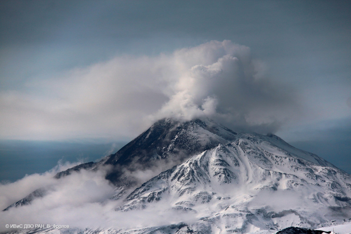
Kamchatka , Bezymianny :
VOLCANO OBSERVATORY NOTICE FOR AVIATION (VONA)
Issued: April 09 , 2025
Volcano: Bezymianny (CAVW #300250)
Current aviation colour code: ORANGE
Previous aviation colour code: orange
Source: KVERT
Notice Number: 2025-16
Volcano Location: N 55 deg 58 min E 160 deg 35 min
Area: Kamchatka, Russia
Summit Elevation: 2882 m (9452.96 ft)
Volcanic Activity Summary:
An effusive eruption of the volcano continues, accompanied by gas and steam emissions. However, the number of hot avalanches is gradually increasing. KVERT satellite data shows an intense thermal anomaly above the volcano. The volcano is likely preparing for a strong explosive eruption. KVERT continues to monitor Bezymianny Volcano. Effusive activity at Bezymianny Volcano is gradually intensifying. The volcano is likely preparing for a strong explosive eruption. Ash explosions could occur at any time, up to 10-15 km altitude. The ongoing activity could affect international and low-flying aircraft.
Volcanic Cloud Height:
NO ASH CLOUD PRODUCED
Other Volcanic Cloud Information:
NO ASH CLOUD PRODUCED
Source : Kvert ru
Photo : , V. Frolov. IVS FEB RAS
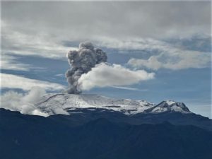
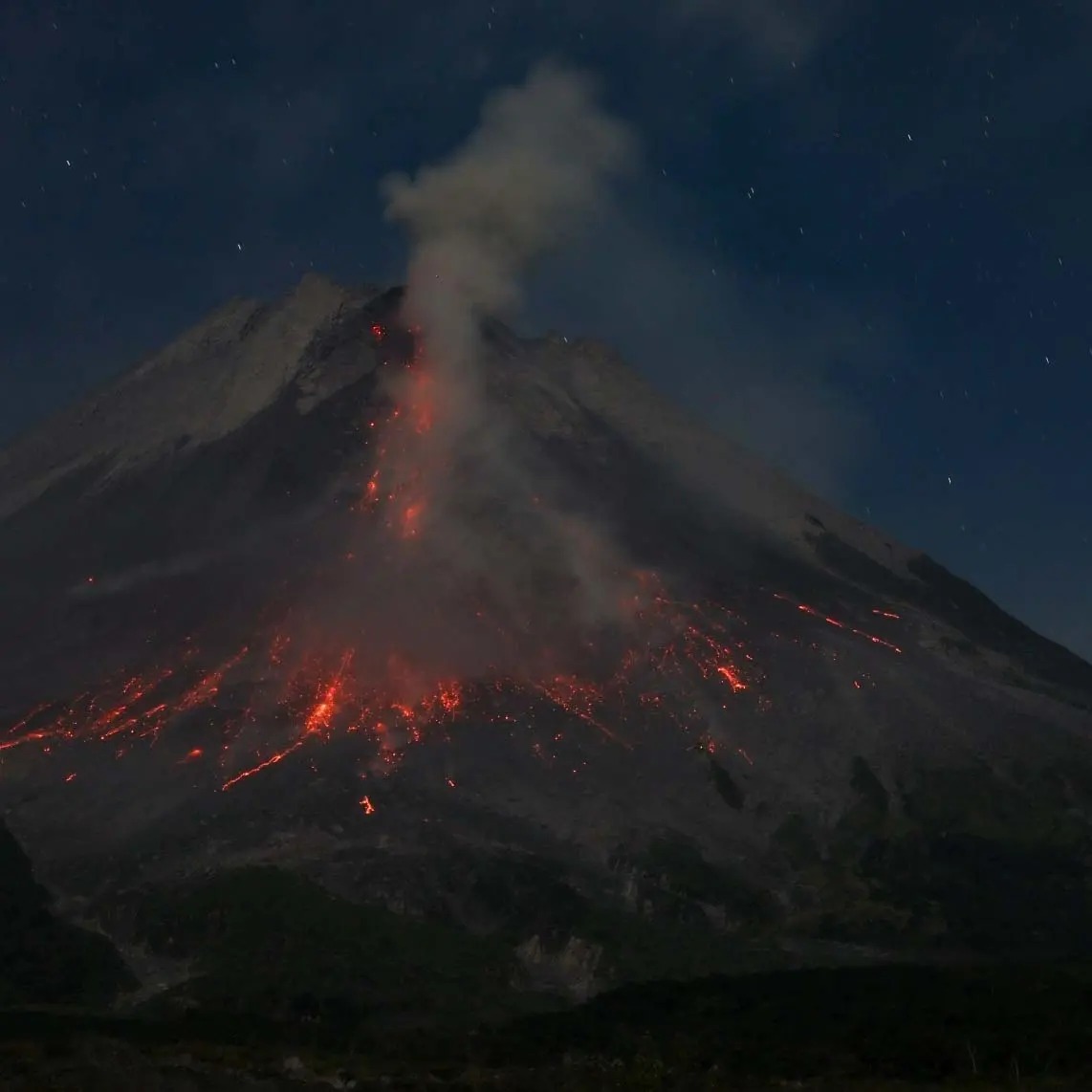
Indonesia , Mérapi :
MERAPI ACTIVITY REPORT from April 4 to 10, 2025
OBSERVATION RESULTS
Visual
The weather around Mount Merapi is generally sunny in the morning and evening, while it is hazy during the day. White smoke, thin to thick, with low to moderate pressure, and a smoke height of 150 m, was observed from the Mount Merapi observation post in Babadan on April 9, 2025, at 06:00 WIB.
This week, lava avalanches were observed once upstream of the Boyong River up to 1,500 m, 31 times upstream of the Bebeng River up to a maximum of 2,000 m, 18 times upstream of the Krasak River up to a maximum of 1,800 m, and 37 times westward of the Sat/Putih River up to a maximum of 1,900 m.
The morphology of the southwest dome has undergone slight changes due to lava flow activity. No significant morphological changes were observed for the central dome. According to an analysis of aerial photos dated March 11, 2025, the volume of the southwest dome is 3,626,200 m3. Meanwhile, the volume of the central dome is measured at 2,368,800 m3.
Seismicity
This week, Mount Merapi’s seismic activity recorded:
5 shallow volcanic earthquakes (SV),
1,125 multi-phase earthquakes (MP),
958 avalanche earthquakes (RF),
2 low-frequency earthquakes (LF),
22 tectonic earthquakes (TT).
The intensity of the earthquakes this week remains quite high.
Deformation
The deformation of Mount Merapi monitored using EDM and GPS this week showed no significant changes.
Rain and Lahars
This week, it rained at the Mount Merapi observation post, with the highest rainfall intensity of 40 mm/hour for 91 minutes at the Kaliurang post on April 10, 2025. There were no reports of additional discharge or lahars in the rivers originating from Mount Merapi.
Conclusion
Based on the results of visual and instrumental observations, it is concluded that: Mount Merapi’s volcanic activity is still quite high in the form of effusive eruptive activity. The activity status is defined as « SIAGA » level.
Source : BPPTKG
Photo : Andi Volcanist
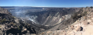
Alaska , Spurr :
Volcanic unrest continues at Mount Spurr volcano and is characterized by ongoing earthquake activity. Seismicity remains elevated with about 55 located earthquakes over the last week. While this is similar to the previous week, earthquake rates have shown variability during this current period of unrest. Ground deformation at Mount Spurr has paused over the last couple of weeks, like the pause in deformation observed for several weeks this past November and December. No sulfur dioxide emissions were detected in satellite data over the past week. AVO is planning to do an overflight of the volcano to measure gas emissions on the next good weather day. High resolution satellite data from April 6 and 8 show some collapsing of ice from the summit crater wall, adding ice to the crater lake and some small snow avalanches, which are common this time of year. Cloudy conditions prevented views of the volcano most of the week. The Mount Spurr monitoring network is functioning well. New snowfall this week has covered up the CKT web camera but other web cameras (like SPCR) are snow free and functioning well.
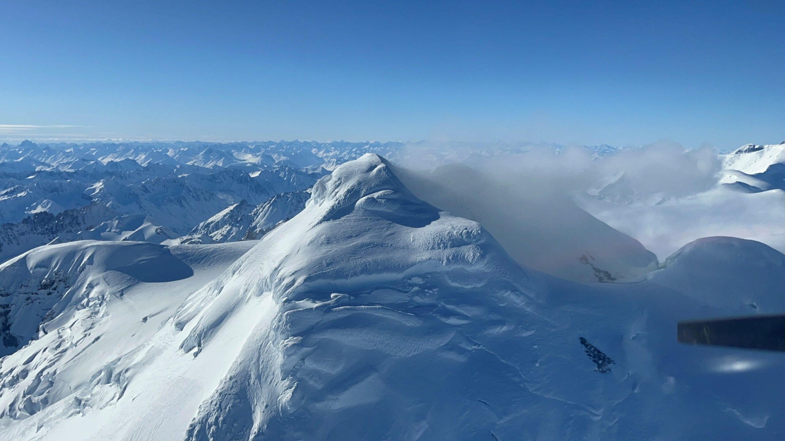
Spurr summit looking to the northwest, with steam plume from the summit fumaroles.
AVO continues to closely monitor activity at Mount Spurr for signals indicating the volcano is moving closer to an eruption using local seismic, infrasound, and GNSS stations, web cameras, regional infrasound, lightning networks, and satellite data. Based on previous eruptions, additional changes in earthquakes, ground deformation, the summit lake, and fumaroles would be expected if magma moves closer to the surface. Therefore, if an eruption occurred, it would be preceded by additional signals that would allow advance warning.
Source : AVO
Photo : Ferenczy, Vince / AVO.
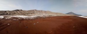
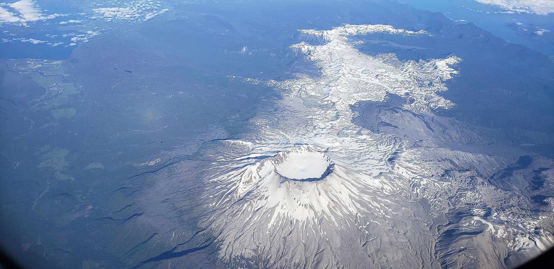
Chile , Puyehue-Cordon Caulle :
Special Volcanic Activity Report (REAV), Los Lagos region, Puyehue-Cordon Caulle volcanic complex, April 12, 2025, 12:20 a.m. local time (mainland Chile).
The National Geology and Mining Service of Chile (SERNAGEOMIN) publishes the following preliminary information, obtained using the monitoring equipment of the National Volcanic Monitoring Network (RNVV), processed and analyzed at the Southern Andean Volcanological Observatory (OVDAS):
On Saturday, April 12, 2025, at 12:05 a.m. local time (04:05 UTC), monitoring stations installed near the Puyehue-Cordon Caulle volcanic complex recorded an earthquake associated with rock fracturing (volcano-tectonic type).
The earthquake characteristics after analysis are as follows:
TIME OF ORIGIN: 00:05 local time (04:05 UTC)
LATITUDE: 40.560° S
LONGITUDE: 72.165° West
DEPTH: 4.9 km
LOCAL MAGNITUDE: 3.1 (ML)
OBSERVATIONS:
At the time of this report, no changes in the monitored parameters or earthquakes of similar characteristics have been recorded.
The Volcanic Technical Alert remains at Green.
Source : Sernageomin
Photo : Wikipedia