April 2025.
Hawaii , Kilauea :
HAWAIIAN VOLCANO OBSERVATORY STATUS REPORT , U.S. Geological Survey
Wednesday, April 9, 2025, 10:16 AM HST (Wednesday, April 9, 2025, 20:16 UTC)
19°25’16 » N 155°17’13 » W,
Summit Elevation 4091 ft (1247 m)
Current Volcano Alert Level: WATCH
Current Aviation Color Code: ORANGE
Activity Summary:
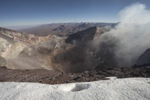
Episode 17 of the ongoing Halemaʻumaʻu eruption ended at 9:45 a.m. HST on April 9 when low fountaining at the south vent stopped. Fountains from the south vent sustained heights of 50-200 feet (15-60 meters). Overall, episode 17 lasted 35.5 hours and consisted of sustained fountains from the south vent and minor north vent activity that stopped around 11:15 a.m. HST on April 8. The north vent pond collapsed sometime last night.
During episode 17, lava flows covered over 40% of the floor of Halemaʻumaʻu within the southern part of Kaluapele (Kīlauea caldera).
During a monitoring overflight on April 9, 2025, USGS Hawaiian Volcano Observatory field crews observed that the ponded lava in the north vent from April 8 had drained and/or collapsed. The south vent was still active, with fountaining sending lava flows across the floor of Halema‘uma‘u.
The UWD tiltmeter recorded approximately 10.5 microradians of deflation during episode 17 with approximately 6.5 microradians change on the SDH tiltmeter. The end of the eruption was coincident with a distinct change in tilt from deflationary to inflationary trending and a rapid drop in seismic tremor intensity at 9:45 a.m. HST.
Each episode of Halemaʻumaʻu lava fountaining since December 23, 2024, has continued for at least 13 hours, and up to 8 days, and episodes have been separated by pauses in eruptive activity lasting less than 24 hours to 12 days.
information
No changes have been detected in the East Rift Zone or Southwest Rift Zone. HVO continues to closely monitor Kīlauea and will issue an eruption update tomorrow morning unless there are significant changes before then.
Kīlauea Volcano Alert Level/Aviation Color Code remain at WATCH/ORANGE. All current and recent activity is within Hawaiʻi Volcanoes National Park.
Source : HVO
Photo : USGS / K. Lynn.
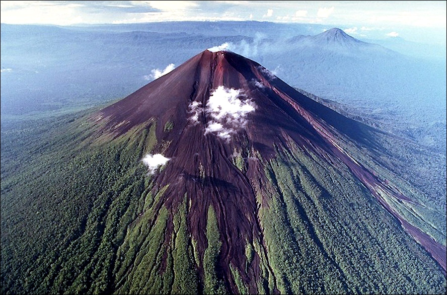
Japan , Sakurajima :
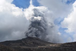
The Japan Meteorological Agency (JMA) reported ongoing eruptive activity at Minamidake Crater (Aira Caldera’s Sakurajima volcano) during 31 March-7 April. Nightly crater incandescence was visible in webcam images. Eruptive activity increased this week with 21 eruptive events, 12 of which were explosions. An explosion at 22h20 on 1 April ejected large blocks 300-500 m from the crater rim. Explosions at 07h03 and 19h22 on 2 April produced ash plumes that rose up to 1.9 km above the crater rim and ejected large blocks 300-900 m from the crater rim. Explosions at 10h23, 16h50, and 19h37 on 4 April produced ash plumes that rose up to 1.5 km above the crater rim and ejected large blocks 800-1100 m from the crater rim. Explosions at 00h27, 06h43, 15h24, and 21h54 on 5 April produced ash plumes that rose up to 2.6 km above the crater rim and ejected large blocks 500-700 m from the crater rim. An explosion at 11h48 on 7 April produced an ash plume that rose up to 2.9 km above the crater rim and ejected large blocks 600-900 m from the crater rim. Ash plumes rose straight up or drifted SE, S, or NE. The Alert Level remained at 3 (on a 5-level scale), and the public was warned to stay 2 km away from both the Minimadake and Showa craters.
The Aira caldera in the northern half of Kagoshima Bay contains the post-caldera Sakurajima volcano, one of Japan’s most active. Eruption of the voluminous Ito pyroclastic flow accompanied formation of the 17 x 23 km caldera about 22,000 years ago. The smaller Wakamiko caldera was formed during the early Holocene in the NE corner of the caldera, along with several post-caldera cones. The construction of Sakurajima began about 13,000 years ago on the southern rim and built an island that was joined to the Osumi Peninsula during the major explosive and effusive eruption of 1914. Activity at the Kitadake summit cone ended about 4,850 years ago, after which eruptions took place at Minamidake. Frequent eruptions since the 8th century have deposited ash on the city of Kagoshima, located across Kagoshima Bay only 8 km from the summit. The largest recorded eruption took place during 1471-76.
Source: Japan Meteorological Agency (JMA), GVP
Photo : via Alex Terry / FB .
Indonesia , Talang :
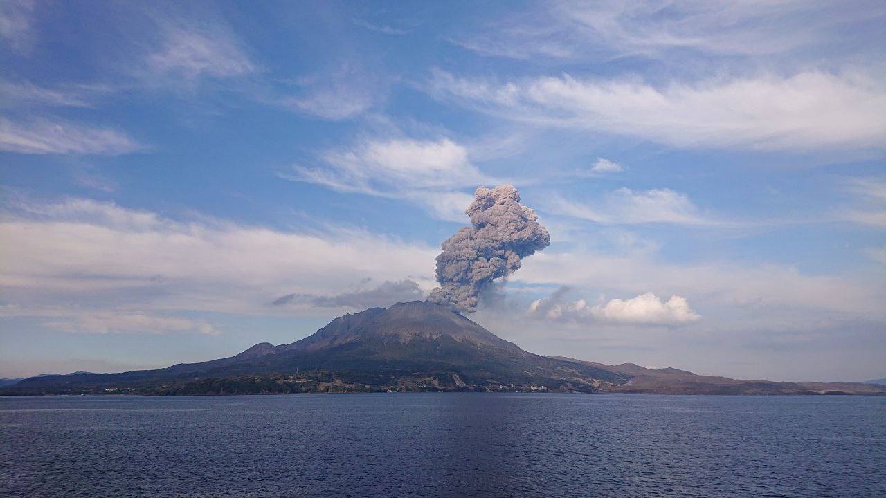
Activity of Mount Talang after the 4.2 magnitude tectonic earthquake on April 8, 2025, at 5:23:35 PM WIB in southeast West Sumatra, April 9, 2025.
Mount Talang is located in Kab. Solok is one of the most active volcanoes in West Sumatra. This volcano is a volcanic complex composed of the Talang Jantan cone to the east and Talang Betina to the west, with the distance between the two cones approximately 1 km. This volcanic complex developed in the central zone of the active Greater Sumatra Fault, namely in the Sumani and Suliti segments. The northern part of the Sumani segment is located on the northern shore of Lake Singkarak, passing through the southwest shore of the lake, crossing the towns of Solok, Sumani, and Selayo, and ending north of Lake Diatas, southeast of Mount Talang.
The activity of Mount Talang is very sensitive to the influence of surrounding tectonic activity, such as the eruption of April 12, 2005, which produced two new craters, namely the Main Crater and the South Crater, which are believed to have been triggered by the Mentawai tectonic earthquake (M 6.8) of April 10, 2005. Until now, these two craters have been the center of activity at Mount Talang along with the Upper Gabuo and Lower Gabuo fissures.
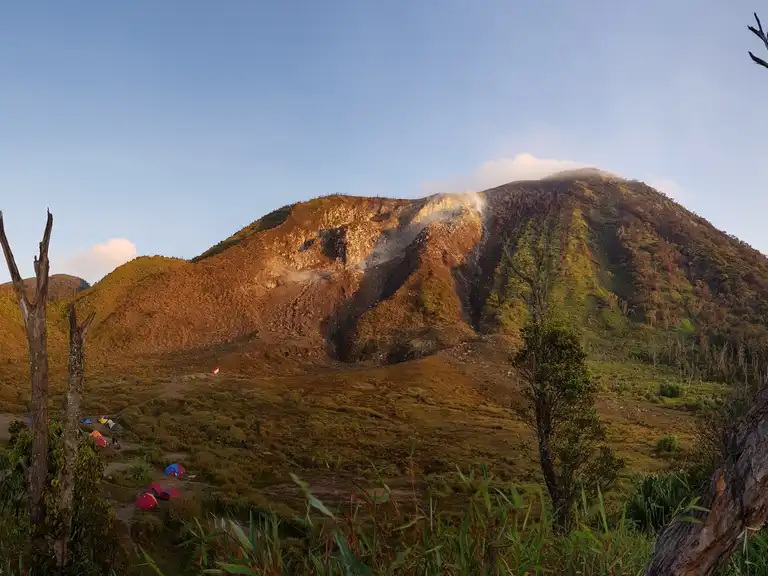
Seismic activity at Mount Talang until April 9, 2025, was dominated by deep tectonic activity. Images of the crater observed from the Mount Talang volcano observation post in Lembang Jaya village, Solok regency, showed no change in the white smoke at a height of 10 to 50 meters above the summit.
A tectonic earthquake occurred on April 8, 2025, at 17:23:35 WIB with a magnitude of M4.2, 20 km southeast of Kab. Solok, West Sumatra (BMKG, 2025). This shallow tectonic earthquake was felt at the G. Talang PGA station on the IV MMI scale. Following this tectonic earthquake, 115 earthquakes were recorded at Mount Talang until 24:00 WIB. The number of deep volcanic earthquakes recorded on April 8, 2025, was 101.
The occurrence of deep volcanic earthquakes indicates the migration or movement of magma from deep magma pockets to the surface. Monitoring of the seismicity of Mount Talang until this morning showed a decrease, and on April 9, 2025, at 00:00-06:00 WIB, 17 incidents were recorded.
The activity level of Mount Talang is currently at Level I (normal).
Source : PVMBG.
Photo : H. Trapp via Komoot com.
Chile , Laguna del Maule :
Seismology
The seismological activity for the period was characterized by the recording of:
1,462 VT-type seismic events, associated with rock fracturing (volcano-tectonics). The most energetic earthquake had a local magnitude (LM) value of 2.4, located 5.5 km west-southwest of the volcanic structure, at a depth of 7.7 km from the center of the lagoon.
Two HB-type seismic events, associated with both rock fracturing and fluid dynamics within the volcanic system (hybrid). The most energetic earthquake had a Reduced Displacement (RD) value of 14 cm² and a Local Magnitude (LM) value of 1.2, located 13.4 km south-southeast of the volcanic complex, at a depth of 5.6 km from the center of the lagoon.
Fluid Geochemistry
No anomalies in sulfur dioxide (SO2) emissions into the atmosphere were reported in the area near the volcanic complex, according to data published by the Tropospheric Monitoring Instrument (TROPOMI) and the Sulfur Dioxide Group of the Ozone Monitoring Instrument (OMI).
Satellite Thermal Anomalies
During the period, no thermal alerts were recorded in the area associated with the volcanic complex, according to analytical processing of Sentinel 2-L2A satellite images, combined with false-color bands.

Geodesy
The geodetic activity during the period was characterized by:
– A slight increase in the magnitudes of the vertical components of the GNSS stations, reaching a maximum of 2.17 cm/month at the MAU2 station (located west-southwest of the lagoon).
– A slight variation in the GNSS monitoring line (distance between GNSS stations) crossing the complex, reaching a maximum of 1.56 cm/month.
– Radar interferometry (time series between 10/30/2014 and 03/11/2025) shows the same uplift as that observed by GNSS, with maximum deformation centered at the MAU2 GNSS station.
It is therefore observed that the deformation of the volcanic complex continues in amplitudes and directions similar to previous periods, but with a slight increase, highlighting deformation rates considered high.
Surveillance cameras
The images provided by the fixed camera installed near the volcanic complex did not record any degassing plumes or variations related to surface activity.
Satellite geomorphological analysis
No morphological variations associated with volcanic activity were identified from Planet Scope and Sentinel 2 L2A satellite images.
Activity remained at levels considered low, suggesting stability within the volcanic complex. The technical volcanic alert remains in effect for:
GREEN TECHNICAL ALERT: Active volcano with stable behavior – No immediate risk
Observation:
The affected area is considered to be within a 2 km radius of the passive CO2 degassing zone.
Source : Sernageomin
Photo : Dr Katie Keranen. ( 2020).
Papua / New Guinea , Ulawun :
The Rabaul Volcano Observatory (RVO) reported that activity at Ulawun was low during 1-7 April. Summit emissions were characterized as white, having variable densities, and containing small amounts of ash. The plumes drifted S and caused minor ashfall in areas within a few km to the S and SW of the volcano. Low rumbling noises were heard in those same areas on 1 and 4 April. Seismicity generally remained low. The seismic station (UULA), 2.8 km from the summit on the lower WSW flank, recorded small low- and high-frequency volcanic earthquakes, with low-frequency earthquakes being the dominant signal.
Starting at about 08h00 on 4 April the seismic signals quickly changed to continuous volcanic tremor and the tremor amplitude grew relatively rapidly. The tremor lasted about 5.5 hours, reverting to discrete seismic signals at around 17h20. The station ceased being operational at around 19h00. The two other seismic stations, UALB (5.6 km) and UULB (10 km NW), did not detect the seismicity due to their distance from the volcano and high levels of cultural noise that obscured signals. RVO noted that a team from the West New Britain Provincial Disaster Office had been conducting community awareness activities within 10 km of Ulawun since 27 March, so far visiting the Ulamona area (10 km NW), Navo, Noau, Voluvolu, Bakada, Sabalbala, Vamakuma, Bago, Kabaia, Soi, and Sohula care center.
Sources: Rabaul Volcano Observatory (RVO) , GVP.
Photo : Ulawun with Bamus behind it to the right. ( dandees, via Panoramio)